On the northwest side of the Loch of Boardhouse can still be found a spring of water which was, in bygone times, the abode of the supernatural creature known as the troll or trow. The site is described in local place-name records and is located near the foot of a slope near Westerhouse, from where a small channel of water runs down into the Loch of Boardhouse about forty yards away. When it was last described in the 1960s, all folk memory of its heathen inhabitants had seemingly been forgotten and no folk-tales seem to have been recorded. Thankfully, the Well itself is still shown to exist on modern OS-maps.
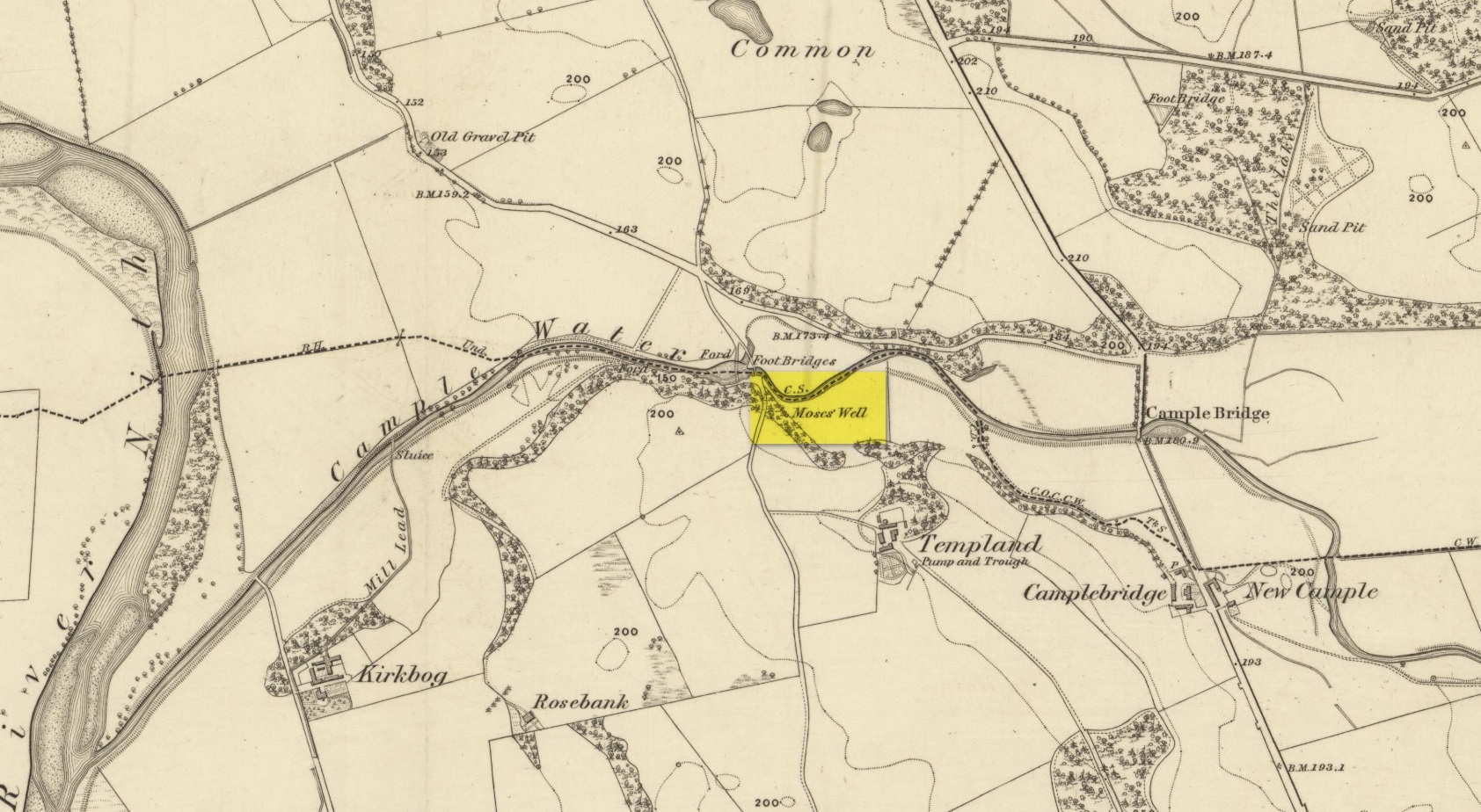
This little-known Biblical-sounding spring has apparently long since fallen back to Earth (perhaps there might be some local folk who could find out for certain). Shown on the 1861 Ordnance Survey map as being at the side of the wall in the small copse of trees—immediately east of kirk- place-names and a half-mile north of St Ninian’s Well—it was briefly described by T.C. Ramage (1876), who seemed to know nothing of its lore, merely telling us that,
“on Templand farm, close to the wooden bridge over the Cample, there is Moses’ Well, an unusual designation, but which some Knight Templar may have given in remembrance of his toils in Palestine.”
The Templar designation was deemed by Ramage to come from the name of the farm. However, a few years prior to this, the early Scottish place-name surveyors were traversing the area and found from local people how it derived “its name from a Tinker named Moses Marshall who with his family lived near it in a Camp during the time they had the small pox.” The Well was also included in the Morris survey (1982), but without comment. Another Moses Well can be found 44½ miles to the northeast, near Galashiels at NT 4046 4306.
Holy Well (destroyed?): OS Grid Reference – SP 5549 4574
Also Known as:
Stock Well
Archaeology & History
This seemingly lost holy well was first mentioned by John Morton (1712), who told us that it was the source of the River Tove. About eighty years later, John Bridges (1791) wrote that,
“In this town was formerly a grange to the monastery of St Andrews in Northampton; and a spring which riseth near the place where this house stood, still retains the name of Halywell Spring.”
Little else was written of the site until H.C. Smith’s (1933) in-depth overview of the famous Washington family (some dood called George apparently) of Sulgrave, where he echoed John Morton’s words that the River Tove “rises from the spring of Holy Well, near the site of the old Grange of St. Andrew’s Priory.” He told that it was located up Stockwell Lane where an old water-mill was located and “the water for the mill is provided by a large mill-pool fed by a spring known in former times as Holy Well Spring.” Local historian Beeby Thompson (1914) identified the Stock Well as being the later alternative name for our holy one.
References:
Bridges, John, The History and Antiquities of Northamptonshire, D. Price: Oxford 1791.
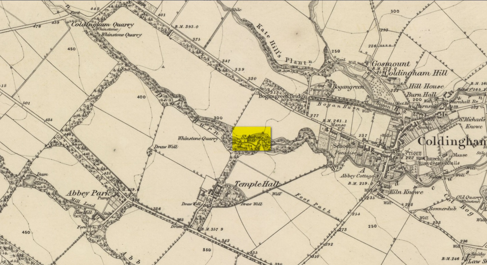
By the side of the stream known as St Andrew’s Burn, in the small wooded glen to the rear (west) of the Crosslaw Caravan Park (right by the side of the A1107 road), you can still find the flowing waters of this all-but-forgotten holy well that was dedicated to Scotland’s patron saint, god knows how long ago! The first description I’ve come across relating to the site is in William King’s (1858) early work on Coldingham Priory, where he told that,
“In a dean a little westward from the village, and on the border of the property of Bogangreen, is a spring of excellent water, called St Andrew’s Well, from which the monastery was supplied by leaden conduits, portions of which are occasionally turning up to view. These pipes are thick and well made.”
Fifty years later when Adam Thomson (1908) penned his magnum opus on Coldingham parish, the well was still in a good state of affairs. Hereby there grew much chamomile which, he thought, “the monks were wont to cultivate for the healing of the sick.”
Folklore
St Andrew’s feast day is November 30 and is known as Anermas.
References:
Hunter, William K., History of the Priory of Coldingham, Sutherland & Knox: Edinburgh 1858.
Holy Well (destroyed): OS Grid Reference – SE 6071 5187
Archaeology & History
At the beginning of the 19th century, William Hargrove (1818) described the scant remains of some old walling along old Haver Lane (renamed as Green Lane and now known as The Stonebow) which were the remains of a building, long gone, and which,
“tradition informs us (was) a religious house, which formerly stood here, called Holy-Priests; and though the site of it is not known, the report is greatly strengthened by the appearance of the walls just mentioned, and by the circumstance of a deep draw-well which now remains, being still called Holy-Priests Well.”
Some suggest that this water source may still exist beneath one of the buildings hereby, but the landscape here has been so badly mutilated over the last two hundred years that it’s very unlikely.
References:
Hargrove, Willliam, History and Description of the Ancient City of York – volume 2, part 2, W. Alexander: York 1818.
From Muthill, go up Thornhill Street out of the village for nearly 1½ miles. You’ll have just passed the double hairpin bend, crossed the rivulet, then reached the large old farmhouse of Lurgs. From here, turn right and after just over half-a-mile you reach Struthill where, running by the side of the house, is a small trackway. Ask the folks at the house, who are most helpful, and walk down the track for nearly 400 yards and go through the first gate on your right, crossing the field until it dips down to the burn. The boggy marshy mass running from near the top of the slope is what you’re looking for!
Archaeology & History
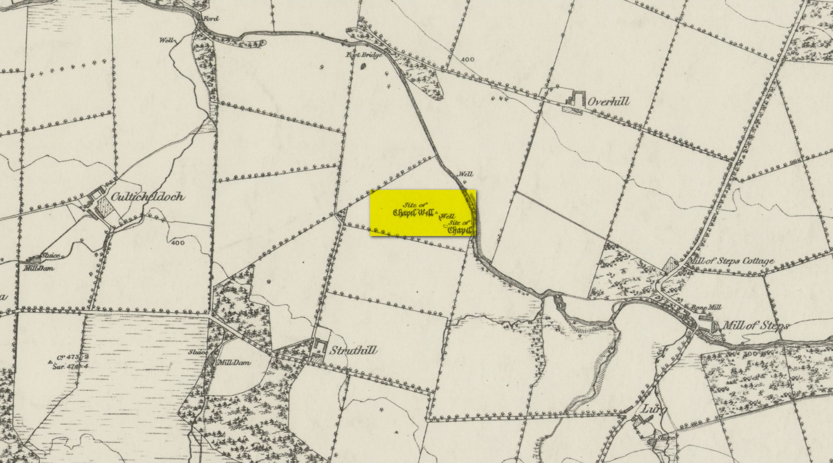
Shown on the 1863 map as the Chapel Well, the dedication of the waters to St. Patrick coincided with a chapel that once stood here, also in his name. Very low faint remains of the chapel, completely overgrown, can still be made out amidst the rushes. It’s one of two holy wells in Muthill parish that are dedicated to St. Patrick.
Very little of any real spring of water can be seen nowadays. Indeed, the site today is merely a much overgrown bog-of-a-well whose water oozes down the slope into the Juncus rushes, trickling into the adjacent burn. I had a drink of the water from the slopes, which tasted OK and did me no harm whatsoever.
Folklore
The most important aspects of this site was its use by local people and the attributes it was given. We know not how far back such folklore goes, but it would have been many many centuries, if not millenia. Water worship (if that’s the right word) is the most archaic of all traditional forms of veneration. This place was no exception. In John Shearer’s (1883) excellent local history work, he gave the following account of the site:
“About a quarter of a mile west from the Mill of Steps, upon a height on the right bank of the Machany, are to be seen the ruins of a small chapel. When other places of Popish worship were thrown down after the Reformation, the Presbytery of Auchterarder ordered it to be demolished about 1650 to repress the superstitions practised at this place of resort. West from the chapel is an excellent spring which was held in great veneration in those dark ages of superstition, when the ignorant and credulous populace were deceived by the crafty priests who stood below the spreading branches of an ancient ash which grew near the fount, pronouncing a benediction on the weary pilgrims as they drank of the waters. And as it was celebrated for its healing qualities in many different distempers, numbers yearly visited it from a great distance to benefit by its virtues with as much devotedness as the Mahometan pilgrims visit the tomb of their Prophet. Insanity was also cured here. Several persons testified before the Presbytery of Stirling, in 1668, that having carried a woman thither, they staid two nights at a house hard by the well. The first night they bound her twice to a stone at the well, but she came into the house to them being loosed without any help. The second night they bound her again to the same stone and she returned loosed. And they also declared that “she was mad before they took her to the well, but since that time she is working and sober in wits.”
“This well was still celebrated in the year 1723 and votive offerings were left, but no one then surviving appeared to appreciate the virtues of the stone. Small offerings were given in coin and thrown into the well and those who had no coin brought white stones which were laid in regular order along the declivity where the water runs to the river. Coins have been of late found in the well and the white stones are still to be seen. The officiating priest generally resided at Drummond Castle. Within the last sixty years, several of the gentry have come in their carriages to inspect these relics which were held in so great reputation in ancient times. The chapel and well are about one mile south west from Muthill.”
References:
MacKinlay, James M., Folklore of Scottish Lochs and Springs, William Hodge: Glasgow 1893.
Holy Well (destroyed?): OS Grid Reference – SO 9609 8284
Archaeology & History
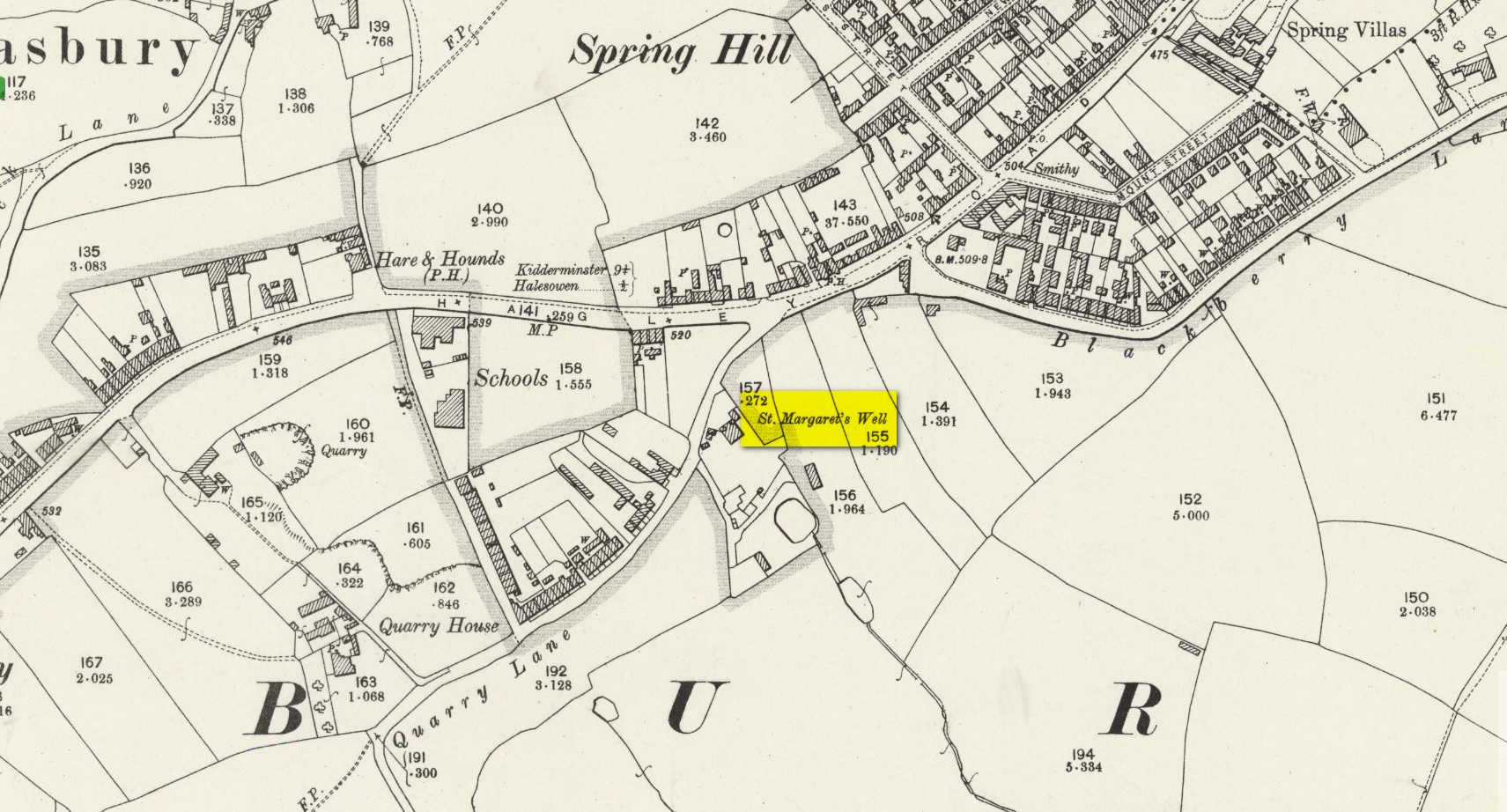
The site on the 1904 map
Shown on the 1904 OS-map, beneath the aptly-named St Margaret’s Hill on its northern side, we can see where the holy well of St Margaret used to be, not too long ago. Although it seems to have fallen pray to industrial destruction, there are a number of old references to the site, mainly gathered together in Jeremy Harte’s (2008) magnum opus on the subject. It was also mentioned in a survey by the British Geological Society (Richardson 1930) where we were told that it was,
“in the private grounds of a house recently erected, and is a spring issuing from the Halesowen Sandstone at the junction of two faults (shown west of the ‘H’ of Hasbury on the new series Geological Map, Sheet 168) about 100 yds SW of the point where Blackberry Lane joins Hagley Road. It is referred to, as a well of good cold unmineralised water, by T. Nash in 1781.”
And it was Mr Nash who gave us the earliest description of the place, saying:
“In the hamlet or township of Hasbury is an ancient holy well, called St Margaret’s Well, which formerly had much good stonework about it; but that was wholly removed in the year 1747. One of these stones contained some curious sculpture, the figure of a man in a posture of hasty walking, and in the next compartment that of another man leaning on crutches… This place is called Margaret’s Hill and the water of the well supplies a small brook, which runs below the Grange, and falls into a piece of water at the end of the town, called Cornbow Pool.”
It’s more than probable that the old carvings he described—of one man on crutches and the other of a figure walking speedily—represents one of the main curative allegations that these waters possessed. Cases of people walking on crutches to sacred wells, drinking the waters, then walking away without them (and in many cases leaving their crutches at the well-side as testament to its properties) are commonplace. And, aptly enough, the curative elements of this ancient site has been maintained in modern times with the medical centre of St Margaret’s Well Surgery being built by this very spot!
Holy Well (destroyed): OS Grid Reference – SK 589 789
Also Known as:
Prior Well
Archaeology & History
Once to be seen in the ancient landscape immediately northwest of Worksop Priory by the old Mill Pond, this sacred well has sadly been built over, but memory of it is still retained in Priorswell street-name and, previously, the Priorwell Brewery. Not much has been written about it, but thankfully the historian John Holland (1826) gave us a short account, saying:
“There is a spring, now enclosed, called the “Priorwell,” and a meadow, of four acres, denominated from the same; and from which, it might be presumed, that the canons would draw their supplies of water, was it not for the convenient proximity of the river, which they must have had to ford for that purpose. It was “formerly”, says Parkyns, in his Monastic and Baronial Remains, “celebrated for miraculous cures; but since monastic deceptions have unveiled themselves, votaries no longer offer, and consequently cures are no longer performed.” This may have been the case: more recently the well has been resorted to by persons having sore eyes, in the cure of which, it is said to be efficacious, and has probably the common virtue of fresh cool spring-water.”
References:
Holland, John, The History, Antiquities and Description of the Town and Parish of Worksop, J. Blackwell: Sheffield 1826.
Parkyns, George I., Monastic and Baronial Remains – volume 1, Longmans Hurst: London 1816.
White, Robert, Worksop, The Dukery and Sherwood Forest, Simpkin Marshall: London 1875.
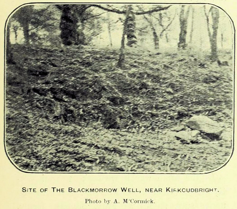
A curious little-known site with more of a Scottish genealogical history behind it. Mentioned in McCormick’s (1906) fascinating survey of tinkers in the Galloway region, the site was given a more succinct description in the Morris survey (1982), where they told that,
Well shown on 1854 mapBlack Morrow Well, c.1905
“a mile from the town in Black Moray (formerly Morrow) Road, a short distance from the road…was this well that the MacLellan family are said to have derived their crest of a Moor’s head impaled on a sword. The local story is that James II wanted to get rid of some gypsies infesting Galloway and offered the Barony of Bombie to anyone who could do so. MacLellan filled the well with potent liquor which the gypsy chief drank to excess and while he was in a drunken stupor MacLellan killed him, cut off his head and presented it to the King on the point of his sword, immediately receiving the barony as his reward.”
This story goes way back and was first mentioned in 1680. According to McCormick (1906), the name Black Morrow derived from the “More”, the title given to the leader of the so-called gypsy clan, “or, as tradition suggests, a man named Black Morrow, of Irish tinkler descent.”
Cross (destroyed): OS Grid Reference – NJ 3755 4408
Also Known as:
St Fumac’s Cross
Archaeology & History
In the ancient tiny hamlet of Botriphnie, local historian J.F.S. Gordon (1880) told us that:
“About 40 years ago, a Cross of rude picked stone, in low relief, and about 5½ feet high, by about 3 feet broad, stood within the Kirkyard of Botriphnie. Unfortunately, about the time indicated, the Stone was broken up by a Blacksmith, who used it as a Hearth for his Smiddy! This had probably been the ancient Cross of St Fumack’s Fair of Botriphnie.”
This little-known saint has a feast day of May 3, when curious ceremonies were performed in and around his holy well, found just outside the churchyard to the northeast. Little is known about Fumac, but he was said to have been the first Christian missionary in this part of Scotland.
References:
Gordon, J.F.S., The Book of the Chronicles of Keith, Grange, Ruthven, Cairney and Botriphnie, Robert Forrester: Glasgow 1880.