From Broadford town, head northwest outta town up the A87 for a mile, turning left and stopping by the electricity station just 100 yards along. Follow the line of cables down, SE, through the trees, dead straight for about 600 yards (crossing the large stream about halfway) till you notice an open gap through the trees on your right where, 40 yards in, there’s a large circular arena which has been kept aside amidst which a scattered mound is clearly visible. In this opening in the trees…this is where the tomb/s rest…
Archaeology & History
Sited a mile east on lowlands beneath the shadow of Beinn na Cailleach mountain, with its host of heathen legends and lore, is reputed to be the prehistoric remains of an important ancestral burial site, under dominion of the cailleach’s eye. In Audrey Henshall’s (1972-2) magnum opus she describes the remains of what may be two separate tombs here as “difficult to interpret”; even “questioning whether they do in fact represent the ruins of a chambered cairn” as has been ascribed. The site is still included in the Canmore survey, where they cite the same reference as I do here, but add no additional data to Henshall’s query. There is obviously something to be seen here, but until excavation of the site has been done, the exact nature of what lies here cannot be clarified. Miss Henshall wrote:
“There is a setting of stones forming about a third of the west side of a circle which would have a diameter of about 30ft if complete; its greatest N to S measurement is 23ft. The stones are thin slabs 4 to 5in thick, up to 3ft 6in long, set on their long sides and projecting up to 2ft above the turf. The stones have probably been reduced in size due to natural fracturing as the stone readily flakes away. Within this setting, which might be interpreted as the kerb of a cairn, there is a rise of about 1ft above ground level and the grass grows greener, but except for this and a number of boulders lying about the site, there is no sign of cairn material. This is curious as there is no obvious reason for removing it.
“Inside the ‘kerb’ there is a horse-shoe setting of five similar slabs, just visible except for two on the S side which project 1ft 2in due to some peat on their N side having been removed. The enclosed area is 7ft wide by 7ft 6in long, open on the E end. On this side, 14ft from the W end of the setting, is a larger stone, set on end, 2ft 8in high. This might be regarded as a portal stone except that it is set opposite the centre of the open end of the horse-shoe setting, and there is a low thin slab projecting westwards from the middle of its W face. E of this there lie a number of flat slabs and boulders, the larger (some measuring 3ft 8in by 3ft and 4 by 2ft) marked on the plan, but they do not suggest the form of the original structure.
“A stone is set radially to the kerb, 15ft 8in to the N. It is on its long edge, 4ft 11in long and 2ft 2in high. Twenty eight feet S of the kerb there is a circular setting of small boulders, 6ft 6in across inside, and part of another concentric setting can be traced 6ft outside these.”
References:
Henshall, Audrey, The Chambered Tombs of Scotland – volume 2, Edinburgh University Press 1972.
As you drive down the A87 road towards Broadford from the Kyle, just before Breakish there’s a small road on the left that runs down to Glen Arroch, where the forest lines the hill. A couple of miles beyond the end of the forest, watch out for the TV mast on the slopes on the right-hand side of the road. Stop here and go up the slopes on the left-side of the road (north), to the peak of Sgurr na Coinnich; and once here you’ll see the high rocky peak of Beinn na Cailleach a half-mile to your northeast.
Folklore
The legend of this sacred mountain was described at some length in Otta Swire’s (1961) excellent work on the Isle of Syke. She wrote:
“”As you drive down the road towards Broadford, three peaks can be seen to the north; the first two are Beinn na Greine (2,000 feet) and Scurr na Coinnich (2,401 feet); the third and most northerly is Beinn na Caillich (2, 396 feet). This last must not be confused with the Beinn na Caillich near Broadford, which is one of the Red Cuchullins although, just to make it more confusing, on the summit of our Beinn na Caillich, as on that of her larger sister, tradition has placed a woman’s grave. This time it is that of a giantess, one of the Fiennes: beneath her body is a large crock filled with gold and jewels, for she was a great lady, no less than Grainnhe herself, wife of Fionn, and at her burial every man of the Fiennes, for love of her and of their leader, cast their rarest jewels into the earthenware crock to do her honour. Her story, as is so usual in Celtic legend, is a sad one. Grainne is the daughter of the King of Morven and is reputed the fairest and truest princess in all Alban, so the Grey Magician, who hates all that is good, carries her off. One day, as Fionn and his men rest after hunting, an old, old woman, wrapped in the red mantle that denoted royal blood, comes to him, tells him of the theft of Grainnhe and begs him to rescue her. He agrees, whereupon she gives him a fir twig and three small pebbles, all highly magic; she then goes out of sight ‘on an eddy of the western wind, growing smaller as she went until she seemed no bigger than a butterfly, a honey bee, a red spider on a thin rope of its web, and a speck of dust in the sun’. Fionn sets out and after many adventures, during which he is assisted by several talking animals, he finds the Grey Magician’s palace and escapes with Grainnhe. Thanks to the old woman’s gifts, forests and mountains rise behind the fugitives, but before they can reach the Red river, to cross which is safety, the Magician overcomes the old woman’s charms. They reach the river bank only to find they cannot cross, and Fionn’s magic is exhausted. But Grainnhe has a jewel, a charm against death; as long as she wears it in her hair no evil can harm her; alternatively it will give her one wish and vanish. She takes it from her hair to wish for a boat and immediately sees, as in a vision, the fate to which she will condemn herself if she gives up her talisman. But Fionn is in peril through his efforts to save her, and already she loves him, so she lays the jewel on the water. A boat at once appears and takes them to safety.
Fionn and Grainnhe are married and live in great happiness until Grainnhe’s son is about to be born. Then come messengers to Fionn to tell him that sea-pirates are attacking his small dark-skinned allies, the Sons of Morna, who have sent to remind him of his pledge to assist them. Fionn longs to remain with Grainnhe but will not break his vow. He and his men spend three days defeating the sea-pirates and when he returns Grainnhe and her baby are gone, carried off by the Grey Magician. Fionn learns from his ‘tooth’ that she has been turned into a hind. He searches for her for many years, but she has been sent to run with the deer in lone Glen Affaric and he never finds her. Twelve years later, when the Fiennes are hunting, their hounds pick up a scent and follow it to a small copse; Bran, who is leading, is the first to enter it, whereupon, to the surprise of all, he turns at bay, teeth bared against the Fiennes and his fellow hounds of the pack and will allow no one but Fionn to pass him. Fionn finds him guarding a wild boy, with long hair and wild, beautiful, frightened eyes, who can make only such sounds as deer make. Fionn adopts him and teaches him human speech. Needless to say, he is Grainnhe’s son, but Grainnhe, the beautiful white hind of whom her son talks, is never found. After her death the Grey Magician permits her son to take her body, once more that of a woman, for burial, and the Fiennes make her grave on the summit of Beinn na Caillich, where she once ran as a hind.
It is recounted of this boy that he had in the centre of his forehead a tuft of deer’s fur where his mother’s tongue had licked him, and that it was from her that he got his gift of poetry. Once he was shipwrecked on Fladda and a party of hunters on the island offered him a share of their venison stew, to whom he made indignant reply: ‘When everyone picks his mother’s shank-bone, I will pick my mother’s slender shank-bone.’ The boy was Ossian.”
References:
Bernbaum, Edwin, Sacred Mountains of the World, Sierra Club: San Francisco 1990.
Swire, Otta F., Skye: The Island and its Legends, Blackie & Sons: Glasgow 1961.
Maypole (destroyed): OS Grid Reference – TQ 3073 8092
Archaeology & History
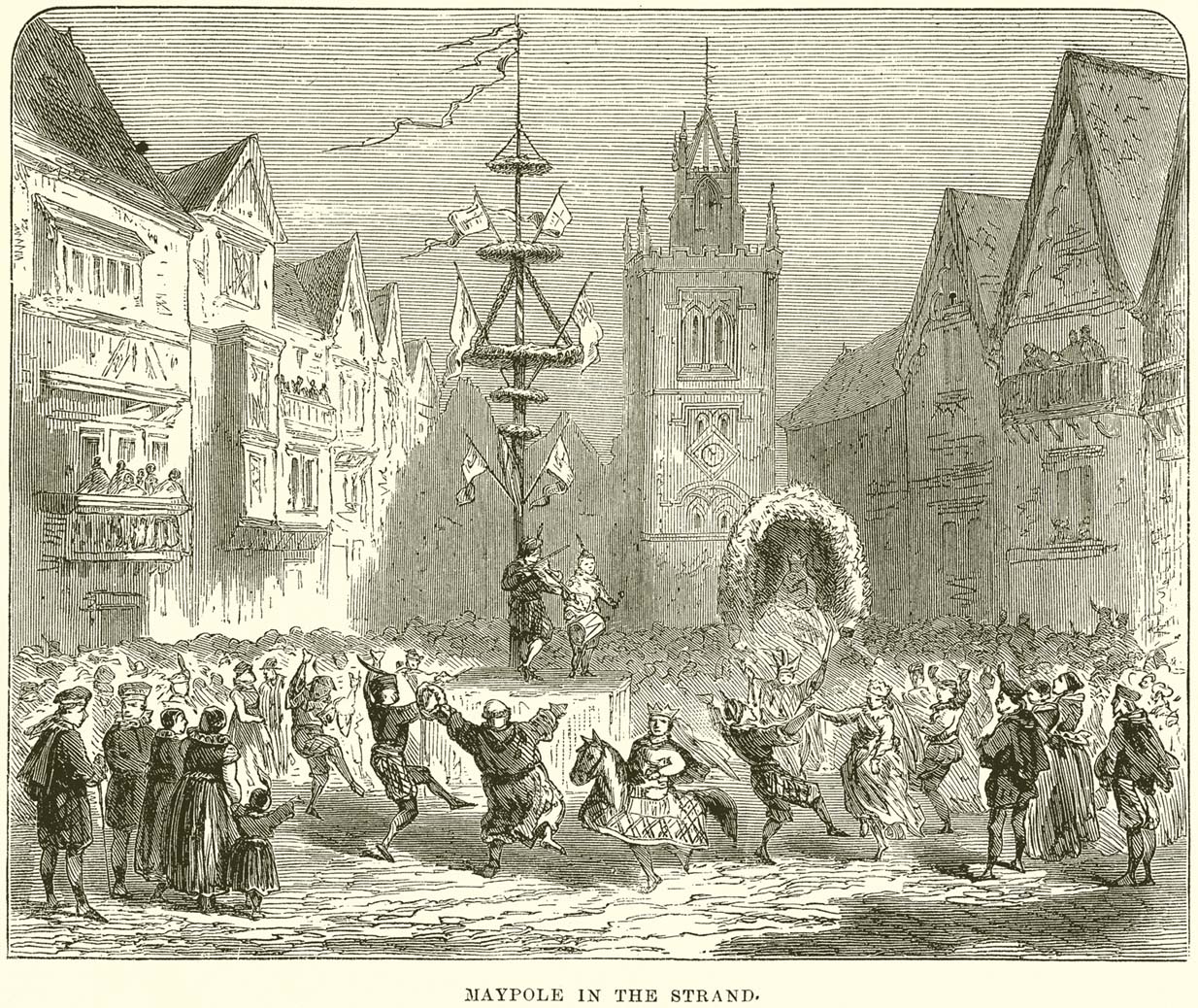
This huge traditional monument was once a sight to behold! It stood close to where an ancient stone ‘cross’ once lived. But—alas!, with the intrusion of the incoming christians bringing a profane ‘religion’ that belongs to countries far from here, its destruction was imposed. They destroyed so many of our ancient monuments with their hatred and ignorance… But thankfully we have some good accounts of this long-forgotten relic of London’s real history.
In A.R. Wright’s (1938) account of it, he called this “the most famous maypole in England” and it stood taller than even the great maypole that’s still raised at Barwick-in-Elmet, in Yorkshire.
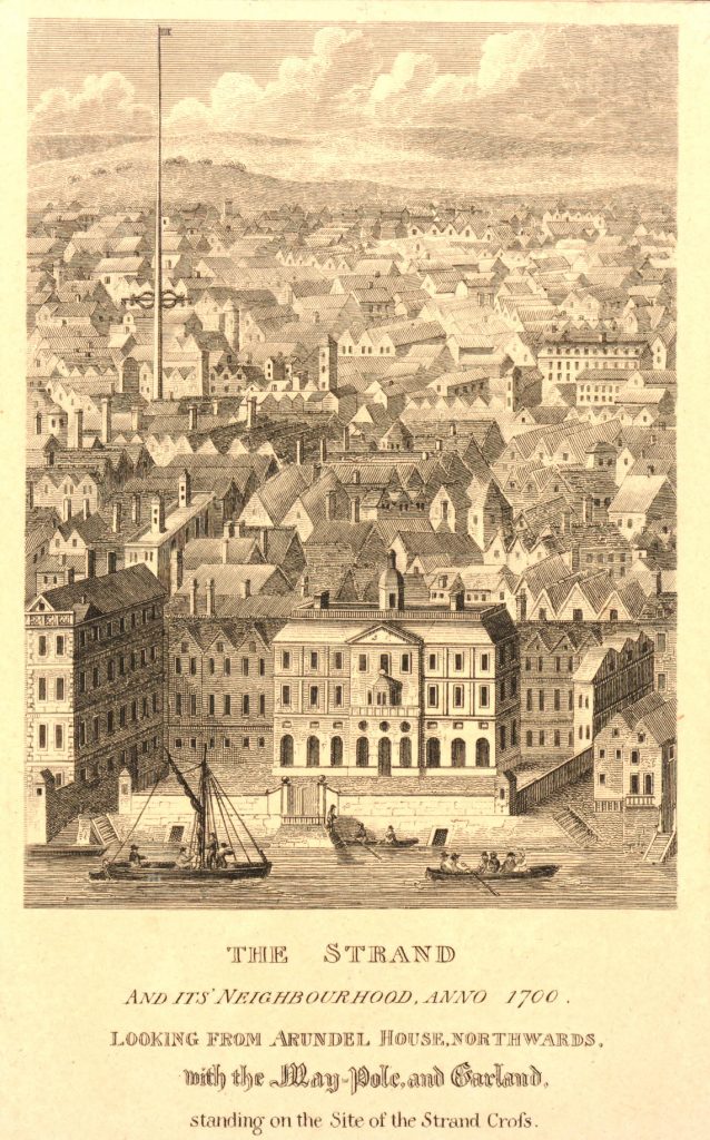
There seems to have been three maypoles on this same site – the first of which was standing before the destruction of Strand’s ancient cross, where local jurisdictions and early village meetings took place. We don’t know the date when the first maypole was erected, but it was shown on a local plan of the area “which Anthony van den Wyngaerde issued in 1543…in front of the old church of St. Mary le Strand, which was demolished in 1549.” According to Mr Hone (1826), it could be found a door or two westward beyond “where Catherine Street descends into the Strand.”
In Edward Walford’s (1878) massive tome, he gave us perhaps the best and most extensive account of the site, telling:
“The Maypole, to which we have already referred as formerly standing on the site of the church of St. Mary-le-Strand, was called by the Puritans one of the “last remnants of vile heathenism, round which people in holiday times used to dance, quite ignorant of its original intent and meaning.” Each May morning, as our readers are doubtless aware, it was customary to deck these poles with wreaths of flowers, round which the people danced pretty nearly the whole day. A severe blow was given to these merry-makings by the Puritans, and in 1644 a Parliamentary ordinance swept them all away, including this very famous one, which, according to old Stow, stood 100 feet high.
On the Restoration, however, a new and loftier one was set up amid much ceremony and rejoicing. From a tract printed at the time, entitled ‘The Citie’s Loyaltie Displayed,’ we learn that this Maypole was 134 feet high, and was erected upon the cost of the parishioners there adjacent, and the gracious consent of his sacred Majesty, with the illustrious Prince the Duke of York:
“This tree was a most choice and remarkable piece; ’twas made below bridge and brought in two parts up to Scotland Yard, near the king’s palace, and from thence it was conveyed, April 14, 1661, to the Strand, to be erected. It was brought with a streamer flourishing before it, drums beating all the way, and other sorts of musick. It was supposed to be so long that landsmen could not possibly raise it. Prince James, Duke of York, Lord High Admiral of England, commanded twelve seamen off aboard ship to come and officiate the business; whereupon they came, and brought their cables, pullies, and other tackling, and six great anchors. After these were brought three crowns, borne by three men bareheaded, and a streamer displaying all the way before them, drums beating and other musick playing, numerous multitudes of people thronging the streets, with great shouts and acclamations, all day long. The Maypole then being joined together and looped about with bands of iron, the crown and cane, with the king’s arms richly gilded, was placed on the head of it; a large hoop, like a balcony, was about the middle of it. Then, amid sounds of trumpets and drums, and loud cheerings, and the shouts of the people, the Maypole, ‘far more glorious, bigger, and higher than ever any one that stood before it,’ was raised upright, which highly did please the Merrie Monarch and the illustrious Prince, Duke of York; and the little children did much rejoice, and ancient people did clap their hands, saying golden days began to appear.”
A party of morris-dancers now came forward, “finely decked with purple scarfs, in their half-shirts, with a tabor and a pipe, the ancient music, and danced round about the Maypole.”
The setting up of this Maypole is said to have been the deed of a blacksmith, John Clarges, who lived hard by, and whose daughter Anne had been so fortunate in her matrimonial career as to secure for her husband no less a celebrated person than General Monk, Duke of Albemarle, in the reign of Charles II., when courtiers and princes did not always look to the highest rank for their wives.
…Newcastle Street, at the north-east corner of the church of St. Mary-le-Strand, was formerly called Maypole Alley, but early in the last century was changed to its present name, after John Holles, Duke of Newcastle, the then owner of the property, and the name has been transferred to another place not far off. At the junction of Drury Lane and Wych Street, on the north side, close to the Olympic Theatre, is a narrow court, which is now known as Maypole Alley, near which stood the forge of John Clarges, the blacksmith, alluded to above as having set up the Maypole at the time of the Restoration.
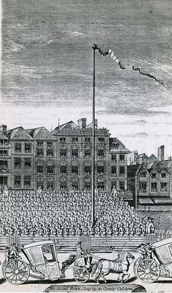
As all earthly glories are doomed in time to fade, so this gaily-bedecked Maypole, after standing for upwards of fifty years, had become so decayed in the ground, that it was deemed necessary to replace it by a new one. Accordingly, it was removed in 1713, and a new one erected in its place a little further to the west, nearly opposite to Somerset House, where now stands a drinking fountain. It was set up on the 4th of July in that year, with great joy and festivity, but it was destined to be short-lived. When this latter Maypole was taken down in its turn, Sir Isaac Newton, who lived near Leicester Fields, bought it from the parishioners, and sent it as a present to his friend, the Rev. Mr. Pound, at Wanstead in Essex, who obtained leave from his squire, Lord Castlemaine, to erect it in Wanstead Park, for the support of what then was the largest telescope in Europe, being 125 feet in length. It was constructed by Huygens, and presented by him to the Royal Society, of which he was a member. It had not long stood in the park, when one morning some amusing verses were found affixed to the Maypole, alluding to its change of position and employment. They are given by Pennant as follows:
“Once I adorned the Strand,
But now have found
My way to Pound
On Baron Newton’s land;
Where my aspiring head aloft is reared,
T’ observe the motions of th’ ethereal Lord.
Here sometimes raised a machine by my side,
Through which is seen the sparkling milky tide;
Here oft I’m scented with a balmy dew,
A pleasant blessing which the Strand ne’er knew.
There stood I only to receive abuse,
But here converted to a nobler use;
So that with me all passengers will say,
‘I’m better far than when the Pole of May.'”
Along with the Strand Cross, this old maypole would have been on the ancient ley (not one of those ‘energy lines’ invented by New Age fantasists) that was first described first by Alfred Watkins (1925)—running from St. Martins-in-the-Field to St. Dunstan’s in Fleet Street. The alignment and maypole was subsequently described in greater detail in Devereux & Thomson’s (1979) work on the same subject, and again by Chris Street. (2010)
The nature of the maypole (and the nearby cross, it has to be said), may have been representative of an omphalos in early popular culture (before the christians of course)—which would put the original ritual function of the place far far earlier than is generally considered. This is something that Laurence Gomme (1912) propounded in one of his London works and cannot be discounted.
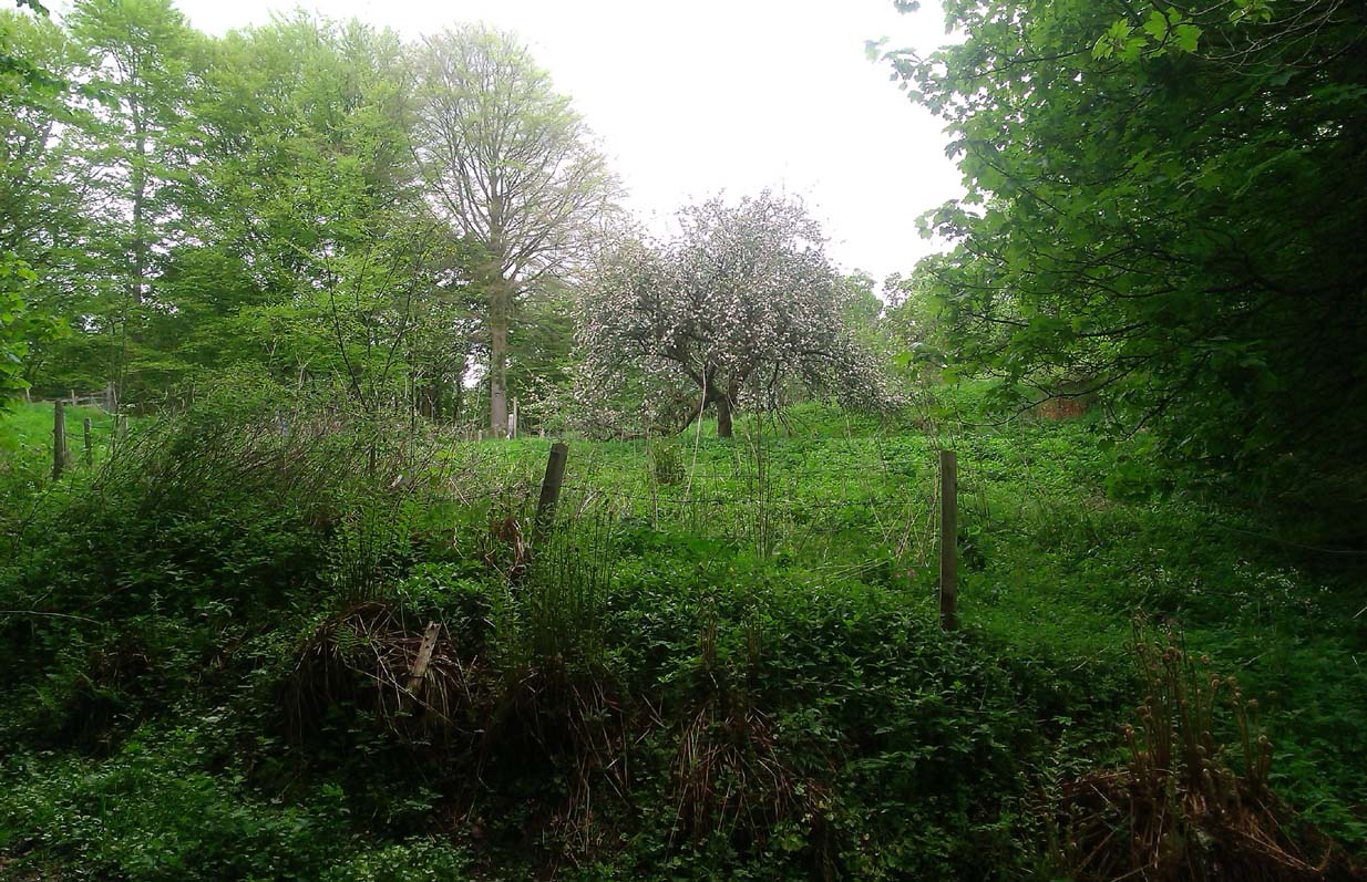
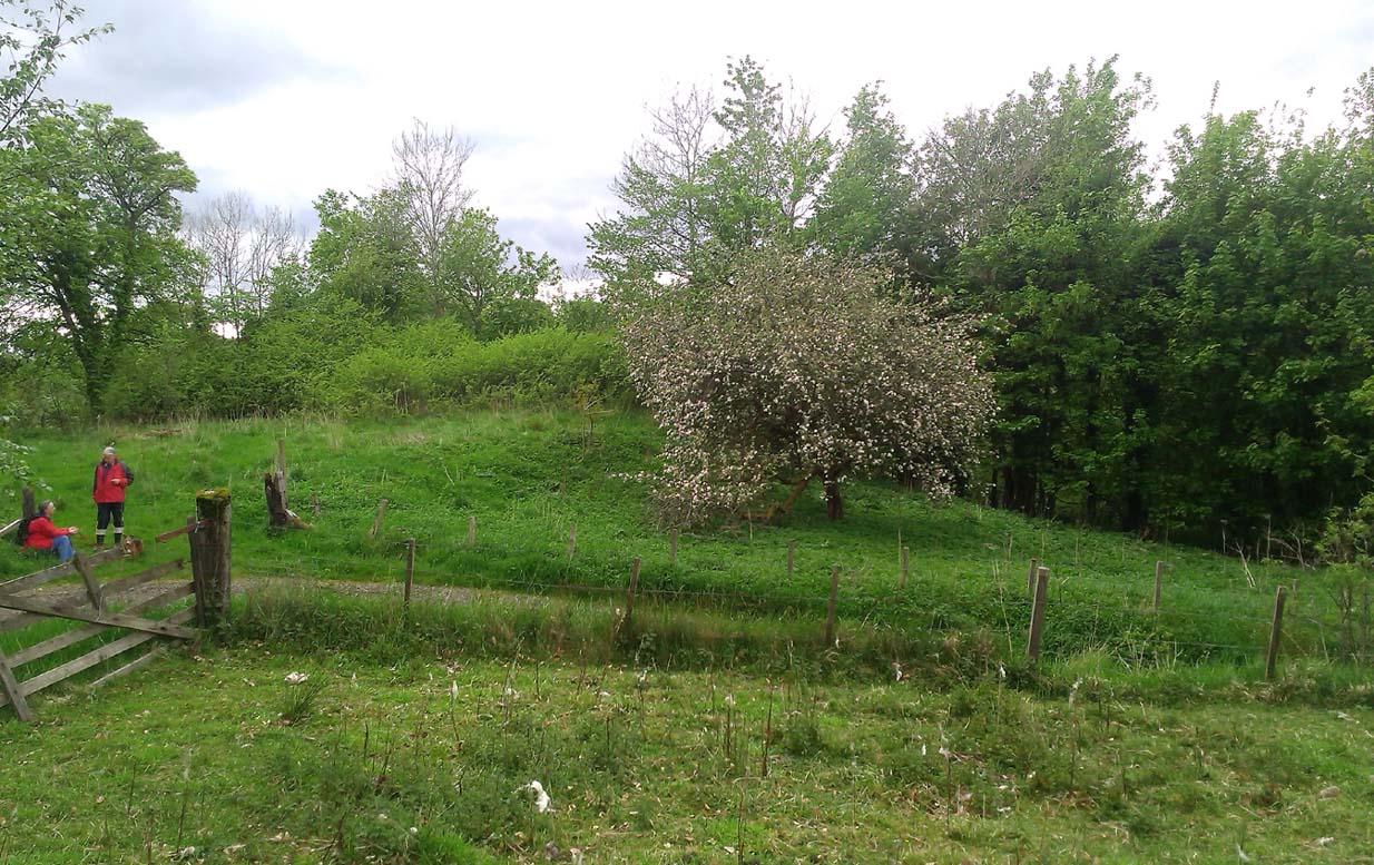
A fascinating site that was described in Johnston & Tullis (2003) local history work on the parish of Muckhart. Amidst an area bedevilled with faerie, boggarts, ghosts and historical shamanic moot sites we find more curious folklore pointing at a long forgotten site, whose age and precise nature remains a mystery. Adjacent to the old boundary line, close to the meeting of streams, the Muckhart authors told that,
“an orchard above the old farmhouse to this day remains mainly untouched. It was the burial site of warlocks from the parish and it is thought some may have even been burned at the Mill. It has always been said that this ground should never be touched! There is an ancient rubble bridge over the Hole Burn which has a Masonic Eye painted on it to ward off any unwelcome spirits. Despite the eye, both the Farmhouse and the Millhouse have been home to many strange and ghostly manifestations.”
The folklore sounds to be a mix of archaic and medieval animistic traits: perhaps of a prehistoric cairn, visited and maintained by local people (as found throughout Britain) until the Burning Times, when christian fanatics arrived, debasing the cultural rites and murdering local innocent people. …Perhaps not.
Looking down on the orchard
When Paul, Maggie and I explored the area a few days ago, we were greeted most cordially by the owner of Muckhart Mill, who knew of the folklore, but didn’t know the exact whereabout of the grave. We couldn’t find any clues as to its exact location either. Apart, perhaps, from the top of the hill immediately above the orchard where, alone and fenced off with an old covered (unnamed) well, a solitary Hawthorn tree stood. We each recalled the aged relationship that Hawthorn has in witch-lore… but that’s as far as it went. The grave remains hidden and may have been destroyed. If anyone discovers its whereabouts, please let us know so that a preservation order can be made to ensure its survival.
References:
Johnston, Tom & Tullis, Ramsay (eds.), Muckhart, Clackmannanshire: An Illustrated History of the Parish, MGAS 2003.
Holy Well (destroyed?): OS Grid Reference – NS 553 658
Archaeology & History
This is the conjectural title conferred by T.C.F. Brotchie (1920) upon a Well uncovered during construction of the Pearce Institute in Govan in 1908. It was certainly an old site and very well made by the sound of it: being “a stone-built well some ten feet deep (and) some eight feet below the present surface of the ground.” Brotchie thought it to be medieval in age – and he may have been right.
On asking local people if they knew anything about the site, he was lucky to meet “a very old man, a Mr Rellie”, who told him that when he was a boy his granny spoke of a lost “guid well (that) was near the kirk.” He continued:
“I have no doubt that the well discovered in 1908 was the guid well, and judging from its proximity to the god’s acre, and also from adjective ‘guid’, that the well was at one time the holy well of St. Constantine, who in the 6th century founded a church in Govan. Of course, that is conjecture, but I venture to think that the conjecture is reasonably well founded.”
The church is immediately adjacent and is indeed dedicated to St. Constantine. Inside of it are a variety of fascinating archaeological relics: not least of which is what Sam Small (2008) called the ‘Pagan Sun Stone’ upon which is carved an ancient swastika! That – I’ve got to see!
Holy Well (destroyed): OS Grid Reference – NS 667 653
Archaeology & History
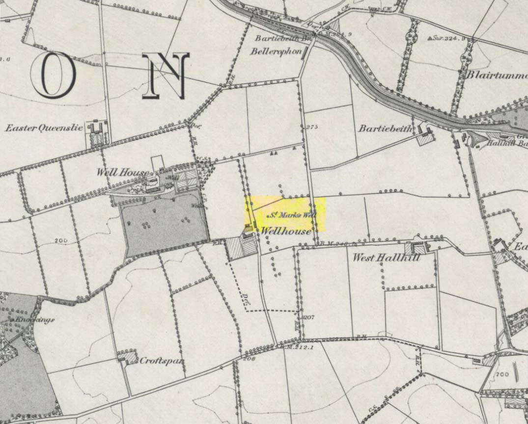
St Marks Well on 1864 map
Information on this long forgotten holy well that once flowed a few miles east of Glasgow city centre, beneath what is now Wellhouse estate, is all but lost. Local history works of the area tell us little (though there must surely be something somewhere?) and even the place-name surveyor of this area—Peter Drummond (2014)—could find nothing. Noted by the Ordnance Survey lads in 1858, when they came to re-survey the area again in 1899 its waters had, it seems, been covered and carried into the ‘Well house’ less about 50 yards to the southwest (another ‘Wellhouse’ found 150 yards further west is the site that gives the estate its present name). From thereon, this wellhouse and St. Mark’s Well fell into the forgotten pages of history and, sadly it seems, even its oral tradition has died…
The origin and nature of the ‘well house’ isn’t too troublesome, as Drummond (2014) explains:
“The name Wellhouse exists in several places in Scotland, and could indicate a ‘house beside wells’, or a protective ‘house over wells’; the early record here suggests the former, since the first Glasgow Water Company’s Act was obtained in 1806, many years later.”
However, the reasons behind the dedication to St. Mark at this probably heathen arena in times gone by, seems to be quite a mystery. Perhaps the folklore of the saint concerned may be of some help.
Customs practiced on St. Mark’s Eve and St. Mark’s Day (April 24-5) are replete with animistic elements throughout and are certainly not christian! Six months after the old New Year, we find rituals once more allowing, not for the passing of, but the emergence of the dead: bringing the spirits into the Spring and Summer. Divination rites were practiced with Cannabis sativa no less! Prophecy and wise-women were advisors to the young. Walking backwards around wells were known at some St. Mark’s wells; whilst others without his name—but on this saint’s day—were leapt across, symbolizing the crossing of danger and darkness in the ritual calendar. All around this period of time, up to and including Beltane, the end of the dark cold year has passed, and these plentiful rites are prequels to the lighter days, warm spring, summer and good autumn: all vital rites for the people in their myths of the eternal return…
St. Mark’s Well at Glasgow meanwhile, seems to have lost its old tales… Surely not?
References:
Banks, M. MacLeod, British Calendar Customs: Scotland – volume 2, Folk-lore Society: Glasgow 1939.
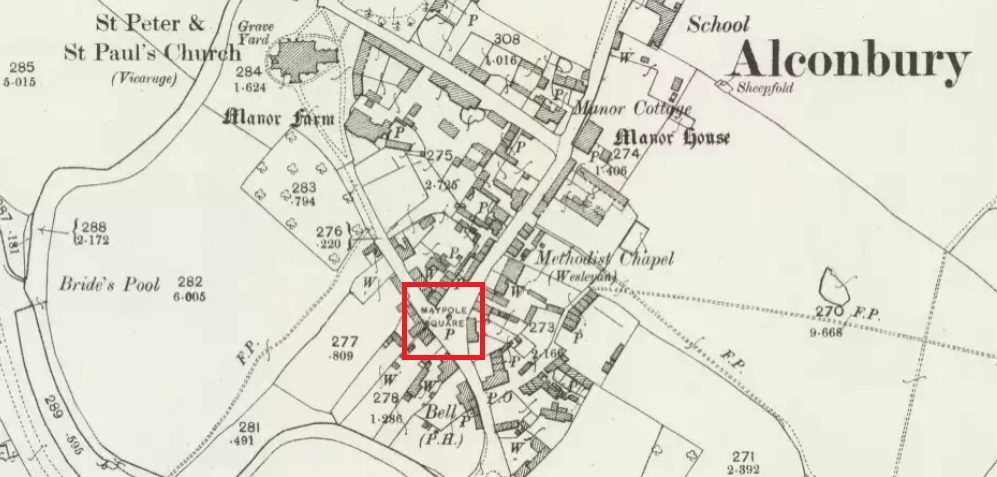
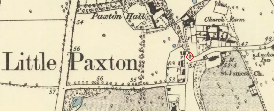
Maypole Square, outlined in red on the 1901 OS map
Maypole Square forms the junction of High Street, Church Way and Chapel Street in the centre of the village.
Archaeology & History
The Alconbury Maypole had passed out of living memory by 1942, but was historically attested by the ‘Maypole Square’ in the centre of the village.
Folklore
C.F. Tebbutt wrote in 1950:
“At Alconbury, it is remembered that about 1890 an old soldier, who lived in the corner house (east end) of the row of cottages facing Maypole Square, used to dig holes in the road opposite the row and set up May bushes there on May day”.
References:
C.F.Tebbutt, “Huntingdonshire Folk and their Folklore”, in Transactions of the Cambridgeshire and Huntingdonshire Archaeological Society, Volume VI, part V, 1942.
C.F.Tebbutt, “Huntingdonshire Folk and their Folklore II”, in Transactions of the Cambridgeshire and Huntingdonshire Archaeological Society, Volume VII, part III, 1950.
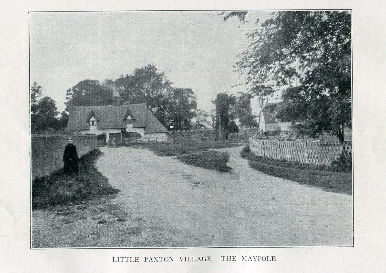
Imposing trunk of The Maypole Tree, right background
The road layout of the village has changed since the destruction of the Tree, but its approximate position was on the north side of the present High Street, at the junction with the east side of St James’ Road.
Archaeology & History
The Little Paxton Maypole Tree was a very late survival of a tradition where Mayday revellers danced around an actual tree rather than a symbolic tree in the form of a maypole. It was described as “a tall straight elm tree” that stood in front of what was then the village Post Office, and from what may be the only surviving photograph, it appears that only the very substantial trunk survived of what was clearly a very old tree.
1887 6″ OS Map, showing the Maypole Tree outlined in red
A Miss Ethel Ladds, who had been born in Little Paxton, recalled in the early 1940s:
“I remember the old tree very well, it was always called ‘the Maypole’, but I don’t know any more about it, except that they used to dance round it“.
The St Neots Advertiser recorded that the Maypole Tree was blown down in a great gale on 24th March 1895.
Folklore
While this writer has been unable to find direct folklore relating to the Little Paxton Maypole Tree, it may be worth remarking that botanically the Elm tree is a cousin of the Stinging Nettle, the Hop and Cannabis. Another Elm Tree used for May revels was the Tubney Elm, near Fyfield in Berkshire and recorded by Matthew Arnold, in his ‘Scholar Gipsy’.
References:
C.F. Tebbutt, “Huntingdonshire Folk And Their Folklore”, in Transactions of the Cambridgeshire & Huntingdonshire Archaeological Society, Volume VI, Part V, 1942
C.F. Tebbutt, “Huntingdonshire Folk And Their Folklore”, in Transactions of the Cambridgeshire & Huntingdonshire Archaeological Society, Volume VII, Part III, 1950
Gerald Wilkinson, Epitaph For The Elm, Arrow Books, London, 1979
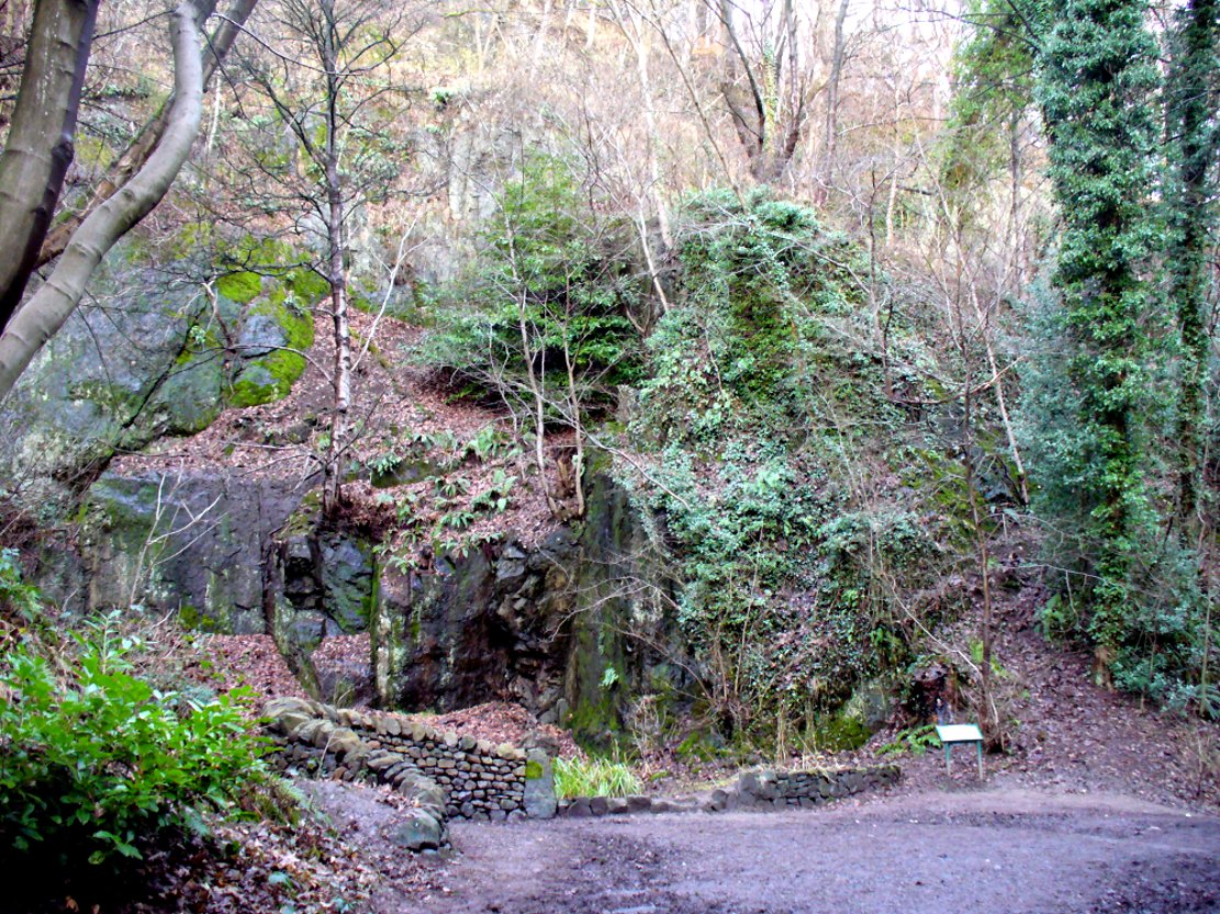
From the main street through Alva, between the Co-op and the corner shop, go up the small road at the side of the Johnstone Arms Hotel (Brook Street) and, at the small crossroads, straight across as if following the sign to the golf course. Stay along the track parallel with the Alva Burn waters and as you go into the trees a hundred yards or so along, to your left is a disused quarry, with a couple of plaques telling you its brief history. This is the spot!
Archaeology & History
This is a truly fascinating site for a number of reasons. Sadly, we can no longer see what had been here for oh so many thousands of years thanks, as usual, to the industrialists destroying the land here. Although in this case, without them we’d be unaware of its very existence. Additionally, there is a twist to the industrial’s find, which seems to have stopped further quarrying by some local people….
The tomb was somewhere in the left-middle
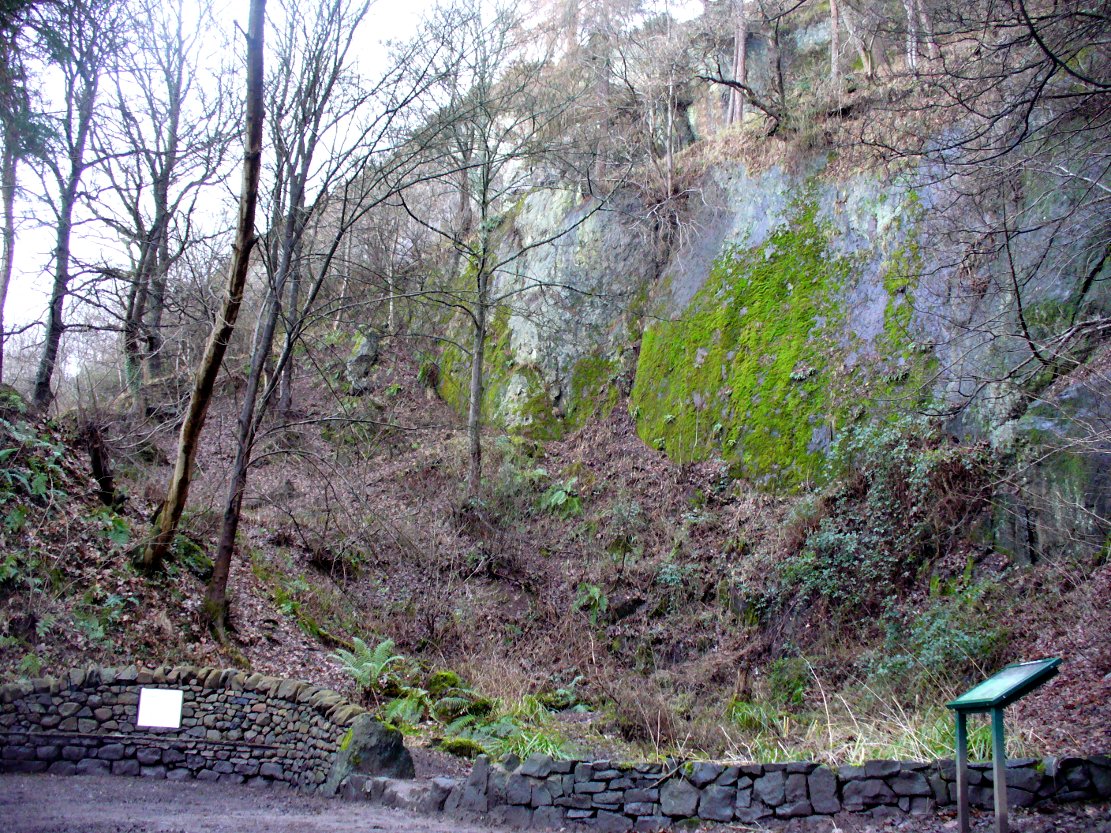
Listed in the relative Royal Commission accounts (1933; 1978), without comments, the tale is a simple one, but was narrated in some detail by J.G. Callander (1914) in Scotland’s prodigious Society of Antiquaries journal. During some quarrying operations over the Christmas period of 1912, James Murdoch “uncovered the remains of a human skeleton which had been buried in a natural cavity in the rock.” Three weeks later, local police officer George Donald and Dr W.L. Cunningham of Alva, accompanied Mr Callander to the site and made a detailed assessment of what had been found. He wrote:
“The quarry in which the grave was found is situated at the mouth of Alva Glen, a few yards distant from the right bank of the burn which flows through it. The body had been placed in a cavity or rock shelter in the face of the cliff, about 40 feet from the base, and about 200 feet above sea-level, and a rough, curved wall of dry-stone building, about 1 foot in thickness, had been built across the opening, which faced the east, the ends of the wall being still in situ when I visited the site. The space enclosed measured about 4 feet 6 inches from north to south, and about 5 feet from east to west. Subsequent to the burial the whole face of the rock and the walling had been covered, to a thickness of probably some 6 feet, by soil and detritus washed down from the hill face above. The greater part of the floor of the cavity was formed of clean, broken, angular stones, but the space on which the body was placed had been covered with a thin layer of soil preparatory to the burial. No charcoal or charred wood, which is so often seen in prehistoric graves, was found in this deposit. The skull lay in the north end of the grave, on its right side, facing the rock to the west, the vertebrae and ribs followed a line to the south, and the nether limbs were inclined towards the interior of the cavity. The whole face, including all the teeth and the lower jaw, was a-wanting. Apparently the body had been placed in a flexed position, half on its side and half on its back. Nothing else was found in the grave but a quantity of snail shells, probably twenty or thirty, which were nearly all broken, the few complete examples being in a very fragile condition.
“Elsewhere it has been stated that these formed a necklace, but while they were strewn out in front of the skeleton for a distance of over 3 feet, none of them showed any signs of artificial perforation. The species of Helixis is probably hortensis, the common garden snail.”
Mr Callander then included a lengthy description of the body itself, some of whose bones were fractured. He told that a certain
“Professor Bryce states that the skeleton is that of a dwarf of about 4 feet 2 inches in stature. The epiphyses are all fully united, although the line of union is visible on the surface at some points. Growth must therefore have been completed, and the person must have been, if the union of the epiphyses of the long bones had pursued its normal course, over twenty-one years of age…”
Regarding the sex of the dwarf, Mr Bryce wasn’t 100% certain, but told:
“The calvaria shows the general characters of a female skull, but it cannot be stated definitely that the individual was a woman, because the cranial characters are such as might have been present in a dwarf of the male sex. The calvaria is of moderate size, and is well formed.”
Bryce concluded as a whole that this person was in reasonably good health and, from the condition of the bones, showed “there was no evidence of the disease known as rickets.” In his final remarks he told:
“The general conclusions to which a careful examination of the skeleton leads, is that we have here to do, not with a representative of a dwarfish race, but with an individual who from premature union of the epiphyses was to a remarkable degree stunted in growth. The condition is a well-known one, and the class of dwarfs, in which this individual must be included, is well recognised.”
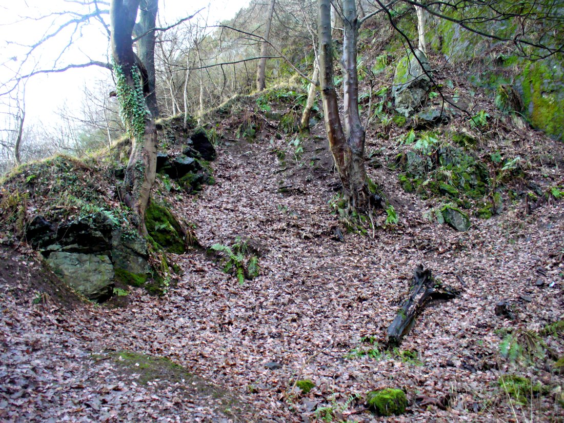
Probable spot of the lost tomb
The exact spot of the tomb appears to have been destroyed, or at the very least is certainly covered over and no longer visible. The section of the quarry looking east, into which the tomb was built, is all-but gone and no initial evidence prevails to show its exact location. However, it would seem from the description to have been close to the tops of the tree-line, perhaps giving a clear view to the rising sun in the east. Perhaps…
The position of this tomb, enclosed high up in the cliffs, hidden away at the entrance to the deeply cut ravine of the Alva Glen, is intriguing in that it is a rarity. Ravines like this are always peopled by olde spirits in animistic tribal traditions — and this dangerous glen with its fast waters and high falls would have been no different, especially to the Pictish people who we know were still here even after the Romans had buggered off. Is it possible that this figure was a guardian to the Glen itself, a medicine woman or shaman, whose very Glen was her home? We know from traditional accounts in many of the North American tribes that dwarves were accessories to the spirit worlds, and some were shamans. (Park 1938) In northern and central European lore, these small people are “the mysterious craftsmen-priests of early civilizations.” (Motz 1987) Whilst in Scottish lowland lore, the ‘Brown Man of the Muirs’ was a dwarfish creature described by Briggs (1979) as “a guardian spirit of wild beasts”, or watered-down shaman figure. There is more to this burial than meets the eye of dry academia…
Folklore
The Alva Glen—in addition to being beautiful and home to the Ladies Well—was long known to be one of many places in the Ochils that were peopled by the faerie folk. (Fergusson 1912) Local people still say this place is haunted by the spirit of a dangerous witch called Jenny Mutton.
It’s worth reiterating the words of Mr Callander (1914) regarding the finding and subsequent death of the man who uncovered this fascinating tomb, as some folk (then as now) think his demise was as inevitable as the man who planned on building turbines in Glen Cailleach:
“On the 24th December last, while quarrying stone for road metal in a quarry at the foot of the Ochils, at Alva, James Murdoch uncovered the remains of a human skeleton which had been buried in a natural cavity in the rock. Two days later he was killed at the same spot by the fall of a mass of overhanging rock, a tragic sequel, which not long ago would have been considered a judgement on him for disturbing the dead.”
References:
Briggs, Katherine M., A Dictionary of Fairies, Penguin: Harmondsworth 1979.
Corbett, L., et al., The Ochil Hills, Forth Naturalist & Historian 1994.
Drummond, A.L., “The Prehistory and Prehistoric Remains of the Hillfoots and Neighbouring District”, in Transactions Stirling Natural History & Antiquarian Society, volume 59, 1937.
Fergusson, R. Menzies, The Ochil Fairy Tales, David Nutt: London 1912.
Gimbutas, Marija, “Slavic Religion,” in Encyclopedia of Religion – volume 13 (editor M. Eliade), MacMillan: New York 1987.
Motz, Lotte, “Dvergar,” in Encyclopedia of Religion – volume 4 (editor M. Eliade), MacMillan: New York 1987.
Park, Willard Z., Shamanism in Western North America: A Study in Cultural Relationships, Evanston: Chicago 1938.
Royal Commission on the Ancient & Historical Monuments, Scotland, Inventory of Monuments and Constructions in the Counties of Fife, Kinross and Clackmannan, HMSO: Edinburgh 1933.
Royal Commission on the Ancient & Historical Monuments, Scotland, The Archaeological Sites and Monuments of Clackmannan District and Falkirk District, Society of Antiquaries of Scotland 1978.
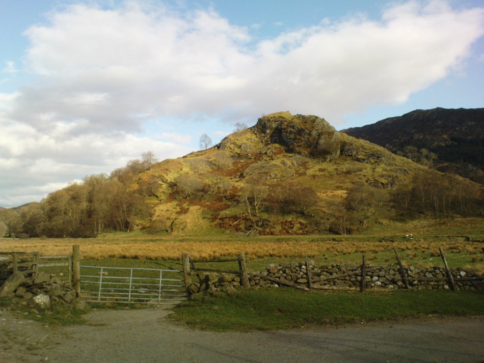
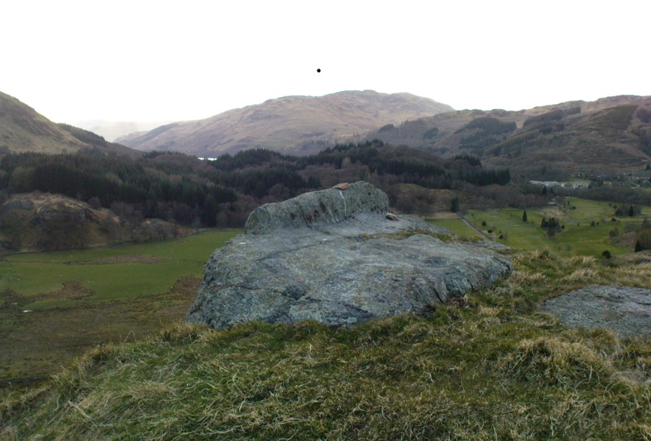
Not hard to find. Between the small towns of Comrie and St. Fillans along the A85 road, keep your eyes peeled for the small but rocky crags that rise in front of the background of dramatic mountains not far from the roadside to the south. It looks truly majestic even on a dull day. Just as you reach the eastern edge of St. Fillans village, take the small road over the river-bridge and go to the golf club. Walk past the golf club itself, keeping along the track that leads you to Dundurn hill. It’s easy enough. Then climb to the very top of the hill where you’ll find this curious, large, flat bed-like rock right in front of you!
Archaeology & History
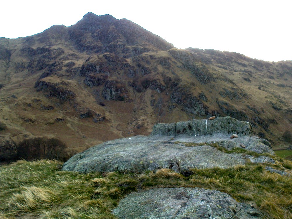
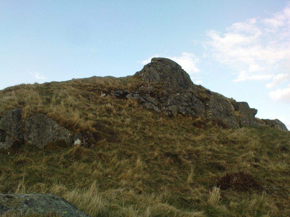
St Fillan’s rocky bed or ‘chair’
The archaeological data for St. Fillan’s Chair relates more to the folklore practices of the people upon Dundurn hill than anything else and ostensibly little can be said by such students. The place is more satisfying for geologists than archaeologists, who would adore the rocky fluctuations and geophysical propensities with greater verve than any archaeologist could muster! For this rocky bed-shaped feature is a fascinating structure whose only potential interest to archaeologists are what may be a couple of reduced cup-marks on the top of the stone (and even then, such potential rock art is more the province of religious historians and anthropologists than archaeologists).
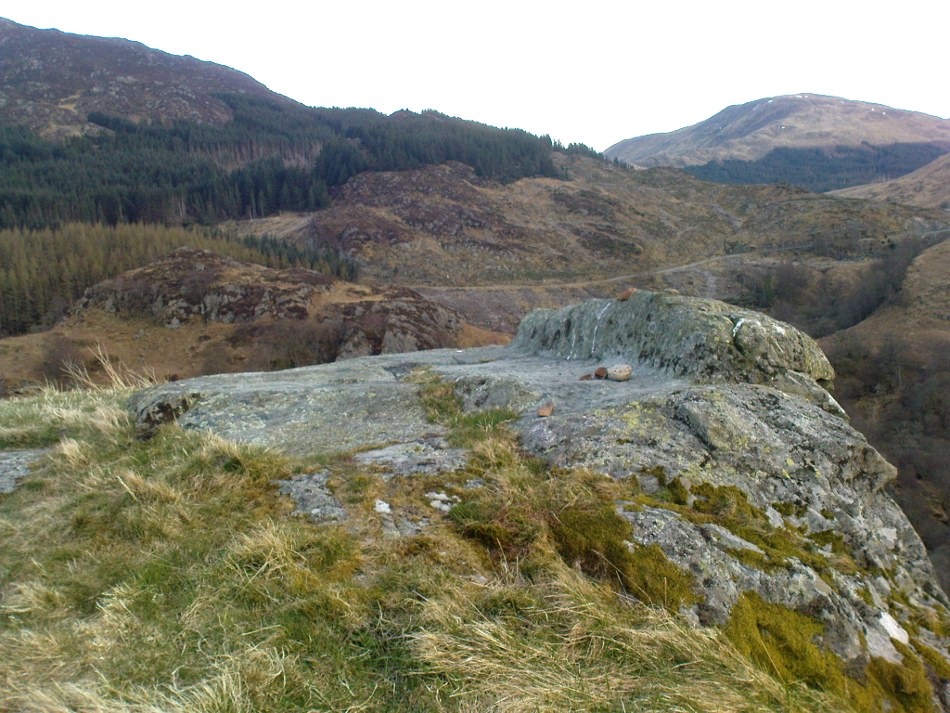
Small quartz offerings left on St Fillan’s Chair at BeltaneView of the Chair from below
But this ‘bed’ or ‘chair’, as it was locally known, was – and it seems, still is – important in the social history of the area, as its folklore clearly tells. The ‘chair’ plays an important part in the holistic role of Dundurn as a hill, a fort, a healing centre, an inauguration site, and very probably an omphalos: a sacred centre whereupon the ordination of shamans, kings and the cosmos as a whole was brought to bear here… (these features will be explored in greater depth when I write a singular profile of Dundurn as a ‘fort’).
Folklore
Looking west over St Fillan’s Chair
The character of St. Fillan was described by James Cockburn (1954) as “an Irish Pict” and the “son of a King – his father being Angus mac Nadfraich who died in battle in 490 AD.” Quite an important dood in his day! The relationship this early christian figure had with this Chair was in its supposedly curative properties. Yeah…you read it right: curative properties! As with countless rocks all over the world, some of Nature’s outcrop boulders were imbued with a spirit of their own and, when conditions and/or the cycle of the spirit ‘awoke’, healing attributes could be gained from the place. And such was the case at St. Fillan’s Chair, especially on Beltane morning (May 1). And some element of this traditional pilgrimage is still done; for when the author Marion Woolley and I visited the site on Mayday 2013, it was obvious that some people had been up earlier that Beltane morning and left some offerings of quartz stones on the top end of the bed.
The earliest written reference of this medicinal virtue was told in the Old Statistical Account of Perthshire (1791):
The rock on the summit of the hill, formed, of itself, a chair for the saint, which still remains. Those who complain of rheumatism in the back, must ascend the hill, sit in this chair, then lie down on their back, and be pulled by the legs to the bottom of the hill. This operation is still performed, and reckoned very efficacious.
More than a hundred years later, the sites was still being used and was described in similar vein in MacKinlay’s (1893) excellent study:
“On the top of green Dunfillan, in the parish of Comrie, is a rocky seat known in the district as Fillan’s Chair. Here, according to tradition, the saint sat and gave his blessing to the country around. Towards the end of last century, and doubtless even later, this chair was associated with a superstitious remedy for rheumatism in the back. The person to be cured sat in the chair, and then, lying on his back, was dragged down the hill by the legs. The influence of the saint lingering about the spot was believed to ensure recovery.”
The origins of this dramatic rite were probably pre-christian in nature and we should have little doubt that St. Fillan replaced the figure of a shaman or local medicine woman of some sort. The ritual “dragging down the hill” may be some faint remnant of initiation rites…
References:
Cockburn, James H., The Celtic Church in Dunblane, Friends of Dunblane Cathedral 1954.
Eliade, Mircea, Rites and Symbols of Initiation, Spring: Woodstock 1995.