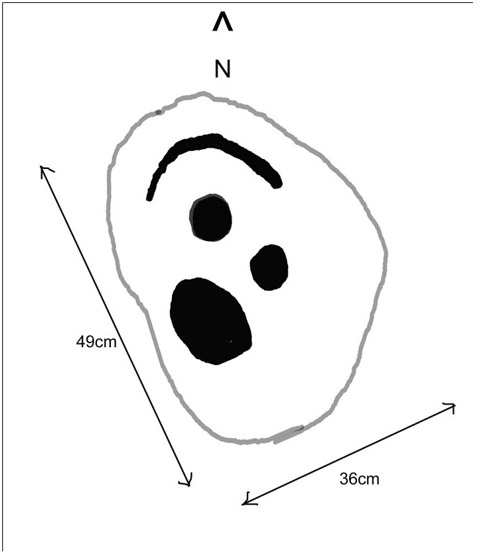
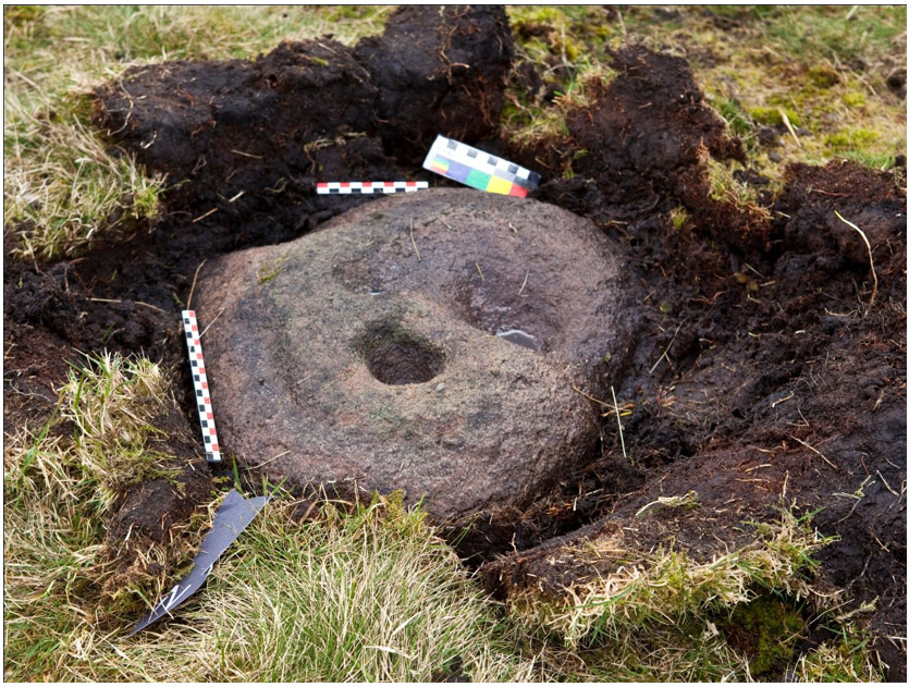
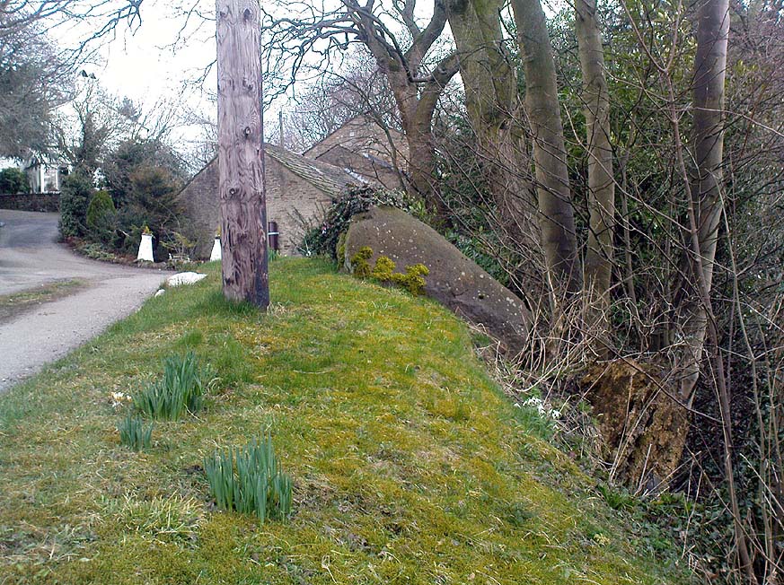
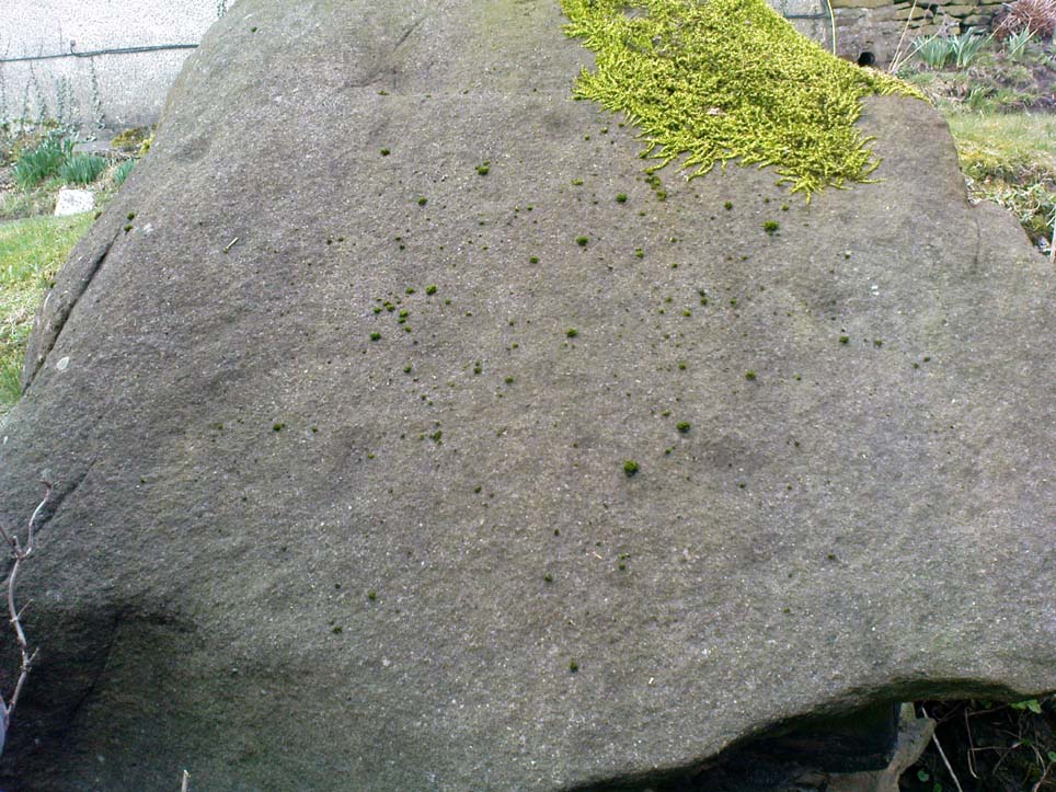
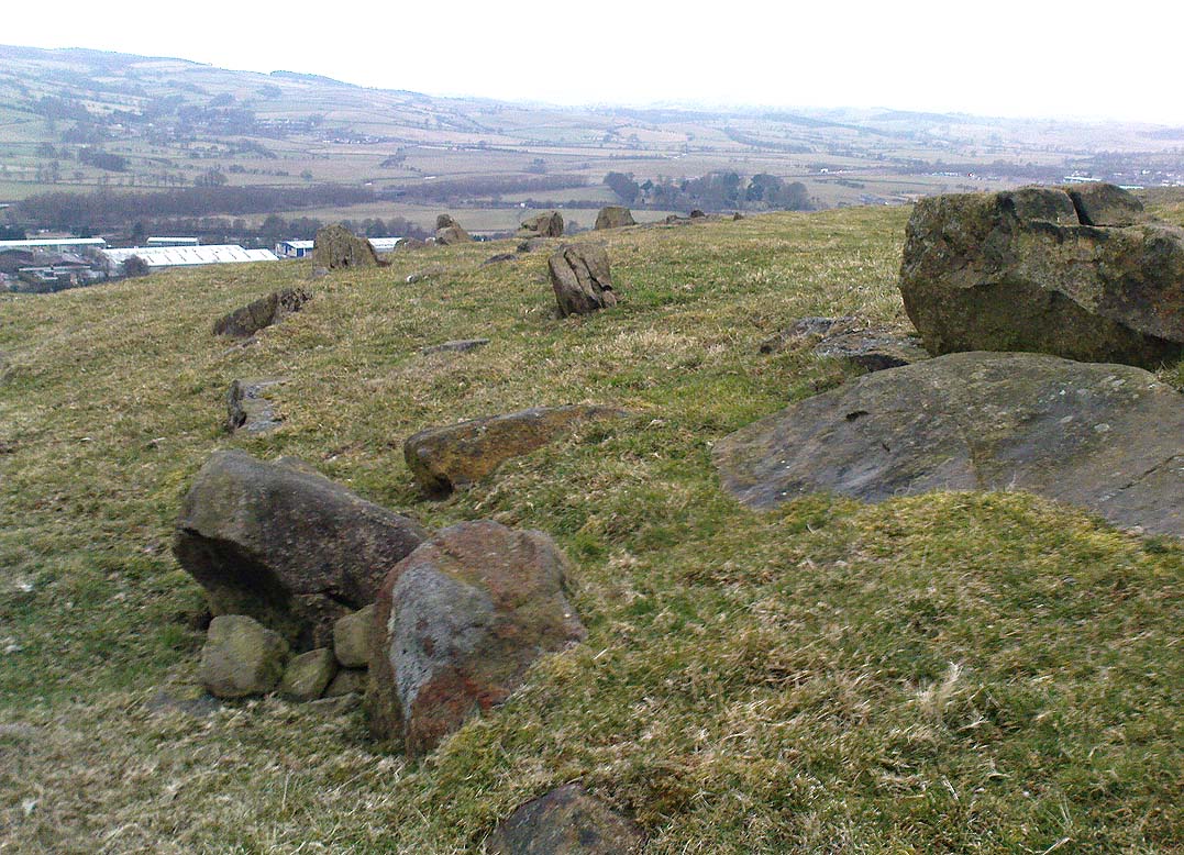
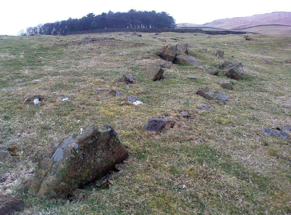
This carving was discovered very recently following an exploration of recognised sites on Middleton Moor by rock art student Mike Short on March 28, 2010. Found amidst a cluster of other carved rocks, it was located after he noticed a small piece of stone poking out of the peat and — as happens to those folk obsessed by these ‘ere carvings — he decided to dig round the stone and cut the turf back to see if there was anything carved on the rock, as there are other cup-and-rings are close by. Thankfully, after a bit of effort digging round the stone, Mike found the carving we see in the images here! (courtesy of Mike and Richard Stroud). With a distinctly ‘facial’ appearance (hence the name), the following notes were written describing the new find:
“Small roughly oval dome-shaped medium grit rock approx. 49cm X 36cm, at and below soil level. Two cups, one of which is conical and deep (55mm deep and 65-75mm diameter) and of similar profile to one of the cups on No. 458; small shallow bowl-like depression with possible peck marks; curving groove on northern edge.”
When Mike finished with their drawings and measurements, the stone was covered back over and left in situ. Although I aint seen the carving ‘in the flesh’ misself yet (we’re gonna have a look next week) it gives me the impression it had some association with burials.
References:
Short, Mike & Stroud, Richard, “Report of New Carved Rock (‘Caspar’) on Middleton Moor,” April 2010.
Take the road up across from Ilkley train station uphill towards the moor until you reach great rocks on your right. From here, the Cow & Calf Stones car park (packed with tourists and litter everywhere these days), go up the steep footpath onto the moor. As you level out looking across the first moorland ridge, to your left is a rounded hillock. Go into the heather there and near its small peak and you’ll find what you’re looking for.
Archaeology & History
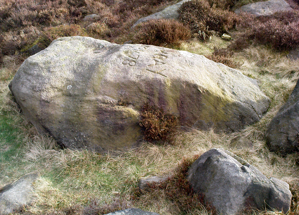
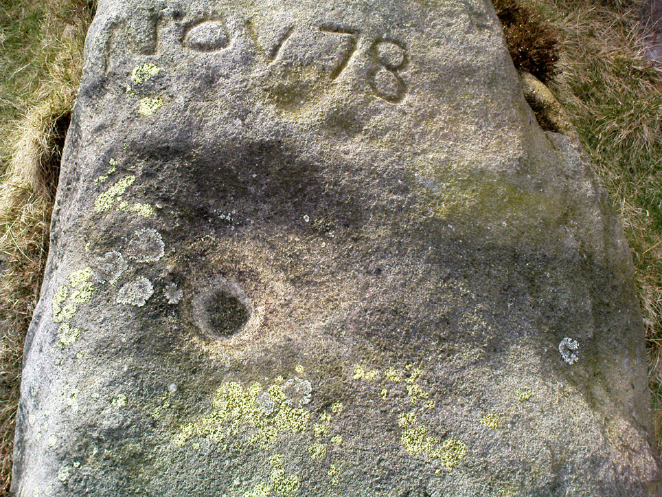
This is a nice big stone, found amidst a clump of other stones, that gives the distinct impression of once being a large cairn or similar artificial prehistoric feature. But that’s wishful thinking on my behalf… This long fat 10-foot long rock has the distinct signature of someone who thought it a good idea to carve his little name on the carving in 1978, as the name of the rock tells: “Wray Nov 78” — vandalism which the local Ilkley Parish Council and local businessman Tom Lonsdale validate as little more than “twenty-first century informal unauthorised carving.” Beneath the great artist’s signature we find two distinct cup-marks above a large rounded bowl, inside of which seems to be the impression of an old ring, but this seems due to the actions of water and lichen. There are perhaps another two faded cup-markings alongside those distinctly visible. In Hedges (1986) survey he described the “top flat surface has three cups and one basin” — so let’s play safe and go with that!
Close-up of cups, bowl & modern etching
It’s a good stone, sat upon a fine ridge with distinctive views for miles both east and west along the valley of the Wharfe, and north to the ancient settlements and burial grounds of Middleton Moor on the other side of the River Wharfe. From here, behind and up onto Ilkley Moor, unfolds its greater mythic history, scattered and hidden over differing ages. In years past, this site was a fine one for reflection and insight. Today, one must venture further and to other sites for such quiet realities. Close by you can find the double-ringed carving of stone 318 and other faded cup-mark stones nearby.
References:
Boughey, Keith & Vickerman, E.A., Prehistoric Rock Art of the West Riding, WYAS: Wakefield 2003.
Cowling, E.T., Rombald’s Way: A Prehistory of Mid-Wharfedale, William Walker: Otley 1946.
Hedges, John (ed.), The Carved Rocks on Rombalds Moor, WYMCC: Wakefield 1986.
From Silsden go up the long hill (A6034) towards Addingham until the hill levels out, then turn left on Cringles Lane (keep your eyes peeled!) for a half-mile where you need to veer right along Banks Lane and go 100 yards past Moorcock Farm Hall where the footpath takes you into the fields on your right. Walk down the line of the wallings, thru the gate, and keep following down until you reach a cluster of large rocks. Stop here and look over the wall where you’ll see one of the boulders poking its head out on the other side. That’s it!
Archaeology & History
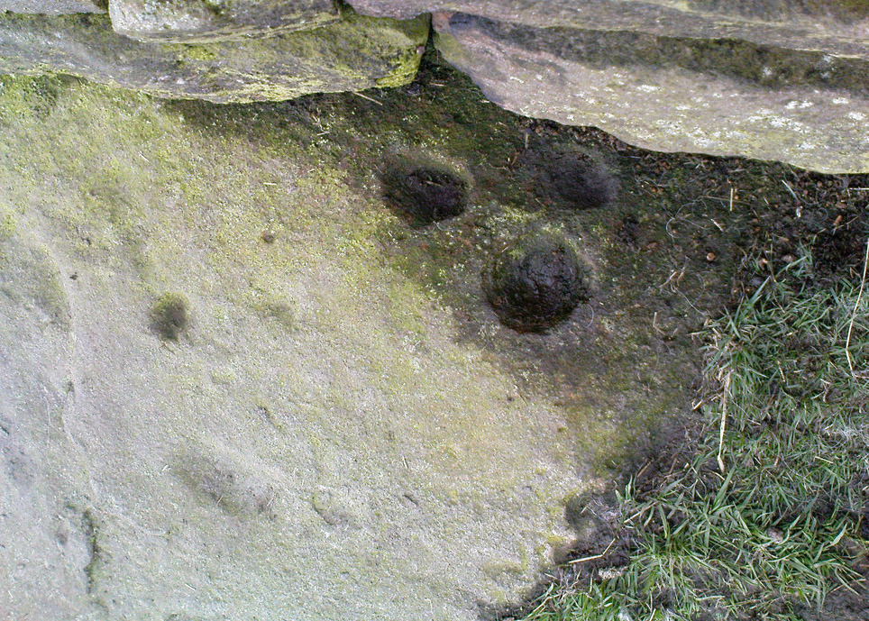
First discovered by Eric Cowling in the late 1930s during one of his explorations of the immense Counter Hill earthworks (thought to be Iron Age), whose remains can still be seen encircling the peaked hill close by. The stone is found in the edge of the walling halfway down the field towards the Marchup enclosure and is just inside the outer edge of the Counter Hill ditched enclosure surrounding the hill above you. (on the other side of the wall from the carving, you can make out the remains of the faint line of the ditch running pretty straight up towards the next wall)
Cluster of cups by wallingCounter Hill carving from above
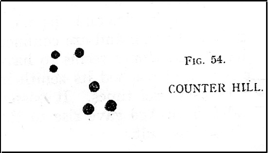
At the top eastern edge of the stone is a clear cluster of 3 cup-markings, just as the rock meets the walling. A much more faint group is visible to the left. Cowling (1946) suggesting that the three-cup-cluster “shows the final form of the fylfot symbol,” i.e., the three-armed swastika. Boughey & Vickerman (2003) meanwhile suggest that one of the two clusters are “doubtful (possibly recent?).”
When we came to this site yesterday, the day was overcast and cloudy. But it seemed there may be more to this carving than has previously been recorded. What may be a faint ring seemed possible near the middle of the stone, with a natural crack running through it (you can just about make it out in the photo on the right). There also seemed to be other faint lines on the rock, but until we’ve been here again with better lighting conditions, the two groups of 3-cups is the symbolic state of play for this stone!
References:
Boughey, Keith & Vickerman, E.A., Prehistoric Rock Art of the West Riding, WYAS: Wakefield 2003.
Cowling, E.T., Rombald’s Way: A Prehistory of Mid-Wharfedale, William Walker: Otley 1946.
Hedges, John (ed.), The Carved Rocks on Rombalds Moor, WYMCC: Wakefield 1986.
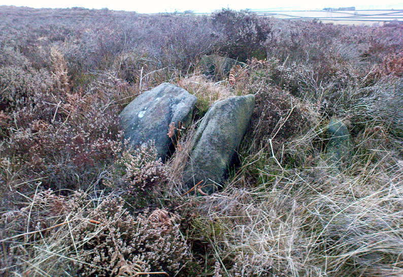
Follow the same directions to reach the Harden Moor circle. From here, walk down the footpath at its side down the slope for 100 yards and take the first little footpath on your left for 25 yards, then left again for 25 yards, watching for a small footpath on your right. Walk on here for another 100 yards or so, keeping your eyes peeled for the image in the photo just off-path on your left, almost overgrown with heather.
Archaeology & History
This is just one of several cairns in and around this area (I’ll probably add more and give ’em their own titles and profiles as time goes by), but it’s in a pretty good state of preservation. Nothing specific has previously been written about it, though it seems to have been recorded and given the National Monument number of 31489, with the comment “Cairn 330m north of Woodhead, Harden Moor.” (anyone able to confirm or correct this for me?)
It’s a good, seemingly undisturbed tomb, very overgrown on its north and eastern sides. Three pretty large upright stones, a couple of feet high, remain in position with an infill of smaller stones and overgrowth (apart from removing a little vegetation from the edges to see it clearer, we didn’t try disturbing it when we found it). It gives the impression of being a tomb for just one, perhaps two people and is more structured than the simple pile-of-stone cairns on the moors north of here above Ilkley and Bingley. Indeed, the upright stones initially gave the impression of it once being a small cromlech of sorts! Other cairns exist close by, but until we get heather-burning done up here, they’re difficult to find – or at least get any decent images of them!
Dead easy this one! On the Keighley-Halifax A629 road, about 500 yards south past Flappit Spring (public house), there’s a small road to your right. Walk on here for 200 yards and look in the field to your right. If the grass is long you might struggle to see it, but gerrin the field and it runs right up against the wall. Y’ can’t miss it really! You can park up a coupla hundred yards down the A629 main road, by the old quarry, and walk back to get here.
Archaeology & History
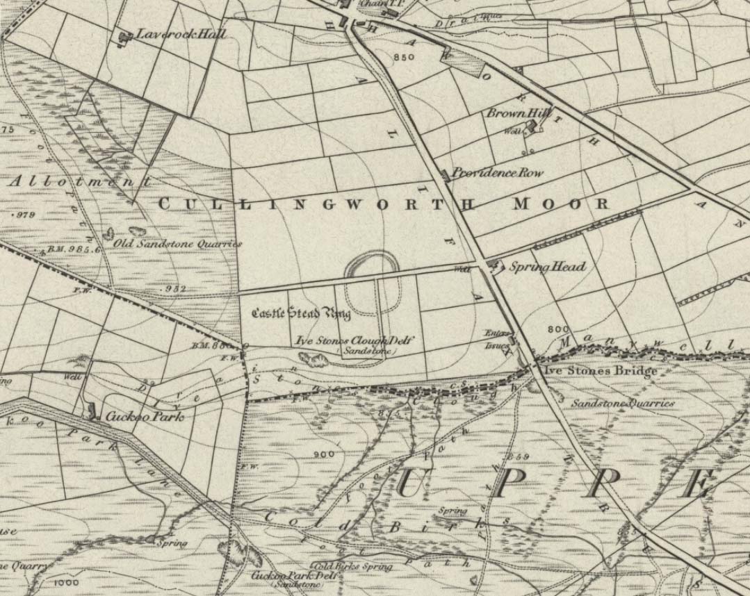
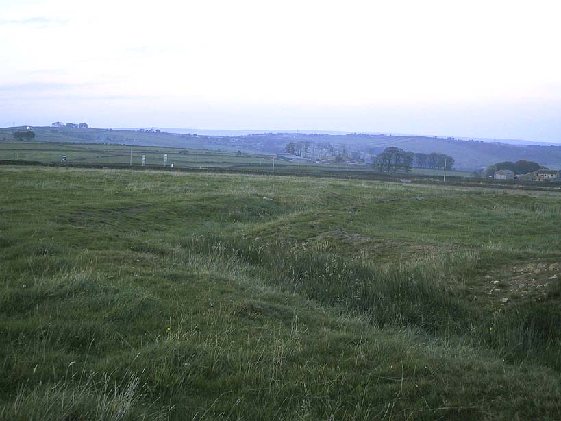
Although I’ve earlier described this as “nowt much to look at,” the more I come here, the more I like the place (sad aren’t !!?). The hard-core archaeology folks amidst you should like it aswell. Not to be confused with the site of the same name a mile to the south of here, this large earthwork was shown on the 1852 OS-map as a complete ring, which is also confirmed in old folklore; and a survey done by Bradford University in the late 1970s indicated a complete circle was once in evidence. To view this for yourself: if you type the OS grid-reference into Google maps, you’ll see from the aerial image that a complete ring was indeed here at sometime in the not-too-distant past.
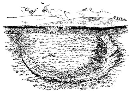
Bend in the ditch on northern side of the ringHarry Speight’s 1898 drawing
Today however – indeed, since William Keighley described it 1858 – there’s only a shallow, semi-circular ditch to be seen in the fields. But despite this, its remains have brought it to the literary attention of about a dozen writers – though we still don’t know exactly what it was! The best conjecture is by the archaeologist Bernard Barnes (1982), who thinks it best to describe as a enclosure or earthwork dating from the Bronze Age. Eighty feet across and covering more than 1.5 acres, an excavation of the site in 1911 found nothing to explain its status.
One of the first descriptions of this site comes from the pen of the industrial Bradford historian, John James in 1876 (though Hearne, Leland and Richardson describe it in brief much earlier). Talking of the sparsity of prehistoric remains in the region (ancient history wasn’t his forte!), he said, “I know of no British remains in the parish that are not equivocal, unless a small earth-work lying to the westward of Cullingworth may be considered of that class.”
Indeed it is! He continued:
“It is situated on a gentle slope, about two hundred yards from a place called Flappit Springs, on the right-hand side of the road leading thence to Halifax. The form has been circular. (my italics) The greater part of it to the south has been destroyed by the plough. I took several measurements of that part which remains, but have mislaid the memoranda I then made; I however estimate the diameter to have been about 50 yards. The ditch to the westward is very perfect. It is about two yards deep and three wide; with the earth thrown up in the form of a rampart on the inner side. The remain is less perfect to the eastward.”
James then speculates on the nature of the site, thinking it to be “one of a line of forts erected by the Brigantes…to prevent the inroads of the Sistuntii.” Intriguing idea!
A few years later when William Cudworth (1876) visited the site, he described:
“At present there only remains about one-fourth part of a circle representing the appearance of a considerable earthwork or rampart. The remainder has been cut away by the construction of the road leading to the allotments.”
Echoing Mr James’ sentiments, Cudworth also suggested “it may have been an enclosure to guard their cattle, while in summer they grazed on the vast slope on which it stands.” Y’ never know…
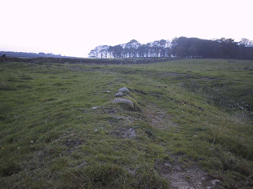
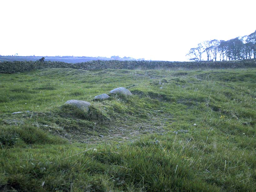
NW section showing bank and ditchExposed stonework of inner embankment
A visit to the place on October 21 2007, found not only a profusion of mushrooms scattering the field (varying species of Amanita, Lycoperdon, Panaeolina, Psilocybes, etc), and the remnants of two old stone buildings 20 yards of the NE side, but a distinctive ‘entrance’ on the northern side of the ring, which gave the slight impression of it being a possible henge monument. It’s certainly big enough! All traces of the southern-side of the ring however, have been ploughed out.
The views from here are quite excellent, nearly all the way round. You’re knocking-on a 1000 feet above sea level and the high hills of Baildon, Ilkley, Ogden Moor and the Oxenhope windmills are your mark-points. There’s one odd thing to think about aswell: if this is a prehistoric site, it’s pretty much an isolated one according to the archaeo-catalogue – and as we know only too well, that aint the rule of things. We’ve got adjacent moorlands south and west of here, very close by. Likelihood is, there’s undiscovered stuff to be foraged for hereabouts…
Folklore
An old folk-name given to this ring is the Blood Dykes, which is supposed to relate to the place being the site of a great battle.
References:
Barnes, Bernard, Man and the Changing Landscape, Eaton: Merseyside 1982.
Bennett, Paul, The Old Stones of Elmet, Capall Bann: Milverton 2001.
Cudworth, William, Round about Bradford, Thomas Brear: Bradford 1876.
Elgee, Frank & Harriett, The Archaeology of Yorkshire, Methuen: London 1933.
Forshaw, C.F., ‘Castlestead, near Cullingworth,’ in Yorkshire Notes and Queries – volume 4, H.C. Derwent: Bradford 1908.
James, John, The History and Topography of Bradford, Longmans: London 1876.
Keighley, J.J., ‘The Prehistoric Period,’ in Faull & Moorhouse’s, West Yorkshire: An Archaeological Survey to AD 1500 – volume 1, WYMCC: Wakefield 1981.
Keighley, William, Keighley, Past and Present, Arthur Hall: Keighley 1858.
Speight, Harry, Chronicles and Stories of Bingley and District, Elliott Stock: London 1898.
Not too far from the High Laithe cup-and-ring stone. Along the A6131 out of Skipton, park up at the Rendezvous hotel and go up the road on your left, over the canal. As you approach the second house up, note the rock on the right-hand side of the tiny road, perched on the edge above the stream, with ivy creeping up one side of it. That’s it!
Archaeology & History
This stone was moved to its present position a few decades back, sometime before Hedges (1986) first recorded it in his Carved Rocks work. It’s a reasonably large boulder, resting on the slope above the drop to the stream below, and will probably drop into the waters in the not-too-distant future. Whether the stream had any initial relationship with the cup-markings etched on its surface, we’ll probably never know (a number of rock art students love the water-stone relationship — and this one is no doubt in their listings!). Its first literary appearance by Hedges described it thus:
“Large fairly smooth grit rock sloping down to stream at E and into ground and grass at W. Eleven cups, circle of nine very small cups at one end, groove from depression, one other groove and possible cup.”
Lower half of CR-016
Which just about does it justice. When we visited the place yesterday, the cluster of small cups at the top of the rock were difficult to see clearly in the grey daylight; but what seems to be another 2 cups (not in Hedges, nor Boughey & Vickerman’s [1986] survey) may be on the lower-half of the stone, and can be seen in the photo here. We need to go back again on a bright day and catch the stone in a different mood to suss out whether we were just seeing things.
References:
Boughey, Keith & Vickerman, E.A., Prehistoric Rock Art of the West Riding, WYAS: Leeds 2003.
Hedges, John (ed.), The Carved Rocks on Rombald’s Moor, WYMCC: Wakefield 1986.
From Skipton town centre follow the A6131 road south, out of town, for less than a mile, and turn left up Cawder Lane. Avoid following the road into the housing, instead bearing up the country lane to your left. Just before reaching the farmhouses 200 yards up, note the stony hilltop above you on your left (up behind Horse Close Farm). Walk up there for 250 yards NE and you’ll find it!
Archaeology & History
Horse Hill enclosure, looking W
This is an impressive site. I’d say very impressive! (but I’m easily pleased) Oddly however, I can’t find a damn thing about this place in any of my archaeo-records and it appears (as far as I’m aware) that no survey has ever been made of it. Which is bloody incredible! Indeed, the only archaeological notes that appear to exist about this very impressive and well-preserved Iron Age enclosure, states, “Subcircular enclosed settlement on Horse Close Hill 250m north of Horse Close Farm.” That’s it! Nothing else! So I’m afraid you’ve only got my crappy description of it to go on for the time being…
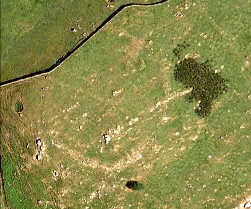
As the aerial image below shows, this is a large oval-shaped enclosure, defined primarily by an almost complete ring of double walling arranged around this hilltop site. Measuring approximately 78 yards (71m) north-south, and nearly 75 yards (70m) along its longer east-west axis, with a circumference of about 235 yards (215m), many of the upright stones which define its edges stand between 1-3 feet in height. Some of these stones have obviously been moved into position by the lads who built the structure, but the site has also taken advantage of a number of large earthfast boulders in its construction.
If you walk around the edges of the walled enclosure, almost every bit of it is clearly visible. Between the defining inner and outer walling of the structure we find sections of the site packed with smaller stones, giving the impression that it may once have been filled all round, making the walls thick strong defensive ones. But without a more detailed investigation, we’ll never really know…
Horse Close settlement, looking NEAerial view of enclosure
It is clearly very similar in structure, and probably date, to the well-known Brackenhall circle on Shipley Glen, near Baildon (though the nature of the Brackenhall site has long been a topic of controversy). And, as with the Brackenhall site, a number of cup-and-ring stones are found close by — including the Great Wood Laithe carving in the field immediately below on the west side. I’ve also found a similar structure to this on the hills above Steeton, a few miles to the south (though it’s not as well-defined as this one).
Although the site is mainly defined by its oval walling, we also find other stretches of walling that run outwards from the central site: one in particular running north-east for 35 yards out towards a small standing-stone further up the field. Other curious earthworks and remains scatter the fields on the eastern sides of this main feature, which the helpful farmer here pointed out to us.
Worth the short trek if you like your cup&rings! On the Aire Valley Keighley-to-Skipton road (A629), as you approach the southern outskirts of Skipton, take the turning at the roundabout as if you’re going into the town up the A6131. Go over the next roundabout a coupla hundred yards on, then 200 yards further on note the right-turn up over the canal (big hotel just here, where you could park up). Walk over the canal up the tiny country lane. Ignore the first left turn and walk up, bearing next left uphill and onto the footpath. Walk up the hillocky quarried bit until you reach the stile in the wall. Once on the other side, look in the walling 20 yards uphill. You can’t miss it!
Archaeology & History
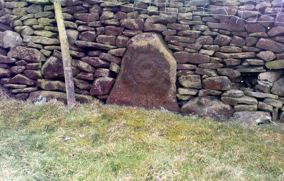
First described by Messrs Hartley and Radley in the Yorkshire Archaeological Register of 1968, this small “standing stone”, less than three-feet tall, has a distinct cup-and-double- ring carved onto its upright north-facing edge. The outline of the carving is visible even in bad light, though you might wanna rest and gaze for a minute or two for yourself and the lighting to adjust if it’s a grey day. There’s another cup-marking below the bottom right of the double-ring, with another ‘possible’ just above ground-level.
References:
Boughey, Keith & Vickerman, E.A., Prehistoric Rock Art of the West Riding, WYAS: Leeds 2003.
Hedges, John (ed.), The Carved Rocks on Rombald’s Moor, WYMCC: Wakefield 1986.
In this lovely little hamlet we find an ancient well, registered as a scheduled monument in its well-house, but with a long history and lots of legends. It was said to have been a wishing well of considerable power, but many local people wouldn’t use it because it was also the place where mischievous pixies lived. It seems that one of its main magical properties was to divine the love of a person. The writer Ruth Tongue (1965) told a long tale she came across in her county folklore book about such a fortune:
“There was a maid servant, see, and she were coming on in years and she do serve a farmer’s wife as were high in station. Proper tackalackey she made of the dear soul, and she having no living kin. Twas pitiful, and her a-longing for a parcel of children underfoot, even if ’twas only to call her Auntie. But there, ‘twadn’t to be, and her with a heart so full a-drip with loving kindness as a honey comb. Oh, she were a proper mannerly maiden, no ways like her mistress who were just a old ewe dressed up lambs fashion and spending her days living two-three steps from nothing. But it didn’t seem like the maiden couldn’t never meet up with a proper man for her. She wadn’t no summer morning to look at, poor soul, and her mistress kept her so thin as a yard of pump water. But there Providence knows best! There were a old fellow over by Aisholt, and he were such a upstanding courageous man he’d a never got round to marrying, let alone finding the bravery to walk arm in crook with a maiden. Well o’ course he were lonely like she. And it come to a St. Agnes Eve when maids creepy over to her well at Cothelstone and whisper their heart’s desire when ’tis dark, and if St. Agnes do fancy the maiden she’ll send a husband that year. Now the poor maid she were coming to the end of her days of womanhood and beginning to blossom about the head, and she were desperate unhappy about it. Her heart was all a-set on children, and she find bravery to slip out after farm’s a-locked up. She didn’t feel ’twere mannerly to worrit St. Agnes over one who was so on in years when there was young maidens as plentiful as blackberries, so what do the dear soul do but go down all in the dimmit to the Wishing Well in Seven Wells Coombe. Proper unket well ’tis, and hard tew find. But St. Agnes must ha’ knowed, for she found’n though there wadn’ but little moon and old fellow he d’hear summat down in coombe and come to look-see. He were a wise old man and nothing hurted he, but he were shy of folks, seems like. Well, whether ’twere St. Agnes I can’t say, but in a year the farm was sold up and the maid was a-wed to the old fellow. So quiet as a sheep the man was, wouldn’ downarg no-one, but he made her a good husband. In a year or two she’d a babe in the cradle and one under her apron, and two clinging to her skirts, and they was all so happy as daisies in the sunshine, as they say.”
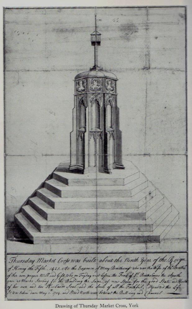
This old cross was demolished long since, but I think it’s important to rejunevate a memory of its existence back into our times. Little has been written about the site as it was destroyed more than 200 years ago and images of the edifice are rare indeed! It was found near the modern centre of the city and although this ornate-looking thirty-foot tall cross was obviously impressive, an even earlier upright stone stood here in the 13th and 14th century. But this new carved monument took precedence over its older and lesser upright. First described — I think! — by Thomas Gent (1730), he told us that,
“The old cross stood towards the Kennel, against the middle of the market. The lower part was an octagon, had an ascent of six high steps, covered with Tyles for Butchers, higher up with nitches, in which had been effigies and a small pillar above with four Dials and over them a Fane.”
A few years later when Francis Drake (1788) described the same monument, he added very few extra details; though told us it had five steps and not six — but this seems to have been an error on his behalf. In C.B. Knight’s (1944) work we have what seems to be the most complete historical description of this lost stone edifice. He wrote:
“In 1429 a new stone cross had been erected in Thursday Market in place of its predecessor by Marion Braythwayt, widow of John Braythwayt, who was Lord Mayor in 1394… This Cross was described by a writer in 1683 as “a fair Cross of stone, built upon the ascent of five steps, and hath neatly cut in stone a turret or battlement eight square, upon which is placed a round pillar with a four-square stone upon the top, which hath a sundial placed upon every square, and a vane above. The Cross hath a penthouse round about it, covered over with tile, to shelter the market people in rainy weather, and is supported upon eight posts, upon one of which, on the south side, is fixed an iron yard-wand, the standard measure of the market.” In 1705 the ancient Market Cross…was pulled down.”
References:
Cobb, Gerald, “Note on a Drawing of Thursday Market Cross, York,” in The Antiquaries Journal, 43:1, 1963.
Davies, Robert, Walks about the City of York, Nichols & Sons: Westminster 1880.
Drake, Francis, Eboracum; or the History and Antiquities of the City of York, Wilson & Spence: York 1788.
Gent, Thomas, The Antient and Modern History of the Famous City of York, Thomas Hammond: York 1730.
Knight, Charles Bruton, A History of the City of York, Herald: York & London 1944.