Takes a bitta finding this one. From the Twin Towers at the top of the moors (Whetstone Gate), walk east along the footpath, past the towers for about another 100 yards, looking out on the other side of the wall until you meet with some walling running downhill onto Morton Moor. Follow this walling for a few hundred yards till it drops down a small valley; then follow the valley down, keeping to its left-hand side, swerving a little round Black Knoll above you. Cross the dried-up stream and about 100 yards ahead of you (southeast), heading towards the Sweet Well, zigzag about (once the heather’s grown back here, this’ll take some finding!). Good luck!
Archaeology & History
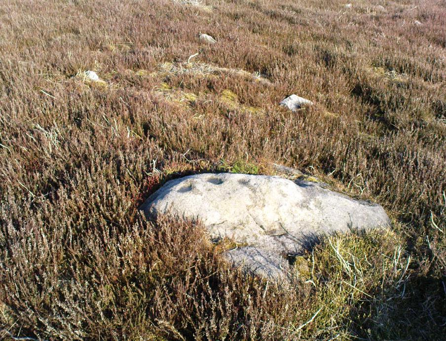
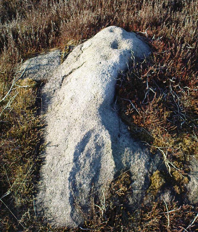
Cup-markings, looking north
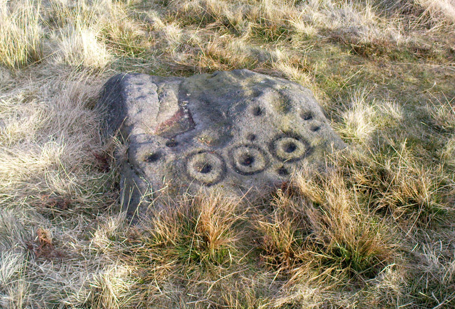
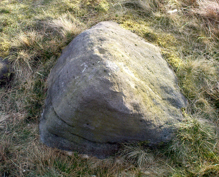
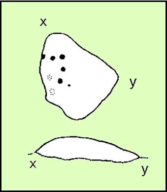
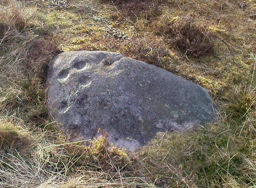
There’s no previous history to this site and archaeological records indicate no prehistoric remains in this region. However, we (that is Dave, Mikki and me) found this and a number of other sites yesterday in a bimbling wander, to and fro, through boggy-heaths and deep heather. It’s a previously unrecorded cup-marked stone, with what seems like an attached burial cairn right by its side (yet again!). The cairn is 3 yards by 2 yards across. Two very distinct cup-marks can clearly be seen near the top of the small stone, with a possible third just below. A curious though natural yoni-like erosion can be seen on the lower side of the stone which may have some significance to people into that sorta thing! Whether it had owt to do with the cup-markings is another thing altogether!
From East Morton village, take the moorland road, east, and up the steep hill. Where the road levels out there’s a right turn, plus (more importantly!) a trackway on your left which leads onto the moor. Go up this track and keep walking till you hit a moorland ‘footpath’ signpost. Just before this walk due west (your left) into the heather for about 10 yards. Look around! (if the heather’s long and overgrown, you might have trouble finding it)
Archaeology & History
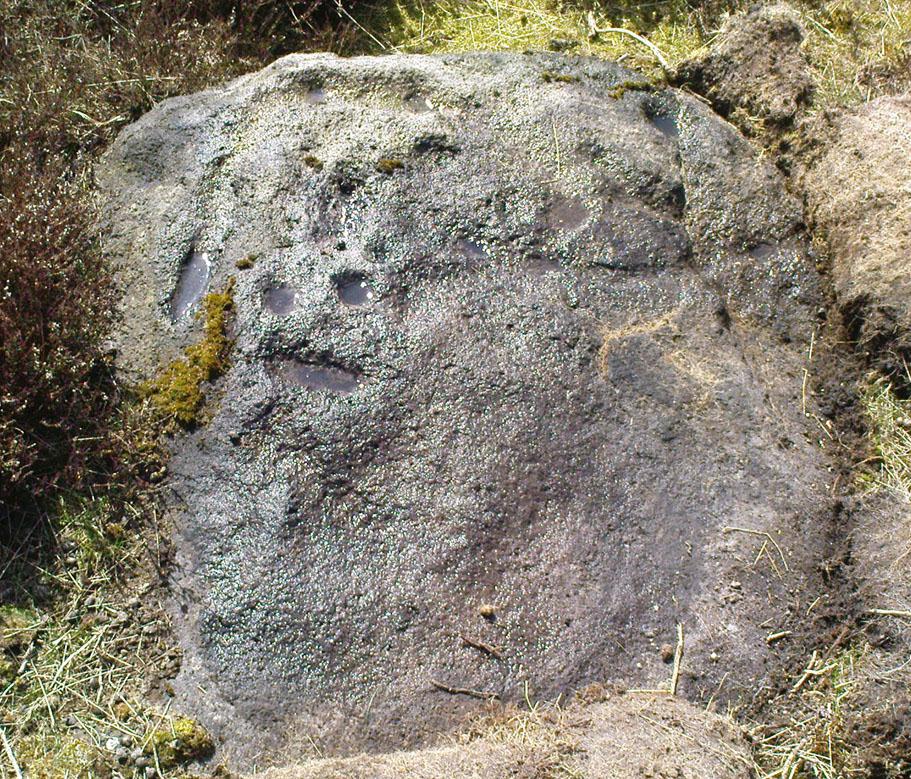
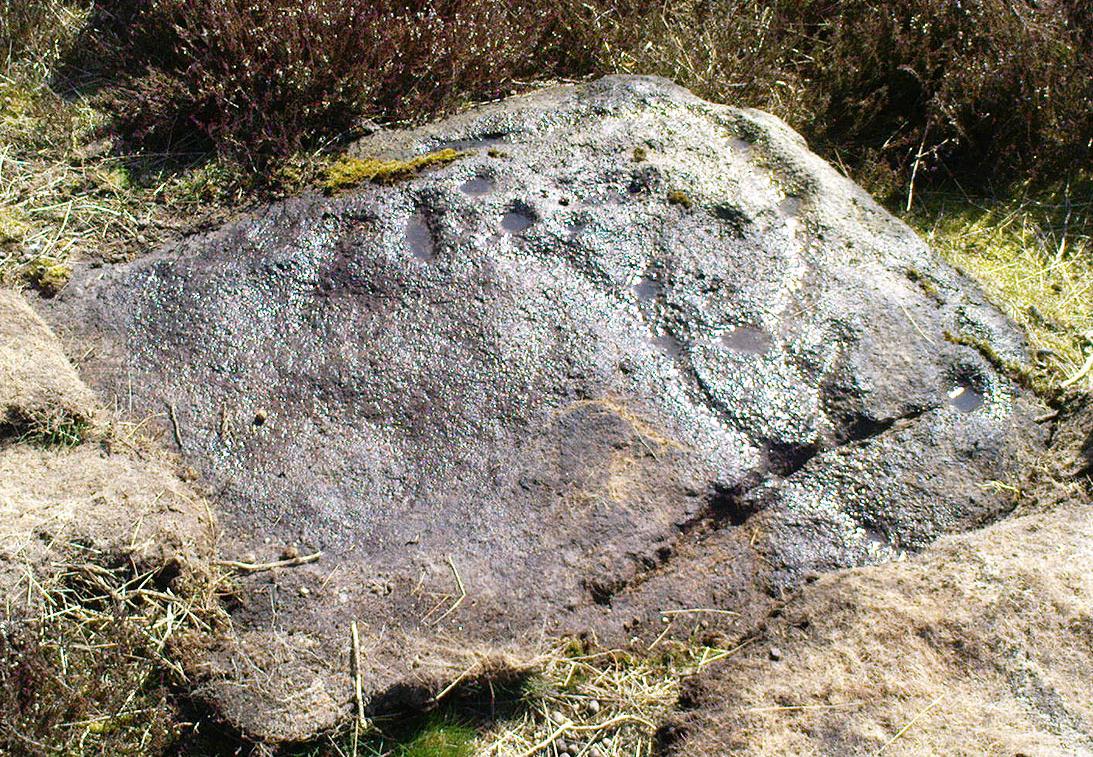
Thought to be one of several carvings that were first reported by Stuart Feather and described in the Yorkshire Archaeological Register* of 1977: near the “denuded remains of a cairn” (there are in fact two here) is “a further cup-marked rock adjacent.” This is thought to be the one registered in John Hedges’ (1986) survey as ‘stone 91’. It’s a cute little thing, about 10 yards south of carving 110 (itself sited near the centre of a much-denuded burial cairn).
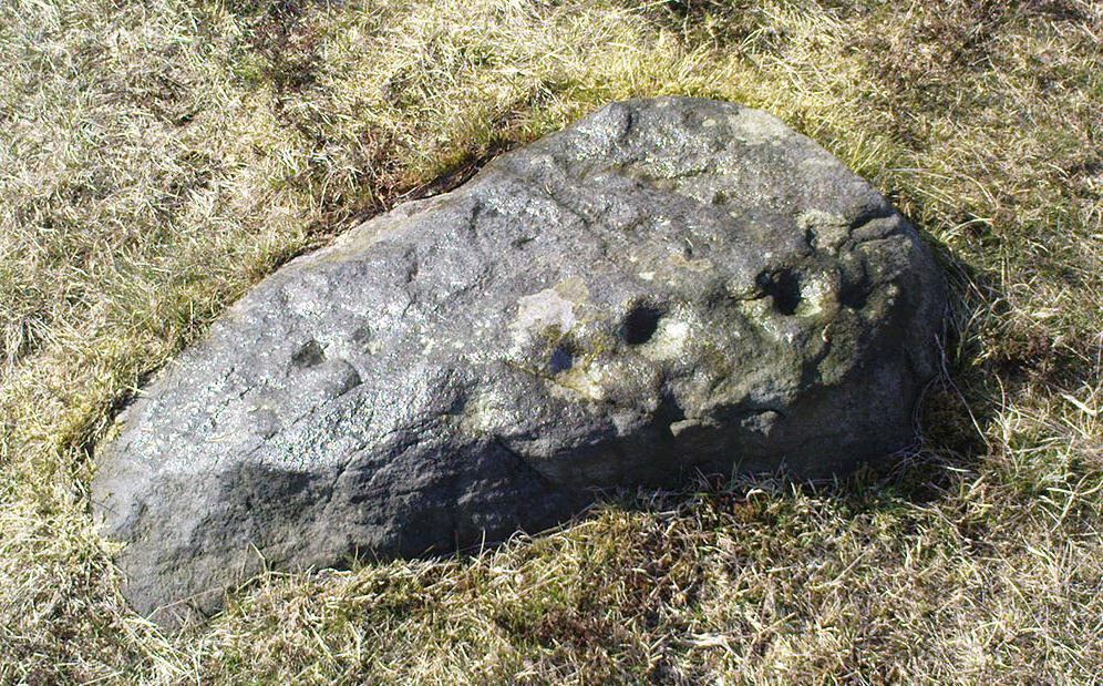
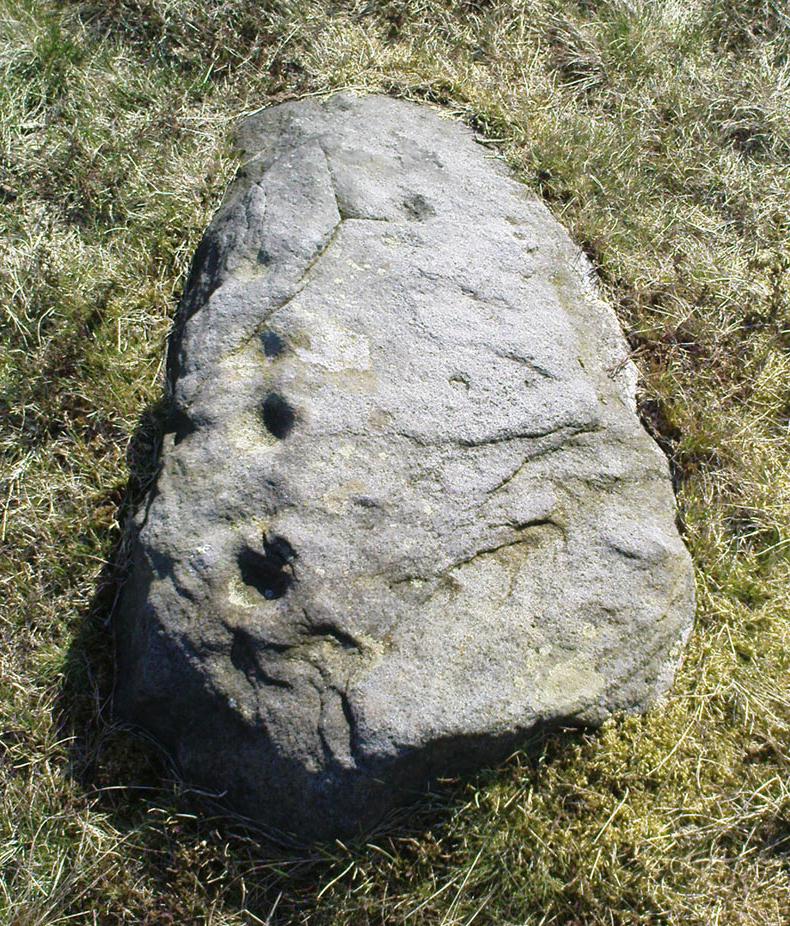
Carving 109, when wet!and when dry!
Similar in design to some of the Baildon Moor cup-marked stones (see carving no.126), the primary design here is a simple one: five cup-markings run along the edge of the small stone, with a small carved “line” running between two of the cups, as if denoting separation; whilst on the lower middle part of the stone is another, single cup, a little more worn than the others. It seems likely that this carving, like its double-ringed companion a few yards away (and others on this part of the moors) was in some way associated with the nearby prehistoric cairns.
References:
Boughey, Keith & Vickerman, E.A., Prehistoric Rock Art of the West Riding, WYAS 2003.
Hedges, John (ed.), The Carved Rocks on Rombalds Moor, WYMCC: Wakefield 1986.
Moorhouse, S. (ed.), “Yorkshire Archaeological Register: 1977,” in Yorkshire Archaeology Journal, volume 50, 1978.
* Does anyone have any idea who you report such new discoveries to so that they can be reported in Yorkshire Archaeology Society’s ‘Register’? I’ve asked ’em several times about a number of previously unrecorded sites that we’ve located, so that they can make a record of them, but I never get a reply.
From Bingley, head up to Eldwick (either road, it doesn’t matter) until you hit the crossroads at the top where you go up Heights Lane onto the moors (ask someone if you’re struggling). Right at the top where the lane meets the moorland road, straight across is a dirt-track onto the moor. You’re going up there! Walk up for about 350 yards, then go into the heather on your left. About 20-30 yards in, keep your eyes peeled for the stone in the photo. It’s low down, a few feet across either way, but easily missed when it gets covered in heather.
Archaeology & History
Todmoor carving’s cup & lines
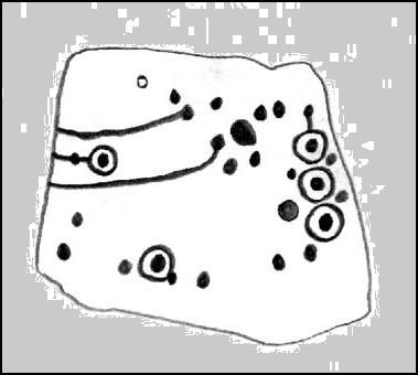
Up here again today — Mikki Potts, Dave and me — this was first carving we came to. It was first discovered by the late great Stuart Feather (1961) on one of his many forays onto these moors. It’s a bittovan odd carving: deep wide grooves, seemingly carved out by humans, in which some other cups have then been carved; plus an odd scatter of other singular cup-markings, what looks like a double-cup, and a long winding line running from near the middle to the stone’s western edge. All the carved elements have been etched onto the southern half of the stone. The lovely little Todmor standing stone is about 50 yards northwest of here.
References:
Boughey, Keith & Vickerman, E.A., Prehistoric Rock Art of the West Riding, WYAS 2003.
Feather, Stuart, “Mid-Wharfedale Cup-and-Ring Markings. Nos. 5 & 6,” in Cartwright Hall Archaeology Group Bulletin, 6:7, 1961.
Hedges, John (ed.), The Carved Rocks on Rombalds Moor, WYMCC: Wakefield 1986.
From the back of Moor End Farm on the south-side of Langbar village, follow the Long Ridge footpath up onto the moor. Walk along the path until its starts dipping down again, onto the moor proper and where another footpath crosses and goes down into the small valley of the Dryas Dike stream: follow it down, crossing the stream and up the small slope till you’re on the next level of ground. Stop here and walk right, off-path and up the gentle slope towards a small fenced-off piece of moor. About 30 yards before the fence, check out the rocks under your noses. You’re damn close!
Archaeology & History
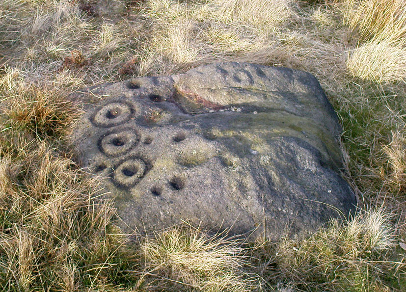
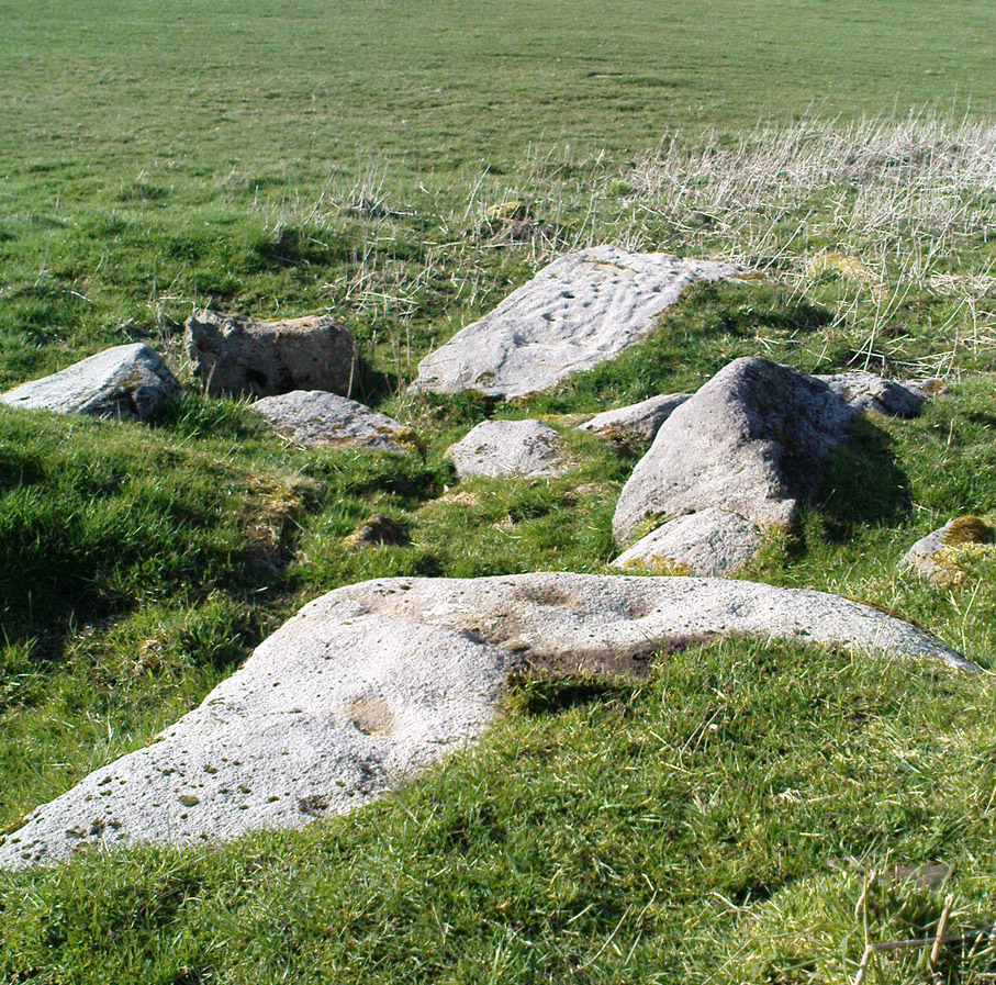
If you’re gonna come up this region, this is the carving you’ll most wanna check out. It’s the most ornamented of all the cup-and-ring stones at the top of Delves Beck. Comprising at least five full cup-and-rings and a number of single cups, carved on a roughly square flat rock, it was first found by Stuart Feather in the mid-1960s. It sits amidst a cluster of many other carvings on the same ridge. This (for me at least) is something of a curiosity, inasmuch as we have a seeming lack of other prehistoric remains in attendance.
Carving 448 with paint damage…and again, with paint damage
On the other side of the Wharfe valley above Ilkley, aswell as where we find cup-and-ring clusters on the Aire valley side at Baildon and East Morton, a preponderance of burials tend to cluster around clusters of rock art; but this doesn’t, initially, seem evident here. A possible cairn is located on the northern side of this small ridge, and there is distinct evidence of another cairn down the slope on the other side of the Dryas Dike stream (by stone 440) just 100 yards away, but that’s it. A more thorough examination of this region is required to see if other burial remains were in evidence hereby in the past. I have photos of seemingly cairn-scatter material, and ancient walling in is clear evidence on the northern side of Dryas, but much more work needs doing. Obviously much of this would require full surface excavation, which means we’re gonna need quite a bit of work and effort to see if the rock-art/burial patterns found elsewhere are echoed here. It’s likely, it’s gotta be said.
…On a slightly more disturbing note: when me and Dave were up here last week, this carving and several others with more ornate designs on this ridge (carvings 446, 453 and others) had been painted over in some black substance. You can see this clearly in the photos we took, above. Whoever did it appears (word gets to me that a arty-dood called Paul did it) has done so to highlight the carvings so they stand out very clearly. If you wanna highlight carvings for better images or photos, there are much better ways of bringing out the designs than the methods you employed there: chalk for one!
References:
Boughey, Keith & Vickerman, E.A., Prehistoric Rock Art of the West Riding, WYAS 2003.
Feather, Stuart W., “Mid-Wharfedale Cup-and-Ring Markings: Nos 43 & 44, Middleton Moor,” in Cartwright Hall Archaeology Group Bulletin, 11:4, 1966.
Follow the same directions to find the Middleton Moor carvings of 441, 445, or others close by. If you can get to carving 445, then you’re about 20 yards northeast away from this one! A bittova upright stone, with another undecorated smooth flat rock about one-foot away.
Archaeology & History
Amidst the clump of other carvings on top of the ridge at the head of Delves Beck on the southern side of Dryas Dike, is this small standing-stone-like rock, which has a distinct single cup-marking right on the topmost part of the stone. In certain lighting conditions it seems that there may have been a partial surrounding-ring on its top, or perhaps a smaller faded cup by its side. It’s hard to tell — so let’s play safe and just stick with it being a single-cup stone for the time being!
References:
Boughey, Keith & Vickerman, E.A., Prehistoric Rock Art of the West Riding, WYAS 2003.
Follow the same directions to find Middleton Moor’s 441 carving. Then, go across the small stream a bit further down the slope and up up the slope until you’re on the level. Once on this small rise in the land, look up the slight slope where approaching the the fenced area. You’re close!
Archaeology & History
Middleton Moor carving 445
On the Middle Ridge between the streams of Delves Beck and Dryas Dike, this small rounded triangular-shaped carved stone has eight simple cup-markings eroded, but notable on its smooth surface. Boughey & Vickerman (2003) suggest some may be gunshot marks, which has to be considered at several of the seeming ‘cup-markings’ on this moor. (particularly at Carving no.440 less than 100 yards away) Archaeo-astronomers amongst you will note the Cassiopeia-like central design on this design — though this is probably coincidental (it might have tickled mi fancy when I was going thru my astroarchaeology phase many years back, but not anymore).
References:
Boughey, Keith & Vickerman, E.A., Prehistoric Rock Art of the West Riding, WYAS 2003.
Standing Stone (destroyed?): OS Grid Reference – SE 2501 4119
Also Known as:
Long Stoop
Archaeology & History
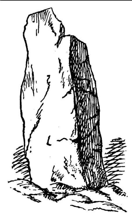
Sadly gone, this looked to be one helluvan impressive standing stone. Described just once by the christian fruitbat Henry Simpson (1879), who told us:
“In a hedge-row, or rather stone row…is a remarkable, ancient monolith, it is thirteen feet in height; from its slender character, it does not appear to have formed one of a trilithon, but rather to have constituted a memorial of some sort, or as a beacon of some usefulness. I can discover no barrow or earthwork near the spot. There are remnants of a quarry close by, with a mound of earth arising therefrom, but no indications to give a clue to the meaning or use of this single pillar. It is composed, moreover, of millstone grit, which is not to be found in the immediate neighbourhood, so it must have been brought from a distance and placed in its present position.
“Some suppose this to be a Roman stoup or pillar, designed for a landmark; but it bears no mark of Roman worksmanship. It is crude in the extreme.”
Simpson’s 1879 drawing
There is no available folklore known to the Long Stoop, although a long straight path terminated where the monolith stood. This path was one of many in an intricate geometric lay-out of perfect circular and dead straight tracks in the woodland immediately south of here [now built over], with four-, eight- and twelve-fold lines intersecting each other over a very large area. It may be that this large, seemingly lost standing stone, could have been a part of the ornate grounds that were laid out here in bygone centuries, perhaps erected by the architects behind the project.
It would be damn good if locals in and around Adel could relocate this monolith — which is as likely propping up some old walling somewhere nearby — so we can make a healthy assessment as to its authenticity. Are there any Leeds pagans who might be able to rediscover this lost standing stone?
References:
Bennett, Paul, The Old Stones of Elmet, Capall Bann: Milverton 2001.
Simpson, Henry Trail, Archaeologia Adelensis; or a History of the Parish of Adel, W.H. Allen: London 1879.
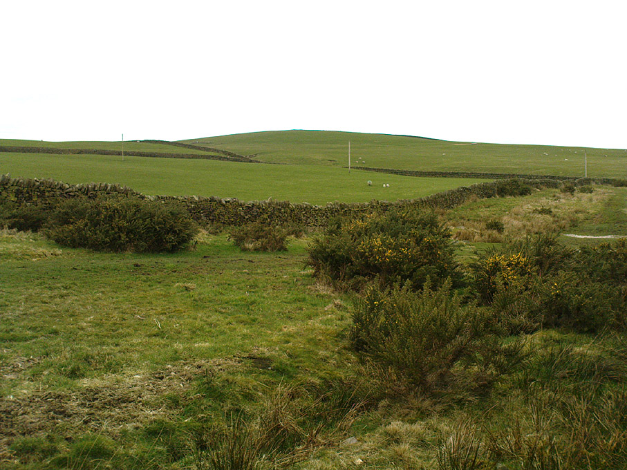
You can come from various angles to approach this site, but I reckon the best is from along the old trackway of Parson’s Lane, between Addingham and Marchup. From Silsden go up the long hill (A6034) towards Addingham until the hill levels out, then turn left on Cringles Lane (keep your eyes peeled!) for about 500 yards until you reach the Millenium Way or Parson’s Lane track, to your right. As you walk along this usually boggy old track, the rounded green hill ahead, to the left, if where you’re heading. Less than 100 yards past the little tumulus of High Marchup there’s a stile on your left that takes you into the field. You’ll notice the depression that runs across near the top, at an angle. That’s part of the earthworks!
Archaeology & History
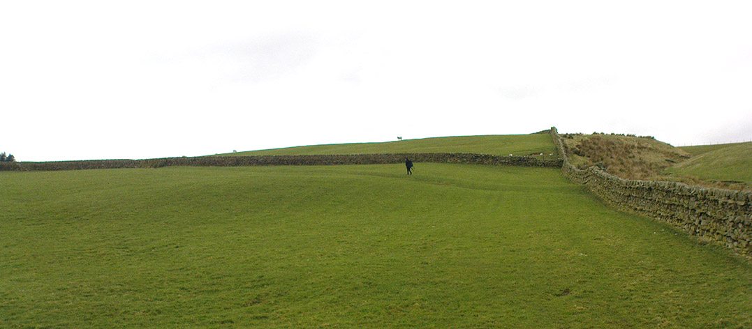
The Counter Hill earthworks just over the far western edge of Rombald’s Moor – thought to be Iron Age – are truly gigantic. More than ¾-mile across along its longest NW-SE axis, and a half-mile from north-south at its widest point, this huge ellipse-shaped earthwork surrounds the rounded peaked hill that gives the site its name: Counter Hill. And although Harry Speight (1900) thought the hill got its name from the old Celtic conaltradh, or Irish conaltra, as in the ‘hill of debate or conversation’ — a possibility — the place-name master Mr Smith (1961) reckoned its name comes from little other than ‘cow turd hill’! We may never know for sure…
Earthworks south of Counter HillCowling’s 1946 plan
The Lancashire historian Thomas Dunham Whitaker (1878) appears to have been one of the first people to describe the Counter Hill remains, though due to the sheer size of the encampment he thought that it was Roman in nature. Within the huge enclosure we also find two large inner enclosures, known as the Round Dikes and the Marchup earthworks. Whitaker’s description of Counter Hill told:
“There are two encampments, on different sides of the hill, about half a mile from each other: one in the township of Addingham, the other in the parish of Kildwick; the first commanding a direct view of Wharfedale, the second an oblique one of Airedale; but though invisible to each other, both look down aslant upon Castleburg (Nesfield) and Ilkley. Within the camp on Addingham Moor are a tumulus and a perennial spring; but by a position very unusual in such encampments, it is commanded on the west by a higher ground, rising immediately from the foss. The inconvenience, however, is remedied by an expedient altogether new, so far as I have observed, in Roman castramentation, which is a line of circumvallation, enclosing both camps, and surround the whole hill: an area, probably, of 200 acres. A garrison calculated for the defence of such an outline must have been nothing less than an army. But it would be of great use in confining the horses and other cattle necessary for the soldiers’ use, which, in the unenclosed state of the country at the time, might otherwise have wandered many miles without interruption. The outlines of these remains is very irregular; it is well known, however, that in their summer encampments the Romans were far from confining themselves to a quadrangular figure, and when we consider their situation near the Street, and the anxious attention with which they have been placed, so as to be in view of Ilkley or Castleburg, there can be little danger of a mistake in ascribing them to that people.”
Counter Hill earthworks, looking west
And though Whitaker’s sincerity and carefully worded logic for the period is quite erudite (much moreso than the greater majority of historians in modern times), his proclamation of the Counter Hill earthworks as Roman is very probably wrong (soz Tom). The embankments are much more probably Iron Age in nature and are very probably the result of indigenous tribal-folk than that of the incoming Romans. Most modern archaeologists and historians tend to see the entrenchments as being from such a period and I have to concur.
Folklore
The old antiquarian Edmund Bogg (1904) wrote that the Counter Hill earthworks were built as a result “of the struggle between the Anglians and the Celt,” long ago. The great Yorkshire historian Harry Speight (1900) narrated similar lore just a few years earlier, but told that the tradition was “of how the Romans drove the natives from this commanding site of Counter Hill.”
References:
Bogg, Edmund, Higher Wharfeland: The Dale of Romance, James Miles: Leeds 1904.
Cowling, Eric T., Rombald’s Way, William Walker: Otley 1946.
Fletcher, J.S., A Pictureseque History of Yorkshire – Part IX, J.M. Dent: London 1901.
Smith, A.H., The Place-Names of the West Riding of Yorkshire – volume 6, Cambridge University Press 1961.
Speight, Harry, Upper Wharfedale, Elliott Stock: London 1900.
Whitaker, T.D., The History and Antiquities of the Deanery of Craven, 3rd edition, Joseph Dodgson: Leeds 1878.
From Steeton go to the top of Mill Lane, turning left up High Street. After about 200 yards, turn right (opposite Falcon Cliff street) and go down past the end of the row of terrace houses, to the end of the dirt-track past the allotments. Then cut up the fields to the rocky crags a coupla hundred yards above you on the left. Over the wall at the top, look out for the single tree in the field by the walling where there’s a small cluster of stones. That’s it!
Archaeology & History
The little Crater Stone and its more ornate companion, below
Hiding away on private land, this lovely simple carving was first located on Wednesday, April 7, 2010 (in the fine company of the Great Guru). Our initial assessment found it to be just a simple cup-marked stone with 4 normal cup-marks, plus two large ‘bowls’ just where the rock goes into the ground. When we found it the other day, Steve pulled a little bit of the earth back to get a better look at the stone, but we need to return here to unearth the rest of the stone (we didn’t have utensils with us this day, as we were just playing out).
The position of the stone in the land is excellent for views, looking down on the greater-looking Dragon Stone carving just a few yards away, but also looks across the Aire Valley and onto the moorland heights above Rivock, and the south-side of Ilkley Moor. I’ll update and add further notes and clearer images when we go back to the site (hopefully) in the next week (aswell as hopefully conjure up a more respectable title!).
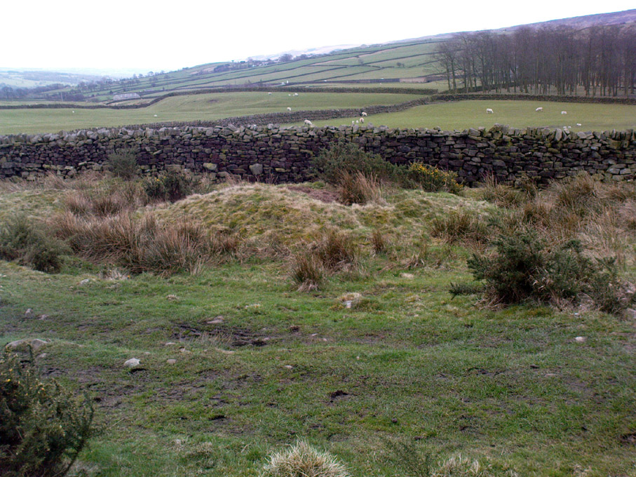
From Silsden go up the long hill (A6034) towards Addingham until the hill levels out, then turn left on Cringles Lane (keep your eyes peeled!) for about 500 yards until you reach the Millenium Way footpath, or rather, green lane track, to your right. Walk along this usually boggy old road for another 400 yards until you’re level with the small copse of trees below the field (about 100 yards away). The slightly raised ditched mound on the left side of the track ahead of you is what you’re after!
Archaeology & History
Unless this old tomb was pointed out, you probably wouldn’t give the place a second glance. It’s a seemingly isolated singular round tomb, subsided on top and surrounded by a small ditch, running into the edge of the walling. Gorse bushes and a few rocks are around the edges of the site. Harry Speight (1900) described this old tomb as a
“lonely isolated mound, to be seen in Parson Lane about a hundred yards west of the Celtic boundary, Black Beck, where some old dying chief has called his friends around him bidding them, “heap the stones of his renown that they may speak to other years.” It is a tumulus 80 feet in circumference and does not seem to have been disturbed.”
In Faull and Moorhouse’s (1981) magnum opus they describe the site as “the denuded remains of a ditched round barrow,” but say little else. It may have had some relationship with the settlement remains in and around the huge Counter Hill complex, immediately north.
References:
Cowling, E.T., Rombald’s Way: A Prehistory of Mid-Wharfedale, William Walker: Otley 1946.
Faull, M.L. & Moorhouse, S.A. (eds.), West Yorkshire: An Archaeological Guide to AD 1500 (4 volumes), WYMCC: Wakefield 1981.
Speight, Harry, Upper Wharfedale, Elliott Stock: London 1900.