From the Askwith Moor car-parking spot, walk up the road (north) for 350 yards and go thru’ the gate on the left-side of the road, up along the track onto Askwith Moor. To get to it, walk on the footpath towards the trig-point on Shooting House Hill from the Askwith Road. Between 50-100 yards before the trig, walk into the heather to the right. Just 5-10 yards off the footpath, it’s there! If the heather’s grown back, don’t even bother looking for the place!
Archaeology & History
Although I add this as the remains of a small Bronze Age or neolithic settlement — which was found on August 3, 2005, in the company of Richard Stroud — subsequent walks up hereabouts in the surrounding heather has shown that, far from being a small independent site, it was part and parcel of a much greater prehistoric landscape all round here: with the remains on High Low Ridge immediately west; the cairnfields of Askwith Moor and Snowden Crags south and east; and numerous cup-and-ring stones scattered all over the place here. It’s a veritable minefield of archaeological remains, from the mesolithic to the Iron Age all over these moors!
Barely visible remains of wallingMore of the walling
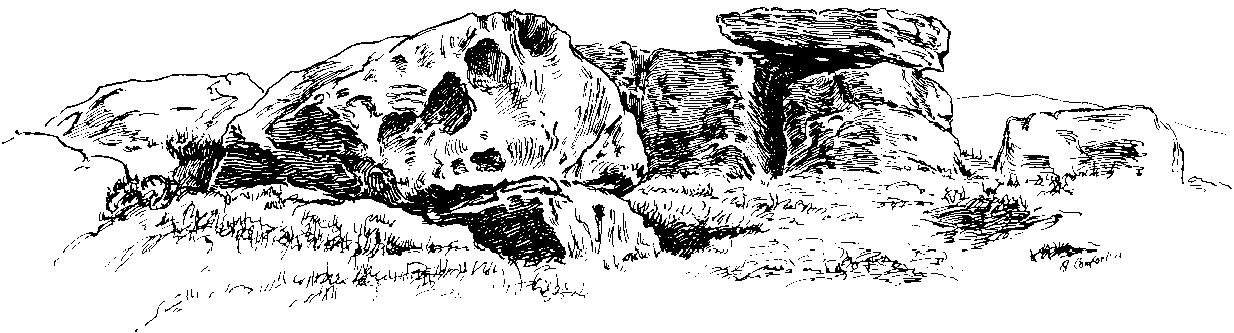
We came wandering up here looking for another of Eric Cowling’s “lost circle” sites described in 1946, near Shooting House Hill, which Graeme Chappell and I looked for ten years previously without success. But on the August 2005 visit, much of the heather had been burned away. Instead of the lost circle however (which remains unfound, though something suspiciously like it is close by) we came across a well-defined, though small settlement complex. The walling of two well-defined near-rectangular structures emerge either side of a reasonably large boulder. Beyond these is further walling and what seems a well-defined hut-circle less than 10 yards away. Like many other sites on these moors, the walling seem to have been pretty much robbed for building grouse-butts. (hence the pictures here looking a bit sparse of stone!) Subsequent investigation found more neolithic walling which ran into the deeper heather — so it has been difficult to work out the full scale of it all.
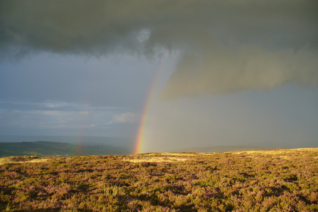
The landscape from here stretches way off. To the eastern horizon (not far away) is the legendary Almscliffe Crag, with the rising hills of Rombald’s Moor due south; whilst far to the sunsetting west rises the great contours of Pendle Hill, to which legend relates some of the witches of the Fewston Valley, a mile below…
References:
Cowling, Eric T., Rombald’s Way, William Walker: Otley 1946.
Takes a bitta getting to this spot, but it’s worth the effort! Make a day of it and walk up here via the little-known Cuckoo Stones monoliths. From here the walk gets steeper! Follow the footpath from the standing stones, uphill, to the legendary Wuthering Heights building of Bronte-fame a half-mile ahead of you. Then walk immediately up the slope at the side of the derelict house higher onto the moor (there’s no real footpath to follow) until the moorland levels out. From here, look west and walk that way for a few hundred yards where you’ll be seeing a large rock outcrop ahead of you. That’s where you’re heading! (if you reach the triangulation pillar, take the small path from there along the top of the moor towards this large rock outcrop)
Archaeology & History
Alcomden’s Altar Stone
To those of you who like a bitta wilderness, or healthy normal people I suppose, this is a stunning place! Even though there’s little by way of archaeology here — save the usual expectations of a few flints and arrowheads — its geomancy, its position in the landscape, makes it excel as a once important ritual site for our ancestors in not-so-distant centuries. Although local tradition gave these great rocks a prehistoric pedigree, the archaeological record doesn’t say as much — but that doesn’t really mean much up here. We’ve found a singular Bronze Age cairn on the level at Middle Moor Flat 400 yards northwest (not in the record books), some prehistoric walling on the flat east of here (not in the record books), so a lot more attention is needed hereby to see what more may be hiding in this rocky heathland area.
The main feature amidst this extensive scattering of rocks is the large rocking stone, said to weigh six- or seven-tons, resting upon other glacial deposits. The rock itself can be made to rock very slightly. It was described in Lewis’ Topographical Dictionary as a
“cromlech, an evident druidical remain, (which) consists of one flat stone, weight about six tons, placed horizontally upon two huge upright blocks.”
But the placement here was done by Nature and not humans — making it much more important to our ancestors. This was a site for solace, for ritual and to commune with the gods themselves. A few visits to this place show this quite clearly — unless you’re unable to relax that is! It’s a place I wanna spend more time working with, as the mythic history around these stones feels strong, despite their absence from written records.
The ‘altar’ resting on rocksAlcomden’s “altar”
The druidic sentiments espoused by Lewis were all but echoed by our otherwise sober historian, J. Horsfall Turner, in his history of Haworth (1879), where he describes the Alcomden Stones as “the remains of a Druid’s Altar.” On top of the main ‘altar stone’ are what could be ascribed as worn cup-markings, but it seems they’re Nature’s handiwork once again; though this wouldn’t deny them as having some significance to our ancestors. A number of other boulders amidst this mass of rocks also have what seem like cup-markings, but none of them can be said with any certainty to have been carved by people. Indeed, the entirety of this legendary rock outcrop seems to have been created solely by the spirits of Nature.
View of Earth, from Alcomden
It was first described as ‘Alconley’ in 1371, then in the 1379 Poll Tax returns as ‘Halcom’, the etymology of which is difficult. Al- is a cliff or rock, many of which occur here; den is certainly a valley, over which we look to the northeast (to Ponden Kirk, 500 yards away); but the central element of ‘com‘ is the greatest puzzle. Blakeborough (1911) tells of the old Yorkshire word ‘con’ — found in the 1371 spelling — meaning “to scan, or observe critically,” which one can certainly apply here in a topographical sense, i.e., “observation stones above a valley.” It’s simple, succinct, and makes sense!
Folklore
As Elizabeth Southwart (1923) rightly said,
“Our forefathers, instinct and imagination more highly developed than knowledge, peopled their woods with fairies and their valleys with ghosts. On the high, wind-swept spaces they built their altars to Unknown Gods.”
Turner’s 1913 drawing
And such she thought was done at this “heap of rocks called Oakenden Stones.” It seems likely, as this place is superb for ritual magick and meditative systems. But all we have are the repeats of numerous old historians, from Whiteley Turner (1913) and his namesake J. Horsfall, to James Whalley, J.W. Parker and more, who recorded what the old locals said: that is was a place of the druids. There may be a grain of truth in it somewhere…
References:
Bennett, Paul, The Old Stones of Elmet, Capall Bann: Milverton 2001.
Blakeborough, Richard, Wit, Character, Folklore and Customs of the North Riding of Yorkshire, W. Rapp: Saltburn 1911.
Parker, J.W., Guide to the Bronte Country, J.W. Parker: Haworth n.d. (c.1971)
Southwart, Elizabeth, Bronte Moors and Villages: From Thornton to Haworth, John Lane Bodley Head: London 1923.
Turner, J. Horsfall, Haworth, Past and Present, Hendon Mill: Nelson 1879.
Turner, Whiteley, A Spring-Time Saunter round and about Bronte Lane, Halifax Courier 1913.
Travel up the B6265 (Skipton to Grassington road) for a mile, watching on the small hills on your left (western) side, and then take the left turn up to Sandy Beck. You can’t miss the place!
Archaeology & History
Rough Haw, looking west
My first view of this place was from the hills east of here, atop of one of the great rock outcrops on the edge of Embsay Moor. The very first impression it gave me was – “That’s a bloody hillfort!”: an obvious worked rounded hill, with ridges typical of such monuments. Subsequent investigation found that there were extensive remains of walling, more typical of the Iron Age period than the neolithic (which some modern archaeologists have proposed), clearly visible around the edges of this great hill. The structure of the site is similar in size and design to the remains at the nearby Horse Close Hill above Skipton, aswell as another (officially unknown) site closer to Keighley. A large overgrown cairn rests on the southern side of the hill, seemingly more of archaic import than a mere clearance or marker point. But I may be wrong…
Very notable at this site are the profusion of springs emerging from all round Rough Haw: the blood of seven such water sources comes from its edges on all sides and would obviously have been of some importance here.
References:
Dixon, John & Phillip, Journeys through Brigantia – volume 1: Walks in Craven, Airedale and Wharfedale, Aussteiger Publications: Barnoldswick 1990.
It seems there’s not been a lot of archaeohistory written about this ruined site — nor its companion that was once visible 50 yards to the west. In Richard Feachem’s (1977) gazetteer he described it simply as:
“a turf-covered stony mound some 10ft in height, standing in the middle of an enclosure formed by a ditch with a wall on its inner lip, which is best preserved on the west.”
Folklore
A common aspect of faerie-lore are incidences of apparent time-lapses — beloved in modern times in certain UFO encounters (Vallee 1969; Keel 1970). Such was the case here, in the story described at this ruinous old site by George Sutherland (1937). He wrote:
“Two men carrying a small keg of whiskey for the New Year festivities were passing the church of Bruan. They heard stirring bagpipe music and a few hundred yards further on they came to the Bruan Broch and found it open, and saw a number of the little folk in green dancing merrily to the music. One of the men was eager to join them in the dance and went in. The other man was more cautious and remained outside, and waited patiently until his friend would have his dance. A long weary time passed and his friend was not appearing. He went to the open door of the broch and called to his friend to come out. His friend said, “I have not got a dance yet!” After another long wait he shouldered the keg of whiskey and set out for home, never doubting but that his friend would return home before morning. Next day he called at his friend’s house to see if he had come home, and to his consternation found that he had not. Then he went to the broch in the hope of finding him there, but the broch showed no trace of a door, and no trace or soil or stones having been disturbed since the days of King Brude MacBile, and there was no appearance of man or fairy. It was an old belief that in such a case the same scene would be enacted in the same place in a year after, and accordingly on the anniversary of that day he went to the Bruan Broch. It was open, the music and dancing were going on as before, and his friend was there. He put some iron article in the door to prevent the fairies from closing it… He went to the open door and said to his friend, “Are you not coming home now?” His friend replied, “I have not got a dance yet.” He told his friend that he had been a year in the broch, and that it was surely time for him to come home now, but his friend did not believe that he was more than an hour or so there. The man then made a rush at his friend, seized him, and dragged him out by sheer force, and they set out for home together. It was difficult for him to realise that his sojourn with the fairies was such a prolonged one, but the fact that his own child did not recognise him, together with other changes that had taken place, convinced him.”
References:
Feachem, Richard, Guide to Prehistoric Scotland, Batsford: London 1977.
Keel, John A., UFOs: Operation Trojan Horse, Souvenir Press: London 1970.
Sutherland, George, Folklore Gleanings and Character Sketches from the Far North, John-o-Groats Journal: Wick 1937.
Vallee, Jacques, Passport to Magonia: From Folklore to Flying Saucers, H.Regnery: Chicago 1969.
Along the Brighouse to Mirfield A644 road, a half-mile east of M62’s junction 25 on Wakefield Road, note the woodland on your left-hand side, above the walling. Although on allegedly private land, you can approach by hopping over the wall by the main road into the woods. Wander up the slope until it levels out and, just at the edge of the tree-line, past the brilliant overgrown folly amidst a mass of rhododendrons, you’ll see the denuded edges of this earthwork. Though you might need a bitta patience seeking it out…
Archaeology & History
Very first sketch of this site (John Watson, 1775)
The remains of this low earthwork is found on the private land of Kirklees Hall and appointment is supposed to be made to explore, both this and the more famous Robin Hood’s Grave, a few hundred yards away. But if you can’t be bothered with that and find this little-known earthwork, you’ll see that it’s roughly squared in shape, though pretty overgrown. In Bernard Barnes’ survey (1982) he described it as a “square or five sided enclosure, 2-3 acres in size, with bank and external ditch”, wondering whether it was used to enclosure cattle and stretching its possible origin between the Iron Age to the medieval.
Although the classical Roman archaeologist Ian Richmond (1925) believed the site to be from that period, the archaeologist J.J. Keighley thought that the site was “more likely to be Iron Age than Roman.” He wrote:
“The earthwork in Kirklees Park is a square or five-sided enclosure with bank and external ditch… The site lies on Richmond’s trans-Pennine route. According to Armitage and Montgomerie, the earthwork is 0.5 hectares in area, but it is actually nearer 0.8 to 1.2 hectares. They compare its construction with the fort at Wincobank (South Yorkshire), stating that the bank on the counterscarp when excavated, revealed “a very rudely composed wall of undressed dry stone.”
Earlier local writers such as John Watson (1775) — whose early sketch of the site is reproduced above — and others also opted for the Roman date. But, unless you’re a bit of an earthwork fanatic, this site may not be too much your cuppa tea. If you are gonna check this out though, make sure you check out Robin Hood’s old tomb in the trees not far away. Very odd.
References:
Barnes, Bernard, Man and the Changing Landscape, Merseyside County Council & University of Liverpool 1982.
Keighley, J.J., “The Prehistoric Period,” in West Yorkshire: An Archaeological Survey to AD 1500 (WYMCC: Wakefield 1981).
Richmond, I.A., Huddersfield in Roman Times, Tolson Memorial Museum: Huddersfield 1925.
Watson, John, The History and Antiquities of Halifax, J. Lowndes: London 1775.
Many ways to get here, but you’ve gotta amble off-path through the woods to eventually find it — but it’s not difficult. From Kilmartin village head to Slockavullin and walk up the winding track which takes you towards the Ballygowan cup-and-ring stones, but follow it into the woods instead. The OS-map’s gonna be your best guide here. I first visited this spot from the south and ambled about, aimlessly at times for several hours, after I’d first been to the great ruined mansion of Poltalloch. Well worth checking out if you enjoy finding allsorts!
Archaeology & History
The old tomb is actually a few hundred yards beneath the small rocky summit of Barr a’ Chuirn, with the overgrowth of the woods imposing itself upon it. The Scottish Royal Commission report (1988) told that there was a large seat built here in the 19th century called the Lady’s Seat, and actually set up on the cairn itself so giving groovy views all round to those who came here. The Seat was made from large slabs of stone, which may originally have come from the old tomb. An excavation here in the mid-19th century,
“found the remains of two cists and some burnt bones, with a ‘skeleton of later date, between the two cists, but probably put there by the men who destroyed the cairn.’ In 1929 Craw re-examined the site and found that the central cist had chambered and grooved slabs. This cist is aligned ENE and WSW, and the E end-slab is now missing; the cist measured about 1m by 0.5m and about 0.3m in depth internally. The northern side-slab is grooved at the west end.”
References:
Royal Commission on the Ancient & Historical Monuments of Scotland, Argyll: volume 6 – Mid-Argyll and Cowal, HMSO: Edinburgh 1988.
Cup-and-Ring Stone: OS Grid Reference – NC 635 384
Archaeology & History
This small cup-marked stone came to light following the work of Mr Angus MacKay of Sutherland, more than 100 years ago. In his essay in the Scottish Antiquaries journal (1905), he wrote the following:
Grumbeg carving
“A cup-marked stone was found by me in the burial place of Grumbeg, Strathnaver, September 1905, standing upright at the head of a grave, and showing about 6 inches above the ground. It is evidently a fragment of a larger slab: its extreme length is 20 inches, and it is about 15 inches at its broadest part. The upper three circles are 2.5 inches in diameter and 1.5 inches deep, very symmetrically hollowed out, but the fourth and lower circle is shallow and indistinct. As the stones covering the other graves are for the most part what is called rough mountain slabs, it seems to me that this cup-marked fragment was found in its present condition elsewhere, and placed here to conveniently show a lair.”
If such was the case, a good contender might be the denuded chambered cairn close by.
Standing Stone (destroyed): OS Grid Reference – SO 117 544
Also Known as:
Hundred House Standing Stone
Archaeology & History
Position of the old stone (on one of Alf’s leys)
In a field less than 200 yards north of an old medieval mound known as The Mount, the great ley-hunter Alfred Watkins (1925) described a standing stone that used to be here along one of his leys, but which, even then, had been “inexplicably blown into several pieces by a quarrymen’s charge.”
The stone was said to have originally come from an adjacent field and then moved next to yet another monolith, which was also broken up. Can any remnants of these poor fellas still to be seen anywhere nearby? Or is it a case of yet another one bites the dust?
References:
Watkins, Alfred, The Old Straight Track: Its Mounds, Beacons, Moats, Sites and Mark Stones, Methuen: London 1925.
From the South Kirkby library, go west along Hague Lane and take the left turn up Homsley Lane on your left after a few hundred yards (keep your eyes peeled!). Go up here, past the housing estate, and where the trees begin on your left at the top of the Hilltop Estate, go thru them and as you emerge out the other side, the earthworks are all around you. In fact you’re just about in the middle of this hillfort-cum-settlement!
Archaeology & History
W.S. Banks (1871) gives an early description of this site, although he thought it to be Saxon in nature. He told that,
“About half-a-mile east of Ringston Hill, in a field between Quarry-road and Hornsley-road, is the site of a supposed Saxon camp, as it is called on the ordnance map — a large enclosure containing above three acres of land. It slopes to the north, and is now rough and uneven, and has been cast into ‘lands.’ The mound on the east, west and south is still very distinct. The northern side is much lower than the other and a ditch is cut across at that part…”
And in Banks’ day, as he told, “the history of it is not known.” But this site was later declared as a hillfort – a Brigantian one at that – for the first time by the director of Wakefield Museum, Mr F. Atkinson, following some excavation work here in 1949. Nothing much was found apart from,
“pieces of decayed and burnt sandstone and medieval pottery sherds,” though he still concluded the site to be Iron Age. Although little of its original form can now be seen due to extensive damage, infra-red aerial photography showed “traces of a five-sided annexe to the northwest, the line of the ploughed-out rampart to the south-southwest, and a possible defended entrance to the south.”
The same aerial survey also found another enclosure to the east of the hillfort.
…to be continued…
References:
Banks, W.S., Walks in Yorkshire: Wakefield and its Neighbourhood, Longmans Green & Co.: London 1871.
Keighley, J.J., ‘The Prehistoric Period,’ in Faull & Moorhouse’s, West Yorkshire: An Archaeological Survey, I, WYMCC: 1981.
Cup-and-Ring Stone: OS Grid Reference – NT 251 696
Archaeology & History
Braid Hills carving
This is a fine-looking old cup-and-ring stone! Although no longer in situ (one of those really important golf courses needed to be built, so it had to go!), the 3 or 4 cup-and-rings seen here, carved at the end of what look like some sort of ‘stalks’, emerging from a distinctive radial under-curve, gave me a somewhat anthropomorphic impression of chaps in a boat — perhaps sailing into the Firth o’ Forth a short distance away! The Scottish Royal Commission (1929) report said the following of the stone:
“In 1897 a boulder of white sandstone with cup-and-ring markings on its surface was discovered on the Braid Hills golf course, and it was later presented to the National Museum of Antiquities. The stone measures almost 3 feet by 1 foot 9 inches, by 1 foot thick and is roughly oblong. The markings comprise seven cups in all, and at least three of these are completely surrounded by a ring and cut by a radial channel.”
Although nothing was said in the RCAHMS account, the stone gives one the impression it was associated with a tomb. And I know it aint the same, but when I first saw this carving, it reminded me of the Ri Cruin carving in Kilmartin, Argyll. It’s the potential “boat” feature that did it for me!
References:
Royal Commission on the Ancient & Historical Monuments of Scotland, Inventory of Monuments and Constructions in the Counties of Midlothianand West Lothian, HMSO: Edinburgh 1929.


")

")
