Our Lady’s Well, Straiton, Loanhead, Midlothian

Holy Well (destroyed):  OS Grid Reference – NT 2728 6669

Archaeology & History

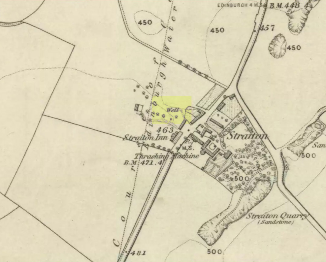
Our Ladys ‘Well’ on 1855 map

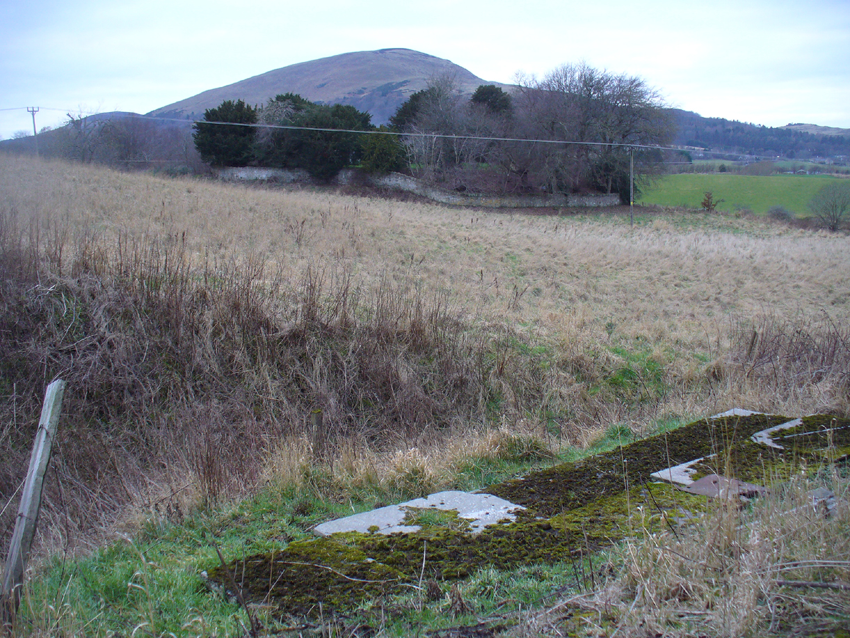
This is another all-but-forgotten holy well once dedicated to the Virgin Mary, close to the south-side of Edinburgh’s outer ring-road.  It would seem to have been one in a cluster of sacred wells not far from each other (with the two Jacob’s Wells and St. Margaret’s Well at nearby Pentland), whose traditional stories have fallen prey to the incredulity of ‘progress’.  I can find very little about the site, other than the note given it in George Good’s (1893) Liberton survey where, in stepping south towards the old hamlets of Broomhill and Straiton, he told:

“A little to the west of the hamlet, and near what was called Straiton Green, is an old draw-well dedicated to the Virgin, and known by the name of Our Lady’s Well. There may possibly have been a cell or chapel near this well, but no tradition or history regarding it is extant.”

We can only presume that the ‘Well’ which is highlighted on the first OS-map in 1855, maybe 20-30 yards west of the old road on what looks like a small park or ‘Green’, would be the ‘Lady Well’ in question. (another ‘Well’ is shown at Broomhill Cottage, which is unlikely to be the contender)

References:

  1. Bennett, Paul, Ancient and Holy Wells of Edinburgh, TNA 2017.
  2. Good, George, Liberton in Ancient and Modern Times, Andrew Elliot: Edinburgh 1893.

© Paul BennettThe Northern Antiquarian


St. Margaret’s Well, Old Pentland, Midlothian

Holy Well (covered):  OS Grid Reference – NT 26388 66338

Archaeology & History

St Margarets Well at Pentland

Described in Hope & Telford’s (1813) rare work, this little-known holy well has escaped the attention of all surveyors since then.  It was one of four sacred and healing sites in the village and “the most copious” of them all, they said.

Located a little to the east of the old churchyard, chemical analysis showed its water to contain carbonates and sulphates of lime, “muriate of soda and a magnesium salt in very minute proportion, and carbonate of iron in a still smaller” amount.

Covering slabs on the well
The ‘Spring’ on 1894 map

Until recently, the waters of St. Margaret could still be seen in the small copse of trees, just off the footpath, but they have now been covered in large stone slabs.  Underneath them, you can clearly hear the sound of the rushing water still pouring out of the ground, quite copiously, as Hope & Telford said!  A little further down the slope—into which the waters have cut a tiny glen—the ground is very boggy and marshy due to the outflow from the well.  However, the waters here seem very dodgy indeed and it isn’t recommended that you try to drink them! (in the adjacent trees is a large dump site)

It is likely that the St. Margaret dedication here relates to the 11th century Scottish Queen, who was believed to have landed at nearby North Queensferry, known as St. Margaret’s Hope.  Literary history tells that she became a Roman Catholic.

References:

  1. Bennett, Paul, Ancient and Holy Wells of Edinburgh, TNA: Alva 2017.
  2. Hope, Thomas C. & Telford, Thomas, Reports on the Means of Improving the Supply of Water for the City of Edinburgh, A. Constable: Edinburgh 1813.

© Paul Bennett, The Northern Antiquarian


Braid Hills, Edinburgh, Midlothian

Cup-and-Ring Stone:  OS Grid Reference – NT 251 696

Archaeology & History

Braid Hills carving

This is a fine-looking old cup-and-ring stone!  Although no longer in situ (one of those really important golf courses needed to be built, so it had to go!), the 3 or 4 cup-and-rings seen here, carved at the end of what look like some sort of ‘stalks’, emerging from a distinctive radial under-curve, gave me a somewhat anthropomorphic impression of chaps in a boat — perhaps sailing into the Firth o’ Forth a short distance away! The Scottish Royal Commission (1929) report said the following of the stone:

“In 1897 a boulder of white sandstone with cup-and-ring markings on its surface was discovered on the Braid Hills golf course, and it was later presented to the National Museum of Antiquities.  The stone measures almost 3 feet by 1 foot 9 inches, by 1 foot thick and is roughly oblong.  The markings comprise seven cups in all, and at least three of these are completely surrounded by a ring and cut by a radial channel.”

Although nothing was said in the RCAHMS account, the stone gives one the impression it was associated with a tomb.  And I know it aint the same, but when I first saw this carving, it reminded me of the Ri Cruin carving in Kilmartin, Argyll.  It’s the potential “boat” feature that did it for me!

References:

  1. Royal Commission on the Ancient & Historical Monuments of Scotland, Inventory of Monuments and Constructions in the Counties of Midlothian and West Lothian, HMSO: Edinburgh 1929.

© Paul Bennett, The Northern Antiquarian