Crook Farm (north), Baildon Moor, West Yorkshire

Cup-and-Ring Stone:  OS Grid Reference – SE 13703 39616

Getting Here
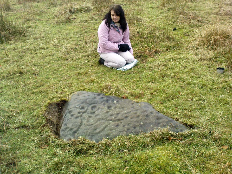
Crook Farm North CnR

Take the road up alongside and past Shipley Glen, taking the turn to go to Crook Farm caravan site. Go right to the very end of the car-park, then walk up the footpath through the trees on your left.  Keep going uphill about 100 yards by the field-wall until the land begins to level out – and shortly before the first gate into the field (on your right) keep your eyes peeled for the triangular stone in the ground, barely 10 yards away from the walling.  Alternatively, from the entrance into the Dobrudden caravan park walk to the far-end of the level area in front of the little cafe and walk along the footpath that crosses the grassland to the walling nearly 300 yards away (south).  Follow the wall down below the gate and zigzag about. You’re damn close!

Archaeology & History
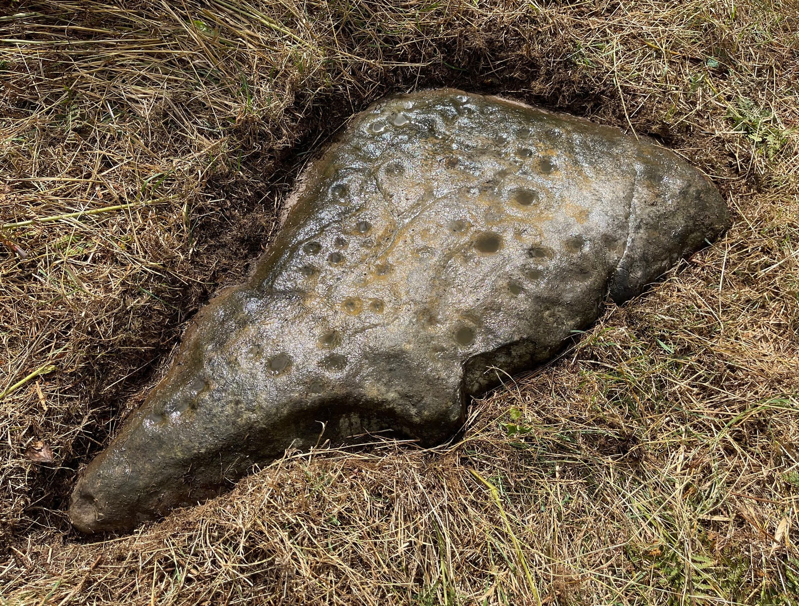
Crook Farm north carving

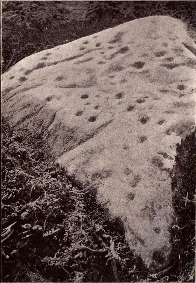
For some reason this has always been one of my favourite cup-and-ring stones on Baildon Moor and it’s well worth checking out if you visit the area!  It was rediscovered by the Bradford historian W.E. Preston, who photographed the carving around 1912.  Shortly afterwards he took fellow historians Joseph Rycroft and W. Paley Baildon to see this (and others he’d located) and subsequently both a drawing and Mr Preston’s photo of the site was included in Mr Baildon’s (1913) magnum opus the following year.

As you can see from the relative photos—with literally 100 years between them—erosion hasn’t taken too much toll and this neolithic or Bronze Age carving remains in very good condition.
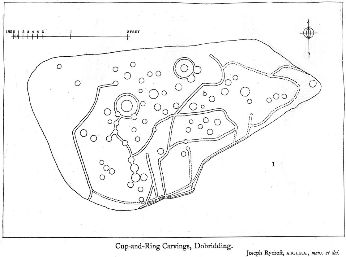
Rycroft’s early drawing
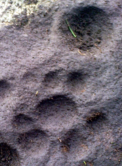
Preston’s 1912 photo

Covered with upwards of fifty cup-markings, there are also two cup-and-rings and numerous carved lines meandering around and enclosing some of the many cups.  One cup-mark was cut into the narrow end or ‘nose’ of the stone.

It’s a fascinating design, with another ‘Cassiopeia’ cluster of cups in one section, beloved of archaeoastronomers who explore these stones.  Mr Rycroft’s drawing of the design (left) is perhaps the best one, to date.

Along this same ridge there are remains of other prehistoric sites, more cup-and-rings, remains of prehistoric walling and what may be a small cairn circle (to be described later).

References:

  1. Baildon, W. Paley, Baildon and the Baildons – parts 1-15, Adelphi: London 1913-1926.
  2. Bennett, Paul, Of Cups and Rings and Things, unpublished: Shipley 1981.
  3. Bennett, Paul, Megalithic Ramblings between Ilkley and Baildon, unpublished: Shipley 1982.

© Paul Bennett, The Northern Antiquarian

Hope Farm Field, Baildon Moor, West Yorkshire

Cup-Marked Stone:  OS Grid Reference – SE 13856 39599

Getting Here

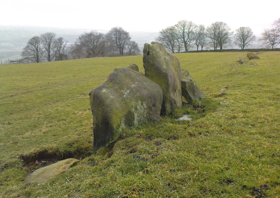
Cup-marked line of old walling

Whether you come via Shipley Glen or Baildon, head for the Dobrudden caravan park on the western edge of Baildon Hill.  As you get to the entrance of the caravan site, walk down (left) the footpath outside the park itself, looking across the grasslands, left, to the tree-lined wall a coupla hundred yards away.  Head for that.  Then go through the gate into the field where you’ll see a denuded line of walling, with what looks like some standing stones along it.  That’s where you need to be!

Archaeology & History

First noticed on February 12, 2012, this simple cup-marked stone is another one that’s probably only of interest to the purists amongst you.  Found below the southern end of Baildon Hill, due west of the lost Hope Farm cup-and-ring stone, the cup-markings here are on the north-face of an upright stone in an old wall.  It’s obvious that this stone was once earthfast, when the carving faced the zenith or night sky, and has been cut in half and turned 90° making the cups more difficult to notice; and very obviously the rock was originally close to its present position in the walling.

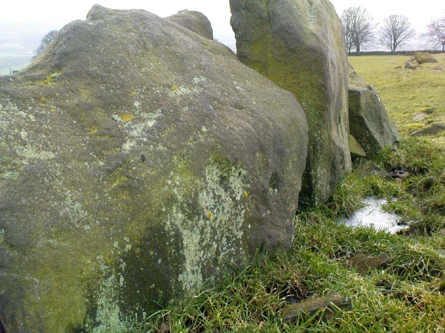
Primary cupmark, right-side of stone
Close-up of cup/s

Found in an area rich in cup-and-ring stones, there’s just one singular cupmark that’s obvious on this stone; but as we looked back and forth, feeling the stone with our fingers, it seemed there may be a couple of others on the rock.  We need to come back here again in better lighting conditions, as opposed to the old grey day She gave us yesterday, and see if the others are real or simple geological marks.

© Paul Bennett, The Northern Antiquarian

Fag Well, Finsbury, London

Healing Well (lost):  OS Grid Reference – TQ 315 817

Also Known as:

  1. Fagge’s Well

Archaeology & History

First described in local church records from around 1190 AD (Webb 1921) as Fageswelle; then again a few years later in early crime records of the region (Hardy & Page, 1892) as Fackeswell, there were a number of other references to this lost water source, which could once be found near the Skinners Well and the more famous Clerks Well, Finsbury.  Gover, Mawer & Stenton (1942) believed the site owed its title to some long-forgotten local name, though could give no specifics. (i.e., they didn’t know!)  The old dialect word ‘fag’, relating to old grass is as good a meaning as any!

The site was described by John Stow in his Survey of London, 1603, saying it was “near unto Smithfield by Charterhouse, lately dammed up.”  In Mr Foord’s (1910) excellent work on the subject, he told that,

“In 1197 certain lands are described as lying between the garden of the Hospitallers and Smithfield Bar, “super rivulum de Fackeswell,” and other lands as between that brook and ‘Chikennelane’… This fixes the position of Faggeswell Brook as approximately at the boundary of the City.”

Further information about this site would be much appreciated.  The grid-reference for this site is an approximation.

References:

  1. Foord, Alfred Stanley, Springs, Streams and Spas of London: History and Association, T. Fisher Unwin: London 1910.
  2. Gover, J.E.B., Mawer, Allen & Stenton, F.M., The Place-Names of Middlesex, Cambridge University Press 1942.
  3. Hardy, W.J. & Page, W. (eds), A Calendar of Feet of Fines for London and Middlesex, 1197-1569 – volume 1, Hardy & Page: London 1892.
  4. Sunderland, Septimus, Old London Spas, Baths and Wells, John Bale: London 1915.
  5. Webb, E.A. (ed.), The Records of St. Bartholomew’s Priory, and of the Church and Parish of St. Bartholomew the Great, West Smithfield – volume 1, Humphrey Milford: Oxford 1921.

© Paul Bennett, The Northern Antiquarian


Skinners Well, Finsbury, London

Healing Well (lost):  OS Grid Reference – TQ 313 822

Archaeology & History

Like oh so many of the healthy old springs and streams in that dreadful metropolis, the blood and natural health of Skinner’s Well was killed long ago by the self-righteous arrogance of Industrialists.  Even its precise whereabouts seems to have been forgotten… So we thank the written words of antiquarians to keep its memory alive.

Mentioned as far back as 1197 AD in early fine records of the region (Hardy & Page, 1892) as Skinnereswell — and thereafter in various local history records from 1200, 1244, 1385 and constantly from thereon — the place-name authorities Gover, Mawer & Stenton (1942) told that the prefix ‘skinner’, “clearly derive from personal names,” from “the occupational name skinner, of Scandinavian origin.”  But this isn’t to everyone’s etymological fancy! When A.S. Foord (1910) sought for information on this healing spring, he found the same 1197 account, in which

“Skinners’ Well is there described as lying in the valley between the Nun’s Priory and the Holeburn, in which was a large fish-pond… Strype, in his continuation of Stow’s Survey (1720) say, ‘Skinners’ Well is almost quite lost, and so it was in Stow’s time. But I am certainly informed by a knowing parishioner that it lies to the west of the church (of St. James, Clerkenwell), enclosed within certain houses there.’  The parish would fain recover the well again, but cannot tell where the pipes lie. But Dr Rogers, who formerly lived in an house there, showed Mr Edmund Howard…marks in a wall in the close where, as he affirmed, the pipes lay, that it might be known after his death.”

Mr Sunderland (1915) thought Skinners Well a probable holy well, “because Mystery Plays were were performed yearly around it by the Skinners of London.” Citing as evidence the earlier words of John Stow in his Survey of London, 1603, which he narrated:

“In the year 1390…I read, the parish clerks of London, on the 18th July, played interludes at Skinners Well, near unto Clerkes’ Well, which play continued for three days together; the king, queen and nobles being present.  Also in the year 1409…they played a play at the Skinners Well, which lasted eight days, and was of matter from the creation of the world.  There were to see the same the most part of the nobles and gentles in England, etc.”

Whether this “matter from the creation of the world” was a tale of a Biblical nature, or more related to indigenous creation myths of the waters and lands around Skinners Well, we have no way of knowing.

References:

  1. Foord, Alfred Stanley, Springs, Streams and Spas of London: History and Association, T. Fisher Unwin: London 1910.
  2. Gover, J.E.B., Mawer, Allen & Stenton, F.M., The Place-Names of Middlesex, Cambridge University Press 1942.
  3. Hardy, W.J. & Page, W. (eds), A Calendar of Feet of Fines for London and Middlesex, 1197-1569 – volume 1, Hardy & Page: London 1892.
  4. MacLagan, David, Creation Myths, Thames & Hudson: London 1977.
  5. Sunderland, Septimus, Old London Spas, Baths and Wells, John Bale: London 1915.

© Paul Bennett, The Northern Antiquarian

Croft Moraig Carving (01), Kenmore, Perthshire

Cup-and-Ring Stone:  OS Grid Reference – NN 79746 47251

Getting Here

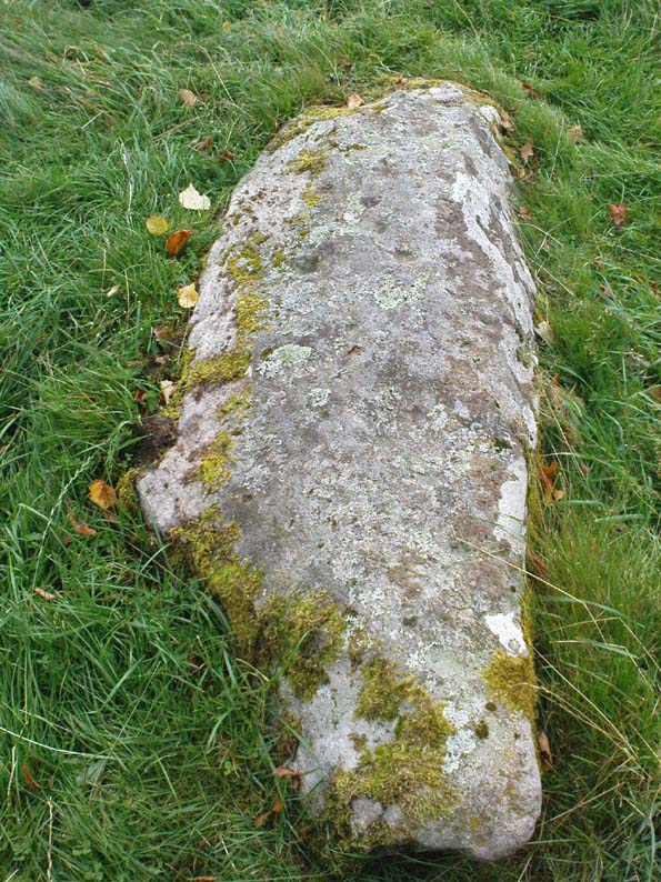
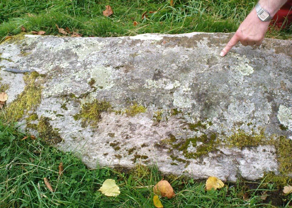
The long cup-marked rock

Follow the same directions for the Croft Moraig stone Circle.  Then check out the elongated stone lying in the grass on the southern edge of the circle.  It’s not that hard to find!

Archaeology & History

Nearly 13 yards (11.75m) south of the faded Croft Moraig 2 carving, this cup-and-ring stone on the SSW edge of Croft Moraig is one of at least four that have been found in this megalithic ring.  It has been suggested that the stone on which the carving is found once stood upright. The earliest account I’ve found of it comes from Alex Hutcheson’s (1889) essay in which he wrote:

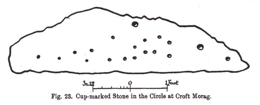
“At the south-west side and in the line of the outer circle lies the cupmarked stone. It is a recumbent stone, and like the others in that circle lies with its larger axis in the direction of the encircling line. It measures 6 feet 6 inches long by 2 feet broad, and bears on its surface 23 cups. Two of these are connected by straight channels. The largest cup is 2 inches in ‘diameter and f inch deep. Two of the cups are encircled, each with a concentric ring.  None of the other stones exhibit any cups or other artificial markings.”

Cup-marks pointed out
Fred Coles 1910 drawing

…Although other cup-marks have subsequently been found on other stones within the circle.  Consistent with the location of cup-and-ring marks elsewhere in the country, Hutcheson found the carved rock to be just in front of “a longish low mound of small stones, like an elongated cairn, which might yield something if it were to be searched.”  Very little of this cairn remains today.

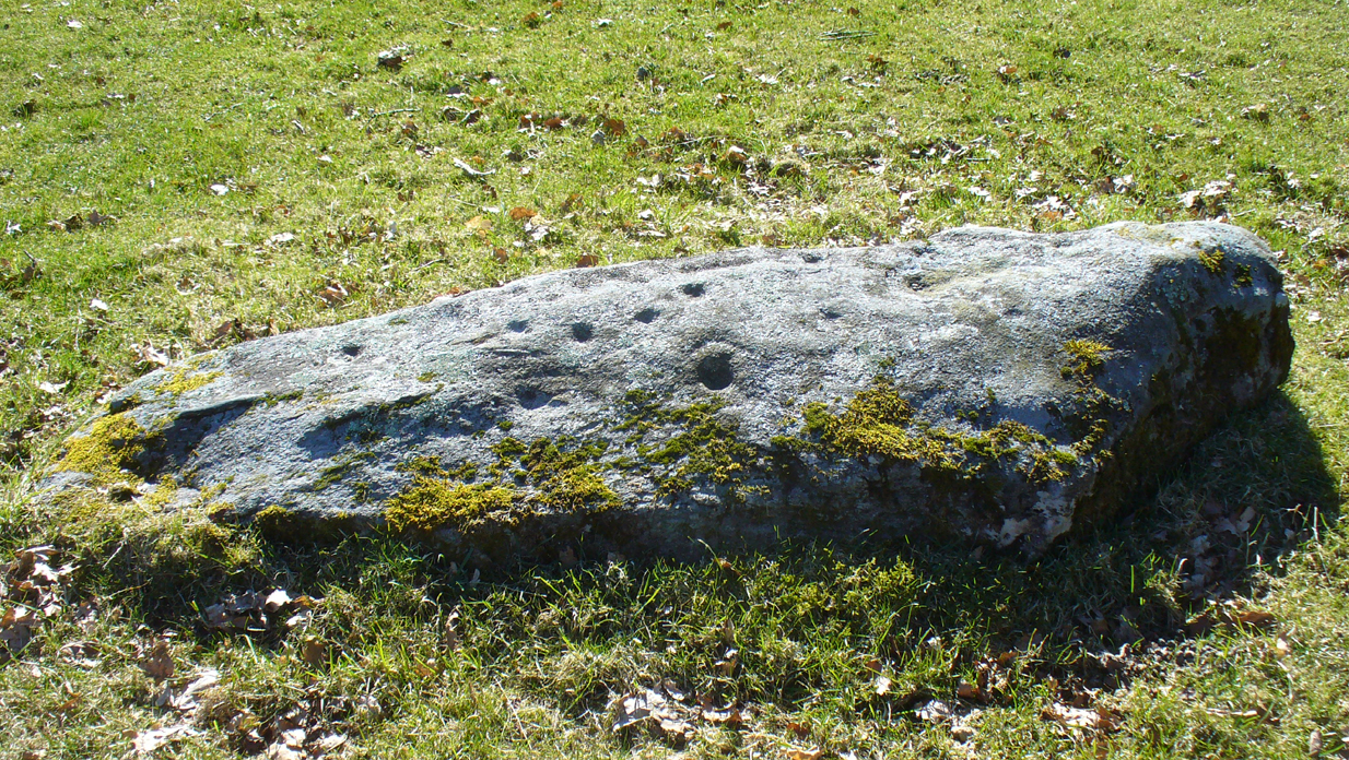
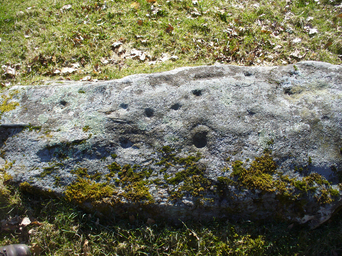
When Fred Coles (1910) came to explore Croft Moraig about 20 years later, he could only discern 19 cups on the stone, most of them the same size, “only two of which differ much in diameter and depth from the rest.”  The cup-and-ring that Hutcheson described and the other missing cups had been overgrown by the grasses, Coles said.  When Sonia Yellowlees described the carving in 2004, she said that 21 cups were visible, “one of which is surrounded by a single ring”—which you can clearly see in the photos below.

Carving 1 with cup-and-ring
Close-up of design

When archaeologist Evan Hadingham (1974) looked at this site, he found deposits of quartz here and thought that their presence may have been relevant to the placement of the carving, noting how such a relationship is found at other circles in Scotland.  In more recent years, rock art students Richard Bradley and others have found similar quartz deposits in or around some petroglyphs a few miles from here; as have fellow students Jones, Freedman and o’ Connor (2011) at some of the rock art around Kilmartin.  In my own explorations of the carvings near Stag Cottage, hundreds of quartz chippings were found that had been pecked into the cups and rings.

References:

  1. Burl, Aubrey, Rings of Stone, Frances Lincoln: London 1979.
  2. Coles, Fred, “Report on Stone Circles Surveyed in Perthshire,” in Proceedings of the Society of Antiquaries, Scotland, volume 44, 1910.
  3. Hadingham Evan, Ancient Carvings in Britain: A Mystery, Garnstone: London 1974.
  4. Hutcheson, Alexander, “Notes on the Stone Circle near Kenmore,” in Proceedings of the Society of Antiquaries, Scotland, volume 23, 1889.
  5. Piggott, Stuart & Simpson, D., “Excavation of a Stone Circle at Croft Moraig, Perthshire,” in Proceedings of the Prehistoric Society, volume 37, 1971.
  6. Yellowlees, Walter, Cupmarked Stones in Strathtay, Scotland Magazine: Edinburgh 2004.

© Paul Bennett, The Northern Antiquarian

Oldfield Hill, Meltham, West Yorkshire

Enclosure:  OS Grid Reference – SE 0874 1009

Getting Here

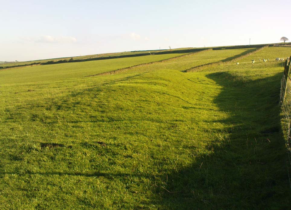
Oldfield enclosure in the field below

From the crossroads at the centre of Meltham, near the church, take the Wessenden Head Road up out of town for about a mile.  Keep your eyes peeled to right (north) for the track leading downhill to Oldfield Hall or Farm.  As you go down the track you’ll see a small cluster of hawthorns running along a small ridge 100 yards or so ahead, at the end of the field, with some line of embankment. This is on the right of the track and is the Oldfield enclosure!

Archaeology & History

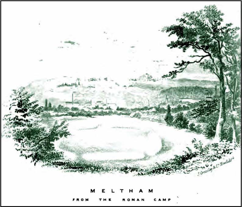
The remains of this large quadrangular settlement were first described as of ‘Roman’ origin in Mr Morehouse’s History of Kirkburton (1861), where he told that,

“In the…township of Meltham are the remains of a Roman encampment, on the moor below West Nab, a short distance to the left of the road which leads thence to the village…forming nearly a square of about four chains.  When I visited the place about twenty years since, in company with the owner and other friends, the whole was very distinct and perfect. This piece of ground has since been brought into cultivation, yet the trenches are still visible.  This encampment would appear only to have been made to supply some temporary emergency.”

Joseph Hughes old drawing of the ‘Roman’ camp
Western embankment & ditch

But Mr Morehouse’s speculation of its Roman origin and function are known to be untrue.  The site is in fact of Iron Age origin and was probably in semi-permanent use for long periods between Spring and Autumn. But the ‘Roman’ nature of the site was echoed a few years later, albeit briefly, in Mr Hughes’ History of Meltham (1866), where he told that “querns or hand-mills for grinding corn were found” at the site.

In 1909, the Saddleworth antiquarian Ammon Wrigley excavated the site but found little that could enable a correct dating of the enclosure. It was explored again a few years later by Ian Richmond and then again by J.P. Toomey in the 1960s.  Bernard Barnes (1982) summarised their respective findings, telling:

“Rampart of rubble and earth 7 feet wide faced with drystone walling; original height c.10 feet; V-shaped rock-cut ditch, 5½ feet deep and 6 feet wide, and a counterscarp bank similar to inner rampart with drystone revetment surviving to 4 courses.  Northeast entrance had double timber gateway.  Pre-rampart palisade trench on at least 2 sides of the enclosure with vertical posts 2 feet apart.  Finds include 2 stone discs, rough out beehive quern, iron slag and very small fragments of pottery.  Site dated to Iron Age.”

Another enclosure of similar period can be found a few hundred yards to the south.

…to be continued…

References:

  1. Abraham, John Harris, Hidden Prehistory around the North West, Kindle 2012.
  2. Barnes, Bernard, Man and the Changing Landscape, Eaton: Merseyside 1982.
  3. Bennett, Paul, The Old Stones of Elmet, Capall Bann: Milverton 2001.
  4. Hughes, Joseph, The History of the Township of Meltham, John Russell Smith: London 1866.
  5. Morehouse, Henry James, The History and Topography of the Parish of Kirkburton, H. Roebuck: Huddersfield 1861.
  6. Toomey, J.P., An Iron Age Enclosure at Oldfield Hill, Meltham, Brigantian: Huddersfield 1976.

© Paul Bennett, The Northern Antiquarian

Ashlar Chair, Burley Moor, West Yorkshire

Legendary Rock:  OS Grid Reference – SE 12075 44833

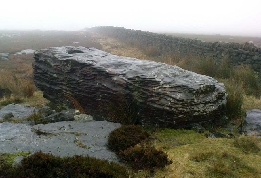
Ashlar Chair, looking southeast

Also Known as:

  1. Carving no.111 (Hedges)
  2. Carving no.115 (Boughey & Vickerman)
  3. Druid’s Chair
  4. Etching Stone

Getting Here

There are two large boulders here, one of which was deemed the Ashlar many moons back. You can approach it from the lazy way: park y’ car at the top of the road by the Whetstone Gate TV masts and walk east right along the boundary path till you get here. The better way is from Twelve Apostles: from there walk a coupla hundred yards north to the Lanshaw Lad boundary stone, where a small path heads west. Along here for another coupla hundred yards, then hit the footpath south for the roughly the same distance again. You’ve arrived!

Archaeology & History

The Ashlar Chair is ascribed in folklore, said Harry Speight (1892), “to be a relic of druidism,” as one of its titles in ages past was the Druid’s Chair.  In the nineteenth century it also became known as the Etching Stone, (Smith 1961-63) but it has retained its present title for more than two hundred years.  Shaped more like a couch than a chair, its present title—the Ashlar—is important in ritual Freemasonry, which has two aspects to it: the ‘rough’ and the ‘perfect’.  The first represents the neophyte; the latter, the illumined one.  Oaths are sworn on the ashlar, and laws are spoken from it.  In its higher aspect it is representative of the spiritual maturity  of evolved man.

Ashlar Chair on 1851 map

Although there are no public records as to who gave the site its present name, the land which lays before it, The Square, is an even greater indicator that this rock was was considerably more than just a curious place-name, for the open moorland that is overseen from Ashlar Chair—The Square — is 396,000 square yards of flat open heathlands that have never been archaeologically explored.  The Square is also one of the most important elements of Freemasonry: representing the manifest universe, its laws are spoken from the Ashlar. (Jones 1950)

Between the two of them, represented here in the landscape near the very tops of these moors, we have a form of late geomancy, although the names of our geomancers are nowhere to be found.  It is obvious though, simply from the name of the land, that dramatic ritual of some form was enacted here.  In recent times, ritual magickians from differing Orders have found the place most effective, as have wiccan folk and other pagans who have frequented it at the summer solstice.  The possibility that some members of the Grand Lodge of ALL England (a legendary Masonic Order, said by the modern London masons not to have existed until the eighteenth century) gave this place its name is not unreasonable.  Records show that in the fourteenth century at least one member of the Order, Sir Walter Hawksworth, frequented ritual circles on these moors; and another member of the same Lodge from the nearby Washburn valley was an ally to the Pendle and Washburn witches who, we know, met on these moors at Twelve Apostles stone circle and probably the Ashlar.  But it proves nothing I suppose. (I tend to believe (not a necessarily healthy viewpoint) that the Grand Lodge did use the Ashlar as one of their moot points, along with the Pendle and Washburn witches.)

Its primary geomantic attribute is as an omphalos.  Geographically the Ashlar Chair is the meeting-point of Bingley, Burley, Morton and Ilkley moors and, metaphorically speaking, when you stand here you are outside the confines of the four worlds yet still a purveyor of them.

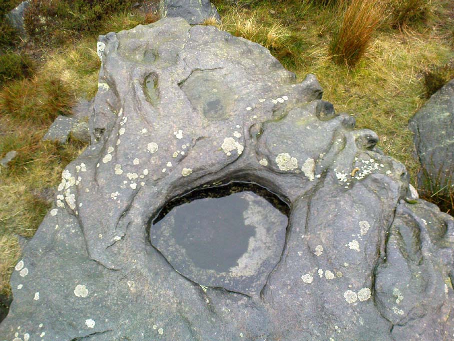
Nature’s cups-and-grooves on the Ashlar

Upon the large rock itself it are carved the faint initials, “MM, BTP, ISP and IG, 1826.”  Several early records described cup-and-ring designs on the Ashlar: firstly in Forrest & Grainge’s (1868) archaeological tour; then in Collyer & Turner’s Ilkley (1885); and lastly by the great Yorkshire historian and topographer Harry Speight (1892, 1900), who said “it bears numerous cups and channels.”  Although we can see some of these on top of the Ashlar, they are mainly Nature’s handiwork.  It is possible that some man-made cup-and-rings once existed on the rock, but if so they have eroded over time.

References:

  1. Bennett, Paul, The Old Stones of Elmet, Capall Bann: Milverton 2001.
  2. Collyer, Robert & Turner, J.H., Ilkley Ancient & Modern, William Walker: Leeds 1885.
  3. Forrest, C. & Grainge, William, A Ramble on Rumbald’s Moor, among the Dwellings, Cairns and Circles of the Ancient Britons in the Summer of 1867 – Part 1, W.T. Lamb: Wakefield 1868.
  4. Jones, Bernard E., Freemason’s Guide and Compendium, Harrap: London 1950.
  5. Speight, Harry, Chronicles & Stories of Old Bingley and District, Elliott Stock: London 1892.
  6. Speight, Harry, Upper Wharfedale, Elliott Stock: London 1900.

© Paul Bennett, The Northern Antiquarian

Panorama Woods (236), Ilkley, West Yorkshire

Cup-and-Ring Stone:  OS Grid Reference – SE 10395 47039

Faint cup-and-ring carving

Also Known as:

  1. Carving no.68 (Hedges)
  2. Carving no.236 (Boughey & Vickerman)

Getting Here

From Ilkley, take the Wells Road heading towards White Wells, bending round the bottom of the moor, making sure you keep left along Westwood Drive (not further up the moor along the Keighley Road).  Keep along Westwood Drive – it becomes Panorama Drive after a while – until you come to the small copse of woods on your right, a short distance before the end of the road.  Go along the footpath by the wall at the side of the house, bending into the woods after 10 yards.  Another 10 yards on, you’re near the edge a drop down the slope, where a number of large rocks are seen.  Look around!

Archaeology & History

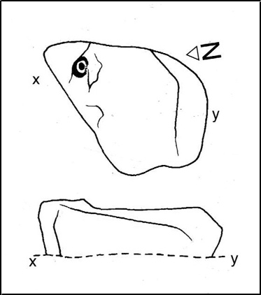
Carving 236 (after Boughey & Vickerman)

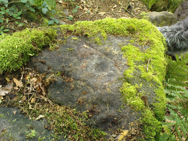
A singular cup-and-ring carving can be seen, rather faintly, near the nose-end of this large mossy stone, close to the edge of the ridge.  It is one of a small cluster of carvings that remain in this small bit of woodland.  Other highly ornate carvings could once be seen in the same stretch of woodland — where the rich houses now stand — amidst remains of a prehistoric enclosure or settlement of some sort.  All remains of this settlement have been destroyed, which is a pity as it may have given us helpful information about the nature of this carving and its nearby relatives.

References:

  1. Bennett, Paul, The Panorama Stones, Ilkley, TNA: Yorkshire 2012.
  2. Boughey, Keith & Vickerman, E.A., Prehistoric Rock Art of the West Riding, WYAS: Wakefield 2003.
  3. Hedges, John (ed.), The Carved Rocks on Rombalds Moor, WYMCC: Wakefield 1986.

© Paul Bennett, The Northern Antiquarian 

Rivock Well, Silsden, West Yorkshire

Healing Well:  OS Grid Reference – SE 07782 44863

Getting Here

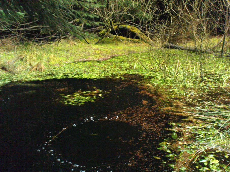
Rivock Well pool

From the B6265 valley road between Bingley and Keighley, just near Riddlesden Hall, take the road up and over the canal into Riddlesden, bearing left up past West Riddlesden Hall and up Banks Lane. As you reach the T-junction at the top, where you hit the Silsden Road that goes round the moors, park up.Cross the road and follow the footpath diagonally across the bottom of the field, then when you hit the track, follow it up through the closed gates into the woods.  A half-mile along the track, watch out for the dark pool a few yards beneath you on your left.  That’s it!

Archaeology & History

The spirit and feel of this pool is a curious one: still, calming, but with a slight sense of unease at times.  It felt like this before the large forestry plantation was planted around it — so it’s good to know it’s kept its spirit intact.  I’m not quite sure how long it will last though… The small spring of water from just above the edge of the pool which in part feeds it, tastes good and refreshing after a good downpour, but sometimes in recent years the waters have slowed somewhat compared to earlier decades — an unhealthy state of affairs that’s happening all over the world.

A favourite haunt for very colourful dragonflies, deer, pheasant and other animals, very little has been written about this site.  Said by place-name authorities to get its name from an old oak that once stood by its side, the name must be pretty old as no remains of such a tree has been mentioned by any antiquarians in the last 200 years.  But the first element in the place-name “riv-ock” is an intriguing puzzle.  Does it mean simply a split oak?  Or was it a more regal in nature, and derive from the old Gaelic Righ, (proncounced ‘ree’) meaning a King’s Oak?  More probably the name relates to the “well by the twisted oak,” from the dialect word, rive, or ‘twisted’.  However, when we begin exploring dialect variations on this word, a whole host of possible meanings emerge!

Ancient people who lived on these moors obviously used this well — and no doubt had old tales of its medicinal virtues, but sadly these are lost.  All we have to remind us that our ancestors came here are the numerous cup-and-ring stones found at Rivock Edge itself, a short distance southeast of here…

References:

  1. Whelan, Edna & Taylor, Ian, Yorkshire Holy Wells and Sacred Springs, Northern Lights: Dunnington 1989.

© Paul Bennett, The Northern Antiquarian

Rivock End, Riddlesden, West Yorkshire

Cup-Marked Stone:  OS Grid Reference – SE 07782 43878  

Getting Here

Clusters of cup-markings

From the B6265 valley road between Bingley and Keighley, just near Riddlesden Hall, take the road up and over the canal into Riddlesden, bearing left up past West Riddlesden Hall and up Banks Lane. As you reach the T-junction at the top, where you hit the Silsden Road that goes round the moors, park up.  Turn left and walk along the Silsden Road, counting the field on your left, moorland-side.  At the fourth, go through the gate uphill, keeping to the walls on the right and going through the second gate up.  Walk straight on for nearly 130 yards (119m) where you’ll see this group of three earthfast rocks right next to each other.

Archaeology & History

‘Ring of cups’ motif

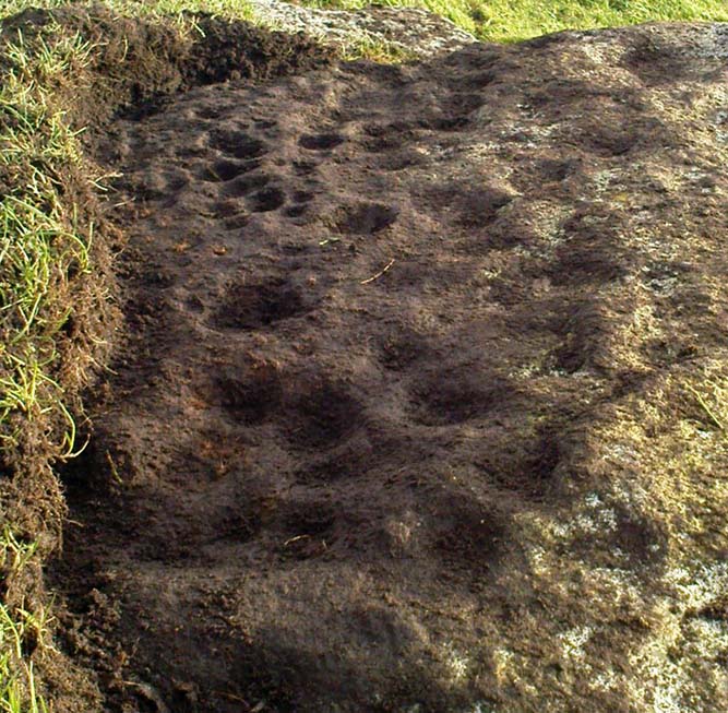
Not included in any pervious archaeological survey, this is a fine cup-marked stone with at least 25 cups etched into this average-sized rock, halfway up this field of stones.  When this carving was rediscovered on Friday, 6 January, 2012, it was noticed that a couple of cup-marks were peeking out from the edge of the grasses covering the rock — and so a careful and gradual uncovering of the rock itself was slowly exposed and see if the initial suspicions of an authentic carving were correct.  Thankfully it turned out right!

When first spotting this, I undercovered more beneath the soil, although it’s not clear how much of this stone is covered in carvings, as the Earth has grown considerably over the top of it.  There is also what seems to be a geological curiosity on the eastern section of the stone; whereby some apparent ‘cups’ seem to have been created by natural process.  However, these have been added to by human hands at a distant time, long ago.  The cup-marks themselves vary in size, from small ones barely an inch across, to larger ones measuring some 3-inches in diameter; and oddly, the cups seem to get larger the further west you travel across the stone!  More research is needed at this site to ascertain the a more complete image of the petroglyph.

…to be continued…

© Paul Bennett, The Northern Antiquarian