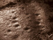
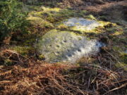
Balnadrum, Moulin, Pitlochry, Perthshire

Souterrain (lost):  OS Grid Reference – NN 9447 5890

Archaeology & History

In Hugh Mitchell’s (1923) survey of prehistoric sites in the Pitlochry district, this long lost souterrain was thankfully captured by his pen.  Two years later John Dixon (1925) also mentioned the site, but he was ostensibly copying what Mitchell had written.  We were told:

“About 50 yards west of Balnadrum Farmhouse there is a weem or underground Pict’s house, which was revealed a good many years ago by the plough lifting one of the stone covers.  The exact position of this weem has been lost site of, but could be found without much trouble.  It was about 50 feet long, slightly curved, having an inside width of about 3½ feet and a height of about 5½ feet.  Nothing was found in it and the cover was carefully replaced.”

The site was included in Wainwright’s (1963) standard survey, where he opted for some slight scepticism regarding its nature as a souterrain due to it being about 30 miles away, or, as he said, “far withdrawn from the main concentration (of souterrains) in Angus.”  A minor point to be honest…  Nevertheless, he gave attention to the words of a Mr William McLaughlan who was the farmer at Balnadrum until the end of World War 2:

“He was born in 1873 and he estimates that the discovery was made about 1885.  He also confirms the site—it is about 150 feet west of Balnadrum, or directly across the road from the gate which leads to the farmhouse.  This spot is now covered by modern houses and/or their gardens.  To this point there is no conflict in the evidence.  Mr McLaughlan however, does not remember a 50-foot passage, and he thinks that the structure was removed.”

Nonetheless, all are agreed that an underground structure of some sort existed at this spot.  Whether or not it still hides deep beneath the soils, filled in, or whether it was destroyed when the houses were built, we know not…

References:

  1. Dixon, John H., Pitlochry Past and Present, L. Mackay: Pitlochry 1925.
  2. Mitchell, H., Pitlochry and District: Its Topography, Archaeology and History, L. Mackay: Pitlochry 1923.
  3. Wainwright, F.T., The Souterrains of Southern Pictland, RKP: London 1963.

© Paul BennettThe Northern Antiquarian
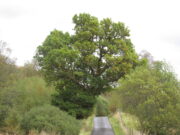
Cnoc Dubh, Moulin, Pitlochry, Perthshire

Stone Circle (destroyed):  OS Grid Reference – NN 9424 5871

Archaeology & History

Missing from the primary surveys of Burl (2000) and Barnatt (1989), a mention of this long lost site was made by local historian Hugh Mitchell (1923) in his survey of the area.  He told that,

“On the east side of the Moulin road beyond the Hydro Hotel a knoll and a clump of trees will be noticed on the right, inside the Hydropathic grounds; this knoll is known as the Cnoc Dubh, or “Black Knoll” and still bears an uncanny reputation as being an old site of Pagan worship.  There was at one time a stone circle on it, but the stones are said to have been broken up, fully 100 years ago, to build the old farmhouse of Balnadrum.”

Something ancient was there, obviously, as it was mentioned in another earlier account—albeit just a tourist guide of Atholl—which said that, on

“the knoll known as Knock-Dhu, within the (Pitlochry Hydro) grounds, are the remains of a pre-historic fort, now overgrown with pine trees.”

References:

  1. Anon., Atholl Illustrated, L. Mackay: Pitlochry c.1910.
  2. Dixon, John H., Pitlochry Past and Present, L. Mackay: Pitlochry 1925.
  3. Mitchell, H., Pitlochry and District: Its Topography, Archaeology and History, L. Mackay: Pitlochry 1923.

Links:

  1. Canmore

© Paul BennettThe Northern Antiquarian
Craig Hill cluster (6), Kenmore, Perthshire

Cup-and-Ring Stone:  OS Grid Reference – NN 81307 44422

Getting Here

Craig Hill cluster (6) stone

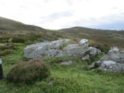
Follow the same directions to reach either the Craig Hill cluster (3), no.4 or no.5 carvings.  Once here, looking at the sloping moorland ahead of you, the elongated stone that’s closest to where the moorland slopes downhill is the one you’re after.  Y’ can’t really miss it!

Archaeology & History

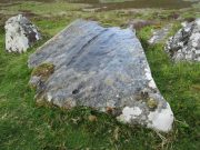
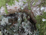
The sixth carving in this small close-knit cluster and, design-wise, the least impressive of the bunch.  There are three distinct cup-marks on the rock: two on its more southern side and one near the middle of the stone.  There may be another two cups, but these may have been part of the curious long, naturally-eroded line running along the length of the stone.  Other man-made elements may have been cut into the stone, but it needs to be seen in perfect low light to tell us one way or the other.

References:

  1. Currie, George, “Craig Hill (Dull parish): Cup-and-Ring Marked Rocks,”in Discovery & Excavation Scotland, NS Volume 6, 2005.

© Paul BennettThe Northern Antiquarian
Heugh Well, Blairgowrie, Perthshire

Healing Well:  OS Grid Reference – NO 17103 46984

Also Known as:

  1. Mineral Well

Archaeology & History

This little-known iron-bearing spring can still be found in the woodland known today as the Heugh of Mawse, a mile north of Blairgowrie.  It was included in the Object Name Book of 1863, where they referred to an earlier account in the New Statistical Account, which told that,

“On the south end of it is a chalybeate spring much resorted to by the people of the locality. “There are one or two chalybeate springs in the parish; but they have never been chemically analyzed. There is one very fine spring called the “Heugh Well” It springs from the face of the “Heughs of Mause” (a mortar cliff of singular appearance; which descends abruptly into the bed of the river with an almost perpendicular declivity of about 200 feet) and judging from its colour, contains a considerable quantity of ferruginous matter. The use of its water has been found to be very beneficial in cutaneous eruptions, & affections of the Stomach.””

Heugh Well on 1867 map

Subsequently highlighted on the 1867 OS-map, a singular footpath led to the site and no further.  It was mentioned by the regional historians J.G. McPherson (1885) and John MacDonald (1899), albeit briefly, where they respectively told that its waters were “formerly much resorted to by persons in the neighbourhood.”  It possessed considerable medicinal properties which, according to tradition, were “found very beneficial for skin diseases and derangement of the stomach”!  Doubtless such attributes will still be effective.

References:

  1. MacDonald, John A.R., The History of Blairgowrie, Advertiser Office: Blairgowrie 1899.
  2. McPherson, J.G., Strathmore: Past and Present, S. Cowan: Perth 1885.

© Paul BennettThe Northern Antiquarian

St. Ninian’s Well, Blairgowrie, Perthshire

Holy Well (destroyed):  OS Grid Reference – NO 180 452

Archaeology & History

The Well Meadow in the middle of Blairgowrie was once the place where the 5th century Apostle of the Southern Picts, or St Ninian, baptised local folk into the so-called “new faith”.  It’s long since gone.  The local historian John MacDonald (1899) told that it was located opposite the buildings on the north-side of the square, adding:

“St Ninian, one of the earliest Christian Celtic missionaries, on his tour through Scotland, pitched his camp where the Wellmeadow now is, and quenched his thirst at an old well or spring which ever afterwards bore the name of “St Ninian’s Well,” until it was covered in and the water led into the town drains.”

Old Ninian’s saint’s day is September 16.

References:

  1. MacDonald, John A.R., The History of Blairgowrie, Advertiser Office: Blairgowrie 1899.

© Paul BennettThe Northern Antiquarian

Craig Hill cluster (4), Kenmore, Perthshire

Cup-and-Ring Stone:  OS Grid Reference – NN 81303 44419

Getting Here

Craig Hill cluster (4) stone

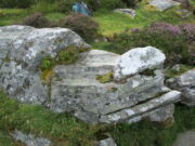
From Kenmore go east up the steep mountain road towards Glen Quaich, or if you’re coming from Amulree, go west along the same glen.  After 2½ miles (4km) up the Kenmore route (nearly 9 miles on the Amulree route) you’ll reach a small lochan on your left (you’ve got a very small parking spot a coupla hundred yards before the loch).  A gate and stile past the loch takes you east along a track into the moors.  More than a mile on, the track splits, but you need to keep to the left and follow the track along the wall-side for another 400 yards or so, where you’ll see a small crag of rocks 100 yards down the slope on your right. Once here, the elongated rock with a “seat” that you can sit in is the stone in question.

Archaeology & History

At first sight this stone doesn’t seem to have anything petroglyphic about it, and—as when we visited the other carvings in this Craig Hill cluster—the weather was grey and overcast, so it was difficult to discern anything at first.  But as we walked round and round inspecting the Craig Hill cluster-5 carving, a glance at this adjacent stone seemed to indicate one or two cup-marks within the curious chair-like aspect of the rock, but we couldn’t initially work out whether they were simple geophysical elements or not.

Very faint cup-&-half ring near the centre
Close-up of the C&R

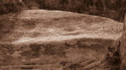
So we poured water onto the stone in the hope that something might show up.  And the more we walked round and round, bending down, looking from as many angles as possible, not only did we see what looked like several cups, but one of them had a half-ring that curved round what may or may not be a natural cupmark.   You can see it pretty clearly in the attached photos.  In other photos that we took, the faint cup-and-half-ring seems to plays its part in a line of three or four other cups; although in order to ascertain whether these elements are man-made or not, we could do with the help of a good geomorphologist.

Acknowledgements:  Huge thanks to Prof Paul Hornby for use of his photos in this site profile; and to Myrna Hurley for getting us up there.  Cheers doods. 😉

© Paul BennettThe Northern Antiquarian

Meikle Whitefield, Cargill, Perthshire

Stone Circle (destroyed):  OS Grid Reference – NO 173 342 (approximation)

Archaeology & History

In an archaeological report by Alexander Hutcheson for the Scottish Society of Antiquaries in 1884, he described and illustrated an impressive cup-and-ring stone that was formerly built into the walls of a demolished house ¾-mile from its original position near Meikle Whitefield farm.  Upon destruction of that house, the farmer of West Whitefield—a half-mile from its original position—then moved the stone it into his front garden.  According to tradition, said Hutcheson, this stone

“was originally removed from a circle of stones, which had stood about half-a-mile eastward, but which have now been buried or broken up.”

Despite the local tradition, Hutcheson was some what sceptical of it, thinking that it

“seems very unlikely that such a weighty stone should have been transported for half a mile merely to serve as a foundation stone for a cottage, when the ground around was capable of supplying as many stones as would be required.”

You can see his point; but there are known circumstances where individual stones from megalithic rings have been preserved.  Hence, like John Barnatt (1989) in his magnum opus who preserved the folk memory of such sites, we include it here.  The tradition may well be valid.  Added to this is the fact that in just a few square miles hereby we once had a large cluster of stone circles, a few of which still remain.

Refeences:

  1. Barnatt, John, Stone Circles of Britain (2 volumes), BAR: Oxford 1989.
  2. Hutcheson, Alexander, “Notice of a Cup and Ring-marked Stone, and of Incised Stones Recently Discovered at Cargill, and of an Incised Boulder at Fowlis Wester,” in Proceedings Society Antiquaries Scotland, vol. 18, 1884.

© Paul BennettThe Northern Antiquarian

Cotterton, Moulin, Perthshire

Standing Stone:  OS Grid-Reference – NO 03818 63692

Also Known as:

  1. Straloch

Getting Here

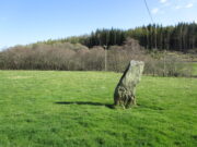
Cotterton standing stone

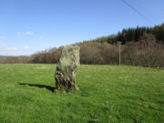
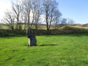
Along the A924 road, just over 4 miles (6.6km) NW from Kirkmichael, or about 8 miles (13km) NE from Pitlochry, you’ll hit the large farmhouse of Straloch.  You’ve really gotta keep your eyes peeled!  A few hundred yards west of Straloch itself, a small parking spot is on the south-side of the road, above the river.  From this parking spot, walk a few yards to the fence that overlooks the river and look into the field below you, where you’ll see the stone.  If y’ walk down the slope, you’ll see a gate on the right that leads you into the field.

Archaeology & History

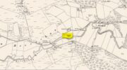
First shown on the 1900 OS-map of the area, this petrified hunchbacked witch-of-a-stone stands on the flat grassland plain (previously scattered woodland when first raised) forty yards from the River Brerachan: a proximity characteristic found at many of the stones along Strathardle.

Cotterton stone 1900 map
Fred Coles’ sketch

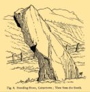
Descriptions of the site prior to 1900 seem non-existent (does anyone know otherwise?).  It was the brilliant antiquarian Fred Coles (1908) who, it seems, was the first to mention the old stone — whose very crooked appearance had an unusual effect on him, saying how “such a decided leaning over towards the north…almost make one uneasy when standing beside it”!  It didn’t have that effect on me, but I was mightily impressed by both its appearance and curious hunched gait.  Twas one of those monoliths that had a distinct ‘feel’ about it, which many people report at such places up and down the country.  Whether it was its position by the river, or the color of the landscape, or the silence, or the shape of the stone, or combinations of them all—which ever it was, there was almost a sense of genius loci residing here…

But in that other world of pragmatic measurements, as Mr Coles told us:

“The Stone is at the base an oblong in shape, measuring 14 inches on its east end, 2 feet 7 inches along its south side, 17 inches at the west, and 3 feet 6 inches on its north side—a girth, therefore, of 8 feet 8 inches.  At the middle its dimensions are the same, but the top is rather less.   At its N.E. apex the Stone is 7 feet 8 inches clear of the ground, and at the west edge 7 feet.  In the illustration…I have shown the monolith from the south, with the craggy profile of Menachban in the background.”

The stone was mentioned in passing in Hugh Mitchell’s (1923) local survey.  A few years later in John Dixon’s (1925) account he repeated the dimensions of the stone that Coles had cited; and although he found there to be no known traditions of the place, he conjectured how it may have been connected with the numerous battles “that in former days occurred along this entrance to the Highlands.”

It’s a damn good site is this.  All you megalith hunters will love it!

References:

  1. Anonymous, Notes on Strathardle, Strathardle 1880.
  2. Coles, Fred, “Report on Stone Circles Surveyed in Perthshire – Northeastern Section,” in Proceedings of the Society of Antiquaries of Scotland, volume 42, 1908.
  3. Dixon, John H., Pitlochry, Past and Present, L. Mackay: Pitlochry 1925.
  4. Mitchell, Hugh, Pitlochry District: Its Topography, Archaeology and History, L. Mackay: Pitlochry 1923.

© Paul BennettThe Northern Antiquarian

Dome Rock, St Fillans, Comrie, Perthshire

Cup-and-Ring Stone:  OS Grid Reference – NN 67511 25028

Getting Here

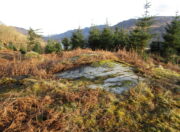
Dome Rock

On the A85 road from St Fillans to Lochearnhead, about 1½ miles on is the Loch Earn Sailing Club, with a large parking spot thereby.  From here, cross the road and go through the gate up the dirt-track, past the cottages where the track bends right until a few hundred yards further up where the track splits, bear right, along and down across the river, up the other side and past the cottage.  From here, the track becomes a grassy footpath.  Walk along here, east towards the trees 5-600 yards away.  Once you go through the large wooden slip-gate, about 150 yards on the path into the scattered trees, you’ll see a large dome-shaped rise on your right (south).  Y’ can’t really miss it!

Archaeology & History

This carving was rediscovered by the great Scottish petroglyph writer Ron Morris in 1968.  He told that, just below the overgrown track, “is a big dome-shaped outcrop with a smooth top.  On a scattered area on this, in 3 main groups, are over 24 cup-marks, up to 3″ diameter, ½” deep.”  But these aren’t mere cup-marks…

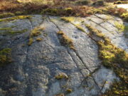
Faint, albeit clear cup-and-rings
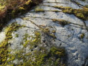
Cup-marks, top & bottom of photo

It literally is just like a large dome of rock, with carvings on certain sections of it.  Half of the cup-marks are easy to see, especially the ones near to the top of the dome and which exist in three main clusters.  Much more faint is another, larger cluster of cups, on its south-side.

Dealing with those on top of the rock: on the easternmost side a long natural crack separates a faint single cup-mark from a notable triangle of three, clearly visible in the photo (left).  Below this are what may be a couple more cups, but they were difficult to make out and may simply be Nature’s handiwork.  Certainly Nature has a part to play in the next small cluster of cups about six-feet further along the stone.  A shallow natural ‘arc’ has clearly been used to create a ring around one of the cups, clearly visible in the photo (right), with another faint cup-and-ring visible below it.  In between these, both Paul Hornby and I could make out what may be another incredibly faint smaller cup-and-ring (and which seemed evident on a couple of photos), but we need to wait for the computer-tech boys to get their teeth into that one!  Several other single cup-marks exist either side of another moss-covered crack in the rock.  And as we roll over the top western-edge of the stone, another small cluster of three, maybe four single cup-marks greets our attention.

Close-up of southern C&Rs
Southern carved section

It’s on the sloping south-side of the stone where the best cluster is found.  At least ten faint cup-marks—one or two with very faint incomplete rings round them—are arranged in gentle arcs into the rock.  On both sides of this section is a covering of vegetation, beneath which the carved designs probably continue.  In fact if this entire stone dome was completely free of vegetation, it’s likely we’d have a much larger piece of prehistoric rock art.  A job for future antiquarians perhaps…

References:

  1. Morris, Ronald W.B., “Glentarken Wood, Strathyre – Cup-marked Rocks,” in Discovery & Excavation Scotland, 1969.

Acknowledgments:  Big thanks to Paul Hornby for use of his photographs.  Cheers dood. 😉

© Paul BennettThe Northern Antiquarian

Fairy Oak, Killin, Perthshire

Legendary Tree:  OS Grid Reference – NN 57 33

  1. Coin Tree

Folklore

The Fairy Oak of Killin

Nothing has previously been written of this site.  Its existence came to light during one of umpteen enquiries I’d made with a well-known and very respected local lady, born and bred in Killin (sadly, a dying breed), who is known as a fount of knowledge regarding the history of the area.  We were talking about the ancient sites and folklore of the neighbourhood and, amidst being her usual helpful self she asked, “have you been to the Coin Tree?  The place where we leave offerings to the spirit of the place?”

I hadn’t.

“No, I’ve never heard of the place.”

“We keep it quiet, ” she said, “for obvious reasons.”

I knew what she meant.  The Fairy Tree at Aberfoyle is a case in point: littered with plastic pentagrams, children’s toys and so-called “offerings” of all kinds that have made it little more than a dumping ground for pseudo-pagans and new-age nuts that needs to be cleaned regularly by local folk.

Anyhow, our informant proceeded to give us directions to find the place, going out of the village, but asked that if we were to write about it, to keep its location quiet, “as the place is still used by us”—i.e., old locals.  After a slow trek along one of the roads out of the village we saw nothing that stood out.  Eventually we came across a fella relaxing in his garden and asked him if he knew anything about an old tree where offerings were made.  He gave us that look that olde locals do, to work out whether you’re a tourist or not and, after telling him what we’d been told and who had told us —that seemed to do the trick!

“You’d mean the Fairy Oak I s’ppose?  Aye,” he said, “gerrin the car and I’ll drive y’ down to it.”

So we did.  A short distance back along the road that we’d come down he stopped and walked along a to large oak tree beside the road.  We’d walked straight past it—but in truth it’s not a conspicuous tree and unless you were shown where it was, you’d miss it as easily as we did (and I’m usually damn good at finding such things!).  We thanked the fella for taking us to see it and he drove back home to leave us with out thoughts.

More coins as offerings
Coins for the little people

Embedded into the tree—some of them barely visible where the bark had grown over them—were clusters of old coins all around its trunk; some of them very old.  These had been inserted into the tree as offerings in the hope that the little people, or the genius loci would bring aid to that which was asked of it.

In a field across the road there’s a large “fairy-mound” hillock: one of Nature’s creations, but just the sort of place where many little people are said to live in many an old folk-tale.  Some such mounds are old tumuli, but this aint one of them.  It’s possible that it had some relationship with the tree where the fairy folk are said to reside but, if it did, our informants didn’t seem to know.

The important thing to recognise here is that in some of the small villages and hamlet in our mountains, practices and beliefs of a world long lost in suburbia are still alive here and there… But even these are dying out fast, as most incomers have no real attachment to the landscape that surrounds them.  Simply put: they see themselves as apart from the landscape as opposed to being a part of it.

© Paul BennettThe Northern Antiquarian