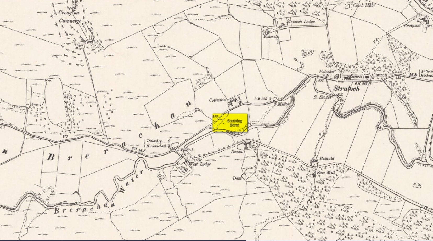
Standing Stone: OS Grid-Reference – NO 03818 63692
Also Known as:
- Straloch
Along the A924 road, just over 4 miles (6.6km) NW from Kirkmichael, or about 8 miles (13km) NE from Pitlochry, you’ll hit the large farmhouse of Straloch. You’ve really gotta keep your eyes peeled! A few hundred yards west of Straloch itself, a small parking spot is on the south-side of the road, above the river. From this parking spot, walk a few yards to the fence that overlooks the river and look into the field below you, where you’ll see the stone. If y’ walk down the slope, you’ll see a gate on the right that leads you into the field.
Archaeology & History
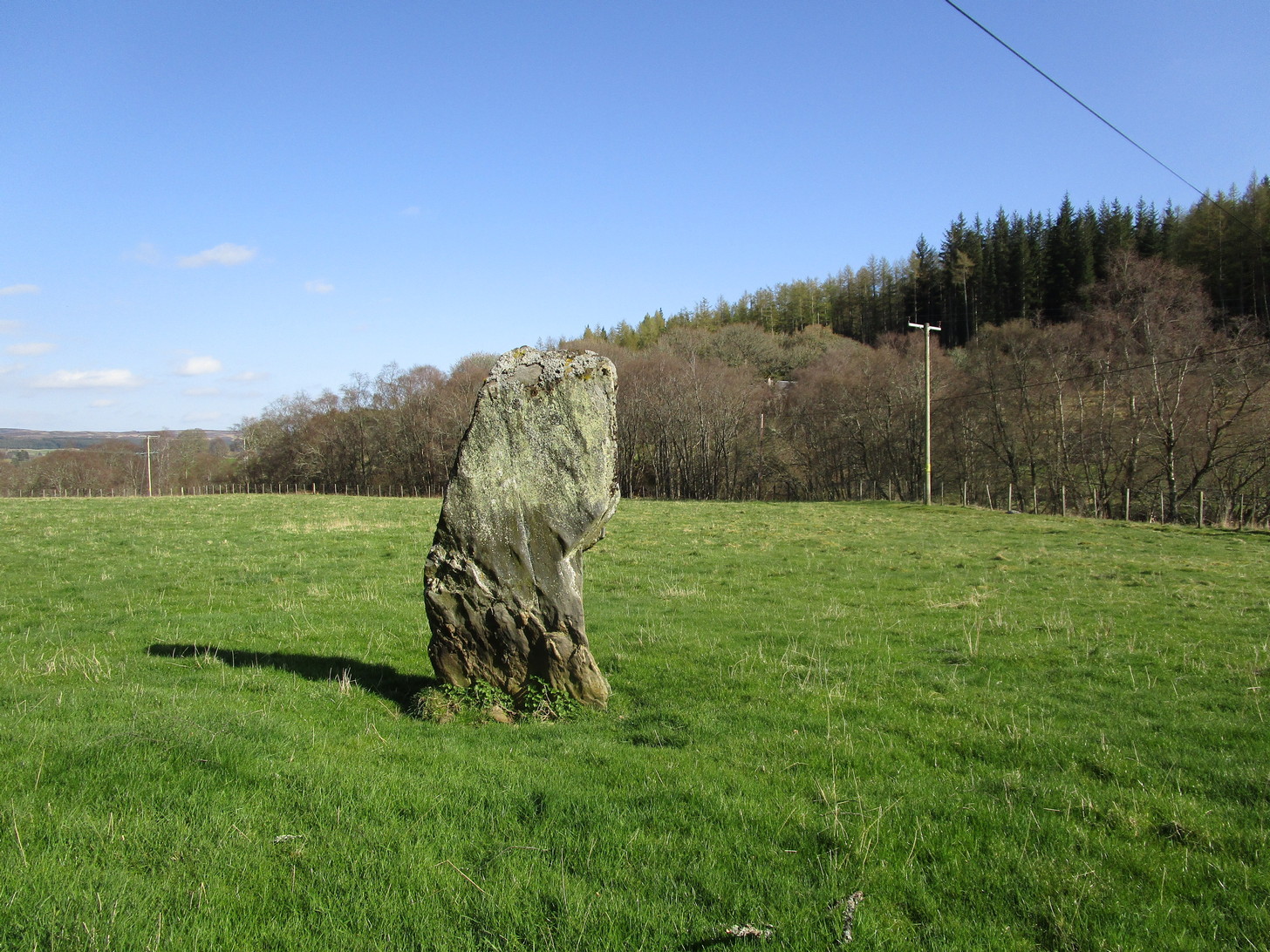
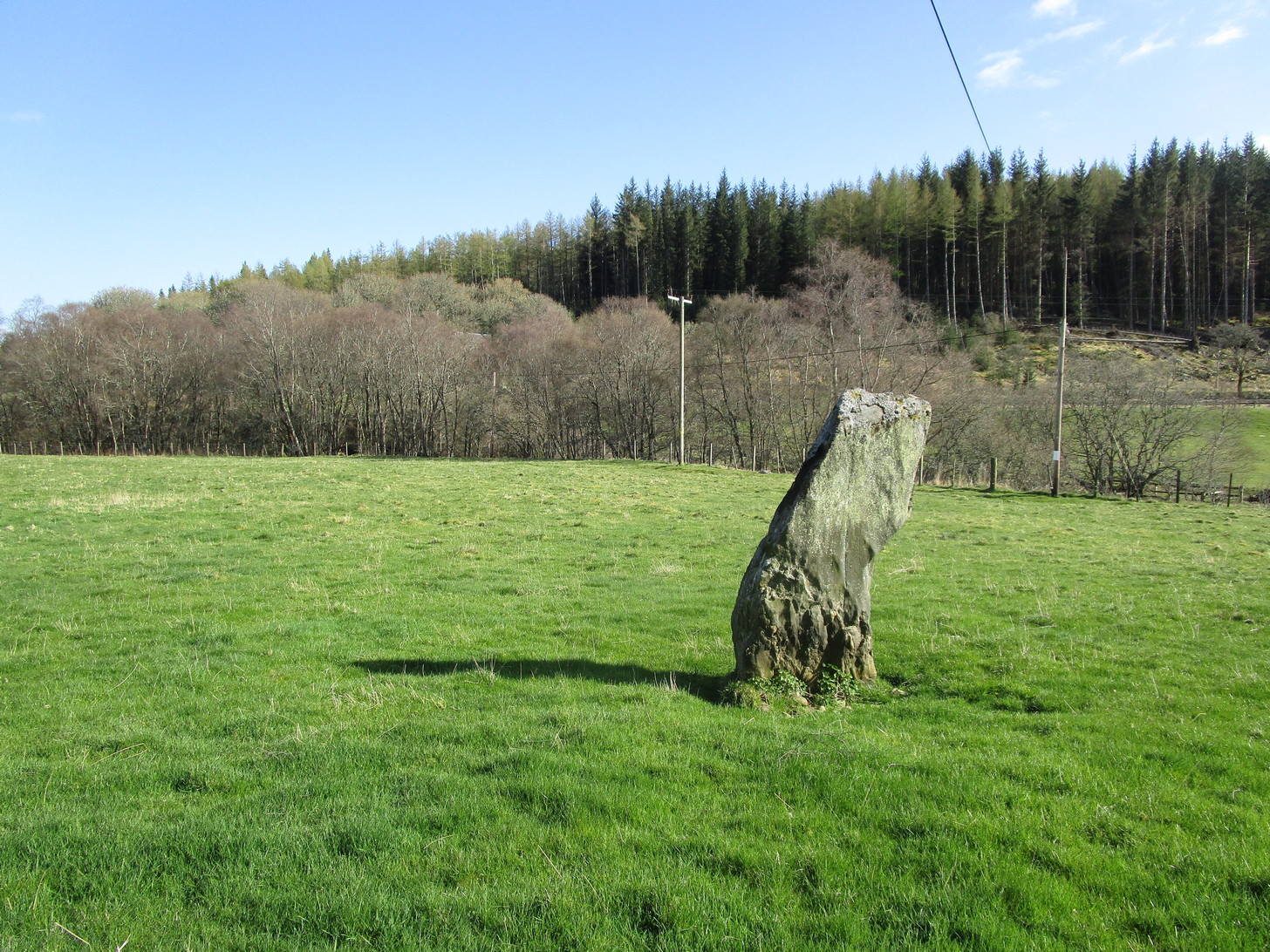
First shown on the 1900 OS-map of the area, this petrified hunchbacked witch-of-a-stone stands on the flat grassland plain (previously scattered woodland when first raised) forty yards from the River Brerachan: a proximity characteristic found at many of the stones along Strathardle.

Descriptions of the site prior to 1900 seem non-existent (does anyone know otherwise?). It was the brilliant antiquarian Fred Coles (1908) who, it seems, was the first to mention the old stone — whose very crooked appearance had an unusual effect on him, saying how “such a decided leaning over towards the north…almost make one uneasy when standing beside it”! It didn’t have that effect on me, but I was mightily impressed by both its appearance and curious hunched gait. Twas one of those monoliths that had a distinct ‘feel’ about it, which many people report at such places up and down the country. Whether it was its position by the river, or the color of the landscape, or the silence, or the shape of the stone, or combinations of them all—which ever it was, there was almost a sense of genius loci residing here…
But in that other world of pragmatic measurements, as Mr Coles told us:
“The Stone is at the base an oblong in shape, measuring 14 inches on its east end, 2 feet 7 inches along its south side, 17 inches at the west, and 3 feet 6 inches on its north side—a girth, therefore, of 8 feet 8 inches. At the middle its dimensions are the same, but the top is rather less. At its N.E. apex the Stone is 7 feet 8 inches clear of the ground, and at the west edge 7 feet. In the illustration…I have shown the monolith from the south, with the craggy profile of Menachban in the background.”

The stone was mentioned in passing in Hugh Mitchell’s (1923) local survey. A few years later in John Dixon’s (1925) account he repeated the dimensions of the stone that Coles had cited; and although he found there to be no known traditions of the place, he conjectured how it may have been connected with the numerous battles “that in former days occurred along this entrance to the Highlands.”
It’s a damn good site is this. All you megalith hunters will love it!
References:
- Anonymous, Notes on Strathardle, Strathardle 1880.
- Coles, Fred, “Report on Stone Circles Surveyed in Perthshire – Northeastern Section,” in Proceedings of the Society of Antiquaries of Scotland, volume 42, 1908.
- Dixon, John H., Pitlochry, Past and Present, L. Mackay: Pitlochry 1925.
- Mitchell, Hugh, Pitlochry District: Its Topography, Archaeology and History, L. Mackay: Pitlochry 1923.
© Paul Bennett, The Northern Antiquarian