Simply follow the directions to reach the Dunruchan monoliths ‘D’ and ‘E’ and then zigzag through the heather to their immediate south—from just a few dozen yards away, to up to 300 yards west. Keep your eyes peeled for the stoney little rises in the heather as you walk back and forth and you’ll see at least some of these cairns.
Archaeology & History
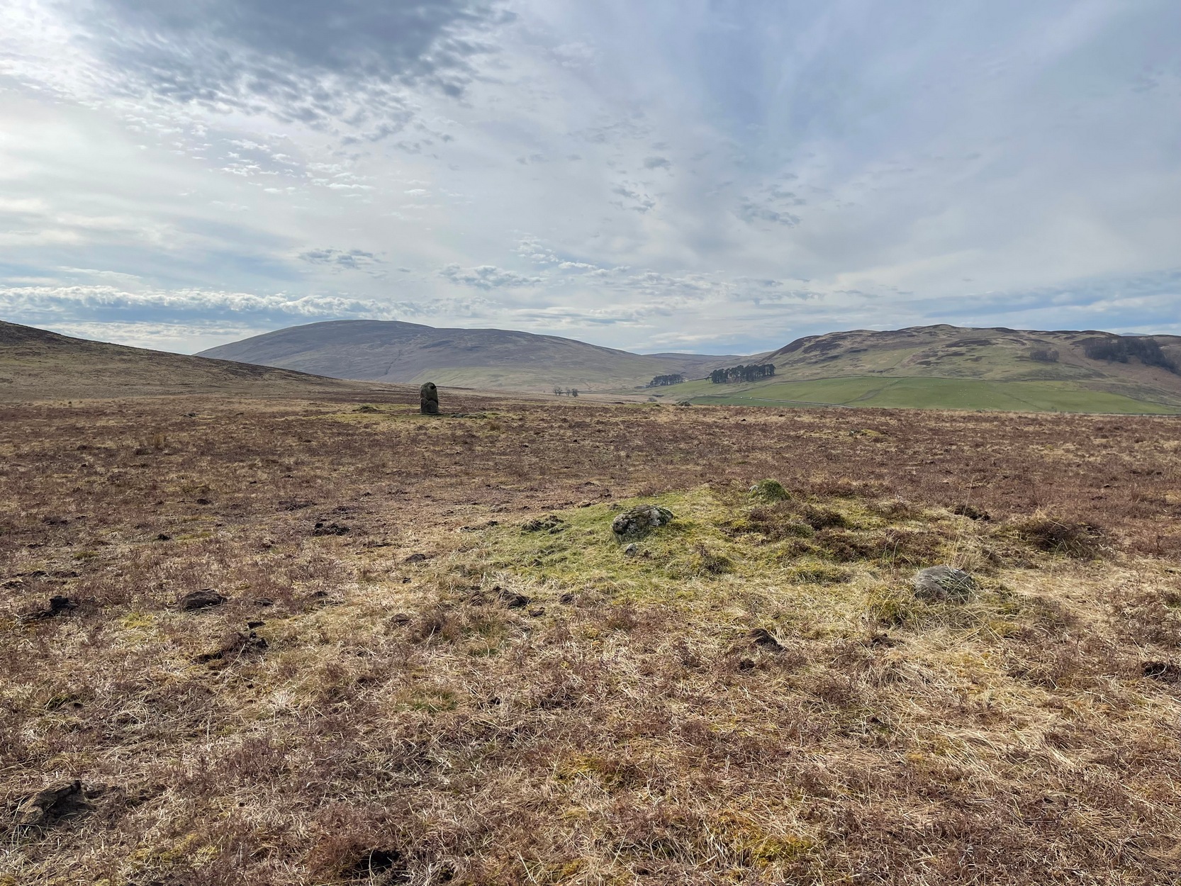
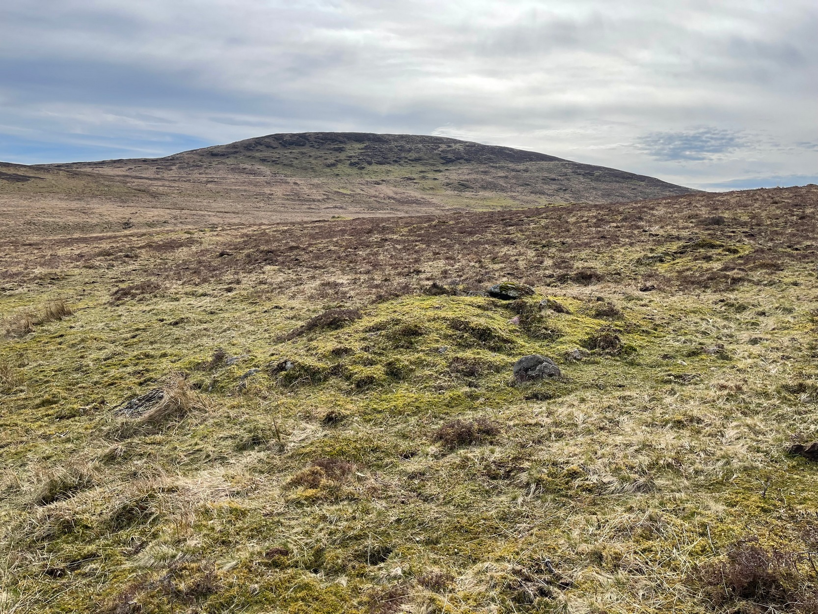
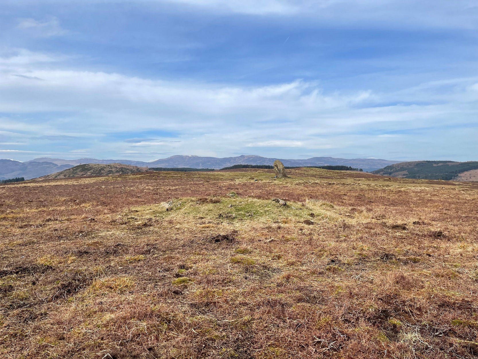
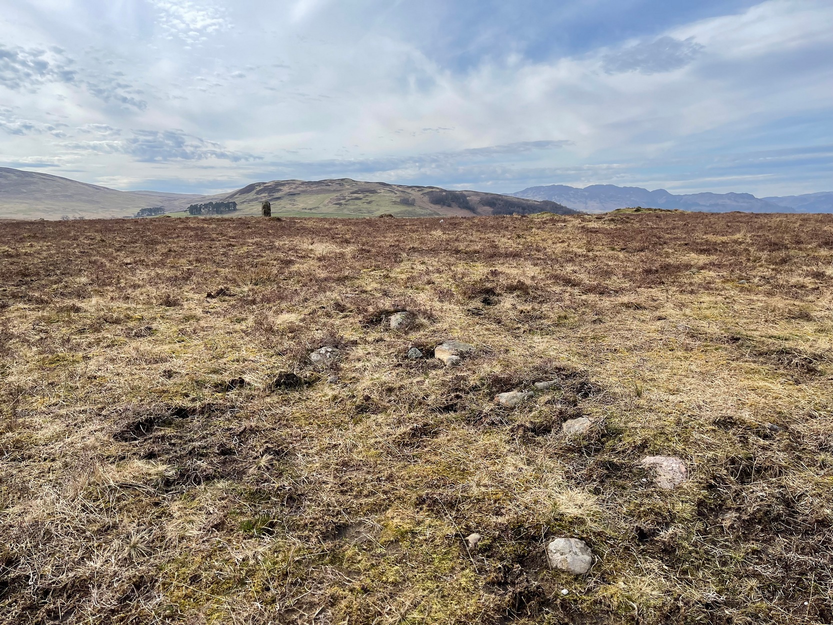
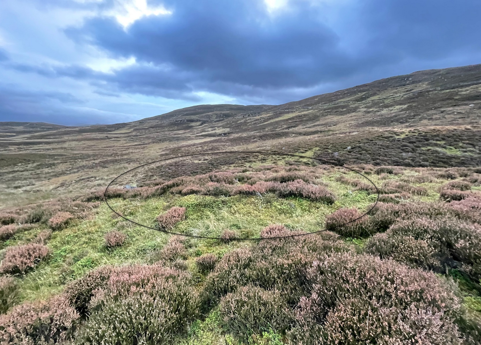
Not to be confused with the large cairn scatter on the grassy plain of Aodann Mhor a short distance north-west (whereon stands the magisterial Dunruchan A monolith), many of which which may be just field clearance cairns. This small group found a short distance east, south and west of Dunruchan stones ‘D’ and ‘E’ are more typical burial cairns. They each average between five and six yards across and none are more than three feet high. We first noticed them about ten years ago and on subsequent visits kept looking them over, but the deep heather ensured they were hard to see. But, after a recent heather-burning exercise on the moors, they are at thankfully visible—for a short time at least.
Cairn SE of Dunruchan ‘D’Cairn S of Dunruchan ‘D’
At the time of writing, probably the best one to see is found 40 yards south of Dunruchan D and 47 yards north-east of Dunruchan E and may have the astronomers amongst you running for the theodolites! It has that distinct look about it when you see it in context with the landscape and adjacent standing stones. The westernmost cairn that’s (presently) known here is 300 yards west of the Dunruchan E stone, just past the Dunruchan enclosure, at NN 7873 1676. It’s likely that there are other unrecorded prehistoric sites in this area.
Low line of ancient walling
Amidst this section of the moors is a line of very low walling that runs a short distance east-to-west, towards the Dunruchan ‘E’ stone. A lot of old walling exists hereby, mainly visible in the fields to the east, but this particular line is much smaller and of a different age by the look of things, presumably older. It has the appearance of walling more usually associated with prehistoric hut circles, but in this case runs in a straight line towards the standing stone. Curious…
Folklore
The standing stones on this plain and the cairns here are said to be the graves of fallen Roman soldiers, slain by our tribal Scots two thousand years ago. In all honesty though, these are likely to be much older than any of those Roman savages.
Standing Stone (lost): OS Grid Reference – NN 795 168
Archaeology & History
When Fred Coles (1911) visited the giant impressive Dunruchan standing stones, he told that “some distance to the east” of the Dunruchan E stone, “near the unnamed stream…my friend Mr James Simpson has seen another great Stone, but lying prostrate.” When he visited the area the weather beat him back (easily done up here!) and prevented him “from wandering far over the moor, and therefore this Stone was not observed.” It remains lost. (the grid-reference given for this site is an approximation)
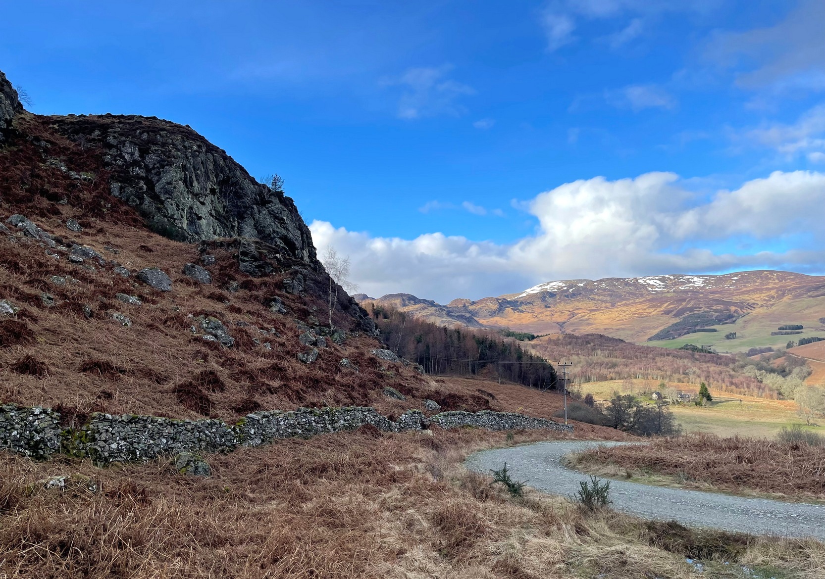
From Comrie village, take the long winding steep road up past the Devil’s Cauldron towards Glen Lednock. After 1½ miles the road begins to level-out and you come out from the trees and about 400 yards along there’s a dirt-track on your left. Park here! OK, now walk further along the road (not the dirt-track) for less than 100 yards and take the footpath up the slope (if this is blocked—it shouldn’t be!—you can walk further along until your reach the next track on your left). Go up this footpath for 200 yards till you reach the track by the large bend; and then walk up it for another 200 yards where there’s another large bend. On your right, past the solitary big rock, you’ll see the sign…
Archaeology & History
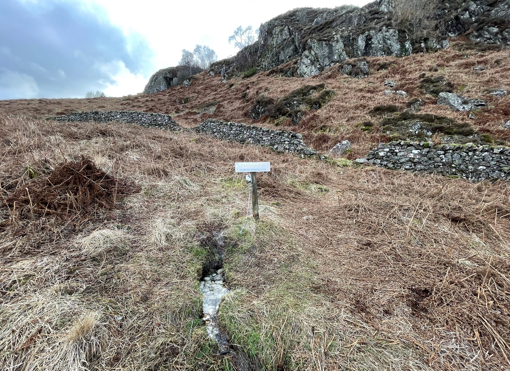
Sign of the Kinkhoast Well
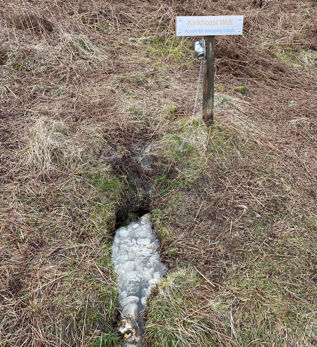
A little-known healing well that all but fell out of existence until, thankfully, some local folks recently decided to revive it. A sign stands above the back of this spring of water as it emerges from the Earth telling you that it’s the Kinkhoast Well. Its clear waters form into a very small pool, wherein are dozen of small white pebbles and and quartz pieces, very smooth and obviously worn by decades, if not centuries, of local folk giving the spirit of these waters—the genius loci—and offering in exchange for its healing virtues in the hope that it cures them of the whooping cough, of which this well is renowned.
It’s one of many whooping cough wells that are found in the Perthshire hills—and most are actually large boulders with hollows into which the rainwater collects and it is this that is used medicinally and not necessarily the spring water. A curious thing indeed…. and I’ve come across Highland folk who were taken to them when they were young children who’ve told me that their whooping cough was subsequently cured! Intriguingly, there is a large boulder just below this well, upon whose top is a natural bowl in which rainwater collects—and although I can find nothing specific telling of such a tradition here, above Comrie, it’s possible that the relationship between stones and wells, found at other places in the Highlands, also existed here.
Small pool full of white offering stonesWell & stone in close attendance
The name Kinkhoast itself (and variables thereof) is a Scottish dialect word, found from Galloway and into the Highlands. Jamieson (1880) describes it as literally “hooping cough”, with a brief note on the disease being cured by water drank from a shell. Meanwhile, in Grant & Morison’s (1960) massive work, they give numerous examples of the term, most of which relate to the same “whooping cough”, with some examples of folk remedies to abate the disease, including one of parents sending their children to take a drink from the “Kinker Steen Wall”—in that case from the parish of Logie. Examples of the very same tradition are known at other kinkhost sites. Check the place out when you’re in the area—and rest for a while to drink in the beautiful views…
References:
Anonymous, “Comrie Folklore – Kingcough Well,” in Crieff & District Post, no.31, August 2012.
Grant, William & Morison, David D. (eds), The Scottish National Dictionary – volume 5, SNDA: Edinburgh 1960.
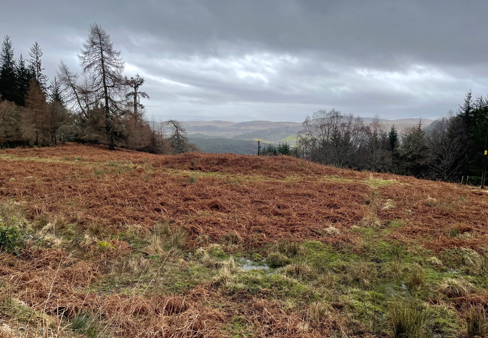
Along the A85 road between Comrie and St Fillans, just over a mile out of Comrie, on the right-hand side (north) of the road is the small farm-track into the fields where the ruined stone circle of Tullybannocher lives. Walk up this track (known as Maam Road), past the stones, and keep going uphill for more than a mile (literally 1 mile up, another track turns sheer right, but ignore it) where the track eventually levels-out; keep walking for another 600 yards, slightly downhill, until you reach a distinct fork in the track where you need to veer right, uphill, and keep walking up the track for ⅔-mile (1km) where you’ll eventually see a cottage ahead of you. 150 yards before this, to your left, down the slight slope and just as it begins to slope back up again on the other side, there’s some olde walling with a coupla big stones in it. It’s there!
Archaeology & History
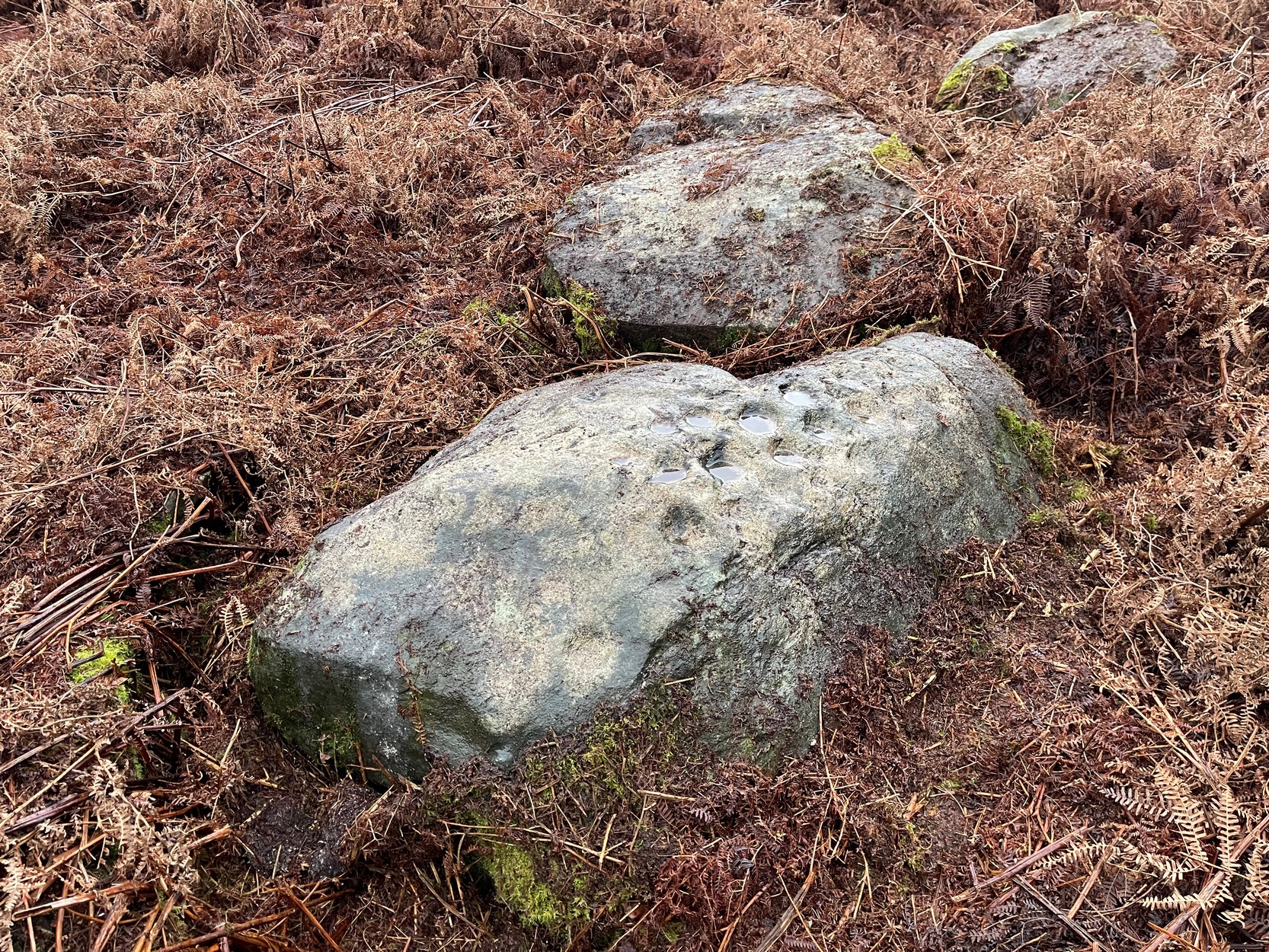
When James MacIntosh (1888) first visited this carving in the 19th century—which is close to the curious cairn of Druim na Cille just 75 yards to the west—he described there being a group of seven large stones forming, what he thought, might have been a large enclosure. I think he was right. Several of these stones can still be seen: each of them along some ancient walling that swerves in an arc to the east. One of these stones has a number of cup-marks on it.
Fred Coles’ 1991 sketchThe carving, from the track
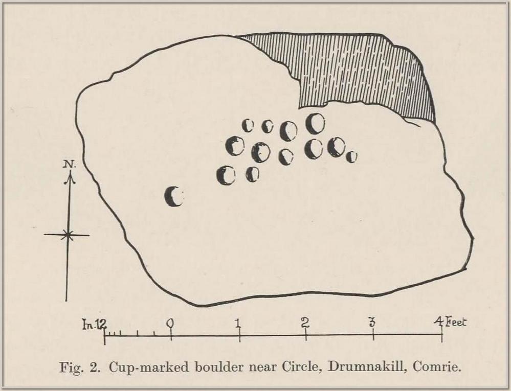
The design isn’t too impressive when compared to others in this neck o’ the woods, but they’re very distinct. We visited the place on a truly dark grey day: conditions that don’t usually allow for good visibility regarding cup-marks; but thankfully the cups along this stone are quite deep and hard to miss. Running along one section of the stone are what Gow called, “eleven beautifully formed cups, varying from 2¼ to 4 inches in diameter and from half an inch to an inch in depth.” When Fred Coles (1911) came here he counted thirteen cup-marks. There may be fourteen.
The stone does possess some more recent groove marks made by a metal instrument, possibly a tractor or perhaps when local workmen stuck up a microwave tower close by. Thankfully it hasn’t directly affected the cups on the stone. Check it out when you visit the nearby ring cairn.
Along the A85 road between Comrie and St Fillans, just over a mile out of Comrie, on the right-hand side (north) of the road is the small farm-track into the fields where the ruined stone circle of Tullybannocher lives. Walk up this track (known as Maam Road), past the stones, and keep going uphill for more than a mile (literally 1 mile up, another track turns sheer right, but ignore it) where the track eventually levels-out; keep walking for another 600 yards, slightly downhill, until you reach a distinct fork in the track where you need to veer right, uphill, and keep walking up the track for ⅔-mile (1km) where you’ll see a cottage ahead of you. About 50 yards before the house, down the slope on your left, a large rounded mass covered in bracken is the site you’re after.
Archaeology & History
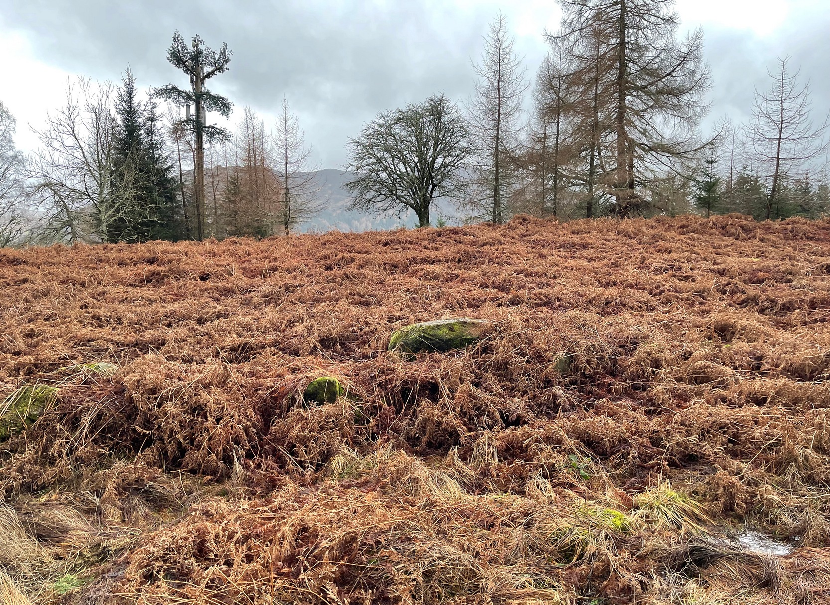
This is an odd site, in more ways than one. In the 18th and 19th century, local people told that it was “a very ancient churchyard, so old, indeed, that the grave-stones among the rank grass are scarcely discernible.” (Carment 1882) This lore was reinforced by the fact that, as James Gow (1888) put it,
“within living memory that a burial took place here, and the tradition is that people came to bury the “wee unchristened bairns” from long distances, such as Loch Tayside, Glendochart, Balquhidder, and Strathyre.”
Looking W, at the circleThe old mound, looking SE
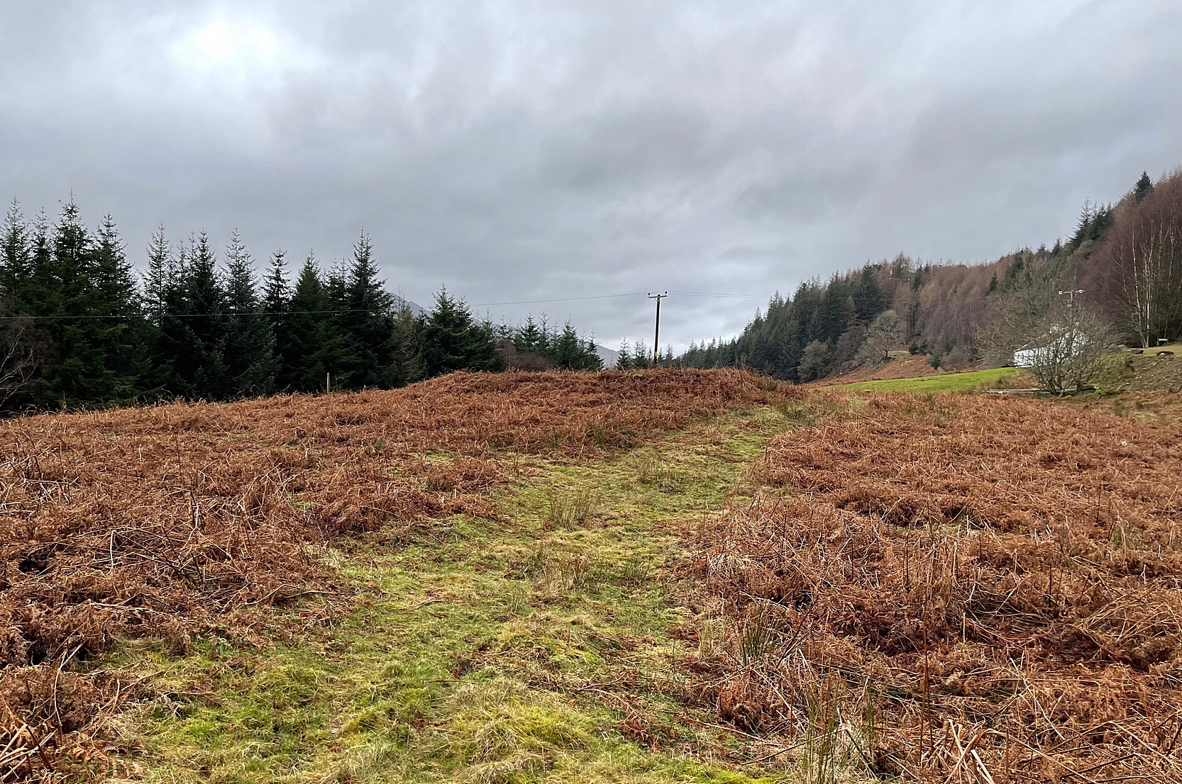
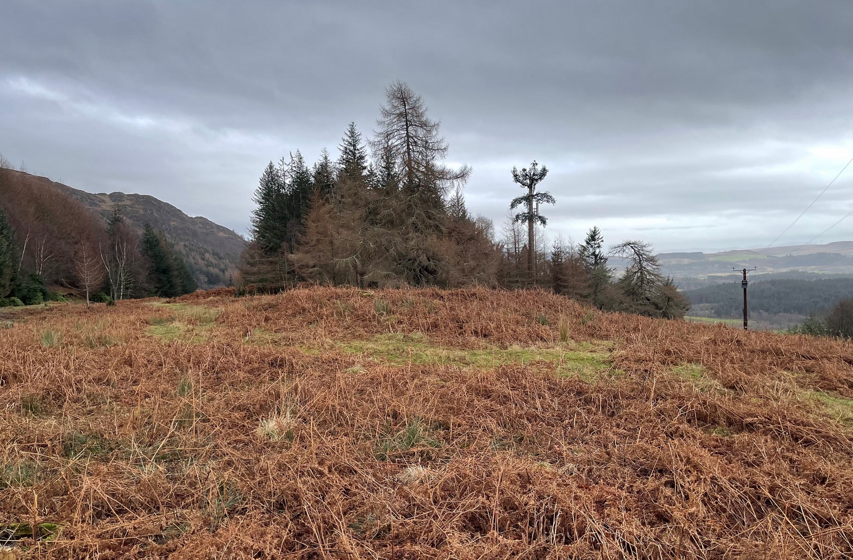
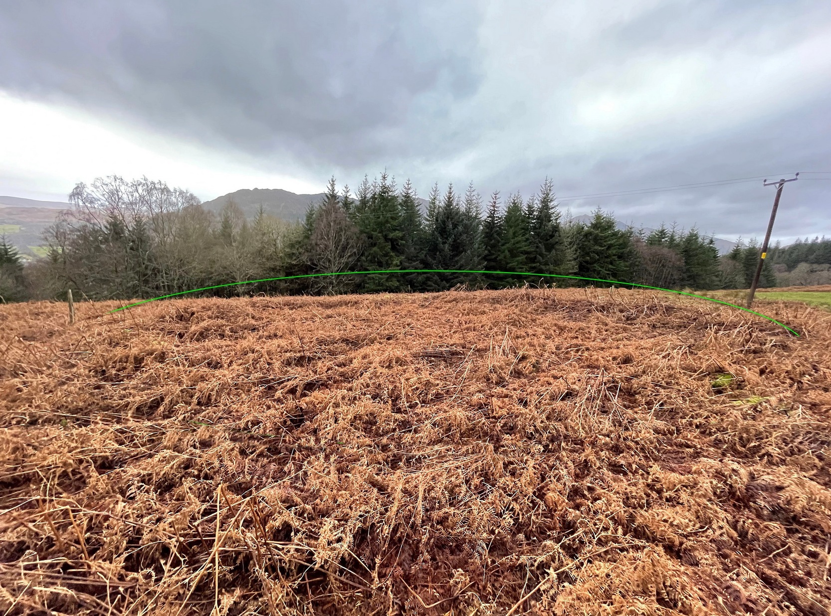
That’s a lot of effort and a considerable distance for some people to travel! But the age and nature of this site is curious. It very name, Drum-na-kill derives from either “ridge of the burial ground” or the “hill of the chapel” (and variants thereof)—yet there are no records of any such early church or religious cell here. That doesn’t mean, of course, that there never was one. A wandering Culdee priest may have set up camp here more than a thousand years ago after doing his service with the fading druids of Dull, less than 20 miles to the north. Such things, never written down, will obviously have happened in these mountains and cannot be discounted merely due to a lack of scripts. But we simply don’t know. When Mr Gow described the place—as “a raised enclosure 25 to 30 feet in diameter, with, a turf-covered wall or rampart 3 or 4 feet high surrounding it”—he emphasized that “in former times (it) was used as a burying ground for unbaptised infants.” (large numbers of Highlanders weren’t in the slightest bit interested in the ways of the Church) So how far back in time did this tradition go…?
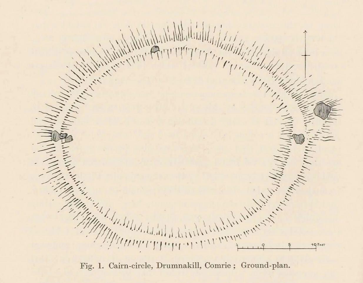
Well, Gow thought the place to be an early christian site. But when Fred Coles came here more than thirty years later, during his massive survey of the Perthshire stone circles, he deemed it to be a much earlier construction. A “cairn circle” no less—which would give it a more Bronze Age footprint. And this definition has stuck. Coles (1911) told that,
Coles’ 1911 diagramRaised ‘walling’ highlighted
“This Cairn-circle is about seventy yards east of the shepherd’s cottage, and it slightly resembles others already noticed in Perthshire. It measures from crest to crest of its circular ridge 44 feet 3 inches east and west by 37 feet 10 inches north and south. Several large blocks of stone lie exposed on the crest, and many others can be felt as one walks along it. The ridge is completely oval-circular, having no break or passage-way, and encloses a flattish, rather uneven space measuring about 34 feet in diameter. The height above the outside ground at the best-preserved portions is fully 4 feet.”
More than a century later, its not changed much—although if you were to believe the updated Trove website, “the cairn has been destroyed in the process of land improvement.” Which is untrue. As the albeit darkened photos here show (we visited it on a truly dark grey day), the raised cairn, despite being covered in a mass of deep bracken, is clearly in a condition similar to what Coles described. It looks like a typical example of this type of monument, of considerable size, with reasonably well-defined edges and comprising the usual scattered mass of stones in and around it. The large boulders that Coles described don’t seem to be in evidence, but these were apparently shifted a few decades back and added to the enclosure walling to the east. To honest, only the untrained eye would miss the place! Check it out when you’re looking at the cup-marked stone, less than a hundred yards to the east…
References:
Carment, Samuel, Scenes and Legends of Comrie, James P. Mathew: Dundee 1882.
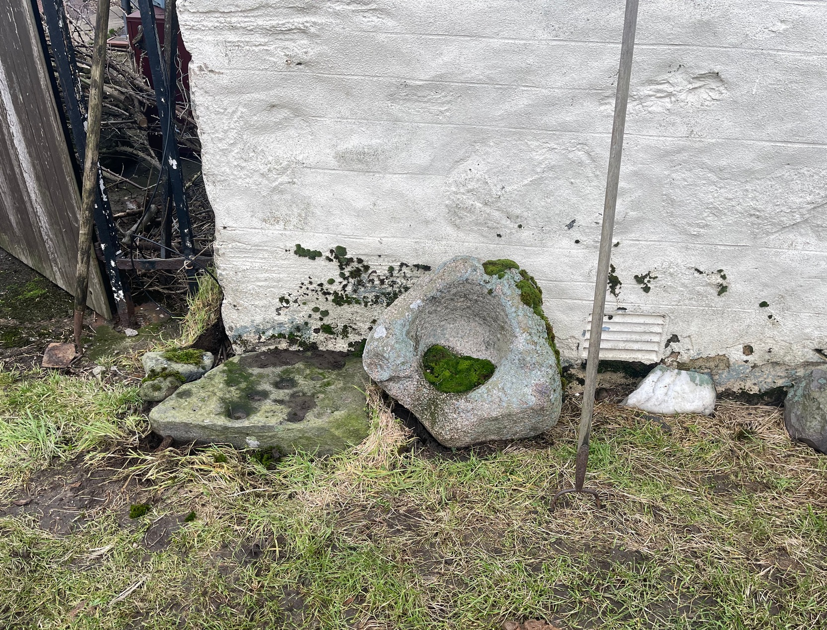
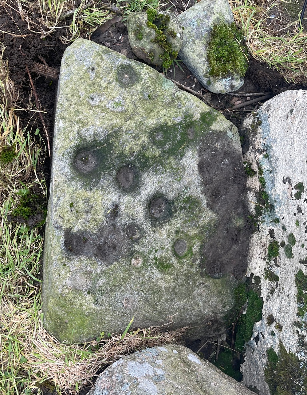
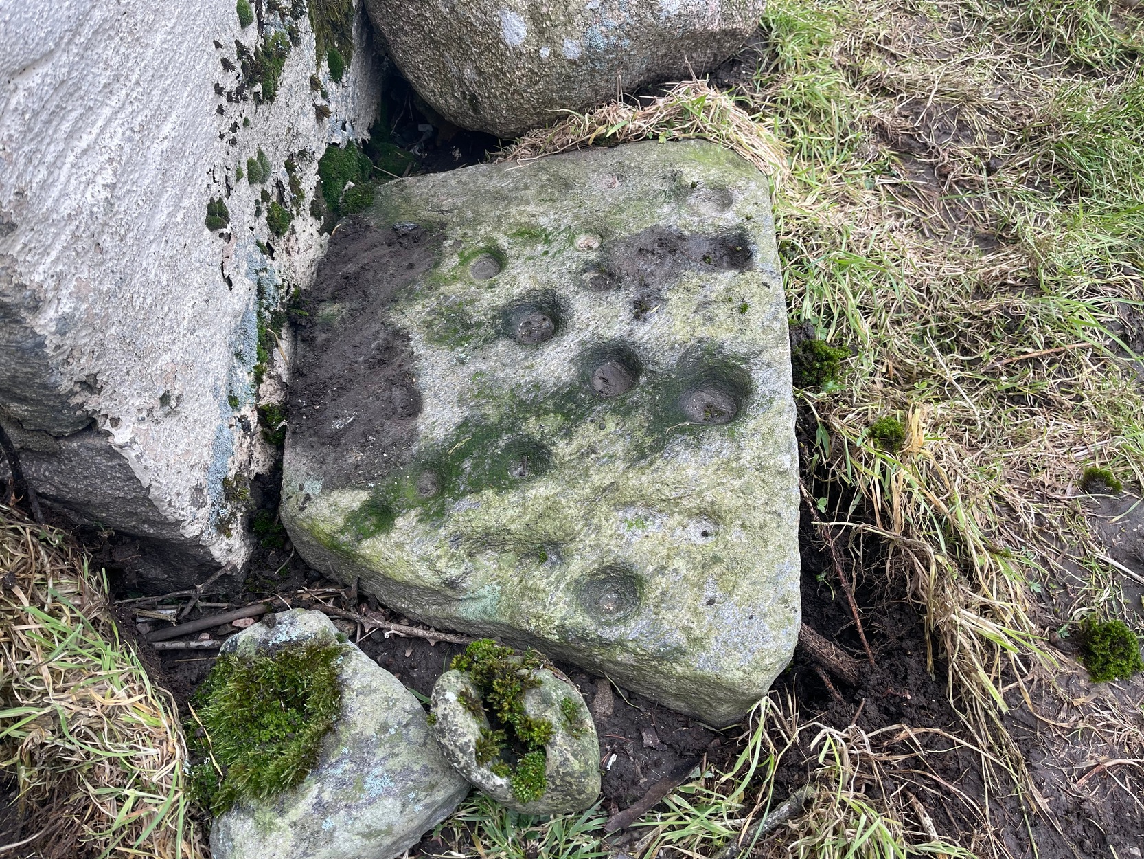
From Blair Atholl village along the B8079 road, take the minor road signposted to the Bridge of Tilt and go all the way to the top, taking the same directions as if you’re visiting the large prehistoric cairn of Monzie. As you walk towards Monzie farmhouse, you need to look at the large end-facing wall and on the ground at the bottom-left corner you’ll see this old cup-marked stone, next to an old bullaun. It’s probably polite to knock and ask the farmer—who we found to be very helpful indeed. (huge thanks fella!)
Archaeology & History
This is an intriguing carving, inasmuch as its present habitat isn’t it original home. When we visited the old stone recently, the farmer was very helpful and told us what he knew of it, which was, he said, “not much.” In pointing out where it had originally come from, he pointed south, “past the fields – somewhere over there. My dad knew about it,” he told, and thought that he may have been the one who found it. Anyhow, it was his dad who brought it to the place where it now sits: right up against the edge of the house on its southeast corner.
“It looks like it might have come from a tomb,” I said, but he didn’t know about that. The giant cairn in the fields past his farmhouse certainly wasn’t where it had come from. Quite the opposite direction… And so it transpired when I looked at the very menial archaeological notes that have been written about it.
When archaeologist Margaret Stewart noted the carving in the 1960s, she told how the stone had reportedly been found in 1953 by the ruined lime-kiln (NN 9052 6672), just above the western shore of Loch Moraig. But what she didn’t know was that the lime-kiln was built at the edge of the prehistoric tomb that was known to local people as Carndeshal, or Cairn Deshal. The word deshal means sunwise, or the direction taken by the sun, clockwise, as in the word deosil. It is usually associated with a ceremonial procession. The cup-marked stone probably came from this cairn when it had been demolished and was thankfully saved by the farmer.
Altogether there are 24 or 25 mainly well-defined cup-marks on this thin slab, covering most of the surface. In a couple of places on the stone, two of the cups are conjoined. There are apparently no cup-marks on the other side of the stone.
Acknowledgements: To my awesome Naomi – for getting us up here.
Along the B8079 road in Blair Atholl village, take the minor road signposted to the Bridge of Tilt. After half-a-mile, where the road splits, keep to the right and head further uphill and, where the almost-track-like road splits again another quarter mile up, bear to the right again and just keep going uphill for nearly two miles until your reach the large car-park on the left. Park here. Note the long straight line of walling on the top-side of the car-park that runs to the NW. Walk along the other side of the wall and, after 100 yards, you go down the marshy dip and, once it rises up onto the small rise, truly truly truly keep your eyes peeled to see what lays beneath your feet. They’re there – honestly!
Archaeology & History
As the years drift by, the remains of these two hut circles—separated barely ten yards from each other—have become increasingly difficult to see. Upon our visit here, the hillside vegetation was at its lowest at the end of the Winter, yet it was still difficult to see them clearly, even when we stood right in them! The land here is marshy and it’s spreading more and more into the soil, slowly but surely taking these old circles back to Earth, where all things return….
It’s there, under your nose!
The circles—and their half-dozen companions on the far-side of the wall—were shown to the archaeologist Margaret Stewart in the 1960s by the farmer at Monzie, who made notebooks of various places and traditions in this area. Both of them are between 12 and 13 yards across, with the outlining walls that define them still thankfully visible above ground level—just! The hut circle that’s closest to the modern wall is more oval-shaped than its circular companion, both of whom have their respective doors or entrances on the southwestern sides—but these were equally difficult to make out when we came here.
To be honest, if you’re wanting to see the hut circles, I’d head for those on the other side of the wall, two or three hundred yards to the west, which are much easier to find and are in better condition.
Acknowledgements: To my awesome Naomi – for getting us up here.
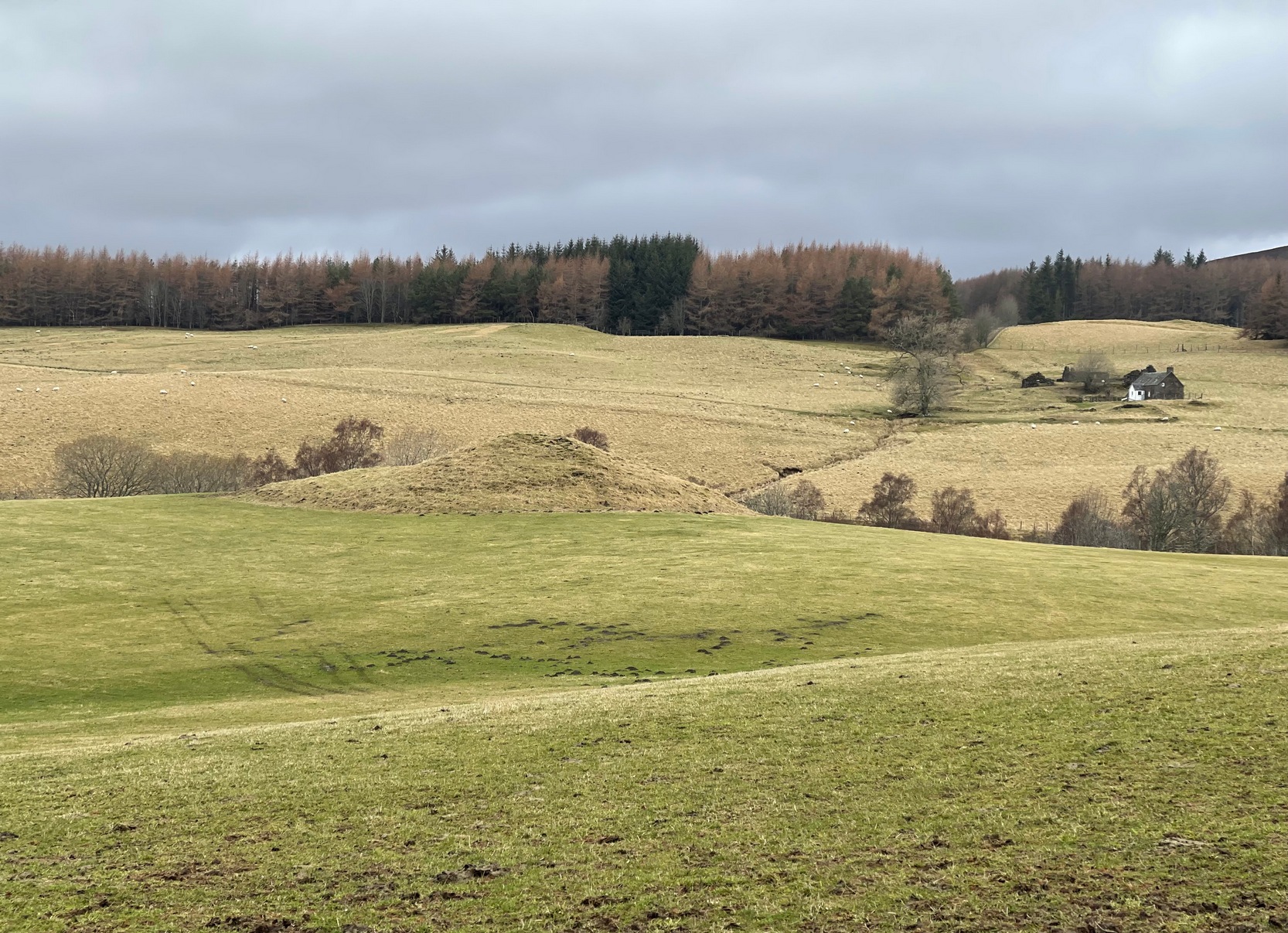
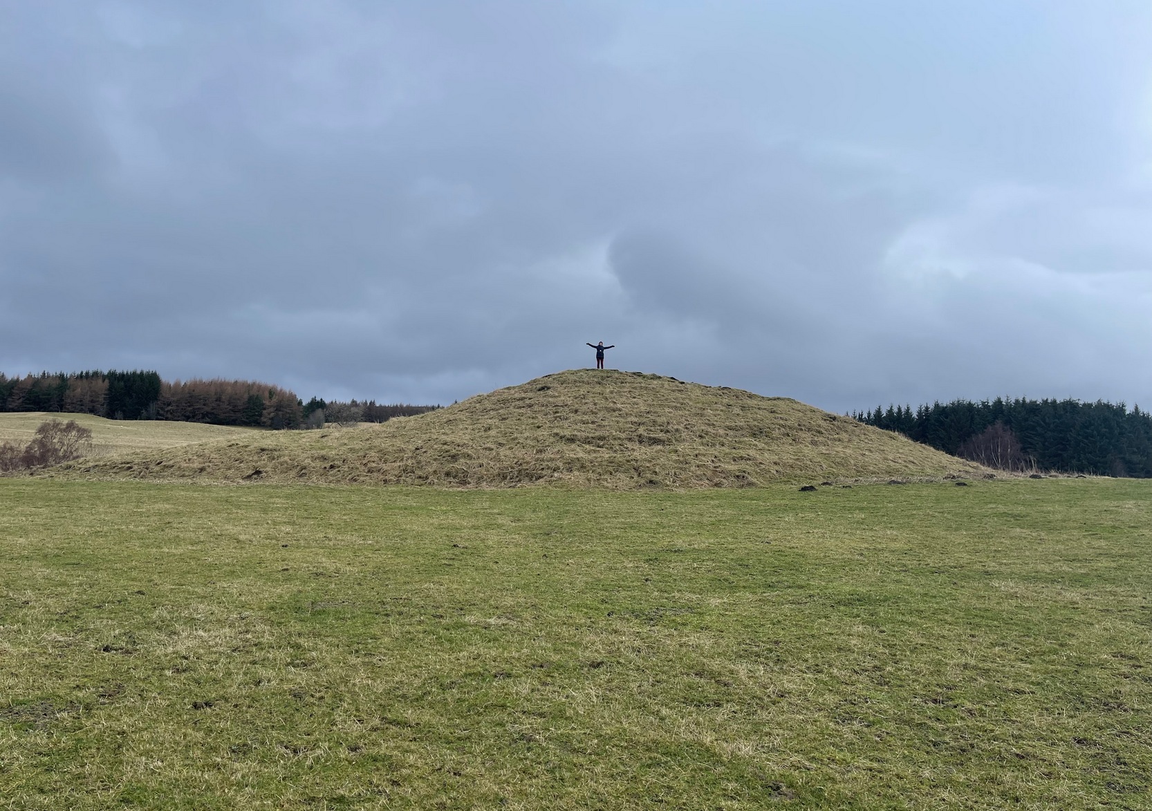
Along the B8079 road in Blair Atholl village, take the minor road signposted to the Bridge of Tilt. After half-a-mile, where the road splits, keep to the right and head further uphill and, where the almost-track-like road splits again another quarter mile up, bear to the right again and just keep going uphill for nearly two miles until your reach the large car-park on the left. Park here and then take the dirt-track to the farm (truly friendly helpful folk) where, in the field to the rear of the buildings, a large unmissable mound rises up!
Archaeology & History
This is a bit of a beauty! Hiding away on the southern edges of the Cairngorms we find this huge archetypal burial mound, 35 yards across and all but covered nowadays in deep layers of soil. But it looks good. When you walk onto its crown, about twelve feet up, you see and feel beneath you the scattered mass of small rocks and stones that comprise the monument as a whole, from top to bottom. On its south-western side, the cairn is lower and elongated: this is due, on the whole, to where field clearance stones were pushed up against the monument many decades ago, making that side of it look bigger than it originally was.
Naomi on top for size!Monzie cairn, looking W
Curiously perhaps, no archaeological attention of any worth has been give to the site apart from the usual estimates of its size and a guesstimate of it being neolithic or Bronze Age in nature (an easy thing to suggest). On top, just beneath the grasses, is what may be the section of a small cist, but this may just be a fortuituous formation. Excavation is required! It’s one of a small number of old cairns and tombs in this locale, but this seems to be the biggest — unless, of course, the lost but legendary Carn Deshal, less than a mile to the south, stood larger…
Acknowledgements: To my awesome Naomi – for getting us up here.
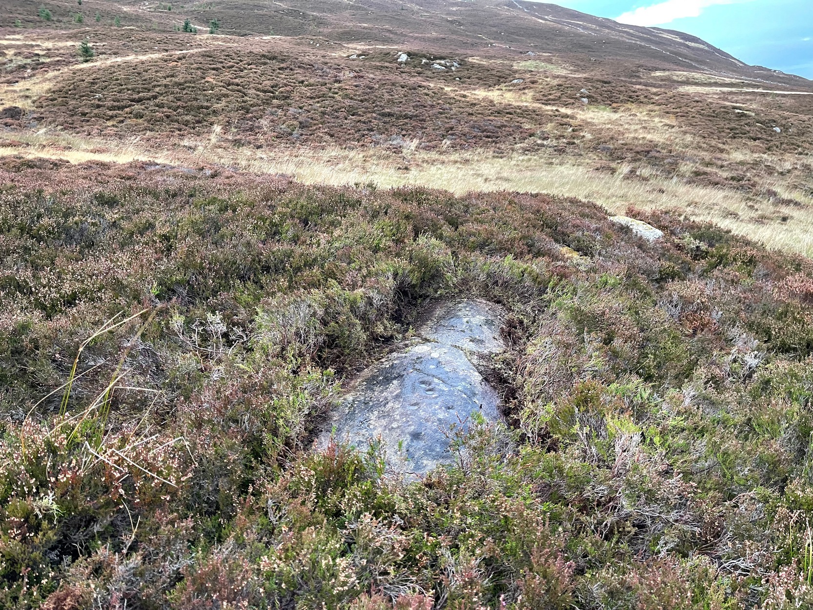
Like many of the Craig Hill carvings, this takes some finding when the heather’s deep… If you can locate the Craig Hill hut circle (there are actually several of them close to each other), face uphill (looking at the trees) and then from the hut circle walk diagonally to your right (northeast) and walk up the slope for 30-40 yards. A large boulder is in front of you and, just past it at the edge of a small rock-face, a fallen tree is your marker. Just a few yards above and past this is an earthfast elongated stretch of rock. You’ll find it…
Archaeology & History
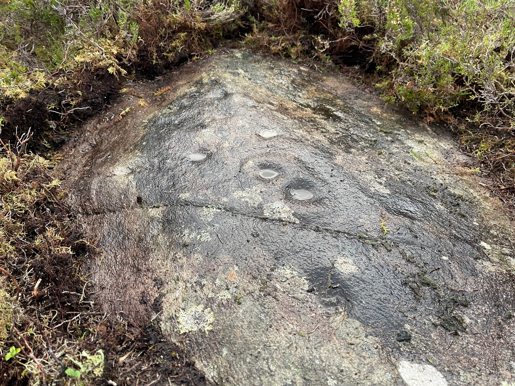
Some cups & 2-in-a-ring
On my visit to this carving I arrived near the end of the day. Within the hour, beneath an already cloudy grey sky, night had fallen; and so, obviously, my assessment of this carvings design was somewhat hampered…
It’s one of several quite separate petroglyphs that almost collide with each other on adjacent rock faces. Etched across this, an elongated slightly convex stone, we find a series of cup-marks in no particular order, mainly running along the topmost section of the stone. Others fall away at the edges, with what seemed like one or two at the more northeastern end of the stone. However, due to the poor lighting when I came here, I struggled to make out the full design and so probably missed some important elements. I’ll update this if/when I visit it again – or if a fellow antiquarian visits the spot and sends in some good images.
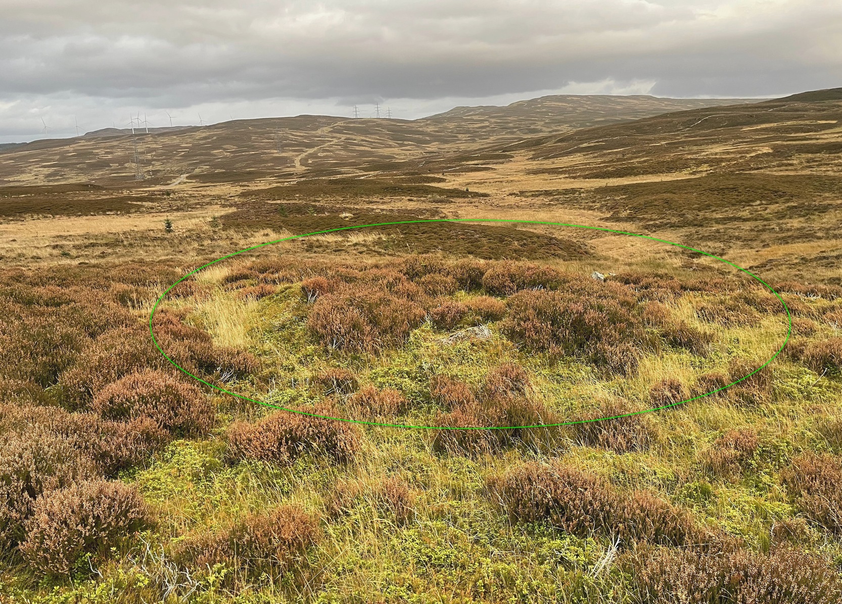
From Kenmore village, just as you’re going out of the village towards Aberfeldy (A827 road), turn right as if you’re going on the minor road on the south-side of Loch Tay. Almost immediately on this road, turn left and take the tiny, steep road uphill towards Amulree. After 2½ miles uphill, the road begins to level out and a small loch is on your left (north). Just past it, on the same side, a track runs onto the moors. Walk along here for nearly a mile where the track splits: keep to your left and the track follows the line of walling. Now’s the hard bit: after literally ⅔-mile, walk downhill and cross the burn (stream), then less than 50 yards up the slope on the other side, zigzag around…
Archaeology & History
Craig Hill circle looking SW
Overlooking a small (unnamed) burn immediately to the right and a large wide marshy hollow to the front, is this small and seemingly singular hut circle, in a good state of preservation, surrounded by the scattered mass of cup-and-ring stones—some complex, some very plain—all over this moorland slope. It’s a very long journey to take just to visit a single hut circle, but I’d assume that you’d be wanting to see the petroglyphs surrounding it too—so mebbe have a look at this whilst you’re fondling the rock art!
Internally this is quite a small circle, measuring barely 5 yards (east-west) by 6 yards (north-south), seemingly with its entrance on the north. Its small size suggests it was constructed for the use of just one person; two at the very most. The structure is still in very good condition considering its age (possibly Bronze Age), with minimal damage apart from Nature’s wind and weathering. The circle is made up primarily of a number of large rocks with many filling stones, with the walling being a yard or so wide all round. In all likelihood, the rest of the building would have been made of timber, with a typical tented roof. It’s an excellent spot to base yourself to explore all the cup-and-ring stones on these slopes. Perhaps, just perhaps, this might have been a shaman’s hut, looking over the ancestral images on the rocks hereby…. ♥