Cup-Marked Stone (lost): OS Grid Reference – NO 003 650
Archaeology & History
When you’ve visited the impressive cup-marked stone at Dalnavaid, this long lost carving might be worth seeking out by the real explorers among you. It’s not been seen for a hundred years and was only reported in brief by the reputable local historian Hugh Mitchell (1923). It’s located a mile north of the Dalnavaid carving, up in the hills on the other side of the road, “on the East side of Clunskea Burn, and on the West shoulder of Ben Skievie.” He described the carving as “having some 16 or 18 cups, and at present it forms part of a grouse butt.”
So if we locate the grouse-butt (they’re usually not too difficult to find), the carving will obviously follow. Mitchell gave us an extra piece of info regarding its location. He described the existence of several other seemingly prehistoric remains within a few yards of the grouse-butt, curious “pit dwellings”, three of them:
“they are of circular shape, about 9 feet in diameter and nearly 5 feet below the surface of the ground, and had evidently been roofed over at one time. The entrance to each is at the lowest level and acts as a drain, to keep the house dry. They are almost the only examples in the district of neolithic dwellings.”
Let us know if you find it!
References:
Mitchell, Hugh, Pitlochry District: Its Topography, Archaeology and History, L. Mackay: Pitlochry 1923.
The quickest and easiest route is to take the A924 road from Pitlochry to Kirkmichael. It’s a gorgeous route in itself! Anyhoo… Once you’re out past the houses of Pitlochry and Moulin, you begin to make the real ascent up the winding road, past the hairpin bend and, 5 miles up where the road has levelled out and the craggy moorlands surround you, green fields begin to appear on your left. The first farm on your left is Dalnacarn and less than a half-mile past here, on your right, a small track takes you to Dalnavaid house. Walk along here, past the house and into the field, then the next field where a section rises up towards the fencing. On top of this are several rocks. You can’t really miss it!
Archaeology & History
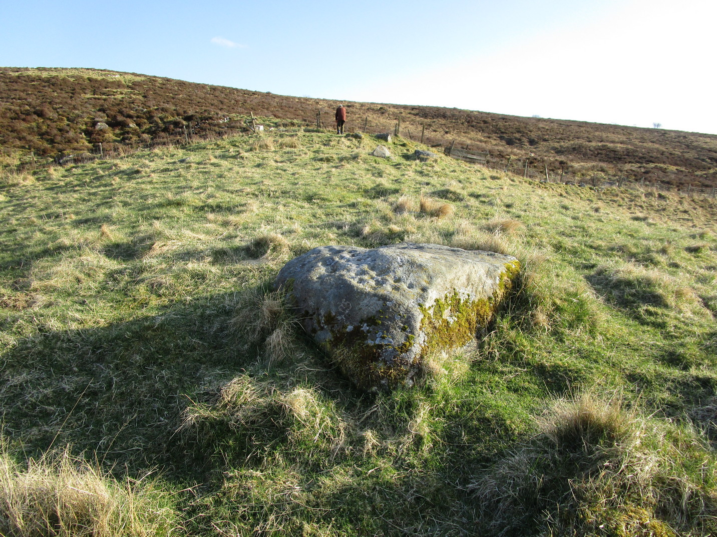
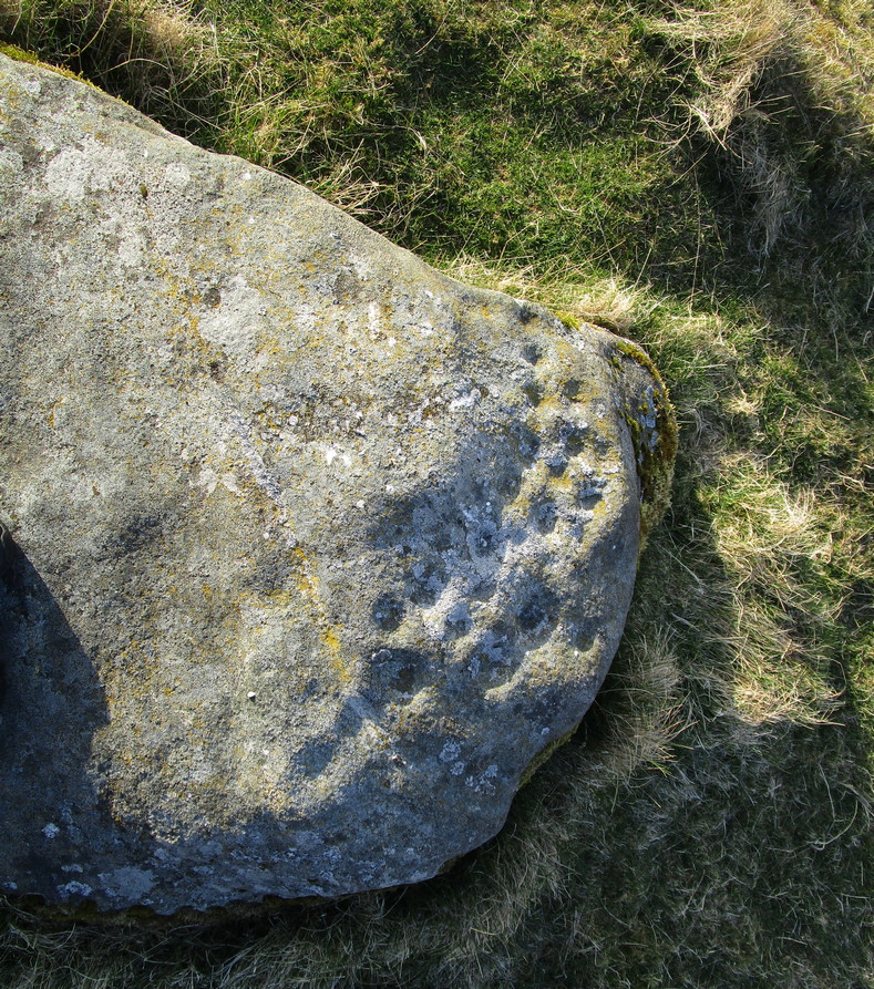
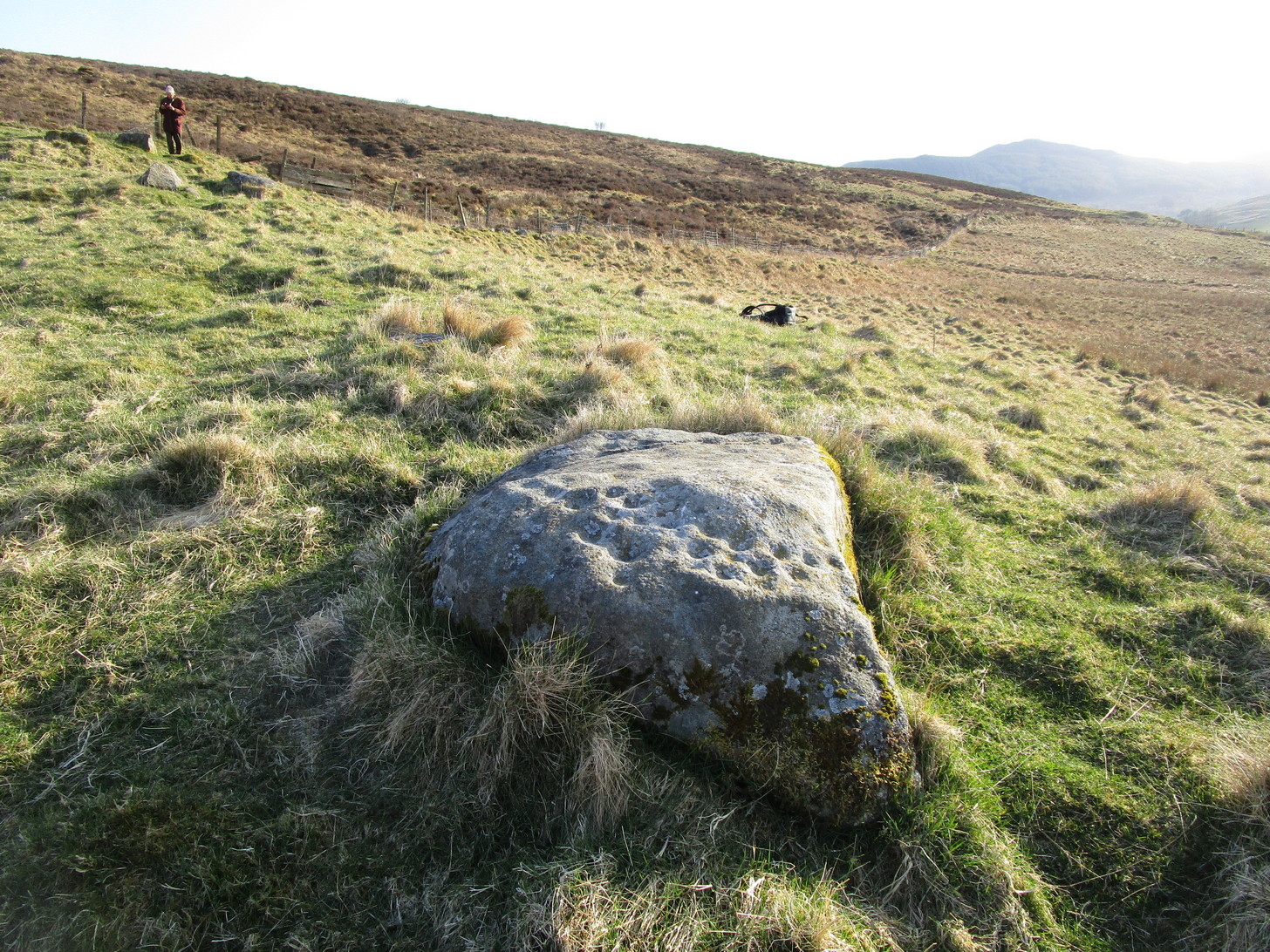
This typically female rounded rock has, unusually, a series of cups in almost three rows along its easternmost slope, with one or two single cups on its top and southern side. It was first described by Fred Cole (1908) merely as “a small boulder, with a remarkable triple row of cup-marks, resting on a cairn-like mound”; but it wasn’t until John Dixon (1921) came here that a full description appeared. He told us,
Primary rows of cupsLong worked (?) line
“About 200 yards due east of (Dalnavaid) house a ridge or spit of land juts out from the adjoining hillside on to an almost level field. The ridge has sloping sides, and the nearly flat top is 10 or 12 feet above the general surface of the field. Near the end of the ridge stands the cup-marked stone… The dimensions of the stone are: length 4 feet 8 inches; width 3 feet; height from 1 foot 11 inches to 2 feet 4 inches. The cups are all near the north-east side of the upper surface of the stone, and are more or less in rows. Some are large, with a diameter of 3 inches and a depth of nearly 1 inch; others are much weathered, and vary from small, scarcely measurable, hollows, to cups 2 inches in diameter and ½ inch deep. The hollows are no doubt cups almost obliterated by ages of weathering. Reckoning them so, there are in all thirty or thirty-one cups. All are of the plain type, without rings or connecting grooves.”
Looking (roughly) west
A few years later Mitchell (1923) counted 26 cups on it. Along the western side of the stone are two natural cracks that run across it roughly north-south. It wasn’t until I crouched down to look at what seemed to be another cup on its vertical face that I noticed how these lines appeared to have been enhanced by human hands.
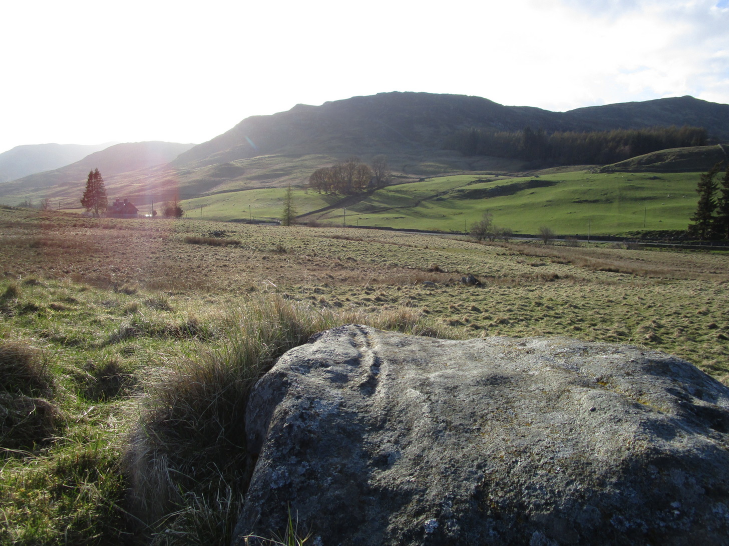
For petroglyph enthusiasts, this is a decent carving well worth the visit. What looks to be a cup-and-ring design is found on a stone due south of here and, in all probability, others are hiding away nearby—the “lost” cup-marked stone of the Clunskea Burn, a mile north of here, being one such place. Let us know if y’ find it!
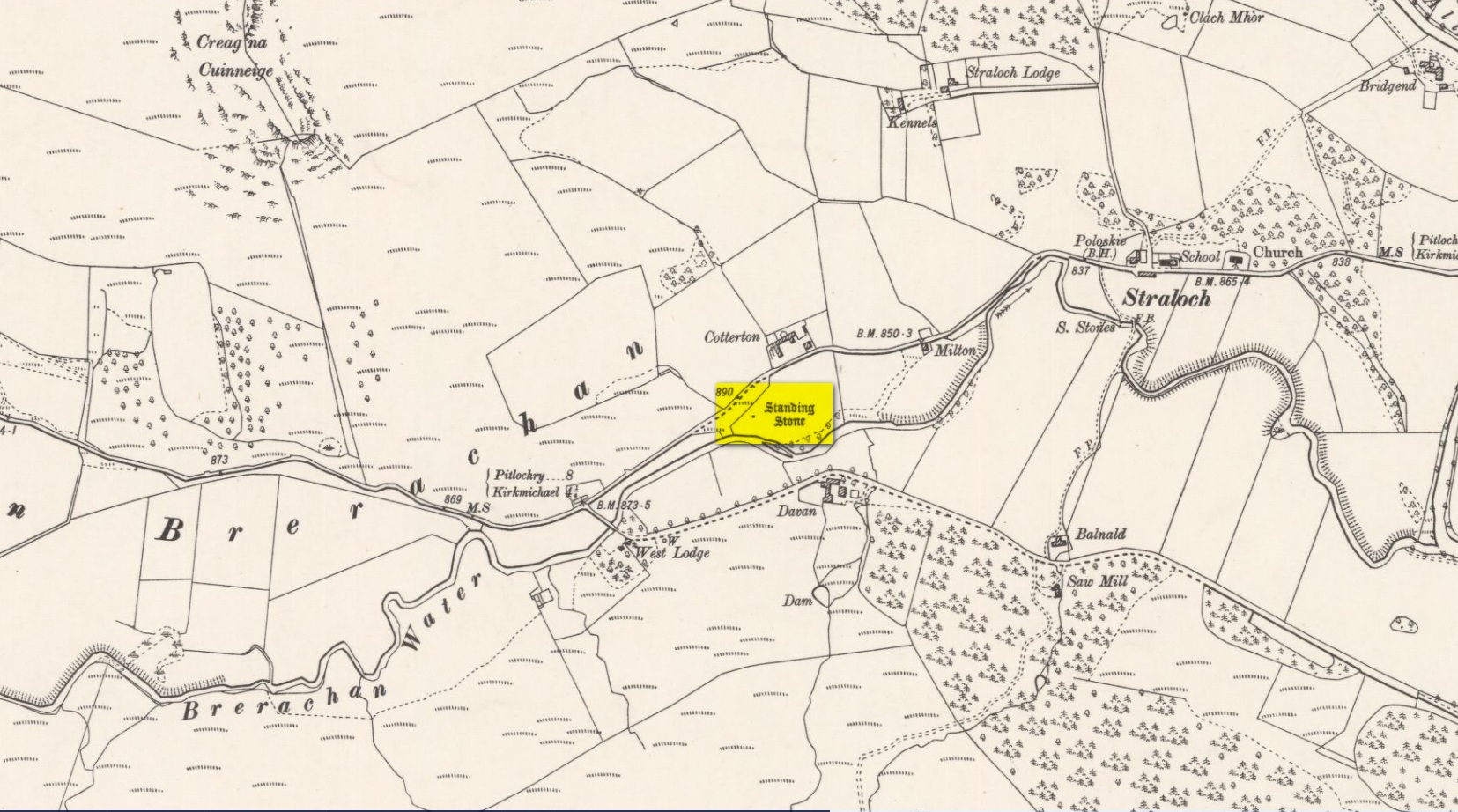
Along the A924 road, just over 4 miles (6.6km) NW from Kirkmichael, or about 8 miles (13km) NE from Pitlochry, you’ll hit the large farmhouse of Straloch. You’ve really gotta keep your eyes peeled! A few hundred yards west of Straloch itself, a small parking spot is on the south-side of the road, above the river. From this parking spot, walk a few yards to the fence that overlooks the river and look into the field below you, where you’ll see the stone. If y’ walk down the slope, you’ll see a gate on the right that leads you into the field.
Archaeology & History
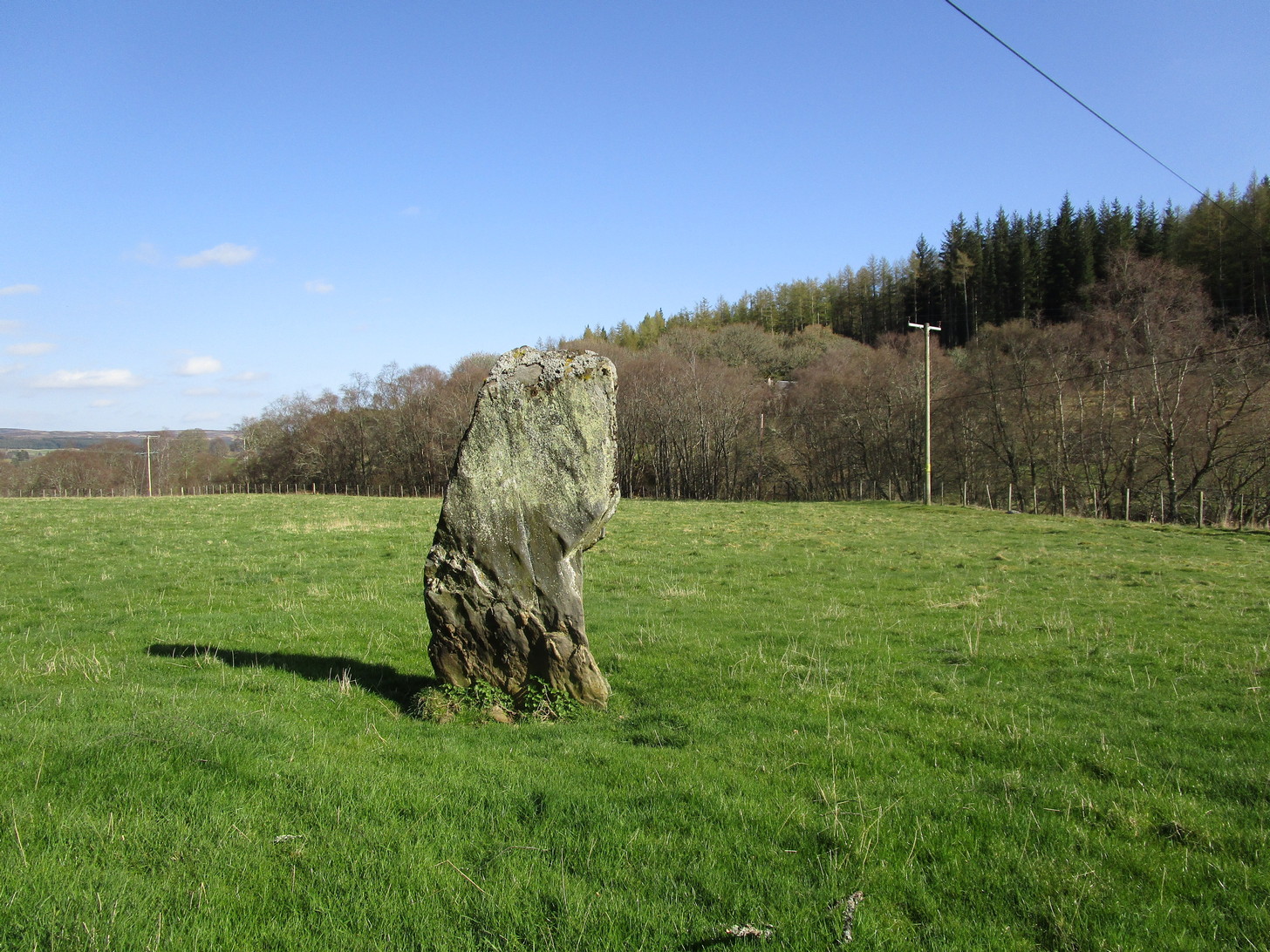
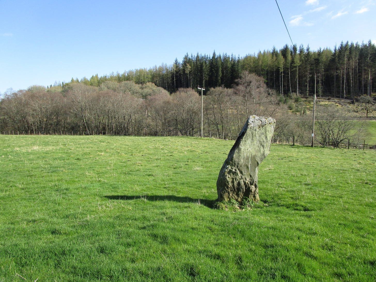
First shown on the 1900 OS-map of the area, this petrified hunchbacked witch-of-a-stone stands on the flat grassland plain (previously scattered woodland when first raised) forty yards from the River Brerachan: a proximity characteristic found at many of the stones along Strathardle.
Cotterton stone 1900 mapFred Coles’ sketch
Descriptions of the site prior to 1900 seem non-existent (does anyone know otherwise?). It was the brilliant antiquarian Fred Coles (1908) who, it seems, was the first to mention the old stone — whose very crooked appearance had an unusual effect on him, saying how “such a decided leaning over towards the north…almost make one uneasy when standing beside it”! It didn’t have that effect on me, but I was mightily impressed by both its appearance and curious hunched gait. Twas one of those monoliths that had a distinct ‘feel’ about it, which many people report at such places up and down the country. Whether it was its position by the river, or the color of the landscape, or the silence, or the shape of the stone, or combinations of them all—which ever it was, there was almost a sense of genius loci residing here…
But in that other world of pragmatic measurements, as Mr Coles told us:
“The Stone is at the base an oblong in shape, measuring 14 inches on its east end, 2 feet 7 inches along its south side, 17 inches at the west, and 3 feet 6 inches on its north side—a girth, therefore, of 8 feet 8 inches. At the middle its dimensions are the same, but the top is rather less. At its N.E. apex the Stone is 7 feet 8 inches clear of the ground, and at the west edge 7 feet. In the illustration…I have shown the monolith from the south, with the craggy profile of Menachban in the background.”
The stone was mentioned in passing in Hugh Mitchell’s (1923) local survey. A few years later in John Dixon’s (1925) account he repeated the dimensions of the stone that Coles had cited; and although he found there to be no known traditions of the place, he conjectured how it may have been connected with the numerous battles “that in former days occurred along this entrance to the Highlands.”
It’s a damn good site is this. All you megalith hunters will love it!