Cross (destroyed): OS Grid Reference – NZ 1709 0085
Archaeology & History
This was one of at least four old stone crosses that used to exist in Richmond. It was accompanied by other functional edifices nearby known as the Oat Cross and Wheat Cross. Like its companions, the Barley Cross is thought to have been the site where this grain was traded. An early reference to it is Chris Clarkson’s (1814) survey, where he told us that not far from the old Market Cross,
“was formerly another, which went by the name of Barley Cross, perhaps so named from that sort of corn being sold there: it was a lofty Pillar of one large stone upon a small flight of steps with a cross at the top: rings were fastened to it, where criminals were punished by whipping: it is not long since it was taken down.”
Barley Cross (centre left) on 1724 town plan
Similar punishments were also administered to people at the original old Market Cross. The grand masters of of Yorkshire history, Edmund Bogg (1908) and Harry Speight (1897) also mentioned this antiquity, but added nothing more.
The cross was highlighted on a 1724 plan of Richmond, just below the larger Market Cross. In 1780 the local council ordered it to be demolished and, at a later date, large weighing scales were erected on the spot next to where it had stood, on the south-west side of the Trinity Church in the market square.
References:
Bogg, Edmund, Richmondshire, James Miles: Leeds 1908.
Clarkson, Christopher, The History of Richmond, T. Bowman: Richmond 1814.
Home, Gordon, Yorkshire Dales and Fells, A. & C. Black: London 1906.
Speight, Harry, Romantic Richmondshire, Elliot Stock: London 1897.
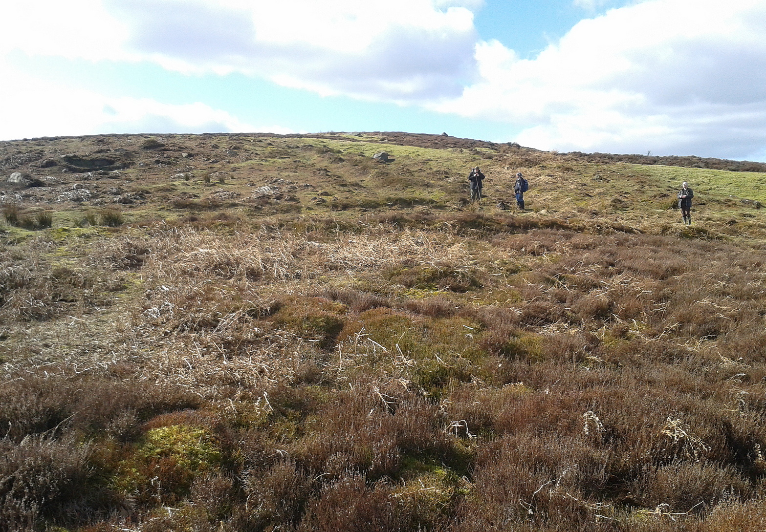
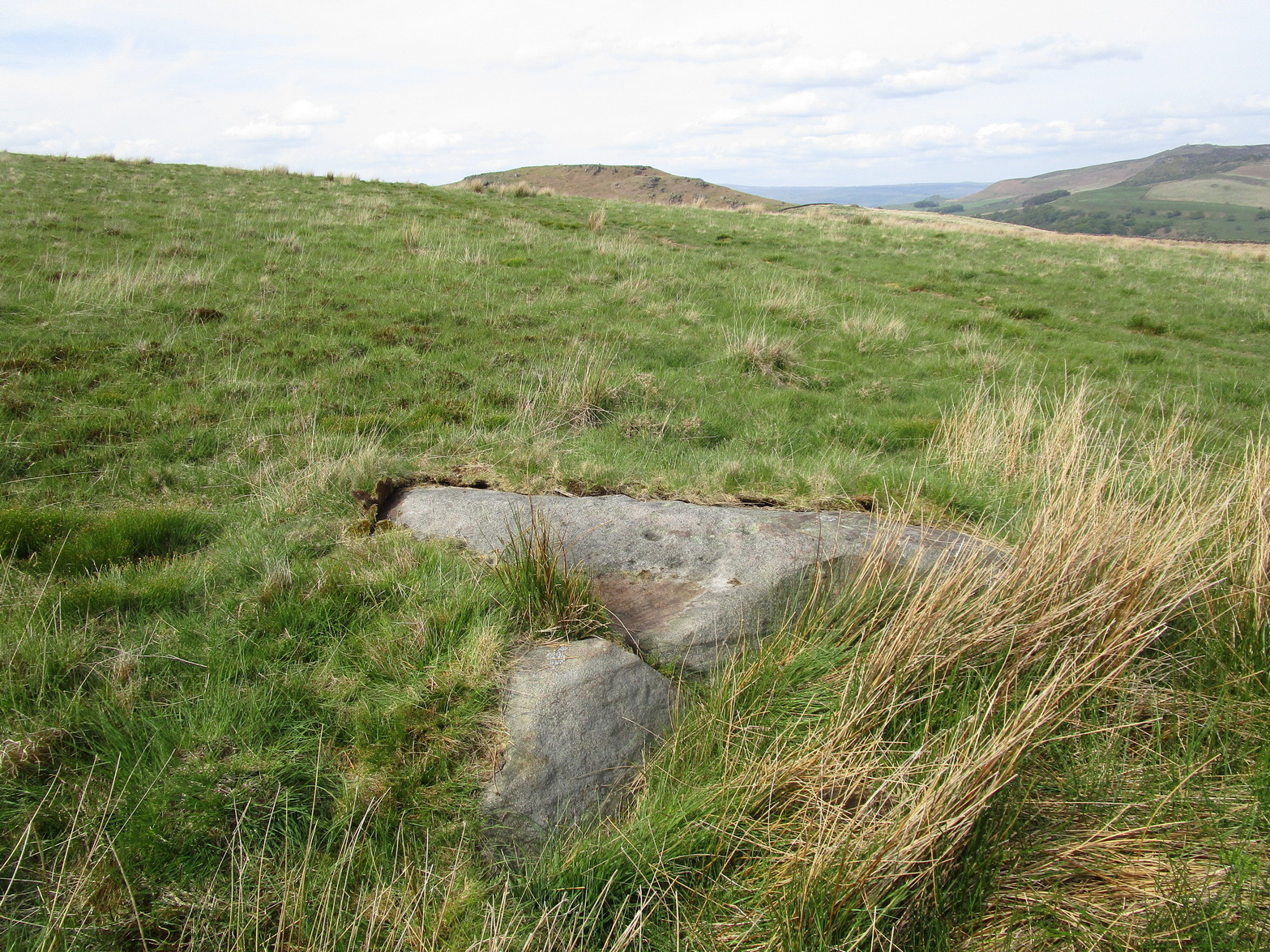
Coming up from Otley, make your way up to the Askwith Moor road (the only one that goes across the moors) and park up on the rough parking spot on the right-side (east) of the road. You can’t really miss it. From here walk up the road for less than 500 yards until your reach the rickety gate and the path onto the moors. From here I walked 600 yards east, thru the heather until I reached the wall (close to the Tree of Life Stone) and then followed the wall up for 150 yards, then back up (west) onto the moor again and, about 50 yards along at the foot of the slope, keep your eyes peeled for the earthworky undulations beneath your tiny feet!
Archaeology & History
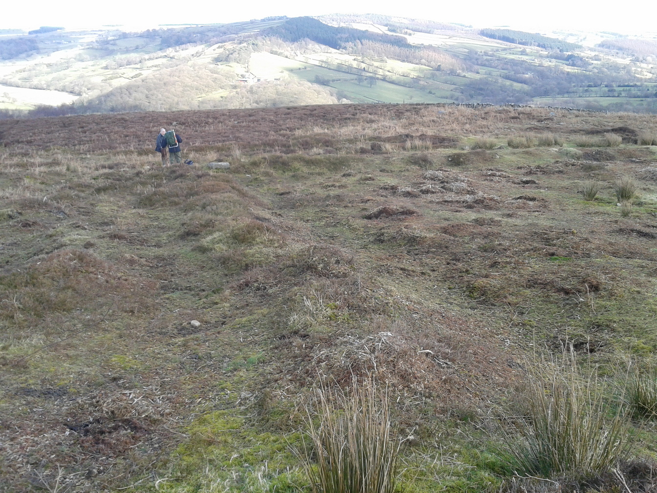
Just below the scattered Snowden Moor settlement we find this curious large structure, first described 75 years ago by the northern antiquarian Eric T. Cowling (1946). Since then, apart from a cursory overview, archaeologists haven’t really paid it much attention.
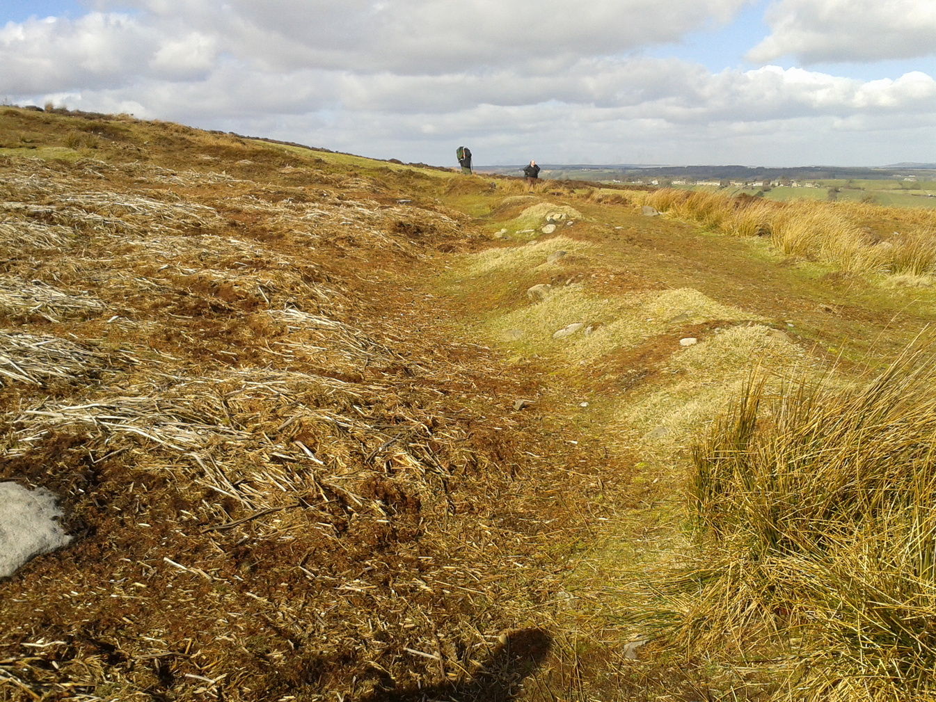
Eastern ditch, looking NEastern ditch, looking S
It’s a large site – and one which Cowling thought was constructed in the Iron Age. He may have been right, but there’s such a profusion of ancient sites on this small moorland area—dating from Neolithic times onwards—that it could be earlier than he thought. It’s an odd site too! Unlike the prehistoric D-shaped enclosure and settlement on the top of the slope less than 100 yards away, and an equivalent D-shaped enclosure to the south, the area inside Cowling’s enclosure ostensibly is on quite sloping ground, with barely a flat level area anywhere inside it. As a result of this, we can safely conclude that it wasn’t where people lived; and the complete lack of any inner hut circles (which you’d expect in a standard enclosure of this size) encourages this view. It’s a bit of a puzzle! Cowling opted for the idea that it was built to enclose cattle – which may be right; but again, even this must be questioned, as there is ample space on more level ground where this could have been done. His description of the site is as follows:
“The most prominent feature (on these moors) is a D-shaped enclosure which covers the nose of the spur; the area is eighty feet from north to south and seventy feet from east to west. The enclosing bank is of piled boulders, three feet high and eight feet wide. Cuttings across the north side revealed no evidence of dry walling, but rather a bank to carry a heavy stockade. A shallow trench runs inside the bank, which is doubled where it is overlooked by higher ground at the northeast corner. A second outer bank at the eastern side has an outer trench. Along the ridge to the east are circles of varying size, probably a hut group. A larger circle (?) of heavy material, some thirty feet in diameter, is isolated on the shelf above Snowden Crags to the west. Strips of wall and remains of enclosures of circular shape abound.”
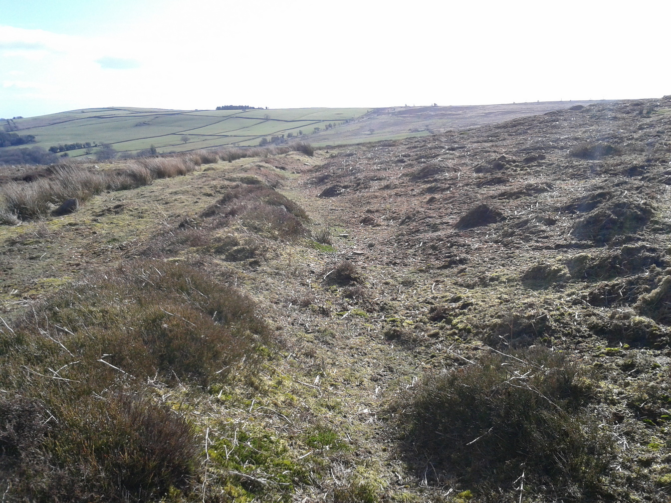
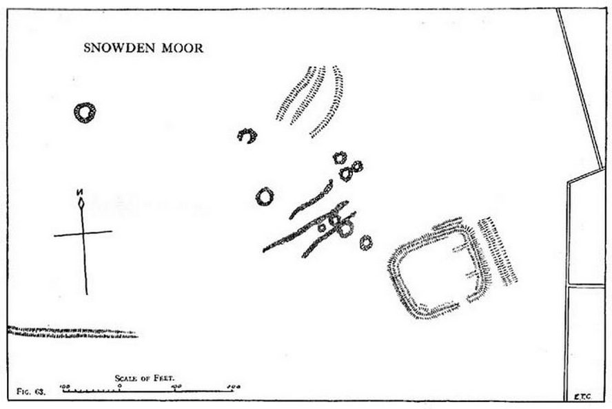
Cowling’s plan of the siteNorthern bank, looking E
Cowling’s initial measurements of the site underestimated its real size, as the bank and ditch that runs roughly north-south is close to 52 yards—nearly twice as long! The same was found along its east-west size: being 56 yards, which is more than twice what Cowling measured. Altogether, the enclosure measures approximately 225 yards around its outer edges. In fairness, Cowling’s error was probably due to it being covered in vegetation when he came to do his measurements here. …So, if you’re gonna check this place out, make sure you do it in the winter or early spring months, before the bracken encroaches.
There’s a real abundance of prehistoric sites all over this part of the moor, from more settlement remains, cairns, ring cairns and petroglyphs. Make a day out of it.
References:
Cowling, Eric T., Rombald’s Way, William Walker: Otley 1946.
If you’re coming via Ilkley, cross the bridge to Middleton and turn left, following the long winding road for several miles until you hit Langbar village. If you’re coming via Bolton Bridge, go to Beamsley village and turn left up Lanshaw Bank until you hit Langbar village. Whichever of the two routes you use: on the north side of Langabr village is a distinct small rough car park. From here, cross the road where the footpath sign is and walk straight up the steep hill to Beamsley Beacon at the top. You can’t miss it!
Archaeology & History
At the highest point on these hills, 1300 feet up, we come across this ancient prehistoric cairn. Its position in the landscape is impressive to say the least, being visible from nearly every direction on the moorland heights for many miles around, as well as being conspicuous from the riverlands below. A visit to the site nowadays shows it surmounted by a more recent mass of small stones turning it into a large walker’s cairn with only its compact base showing any real sign of antiquity.
Site shown on 1853 mapWestern side of the cairn
Mentioned briefly in parish records from 1658 onwards, it was highlighted on the earliest OS-map as simply a Beacon hill, due to it being used for beacon fires. We’re not certain when its beaconesque function first came about; and, it’s possible, that its beacon element could have replaced a much earlier heathen fiery function, typical of many hilltop sites up and down this and other countries. But we do know that such fires were lit here at the beginning of the 19th century. The great Harry Speight (1900) told that of its
“use as a prospecting-point and beacon there is no doubt. In the Bolton Abbey registers, under date 1803, is this entry:
“Apprehensive of a French invasion, Beamsley Beacon was put in a state of repair, and four people appointed to watch it. About — of the inhabitants of this chapelry inrolled themselves as Volunteers, the whole number of whom in Craven amounted to 1,200 Infantry and 200 Cavalry. A Sergeant was appointed to drill the volunteers of this chapelry at Bolton.”
The beacon at this time received light from Pinhaw on Carlton Moor and sent it forward to Otley Chevin, as appears by an old chart at Wakefield, dated 1803.”
The beacon’s ancient name of Howber Hill is literally the Hill of Tombs, as derived from the Teutonic haugr, and Anglian how, being a burial mound; and berg is a hill, sometimes fortified. Whilst there seems to be no evidence of ancient fortification, compacted cairn material at the base seems to confirms the -how element. Yet despite Speight citing this etymology, he was was somewhat sceptical wondering, instead, if the site was merely a giant boundary marker—which it has been for centuries.
A short distance along the footpath to the east is the denuded old cairn known as The Old Pike. Further east still, along the same boundary line, there was once another old tomb, long since gone…
Folklore
I’m not sure whether this should gone in the folklore section or not. But, well, it’s here nonetheless! In Guy Phillips’s (1976) book on the mythic history of ancient Brigantia, he describes a number of alignments, or leys (not one of those stupid energy lines, which has nowt to do with leys)—one of which crosses Beamsley Beacon. It’s an west-east line that begins at Cockerham and from there goes,
“through Top of Blaze Moss SD 619525, Slaidburn (it is very clear here), Flambers Hill SD 877523, southern edge of Copy Hill 952523, Draughton (extremely clear), Beamsley Gibbeter and Beamsley Beacon, Heligar Pike, Scow Hall 203523, Little Almscliffe Crag, Tockwith church and on to the coast.”
I have to say that I’m sceptical of the veracity of this alignment.
References:
Bogg, Edmund, Higher Wharfeland, James Miles: Leeds 1904.
Cobley, Fred, On Foot through Wharfedale, William Walker: Otley 1880.
Phillips, Guy Ragland, Brigantia – A Mysteriography, RKP: London 1976.
Smith, A.H., English Place-Name Elements – volume 1, Cambridge University Press 1956.
Smith, A.H., The Place-Names of the West Riding of Yorkshire – volume 5, Cambridge University Press 1963.
Speight, Harry, Upper Wharfedale, Elliott Stock: London 1900.
Acknowledgements: Huge thanks to James Elkington for use of his photo on this site profile. Cheers mate. 😉
Holy Well (destroyed): OS Grid Reference – SE 6071 5187
Archaeology & History
At the beginning of the 19th century, William Hargrove (1818) described the scant remains of some old walling along old Haver Lane (renamed as Green Lane and now known as The Stonebow) which were the remains of a building, long gone, and which,
“tradition informs us (was) a religious house, which formerly stood here, called Holy-Priests; and though the site of it is not known, the report is greatly strengthened by the appearance of the walls just mentioned, and by the circumstance of a deep draw-well which now remains, being still called Holy-Priests Well.”
Some suggest that this water source may still exist beneath one of the buildings hereby, but the landscape here has been so badly mutilated over the last two hundred years that it’s very unlikely.
References:
Hargrove, Willliam, History and Description of the Ancient City of York – volume 2, part 2, W. Alexander: York 1818.
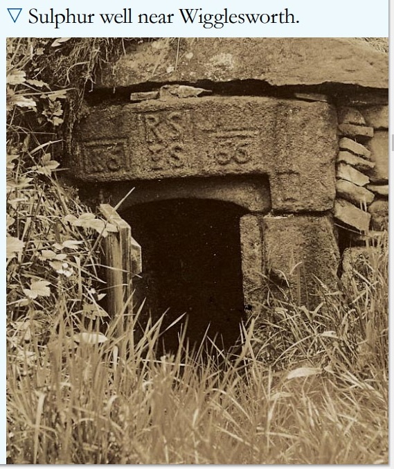
In William Addison’s (1951) standard work on the history and development of Spa Wells, he told us that “the spas began as holy wells”; yet in spite of him listing the Wigglesworth Spa in his work, such “holiness” wasn’t a feature found here and, sadly, we have no written records that tell of any. But that doesn’t mean to say it had no sense of importance or animistic sacrality to local people. The earliest written record we have of this Sulphur Well is to be seen on the stone-work at the top of the small well-house, where the year “1666” was carved, marking the year when the structure was built under the directions of a local rich dood. But earlier knowledge of these healing waters would have been passed to the land-owner by local people, as indicated in Thomas Short’s (1765) words where he told that “it has been used time out of mind.”
Mr Short (1724) makes mention of this Sulphur Well in his gigantic early work, but only in its similarity in both taste and smell to the Sulphur Well at Harrogate and letting us know that, “I have tried carefully” the waters of the two sites. We had to wait another forty years before he gave us a more detailed account of the medicinal properties here. He wrote,
“Now come we to a sulphur water of a very peculiar nature, such as I never met with or heard of in England besides, and deserves to be much more strictly examined and enquired into, viz. Wigglefworth Spaw, near Settle, in the parish of Long-Preston. It has been used time out of mind, and more formerly than at present, because it is little known; rains and drought affect it not. Country people drink four or five pints of it in a morning to vomit them, and six or seven pints to purge them. The water is very black, smells strong of sulphur, has a very small stream, but stagnates not, bubbles not, but springs up; it is always covered with a white scum, (and) dies all in its course white. It rises out of a great stone soil, near much lime-stone, at the foot of a hill. It tastes salt, yet curdles not soap, and boils with milk. A phial glass, one third part full of it, well corked, and tied down with a bladder, and set in the cold water to be evaporated; when the water began to boil, it was taken out and poured a little of it on solution of silver, which turned black and curdled. The phial was corked again, and set half an hour longer in the boiling water, it still turned solution of silver black. It was corked a third time, and set half an hour longer in the boiling water, then tried, but was not so black as before, and caused little curdling. This last stood all night, next day its precipitation was blackish; the water was clear above. This is the only blackish sulphur water I have met with (as Rippon is a greenish yellow) and retains its sulphur the longest, from its contained oil.”
Consistent with other writers of his time, Mr Short then wrote at length on how the Wigglesworth waters reacted to various chemical tests, many of which were done in order to indicate the veracity, or otherwise, of any medical qualities. He also made comparative studies between this and the sulphur wells at Harrogate and elsewhere, and concluded that the Wigglesworth Spa would successfully deal with the following ailments or conditions:
“Sloth, idleness, too violent slavish exercise or labour, too great affluence, or plenty of nourishing rich high foods, spices, forced meats, acrid, stimulant and aromatic viands; the earthy viscid dregs of fermented liquors, or the parching, drying, shriveling spirits of wine, sugar, fruits, grain, or fermented liquors, as well as poverty and unwholesome diet, irregular hours, etc, are the parents of many diseases, whose cure lies in relieving oppressed nature from the unwieldy load (brought upon her by indolence, gratifying the vitiated taste, intemperance and debaucheries) by cleansing and rousing the vessels, restoring the juices to a healthy state; rectifying and establishing the secretions and excretions of the body, and restoring vigour and activity to the fibres, vessels and solids. To the above causes of diseases, we may add pride, luxury, sensuality, inverting the natural course of time, turning day to night, and night to day. These give birth to many chronic diseases, as well as acute, from acidities, crudities, viscidities in the stomach, communicated thence to the bowels, and so to the whole habit; hence are vitiated juices, great obstructions, and a long train of diseases affecting sundry parts of the body, and therein the whole nervous system, with hypo, hysterics, melancholy, costiveness, or looseness, suppression of natural necessary discharges, etc., which require thinning, relaxing, resolving, opening, or invigorating remedies.”
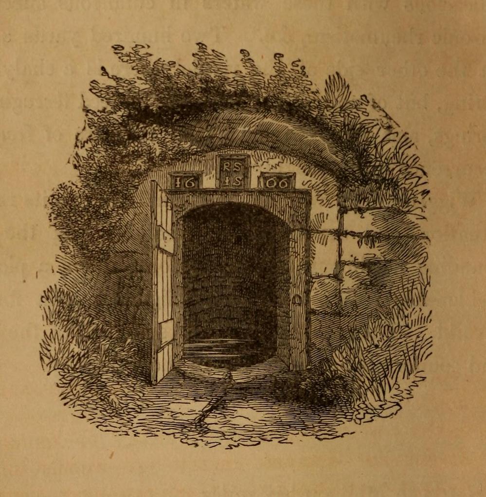
Photo of the well, c.2008Howson’s 1850 sketch
For about two centuries this well had a very favourable reputation. It’s therefore slightly curious as to why the great spa-writer, A.B. Granville, in his visit to this part of Ribblesdale to seek out some of the medicinal springs in the 1830s (including a petrifying well), made no mention of our Sulphur Well. Whether this was due to his patronizing attitude towards local people isn’t known, but it certainly wouldn’t have helped him in Yorkshire! One might suggest it was due to the fact that the spa had fallen into disuse, but this wasn’t the case because, subsequent to Granville’s visit, the local writer William Howson (1850) later told us that,
“In the woody dingle to the north of the village is a sulphurous spring, protected by a neat and antique stone canopy bearing the date 1666, and the initials of Sir Richard Sherburne and Isabella his wife, a daughter of John Ingleby of Lawkland Hall. Of this well, Dr (John) Murray the well-known analytical chemist says, ” It is a most valuable and unusually strong sulphuretted water, and as far as I have examined mineral waters, second to none.” From his analysis and that of Dr. Garnett it appears that a gallon of the water contains seventeen cubic inches of sulphuretted hydrogen, four of azote, and a small portion of carbonic acid, sulphate of magnesia in the proportion of seventy five grains to a gallon, a considerable quantity of muriate of soda, and a minute proportion of carbonate of lime.”
(The aforementioned Dr Garnett was a renowned 18th century authority on medicinal wells in Yorkshire, best known for his works on the spa wells of Halifax (1791) and Harrogate (1791, 1792), along with some in Scotland.)
Messrs Short (1765) and Howson (1850) mentioned other medicinal springs very close by, including the Chalybeate Well in the field immediately north on the other side of the stream.
References:
Addison, William, English Spas, Batsford: London 1951.
Brown, G.H., Walks, Drives and Excursions around Settle, Craven Printing: Settle 1880.
Healing Well (destroyed?): OS Grid Reference – SD 8047 5700
Archaeology & History
In Thomas Short’s (1765) description of the once-renowned Wigglesworth Sulphur Well, he mentioned briefly that there were “some (other) chalybeates near it.” Thankfully 85 years later, with the aid of William Howson (1850) who gave us a marginally better description, we were able to locate the whereabouts of one of them! From the Sulphur Well, this one could be found,
“two hundred yards above, on the other side of the rivulet there is a chalybeate spring, but (it was) of no unusual strength.”
In fact it’s a little closer to being 300 yards than 200—but that’s a minor issue in the grand scheme of things! The place in question was marked on the 1852 OS-map, marked simply as a “Well.” …This iron-bearing spring would have been a good pick-me-up and, as with all such wells of this nature, fortifies the blood and the immune system. Mr Howson also told us that “ferrugineous springs, stronger than this, are of frequent occurrence in the neighbourhood,” echoing Short’s earlier remark. Sadly, it seems that all trace of this Well has disappeared.
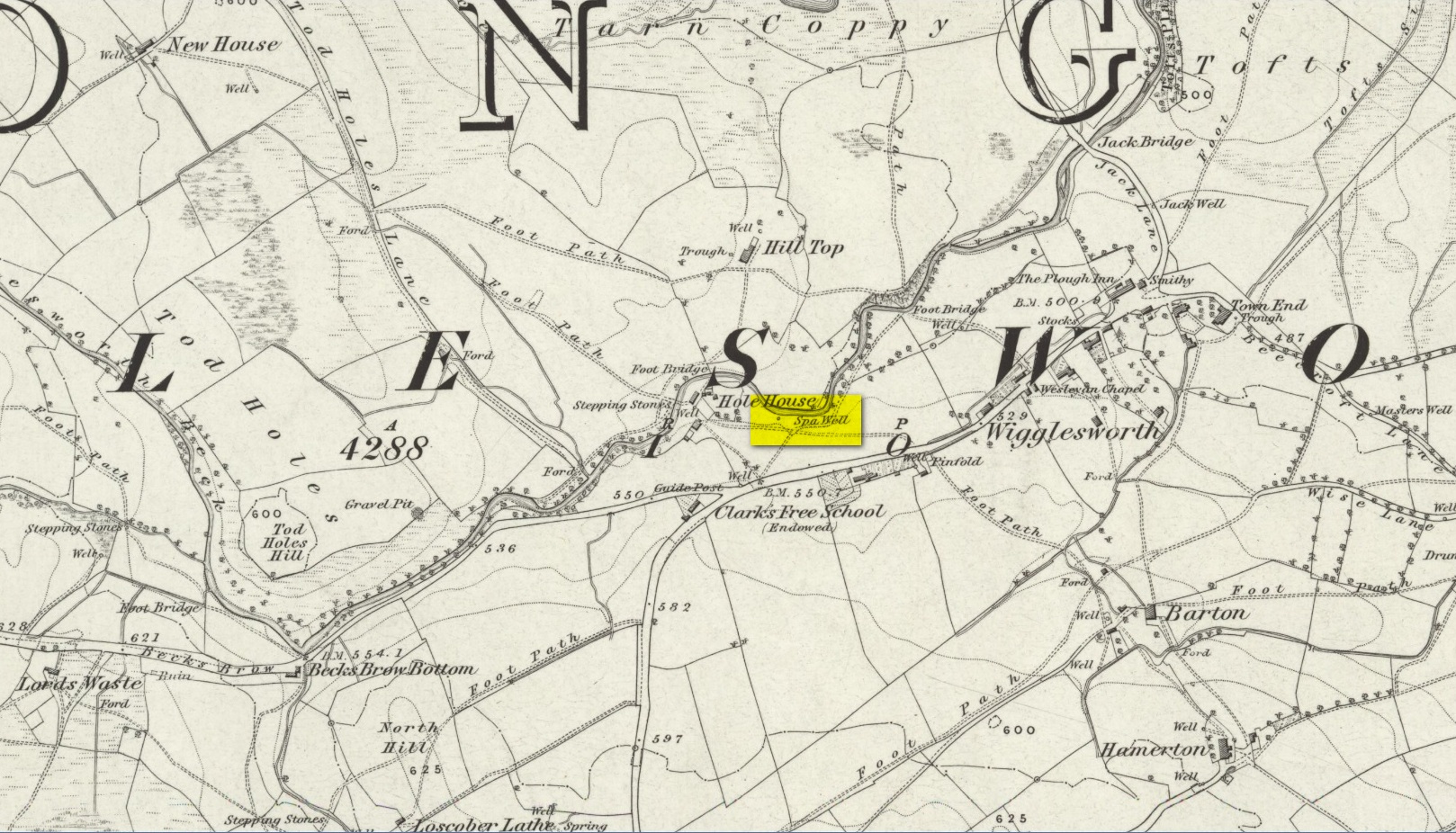
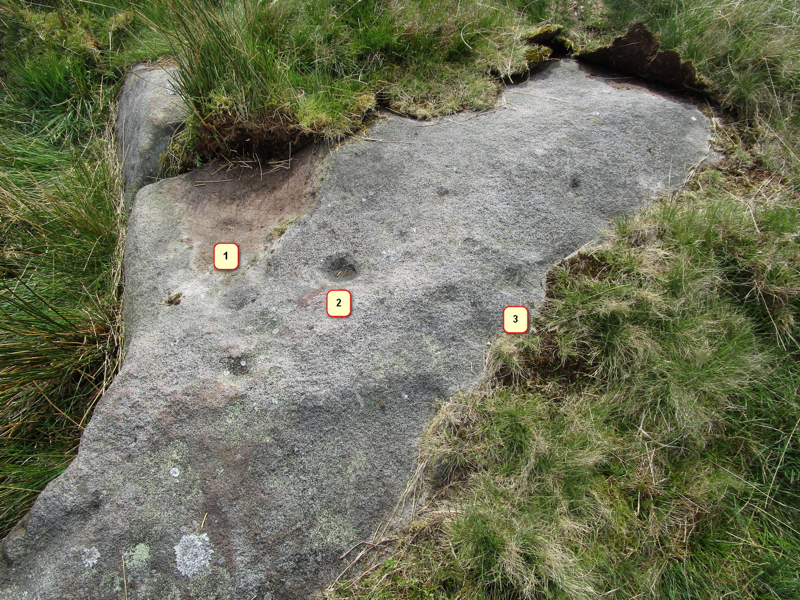
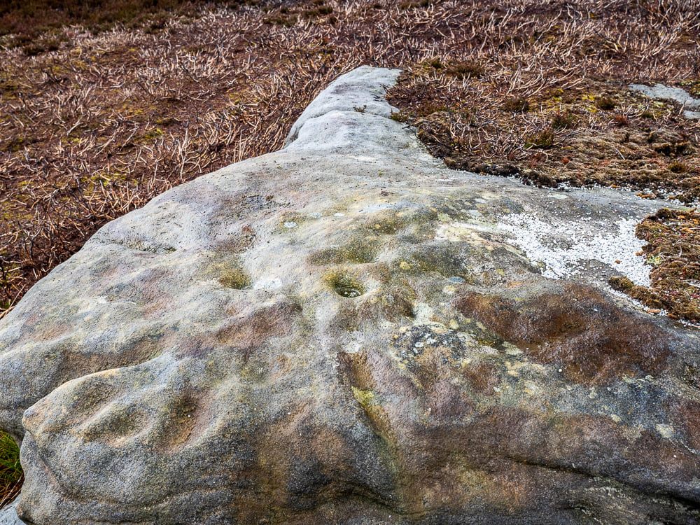
From Skipton head up the B6265 Grassington Road and after a short distance you will reach the Craven Heifer Pub on your left. About ¾-mile past the pub is a small turning on your left called Bog Lane. Go along here for about ¼-mile till you come to a sharp left bend and on the right you will see a gateway with room to park. Once here you’ll notice a sharp-pointed hill—and that’s Sharp Haw! Go through the gate, up the gravel track parallel to the wall on your left for 500 yards. Where the wall ends take the small path on your right and walk up here for ¾-mile where the path splits again. Take the right-hand path for 85 yards and the stone is on the left of the path.
Archaeology & History
Positions of cup-marks
Nowt special to look at, this is merely an elongated earthfast female stone that will be hard to find when the reeds grow high. The design consists of at least three cup-marks, with the most prominent one near the middle of the stone. A second one is shallow and on its northern side, near the middle; whilst the third one on its southern side was uncovered when we peeled back the vegetation; the peck marks are still visible. In the photo to the left I’ve placed numbers below the position of the respective cup-marks. In a cursory meander here, we found no other carvings – but that doesn’t mean there aren’t any!
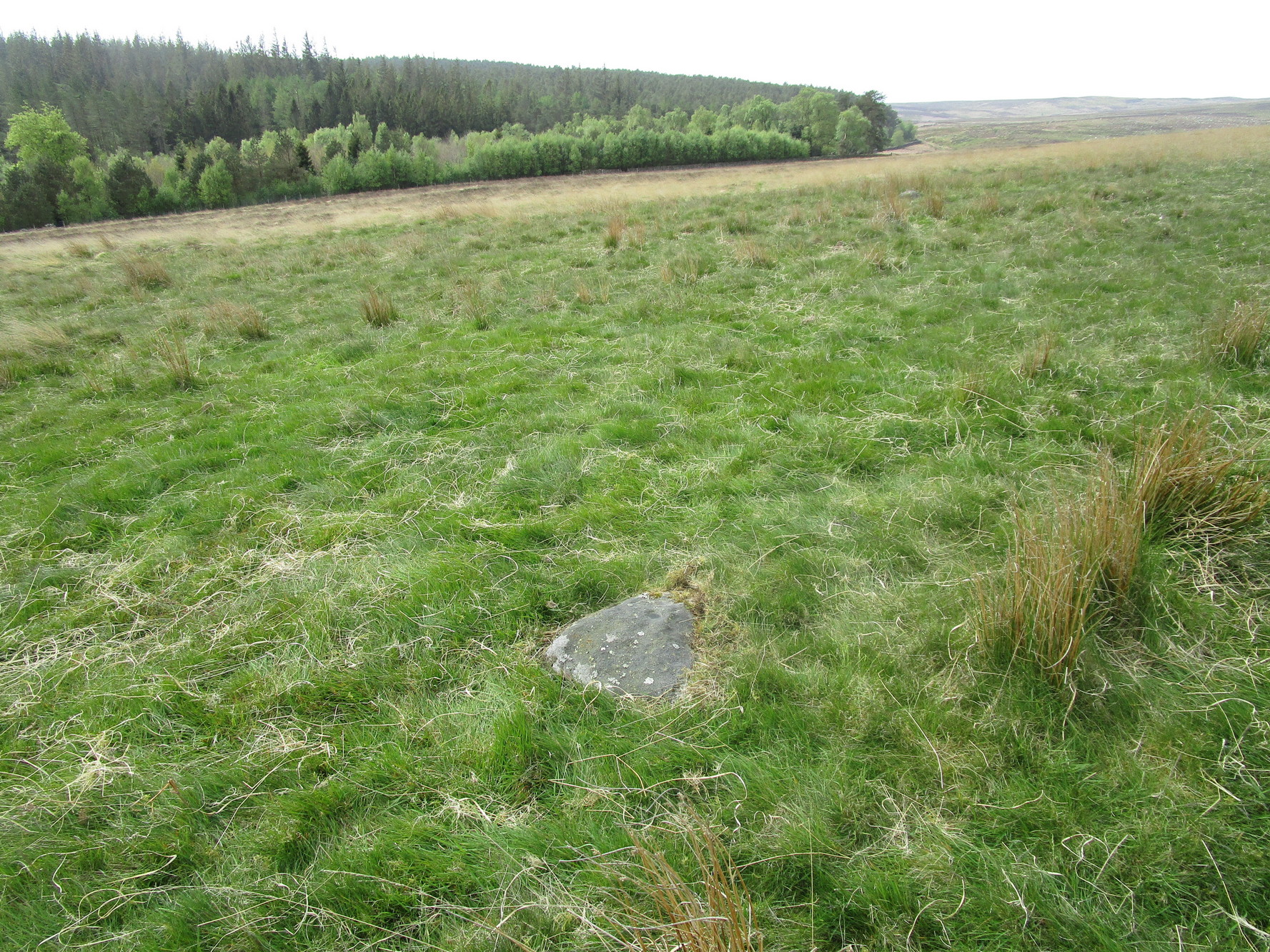
It’s probably easiest to start from the Green Plain settlement, from here crossing the Sun Bank Gill stream and walking east through the scattered heather and grasslands for 450 yards to the right-angled edge of the woodland. Keep walking eastwards alongside the woods for about another 250 yards, then walk into the grasslands north for about 140 yards or so. Zigzag about – you’re damn close!
Archaeology & History
Only for the purists amongst you. This is a simple small triangular stone, with a single notable cup-mark near the middle. It would seem to be in isolation as we could find no others in the immediate vicinity. An early marker no doubt.
Acknowledgements: With thanks to Helen Summerton, who helped with location on this fine day.
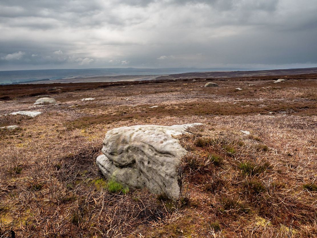
This one really takes some finding. Take the high moorland road running between Lofthouse and Healey villages, and at the very top by the cattle-grid, park up. Walk across the road and walk east. A mile or so on you’ll pass the Shooting Lodge house: keep walking for nearly another mile where another track goes left. Walk down here about ½-mile and you’ll see a crag down the the slope on your right. From here, walk uphill to your left; over the wall, and keep going about 500 yards until the moorland levels out. Hereby is a small outcrop of rocks. Look around!
Archaeology & History
Recently rediscovered by young antiquarian Mackenzie Erichs in May 2021, this flat rock—roughly 5 feet by 3 feet— is one of many amidst the heather which, when fully grown, is gonna be hard to see. This is one of the many petroglyphs possessed with both natural and artificial elements roughly of the same number here.
Upon the mainly southern-side of the stone is a cluster of cup-marks with several on the edges of the rock, most of which are probably natural, or naturally affected. The main cluster of cups—about eight in all—have differing levels of erosion, suggesting differing periods of execution. The most obvious cup is the deep one near the middle of the stone; a group of 3-4 very eroded ones are closer to the edge; and 2-3 three others of varying shallow depths can be seen. One of the cups at the edge of the rock may also have been partially worked.
Holy Well (destroyed): OS Grid Reference – NZ 9006 1102
Archaeology & History
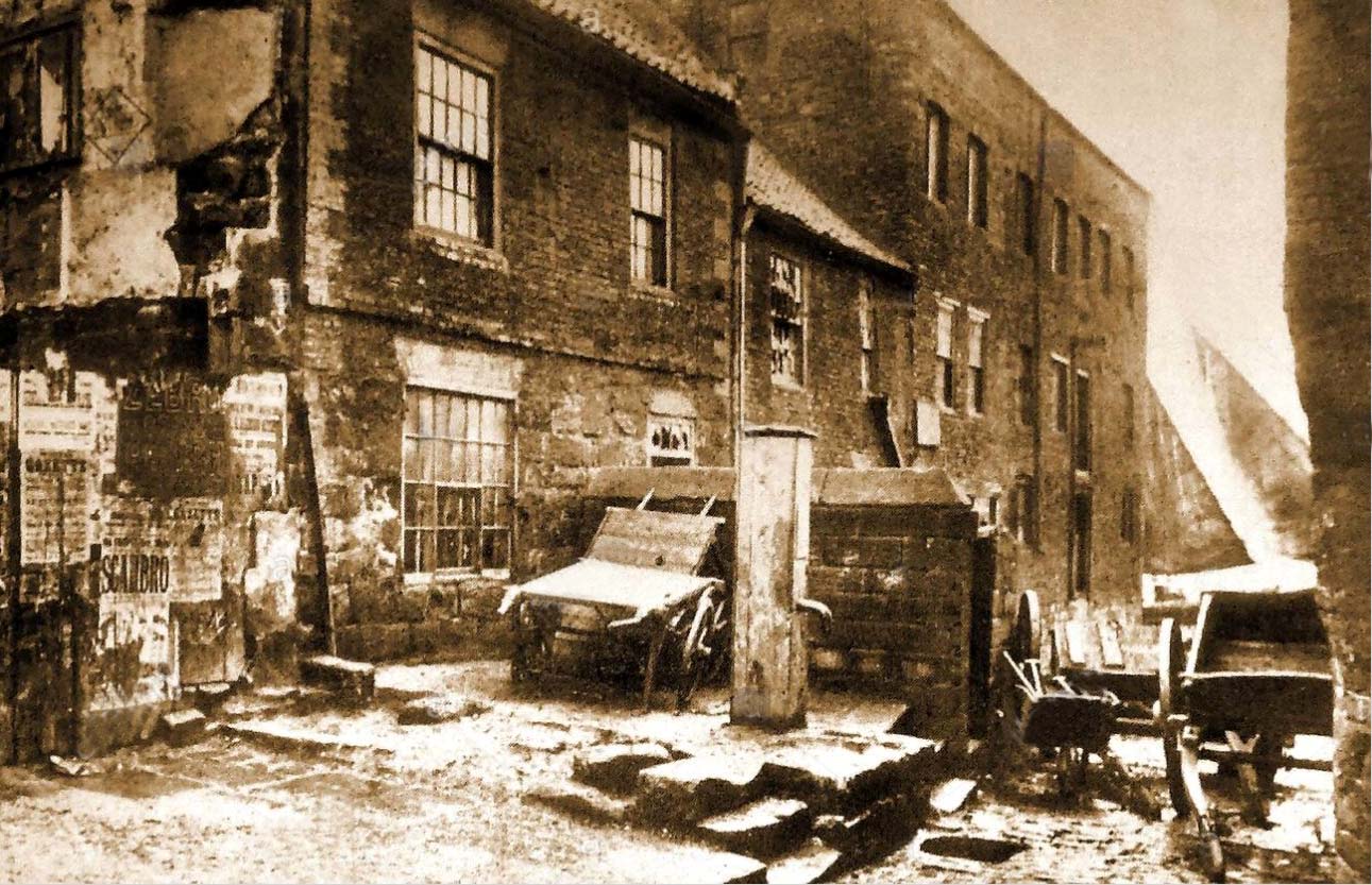
Virgin’s Pump, c.1890
This is one of at least five wells dedicated to St. Hilda in North Yorkshire that my old colleague Graeme Chappell has uncovered over his many years of research. It’s sadly been destroyed, and accounts of it seem to be few and far between; but from the short description of it by Mr J.C. Atkinson (1894)—and helped out by its later title—we at least know where it once was.
In his account of the old roads in the village, Grape Lane was mentioned as far back as 1396, and close by, he wrote,
“is a spring called Seynt-Hild-keld, possibly where the so-called “Virgin pump” stands, or stood, not so very long since.”
This ‘ere “virgin pump” is shown in an old photo taken about 1890, just round the corner from Grape Lane where, today, is the car park on Church Street, opposite The Endeavour.
Folklore
St Hilda was a 7th century saint who was reputed to have founded Whitby Abbey. Her festival date was November 17.
References:
Atkinson, J.C., Memorials of Old Whitby, MacMillan: London 1894.