Bride Stone, Farnley Moor, North Yorkshire

Standing Stone:  OS Grid Reference – SE 1991 4932

Getting Here

From Otley go north straight over the river and upwards into the countryside for nearly two miles (past the TV mast on the right).  As you reach near the top of the hill, there’s a turn to your right.  Go on here for a hundred yards or so, then walk along the footpath to your right.  After a few hundred yards, keep your eyes out for the stone just through the gate, in the walling on your left.

Archaeology & History

Although we see named on the 1853 Ordnance Survey map the respective place-names of Bride Cross House and Bride Cross Allotment, the first literary reference to any site here as a standing stone appears to be Eric Cowling (1946) who, when commenting on the pagan tradition and folklore of ancient sites, told that

“The name of Bride Cross Farm, Dob Park, is very significant, for at the meeting place of several tracks to the south-east is a squat standing stone built into a wall and marked as a boundary stone, which was probably Brides Cross.”

Bride Stone, Farnley Moor
Boundary markers on top

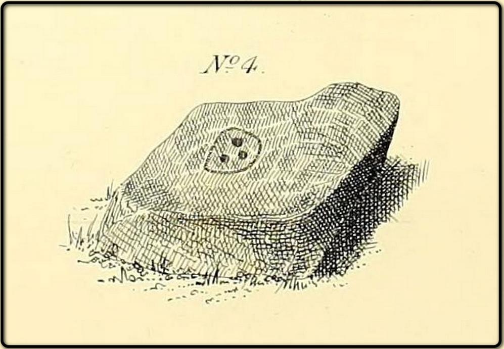
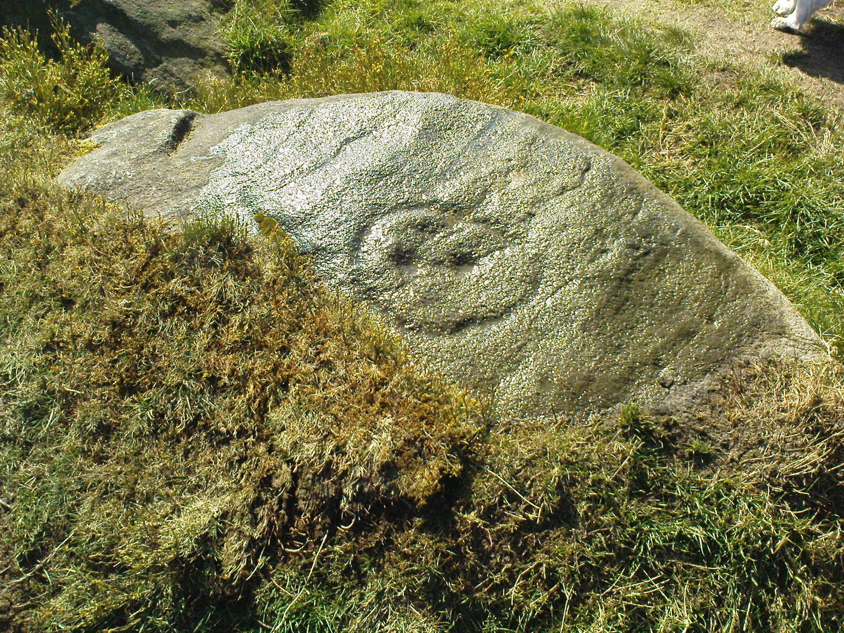
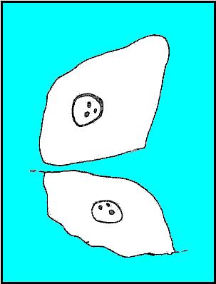
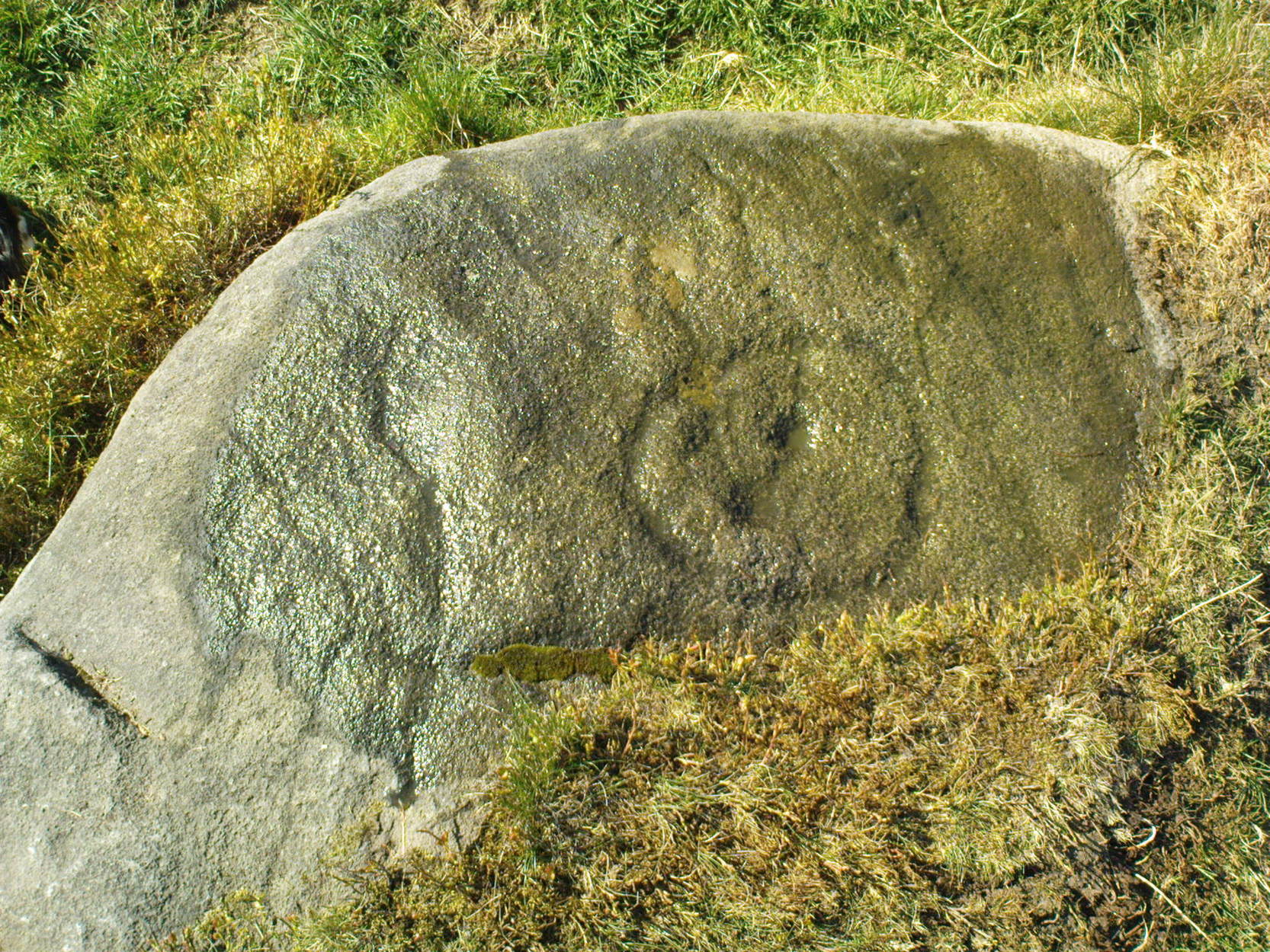
Although I’d read about this place as a kid, it was Graeme Chappell who first brought me here some twenty years back, in one of our many exploratory forays into the prehistory of this area.  It’s a nice fat squat standing stone, similar in stature to the more famous Bull Stone near Otley Chevin, a few miles to the south — though our Bride Stone here is about half as high.  Only about three-feet tall, it stands by the gate at the wall-side about 200 yards down the footpath from the Dob Park Lodge road and does seems to have been used as a boundary marker, as the letters “F.F.” are carved deeply on top of the upright (possibly denoting the Fawkes family of Farnley).

Cowling’s assertion that this old stone accounts for the ‘Bride Cross’ place-name is probably right, as the site is roughly midway between the respective place-names of the House and Allotment.  There is an old field-name of Crosse Close in the vicinity, from 1692, but I haven’t located it.  If such a cross ever existed nearby (most likely, it’s gotta be said), it’s obviously the relic which left the place-names — though the standing stone was certainly here first!  As yet, we’ve found no references to this place before 1853…which can’t be right…

Folklore

Seems to be a petrification legend in here somewhere. Although the short tale doesn’t say as much, it is supposed to have got its name through “the murder of a bride, rejected by a suitor, on her return from a wedding.”  Indeed, I’d go so far as to say ‘fertility’ as well!

Eric Cowling (1946) really stuck his neck out and reckoned sacrifices occurred here in the not too distant past. This may relate to the nearby Haddock Stones, a few hundred yards south, thought to derive its name from a cairn and ‘altar stones.’

References:

  1. Bennett, Paul, The Old Stones of Elmet, Capall Bann: Milverton 2001.
  2. Cowling, E.T., Rombald’s Way, William Walker: Otley 1946.
  3. Phillips, Guy Ragland, Brigantia — A Mysteriography, RKP: London 1976.
  4. Smith, A.H., The Place-Names of the West Riding of Yorkshire – volume 5, Cambridge University Press 1961.

© Paul Bennett, The Northern Antiquarian


Brackenhall Circle, Baildon Moor, West Yorkshire

Enclosure:  OS Grid Reference – SE 1305 3908

Also Known as:

  1. Brackenhall Ring
  2. Catstones Ring
  3. Soldier’s Trench

Getting Here

To get here, ask all and sundry where Shipley Glen is and, once there, head to the Brackenhall Countryside Centre. It’s less than 100 yards past it, right on the roadside (a coupla nice birches sit in its edge).

Archaeology & History

Lay-out of the Catstone's Ring (North is an approximation)
Lay-out of Catstone’s Ring

Described by many local writers over the years and marked on modern OS-maps as ‘The Soldier’s Trench,’ this curious double-ring of stones has long been somewhat of an archaeological anomaly.  The archaeologist John Barnatt thought it to be “almost certainly an enclosure, of indeterminate age”; and similarly so by Faull and Moorhouse (1981), who described it as a settlement or enclosure.  It has previously been classified as a ‘stone circle’ by archaeologists, and although I’ve added it to the listing of such sites here on TNA, I do so as a historical tradition, as the site aint a true megalithic ring.  Although we don’t know exactly what it was used for, we’re better using the term ‘enclosure’ for it.

The first description of the place was by J.N.M. Colls (1846).  When the pseudonymous Johnnie Gray (a.k.a. Harry Speight) got here he wrote:

“It comprises portion of an earthwork (which was perfect a few years ago), raised between two concentric circles, whose grater circumference is 137 yards, and diameter 57 yards north to south, and 39 yards east to west… There are unmistakable evidences about it of immense fires.”

Earliest known image (Glossop 1882)

At least two of the stones in this double-ringed complex have cup-markings etched on them; though Boughey and Vickerman (2003) report a third such carving, but doubt its authenticity.  They may be right.

Folklore

The other name for this site, the Soldier’s Trench, comes from an old tale which relates to the place being used as a camp by a group of soldier’s the night before they went into battle.

Drawing by John la Page (1951)

The site stands right next to a prominent geological fault (as any visitor clearly sees!).  It’s likely that this cleft in the Earth is one of the causative factors in the creation of numerous UFO phenomena that have been reported hereabouts through the years.  One large spherical object with a very slight ‘tail’ to the rear, travelled slowly over this site in the 1980s and was watched for several minutes slowly following the geological ridge up and round Baildon Hill to the north, fading back to Earth and eventually out of sight.

References:

  1. Baildon, W. Paley, Baildon and the Baildons – parts 1-15, Adelphi Press: London 1913-1926.
  2. Bennett, Paul, The Old Stones of Elmet, Capall Bann: Milverton 2001.
  3. Boughey, Keith & Vickerman, E.A., Prehistoric Rock Art of the West Riding, WYAS 2003.
  4. Colls, J.N.M., ‘Letter upon some Early Remains Discovered in Yorkshire,’ in Archaeologia 31, 1846.
  5. Faull, M.L. & Moorhouse, S.A. (eds.), West Yorkshire: An Archaeological Survey to AD 1500 – 4 volumes, WYMCC: Wakefield 1981.
  6. Glossop, William, ‘Ancient British Remains on Baildon Moor,’ in Bradford Antiquary, 1882.
  7. Gray, Johnnie, Through Airedale from Goole to Malham, Elliott Stock: London 1891.
  8. Hedges, John (ed.), The Carved Rocks on Rombald’s Moor, WYMCC: Wakefield 1986.
  9. la Page, John, The Story of Baildon, Byles: Bradford 1951.

© Paul Bennett, The Northern Antiquarian


Blue Scar Settlement, Arncliffe, North Yorkshire

Settlement:  OS Grid Reference – SD 9319 7102

Getting Here

Pretty easy really.  From Arncliffe village, walk up the Monk’s Road footpath, heading for the rocky mass immediately south.  Once you get onto the moor edge, veer straight up to your right and keep walking till you hit the rocks.  Look around!

Archaeology & History

Drawing of main part of the settlement (Raistrick 1929)

Described by Miss D. Charlesworth at one of the annual meetings of the Archaeological Society in July 1968, this ‘settlement’ is found immediately south of Arncliffe village, literally 1000 feet up on the hillside and has a field system attached to it.  When Charlesworth described this place, it had not been excavated, though her description of the place very much echoed those of Raistrick & Chapman (1929) nearly forty years earlier.  She wrote:

“It faces north and east over the Skirfare valley, sheltered by the bulk of Parson’s Pulpit. The most interesting feature is the rectangular enclosure west of the sunken road. The walls are built of limestone some 5ft wide at the base and standing 2-3ft (tall). The huts are grouped round a courtyard at the south-eastern end and have a large stockyard attached to them. Of the 14 huts, only two are circular (those in the northwest corner), and one on the east side is approximately a circle. The remainder are rectangular, approximately 30 by 12ft.”

Although the sites is generally ascribed as Iron Age to Romano-British in date, it seems evident that these buildings were used in much later centuries — perhaps until late medieval periods.  Other remains of similar size and stature can be found scattered on the hills near here (I’ll add them on TNA at sometime in the future).

References:

  1. Charlesworth, D., ‘Iron Age Settlements and Field Systems,’ in Proceedings of the Archaeological Journal, 125: 1968.
  2. Raistrick, Arthur & Chapman, S.E., ‘The Lynchet Groups of Upper Wharfedale, Yorkshire,’ in Antiquity, volume 3, 1929.

© Paul Bennett, The Northern Antiquarian


Bent Head, Todmorden, West Yorkshire

Cup-Marked Stone:  OS Grid Reference – SD 9602 2587

Also Known as:

  1. Upper Eastwood Carving

Getting Here

Bent Head cup-marking

From Todmorden go east on the A646 for less than a mile and take the Cross Stone road on your left.  Keep going all the way up till you hit the moorland edge road, where you’ll see the Great Rock (a massive boulder right by the roadside). Then go down Eastwood Lane, past the house where the lane swings right and here you’ll see a stile in the wall on the right (just after the next lane on your left).  Walk along this path, over the stiles in the walling until you reach a wooden stile. The carving is hereby!

Archaeology & History

This carving was described just once by Mr J.A. Heginbottom (1979) as, “a small cup-marked boulder in a stile 100 metres east of Bent Head, Todmorden.” A small, innocuous stone used in the drystone walling, it gives the distinct impression of being one of the many ‘portable’ cup-marked stones typical of those found in prehistoric cairns and other tombs — but the record-books speak of no such remains here; and various ambles about in search of such a potential tomb have drawn a blank. Nevertheless, the cup-markings here are pretty obvious once you see ’em (assuming the daylight aint overcast, which can hide the carvings sometimes).  About 2 feet long, about a foot wide and a foot high, this cup-marked portable is similar in size and form to the Nine Stones cup-marking, Derbyshire, recently found in walling very close to where an old tomb was recorded (though the Derbyshire one has only 2-3 cups).  Certainly worth a look if you’re in the area.

References:

  1. Heginbottom, J.A., The Prehistoric Rock Art of Upper Calderdale and the Surrounding Area, YAS: Leeds 1979.

© Paul Bennett, The Northern Antiquarian


Battle Hill Dolmen, Huntly, Aberdeenshire

Cairn (destroyed):  OS Grid Reference – NJ 542 401

Archaeology & History

In a short article, ‘Dolmens in Scotland’, written by Dr H.O. Forbes in the esteemed Antiquity journal of June 1929, Dr Forbes reported the former existence of a dolmen-like monument that stood,

“some 70 years ago…at the north or northwestern extremity of Battle Hill which looks down on the town of Huntly on the River Bogie in Aberdeenshire.  In walking from Drumblade to the town, about 3 miles off, one usually took a short cut over Battle Hill.  This bypath diverged from the turnpike road leading north to Banff and led to the top of Battle Hil (400ft), close past the edge of the wood, a few yards within which stood this monument.  It was a typical dolmen, of which I retain a perfectly clear recollection, with its large granite capstone supported by three massive, rudely shaped pillars.  On the aspect towards the bypath, there were some blocks of stone on the ground which may have constituted a fourth pillar or the ruins of a dromos, otherwise the dolmen was in excellent preservation.  It stood about 6 to 7 feet high above the ground level, for I remember it took some climbing for me as a small boy to get on top.”

Folklore

Dr Forbes also described several legends attached to this long forgotten old tomb.  He told “that it was a ruined druid’s altar; that the stones were dropped down through a hole in the devil’s apron when on his way to Knock Hill to deposit the cloven-stone there (a large glacial erratic); and that it is the tomb of a great warrior.”  A story that we find at a number of prehistoric tombs in both Britain and abroad.  At some nearby tumuli, legend told that they stood on the site of a great battle.

References:

  1. Forbes, H.O., ‘Dolmens in Scotland,’ in Antiquity journal, volume 3, June 1929.

  2. Grinsell, Leslie, Folklore of Prehistoric Sites in Britain, David & Charles: Newton Abbot 1976.

© Paul Bennett, The Northern Antiquarian 


Barrnacoilich, Ardmaddy Castle, Argyll

Standing Stone:  OS Grid Reference – NM 794 164

Getting here

This old stone is another one tucked away, but not too far south of Oban.  Take the Kilninver road and keep heading southwest, past Loch Seil.  Instead of following the road right, to Clachan and then onto Seil Island, bear left and towards Armaddy Castle.  Where the single-track road turns into the woodland towards the castle, the track keeps on into the rocky hills.  Keep going for about another 500 yards.  You’re nearly there!

Folklore

By the coast just north of Loch Melfort, near the hamlet of Degnish, is the grand old Armaddy Castle. On the other side of the trees from here, to the east, Scottish writer and folklorist A.A. MacGregor tells there to be an old standing stone. In his Ghost Book of 1955, he tells the tale of a local man called Donald MacDougal who, returning home after his day’s work at the castle, crossed over the old burn of Eas nan Caerdach where the standing stone can be found, just past the bend in the track.

On reaching it, Donald became aware of a strange light a short distance in front of him. Thinking at first it was the lamp of his co-worker making for the Home Farm, he walked past the stone – but it wasn’t until he got home himself and found he was alone that he questioned what on earth he’d seen! Upon asking other people in the neighbourhood, it was found that other locals had seen the same light, traversing the land from the old standing stone along the footpath to the farm.

References:

  1. MacGregor, Alasdair Alpin, The Ghost Book, Robert Hale: London 1955.

© Paul Bennett, The Northern Antiquarian


Baildon Moor (171), West Yorkshire

Cup-Marked Stone:  OS Grid Reference – SE 13842 40268

Also Known as:

  1. Carving no.37 (Hedges)

Getting Here

W.P. Baildon’s sketch

Upon the heights of Baildon Hill, get to the Dobrudden Farm caravan site. 100 yards up the track leading from it (north), go into the tribbles of grassland immediately to your left.  Look around!

Archaeology & History

This is only a small stone and takes some finding when the grasses are long.  It’s found upon the once archaeologically rich High Plain with at least 17 cup-markings etched onto its surface.  A single prehistoric tomb appears to have accompanied the rock and its cup-marks.

It was first described by Mr Baildon (1913) in his magnum opus; then later catalogued in Hedges (1986) survey, a couple of years after I did my first drawing of this stone.

References:

  1. Baildon, W. Paley, Baildon and the Baildons – parts 1-15, Adelphi: London 1913-1926.
  2. Bennett, Paul, Megalithic Ramblings between Ilkley and Baildon, unpublished: Shipley 1982.
  3. Boughey, Keith & Vickerman, E.A., Prehistoric Rock Art of the West Riding, WYAS: Leeds 2003.
  4. Hedges, John, The Carved Rocks on Rombald’s Moor, WYMCC: Wakefield 1986.

© Paul Bennett, The Northern Antiquarian


Baildon Moor (152), West Yorkshire

Cup-Marked Stone:  OS Grid Reference – SE 13743 40161

Also Known as:

  1. Carving no.24 (Hedges)

Getting Here

If you wanna find this, get onto the Low Plain north of the Dobrudden caravan park and its about 10 yards off the path running north from there, not too far from the other Baildon Hill carvings.  Scramble about a bit & you’ll find it.

Archaeology & History

W.P. Baildon’s early sketch

Don’t ask me why, but I really like this carving. It’s one of the many I first saw on these moors when wandering about up here when I was 10-12 years old — and they had an effect on me.  I call this one of the “primary design” stones, i.e., a number of CRs on this moor (and everywhere else for that matter) appears to have a central design feature. (I’ll point out the others as I post ’em) Some folk think it’s just the slant of the local rock-artist…I think it’s summat a bit different…  Local astronomer Gordon Holmes (1997) found a similar pattern here and thought they may have represented star formations, but this is unlikely.

It was first described and illustrated by W. Paley Baildon (1913), way before Mr Jackson (1955) resurrected its attention for archaeologists.

References:

  1. Baildon, W. Paley, Baildon and the Baildons (parts 1-15), St. Catherines: Adelphi 1913-26.
  2. Boughey, K.J.S. & Vickerman, E.A., Prehistoric Rock Art of the West Riding, WYAS: Leeds 2003.
  3. Hedges, John (ed.), The Carved Rocks of Rombald’s Moor, WYMCC: Wakefield 1986.
  4. Holmes, Gordon, 2000 BC – A Neolithic Solstice Odyssey, SASRG 1997.
  5. Jackson, Sidney, ‘Cup-and-Ring Boulders of Baildon Moor,’ in Cartwright Hall Archaeology Group Bulletin, 1:7, 1955.

© Paul Bennett, The Northern Antiquarian


Baildon Moor (146), West Yorkshire

Cup-Marked Stone:  OS Grid Reference – SE 13666 39756

Also Known as:

  1. Carving no.19 (Hedges)
  2. Carving no.146 (Boughey & Vickerman)

Getting Here

South of Dobrudden caravan park, heading towards the wall, you’ll stumble across this old carving in the tribbly grass. Zigzag about and keep your eyes peeled!

First known drawing (W.P. Baildon 1913)

Archaeology & History

First described by W. Paley Baildon in his monumental 15-part study (1913) of the region, this carving was then later included in John Hedges (1986) survey as ‘Baildon stone 19.’  It was then catalogued as stone 146 in Boughey & Vickerman’s (2003) updated and expanded survey.

Modern drawing (after Hedges 1986)

This carving was one of several in the Baildon Moor complex that was thought by local astronomer Gordon Holmes (1997) to possibly represent heavenly constellations, with Pleiades and Cassiopeia being primary contenders amidst the scattering of carved cups on this stone.  This was something I explored in my own research on the possible nature of these carvings in the 1980s, but found that although it seemed a good idea, it was pretty unlikely (unfortunately!).  The nature of this and other stones related to the other prehistoric remains where, in bygone days, many prehistoric cairns scattered this grassy moorland plain.  The carving was more related to the cosmology of death and the psychogeography of spirit worlds: a factor understood at many other cup-and-rings across the country.

References:

  1. Baildon, W. Paley, Baildon and the Baildons – parts 1-15, Adelphi: London 1913-1926.
  2. Boughey, Keith & Vickerman, E.A., Prehistoric Rock Art of the West Riding, WYAS: Leeds 2003.
  3. Cowling, Eric T., Rombald’s Way, William Walker: Otley 1946.
  4. Hedges, John, The Carved Rocks on Rombald’s Moor, WYMCC: Wakefield 1986.
  5. Holmes, Gordon, 2000 BC – A Neolithic Odyssey, SASRG: Baildon 1997.

© Paul Bennett, The Northern Antiquarian


Mitton Springs, Baildon Moor, West Yorkshire

Cup-and-Ring Stone:  OS Grid Reference – SE 12897 39490

Also Known as:

  1. Carving no.4 (Hedges)
  2. Carving no.121 (Boughey & Vickerman)

Getting Here

Glossop’s 1888 sketch

This lovely little stone is found on Shipley Glen.  Walk a few hundred yards up past the Brackenhall circle until, on the right-hand side of the road, you reach the track which leads up the slope to Mitton Springs farmhouse.  About 20 yards past the track, cross the road from and near to where the land drops down to the glen below and about 20 yards from the rowan tree, you’ll find this carving on one of the smaller low flat stones.  Be patient and look around.  You’re damn close!

Archaeology & History

The carving first appears to have been described by the Bradford historian, William Glossop (1888), in his local survey of prehistoric remains here (see his drawing).  It’s a cute little thing on a small stone, consisting of a simple large ‘enclosure’ ring with three archetypal cup-markings etched inside.  Described by several other local writers since, no other archaeological remains have been found in relation to this carving, making any realistic academic assessment on its nature almost wholly impossible.

References:

  1. Baildon, W. Paley, Baildon and the Baildons (parts 1-15), St. Catherines: Adelphi 1913-26.
  2. Boughey, K.J.S. & Vickerman, E.A., Prehistoric Rock Art of the West Riding, WYAS: Leeds 2003.
  3. Glossop, William, “Ancient British Remains on Baildon Moor,” in Bradford Antiquary No.1, 1888.
  4. Hedges, John (ed.), The Carved Rocks of Rombald’s Moor, WYMCC: Wakefield 1986.

© Paul Bennett, The Northern Antiquarian