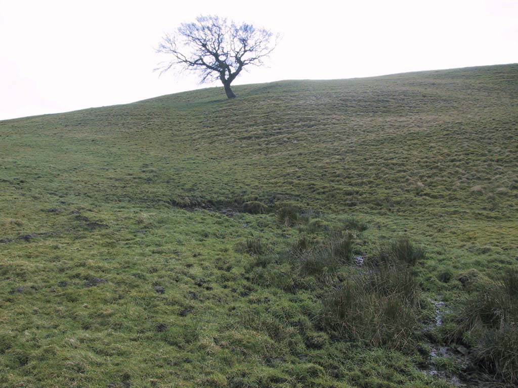
St Winefride’s Well, Holywell, Flintshire

Holy Well:  OS Grid ReferenceSJ 1851 7627

Also Known as:

  1. Ffynnon Gwenfrewi
  2. St. Winifred’s Well

Getting Here

St.Winifred’s Well

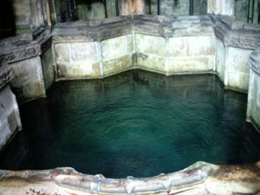
From the Chester ring road head into north Wales along the coast road (A548) from Connah’s Quay for about 13 miles taking you through Flint. After 12 miles turn left into Holywell town (Treffynnon). At the western end of the town go down the Greenfield-Mostyn road back towards the A584 taking you down a hill.  After 500 hundred yards you arrive at the holy well/shrine and pilgrimage centre on the right-hand side; there is parking on the opposite side of the road. There is a small entrance fee, but as well as the famous healing well and bathing pool, they have a gift shop, toilet facilities and a late medieval/Gothic two-storey structure that is built over the polygonal, vaulted well chamber, whilst at the side (at the corner of the hill) stands another Gothic chapel from 1500.

History and Legend

According to the well known legend, a young Welsh girl called Winefride or Gwenfrewi, was the daughter of patrician parents, Thenith (Thewyth) and Gwenlo, who lived at Bryn-y-Castell (Treffynnon) at the beginning of the 7th century AD.  She was a very religious girl who was known for her kindness and charities to people in the area that was then called Tegeingl (after the Decengle tribe).  Winefride grew up to be a very beautiful young woman which troubled her because she had no wish to marry, only to live a life of chastity and serve God as only she knew how.
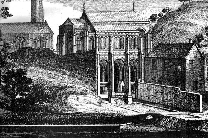
St. Winefrides Well 1742

One day a local chieftain from Hawarden (Penarlag) called Caradoc ap Alyn came hunting in the area. He became very thirsty so stopped off at the house where Winefride lived with her parents.  However, on this particular day her parents were attending the local church where St Beuno, her uncle, was conducting a service.  Prince Caradoc soon began to seduce her so she ran to the church but with the prince in hot pursuit.  When he caught up with poor Winefride, she again resisted him so he took his sword and beheaded her.  Her severed head fell to the ground and rolled down a hill and where it came to rest a spring of water gushed forth from the ground.  Her parents and uncle came rushing out of the church at which point St Beuno cursed the evil prince, who was calmly wiping blood from his sword, causing him to sink into the ground — never to be seen again.  St. Beuno then placed the severed head back into place, restoring Winifred to life again but leaving her with a thin scar round her neck.

Later, Winifred was entrusted for her education to St Beuno whom sent her to various holy men including St. Elerius at Gwytherin near Llanwrst.  Here she became abbess of a convent that had been founded by Elerius, with his mother St. Theonia as first abbess; and it was here for the next 40 years that Winifred lived out her life.  She was said to have died at Gwytherin in either 65o or 670 AD.  Her body was first interred in the churchyard there, however in 1138 her relics were transferred to Shrewsbury Abbey.  Sadly however, her shrine there was destroyed in the 16th century and now only a few relics remain with a finger-bone being housed at a convent in Holywell.

Mythology and Folklore
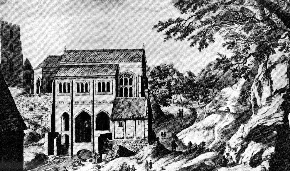
St. Winefrides Well 1750

The holy well and shrine of St. Winifred at Holywell became a place of pilgrimage during the middle-ages and many miracles of healing were wrought there.  The sick were cured of infirmities of the legs and body; crutches were left at the well and many were cured of leprosy, eye complaints, loss of hearing, being not able to bear a child, mental illness, palsy and lung disorders etc.  During the Reformation the holy well suffered much, but from the 17th century onwards pilgrims were returning to the holy place and, more recently it has become the Welsh Lourdes and still pilgrims come in droves from all over Wales and beyond.  The vaulted Gothic structure covering the well shrine is richly carved with bosses depicting various characters including St Beuno, Earl Stanley, Lady Margaret Beaufort, biblical characters, animals and an abbot of Basingwerk abbey, but there is also much recent graffiti too.  A tall statue of St Winefride looks down over the well while candles burn all around.  In the larger bathing pool outside, a stone lies at one side — this is claimed to be where St. Beuno sat whilst teaching his young niece.  Red stains on stones at the front of the well-basin were long taken to be the martyr’s bloodstains, but now these are thought to be iron oxide pigmentation on the lichens.  Today the people still come either to bathe in the special pool, throw coins in the well, or fill bottles with holy water from a tap on the wall.  Faith in miracles of healing is still much in evidence here and may it continue to be for many years to come.  Everyone is welcome here, you don’t have to be a Roman Catholic!

References:
  1. UneXplained - LiebreichBord, Janet & Colin, Sacred Waters, Paladin: London 1986.
  2. David, Christopher, Saint Winefride’s Well  – A History and Guide, Gomer Press: Llandysul 2002.
  3. Edwards-Charles, Thomas, Saint Winefride and Her Well – The Historical Background, Holywell 1962.
  4. Heath, Sidney, In the Steps of the Pilgrims, Rich & Cowan: London 1950.
  5. Jones, Francis, The Holy Wells of Wales, University of Wales Press: Cardiff 1992.
  6. Liebreich, Karen, UneXplained: Spine-tingling tales from Real Places in Great Britain and Ireland, Kindle 2012.
  7. Simcock, Richard, North Clwyd At Random, Countryside Publications Ltd: Chorley 1986.
  8. Spencer, Ray, A Guide to the Saints of Wales and the West Country, Llanerch: Felinfach 1991.
Copyright © Ray Spencer 2011
Lowlands Well, Wycoller, Lancashire

Healing Well:  OS Grid Reference – SD 9317 3944

Archaeology & History

Lowlands Well

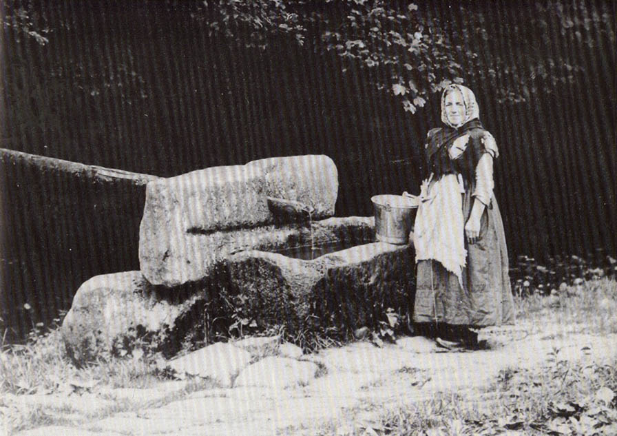
The huge stone trough at the side of the Wycoller Beck further down than the old bridge had a pipe leading to it from a spring on the other side of the beck.  Cookson & Hindle (1974) told that this was “the only source of drinking water” — which wasn’t quite true.  In the old photo shown here, the groove in the supporting vertical stone once held a lid over the top of the trough, “to prevent animals, dead leaves, etc, from fouling it.”  In addition to the old photo shown here, the well is also illustrated in Folley’s Romantic Wycoller (1949) with two young girls drinking the running water.

References:

  1. Bentley, John, Portrait of Wycoller, Nelson Local History Society 1975.
  2. Cookson, Stanley & Hindle, Herbert, Wycoller Country Park, H. Hindle: Colne 1974.
  3. Folley, E.W., Romantic Wycoller, Coulton & Co.: Nelson 1949.

© Paul Bennett, The Northern Antiquarian


Dissenters Well, Kelbrook, Earby, Lancashire

Healing Well:  OS Grid Reference – SD 92104 43179

Getting Here

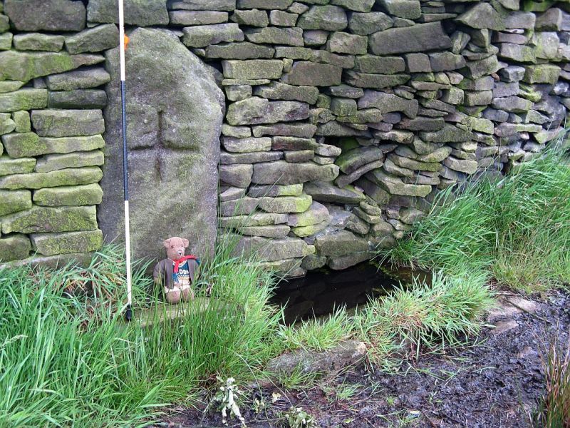
From Kelbrook village head south past Old Stone Trough then continue as far as the lane goes. Then head eastwards for about 1 mile on footpaths to a building called Laycocks. From here continue east along footpaths for another 1 mile or so until you reach Copy House (now called Hawres Farm). Go to the back of the farm where you will see in the wall a cross-incised boundary stone. At the side there is a square-shaped holy well. (You may need to ask permission at the farm).

Archaeology & History

Dissenters Well & Cross (image courtesy ‘QDanT’)

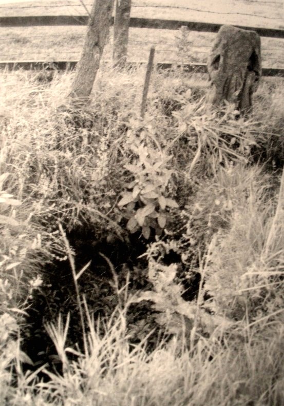
The so-called Dissenters’ Well is a rectangular feature in the ground next to the wall.  It is said locally to date from the 17th-18th century, but is most probably an ancient moorland spring.  The well was in use from the 17th century by Quakers, Baptists, Methodists and possibly Roman Catholics, at a time when there was much animosity towards non-Conformists.  Legislation was passed stopping all illegal gatherings to be held within a 5 mile radius of any church – thus leading to religious gatherings in bleak, remote places on the moorland above towns and villages.  In 1812 an Act of Parliament against non-Conformists was repealed and dissenters were given equality regarding where they could worship. The water in the well no doubt had some medicinal qualities or, was a source of spiritual up-lift at the time.

By the well there is 3 foot high pointed boundary stone or waymarker known as ‘Tom’s Cross’ and it has a thin incised cross carved onto it.  The stone is partly embedded in the wall.  It probably marks the old boundary between Lancashire and Yorkshire.  I don’t know who Tom was though he may have been the person who set up the stone. The age of the stone is not known.

The Bleara Lowe tumulus and its nearby prehistoric companion can be found upon the hilltop a mile north of here.

References:

  1. Oldland, Fay, The Story Of Foulridge, Pendle Heritage Centre Ltd, 1990.

Copyright ©  Ray Spencer 2011

Peg o’ Nell’s Well, Clitheroe, Lancashire

Sacred Well:  OS Grid Reference – SD 7355 4257

Also Known as:

  1. St. Margaret’s Well

Getting Here

Peg o’ Nells Well

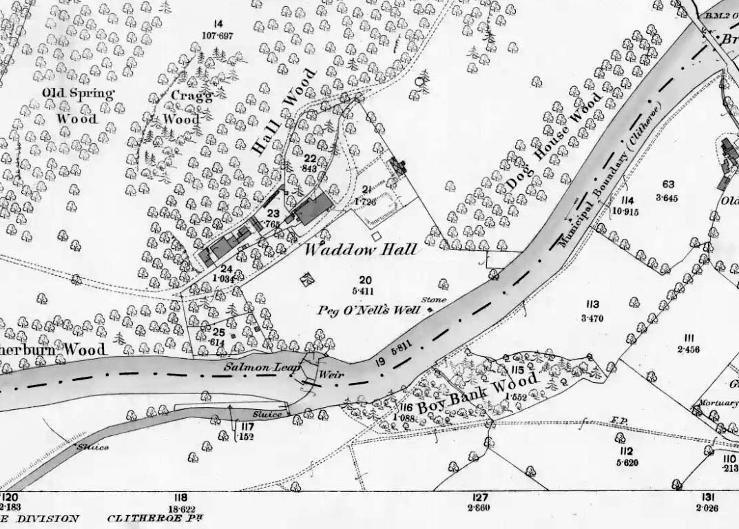
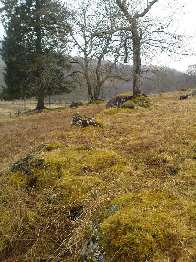
The well is located in the grounds of Waddow Hall close by Brungerley Bridge, near Waddington, in the Ribble Valley. The hall is just off the B 6478 road about three-quarters of a mile south-east of Waddington village. It is on private land, but you can see the well by walking along a footpath at the western side of the hall running along the banks of the River Ribble at the southern side of the hall grounds.

Folklore

The legend originates from the 18th century although the well is a pre-Christian spring. According to this most often told ‘legend’ Peg O’ Nell was a servant girl at Waddow Hall.  However, she often fell out with her masters, the Starkie family, often quarreling with and being disobedient to them. One night, in particular, Peg had a blazing row with Mistress Starkie after saying she didn’t want to fetch water from the well; the mistress was so enraged that she shouted at the servant saying “I hope you fall and break your neck”. At a later date this came true when on a particularly icy night Peg went to fetch water from the well, but on her way there she slipped on some ice and fell into the River Ribble, at a treacherous spot, and did indeed break her neck. From that time on there seems to have been a curse on the Starkie family – anything and everything that happened at the hall was blamed on Peg, or her ghost, which was now haunting the house and grounds. Mistress Starkie became so fed up with the curse that she took an axe and chopped off the head of a statue that had earlier been placed beside the well in memory of poor Peg. Thinking that by doing this the curse would come to an end, and it seems to have done just that, because afterwards peace and quiet seems to have come upon the hall.

Peg o’ Nells Well on 1884 map

Another legend or tale says that Peg dwelt by the well, perhaps as a kind of sprite, but that she caused a local Puritan preacher to fall into the River Ribble.  As a punishment for this dastardly trick the head of the statue was chopped off.  Folklore says that a water spirit or “sprite” lived in the well which was connected underground to the nearby River Ribble.

But the truth about this seems to be that the headless statue is that of St Margaret of Antioch who was beheaded for her faith in the early centuries of Roman rule. St Margaret’s feast day was on 20th July. Apparently, her statue was brought to Waddow Hall from either Sawley Abbey or Whalley Abbey where it had stood in its own niche, or possibly it came from a local Catholic church. The headless statue appears to be holding a bible in one hand; so it was probably placed at the side of the well in order to make the well holy and sacred to pilgrims who used to visit the site for healing purposes on the saint’s day. The head of the statue used to reside in an upstairs room at the hall, but it was lost for a time, only to be re-discovered and embedded into a wall at Brungerley farm not far from the bridge.

But we may never know what really did happen here because legend and folklore have become mixed in with other tales that may, or may not, be true. The holy well stands in a meadow in the hall grounds and is a square-shaped hollow in the ground where water still flows, possibly fed by the river close by. The statue still stands at the side; and fencing now surrounds this sacred site. The hall and grounds are still said to be haunted by a ghost, but whether it is Peg’s ghost we do not know, because this particular ghost is said to be hooded ? The curse itself used to claim a victim once every seven years; the screaming spirit of Peg would rise up from the murky waters of the river on stormy nights – an animal could apparently suffice as a victim, rather than a human.   This story was almost certainly made-up probably to frighten the Starkie family who it was originally aimed at.

Waddow Hall is now a Training and Activity Centre, but it used to be a Centre for girl guides and during the second world war it was an isolation hospital.

References:

  1. Bord, Janet & Colin, Sacred Waters, Paladin Books 1986.
  2. Hilton, J.A., “Return to Peggy’s Spout”, in NEM 70, 1997.
  3. Nelson, Carole, “Peg o’ Nell’s Well, Clitheroe, Lancashire,” in Source No.6, Summer 1998.
  4. Harte, J., “Death by Water – Rivers and Sacrifice,” in White Dragon 1998.
  5. Taylor, Henry, The Ancient Crosses and Holy Wells of Lancashire, Sherratt & Hughes: Manchester 1906.
  6. Whitaker, Terence W., Lancashire’s Ghosts and Legends, Robert Hale: London, 1980.

© Ray Spencer, 2011


Our Lady’s Well, Fernyhalgh, Preston, Lancashire

Holy Well:  OS Grid Reference – SD 555 335

Also Known as:

  1. Holy Well
  2. Lady’s Well
  3. St. Mary’s Well

Getting Here

The well can be reached along a narrow country lane to the east of the A6 road, some 3-4 miles north of Preston. Fernyhalgh is a tiny hamlet between the villages of Broughton and Grimsargh with pleasent countryside on all sides. The holy well of Our Lady is in the garden of a house with a Roman Catholic chapel and pilgrimage centre at the side of a secluded country lane; entrance through a little gate.

Archaeology & History

Our Ladys Well, Fernyhalgh

There was a chapel on this site way back in 1348, and the spring itself is obviously a pre-Christian one with its dedication to Our Lady – St Mary the Virgin.  According to the legend, in about 1471 a merchant sailing across the Irish sea was caught in a terrible storm; afraid that he was going to drown he prayed to the Virgin Mary and vowed that if his life was saved he would undertake some work of devotion to her.  Soon the storm cleared and he found himself washed-up but safe on the Lancashire coast but he himself had no idea where he was. At that moment a heavenly voice spoke to him and told him to find a place called Fernyhalgh and there build a chapel at a spot where a crab-apple tree grew – the fruit of which had no cores, and where a spring would be found. He began to search around for this sacred place but no matter how much he tried he could not find the place.

The merchant found lodgings in Preston and, was about to give up altogether, when he overheard a serving girl at the inn. She started to explain why she was so late on arrival.  She went on to say that she had had to chase her stray cow all the way to Fernyhalgh.  He asked her if she could take him to this place. In a short time he discovered the apple tree with fruit bearing no cores and beneath it a spring and also a lost statue of the Virgin and child. The merchant began to build a chapel close by in memory of Our Lady and soon pilgrims were visiting the holy well and receiving miracles of healing. However, during the time of persecution from the reign of King Henry VIII and through to the reign of King Edward VI the well was abandoned and left derelict; the chapel itself was demolished.

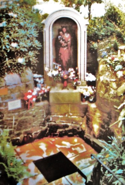
The holy well of Our Lady was fully restored in the late 17th century and a new chapel was built in 1685 when persecutions towards Catholics had eased.  Again, the place became a place of pilgrimage and many miraculous cures were being recorded there; the chapel (which is now built onto a house) being used by religious sisters as a place of retreat.  Today it is a renowned Roman Catholic pilgrimage centre with thousands of visitors coming from far and wide. The holy well stands within a rectangular enclosure with steps descending down; the well itself being a small-square shaped basin overlooked by a niche inside which stands the Virgin Mary holding baby Jesus. It is very well cared for by the Catholic community with flowers usually adorning the site during the Summer months. Coins are often thrown into the well, though it is not regarded as a “wishing well”. Visitors are always welcome and, you don’t have to be a Catholic, everybody regardless of what persuasion you are can visit the well.

References:

  1. Bord, Janet & Colin, Sacred Waters, Paladin Books 1986.
  2. Fields, Ken, The Mysterious North, Countryside Publications.
  3. Taylor, Henry, The Ancient Crosses and Holy Wells of Lancashire, Sherratt & Hughes: Manchester 1906.

© Ray Spencer, 2011


St. Helen’s Well, Sefton, Lancashire

Holy Well:  OS Grid Reference — SD 3544 0128

Getting Here

It is best to start at the Punch Bowl Inn car park, Sefton, then travel a short distance along Lunt Road by St Helen’s church. A footpath/lane is reached where a barrier stands and about 10 metres opposite the main road beneath the undergrowth is St. Helen’s holy well, or what remains of it.

Archaeology & History

St Helens Well, Sefton 1850
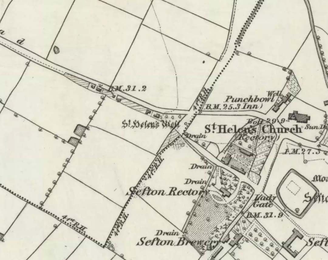
St Helen’s Well on 1850 map

The well is now, sadly, capped off with an inscribed stone that recalls ST HELEN’S WELL.  The well originally stood inside a rather nice little wellhouse with a pyramid-shaped, overlapping roof, with railings running around it.  It was renowned for its icy waters which were especially good for people suffering from rheumatism, sprains, bruising and, also nervous problems.  It had a hand pump at the side of the well-house to enable people to drink the water. But all this has now gone, though the church congregation still visit the site on the saint’s feast day and are still hoping that some day the well will be restored again.

It was probably a pre-Christian spring that in the Middle Ages turned into a pilgrimage site, especially so in the 14th century when the church was built close by.

Folklore

In pre-Reformation times it was much in use, but later on and in more recent times it had become a wishing well; pins were thrown into the well by young folk. Apparently, if the pin could be seen at the bottom of the well a favourable outcome was likely with regard to good luck in a forthcoming marriage by a couple much in love.

Addenda:

To complement Ray’s entry, here are Mr Taylor’s notes from his Ancient Crosses and Holy Wells (1906), in which he wrote the following:

“This celebrated spring rises at a distance of three hundred yards in a westerly direction from Sefton Church.  In the year 1891 the well was walled round, and a handsome canopy placed over it, from the designs of Mr John Douglas, at the cost of William Philip, fourth earl of Sefton.  The traditions connected with this holy well are thus graphically summed up in the History of Sefton:-

“”We must not omit to mention St Helen’s Well, which springs near the first cottage in the Thornton Road, beyond the inn.  Formerly a ‘pad-road’ only led from the well to the church, the Thornton Road passing through the Rectory grounds.  In the Churchwarden’s accounts we find several items of expenditure incurred for the keeping in order of St Helen’s Well.  Thus we read in 1758: ‘For a new Dish and Chain for S. Ellen’s Well, 2/-.’  Ashcroft  [writing about the year 1819] tells us ‘that this well was once in great repute for curing rheumatism, strains, bruises and weaknesses of the nerves.  It has no mineral quality, however, and he remarks that its principal virtue seems to have been its coldness.’  In different times great respect was paid to wells ’eminent for curing distempers upon the Saint’s Day whose name the well bore,’ and it was once the custom to decorate the wells of Holy Thursday with boughs of trees, garlands of flowers, etc, places in various devices, and after service in the church the parson and singers repaired to the well, where they sang psalms and prayed.  The bottom of the well, which is of no great depth and very clear, may generally be strewn with pins which are dropped in by superstitious young country folks to denote to them the probability of their marriage, which is said to be near if the pin falls pointing towards the church.  Pins and pebbles were often dropped into wells, and the circles formed thereby on the surface of the water (or the question whether the water was troubled at all) were used as omens by which the observers drew inferences of future events.  Mr Hampson, in his Medii Ævi Kalendarium, says: ‘I have frequently seen the bottom of S. Helen’s Well, near Sefton, Lancashire, almost covered with pins, which I suppose must have been thrown in for like purposes.'”

“…Mr Gregson wrote: ‘With regard to the curious frequency of well dedication to S. Helen, I formed a theory many years ago that the S. Helen of the county of Lancaster is not unconnected with the Celtic S. Elian, who is a frequent patron saint of wells in North Wales.  Do they not both draw a common ancestry from Ella, the water sprite?'”

References:

  1. Caroe, W.D. & Gordon, E.J.A., Sefton: A Descriptive and Historical Account, Longmans Green: London 1893.
  2. Taylor, Henry, The Ancient Crosses and Holy Wells of Lancashire, Sherratt & Hughes: Manchester 1906.

© Ray Spencer, 2011


Duncroisk Burn, Glen Lochay, Killin, Perthshire

Cup-and-Ring Stone:  OS Grid Reference – NN 5281 3635

Also Known as:

  1. Canmore ID 24177
  2. CEN 19 (Morris)
  3. Duncroisk 2 Carving (Canmore)
  4. Tirai Wall Carving
  5. Tullich (Morris)

Getting Here

A ring of cups, encircling cups

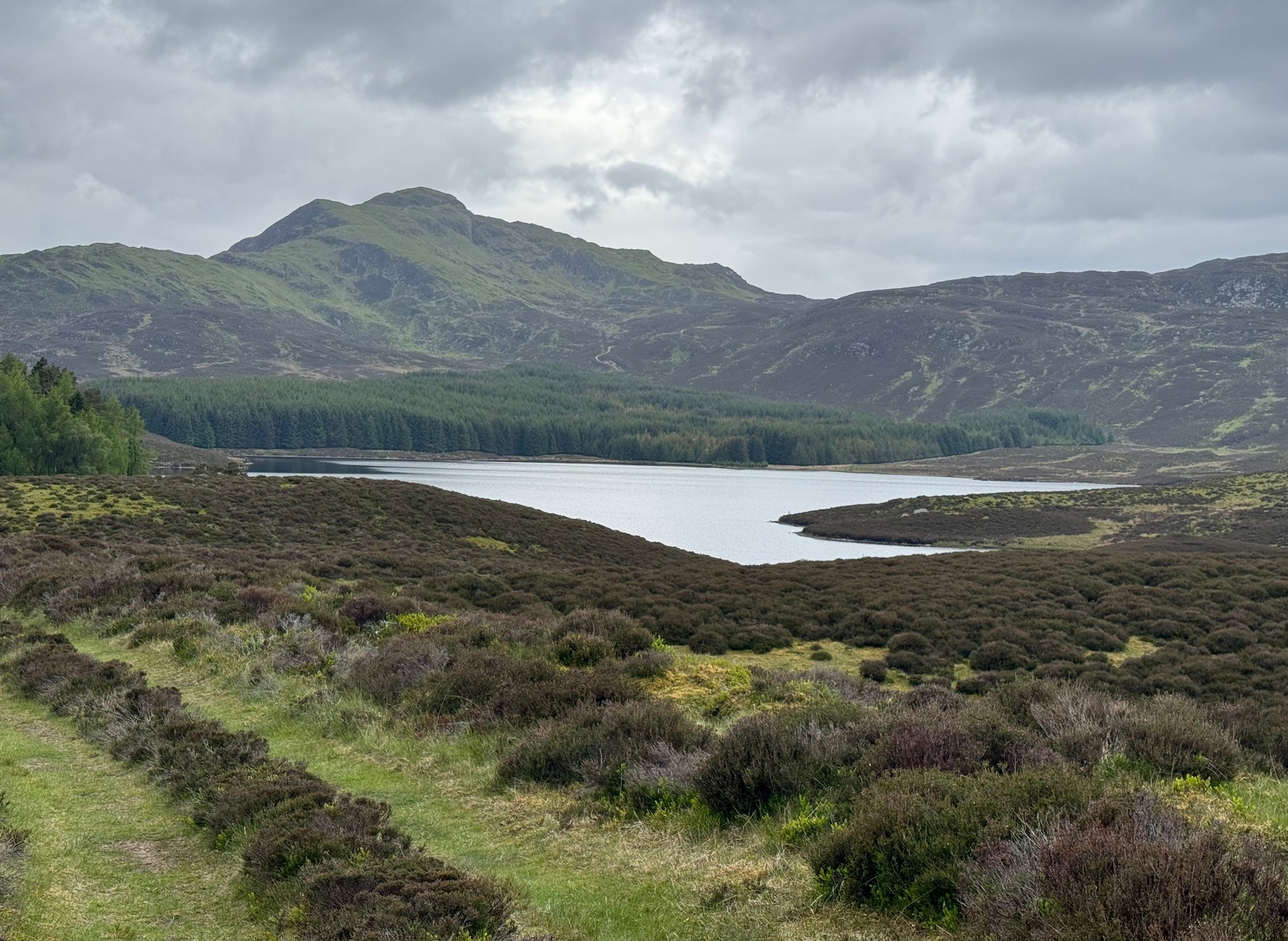
Go thru Killin and, just past the Bridge of Lochay hotel, take the tiny road on your left.  Go down here for 3 miles till you pass the gorgeous Stag Cottage (with its superb cup-and-rings in the field across the road) for another 300 yards, past Duncroisk Farmhouse set back on your right, then over the small river bridge.  Just over the bridge there’s a gate on your left.  Go thru this and up the track until you get to another large gate.  Go thru this, then walk immediately left where you’ll notice a large-ish boulder sat on the nearby slope ahead of you in a part of some very old walling.  That’s your target!

Archaeology & History

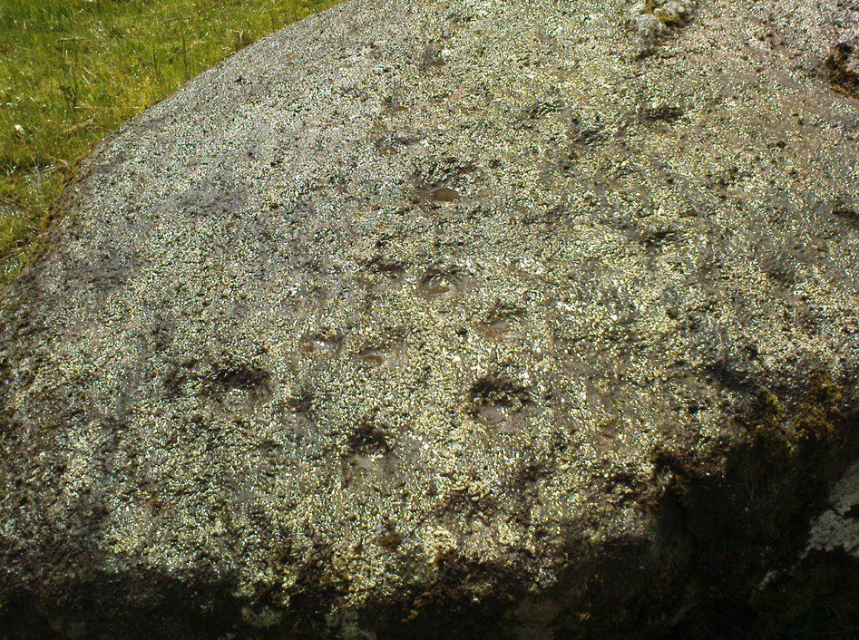
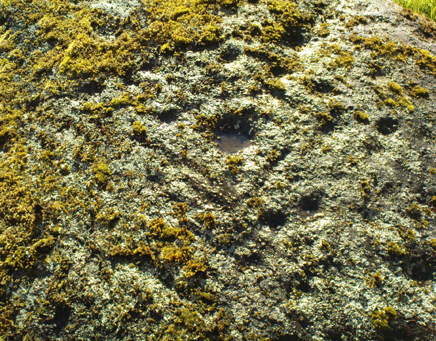
The title of this carving is slightly misleading, as the stone concerned is about 50 yards west of the fast-running burn.  But it’s pretty easy to locate.  When we visited the stone recently, as the photos show, the rock was all-but covered in a beautiful patchwork of lichen and moss, inhibiting the visibility of a quite impressive carving.  But we have to let this be.

The carving’s on the big rock by tree, in the walling
Line of walling clearly evident

The carved rock plays an important part in a line of ancient prehistoric walling, which looks Iron Age in nature, but without an excavation we’ll not know for certain.  The walling is quite extensive and is an integral part of the extended derelict village of Tirai, with its standing stones and other monuments.  This begs the questions: was the carving executed before or after the walling was created?  Was the stone carved in traditional neolithic/Bronze Age periods and later accommodated into the walling?

Even in the grey overcast light of a winter’s day when we first visited here, many cups were clearly visible on the rock’s surface, but they were difficult to contextualize in terms of artificial and natural aspects of the stone.  Later visits here at the end of Spring enabled a much better assessment — though capturing the surrounding “rings” proved difficult.  The carving is shown highlighted on Ron Morris’ (1981) map of the cluster of Duncroisk carvings, and described as a:

“domed schist boulder, 2½m by 2m, 1¼m high (8ft x 6ft x 4ft).  On its top, mostly where sloping…are: 2, and possibly 3, cups-and-one-ring, much weathered and only visible when wet in very low sun, probably un-gapped, and at least 32 cups.  Diameters up to 17cm (6½in) and depths up to 1cm.”

But this is only half the story.  Despite what Mr Morris and the more recent Canmore records tell us about this carving, there are in fact at least 52 cups on the surface of the rock, at least two of which have definite ring-like forms around them.  The largest of the cups has linear features around a large section of it, but to ascribe these elements as ‘rings’ is also stretching it a bit — as one of the photos here clearly shows.  The ‘ring’ consists more of two separate straight lines with curvaceous ends: more like a right-angled carving with a swerve than any traditional ring.  It’s a quite unique feature by the look of things.

Faint cup-and-ring and cups…and…
Cups & right-angled lines

The majority of the carved cups and lines occur on the eastern side of the boulder, with only a few singular cups almost fading their way onto its western sloping sides.  And of primary visual interest are the swirl of cups that surround two small cups at the ESE corner of the rock.  These give the impression of running into another swirl of cups that hedge their ways around the edges of the largest cup-and-right-angled-lines, until bending back up and along the southern-side of the stone.  This possibly deliberate sequence of cups then continues in roughly the same form back upwards to near the top-middle of the rock and onto a complete cup-and-ring.  Just above the top of this runs a short pecked line just detached from the cup-and-ring, but of obvious mythic relevance in the story which this carving once told.

RWB Morris’ sketch of the design

It’s an absolutely fascinating carving which gives the distinct impression of narrating a myth of journeying, by either a person, tribes or ancestral beings.  Of course we’ll probably never know for sure what story it once told; but its tale may have been known by the people of the once proud village of Tirai which was only destroyed a couple of centuries ago, along whose fallen walls this great stone still rests within…

And finally, for those students exploring the potential relationship that cup-and-rings may have with water: please note that in wet conditions, a spring of water emerges right underneath the very base of this large rock.

…to be continued…

References:

  1. Morris, Ronald W.B., The Prehistoric Rock Art of Southern Scotland, BAR 86: Oxford 1981.
  2. Royal Commission on the Ancient & Historical Monuments of Scotland, Archaeological Sites and Monuments of Stirling District, Central Region, Society of Antiquaries of Scotland 1979.

© Paul Bennett, The Northern Antiquarian


Loch Glassy, Weem, Perthshire

Sacred Loch:  OS Grid Reference – NN 850528

Also Known as:

  1. Loch Glassie

Folklore

Here we have another case of another loch in Scotland that was said by local people to be inhabited by legendary water monsters.  In the tale which follows we may simply have a case of a very bad accident that was, in more superstious times, bestowed upon this legendary animal.  We may never know.  James Kennedy (1928) told the story, saying:

“It was inhabited, like Loch Derculich, by the ‘Each Uisge‘ of Icelandic origin.  On summer evenings it could be seen roaming at large on a green meadow adjacent to the tarn, and to all appearance a canny enough creature.  One summer Sunday afternoon, six Strathtay girls and a boy set out from their homes to inspect the ‘Each Uisge.’  They found him, patted him on the head and neck, and this kindness is apparently relished, for it lay on the sward and allowed them to sit on its back.  The boy, who had a semi-bald scabbed head, stood at a distance and watched developments.  He concluded that this animal was not the genuine horse it seemed to be, and thought that it grew considerably larger than it was at first.  When the Each has the six girls comfortably seated on its back, it suddenly rose, plunged into the loch, and drowned the lot.  The boy immediately took to his heels and the Each after him, but fear enabled the boy to outstrip the horse, who would stop now and again in the pursuit and cry, “Fuirich mo ghille maol carrach!  Fuirich mo ghille maol carrach!” — Stop, you bald scabbed-headed boy.  Ultimately the Each gave up the chase, and the boy, much frightened, got safely home and related all that happened on that eventful Sunday evening.  The parents of the girls found parts of their bodies floating on the waters of the loch, and the name Loch Lassie was given to it, which it retains to this day.”

References:

Kennedy, James, Folklore and Reminiscences of Strathtay and Grandtully, Munro Press: Perth 1928.

© Paul Bennett, The Northern Antiquarian

Loch Derculich, Dull, Perthshire

Sacred Loch:  OS Grid Reference – NN 864 549

Folklore

Although this upland loch is today renowned as little more than a decent fishing spot, the waters here were long known to be haunted and the abode of a legendary water spirit.  In local tradition, the loch is said to be named after “an ancient Chief of Pictish origin” — whose burial mound is nearby — and in James Kennedy’s (1928) fascinating folklore work he also told that,

“Loch Dereculich was the habitation of a ‘Tarbh Uisge’ (water bull), the dangerous water demon… This dreaded monster, as the Norwegian peasant will gravely assure a traveller, demands every year a human victim, and carries off children who stray too near its abode… Less than one hundred and twenty years ago, the Loch Derculich Water Bull was seen sauntering along its shores.  At peat-making times it was observed very frequently.”

References:

  1. Kennedy, James, Folklore and Reminiscences of Strathtay and Grandtully, Munro Press: Perth 1928.

© Paul Bennett, The Northern Antiquarian

True Well, Oakworth, West Yorkshire

Healing Well:  OS Grid Reference – SE 0272 4017

Getting Here

Modern True Well troughs

Take the Oakworth Road outta Keighley, turning right after a quarter-mile up Fell Lane.  Go all the way up the very end (a mile or so), turning right at the end.  After 100 yards or so, go up the track to the True Well Hall equestrian centre.  As you approach the farmhouse, look on the grassy slope to the left and you’ll see a small run-down stone structure in the field above you.  That’s it! 

Archaeology & History

This is a curious site by virtue of so little being said of it, despite some modern proclamations of it having pagan values.  Even the local historians say little on the place, with William Keighley (1858) being our notable exception.  In his notes on the erroneous dedication of the Jennet’s Well to a fictitious saint of the same name, he mentions this once important water supply, writing:

“Westwards of Jennet’s Well there was another fountain, emphatically styled the ‘true well’, and probably from its once boasted efficacy intended as a rival to the former.  This spring though no longer remembered for its healing qualities, evidently gave name to the farmhouse denominated ‘True Well Hole.'”

In Wright’s Dialect Dictionary (1898) we find the word ‘trew’ — also written as ‘true’ or ‘trow’ — could mean “to trust, believe, feel sure”, which may be applicable in terms of the value of the waters that once flowed here.  We may never know.  Though note should be made of the error at a recent exhibition in Cliffe Castle museum, where the 1842 Tithe Awards map of the region was copied and the field-names listed, showing the old True Well erroneously displayed as the ‘Time Well’.  I assume they must have had a long day when they were copying the notes…!

Spring behind True Well Hall

A little further along the track running beyond True Well Farm we find another spring of water emerging from the grassy hill and which, perhaps, relates to the True Well.  On the 1852 OS-map, we see a ‘trough’ shown in front of the farmhouse and not in the position where the modern map shows the True Well to be — and where the recent stone-worked trough in the photo is shown.  In fact, on the 1852 map, no such well nor stonework is shown in the position presently deemed to be where the True Well is supposed to be, so the original position of the well is unclear.  Is it possible that the spring of water which runs from the hillside behind True Well Farm may have been the site which gave this spot its name.  Certainly the water from this spring is quite fresh and drinkable.  If anyone knows owt more about the history of this curious site, it would be good to hear from you.

References:

  1. Keighley, William, Keighley Past and Present, Arthur Hall: London 1858.

© Paul Bennett, The Northern Antiquarian