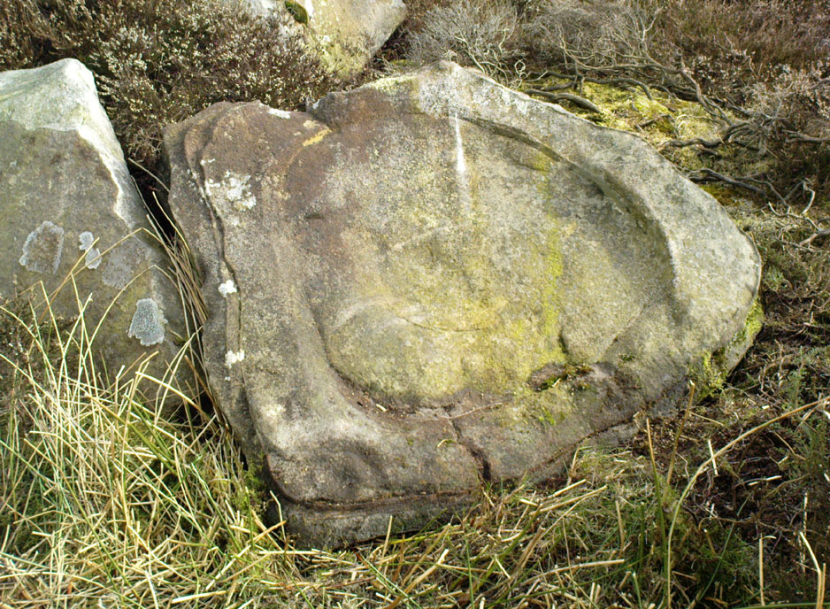
Angel Moon Field, Ferrybridge, West Yorkshire

Tumulus (destroyed):  OS Grif Reference – SE 4734 2449

Also Known as:

  1. Mound 1 (Pacitto)
  2. Roundhill Field

Archaeology & History

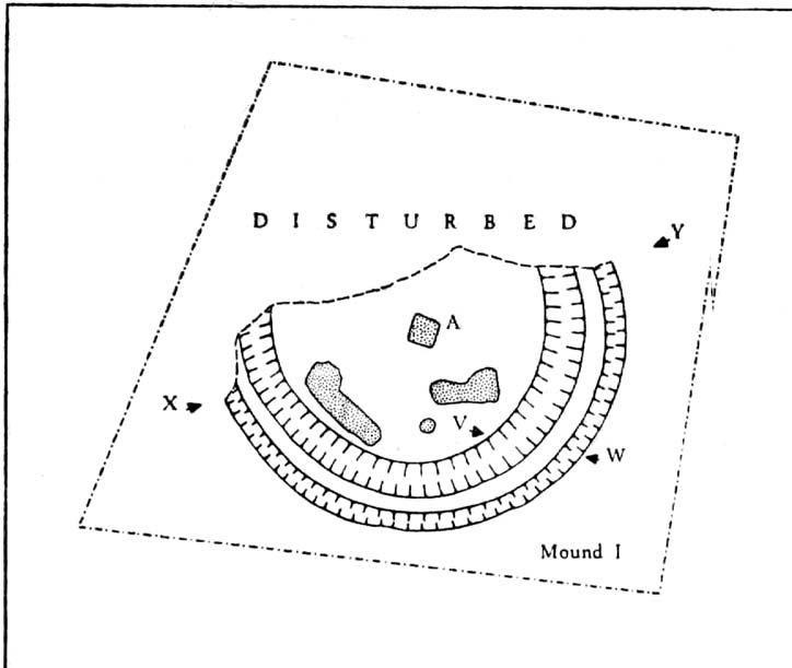
Pacitto’s plan of the tomb (after YAJ, 1969)

One of a number of sites that used to exist in this part of West Yorkshire before the coming of the Industrialists and their ecocidal ways.  Found in conjunction with the Round Hill Field tumulus 53 yards to the south, this fallen monument was thankfully looked over several times before its final demise when the power station was built. The first literary account of it seems to be Forrest’s (1871) local history work, soon followed by another dig by the legendary tomb raider, William Greenwell. (1877)  Both of these digs were very good indeed and give us the most detailed account of the remains here.

One of the urns found in the mound (Forrest 1871)

The name of this tumulus and the nearby Round Hill site needs some clarification before continuing to the archaeological account.  In both Forrest and Greenwells’ accounts, they each named this site as the ‘Round hill tumulus’, but since their original fine work, archaeologist A.L. Pacitto (1969) and his team found the other previously unrecorded tumulus and surrounding ring-ditch in the original field called Roundhill field.  Old records showed that a wall or fence once ran between the two sites, and that the tumulus which Forrest and Greenwell previously called the Roundhill site was actually located in the curiously named ‘Angel Moon field’ — hence the change of name in this (and Pacitto’s) account. (if y’ get mi drift) It’s an important point.  So as you read the accounts below, where the authors describe the Roundhill tumulus, they are in fact referring to this, the Angel Moon tumulus.  Gorrit?  OK!

The site was noted for the first time as a tumulus by the local owner of the land here, a Mr Hall, in 1811, who wanted it levelled and attempted,

“to remove it altogether, but so many human bones were then met with, that after removing a considerable portion, it was abandoned, and the exhumed bones removed to the neighbouring churchyard of Ferryfryston.”

Mr Forrest then said:

“We are told by an eye-witness that on this occasion two plates of metal were found, but of what kind of metal pr what became of them we have no certain information.”

Thereafter began Forrest’s lengthy account of the initial excavation of the Angel Moon burial mound, undertaken (I think) by himself and other locals.  Readers will hopefully forgive the lengthy profile I’ve given this place, but I know it will be of interest to local historians in the Pontefract and Ferrybridge area:

“This Tumulus, which is situated in Roundhill Field, on the left of the road leading from Ferrybridge to Castleford was first opened on March 28th, 1863. For the sake of ascertaining its structure, a trench was dug on the side not previously disturbed, to within a few feet of the centre, but without result, except ascertaining that the material gradually changed from sandy gravel to large stones as the middle was approached, and that it had been raised upon a natural swell of the strata, thus offering a dry situation; a condition about which the ancients appear to have been solicitous in choosing the sites of their sepulchral mounds. They then began to dig at the top, and immediately under the sod lay two human skeletons, one upon the other, with no more than six or eight inches of soil upon them. Near them lay portions of two antlers of…red deer, the uppermost skeleton was that of a tall adult male, the teeth nearly entire and in fine preservation, the other was of shorter but stouter proportions, the feet of both were gone, probably by the diggers in 1811, who it is conjectured had previously discovered these remains, and covered them up, with the few inches of soil, under which we found them; they had evidently not been removed, all the bones present being in their natural position, the whole of the bones and horns were much crushed and broken by the superincumbent earth which must once have covered them.

“With them were found several detached pieces of what appeared to have been the tusk of some animal, probably the wild boar, and fragments of half-baked pottery which on comparison were found to be portions of two urns of the early British type, such as are usually found in grave-hills attributed to that period.  The smaller one (of which the principal portions were recovered) was of the size and much of the shape of an ordinary breakfast cup, three inches high, scored all over with vertical indentations as if by a piece of flint. The other was much larger, more elegant in shape, on which considerable taste was displayed in the ornamentation, composed of parallel lines, chevrons, zigzags and punctures, in which a dextrous use of the twisted thong was evident; this was ten inches high.

“About eighteen inches to the left of these, and a few inches deeper, lay the skeleton of another person, who had evidently lived to a great age, the teeth being worn nearly to the roots, tho’ showing no signs of decay. All the three lay east and west as in the present mode of Christian sepulture. No other human or animal remains were found, nothing metallic, or any implements, no appearances of cremation, no ashes, neither did the urns appear to have contained any, no stones to indicate that a cist had enclosed them, they had been buried in the soil, which here only differed from that surrounding it, in its somewhat darker colour.

“Digging downward, immediately under the skeletons first discovered, a large rough slab was reached at the depth of four feet from the surface. Its removal disclosed a stone cist or grave, of which it had formed the cover, composed of four rough stones set on edge, and paved with smaller pieces at the bottom; width at the head 2 feet, at the feet 1 foot 5 inches internal dimensions. It was entirely filled with small gravel, in which was interred the skeleton of an adult male, apparently of large stature, the thigh bones measuring in length 19¾ inches, the leg 16 inches. The knees were bent up in the manner in which such interments are usually found, and the face toward the south.  The skull was accidentally broken, but well developed, and indicating the age about forty. The teeth were all present, and in beautiful preservation, the enamel white and bright as in the living subject.  In front of the breast was an urn, laid on its side, of very coarse make, imperfectly baked, and so fragile, that on the most careful attempt to remove it, the urn crumbled into fragments, the whole was however collected, and sufficed to give a correct idea of its size, shape and ornamentation. It contained nothing but small gravel, like that in which it was laid. Near it was a small chipping of flint with a cutting edge, 2½ by 1¼ inches, this was the only article having any resemblance to a tool or implement hitherto met with.

“The cist being filled with gravel, I suppose to be an unusual circumstance.  It could not have penetrated through any fissures in its sides, neither was the cist likely to have been opened subsequently, as nothing appeared to have been disturbed.

“Proceeding downward, it was seen that this cist was built upon and its sides supported by large rough stones inclined towards it ; the surrounding gravel was mixed with fragments of human bones, small pieces of urns, and occasionally bits of charcoal, and in a cavity a piece of wood was found but so decayed that its original shape or purpose could not be ascertained. Among the bones was a portion of a skull, showing a fracture from which the subject had recovered.

“At about the depth of seven feet, and a little to the east was a flat stone laid horizontally, length 4½ feet, width 3 feet, under this was a layer of dark earth two or three inches thick, totally different from that surrounding it, inodorous, and in which was no perceptible trace of animal remains, but exhibiting hollow casts of something resembling stone fruit about 1 inch long by ½-inch wide. Near this was found a thin stone of a round or oval shape about 6 inches broad, apparently chipped to shape and having a rough cutting edge ; its use can only be conjectured.

“At the depth of nine feet, the native rock was reached in which was a cavity about ten inches deep, but as far as could be ascertained containing nothing but gravel mixed with bones like the surrounding part.

“From observations then made I came to this conclusion: that the mound had been used for interments anterior to the formation of the cist, on which occasion, its upper part was levelled to make a convenient platform for it ; when the bones of former interments were disturbed and scattered about with as little respect for the dead as would a modern gravedigger; in making room for a new occupant.

“The fact of the three skeletons first noticed being interred after the Christian mode, is presumptive evidence that they were Saxons. It is well ascertained that this people had their coming here, frequently buried their dead in British tumuli, even after they had embraced Christianity, which occasioned an edict to be published in the year 987, prohibiting this practice, and providing that no Saxon should be buried in the tumuli of the Pagans, but only in the cemeteries of the churches, neither do urns nor antlers (which are undoubtedly British) militate against this supposition, when it is considered that they were all fragmentary, and as the skeletons with which they were, had evidently been disturbed though not removed, it is very probable that these fragments had been taken from that part of the mound removed in 1811, and thrown among these bones in the random manner in which we found them.

“From all these circumstances, this barrow appears to have had a very early and prolonged existence as a place of sepulture. The cavity in the rock was probably the grave of the first interment. The fragments of bones under and around the cist show that interment had taken place before its formation. The absence of any evidence of cremation either in the cist or elsewhere, shows that these interments were prior to the introduction of that ceremony from the nations with whom the Britons afterwards had intercourse. The absence of any weapon or other instrument save the single chipping of flint, and the roughly fashioned stone and the rudely found urn of clay, all go to prove that this was one of the very earliest of British Barrows. And if my hypothesis as to Saxon burial be admissible it will bring its sepulchral history down to the Christian era.

“At the upper end of the field are some earthworks of considerable depth, but as the whole is under cultivation, their form and purpose can scarcely now be determined.”

A few years later the legendary tomb raider Mr Greenwell and his mates turned up and gave the site their additional attention.

“On this occasion the digging commenced on the east side, where a deposit of burnt bones was found upon a flat stone just above the surface, and ten feet from the outside.  Six feet to the north of this was another similar deposit laid upon the natural surface. Five feet south of the centre, was an unburnt body, doubled up and on its right side, with its head to the south. Immediately beneath, and in close contact with it, was a burnt body, apparently deposited at the same time. These interments in opposite customs present very interesting features in British sepulchral usage, as if the practice of cremation though at one period generally adopted, was not universal, but influenced by the wish of the deceased, or the inclination of surviving friends. With these remains were found an urn, of beautiful type, 4½in high, ornamented outside with twenty-seven thong markings, it would be impossible to decide to which of the bodies this belonged, such urns are found with both modes of burial.

“These deposits of burnt bodies were all found on the south-east side of the tumulus and consequently none were met with during the partial examination in 1863; but as the diggers in 1811 commenced at that point, they must have found and removed several such.

“As the work proceeded, the large flat stone covering the deposit of dark earth, was again met with ; and southward of this was another similar deposit also covered by a stone.  In this earth was found a small seed pod or fruit, with striated markings, about nine lines in length, and black as the soil in which it was found ; its size and shape suggest the idea, that such fruit might have been the occasion of the hollow cists observed in the first discovered deposit.  Close to these deposits was one of very dark sand, inclined to dark red or chocolate colour in some parts, this had evidently been subjected to the action of fire.

“The tumulus was so far removed, as to reveal the nature of the surface on which it had been built, which proved to be a natural outcrop of the limestone rock, and upon it these dark deposits were found. Their origin and purpose, offer an interesting subject of enquiry to the Archeologist. Their situation on the edge of the projecting rock is suggestive of their sacrificial character, or their connection with some of the druidical rites of the ancient Britons. The burnt sand may mark the site of the place where the act of cremation had been performed.

“The next object of interest was the rock grave, the edge of which had been reached in 1863, but reluctantly abandoned. This was found, and proved to be a large circular one, nearly six feet in diameter, and two feet six inches deep. At the west end was a rudely-formed cist, filled with gravel like the first one, in which was found a body, bent up in the usual manner, lying on its right side, and with its head to the south-west.  At its feet was a drinking cup laid on its side, height seven inches, profusely ornamented with thong markings, consisting of three sets of horizontal lines filled up between with vertical lines, below these, and between two more horizontal lines, was a line of zigzags, the lower triangles of which were filled up with horizontal markings. The same pattern occupied the upper and lower halves of the vase. In the hollow of the knees was found a bronzed pin much oxydized, about 1½in. long, this might have been used to fasten some portion of the dress in which the person had been buried. It was the only piece of metal found in the tumulus, with the exception of that found in 1811, which is now supposed to have belonged to an Anglo-Saxon, buried with sword, spear, shield, etc.”

Then in 1962 came the final examination here, shortly before the site’s destruction.  Pacitto (1969) and his team didn’t really find much more than his Victorian predecessors, apart from a couple of flints, some other fragments of bones and some modern bits and bats.  However,

“The mound was surrounded by two concentric ditches, respectively 55ft and 75ft in diameter.  The outer ditch was only a few inches deep, but the other had been cut into the limestone (my italics, PB) to a depth of 2ft 6in”

References:

  1. Forrest, C., The History and Antiquities of Knottingley, W.S. Hepworth: Knottingley 1871.
  2. Greenwell, William, British Barrows, Clarendon Press: Oxford 1877.
  3. Pacitto, A.L., “The Excavation of Two Bronze Age Burial Mounds at Ferry Fryston in the West Riding of Yorkshire,” in Yorkshire Archaeological Journal, volume 42, part 167, 1969.
  4. Roberts, I. (ed), Ferrybridge Henge: The Ritual Landscape, WYAS 2006.

© Paul Bennett, The Northern Antiquarian

Round Hill Field, Ferrybridge, West Yorkshire

Tumulus (destroyed):  OS Grid Reference – SE 4733 2444

Also Known as:

  1. Mound 2 (Pacitto)
  2. Roundhill Field

Archaeology & History

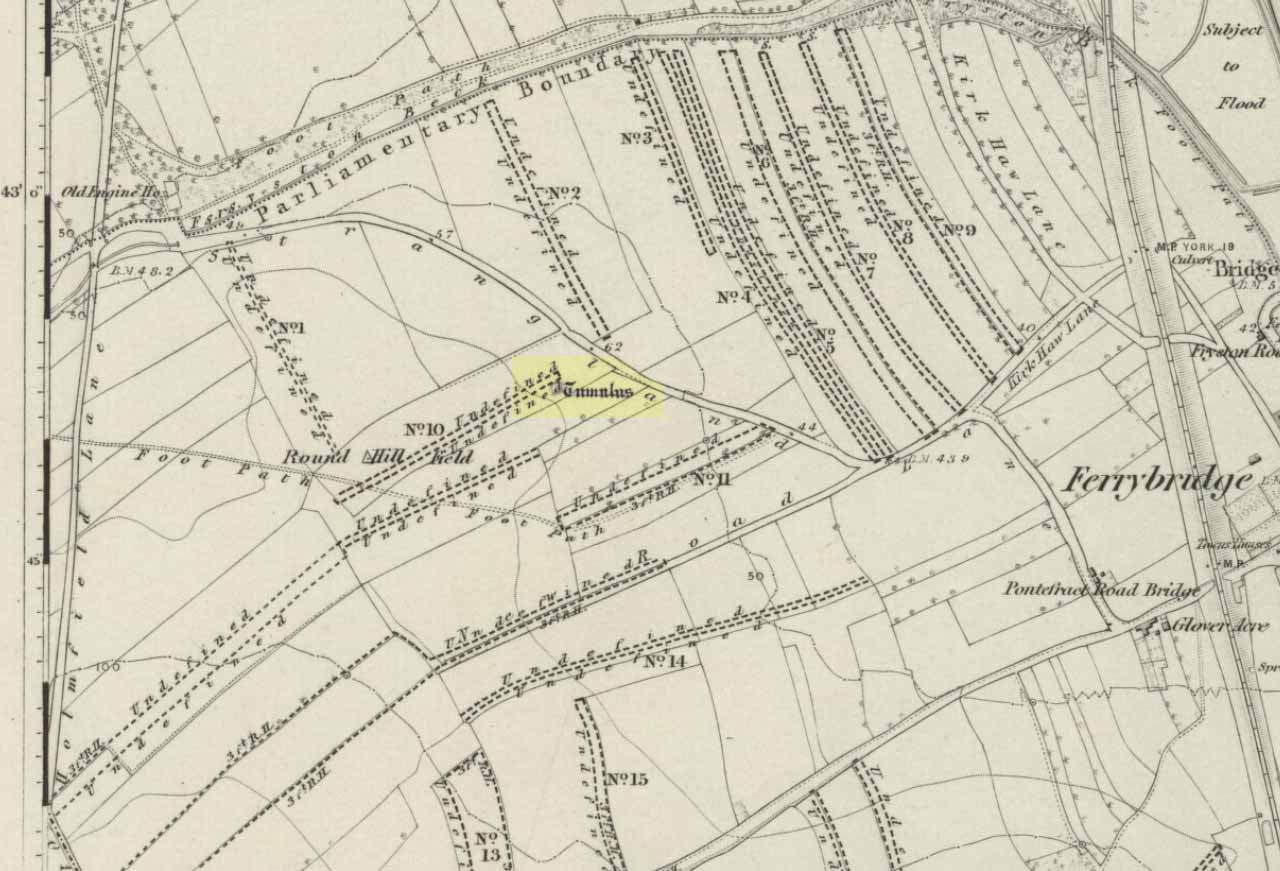
Tumulus on the 1852 map

Close to the important ceremonial monument of Ferrybridge Henge could once be seen be this singular grave and ring-ditch, 53 yards north of the curiously-named Angel Moon tumulus. But, thanks to that regular ingredient of self-righteous industrialism, neither of the sites exists anymore.  It had initially been damaged by some agricultural ignorance (they like to the PR-term ‘agricultural improvement’), but was thankfully rediscovered following excavation work on the Angel Moon site by A.L. Pacitto in April 1962, in advance of the construction of the Ferrybridge C power station. (in truth, the exact position of this Round Hill tumulus was in an area that has not been built onto, at the southeastern edge of the modern car-park on the grassy area next to the trees; showing that it could have easily been preserved).

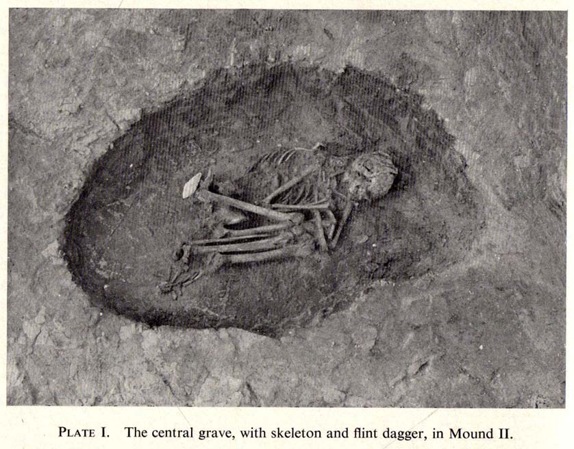
Roundhill tomb skeleton
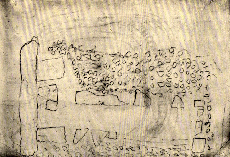
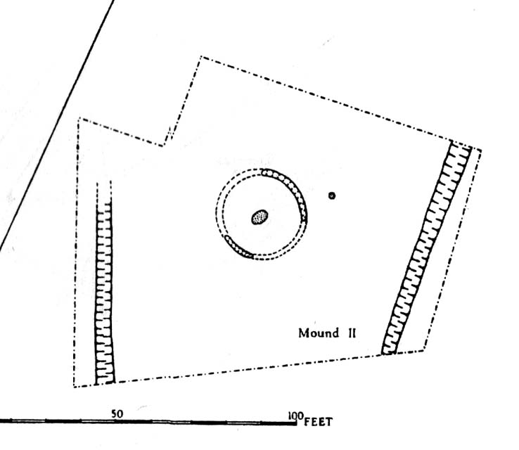
Roundhill tomb plan

The site was certainly an important one amidst what Ian Roberts (2006) called “the ritual landscape” in this part of prehistoric Airedale.  When the archaeological team came to do their work here, very little of the monument could be seen on the surface—Mr Pacitto described it as “barely perceptible”—but they were both pleased and surprised at what they found.  Detailing their excavation work, Pacitto (1969) wrote:

“Natural rock was found immediately below the ploughsoil, and it had been scored by ploughing.  In view of the complete lack of stratification the first traverse of the (Drott) machine was arranged so that it cut across the mound from side to side, with one edge coinciding with a line drawn through the centre.  This first traverse exposed half an oval grave pit, measuring 3ft 9in by 5ft.  On excavation it proved to be only 5in deep, but in spite of this it contained an undisturbed crouched inhumation.  The body was on its left side, facing south, and a notched flint dagger behind the pelvis was perhaps attached to a belt at the time of burial.  The dagger…is very neatly flaked from a fine flint with a pale blue patina.  It has three notches on each side of the haft and is very similar to one found in Doncaster in 1935.  The filling of the grave also included several fragments of human bone, one of which had been calcined.

“The grave was surrounded at a distance of 11ft to 12ft by the remains of a circular ditch.  Only two segments of this had survived, representing less than half of the total circumference.  Doubtless ploughing had destroyed much of the original rock surface.

“Outside the ditch and 20ft to the southeast of the grave was a small circular pit.  With a flt bottom and vertical sides, it measured 2ft 3in in diameter and was 1ft 2in deep.  The filling was mainly of broken and crushed limestone fragments, and there was no clue to its date or purpose.  This pit was sited on the line of an east-west fault or joint in the rock.”

References:

  1. Forrest, C., The History and Antiquities of Knottingley, W.S. Hepworth: Knottingley 1871.
  2. Pacitto, A.L., “The Excavation of Two Bronze Age Burial Mounds at Ferry Fryston in the West Riding of Yorkshire,” in Yorkshire Archaeological Journal, volume 42, part 167, 1969.
  3. Roberts, I. (ed), Ferrybridge Henge: The Ritual Landscape, WYAS 2006.

ACKNOWLEDGEMENTS:  Huge thanks to the Yorkshire Archaeological Society for use of images in this site profile.

© Paul Bennett, The Northern Antiquarian

Heyshaw Moor (north), Dacre, North Yorkshire

Cairns:  OS Grid Reference – SE 16218 63253

Getting Here

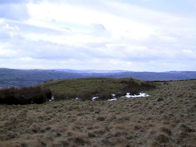
Heyshaw cairn, looking NW

From the road between Pateley Bridge and Summerbridge, the B6165, turn down to Glasshouses, following the road through the village and round past the reservoir; then as the road bends, keep to your left and go the steep zigzaggy hill, stopping where a gravel parking space is on the right-hand side of the road, by the bend.  From here, cross the road and walk up the footpath to Yorke’s Folly.  Go over the wall and along the footpath by the wall (the Nidderdale Way) for a coupla hundred yards.  Then turn into the heather about 50 yards up from the walling.  Look around!

Archaeology & History

Heyshaw Moor cairn no.1

There’s no previous reference to this site.  It was found yesterday and is one of several such small heaps of stones (cairns) found along the flat ridge of moorland just south the hugely impressive of Guisecliff Crags on the northern edge of Heyshaw Moor.  The one illustrated here is probably the best of the several we found and may be indicative of a previously undiscovered cairnfield.  On a visit to the western side of the moors a few months ago we found another small cluster of similar cairns in very good condition, much like the one pictured here.  It would appear to be prehistoric in nature — although the existence of an old track that ran nearly 20 yards to the west may indicate its previous use as a marker cairn.  On the slopes below here (north) there are several examples of cup-and-ring stones, which tend to indicate the proximity of prehistoric graves.  This cairn could well be such marker.

We also found evidence of other early human remains on this ridge and further up the moor (walling, rectangular building, possible cairn circle), but there appears to be no literary information explaining its nature.  Further visits are needed here.

© Paul Bennett, The Northern Antiquarian

Wytchley Warren, Edith Weston, Rutland

Tumulus (destroyed):  OS Grid Reference – SK 961 052

Also Known as:

  1. Wicheley Warren

Archaeology & History

This tomb and, it would seem, another 200 yards away, have long since been smashed up.  The only decent reference to the site comes from Reginald Haines’ address to the Society of Antiquaries in January, 1903, where he told:

“In a quarry worked for freestone on Major Brathwaite’s land…was found in 1900 a skeleton, probably neolithic.  The body was in a crouching position, with ‘the knees tucked under the chin,’ at a depth of about 3 feet.  Unfortunately, no one interested in such things was at hand, and the remains were incontinently thrown aside and (are) presently buried under a mass of rubbish from the tunnels which were being worked for stone.  Mr V.B. Crowther-Beynon was only able to recover a few teeth, though he seems to have found a few fragments of animal bones and bits of pottery at or near the spot.

“In December 1901, at a point about 200 yards from the last, where a fresh excavation was being made, a second interment was found.  In this case the soil containing the remains came down in one block, and a few broken fragments of bone came to light, with a lower jaw.  The jaw is now in Mr V.B. Crowther-Beyson’s possession, who communicated with Lord Avebury on the subject, sending the jaw, and received the following reply:

“‘to judge from your description (i.e., of the interment) it is certainly probable that the interment you mention belonged to the stone (neolithic) age.  This, however, in the absence of weapons or implements, cannot be put higher than a probability.  I think that lower jaws like very this might be found among our existing people, though I fear with hardly such good teeth.  Their soundness and the way they were worn point strongly to a great antiquity.’

“Near the second interment occurred little patches of burnt soil of a conspicuously red colour.  These may have been the sites of hearths.”

Mr Haines makes a final note about the scarcity of prehistoric remains found hereby, saying that “the only other relics of the stone age that claim notice here are an arrow-head of flint, picked up in a field near Market Overton in November 1990, by Mr Wing” — which is quite a distance away!

References:

  1. Haines,  “Prehistoric Graves at Wicheley Warren,” in Proceedings of the Society of Antiquaries, volume 19, no.2, 1903.

© Paul Bennett, The Northern Antiquarian

Lippersley Pike, Denton Moor, North Yorkshire

Cairn:  OS Grid Reference – SE 14335 52478

Getting Here

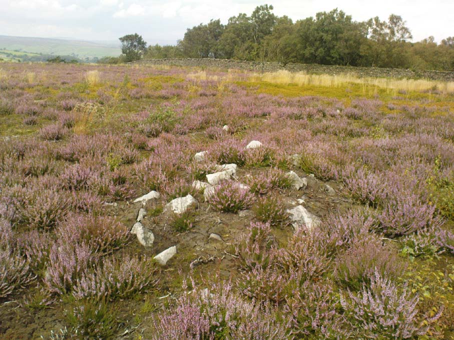
Follow the directions to reach the Lippersley Pike cup-marked stone, then keep walking westwards, but go up the slope immediately on your right (north) and walk upwards along the path to the notable stone structure at the top-end of the ridge a coupla hundred yards ahead.  Once there, you’re standing on it!

Archaeology & History

Lippersley Pike & shooter’s butt

A little known site with some excellent 360° views all round, reaching as far west as Pendle Hill, north past Simon’s Seat, and east onto the far reaches of the North York Moors.  The landscape here is truly superb!  And humans have been here since, it would seem, mesolithic periods at least, if Cowling’s finds are owt to go by! For although he described the much denuded tomb that we can still see under the herbage and recently-built shelter, there was also, “on the northern slope…a small occupation immediately below the summit on the northern side.”  We found remains of it on our visit here the other day.  But of the tomb itself — which Mr Cowling thought was neolithic in age — he wrote:

“The highest point of Lippersley Pike, on Denton Moor, is crowned by a stone cairn 1083 feet above sea level, and overlooks, on the northern side, a small site which appears to have been occupied by the ‘Broad Blade’ people, for there occur several pieces of patinated flint, along with scrapers and worked blades.”

Aerial view of Lippersley Pike

Cowling then describes a number of flints and other prehistoric working utensils that he found all round here.  The remains of the cairn measure some 25 feet east-west and 23 feet north-south.  There has been no excavation here, although the fella’s who dug out much of the stone to build the shooter’s butt on its top may have found summat, but have kept it quiet!

The cairn is an ancient marker along the boundary line marking the townships of Denton and Great Timble and was visited in perambulation walks in previous centuries.  Grainge (1871) describes the extensive perambulation in his Knaresborough Forest work.  ‘Lippersley’ itself first appears in records from 1576, although A.H. Smith (1963:5) does not suggest an etymology.  The place is worth visiting as a good starting point to explore the other little-known prehistoric remains on these moors, including the Crow Well settlement, the Heligar Pike tomb, etc, etc.

References:

  1. Cowling, E.T., Rombald’s Way: A Prehistory of Mid-Wharfedale, William Walker: Otley 1946.
  2. Grainge, William, The History and Topography of Harrogate and the Forest of Knaresborough, John Russell Smith: London 1871.
  3. Grainge, William, The History and Topography of the Townships of Little Timble, Great Timble and the Hamlet of Snowden, William Walker: Otley 1895.
  4. Smith, A.H., The Place-Names of the West Riding of Yorkshire – volume 5, Cambridge University Press 1963.

© Paul Bennett, The Northern Antiquarian

Pillar of Eliseg, Pentrefelin, Llangollen, Denbighshire

Cross:  OS Grid Reference – SJ 20267 44522

Also Known as:

  1. Eliseg’s Pillar

Getting Here

The Eliseg Pillar

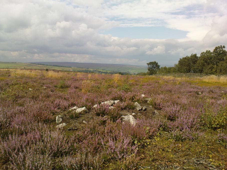
From Llangollen, take the A542 north for about three miles up along the famous Vale of Llangollen.  At the ruined abbey of Valley Crucis continue along the same road for another ½-mile whence, at the side of the road in a field and upon a small mound, stands the ancient monument: the Pillar of Eliseg.

Archaeology & History

The sandstone pillar or pillar-shaft stands upon a large square-shaped base stone which sits atop a tumulus — a Bronze Age burial mound (cairn) inside which were found, during excavations in 1803, the remains of a body, perhaps that of a Romano-British or Dark-Ages chieftain (possibly Eliseg?), with what were described as “blue stones” both beneath and on top; the cremated body lying within a stone-slab chamber along with a silver coin.  But the ancient pillar monument itself is much later in date — probably mid-9th century AD, though there has been speculation by some historians that the pillar was actually a tall cross, alas without its head, dating from a couple of centuries earlier, with the inscription being carved onto it sometime between 840-845 AD.  It was erected by Prince Cyngen fab Cadell (Concenn) about the year 844 in memory of his great-grandfather Eliseg or Elise.  Cyngen died in Rome in 854 AD.

Over the centuries the pillar has suffered from the ravages of time.  Its long Latin inscription was originally 31 lines divided into readable paragraphs running horizontally but now only 7 or 8 of these lines are visible.  But fortunately the writer and historian Edward Lhuyd made a drawing of the monument and its inscription back in 1696.  The inscription when translated reads as follows:

1. Concenn son of Cadell, Cadell son of Brochmail, Brochmail son of Eliseg, Eliseg son of Guoillauc

2. Concenn therefore being great-grandfather of Eliseg erected this stone to his great-grandfather Eliseg

3. It is Eliseg who annexed the inheritance of Powys…throughout nine (years) from the power of the English which he made into a sword-land by fire

4. Whosoever shall read this hand-inscribed inscription stone, let him give a blessing on the soul of Eliseg

5. It is Concenn Who…with his hand…to his own kingdom of Powys…and which…the mountain…the monarchy Maximus…of Britain…Concenn, Pascent…Maun, Annan.

6. Britu, moreover, (was) the son of Guorthigirn (Vortigern) Whom (St) Germanus blessed and whom Severa bore to him, the daughter of Maximus the king who slew the king of the Romans and

7. Convarch painted this writing at the command of his king Concenn

8. The blessing of the Lord (be) upon Concenn and all members of his family and upon all the land of Powys Until the day of judgement or doom. Amen.

The upper section of the pillar, which is broken at the top, was re-erected on top of the burial mound in 1779 which probably means that the monument is not in its original place.  The lower section was sadly broken away from the shaft during the English Civil war and has long since disappeared. However, this monument is still quite an impressive site and can be seen from a great distance around.

References:

  1. Bartrum, P.C.,  Early Welsh Genealogical Tracts, Cardiff: UWP, 1966.
  2. Barber, Chris, More Mysterious Wales, Paladin 1987.
  3. Houlder, Christopher, Wales: An Archaeological Guide – the prehistoric, Roman and early medieval field monuments, Faber and Faber, London 1974.
  4. Tyack, George S., The Cross in Ritual, Architecture and Art, William Andrews: London 1900.
  5. Westwood, J.O., Lapidarium Walliæ – The Early Incised and Sculptured Stones of Wales, Oxford University Press 1879.

Copyright © Ray Spencer 2011 


Bedd y Cawr, Llanymynech, Montgomeryshire

Chambered Cairn (destroyed):  OS Grid Reference – SJ 266 223

Also Known as:

  1. Llanymynych Hill
  2. Llech y Wydhon
Scruffy 1835 ground plan of the lost tomb

Archaeology & History

An exact grid-reference for this once-impressive chambered tomb is difficult as “nothing remains of this site at the present day” (Daniel 1950) and the majority of the hilltop itself (a prehistoric hillfort no less), has been turned into one of those awful golf courses which are still spreading like cancer over our ancient hills.  It was obviously very close to the Shropshire border, as the folklorist Charlotte Burne (1853) said the grave was “on the Shropshire side of Llanymynech Hill,” perhaps placing it in the township of Pant.  But traditionally it remains within Llanymynech, within and near the top of the huge hillfort and east of Offa’s Dyke.

The old tomb was mentioned in an early letter of the great druid revivalist, Edward Lhwyd, who left us with the old ground-plan, reproduced above; and based on Lhwyd’s drawing and early narratives, Glyn Daniel (1950) thought the site “was perhaps a gallery grave”.  The best description we have of Bedd y Cawy was penned by John Fewtrell (1878) in his essay on the local parish in which he told:

“This interesting relic of antiquity stood on the north-eastern end of the hill.  It was formed of four upright stones, on the top of which was placed a flat slab measuring 7ft by 6ft, and 18 in thickness.  It is known by the name “Bedd-y-Cawr” (the Giant’s grave).  The British name appears to support the theory that the cromlech is a burying place, and not an altar devoted to religious purposes.  The word is derived probably from the Welsh cromen, a roof, or vault, and lech, a stone, meaning a vault formed by a slab supported upon uprights ; or, according to some, ” the inclining flat stone”.  Rowlands derives it from the Hebrew cærem-luach, “a devoted stone”, but this is far-fetched for a word or name in common use among our British forefathers.  Many regard the cromlech as a distinct species of monument, differing from either a dolmen or a cairn.

“When the covering of stones or earth has been removed by the improving agriculturist, the great blocks which form the monolithic skeleton of the mound and its chamber usually defy the resources at his command.  As the skeleton implies the previous existence of the organised body of which it formed the framework, so, upon this theory, the existence of a ‘ cromlech ‘ implies the previous existence of the chambered tumulus of which it had formed the internal framework.  Sepulchral tumuli were formerly classified according to their external configuration or internal construction; but more extended and critical observation has shown that mere variations of form afford no clue to the relative antiquity of the structures. But as it has always been the custom of the prehistoric races to bury with their dead objects in common use at the time of their interment, such as implements, weapons, and personal ornaments, we have in these the means of assigning the period of the deposit relatively to the Stone, Bronze, or Iron age.” Sometimes no traces whatever of human remains are found in the chamber.  Search was made to some depth in this cromlech, but nothing was found.”

In Fewtrell’s same essay he also described another megalithic site (also destroyed) on the southwestern part of the Llanymynech Hill, where,

“stood two rows of flat stones, parallel, 6 feet asunder, and 36 in length. A tradition exists which states that in digging near this place a Druid’s cell was discovered, but of what shape or size it does not relate.  There were a number of human bones and teeth in a state of good preservation also discovered.  In digging between the parallel rows a stratum of red earth was found, about an inch thick.”

Folklore

As the name of this old tomb tells, it was once reputed as “the Grave of the Giant”, but in Charlotte Burne’s huge work on the folklore of Shropshire (volume 1), she told it to be the tomb of his lady:

‘The Giant’s Grave’ is the name given to a mound on the Shropshire side of Llanymynech Hill, where once was a cromlech, now destroyed. The story goes that a giant buried his wife there, with a golden circlet round her neck, and many a vain attempt has been made by covetous persons to find it, undeterred by the fate which tradition says overtook three brothers, who overturned the capstone of the cromlech, and were visited by sudden death immediately afterwards.”

There is also a legendary cave beneath Llanymynech Hill which have long been regarded as the above of goblins and faerie folk.  More of this will be told in the profile for the hillfort itself.

References:

  1. Burne, Charlotte Sophia (ed.), Shropshire Folk-lore, Trubner: London 1853.
  2. Daniel, Glyn E., The Prehistoric Chamber Tombs of England and Wales, Cambridge University Press 1950.
  3. Fewtrell, John, “Parochial History of Llanymynech,” in Collections Historical & Archaeological Relating to Montgomeryshire, volume 11, 1878.
  4. Wynne, W.W.E., “Letters of E. Lhwyd,” in Archaeologia Cambrensis, vol.3, 1848.

© Paul Bennett, The Northern Antiquarian

Round Hill, Middleton Moor, North Yorkshire

Tumulus:  OS Grid Reference – SE 107 509

Also known as:

  1. Black Hill tumulus

Getting Here

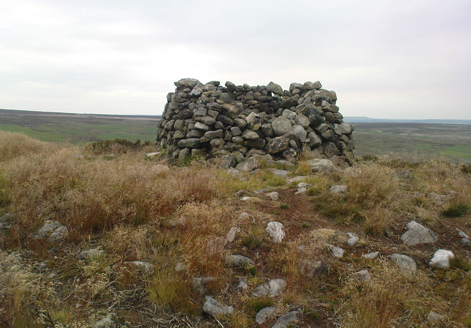
Round Hill tumulus, Middleton Moor

From Ilkley town centre, taken the road north across the River Wharfe, turning left and up the country lane towards Nesfield.  As you’re driving with the farmed fields on either side, you’ll go round a couple of swerves in the lane and reach the open moorland on your right, just past the small copse of trees on the same side.  There’s a small place to pullover on the right 100 yards on and walk up the footpath running northeast onto the moor.  Go past the disused quarry and up further till you reach the rounded hill where the tumulus stands.

Archaeology & History

On the moors north of Ilkley – as shown on OS-maps since the 1850s – on the southeastern edge of Middleton Moor, is this singular tumulus, a short distance west of some old quarrying at the curiously-named Lurgy Delf.  The small hill is easy to find and appears at the western edge of a whole host of neolithic and Bronze Age remains.  It is included as a boundary marker between Middleton and Langbar, as marked by an old stone on its southern side.  Eric Cowling (1946) described this as “a spread of stones on Round Hill” in the same context as other burial mounds and cairns in the region, also naming it as the Black Hill tumulus.  Many flints had been found all round here and it stands at the western edge of a great number of cup-and-ring stones, stretching eastwards across the moors for several miles.  To my knowledge, no excavation has taken place here.

References:

  1. Cowling, Eric T., Rombald’s Way, William Walker: Otley 1946.

© Paul Bennett, The Northern Antiquarian

Boatbridge Quarry, Thankerton, Lanarkshire

Cists (destroyed):  OS Grid Reference – NS 981 376

Also Known as:

  1. Tinto Quarry

Archaeology & History

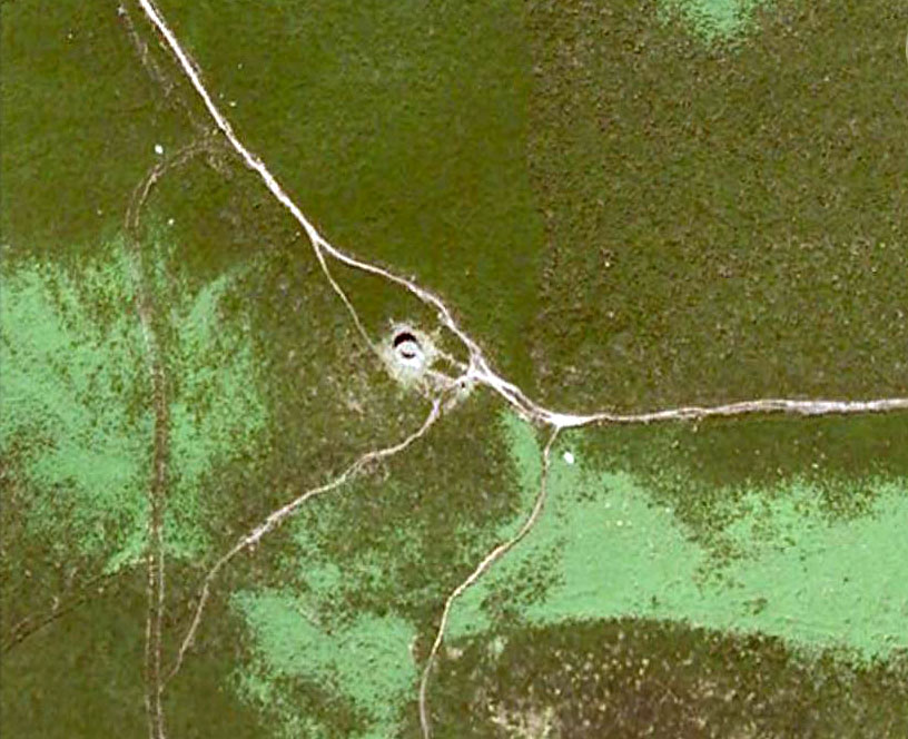
The sites that were once here have long since been destroyed as a result of quarrying operations.  But thankfully this place was given a quick appraisal by those renowned Scottish archaeologists, Anna Ritchie and D.V. Clarke, before final destruction.  They recorded the site in an early edition of Discovery & Excavation in Scotland:

“Two short cists were discovered in November, 1970, during the removal of a long low gravel ridge protruding into the flood plain of the River Clyde.  The two cists were both aligned NE-SW and were 14m apart.  Both employed identical construction techniques.  The side slabs overlapped both end slabs and the N end slab was shorter than the other three slabs, necessitating a building-up of the floor by some 30cm.  Both appear to have had a double layer of capstones although this is uncertain in one case.  The cists contained and adult and child without grave goods on a gravel floor in one, and an adult with a beaker on a ‘crazy-paving’ floor in the other.”

Crazy-paving in prehistoric times sounds good!  The Scots got there first!

References:

  1. Clarke, D.V. & Ritchie, Anna, “Boatbridge Quarry: Short Cists,” in Discovery & Excavation in Scotland, 1971.

© Ian Carr, The Northern Antiquarian 

Solar Stone, Askwith Moor, North Yorkshire

Cup-and-Ring Stone:  OS Grid Reference – SE 17738 51003

Also Known as:

  1. Carving no.567 (Boughey & Vickerman)
  2. TV Stone

Getting Here

Stone at cairn edge

From the scruffy Askwith Moor lay-by car-park, along Askwith Moor road, follow the fence north up along the roadside until you reach the gate on your right.  Go thru this and head due west into the moor, towards the small cluster of other carved stones (carvings 581, 582, etc), particularly the Small Rings Stone (carving 579).  Around here, you’ll notice a cluster of about 10 mounds in the heather, which seem to be prehistoric cairns, and this particular stone rest against the northwestern side of one of them, about 30 yards west of carving 579.  If you’re patient, you’ll find it! (if you fancy a look at all these on the moor, gimme a shout & I’ll take you straight to ’em – but you need to make a booking!)

Archaeology & History

This carving takes a bitta finding amidst the mass of deep heather and open moorland and is probably only gonna be of interest to real cup-and-ring fanatics.  But it’s the setting which makes it more intriguing — for me anyhow!

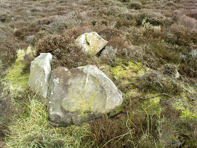
Trying to highlight the internal CnR
Solar Stone carving

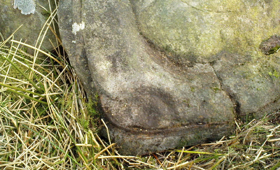
Like other carvings on this moorland, we find it in direct association with a prehistoric tomb (though it aint been excavated), resting up against the edge of one.  However, it seems to have been moved from its original position and may, perhaps, have actually faced the other way at some time in the past.  We might never know.  However, some student in the recent past saw fit to name this small carving the ‘TV Stone’, thanks to the slightly cronky outline of an old television screen, with its small half-cup-and-ring near the bottom corner of the rock.  You can see where they were coming from!

Boughey & Vickerman (2003) made only a brief note of the stone, seeing only the cup-and-half-ring here; but there seems to be a faint cup-marking near the middle of their TV screen, along with faded evidence of an incomplete ring around it.  You can just about make it out in the poor photos we took of it. (sadly, we were without water when we visited it, which would have highlighted the additional cup-and-slight ring more clearly)

Close-up of cup-and-half-ring

We gave this stone the title ‘Solar Stone’* as it seems more appropriate and would certainly have more mythic relevance to the people who carved this.  The curious natural ring, or TV outline, running round most of the stone (with the faded cup-and-part-ring near its centre) may have been attached with more animistic attributes than us moderns tend to give things — children notwithstanding!  Circular forms in Nature have universal tendencies in more traditional cultures with such heavenly bodies as sun or moon, which might have been relevant here with the stones association with a tomb.

…Again, we might never know…

References:

  1. Boughey, Keith & Vickerman, E.A., Prehistoric Rock Art of the West Riding, WYAS: Wakefield 2003.

* though did debate in somewhat primitive northern lingo: “Ugh – errr…solar? lunar? Ey? — Solar? Lunar?” uttering the same queried mantra numerous times between ourselves till we got tired and stuck with ‘solar’, as seems common these days (though I preferred ‘lunar’, it’s gotta be told!).

© Paul Bennett, The Northern Antiquarian