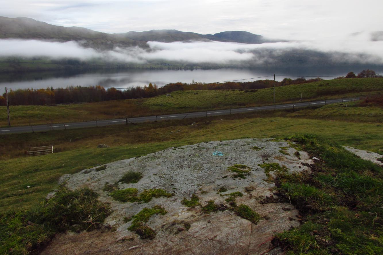
Cross / Sacred Tree: OS Grid Reference – NN 581 012
Also Known as:
Law Tree
Archaeology & History
As a folklorist and antiquarian, I find this long lost site more than intriguing. Most ancient crosses are stone; but in early centuries many were made from wood which, obviously, have decayed down the years. But this cross, located on the northeast edge of the Lake of Menteith, was actually a tree: a hawthorn no less. This choice would have been made based on it being one of the few trees that are deemed sacred in both christian and indigenous lore. It was described—albeit briefly—in A.F. Hutchison’s (1899) excellent history book of the area:
“The cross of the burgh is said to have been the trunk of an old hawthorn tree, which stood by the lake side, opposite the manse of Port, and was known as ” the law tree.” Around this tree an annual fair was held in the month of September, and called after St. Michael.”
We’re obviously seeing here the traditional animistic veneration of trees by local people, with the incoming christian symbol being grafted onto it. Hawthorns were one of the potent protections against witchcraft and so the handshake between christian and pre-christian systems obviously worked here. Faerie-lore was also rampant at many places for many miles around this site.
References:
Hutchison, Andrew F., The Lake of Menteith – Its Islands and Vicinity, Eneas Mackay: Stirling 1899.
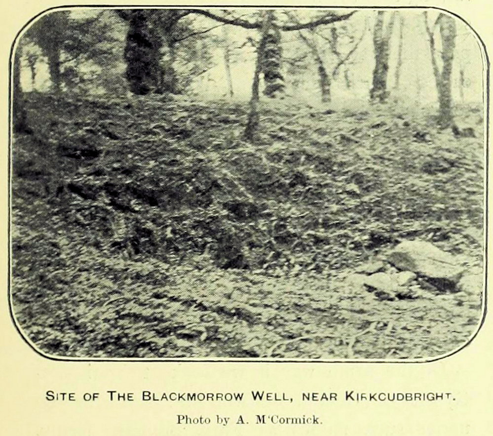
A curious little-known site with more of a Scottish genealogical history behind it. Mentioned in McCormick’s (1906) fascinating survey of tinkers in the Galloway region, the site was given a more succinct description in the Morris survey (1982), where they told that,
Well shown on 1854 map
Black Morrow Well, c.1905
“a mile from the town in Black Moray (formerly Morrow) Road, a short distance from the road…was this well that the MacLellan family are said to have derived their crest of a Moor’s head impaled on a sword. The local story is that James II wanted to get rid of some gypsies infesting Galloway and offered the Barony of Bombie to anyone who could do so. MacLellan filled the well with potent liquor which the gypsy chief drank to excess and while he was in a drunken stupor MacLellan killed him, cut off his head and presented it to the King on the point of his sword, immediately receiving the barony as his reward.”
This story goes way back and was first mentioned in 1680. According to McCormick (1906), the name Black Morrow derived from the “More”, the title given to the leader of the so-called gypsy clan, “or, as tradition suggests, a man named Black Morrow, of Irish tinkler descent.”
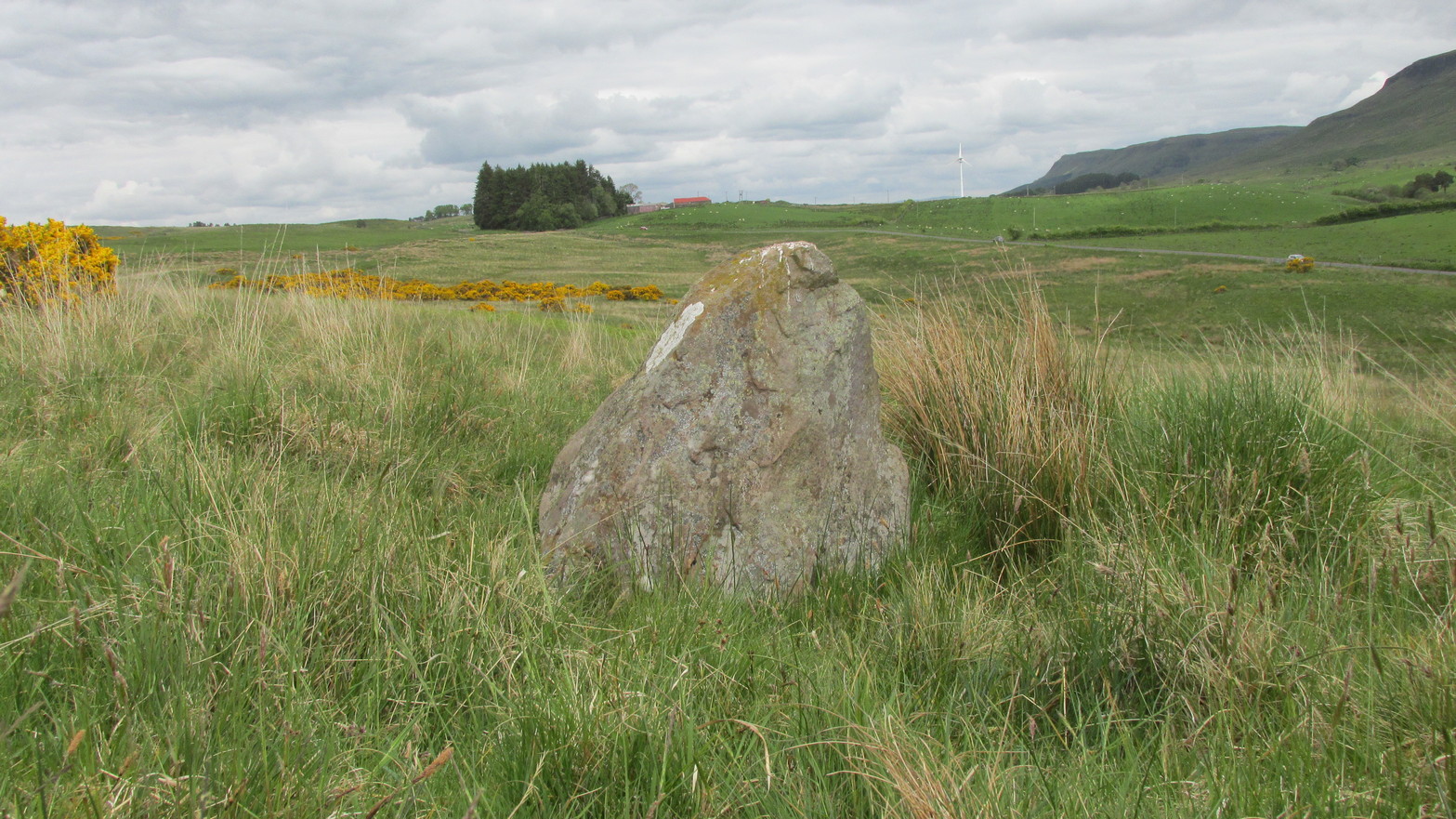
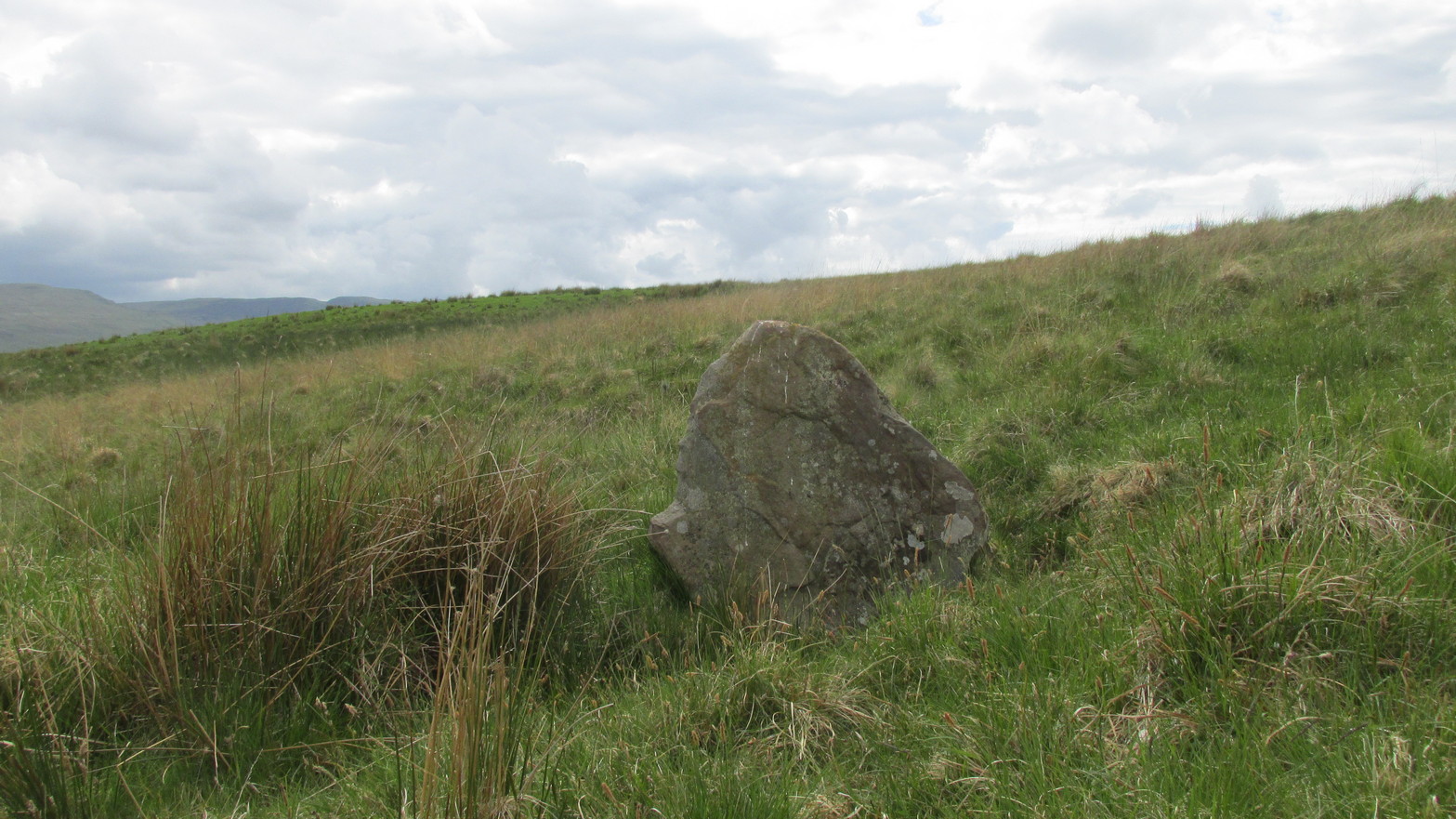
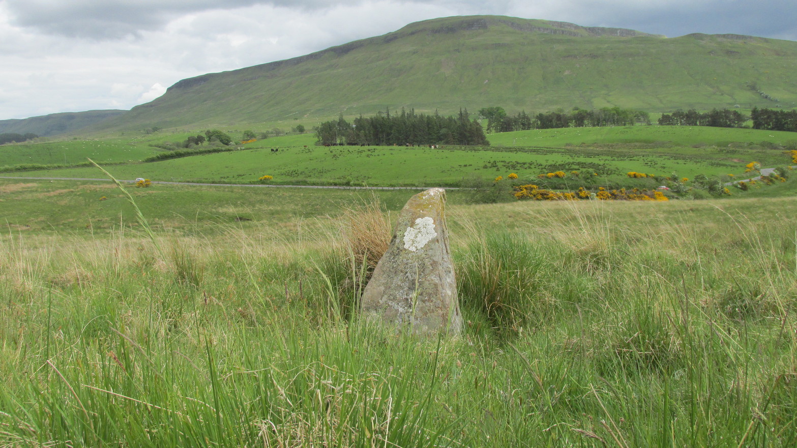
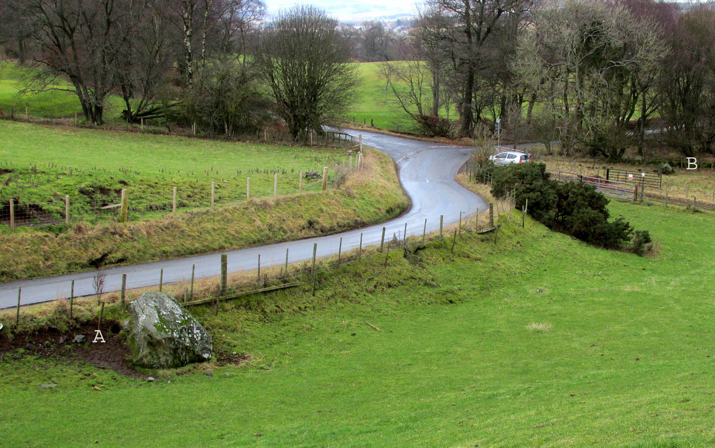
Go up the B822 road from Fintry for literally 2.5 miles (about 500 yards below the small copse of trees that almost hide Balafark Farm above you) and at a very small ‘parking’ spot are 2 farm-gates. Go through the lower of the two and head downhill, crossing the small burn and up the other side for just over 100 yards where you’ll meet a very low, old and very overgrown wall. Keep your eyes peeled for it! Walk left along this wall, uphill, for another 100 yards till you meet a a dried-up dyke that runs downhill. 10-15 yards down this, a small stone greets you…
Archaeology & History
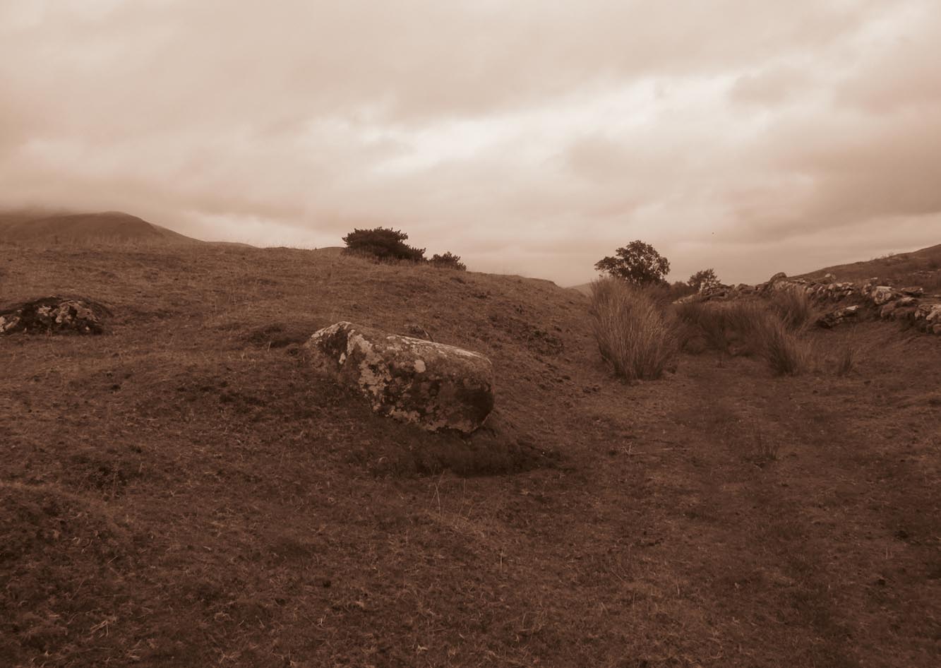
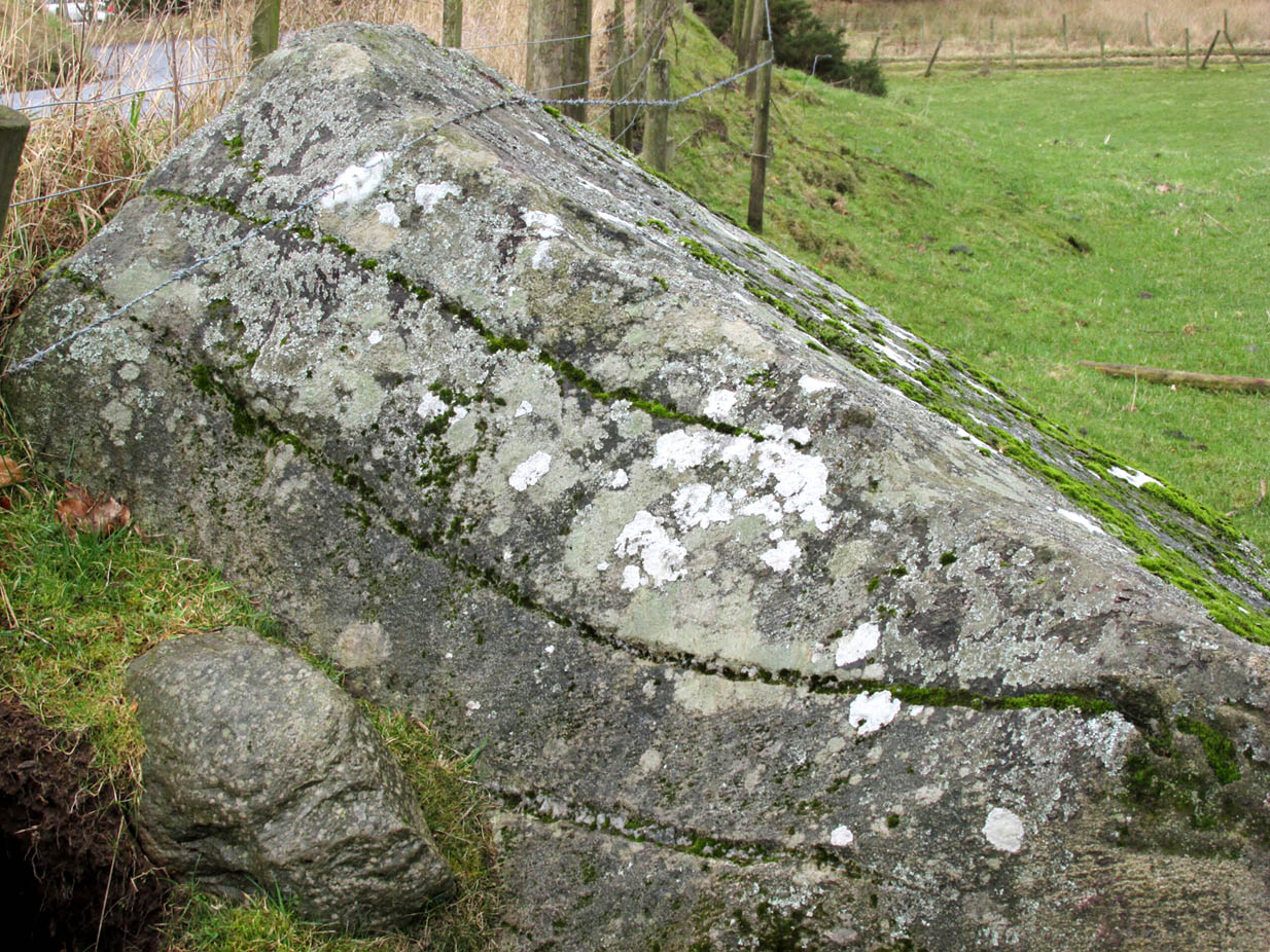
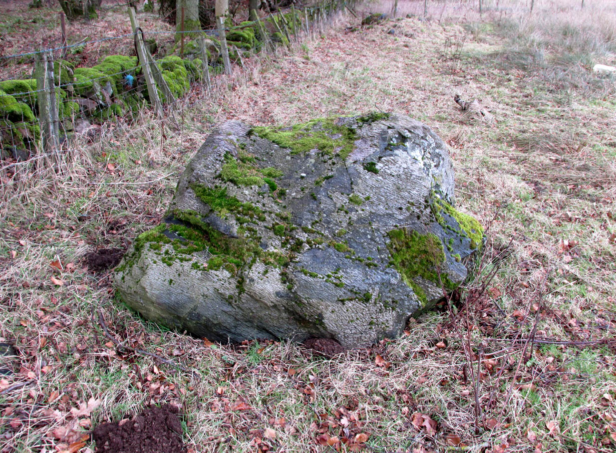
It’s difficult to call this a ‘standing stone’ and, as far as I’m concerned, is even more troublesome to cite it as a legitimate prehistoric monument. Nevertheless it is shown on the modern OS-maps as such and was listed by the Royal Commission (1963:1) lads in their standing stones inventory. But it’s really pushing it to be honest! They told us:
“This stone stands about 180 yds NW of a gate which opens off the Fintry-Kippen road, 340 yds N of its crossing of the Lernock Burn. It is triangular in profile and wedge-shaped in section, measuring 3’3″ both in height and breadth along its base, by 1’7″ in greatest thickness. It may well have been a boundary stone as it is near the corner of some ground which is enclosed by a turf dyke and has been cultivated.”
Looking southwest
Looking up to the ancient cairn of Stronend
In truth, if we call this a standing stone, then there are hundreds of others that I’ve come across over the years—frobbling off-path across huge swathes of moorland—that must also be added to our prehistoric inventories, as the height of this isolated rock is echoed in countless others which are off the archaeological listings. One such stone ‘stands’ 100 yards northeast of here—although there are many others with much greater potential. …I think the only thing that may sway this as being a possible prehistoric upright is the fact that the top of the stone appears to have been broken off, albeit a few hundred years ago if the weathering is owt to go by. But a cursory look for any broken top-piece found nothing.
References:
Royal Commission on the Ancient & Historical Monuments Scotland, Stirling – volume 1, HMSO: Edinburgh 1963.
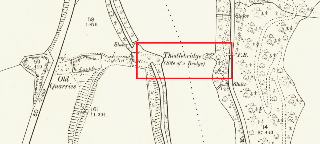
The easiest way to see the site is to stop at the car park at Craighall on the B9099 south of Stanley, and follow the path to the river. The remains of the Brig will be seen on the other side of the Tay from the riverside walk.
Archaeology & History
The Thistle Brig was described in the nineteenth century Ordnance Survey Name Book as:-
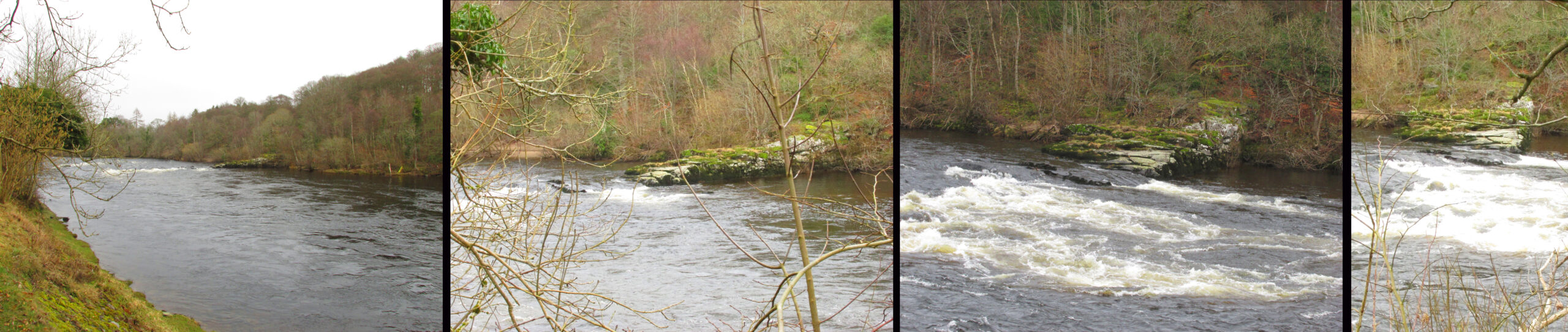
‘A remarkable spot in the River Tay, when the breadth of the river becomes suddenly narrow by the protrusion of a bed of trap rock which crosses it at this place.’
Thistle Brig & the quarries for its hard stone on the 1901 25 in OS-map
According to local historian Alexander Scott, the Thistle Brig formed a convenient place to ford the Tay until much of it was blasted away by explosives some time in the mid-nineteenth century in order to improve the flow of the river. Old maps imply that an actual bridge may have spanned the Tay hereabouts at some time in the past. The seemingly little known folklore of this site relates to an invasion by the Danes in the early mediaeval period. Elsewhere there are similar stories, so the truth or otherwise depends on where you are in Scotland, but this one may have more validity as the tale seems to give its name to the place!
The name ‘Thistle Bridge’ has been applied on old postcards to a stone footbridge over a side channel or lade between the road and the River Tay to the south of the Brig, and is not the subject of this profile.
The remains of the Thistle Brig – a hard basalt dyke on the east bank of the River Tay
Folklore
Alexander Scott, writing of the Brig:-
“…tradition holds that here the thistle received the distinction of becoming the national emblem of Scotland. In one of the many invasions the country suffered from foreign armies, the Danes, on one occasion, having landed on the east coast sacked the town of Montrose and continued on their march across the country, burning and pillaging as they went. While crossing the Tay at this ford at night, the incident occurred of one of the leading soldiers arriving on the opposite side suddenly coming in contact with a thistle with his bare leg, which caused him to emit a shreik of pain.
“The noise was heard by the Scots, who had been encamped nearby, and the alarm thus given was the means of securing a victory over their enemies. The thistle was thereafter honoured as the national badge.”
Reference:
Scott, Alexander, St Martins and Cambusmichael, A Parochial Retrospect, Munro & Scott 1911.
Although you could just as well follow the directions to reach the Cragganester 22 carving (exactly 100 yards away), it’s probably easier to get there from where the track leads down to Balnasuim, but there’s nowhere to park any vehicle here—unless you’re on a bike! Across the road from the Balnasuim track is a gate. Go thru this and then follow the fence immediately on your left, running parallel with the road for roughly 250 yards (218m), until you reach a denuded wall that runs onto the hillside above you. Follow this up for roughly 200 yards (96m) until you reach a grass-lined track. Walk to your left and keep your eyes peeled for a reasonably large rounded boulder next to the track 40 yards on. That’s it!
Archaeology & History
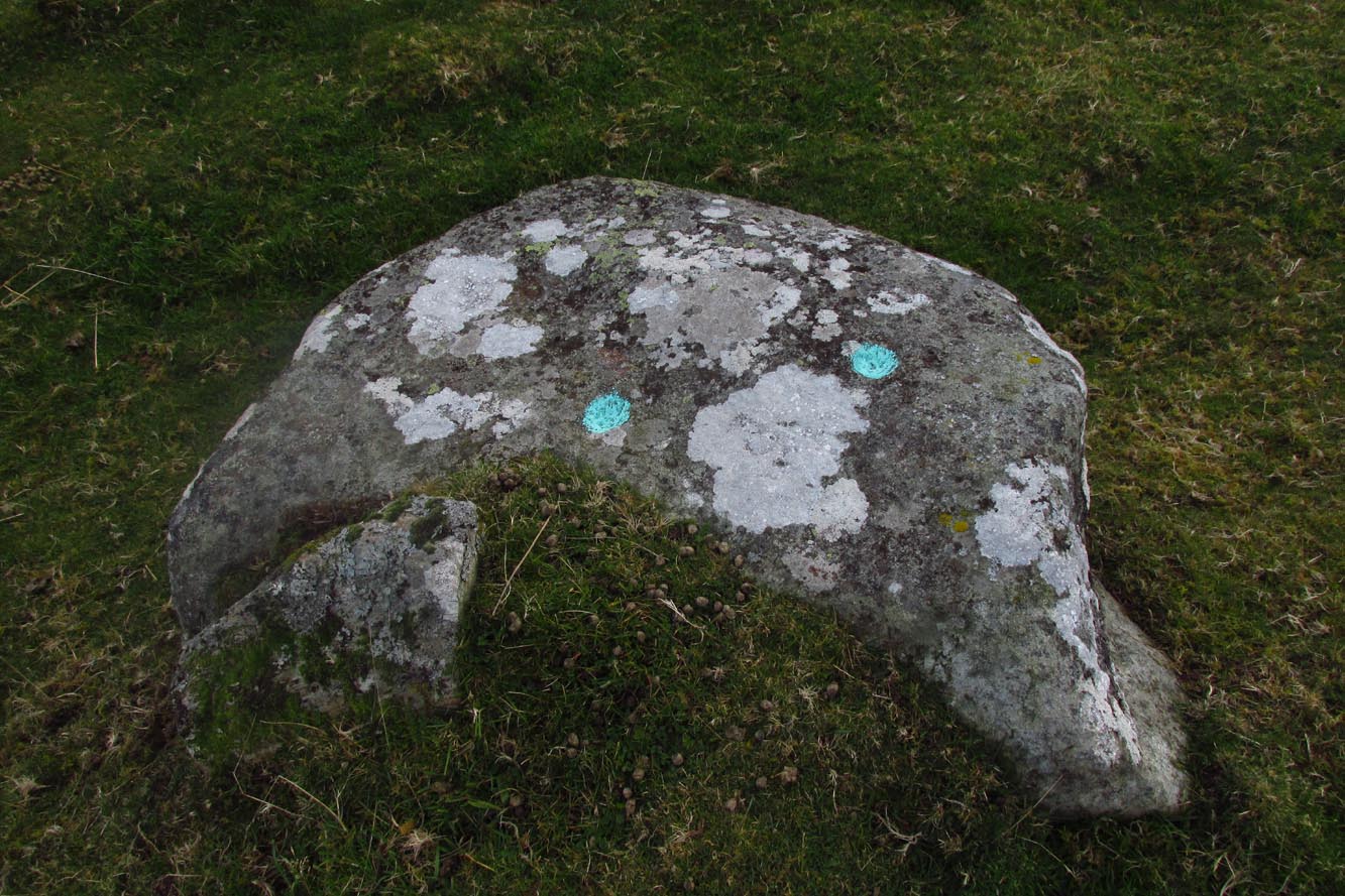
2 cupmarks highlighted
This is one of the many simplistic petroglyphs in the Cragganester complex, probably only of interest to the fanatics amongst you! There are two distinct cup-marks on this nice rounded ‘female’ stone, one near the top and one near the middle, amidst the olde lichen growth. Loch Tay stretches along the glen below here, but only a portion of it is visible nowadays. In times gone by, tree growth probably prevented any vision of the waters below…
It’s a bittova pain-in-the-arse to reach this and its associated carvings, as there’s little place to park along here. The easiest is to park 600 yards east of Tombreck at the spot just by the small bridge at Craggantoul. Keep your eyes truly peeled! From here, walk along the road for ⅔-mile where you’ll hit a gate taking you onto the boggy hillside. Go diagonally up here for 150 yards where you’ll hit an overgrown track and small disused quarry. Some 50 yards along you’ll see a small rock outcrop on your left (as if you’re going back to the road). That’s the spot!
Archaeology & History
Close-up of cupmark
Not previously recorded, this simple petroglyph on a small rock outcrop—barely 50 yards above the A827 Killin-Kenmore road—comprises of one clear cup-mark prominently etched near the middle of the upper surface; and another possible cup on the left (eastern) section of the rock. Cragganester carvings 19 and 20 are respectively about 100 yards NE and NW of here but, like other carvings nearby, is only gonna be of interest to the fanatic nutters out there!
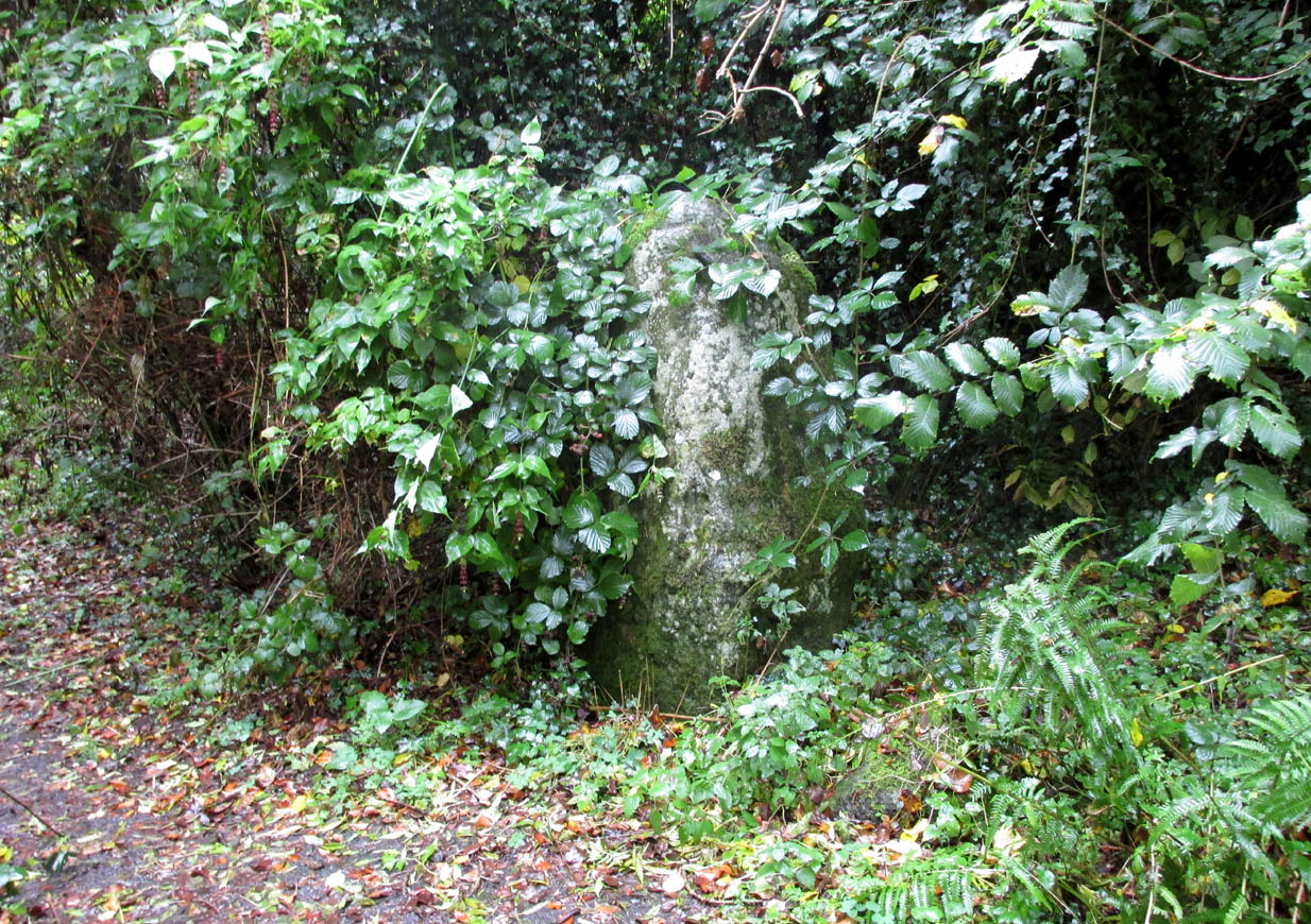
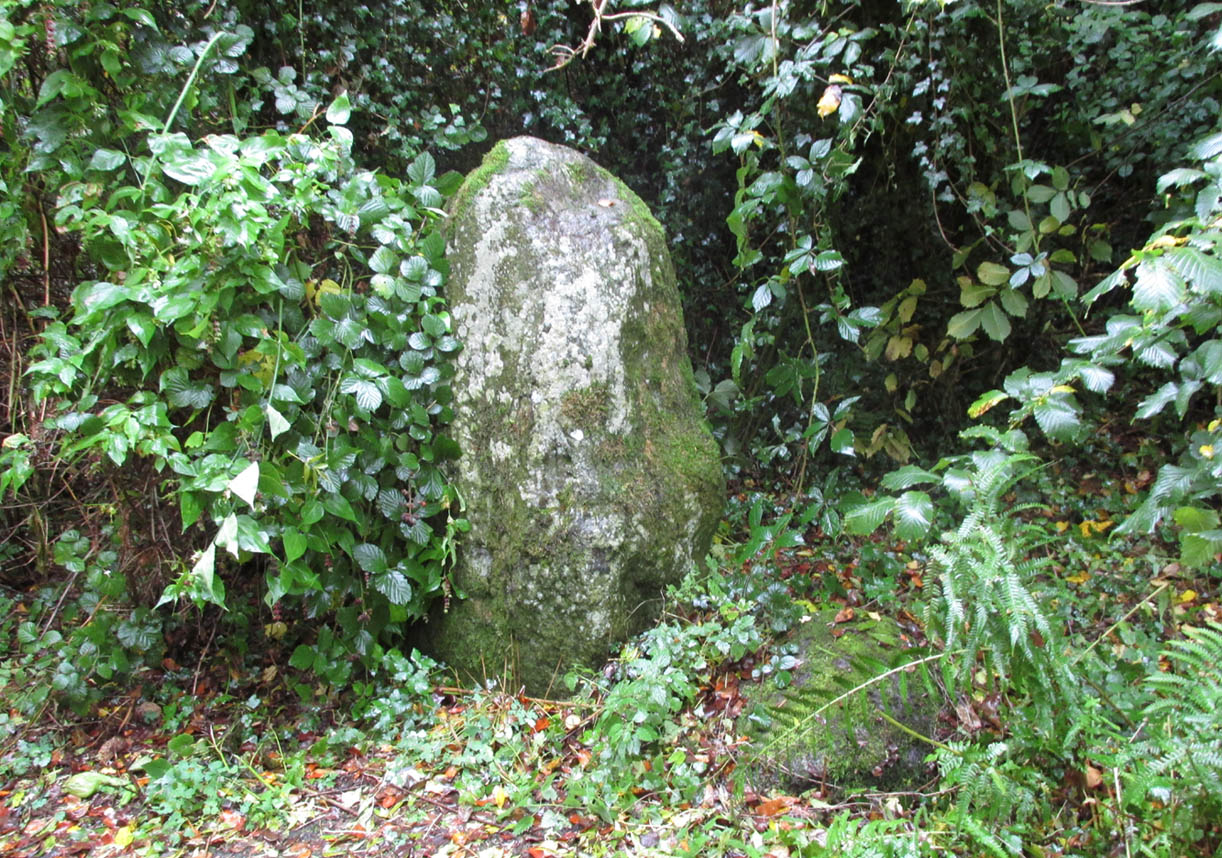
Along the main A913 Perth Road that runs round the northern edge of Abernethy village, as you approach the village from the western side, go right at the mini-roundabout up the Main Street into the village. However, just where this roundabout is, there’s a footpath into the trees known as the Castlelaw. Walk up here, keeping to the left-side of the burn (don’t cross over onto the right-hand side!) and after about 200 yards or so, keep your eyes peeled for a large upright stone, almost overgrown in dark vegetation on your left.
Archaeology & History
An intriguing standing stone in a most unusual position: a small wooded glen with a steep slope on its immediate eastern side, very enclosed. It’s quite a big thing too, standing some six-feet high with the usual worn rounded crown, typical of olde stones.
The olde stone, unmasked
In the very brief account of this site by Hallyburton & Brown (2000) they describe this “previously unrecorded /lost standing stone and possible ruinous stone circle.” This is also echoed in Canmore’s description. A standing stone we certainly have, but in several visits here there was no evidence of any stone circle either side of the burn. It was suggested that the “circle” may once have been atop of the slope immediately above this stone, but again there is no evidence at all to suggest this and old maps show nothing. I’m extremely doubtful of any megalithic ring here (I’d love to be wrong though).
References:
Hallyburton, I. & Brown, R., “Abernethy Den (Abernethy Parish),” in Discovery & Excavation Scotland, New Series – volume 1, 2000.
Travelling north from Perth on the A94, take the right turning for Murrayshall just before entering Scone, then take the first right and continue up to the road junction, and park up at the trackway opposite. You’ll see the big stone in the field to the right, up against the road embankment; and the small stone is in the paddock to the left of the trackway at the edge of the trees.
Archaeology & History
Two large glacial erratics which have acquired mythic status and picked up a Christian triumphalist message on the way.
Folklore
In Lawrence Melville’s (1939) excellent local history work, he thankfully put to pen an all-but-forgotten tale of oral tradition:
“Where the road from the Muir of Durdie leaves Kilspindie parish, a grass grown road leads north to Boglebee….. A few yards from the highway lie two large stones, said to have been flung from the Giant’s Hill in Collace parish – the flat topped eminence lying due north from the stones, about two or three miles away, better known as “Macbeth’s Hill”, or “Dunsinane Hill”.
The ‘string’ marks of legend
The smaller stone with its ‘string’ marks
“When the church dedicated to St John in Perth was being built and its tower began to appear, a witch living in Collace was enraged to see this proof of the approach of Christianity and determined to destroy it. She had a son, a giant (after whom the hill receives one of its names), whom she sent to the top of the hill, giving him two huge stones with which to destroy the rising church.
“By her incantations she had supernatural power and knew that when Christianity came her power would be destroyed. She gave him her mutch from her head to be used as sling and in it the giant put the two huge stones. Whirling it around his head, he aimed them in a line with the tower, but, just as he let them fly, the string of his mother’s cap broke and the stones only went the length of Boglebee. The marks on the stones are said to be the marks of the witch’s mutch strings.”
Another view of the larger stone
A familiar folkloric message is remembered the length of Britain: a giant, a devil or other supernatural being throwing stones that either spill out of an apron or otherwise miss their mark. And in this case an unsubtle message to anyone trying to take on the might of the church. But what was the original story of these stones as told by the old time oral storytellers before Christian missionaries stalked the land?
If the string hadn’t broken and the stones had followed their original trajectory they would have fallen south of St John’s Kirk, but it was the thought that counted….
Reference:
Melville, Lawrence, The Fair Land of Gowrie, William Culross: Coupar Angus, 1939.
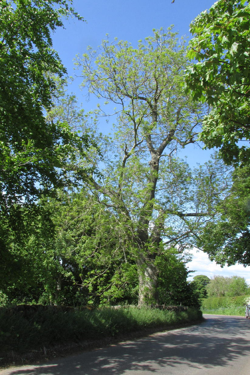
The tree is at Templeton on the west hand side of the Newtyle to Balkeerie Road travelling north, just before the bend in the road at Templeton Farm.
Archaeology & History
The only written record of the tree is in Strathmore Past and Present by the Reverend J.G. M’Pherson (1885):
Standing Proud
“After driving two miles eastward from the village of Newtyle along a most excellent level road, we enter the united parishes of Eassie and Nevay. The time-honoured boundary-mark is a conspicuous old ash, which popularly goes by the name of the Temple-tree. Tradition cannot guess its age. It is of considerable diameter, but quite hollow from the ground upwards for twenty feet. The bark is stripped off in several parts, and the thin shell of wood exposed is quite worm eaten; here and there being quite worn through, forming a rude door and rugged windows for the weird like interior.
“Large branches spread out, half dead-and-alive, with some foliage, scantily furnished with the life-giving root-sap. Could it speak it would tell of many a strange incident in its vicinity or underneath its arms. Its appearance might almost take one back to the time when the Templars left the neighbourhood; thus fixing its curious appellation”.
Sadly the tree described in the above quotation from 1885 has perished, but, just as it was not growing at the time of the Knights Templars’ local involvement, it is not unreasonable to speculate that it was a daughter of an ash tree that had formed a parish boundary marker of the original estate at the time of the Templars or even before. And now a daughter tree of that venerable 1885 tree grows in its place, the Temple-tree of the present day.
Various writers have attested to the Templar presence in Meigle, indeed M’Pherson writes:
“When the Knight Templars were in pomp…they had considerable interest in Meigle, several lands in the parish still being known as the Temple Lands. We prefer this derivation to the common one of templum, any religious house”.
In describing the now famous Meigle Pictish stones in the New Statistical Account, the Reverend William Ramsay (1845) writes;
“…A more satisfactory account of them has been suggested by Captain T.P. Mitchell, …He considers them as neither more nor less than the monuments of the Knights Templars, who unquestionably had a burying-ground at Meigle”.
While Mitchell was wrong in his attribution of the carved stones, he was clearly aware of the continuing memory of the Templars.
Modern research has shown that many of the Templar estates and lands in Scotland remained as separate fiscal entities within the Hospitaller lands up until at least the Reformation, which may explain the enduring Templar nomination of our tree.
Note: The tree formed the 19th century boundary of the parishes of Eassie and Nevay to the north, and Newtyle, both in Angus. We must assume the Templar lands boundary has been incorporated into the later parish system.
Note: This is not a clooty tree – please treat her with respect.
References:
Rev William Ramsay, Parish of Alyth, The New Statistical Account of Scotland, 1845.
Rev J.G. M’Pherson, Strathmore Past and Present, S. Cowan & Co: Perth, 1885.
Robert Ferguson, The Knights Templar And Scotland, The History Press: Stroud 2010
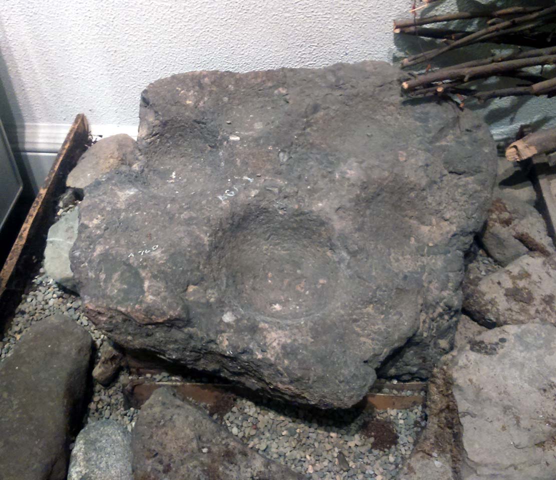
This is a curious stone and may not be the type of ‘cup-marked’ rock we’re used to. Maybe… It is presently housed in Stirling’s Smith Art Gallery & Museum, where a small note tells that is was originally found “on the top of the Ochils, near Mount Alt Farm, Path of Condie in 1893.” The stone was found at the same time, and adjacent to, a prehistoric collared urn—which implies it had an association with a cairn or cist, or burial site of some sort (which isn’t uncommon). However, the exact location of its original whereabouts has been forgotten.
Broken off from a larger piece of stone, the remaining piece of rock has six cup-markings cut into it, between one and three inches across. The smallest cup is what we might call a ‘normal’ size, but the rest of them get increasingly large and may have been more functional than purely mythic in nature. In a small note attached to the stone in the Museum, they add the interesting note that,
“There are…indications that in some places they may be related to transhumance: the practice of moving sheep, cattle and goats to higher pastures in the summer, where they may have been used to mark routes or sources of water.”
They may indeed – amongst a variety of other things too. But the suggested relationship with cattle occurs in stones found near Haworth, West Yorkshire, where large man-affected carved ‘cups’ such as the ones here, were known to be filled with milk at specific times of Nature’s calendrical rhythms, for the spirits of the place to give good fortune to the farmer and local people. We know of one instance where this practice still occurs and goes back generations in the same family. Examples of this animistic practice have also been found in the Scottish Highlands.