Fiscary (2), Farr, Sutherland

Chambered Cairn:  OS Grid Reference – NC 73112 62604

Also Known as:

  1. Canmore ID 6445
  2. Carn Chaoile

Getting Here

A mile east of Bettyhill along the A836 road, watch out for the large piles of rocks up on the hill on your left (north).  Go through the gate, past the Fiscary 3 cairn and 150 yards northwest you’ll reach the crowning cairn on the hilltop itself – the Fiscary 2 cairn.

Archaeology & History

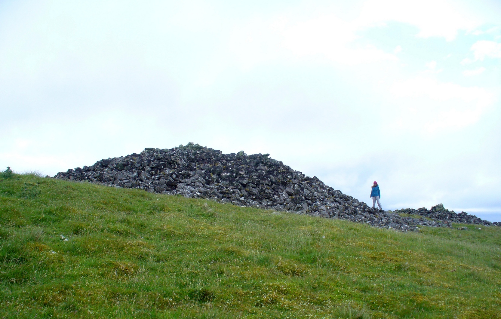
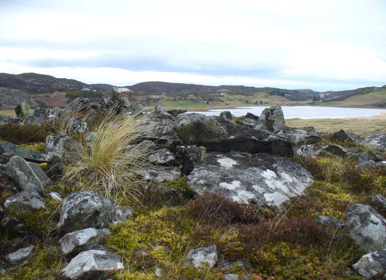
Fiscary 2 cairn, looking NW

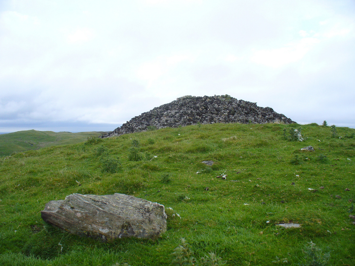
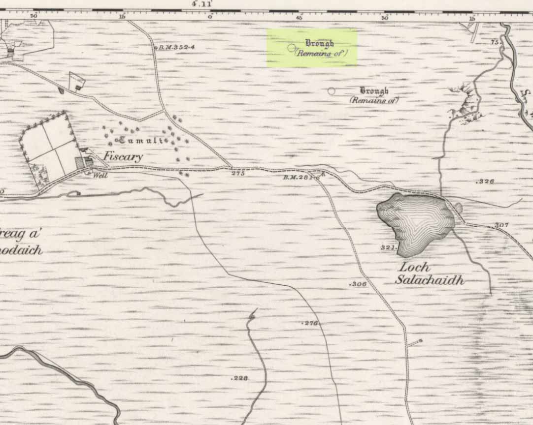
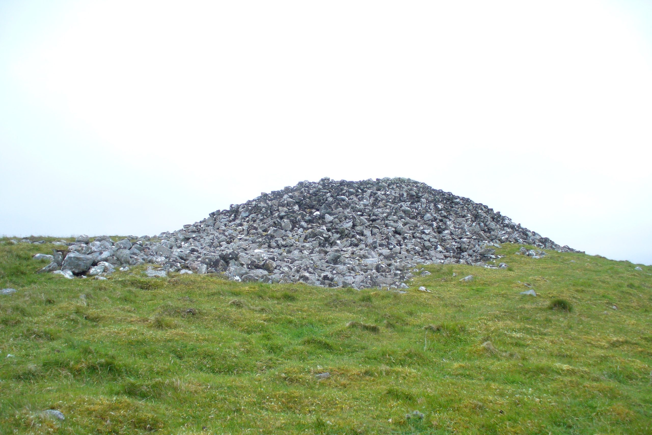
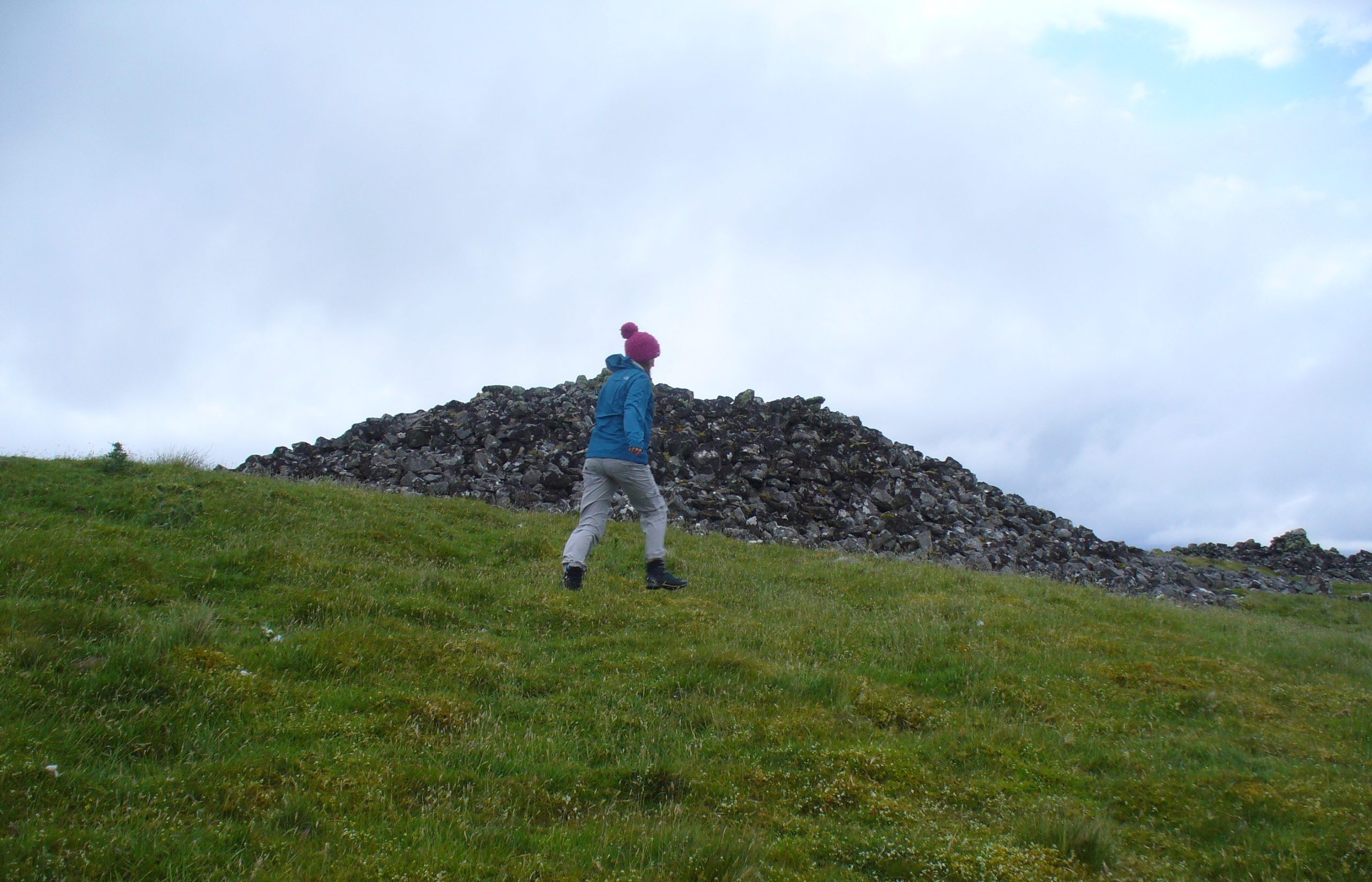
The second of the three giant chambered cairns on this moorland hillside is the largest (only just!) of them all.  Positioned right on top of the small hill, this great mass of rocks stands out from the roadside a quarter-mile to the south quite blatantly, yet it somehow evaded the eyes of the early Ordnance Survey lads in their visit here in 1873 (though the nearby Fiscary 3 cairn was plotted).  Odd…

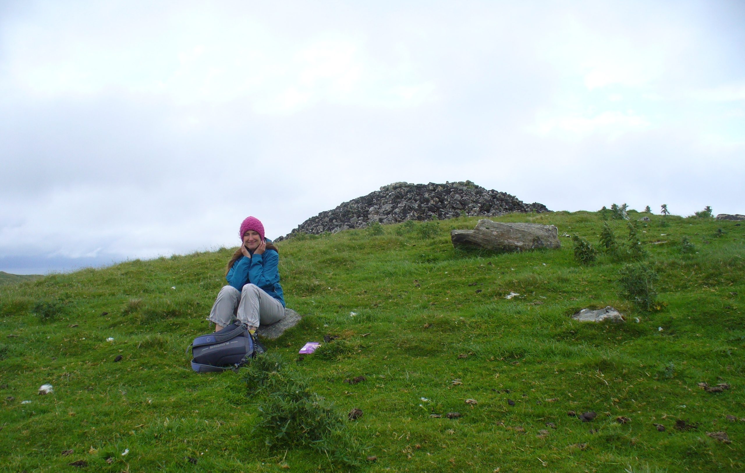
Aish by the side o’ the cairn

When I came here with Aisha and her clan a few weeks ago Nature was blasting us with full gales and so half her bunch returned after a short while, leaving us to get thrown about in the winds!  Even just trying to stand upright on this and its associated tomb proved difficult.  But despite this and the low grey clouds—typical of northern Scottish weather—it was obvious that the views from here would be superb, seeing far into the distance with a 360º view.  I have little doubt that other important prehistoric sites would be speaking with this giant neolithic cairn, but there is nothing in the archaeology accounts to help us on such matters.

The giant tomb is almost linked to its companion—Fiscary 1—by a low scatter of rocks running between them, with only a yard or two separating their disturbed masses.  Several archaeology students have posited that the two seemingly separate sites were, many thousands of years ago, perhaps one elongated chambered tomb, just like the ones found nearby at the Coille na borgie and Long Skelpick cairns; but it seems unlikely in this case…

Fiscary (2) on 1908 map
Fiscary (2), looking SE

Although Adam Gunn (1893) mentioned the “four large cairns” at Fiscally (the fourth and smallest is 262 yards to the west), the first real description I can find of the place comes from an article by a local man called Cathel Kerr (1892) who told us it was “about 220 feet in circumference, and 15 or 16 in height”; but most of his article dealt with his excavation into the adjacent Fiscary 1 tomb, which he noticed was connected by a stone platform that ran between the two sites.  This was the first mention of such a connecting platform—and a curious feature it is indeed.  When the Royal Commission lads came here in May 1909 they also noted this connecting platform.  They found that the cairn itself,

“does not appear to have been excavated.  It is circular with a diameter of about 52ft and is some 10ft high to the top of the modern pile of stones on its apex.  It presents a peculiar feature.  At the north end is clearly visible a broad platform of stones extending to a distance of 25ft from the base of the cairn and, though largely overgrown with turf, traceable by the outline of stones almost entirely around it.  This platform has been described as a neck connecting the two cairns (Fiscary 1 and 2, PB), but in reality it stops 7ft distant from the adjacent cairn.”

In strong gales at Fiscary 2
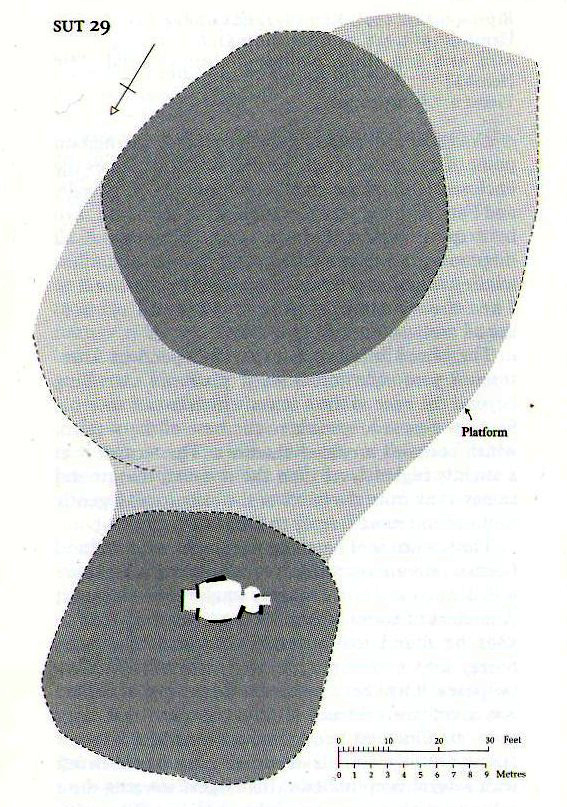
Henshall’s plan of Fiscary 1 & 2

Indeed, this “platform” seems to have been either deliberately constructed with the hilltop cairn positioned on top of it, or has been set around the tomb.  It’s difficult to say with any certainty without further excavation.

The great Audrey Henshall (1963; 1995) wrote extensively about this ancient monument in her works, finalizing her site entry in The Chambered Cairns of Sutherland (1995).  After describing in some detail the obvious archaeological association this site has with Fiscary 1, she gave us a detailed description on this one and wrote:

“The larger south cairn (Fiscary 2, PB) is bare, steep-sided, and has been little disturbed.  The diameters are between 19.5 to 21.5m, and the height is 5.5m measured from the NW.  The edge is clear for about half of the circuit.  The surrounding platform is quite low and is partly covered with peat and deep heather which in places obscure the edge.  The platform varies in width from 4.8 to 7.3m.  On the SE side the cairn edge is clear and there is no sign of the platform.  It appears on the NE side where it is largely free of heather, and the cairn material merges into its stones.  This part of the platform is edged by a rough kerb which fades away westwards into the spread of stones which links the two cairns.  In the area between the cairns the stones are mainly covered by peat on which grow turf and heather.  The spread of stones appears to be thin, but on the NW side of the cairn, where there is evidently a drop in ground level, breaks in the peat cover show that here the stone spread has considerable depth.  Round the W side the platform is heather-covered, and along the SW part, where the hill drops away steeply, there is a rough kerb at a lower level than elsewhere, within which the surface of the platform rises to the base of the cairn.  The S end of the platform, which here is bare stones, seems to turn sharply towards the S edge of the cairn, though the actual edge of the platform is indefinite.”

The likelihood is that this cairn is the oldest of the cluster of three found here, most likely constructed in the neolithic period.  Its position in the landscape would indicate that the site would have been built to commemorate the spirit of a local tribal elder, a King or Queen.  It’s a superb site and I’ll be visiting it again very soon indeed!

Folklore


Bouncy elven sprite flies by

The folklorist Otta Swire (1963) told that this region was once peopled by giants who created the landscape itself around here (a common attribute of giants the world over), and they also played a part in the creation of this and other giant tombs in the area.  The one time local school-teacher at Bettyhill, Alan Temperley (1977), also told us that the fairy folk lived close to the giant tombs of Fiscary.

References:

  1. Gourley, Robert, Sutherland: An Archaeological Guide, Birlinn: Edinburgh 1996.
  2. Gunn, Adam & Mackay, John, Sutherland and the Reay Country, John Mackay: Glasgow 1893.
  3. Henshall, Audrey S., The Chambered Tombs of Scotland – volume 1, Edinburgh University Press 1963.
  4. Henshall, Audrey S., “The Distant Past,” in The Sutherland Book (edited by Donald Omand), Northern Times: Golspie 1991.
  5. Henshall, Audrey S., The Chambered Cairns of Sutherland, Edinburgh University Press 1995.
  6. Kerr, Cathel, “Notice of the Excavation of a Chambered Cairn in the Parish of Farr, Sutherlandshire,” in Proceedings Society of Antiquaries, Scotland, volume 26, 1892
  7. Lelong, Olivia C., “Writing People into the Landscape: Approaches to the Archaeology of Badenoch and Strathnaver,” University of Glasgow 2002.
  8. o’ Reilly, Kevin & Crockford, Ashley, What to See Around Bettyhill, privately printed 2009.
  9. Sutherland, George, Folk-lore Gleanings and Character Sketches from the Far North, John o’ Groats Journal: Wick 1937.
  10. Temperley, Alan, Tales of the North Coast, Research Publishing Company: London 1977.

Acknowledgments:  To the beautiful Aisha Domleo, for her images, bounce, spirit and madness – as well as getting me up to see this cluster of sites. And a Huge thanks for use of the Ordnance Survey map in this site profile, reproduced with the kind permission of theNational Library of Scotland

© Paul BennettThe Northern Antiquarian

Allt a’ Chaisteil, Bettyhill, Farr, Sutherland

Stone Circle:  OS Grid Reference – NC 7251 5756 

Getting Here

Allt a' Chaisteil 4-poster, Bettyhill

Allt a’ Chaisteil 4-poster remains

From Bettyhill village, take the A836 road west, down the hill from the village. Just before crossing the metal bridge over the River Naver at the bottom, go down the tiny road on the left. A mile or so along, go past the small loch by the roadside for another few hundred yards until you reach a quarry on the right. From here, cross the road and walk along the track towards the impressive Allt a’ Chaisteal Broch up the gorge.  About 100 yards above this, on the south-side of the fence, keep your eyes peeled for two small standing stones. You’ll find ‘em!

Archaeology & History

There seems to be no previous mention of this site in any of the archaeology records.  We were fortunate in venturing upon the place when Aisha, Lara and I were doing a typically circuitous meander to what I call the ‘Queen’s Cairn‘ of Strathnaver, above Skelpick Long.

Allt a' Chaisteil012

The southernmost stones

The site on its raised platform

The site on its raised platform

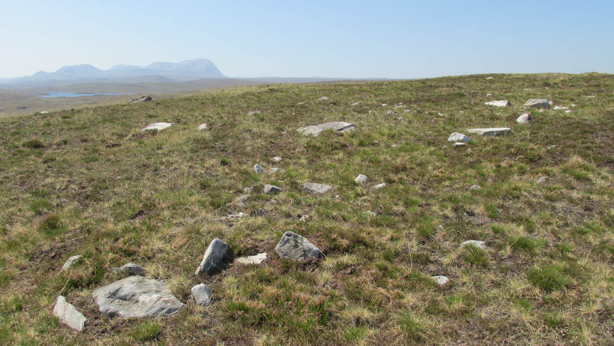
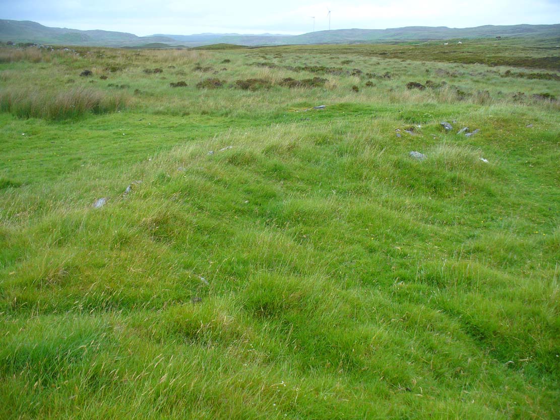
Approximately 10 yards in diameter, a raised platform 2-3 feet high consisting of thousands of small rocks in a roughly circular formation, is set on the edge of a slope above the Allt a’ Chaisteal Burn.  Two small upright standing stones are set near the southern edge of the platform, with a third on the northwestern bank of rubble, leaning or fallen into the stone mass.  A fourth stone to the northeastern edge is almost covered in rubble.

When we found the site, much of the heather had been burned away; if this had not been done, the site would not have been visible.  Even with this however, accurate visibility was troublesome as the heather had began to grow back and the infestation of bracken was raising its tick-infested fronds.

Close-up of the southern stones

Close-up of the southern stones

The site seems to be a good example of what Aubrey Burl (1988) calls a “four poster stone circle” – a number of which seem to be architectural ritual developments between cairns and stone circles.  It exists within the immense Strathnaver prehistoric complex – a literal ‘Valley of the Kings’ – where dozens of large cairns, and a number of immense megalithic tombs exist. It is very similar in size and lay-out to the recognized four-posters at Druid’s Altar in Yorkshire, the Glenshervie Burn in Glen Almond, etc.  It seems in relative isolation from other four-posters, the nearest known one being at Balnakeil (which Burl terms as being “uncertain”), more than 20 miles west of here; and the next being the Aberscross site some 35 miles away.   However, the remote landscape would explain its seeming isolation, as many more prehistoric sites remain unrecorded in the area.

References:

  1. Burl, Aubrey, Four Posters: Bronze Age Stone Circles of Western Europe, BAR 195: Oxford 1988.

Acknowledgements:  Huge thanks to the big heart of Aisha Domleo – and her sproglett Lara – for gerrin us up here, enabling its rediscovery.

© Paul BennettThe Northern Antiquarian

Achamore Hut Circles, Bettyhill, Farr, Sutherland

Hut Circles:  OS Grid Reference – NC 74219 58055

Also Known as:

  1. Canmore ID 6262

Getting Here

Achamore's NE 'hut' circle, looking E

Achamore’s NE ‘hut’ circle, looking E

Along the A836 road a mile east of Bettyhill, a track goes south onto the moors just before Loch Salachaidh. Walk along here for several miles, past the windmills and past the Achadh Thaibstil Cairn, until you reach the remote green fields that are the remains of the clearance village of Achamore.  As you walk into the green grasses, a ruined building is to your left.  In front of you, a large raised round structure almost entirely covered in grass.  You’re here!

Archaeology & History

This is a curious structure – and were it not for being labelled as a ‘hut circle’ by the lads at Ordnance Survey, on first impression I’d be more tempted to classify it as either a collapsed broch, or a large cairn circle.  This is entirely due to the size of the thing, as it’s big for a hut circle!

NW arc of the circle

NW arc of the circle

Eastermost embankment

Eastermost embankment

Circular in form, the sides of the structure on its eastern face are nearly three feet high, piled at an angle of nearly 45 degrees, and several feet across before you reach the internal section of the said ‘hut circle.’  As you walk around it, the height of the piled stones diminishes to between 1-2 feet, but the diameter of the walling all round is consistently wide – increasing the thought of it being a collapsed or robbed-out broch.  The diameter of the structure is some 20 yards across, with an approximate circumference of 64 yards.

'Hut circle' atop of nearby hill

‘Hut circle’ atop of nearby hill

Another “hut circle” is immediately visible some 80 yards to the south, on top of the nearby grassy hilltop.  The majority of this is also covered in meadow grasses, with edges and upper surfaces all but hidden.  On its southeastern edge is what looks like a structural stone ‘entrance’ some two yards across and three yards long.

Other smaller hut circles in the area indicate that this region – like others nearby – was a place of consistent human habitation from prehistoric (probably Neolithic) times, unbroken all the way through until the 18th century.

© Paul BennettThe Northern Antiquarian 

Kilry, Glen Isla, Angus

Standing Stone: OS Reference – NO 2432 5449

Also Known as:

  1. Canmore ID 31093

Getting Here

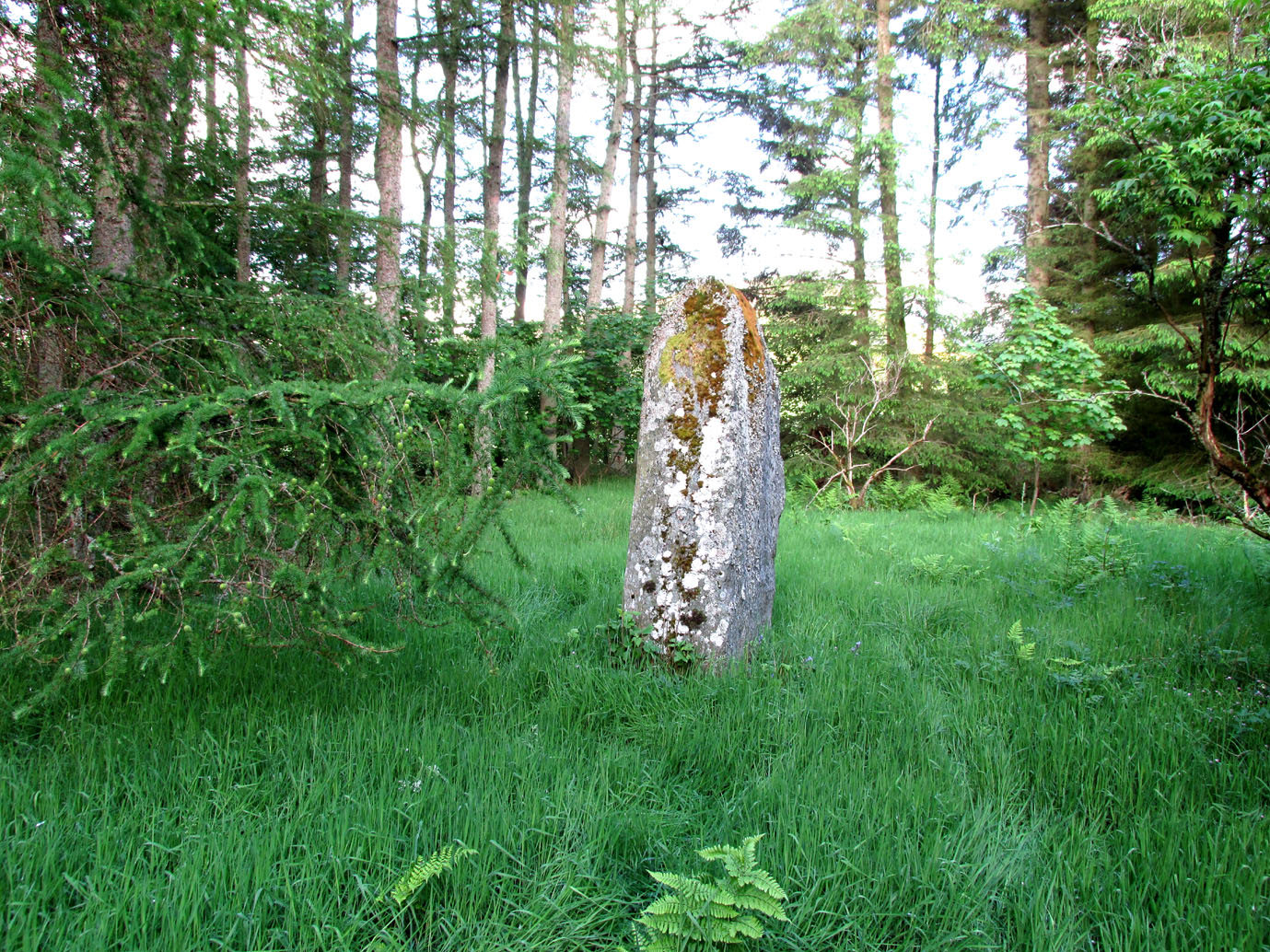
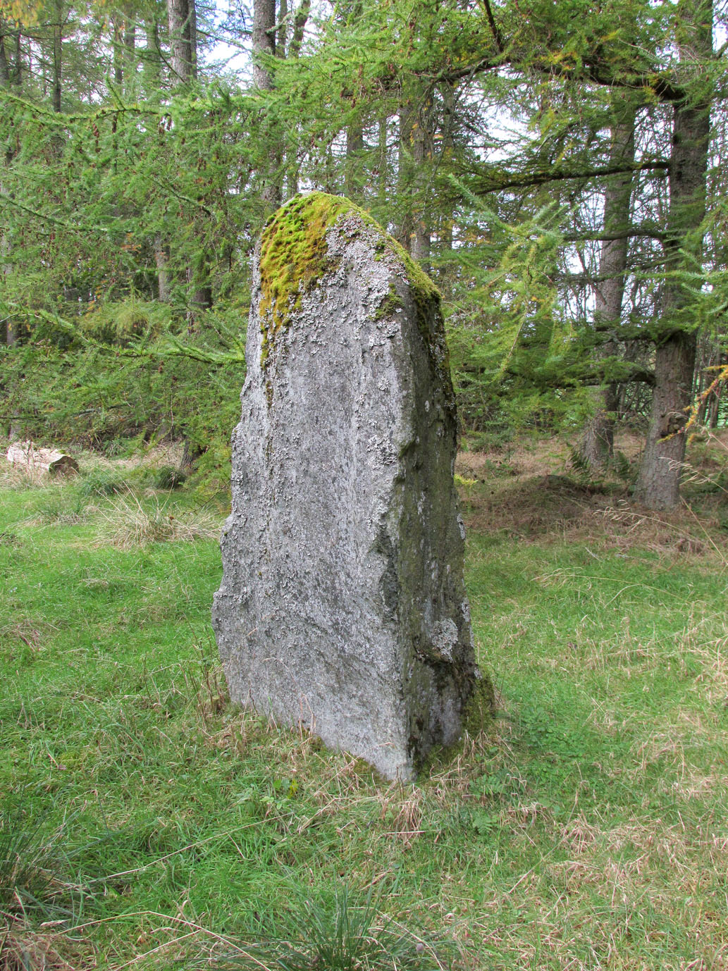
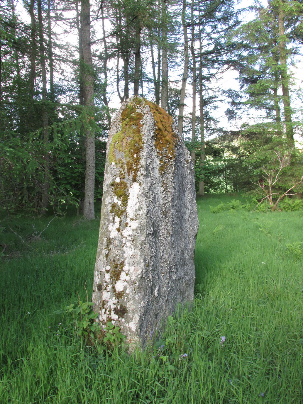
Take the B954 north from Alyth, and turn left onto the unclassified road at Craigisla House, turning right at Dykehead, then take the right fork at Faulds. Park up by the school about ¼ mile further on, and the stone is in a wooded glade on the opposite side of the road along a track to the left of ‘Standing Stone’ cottage.

Archaeology and History

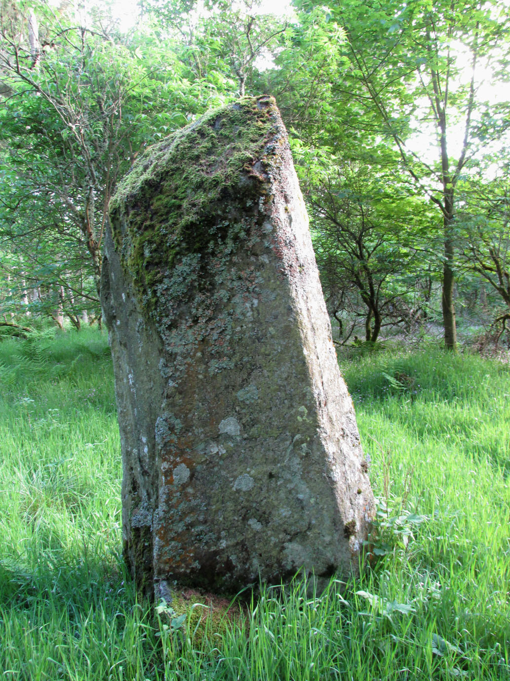
Quoted in the Canmore database, A.J. Warden, writing in 1882, described the stone:

The standing stone on Broomhall estate is a large amorphous whinstone, standing in a small field near the confluence of the Kilry Burn and the River Isla.  It is c.7′ high and c. 10′ in circumference at the base. Tradition states that it commemorates a battle fought between the laird of Kilry and the Durwards of Peel.’

On the OS map the stone is aligned with the Pitmudie Stones and the Knowehead of Auldallan Stones to the north east.

References:

  1. Warden, A.J.,  Angus or Forfarshire: The Land and People, Descriptive and Historical – volume 3, Dundee 1880-5.

© Paul Hornby, The Northern Antiquarian


Lochay Woods, Killin, Perthshire

Cup-and-Ring Stone:  OS Grid Reference – NN 54125 35388

Also Known as:

  1. Canmore ID 274203

Getting Here

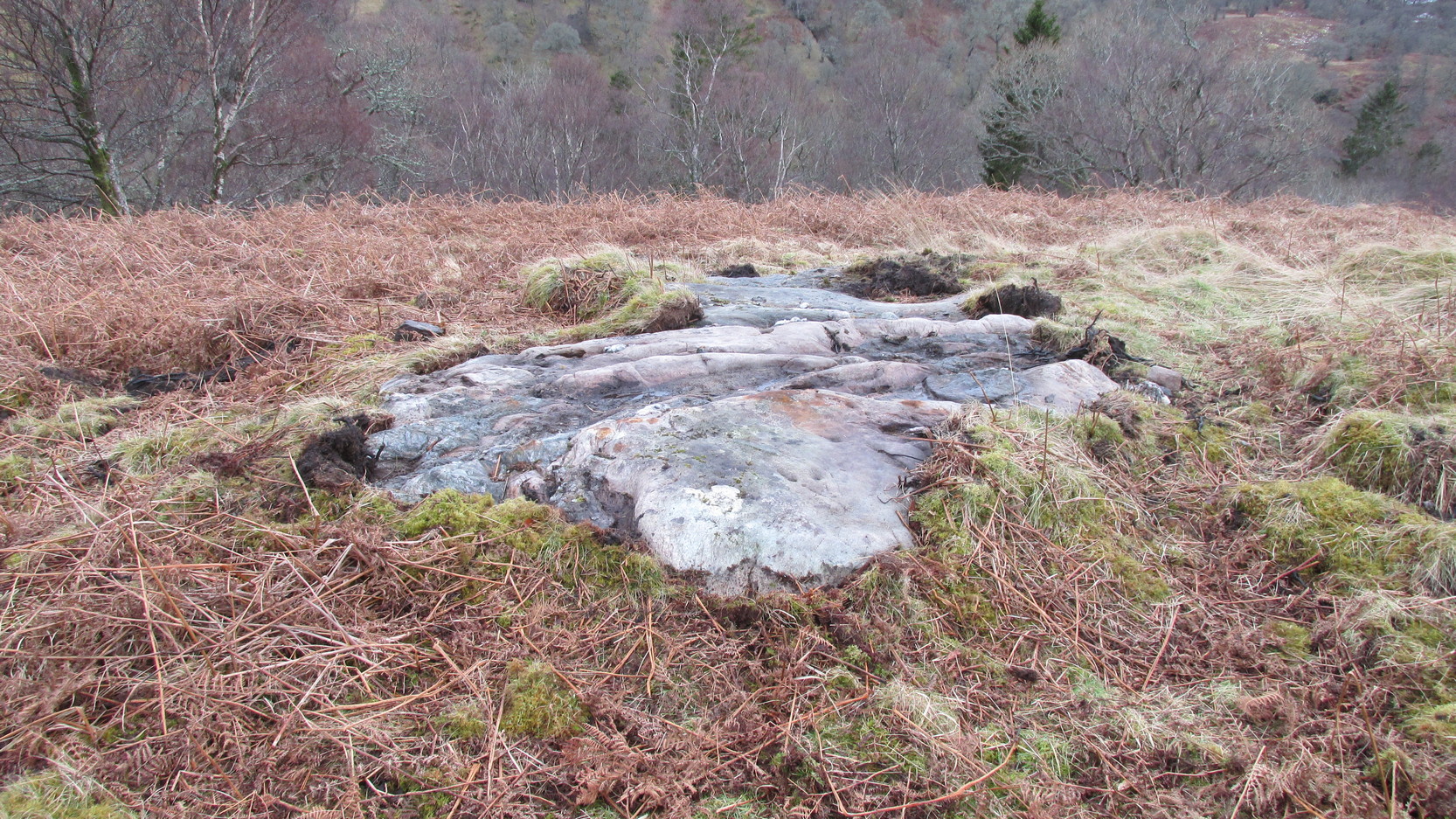
The stone in question

Going out of Killin towards Kenmore on the A827 road, immediately past the Bridge of Lochay Hotel, turn left.  Go down here for just over 2 miles and park-up where a small track turns up to the right, close to the riverside and opposite a flat green piece of land—right by The Green cup-marked rock-face.  Walk up the small bendy track for about ⅔-mile (1km) and eventually, high above the tree-line, the road splits.  Right here, go through the gate and walk downhill, over the boggy land, cross the burn, then the overgrown wall, and a second overgrown wall.  Very close hereby is a small rise in the land amidst the mass of bracken, upon which is the stone in question!

Archaeology & History

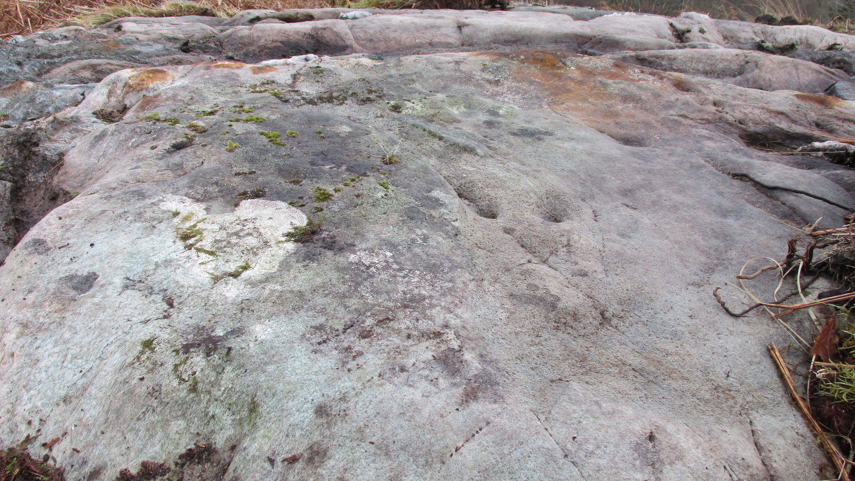
Close-up of some cups

This large long, undulating, quartz-rich stretch of rock has two main petroglyphic sections to it, with curious visual sections of natural geological forms accompanying the cup-markings, found either side of the stone on its north and south sides.  Its northern face has at least 20 cup-marks, of differing sizes, measuring between one and two inches across and up to half-an-inch deep.  Their visual nature is markedly different to those on the more southern side of the stone, where they are generally smaller and much more shallow, perhaps meaning they were carved much earlier than their northern counterparts. One of the cups on this section has a very faint incomplete ring around it.

Running near the middle of the rock is a large long line of quartz and a deep cleft in which I found a curious worked piece of quartz shaped like a large spear-head, and another that looks like it’s been deliberately smoothed all round the edges.  Both these pieces fit nicely in my hand.  All around the edges of the stone, many tiny pieces of quartz were scattered, as if they had been struck onto the stone—either to try carving the cups (damn problematic!), or for some visual/magickal reason.

© Paul Bennett, The Northern Antiquarian
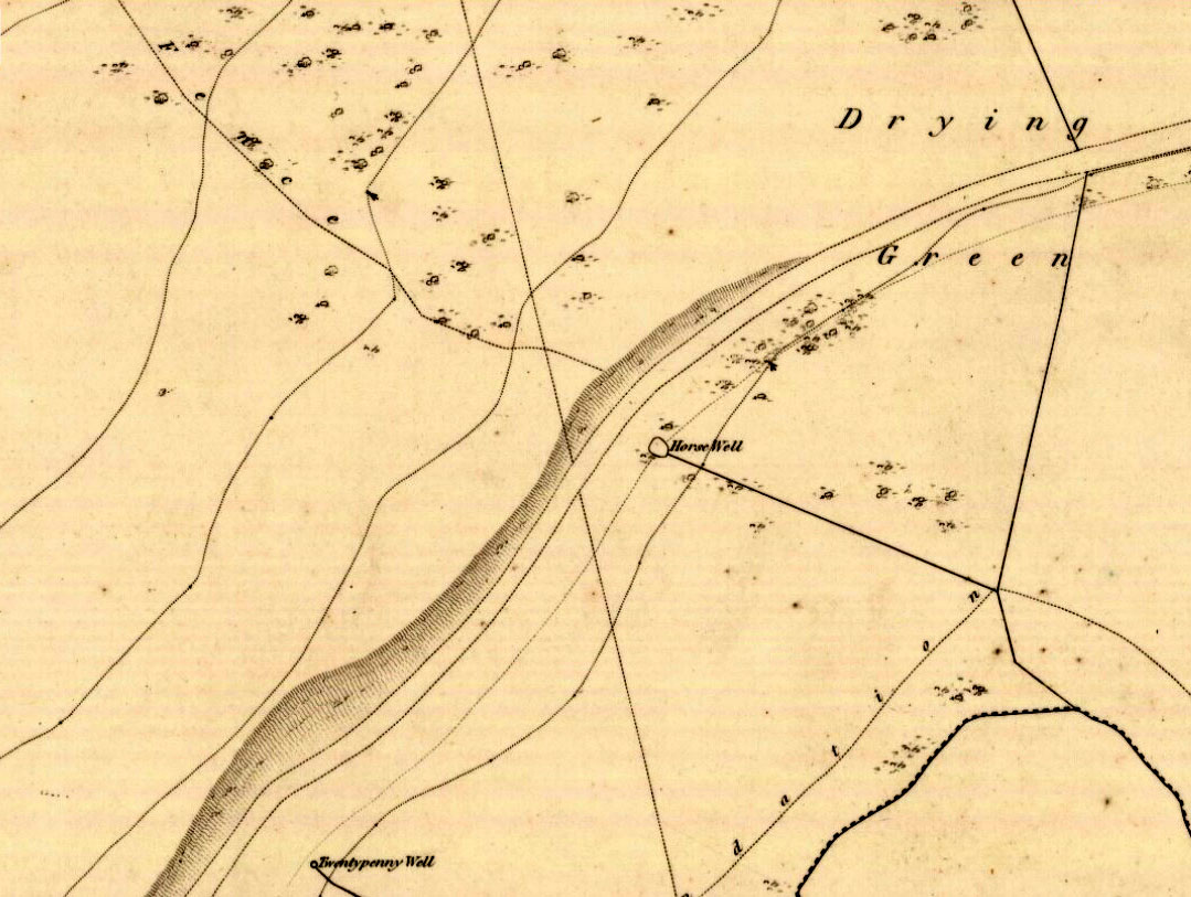
St. Michael’s Well, Edinburgh, Midlothian

Holy Well (destroyed):  OS Grid Reference – NT 2618 7353

Also Known as:

  1. Canmore ID 75958
  2. Silver Well

Archaeology & History

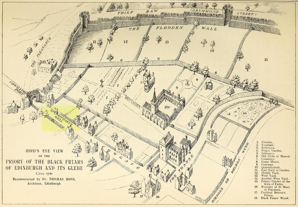
Reproduction 1540 sketch showing the Well

This ‘holy well of the dragon-slayer’ could once be found close to where old Cowgate meets St Mary’s Street.  Highlighted on an old map of the city around 1540, and on Mr Bryce’s sketch of the old inner city at the end of the 19th century, we do not know when the Well acquired its name, but it may have been by an early group of jews, to whom the saint was important.   Hereby in 1779 was listed a small piece of land called the ‘Silverwell Close’ which both Watson (1923) and Harris (1996) thought was a corruption of the St Michael’s Well, somehow.  Watson (1923) explained that St Michael’s

“connection with fountains, or a ‘silver well’, is probably due to the legends of the miraculous spring of Monte Galgano in Apulia and Mont-Saint-Michele in Normandy.”

In Ruth & Frank Morris’ (1981) survey of Scottish holy wells, they report how, in the 16th century, this forgotten site was “a favourite resort” of local people.  They told how,

“in 1543 an act of penance was ordered to be performed at the fountain of St. Michael.”

The greatest scattering of accounts relating to St Michael’s Well are found in the Records of the Burgh of Edinburgh, wherein we read:

29 July, 1556: “The prouest baillies and counsale foirsaid deputtis Dauid Symmer to be oursear of the well callit Sanct Michaellis well, and Johne Loch to the Mvs well, to caus tham be maid depar and preparit for watter gaddering.”

16 December, 1556: “The prouest baillies and counsale ordanis the thesaurar Alexander Park Auent the to reperell the wcllis callit Sanct Michaellis well, the Mws well, and the Stok well, and to begyn thairto at Sanct Mongois day nixt tocum, and ordanis Maister Johne Pirstoun to be oursear to Sanct Jlichaelis well, Johne Loch to the Mws well, and Alexander Barroun to the said Stok well, and quhat expens he makis thairon salbe allowit to him.”

Folklore

St Michael was a powerful mythic figure to the Muslims, Christians and Jews.  In the old calendar in Scotland his festival date was September 29th and known as ‘Michaelmas’ (although other dates have been ascribed by the varying sects in other countries).  In truth, this site should be highlighted for tourists, pilgrims, historians and religious followers alike due to the importance this mythic figure once held in the various pantheons.

References:

  1. Bennett, Paul, Ancient and Holy Wells of Edinburgh, TNA 2017.
  2. Harris, Stuart, The Place-Names of Edinburgh: Their Origins and History, Gordon Wright: Edinburgh 1996.
  3. Marwick, J.D. (ed.), Extracts from the Records of the Burgh of Edinburgh, Scottish Burgh Records Society: Edinburgh 1871.
  4. Morris, Ruth & Frank, Scottish Healing Wells, Alethea: Sandy 1982.
  5. Watson, Charles B.B., “Notes on the Names of the Closes and Wynds of Old Edinburgh,”in Book of the Old Edinburgh Club, volume 12, 1923.

© Paul Bennett, The Northern Antiquarian 
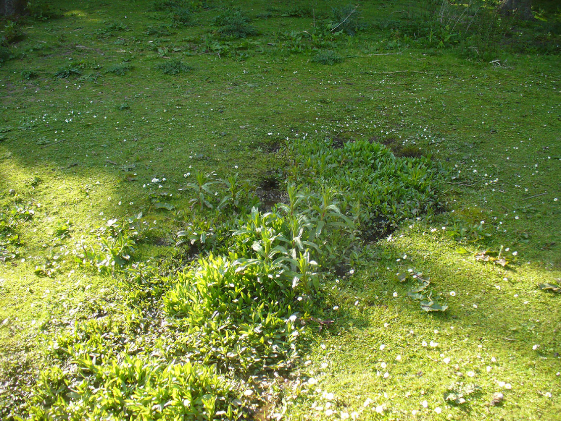

Dun Riaskidh, Torrisdale Bay, Sutherland

Chambered Cairn:  OS Grid Reference – NC 68763 61406

Also Known as:

  1. Canmore ID 5775
  2. Dun Richard

Getting Here

Approaching Dun Riaskidh

Along the A836 road between Bettyhill and Tongue, keep your eyes peeled for the turning down to Borgie and Skerray.  Go along here for 1.8 miles (2.9km) until, just past a tiny road on your left, a small parking spot with a tourist board is by the roadside. Walk down hill and over the River Borgie below and follow the footpath round until your reach the edge of Torrisdale Beach. From here, walk right, uphill, across overgrown sand-dunes to the stone escarpment 400 yards or so to the east.  A large scattered mass of rocks on top of one of the first rocky knolls is what you’re looking for.  You can’t really miss it.

Archaeology & History

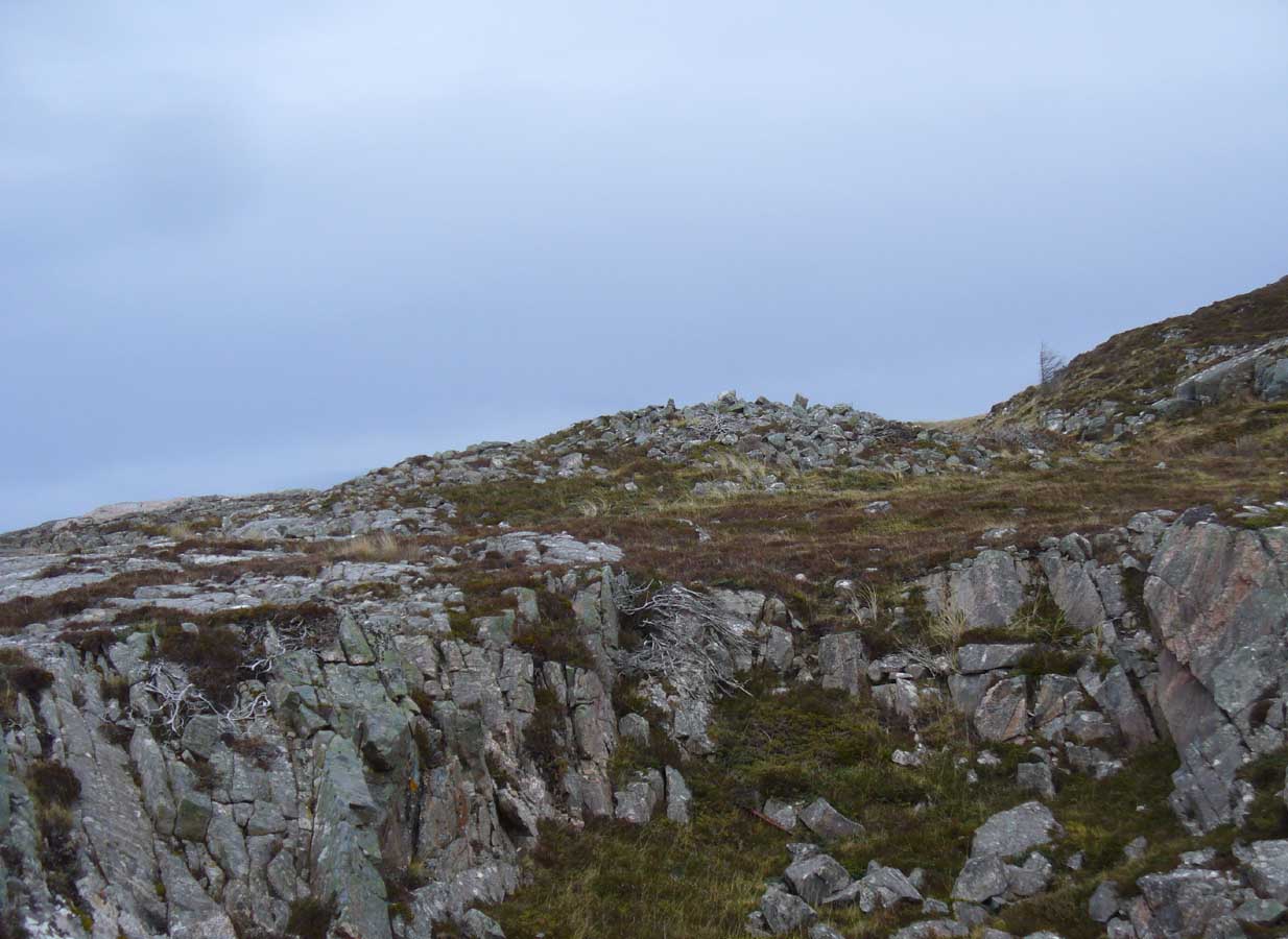
Dun Riaskidh, looking north

This is worth the journey for the scenery of Torrisdale Bay alone: one of the most beautiful places in all Scotland. …Not far from the legendary Ringstone and the carving above, this collapsed mass of scattered rocks was said, in local lore, to have been the remains of an old broch—or that’s what Hew Morrison told the Royal Commission (1911) lads about it when they surveyed the area more than a century back.  Their description was short:

“About ½-mile E of the footbridge across the River Borgie, near Torrisdail, and on the W. side of Druim a’ Chleibh, are the remains of a broch. No outlines of walls are visible. The site is indicated by a structureless heap of stones.”

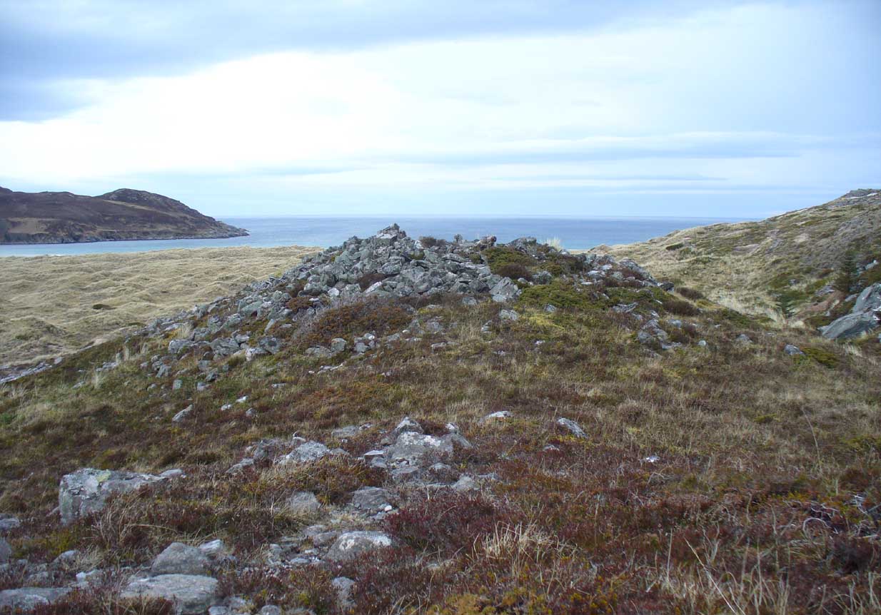
It seems at first to be in an unusual position for a chambered cairn: built onto solid rock instead of soil.  Yet we find this geocentric structuralism echoed at the Borgie chambered tomb 1½ miles to the southeast.  When you reach the place, a large mass of stones—hundreds of them piled-up several feet high—is strewn across the rocky surface and reaching onto more typical moorland ground.  On top are a number of large stones, some laid down, some half-upright appearing, perhaps, to have played some part in an internal cist or chamber.  On the eastern side the rocky mass falls down a natural steep slope, with many of the fallen stones covered by centuries of vegetation.  As you walk around it, cairn-scatter seems to extend southwards towards another natural rocky knoll 20 yards to the south, giving the impression of a second cairn (much like the Fiscary 1 and 2 cairns 2.8 miles to the east), but this is improbable.

The first detailed archaeological account of the site was by Audrey Henshall (1972), who told us:

“…The cairn is about 4ft high, consisting of a mass of angular stones.  On the S side the edge can be traced, and the indications are that the diameter was about 57ft.  The edge on the N side is rather vague and may have been flattened in plan.  On the E and W sides, where there are steep drops, the stones have evidently spread downhill, though on the E side parts of a roughly built edging can be seen.

“Many large slabs lie about the site, probably mainly displaced corbels and roofing stones.  Much of the chamber structure probably exists, and a few visible orthostats are probably in situ.  The entrance has probably been from the N or seaward side.  A slab towards the S side, aligned E-W, projects 1ft 6in, and is likely to be the back-slab.  The E side of the chamber is represented by a slab 4ft 6in to the N, aligned N-S, which is just visible.  On the W side of the chamber there are a number of large slabs, one over the other wide their E edges aligned vertically, and laid declining to the W, which appear to be corbel stones only slightly displaced.  To the N of them, a stone set transversely to the axis of the chamber, 10ft 3in N of the back-slab, might be a portal stone.  Another upright stone seemingly firmly set but obstructing the probable position of the entry into the chamber, is presumably displaced.”

More than twenty years later however, Miss Henshall (1995) revisited Dun Riaskidh and altered her initial diagnosis of it as a chambered cairn, suggesting it to be something completely different, telling:

“The cairn-like structure…has an overall spread of about 17m including stone displaced downhill, and a height of 1.6m on the S side.  On the summit a group of upright slabs protrudes up to 0.35m, and forms a rough oval 5.5m E to W, by 4.5m N to S.  They seem to be on the inner side of a ring of stony material  about 2.5m thick.  In the interior is a disorganised mass of lintel slabs and three earthfast upright slabs.  The structure appears to be a house with spaced uprights in the inner face of the wall, and with a series of uprights which helped to support a partly lintelled roof.  A hollow on the N or seaward side probably indicates the position of the entrance.”

Top of the cairn, looking W

Now woe am I to go against the words of a giant like Miss Henshall, but having slept in numerous derelict houses and seen countless numbers of them in the hills, this structure does not seem to have such properties.  The category that is continued by Canmore and Ordnance Survey re Dun Riaskidh is still a “chambered cairn”; but, perhaps, if Miss Henshall is correct in saying that it is not a cairn, then maybe the words of local tradition may have been right all along (again!) and this is a collapsed broch?  Who knows for sure…?

Whatever its original nature and function, this vestige of antiquity is enveloped within another one of Nature’s incredible domains…

References:

  1. Henshall, Audrey S., The Chambered Tombs of Scotland – volume 2, Edinburgh University Press 1972.
  2. Henshall, Audrey S. & Ritchie, J.N.G., The Chambered Cairns of Sutherland, Edinburgh University Press 1995.
  3. Horsburgh, James, Notes of Cromlechs, Duns, Hut-circles, Chambered Cairns and other Remains, in the County of Sutherland“, in Proceedings Society of Antiquaries, Scotland, volume 7, 1870
  4. Mercer, R.J. & Howell, J.M., Archaeological Field Survey in Northern Scotland – volume 2, University of Edinburgh 1981.
  5. Royal Commission on Ancient & Historical Monuments, Scotland, Inventory of Monuments and Constructions in the County of Sutherland. HMSO: Edinburgh 1911.

Acknowledgments:  Huge thanks to Donna Murray, for putting me up in this part of Paradise.  Cheers Donna.

© Paul Bennett, The Northern Antiquarian 

Castlehill Wood, St Ninians, Stirling, Stirlingshire

Dun:  OS Grid Reference – NS 75074 90902

Also Known as: 

  1. Canmore ID 46233
  2. Castlehill Wood

Getting Here

In ghostly mist and bracken

Take the Gateside Road from St Ninians or Polmaise Road out of Torbrex across the M9, heading out west onto the southern moors of Touch Hills, passing the Wallstale dun in the trees and then the Castlehill dun just off the road.  Keep going uphill for just over half-a-mile, keeping your eyes peeled on the right for where the MOD lads play some of their war-games.  Walk along the track here, following the line of the woods, until it gets to the spot where it doubles back on itself.  Just here, about 30 yards in front of you, a rounded walled knoll gives the game away!

Archaeology & History

Artists impression of the reconstructed site (PSAS 1959)

An impressive-looking site, not too far off the moorland road, it is one of more than half a dozen hillforts and duns found to the west of Stirling, all of them relatively close to each other—showing that a lot of human activity was going on here in the Iron Age and, probably, much earlier.  Looking like a cross between a broch and a traditional hillfort, the site is best visited in the Winter and Spring months before the bracken starts to encroach and cover it.

Officially rediscovered in 1952 and excavated three years later, it was thought to have been built in the 1st century AD and used for a few hundred years thereafter.  As you walk up to the eastern edge of the monument, a large entrance, 4½ feet wide, allows you into the large open space within.  From here, and walking around both the inner and outer walls, you get an idea of the huge amount of work it must have taken to build this structure.  The walls alone which constitute the main of Castlewood Dun are, on average, 16 feet thick!  The Royal Commission report for the area (summarizing the archaeological work of F.W. Feacham in the ’50s) gives the basic architectural features of the place:

“The dun is oval in plan…and measures 75ft from NE to SW, transversely within a drystone wall 16ft thick.  The faces of the wall are composed of large, angular blocks, and the core of boulders, small rubble and earth.  The entrance in the E arc, is provided with door-checks.  Within these, the passage measures 4ft 6in in width, and outside them 3ft 9in.  A few paving-stones were laid to level the rough rock surface of the passage-floor.  Traces of what might have been the bottom step of a stair, rising up the inner face of the wall, were found at a point 8ft N of the entrance.  The dun had no mural stair or galleries, but two sets of mural chambers were located, one in the W and the other in the S acr of the wall.  The former consisted of an entrance-passage, 6ft in length, which varied in width from 2ft at the outer to 3ft at the inner end, where it opened into a circular chamber 4ft in diameter.  From either side of the passage a narrow duct or flue, about 19ft in length and 1ft 6in in width, led off obliquely through the core of the wall to debouch into the interior of the dun.  The construction in the S arc consisted of a similar passage, one flue and a smaller chamber.  Ash and a clinker of very light weight were found in the form of deposits in both passages and all the flues. …The excavator suggested they might have been corn-drying installations.”

Groundplan of site (PSAS 1959)

Entrance details (PSAS 1959)

Apart from a small piece of Roman glass, quern fragments, anvils stones and a pot lid, the excavators found very little inside the dun—not even any hearths.  The walling on the southwest and western edges was built onto a small cliff, making access slightly difficult from that side.

From the site itself, views are excellent, particularly in an arc through the north, east and southeast, with the western skylines being only a short distance away.  This enabled relatively easy tribal communication with people at the other brochs, duns and forts in the area, across an otherwise large but difficult landscape in prehistoric times.  A few hundred yards to the northeast, on the other side of the recently planted tree-farm (forestry plantation), a large D-shaped structure—possibly Iron Age, possibly medieval— is accompanied by lines of ancient walling running down the slopes.

References:

  1. Feachem, R W., “Castlehill Wood Dun, Stirlingshire“, in Proceedings Society Antiquaries, Scotland, volume 90, 1959.
  2. Feachem, R W., “Castlehill Wood, Polmaise”, in Discovery & Excavation Scotland, 1955.
  3. MacKie, E W. “English Migrants and Scottish Brochs’, in Glasgow Archaeological Journal, volume 2, 1971.
  4. Royal Commission on the Ancient & Historical Monuments Scotland, Stirling – volume 1, HMSO: Edinburgh 1963.
  5. Royal Commission Ancient & Historical Monuments, Scotland, Archaeological Sites and Monuments of Stirling District, Central Region, Edinburgh 1979.

© Paul Bennett, The Northern Antiquarian 
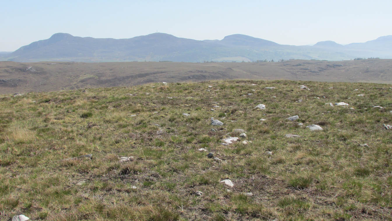

Lady Fife’s Well, Leith, Midlothian

Holy Well? (destroyed):  OS Grid Reference – NT 27534 75794

Archaeology & History

Despite this site having a number of albeit brief literary references, from the early 19th century onwards, the history and traditions of this Well are very scant indeed.  It figures in various texts that detail the historical ‘Battle of Leith’, but there is little additional information in such tomes.  Even local history works pass it by with brevity.

Lady Fifes Well on 1852 map

Lady Fifes Well on 1853 map

Its present name derives from the Countess of Fife who, in the 19th century, lived in the nearby mansion of Hermitage House (and who also grafted her name onto the nearby mound of Lady Fife’s Brae); but this title seems to have been grafted onto the earlier ‘Ladie Well’, implying it had a dedication to St. Mary or more probably an earlier heathen female spirit at the waters. Although it is shown on the OS-maps of 1852 and ’53, and described in Grant’s 1883 work as being there in his time, all subsequent maps after this date seem to indicate that it had gone.

All that we know is that the waters ran into a small stone trough and that Lady Fife enjoyed her evenings here, partaking of the waters.

References:

  1. Bennett, Paul, Ancient and Holy Wells of Edinburgh, TNA 2017.
  2. Campbell, Alexander, The History of Leith from the Earliest Times, William Reid: Leith 1827.
  3. Grant, James, Cassell’s Old and New Edinburgh – volume 3, Cassell, Petter Galpin: London 1883.
  4. Harris, Stuart, “The Fortifications and Siege of Leith,” in Proceedings Society of Antiquaries, Scotland, volume 121, 1991.
  5. Harris, Stuart, The Place-Names of Edinburgh: Their Origins and History, Gordon Wright: Edinburgh 1996.
  6. Hutchison, William, Tales, Traditions and Antiquities of Leith, Leith 1865.
  7. Maxwell, C.A., The Wars of England and Scotland, W.P. Nimmo: Edinburgh 1870.
  8. Russell, John, The Story of Leith, Nelson 1922.

© Paul Bennett, The Northern Antiquarian 
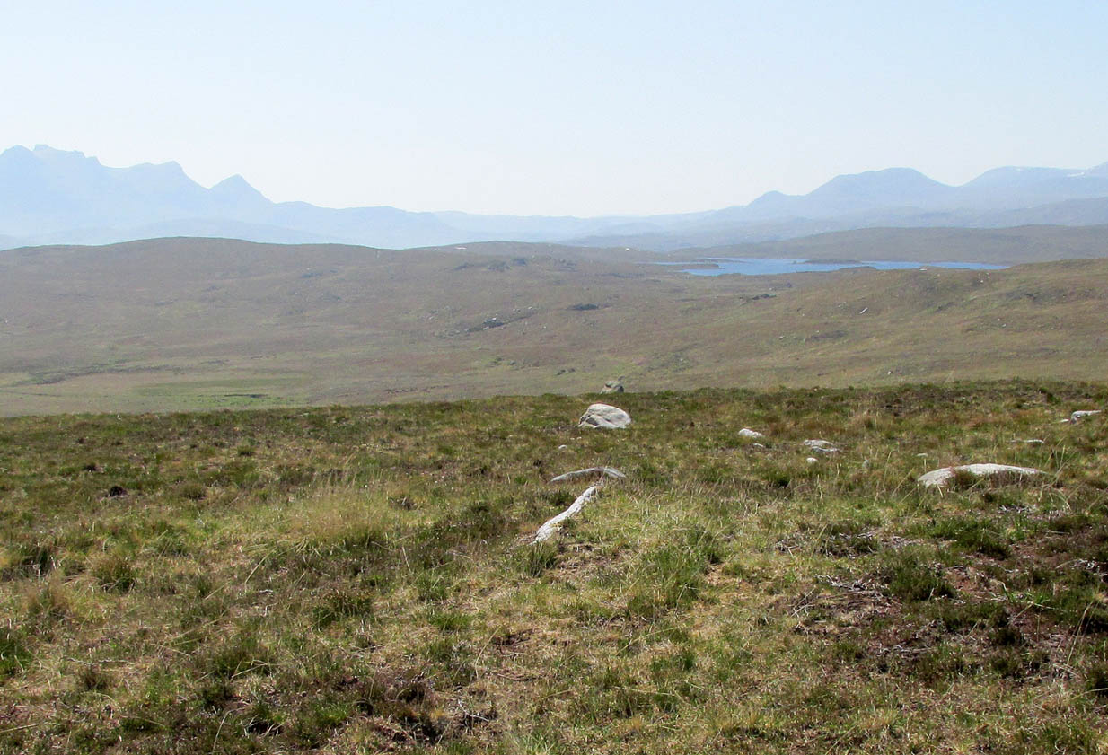

Westport Well, Old Town, Edinburgh, Midlothian

Healing Well (destroyed):  OS Grid Reference – NT 2511 7322

Archaeology & History

Like many others in the city centre, this old well has long since passed into history.  Said by Stuart Harris (1996) to have been “about twenty-five yards east of the eastern corner of Lady Lawson Street”, the Victorian writer Alison Dunlop (1890) told it to be by “a narrow close and an outside stair gave (which) entrance to the Court-house.”  It was the focus of much social activity in ages past; and although a number of public wells could be found in this part of the city, south of the Castle, the Westport Well was the most renowned.  Miss Dunlop told that,

“…its waters (were) of excellent repute (and) had to satisfy the necessities of all the inhabitants of the district.  The early morning never failed to see a long line of water-stoups stretching from it in either direction like the queue at a French theatre door.  Not so quiet, however, for tongues, mostly feminine, wagged freely, and the ‘Waal’ news and gossip were then the equivalent for a racy morning newspaper.”

According to her account, the patience of the people collecting the water was exemplary:

“All crowding-in was fiercely resented; gentle and simple had to stand their turn; only the water-caddies had the abiding right of precedence, and satisfied their customers at the moderate rate of two stoupful for a penny. We have already mentioned these ancient aquarian vessels peculiar to Scotland. In the event of a marriage taking place—in which case the bride was responsible for an amount of house plenishing not considered incumbent or even fashionable now-a-days—the ‘stoups’ were invariably purchased by the intending husband.  Indeed, the Weetin’ o’ the Stoups was the synonym for the last bachelor supper prior to matrimony.  Such festivities are understood to be hilarious, happy, hopeful; and the weetin’ o’ the stoups in Old Portsburgh, as in Old Edinburgh, was sometimes very wet indeed.”
References:

  1. Bennett, Paul, Ancient and Holy Wells of Edinburgh, TNA 2017.
  2. Dunlop, Alison Hay, Anent Old Edinburgh and some of the Worthies Who Walked its Streets, Somerville: Edinburgh 1890.
  3. Harris, Stuart, The Place-Names of Edinburgh: Their Origins and History, Gordon Wright: Edinburgh 1996.

© Paul Bennett, The Northern Antiquarian