Gray Stone, Dunning, Perthshire

Standing Stone:  OS Grid Reference – NO 02182 11809

Also Known as:

  1. Big Stane
  2. Canmore ID 26681
  3. Grey Stone
  4. Maormar‘s Stone

Getting Here

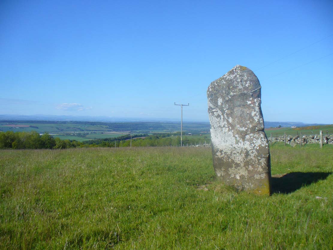
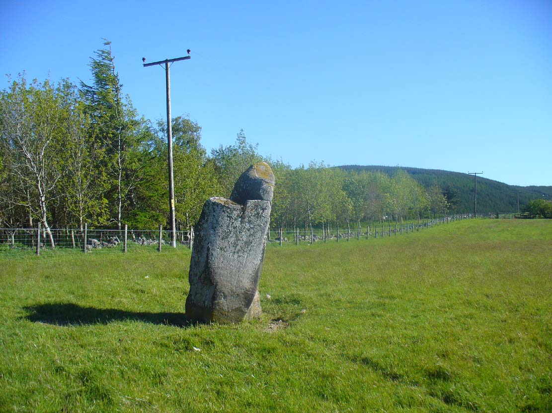
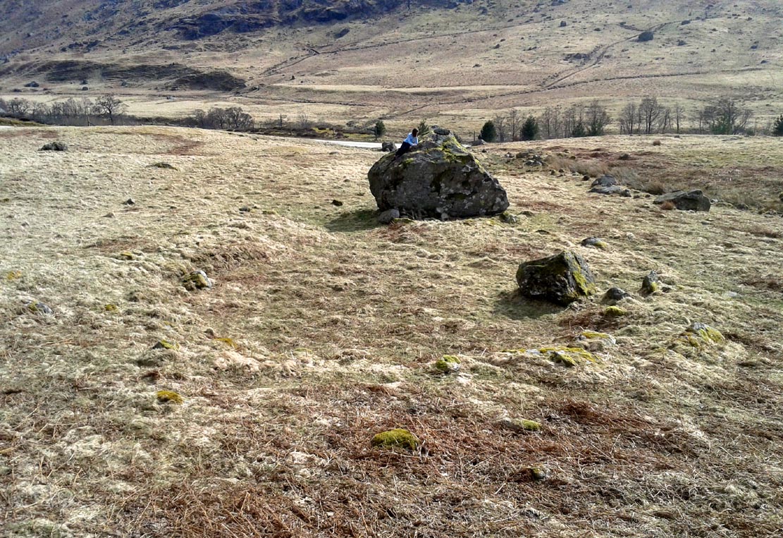
Grey Stone, looking NE

Take the B934 road south, uphill, out of Dunning, for 2.1 miles (3.4km), past Kippen, past Pitmeadow and past Quilts.  It’s the track to Knowes that you’re after!  Along this track, keep to the field-side on your right, following the edge of the fencing until you reach the small copse of trees.  At the far side of the trees a gate takes you into the field with the standing stone, which is just over 100 yards to the north. You can’t miss it!

Archaeology & History

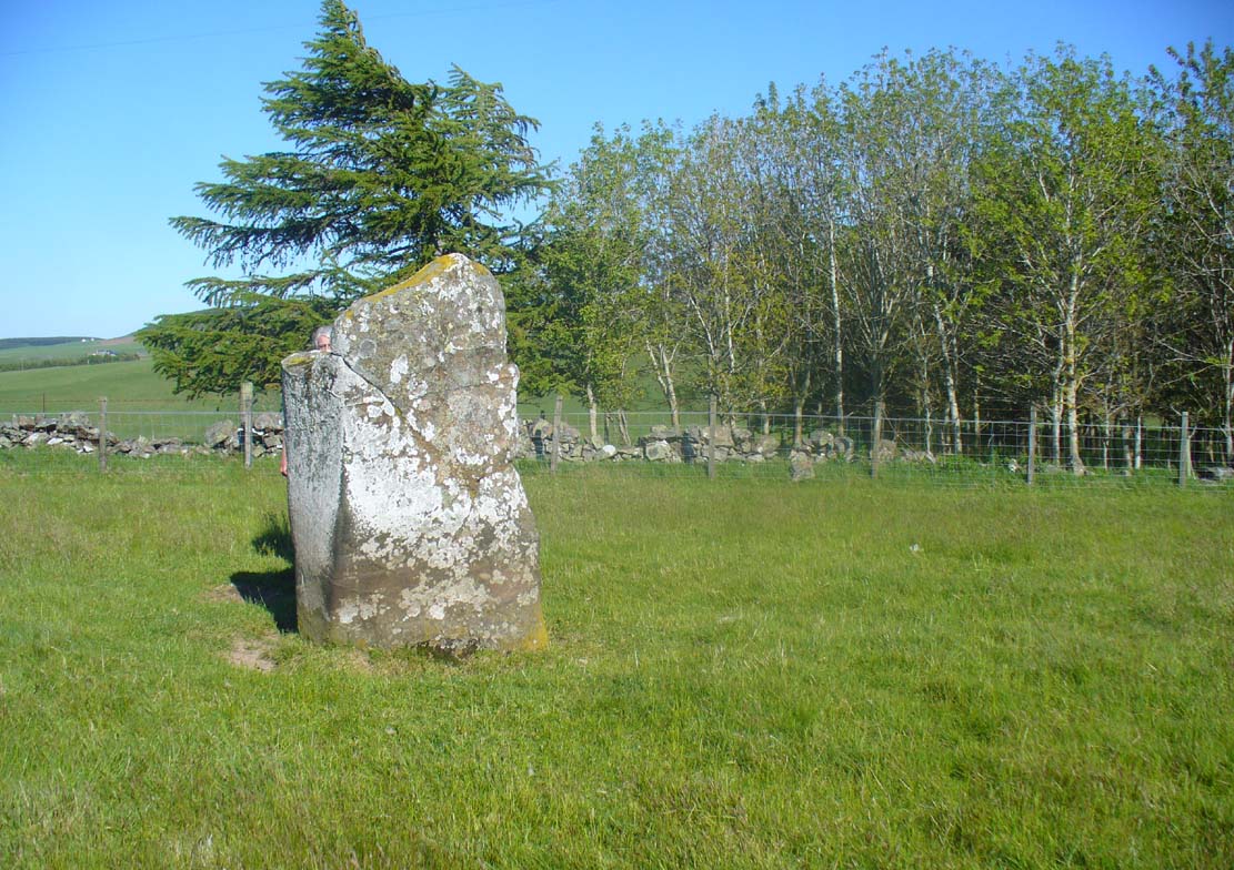
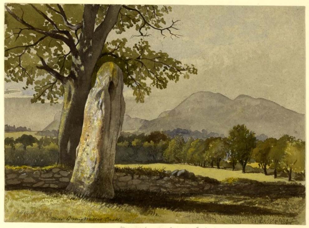
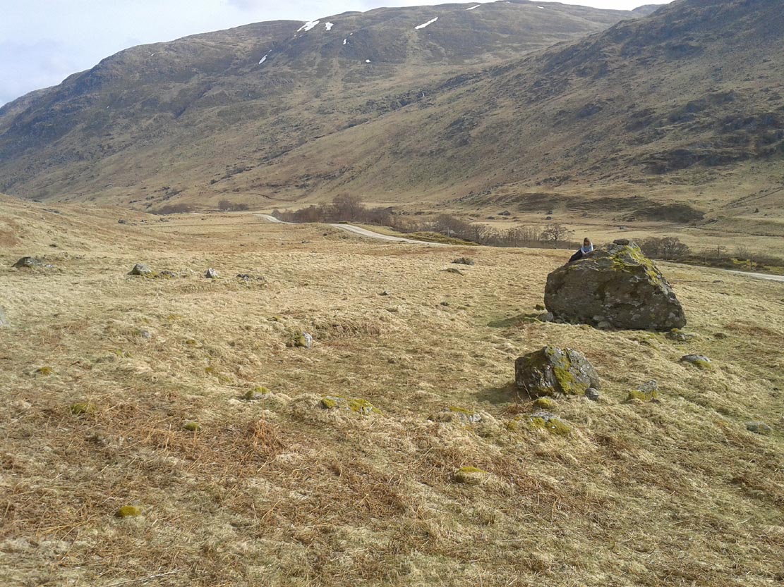
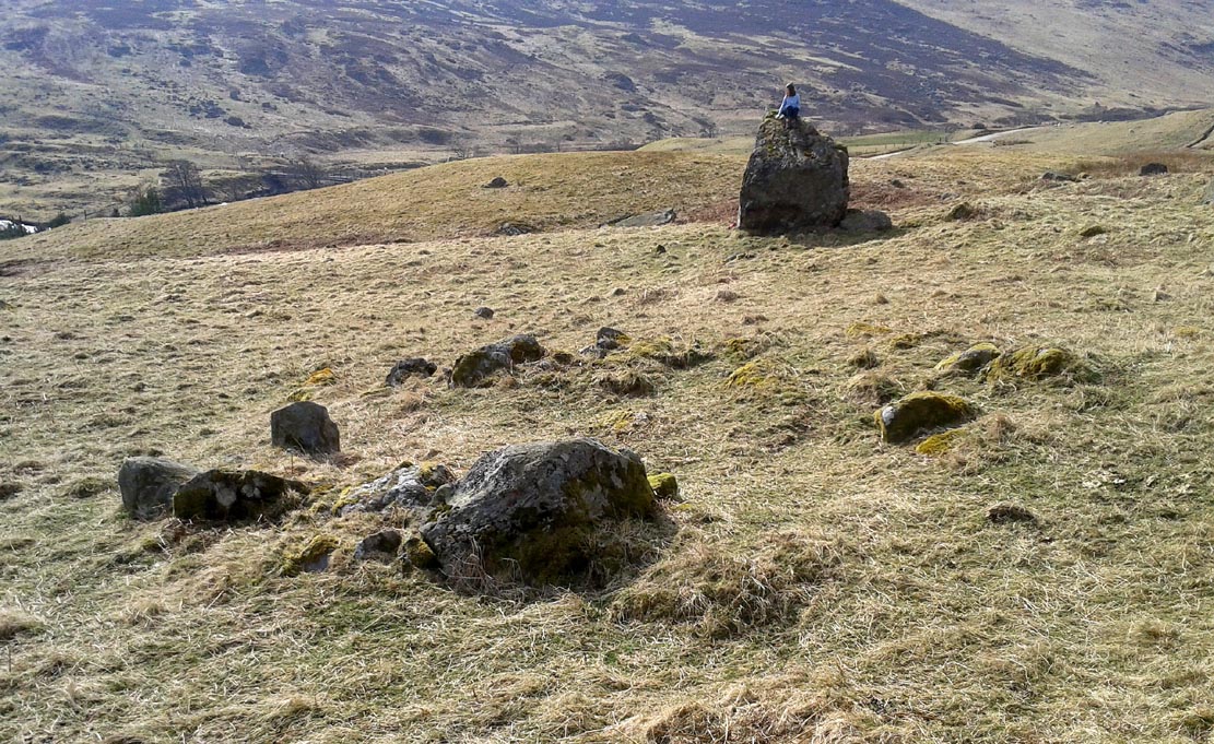
Although mentioned in several folklore works and just a couple of archaeology tomes, almost nothing has been written about this large upright standing stone.  A very bulky stone nearly seven feet tall, it has been broken into pieces at sometime in the recent past but, thankfully, good locals put the stone back together and placed it upright once again.  Its position in the landscape is quite superb, overlooking the lowlands of Tayside below and then far into the rising mountains of Perthshire and beyond, easy fifty miles or more.


Grey Stone, looking south
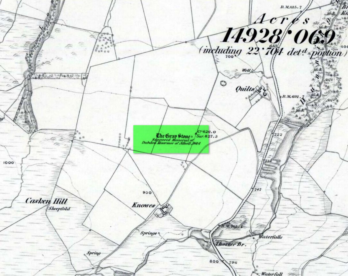
Gray Stone on 1866 map

Shown on the earliest Ordnance Survey map of the area, the name of the stone is somewhat of a puzzle, for in a lot of cases ‘gray’ stones are found on local boundary lines—indeed, the name gray stone and boundary stone are interchangeable in many cases—yet the nearest boundary from here is some distance to the east.  It may simply relate to the colour of the rock (although this is unlikely).  Whatever its reason, it’s an impressive stone and is well worth checking out!

Folklore

Gray Stone, looking east

The local farmer told that the field where the Grey Stone lives was known as the Big Stane Field.  Makes sense!  Legend has it that the Gray Stone was the burial place of Maormor, the Steward of Atholl in the Battle of Duncrub, after dying in Thanes Field (Watson 1995), on land to the north of Dunning village in 964-5 CE.

References:

  1. Holder, Geoff, The Guide to Mysterious Perthshire, History Press 2006.
  2. McKerracher, Archie, Perthshire in History and Legend, John Donald: Edinburgh 1988.
  3. Swarbrick, Olaf, A Gazetteer of Prehistoric Standing Stones in Great Britain, BAR: Oxford 2012.
  4. Watson, Angus, The Ochils: Placenames, History, Tradition, PKDC: Perth 1995.

© Paul BennettThe Northern Antiquarian


Judge’s Cairn, Dunblane, Perthshire

Cairn:  OS Grid Reference – NN 73944 05618


Also Known as:

  1. The Big Cairn
  2. Canmore ID 24661
  3. Dalbrack

Getting Here

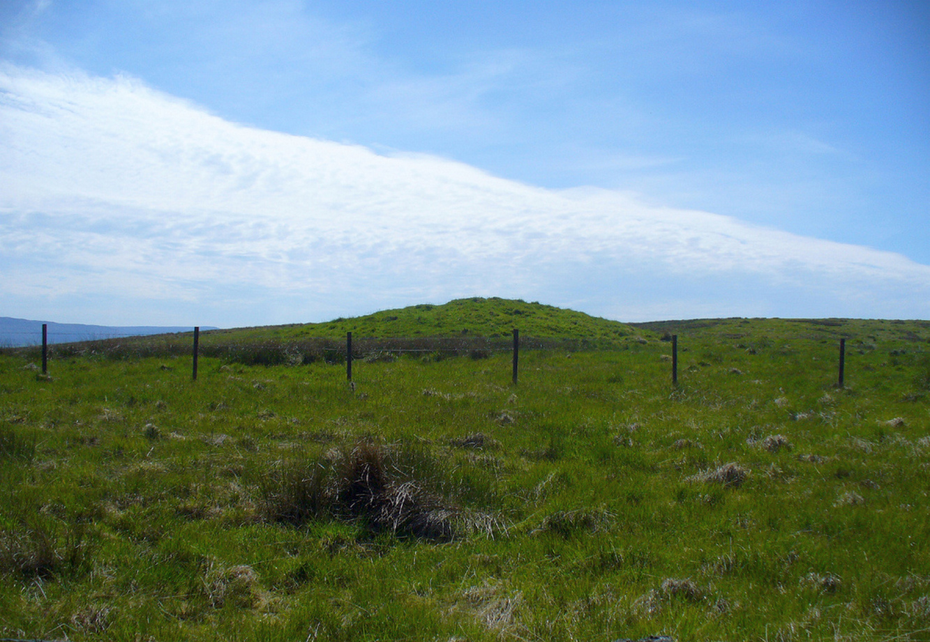
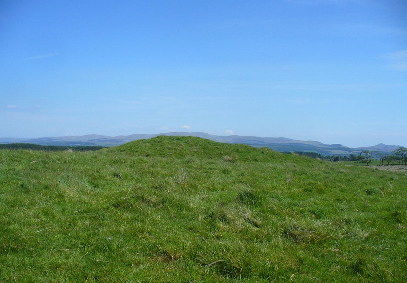
Judges Cairn, looking west

Along the A820 road between Dunblane and Doune, from the Dunblane-side, take the very first minor road on your right a few hundred yards after you’ve come off (or over) the A9 dual-carriageway.  Go all the way to the very top of this long and winding road for several miles, until you reach the gate which prevents you going any further. Walk up the slope on your left (west) and you’ll see the large grassy mound a coupla hundred yards ahead of you. That’s it!

Archaeology & History

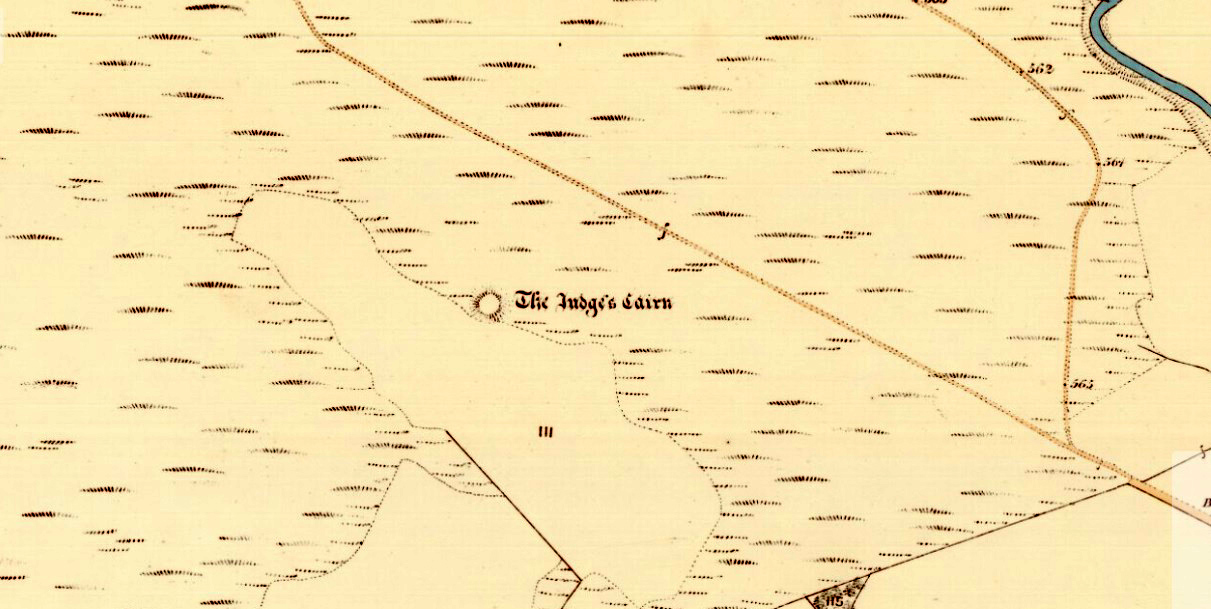
Highlighted on the first Ordnance Survey map of the area in 1862, this is a large rounded prehistoric cairn of some considerable size, whose position in the landscape allows for an impressive 360° view way into the distance in several directions—a deliberate ingredient, no doubt, when it came to building this probable tomb.  I say “probable”, as there has never been a dig (not an ‘official’ one anyway) into the heart of this overgrown rocky mound.

Looking SE into the Ochils
Judges Cairn on 1862 map

More than 60 feet in diameter at its greatest and 6 feet high, with a circumference of 67 yards (61m), the top of the mound has been disturbed and, clearly, has been dug into at some time in the distant past—but archaeohistorical accounts are silent on this matter.  The first description of the Judge’s Cairn seems to have been in Peter Stewart’s (1839) notes on the local antiquities of Dunblane, where he described it most simply as:

“The Judges Cairn, yet undispersed, a circular heap of rough mountains stones covered with furze, on the farm of Bowie, barony of Kilbride.”

Along with the Ordnance Survey lads who came here in 1862, all subsequent visits gave rise to only short notes about the place.  Odd, considering its size and distinct vantage point.  And yet it remains hidden from view unless you come from the north, from whence that archetype of a fairy mound raises itself above Nature’s fair body into the eyes of any ambling wanderer…. A wonderful place to sit and dream for a while…

Folklore

Judges Cairn, looking NE

We enquired with a local whose family had been resident here since the mid-18th century about the name and folklore of the site, but he said he knew of nothing.  However, in earlier times it was said to be a place where the local sheriff held court and dispensed justice.  Mr Mackay (1984) told that the site “has been connected with the Judge’s Seat at Severie” nearby.  It seems possible that, as “it is just outside the parish boundary” between Doune and Dunblane, this may have been a moot site in ancient times, from whence laws were dispensed.  Old perambulation records may, perhaps, prove fruitful…

References:

  1. Barty, Alexander, The History of Dunblane, Eneas MacKay: Stirling 1944.
  2. Mackay, Moray S., Doune – Historical Notes, Forth Naturalist: Stirling 1984.
  3. Royal Commission on the Ancient & Historical Monuments of Scotland, Archaeological Sites and Monuments of Stirling District, Central Region, Society of Antiquaries of Scotland 1979.
  4. Shearer, John E., “Prehistoric Man and Prehistoric Remains in Britain,” in Transactions of the Stirling Natural History & Archaeological Society, 1907.
  5. Stewart, Peter G., Essay on the Dunblane Mineral Springs, Hewit: Dunblane 1839.

© Paul BennettThe Northern Antiquarian


Conichan East, Glen Almond, Perthshire

Settlement:  OS Grid Reference – NN 84645 32074

Getting Here

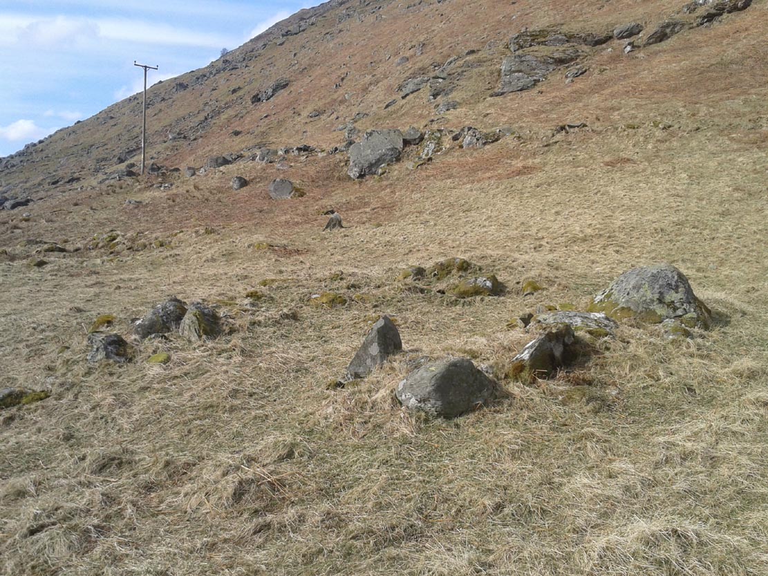
The setting of the remains

The setting of the remains

Park up and walk the long estate track up Glen Almond for nearly three miles until, on your left, you’ll see a small pond.  From here, walk up the slope and, about 100 yards above you, note the large solitary boulder ahead, above the dyke of a small walled stream, where the land levels out.  Just past the rock itself is the first of several remains.

Archaeology & History

First things first: the grid-reference cited here is centred upon the largest of several rings of stone found on this small grassy plateau, 150 yards north above the River Almond, just past the huge boulder.  It’s an impressive site – and a previously unrecorded one.

The raised ring of Conichan

The raised ring of Conichan

Looking southeast

Looking southeast

At least three large hut circles can be clearly seen on this small ridge, amidst a sea of prehistoric sites scattered all down this lonely Scottish glen.  When Paul Hornby, Lara Domleo and I meandered up here the other day (to visit the Clach na Tiompan megaliths), extensive prehistoric walling called my nose up the slopes to see if anything was hiding away—and a large prehistoric ring, more reminiscent of the Derbyshire stone circles and ring cairns than any hut circle, appeared before me.

The first and largest that I came across is the one immediately north of the huge boulder (which may have slight traces of ancient walling running up to it).  The large ring is clearly raised onto a flat level platform, with an entrance on its southern edge.  The ring itself measures, from outer-wall to outer-wall some 12 yards wide (E-W) and 11 yards N-S.  The northernmost section of the walling or stone embanked structure is built into the sloping hill to the rear, with the east and western walls constructed simply onto the flat land.  The walling itself is typical of prehistoric structures, comprising the usual mass of small stones packed within a number of larger upright stones; although much of it is very overgrown with centuries of vegetation.  The walling that constitutes the ring itself is between 1-2 yards across and about two-feet high above the present ground-level.

Second circular remains

Second circular remains

...and from another angle

…and from another angle

To the east of this is a smaller, roughly circular construction of similar form.  The rocks that make up this site are much more visible and may have been robbed and used in the more extensive walling above and the dykes below.  It is unclear whether the nature of this site is the same as that of the more defined circular enclosure we have just described.

The remains of a third structure was clearly evident a short distance to the east of this, but I didn’t have much time here and another visit is needed to make further assessments.  Iron Age walling and other undocumented prehistoric remains were also found close by.

Acknowledgements:  Many thanks to the noses of little Lara Domleo and Prof. Paul Hornby for their bimbling aid to relocate this site – and one or two others that have been off the radar for many-a-century.

© Paul BennettThe Northern Antiquarian


Auchnafree, Glen Almond, Perthshire

Standing Stone:  OS Grid Reference – NN 8225 3336 

Getting Here

Auchnafree Stones, looking east

Auchnafree Stones, looking E

Walk up the long track of beautiful Glen Almond, past the East Conichan circle and past the giant tomb of Clach na Tiompan.  After about 4.2 miles (6.8km), the track diverges: take the one directly west, over the old bridge, and less than 100 yards past here, note the gate on your right.  Go into the field and start walking uphill until you’re at the highest point a few hundred yards up.  You’ll find the stones in front of you.

Archaeology & History

Auchnafree Stones, looking NW

Auchnafree Stones, looking NW

Somewhat reminiscent in style and form to the standing stones at Dumgoyach, north of Glasgow, this one upright monolith and its seemingly fallen companion have not previously been recorded by archaeologists—but it is quite a distance away from anywhere. The upright stone is about one metre tall and its lumbered companion about four feet long.  The remains of a small stone, probably broken from the larger mass, extended beyond the long stone.  Another unrecorded standing stone can be found on another hillock a few hundred yards from here.

© Paul BennettThe Northern Antiquarian


Allt a’ Choire Chireinich, Kenmore, Perthshire

Cup-and-Ring Stone:  OS Grid Reference – NN 65096 39442

Getting Here

The stone, uncovered

The stone, uncovered

Take the A827 road between Killin and Kenmore and park-up at the entrance to Tombreck. Cross the road and walk up the track that goes up Ben Lawers.  As it zigzags uphill, watch out for you being level with the top of the copse of trees several hundred yards west, where a straight long overgrown line of walling runs all the way to the top of the copse. Go along here, and just as you reach the trees, walk uphill for about 50 yards.  You’re damn close!

Archaeology & History

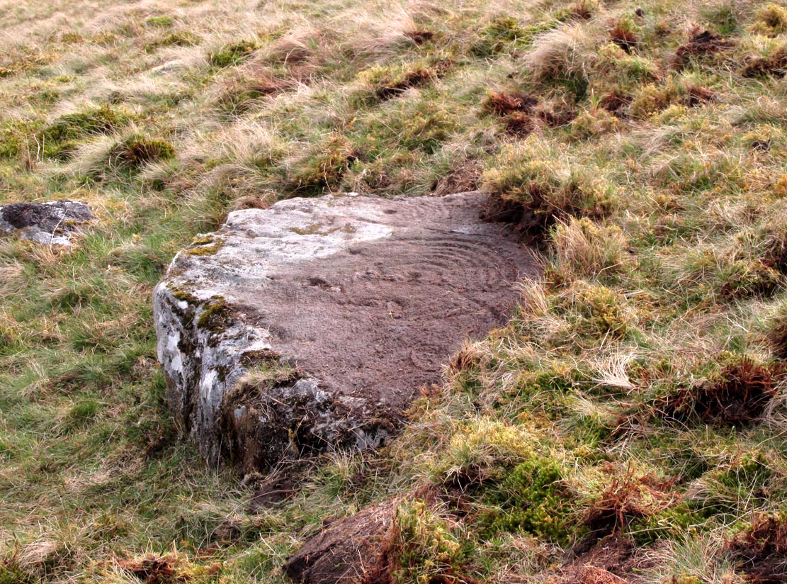
Whether you’re into prehistoric carvings or not, this is impressive!  It’s one of several with a very similar multiple-ring design to be found along the southern mountain slopes of Ben Lawers.  Rediscovered on May 13, 2015, several of us were in search of a known cup-and-ring stone just 260 yards (238m) to the northwest in this Allt a’ Choire Chireinich cluster, but one stone amongst many called my nose to have a closer sniff—and as you can see, the results were damn good!

Looking from above

Looking from above

Etched onto a large flat rock perhaps 5-6000 years ago, probably over at least two different seasons, the primary design here is of two sets of multiple-rings: in one case, seven concentric ones emerging from, or surrounding a central cup-marking (more than an inch across); and the other is of at least eight concentric rings emerging from a cup-marking, about half-an-inch across. The largest cup-and-seven-rings is the one near the centre of the stone.  Initially I thought this was simply two concentric seven-rings; but the more that I looked through the many photos we’d taken, the more obvious it became that the residue of an eighth ring (possibly more) exist in the smaller-sized concentric system.  It must however be pointed out that neither of the concentric carved rings seem to be complete – i.e., they were never finished, either purposefully or otherwise.  The largest cup-and-seven-rings is the one near the centre of the stone; with the outer smaller example being half the size of the one in the middle.  At first glance, neither of the concentric rings seem complete – and so it turned out when it was enhanced by rain and sun.

First photo of the double-rings

First photo of the double-rings

The large central cup-and-seven-rings has two additional cup-marks within it: one on the outer fifth ring to the southeast, and the other in the outer sixth ring to the west.  This western cup-mark is also crossed by a carved line that runs from the first ring outwards to the west and to the edge of the rock, crossing another cup-mark along the way.  This particular carved line might be the same one that integrates itself into the first ring, and then re-emerges on is northeastern side, to continue out of the multiple-rings themselves and curve over to the eastern side of the rock.  Running roughly north-south through the middle of this larger seven-ring element, a line scarred by Nature is visible which has been pecked by humans on its northern end, only slightly, and running into the covering soil eventually, with no additional features apparent.  Another possible carved line seems in evidence running from the centre to the southeastern edge – but this is by no means certain.

The carving, looking north

The carving, looking north

This large central seven-ringed symbol has been greatly eroded, mainly on its southern sides, where the rings are incomplete, as illustrated in the photos.  Yet when the light is right, we can see almost a complete concentric system, with perhaps only the second ring from the centre being incomplete on its eastern side.  On the southern sides, the visibility factor is equally troublesome unless lighting conditions are damn good.  The northernmost curves, from west to east, are the deepest and clearest of what remains, due to that section of the stone being covered in soil when it was first discovered, lessening the erosion.
Smallest 7-ring section, with cups

Smallest 7-ring section, with cups

Multiple-ring complex & cups

Multiple-ring complex & cups

Moving onto the second, smaller concentric set of rings: this is roughly half the size of its counterpart in the middle of the stone.  Upon initial investigation you can clearly make out the seven rings, which have faded considerably due to weathering.  It seems that this section was never fully completed.  And the weathering on this smaller concentric system implies one of two things: either that it was left open to the elements much much longer than its larger seven-ring system, or it was carved much earlier than it.  In truth, my feeling on this, is the latter of the two reasons.  Adding to this probability is the fact that even more rings—or at least successive concentric carved ‘arcs’—are faintly visible around this more faint system: at least eight are evident, with perhaps as many as thirteen in all (which I think would put it in the record-books!).  But we need to visit it again under ideal lighting conditions to see whether there are any more than the definite eight.  It is also very obvious that the very edge of the rock here has been broken off at some time, and a section of the carving went with it—probably into the ancient walling below or the derelict village shielings on the mountains slopes above.

Just above the eroded eight-ring section are three archetypal cup-marks close to the very edge of the rock, one above each other in an arc.  Of these, the cup that is closest to the eight-rings possesses the faint remains of at least two other partial rings above it, elements of which may actually extend and move into the concentric rings themselves—but this is difficult to say with any certainty.  However, if this is the case, we can surmise that this small cup-and-two-rings was carved before its larger tree-ring-looking companion.

Below the smaller seven-ringer is the possibility of a wide cup-and-two-rings: very faint and incomplete.  This only seems visible in certain conditions and I’m not 100% convinced of its veracity as yet.
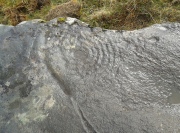
Curious 'eye'-like symbol

Curious ‘eye’-like symbol

'Eye' to the bottom-left

‘Eye’ to the bottom-left

We also found several other singular cup marks inscribed on the rock, all of them beneath the two concentrics, moving closer to the edge of the rock.  But a more curious puzzle is an eye-like symbol, or geological feature, on the more eastern side of the stone.  It gives the impression of being worked very slightly by humans, but as I’m not a geologist, I’ve gotta say that until it is looked at by someone more competent than me, I aint gonna commit myself to its precise nature.  What seems to be a carved line to the left (west) of this geological ‘eye’ may have possible interference patterns pecked towards it.  Tis hard to say with any certainty.

So – what is this complex double-seven-ringer?!  What does it represent?  Sadly we have no ethnological or folklore narratives that can be attributed to the stone since The Clearances occurred.  We only have the very similar concentric six- and seven-ringed petroglyphs further down the mountainside to draw comparisons with.  We could guess that the position of the stone halfway up Ben Lawers, giving us a superb view of the mountains all around Loch Tay might have some relevance to the carving; but this area was probably forested when these carvings were etched—which throws that one out of the window!  We could speculate that the two multiple rings represent the Moon and Sun, with the smaller one being the Moon. They could represent a mythic map of Ben Lawers itself, with the central cup being its peak and outer rings coming down the levels of the mountain.  Mountains are renowned in many old cultures as, literally, cosmic centres, from whence gods and supernal deities emerge and reside; and mountains in some parts of the world have been represented by cup-and-ring designs, so we may have a correlate here at Ben Lawers.  O.G.S. Crawford (1957) and Julian Cope (1998) would be bedfellows together in their view of it being their Eye Goddess.  But it’s all just guesswork.  We do know that people were living up here and were carving other petroglyphs along this ridge, some of which occur inside ancient settlements; but the traditions of the people who lived here were finally destroyed by the English in the 19th century, and so any real hope of hearing any old myths, or possible rites that our peasant ancestors with their animistic worldview possessed, has died with them.

Tis a fascinating carving nonetheless—and one worthy of seeking out amongst the many others all along this beautiful mountainside…

References:

  1. Bernbaum, Edwin, Sacred Mountains of the World, Sierra Club: San Francisco 1990.
  2. Cope, Julian, The Modern Antiquarian, Thorsons 1998.
  3. Crawford, O.G.S., The Eye Goddess, Phoenix House: London 1957.
  4. Eliade, Mircea & Sullivan, Lawrence E., “Center of the World,” in Encyclopedia of Religion – volume 3 (edited by M. Eliade), MacMillan: Farmington Hills 1987.
  5. Evans-Wentz, W.Y., Cuchuma and Sacred Mountains, Ohio University Press 1980.
  6. Gillies, William A., In Famed Breadalbane, Munro Press: Perth 1938.
  7. Michell, John, At the Centre of the World, Thames & Hudson: London 1994.
  8. Yellowlees, Sonia, Cupmarked Stones in Strathtay, Scotland Magazine: Edinburgh 2004.

Acknowledgements:  Huge thanks to Paul Hornby for the use of his photos in this site profile; to Lisa Samson, for her landscape detective work at the site; and to Fraser Harrick, for getting us there again.

© Paul BennettThe Northern Antiquarian

Aikenhead Farm, Blairgowrie, Perthshire

Cup-and Ring Stone (destroyed):  OS Grid Reference – NO 143 430

Archaeology & History

In John MacDonald’s History of Blairgowrie (1899), he describes a number of the prehistoric sites in the neighbourhood, including the cup-marked standing stone at nearby Glenballoch. However, one petroglyph that seems to have escaped the attention of all previous surveys was, “one unearthed in 1897 at Aikenhead,” southeast of Blairgowrie.  Mr MacDonald described it as possessing “a large number” of cup markings “of various sizes.” But even in his day he reported that the carving had, “unfortunately, been destroyed.”

I can find no other references to this site.  Is anyone aware of any, or know anything more about this lost stone?

References:

  1.  MacDonald, John A.R., The History of Blairgowrie, Advertiser: Blairgowrie 1899.

© Paul BennettThe Northern Antiquarian

Ravenswood Avenue, Liberton, Edinburgh, Midlothian

Standing Stone:  OS Grid Reference – NT 28282 70502

Also Known as:

  1. Canmore ID 52108
  2. Craigend
  3. Greenend

Getting Here

The stone in the 19th century

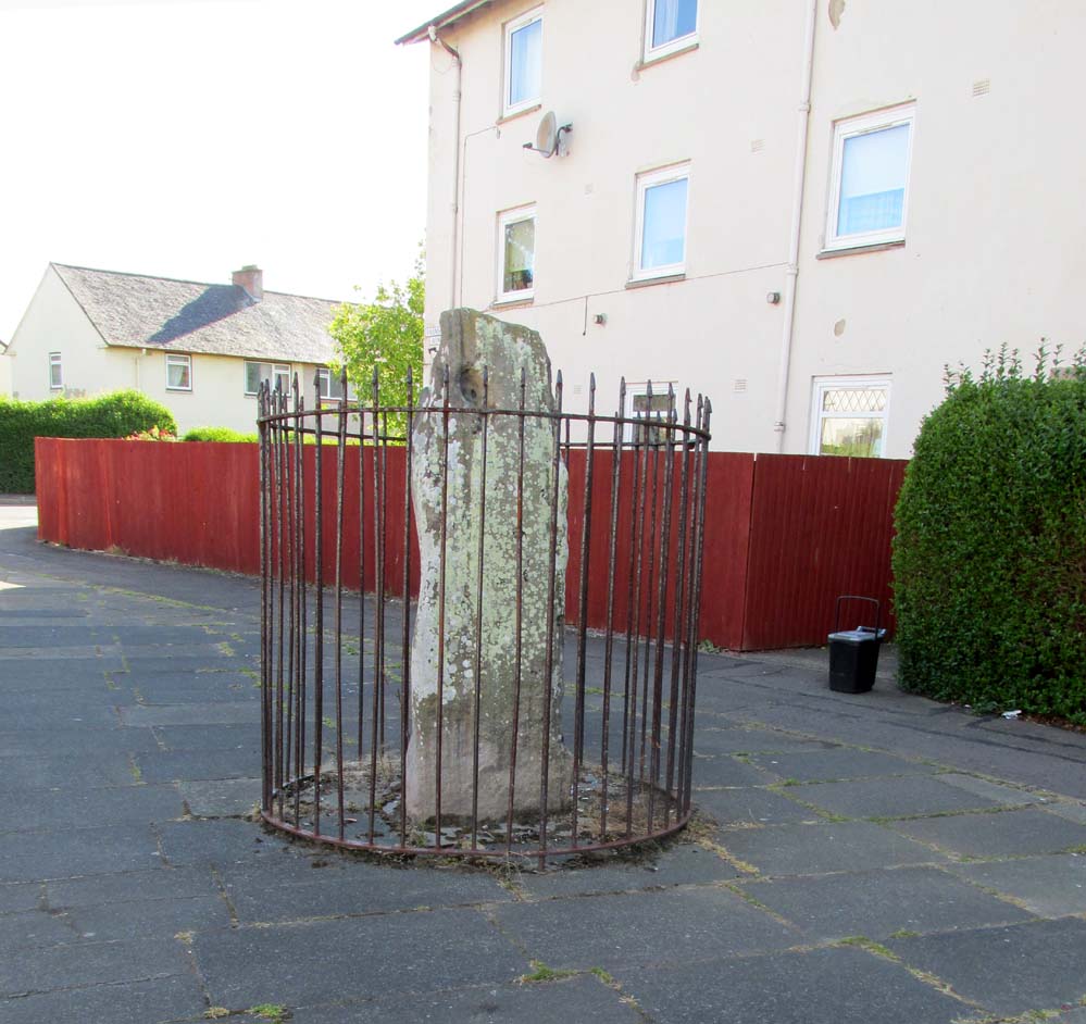
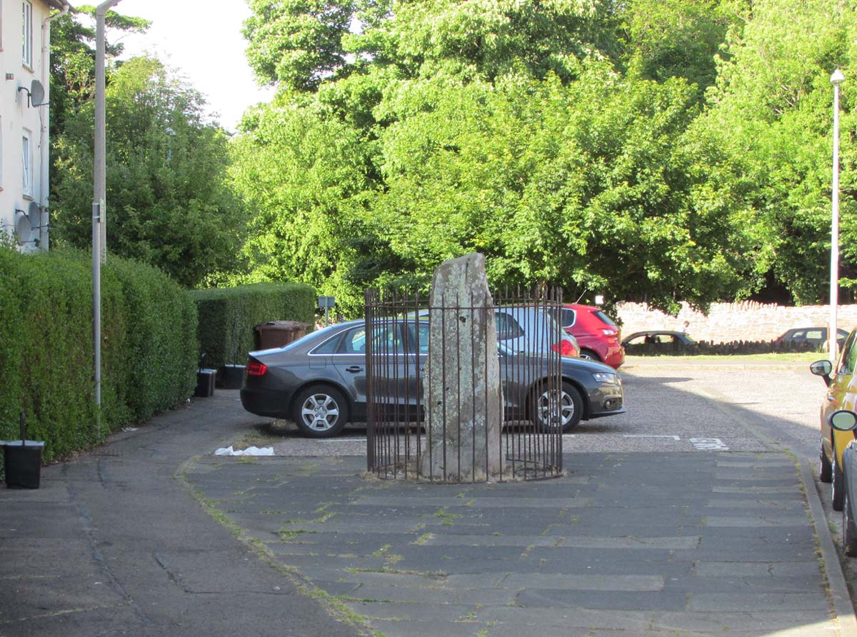
Take the A7 road south from Edinburgh central (off Princes Street) for several miles.  It becomes known as the Old Dalkeith Road eventually, just as it passes the huge wooded ground of Craigmillar Castle on your left (east) and the Inch estate on your right. Walk along here, keeping your eyes peeled for the small path that takes you onto Ravenswood Avenue.  Barely 30-40 yards from the main A7 road, the standing stone is there surrounded by railings.

Archaeology & History

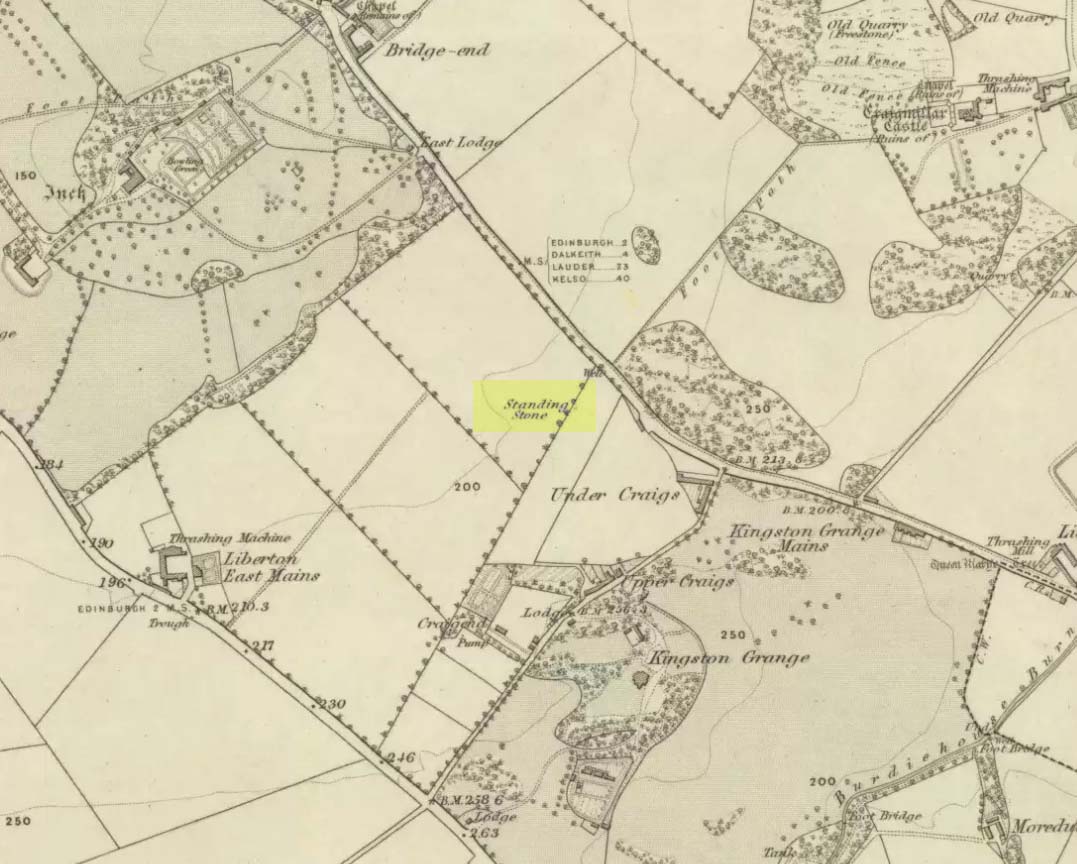
A curious place to find a standing stone – especially one that’s still alive!  But that’s what we find on the Inch housing estate, thankfully.  Highlighted on the 1855 Ordnance Survey map, it was one of a number of standing stones described in George Good’s (1893) fine survey on Liberton parish, which he thought commemorated ancient battles.  When he wrote about it, the monolith was “built into the wall on the public road to Greenend”, just as shown on the OS-map.  He told how the

“stone was taken down in the beginning of the present century (c.1801), when the road was widened, and it long lay in the field opposite, but was restored to its original place in 1891.”

When the Royal Commission (1929) lads came here many years later, they gave their own archaeocentric description, telling:

Site shown on 1855 map
The old stone in its cage

“About 40 yards from the main road near Little France…is a standing stone, which is set up without packing, with its main axis almost due north and south, but with a slight inclination towards the east. It stands 6¾ feet above ground, and has a girth of 6 feet 5 inches at 3 feet from the base.  It is of grey sandstone, badly weathered on two sides and without traces of any artificial markings or design.”

The monolith was included in Adam McLean’s (1977) megalithic survey of the area, where he rightly said how the iron fence that surrounds the stone destroys any atmosphere that might once be had here.  Still, at least it’s still standing and is worth checking out if you’re in the area.

Folklore

The Ravenswood Stone

An old footpath that runs dead straight from Craigmillar Castle towards the stone was long ago said to be the pathway taken by the ghost of a white lady.

In days prior to the housing estate being built, local folk had annual bonfires here between Samhain (Halloween) and Guy Fawkes Night (Oct 31 – Nov 5).

References:

  1. Good, George, Liberton in Ancient and Modern Times, Andrew Elliot: Edinburgh 1893.
  2. McLean, Adam, The Standing Stones of the Lothians, Megalithic Research Publications: Edinburgh 1977.
  3. Royal Commission on the Ancient & Historical Monuments of Scotland, Inventory of Monuments and Constructions in the Counties of Midlothian and West Lothian, HMSO: Edinburgh 1929.

© Paul BennettThe Northern Antiquarian

Wells o’ Wearie, Duddingston, Edinburgh, Midlothian

Sacred Wells (destroyed):  OS Grid Reference – NT 2741 7241

Also Known as:

  1. Wells o’ Weary
  2. Well of Wery

Archaeology & History

The precise spot for these “wells” is difficult to say today with any certainty, which is unfortunate as it was a renowned spot for a variety of reasons.  The wells were apparently disrupted and fell back into the Earth when the Industrialists dug their train-line into the south-side of Arthur’s Seat.  On the early maps, we can see several ‘troughs’, ‘pumps’ and ‘wells’—one or more of which are said to be the site (and which we base the OS grid-reference on, above).

Site on 1821 Kirkwood map
Wells o’ Wearie ponds

The Wells of Wearie were one of nearly a dozen sacred and healing wells surrounding legendary Arthur’s Seat at the edge of Edinburgh, and whose waters were also said to have supernatural properties.  Shown on James Kirkwood’s 1821 map of Edinburgh (left) as the ‘Well of Wery’, this curiously named site was renowned in earlier centuries as an excellent water supply for the local people — “to cure the weary traveller” for one.  Today, all we have left of them are the small ponds immediately below the road, next to the converted railway line path, just as you come out of the long tunnel.

Folklore

In Henderson & Cowan’s (2007) fine work on Scottish fairy lore, they outline the witchcraft trial of a local woman, Janet Boyman, who was said to have performed ritual magick at the Wells of Wearie.  They told:

“Jonet Boyman of Canongate, Edinburgh, accused in 1572 of witchcraft and diabolic incantation, the first Scottish trial for which a detailed indictment has so far been found. Indeed, it is one of the richest accounts hitherto uncovered for both fairy belief and charming, suggesting an intriguing tradition which associated, in some way, the fairies with the legendary King Arthur.  At an ‘elrich well’ on the south side of Arthur’s Seat, Jonet uttered incantations and invocations of the ‘evill spreits quhome she callit upon for to come to show and declair’ what would happen to a sick man named Allan Anderson, her patient.  She allegedly first conjured ‘ane grit blast’ like a whirlwind, and thereafter appeared the shape of a man who stood on the other side of the well, and interesting hint of liminality.  She charged this conjured presence, in the name of the father, the son, King Arthur and Queen Elspeth, to cure Anderson.  She then received elaborate instructions about washing the ill man’s shirt, which were communicated to Allan’s wife.  That night the patient’s house shook in the midst of a huge and incomprehensible ruckus involving winds, horses and hammering, apparently because the man’s wife did not follow the instructions to the letter.  On the following night the house was plagued by a mighty din again, caused, this time, by a great company of women.’”

The Wells were, in earlier centuries, a site where lovers and wanderers came to relax and dream. It was a traditional gathering spot — not just for witches! — and poetry was written of them – including this by A.A. Ritchie:

“The Wells o’ Wearie — 

Sweetly shines the sun on auld Edinbro’ toun.
And mak’s her look young and cheerie;
Yet I maun awa’ to spend the afternoon
At the lanesome Wells o’ Wearie.

And you maun gang wi’ me, my winsome Mary Grieve,
There’s nought in the world to fear ye;
For I hae ask’d your minnie, and she has gien ye leave
To gang to the Wells o’ Wearie.

O the sun w-inna blink in thy bonny blue een.
Nor tinge the white brow o’ my dearie.
For I’ll shade a bower wi’ rashes lang and green,
By the lanesome Wells o’ Wearie.

But Mary, my love, beware ye dinna glower
At your form in the water sae clearly,
Or the fairy will change ye into a wee wee flower,
And you’ll grow by the Wells o’ Wearie.

Yestreen, as I wander’d there a’ alane,
I felt unco douf and drearie,
For wanting my Mary a’ around me was but pain
At the lanesome Wells o’ Wearie.

Let fortune or fame their minions deceive,
Let fate look gruesome and eerie ;
True glory and wealth are mine wi’ Mary Grieve,
When we meet by the Wells o’ Wearie.

Then gang wi’ me, my bonny Mary Grieve,
Nae danger will daur to come near ye.
For I hae ask’d your minnie, and she has gien ye leave
To gang to the Wells o’ Wearie.”

References:

  1. Baird, William, Annals of Duddingston and Portobello, Andrew Elliot: Edinburgh 1898.
  2. Bennett, Paul, Ancient and Holy Wells of Edinburgh, TNA: Alva 2017.
  3. Carrick, John D. (ed.), Whistle-Binkie, or the Piper of the Party – volume 2, David Robertson: Glasgow 1878.
  4. Colston, James, The Edinburgh and District Water Supply, Edinburgh 1890.
  5. Henderson, Lizanne & Cowan, Edward J., Scottish Fairy Belief: A History, John Donald: Edinburgh 2007.
  6. Ramsay, Alexander, On the Water Supply of Edinburgh, Neill & Co.: Edinburgh 1853.

© Paul BennettThe Northern Antiquarian

Horse Well, Duddingston, Edinburgh, Midlothian

Healing Well:  OS Grid Reference – NT 28198 72642

Getting Here

Horse Well on 1852 map

Get to the Delf Well from Duddingston and keep walking along the lochside road for 60-70 yards, where you go through the black metal gate in the fence on your left.  Walk down the slope just a few yards and (drought dependent!) you’ll see an initial damp patch where the well used to arise 150 years ago; just a few yards further down the slope is the more notable spring water of the Horse Well below you.

Archaeology & History

The site is shown on the 1852 map of the area where it was later “capped” and used by the old local water authority.  Thankfully the water has managed to escape and is once more feeding the birds and the land, running into the loch below.  When we arrived here, a crow was drinking from the waters.

Horse Well & its herbs

Although you’d expect that this was once a watering-place for horses, the name of the well may relate to the Scottish folk-name of the herb Veronica beccabunga, generally known as Brooklime or European Speedwell, but locally called Horse-well grass—some of which seemed to be growing in the watery spring amidst the other plants.  As a herb it was used in the treatment of scurvy.  The history of the well however, seems all but forgotten…

References:

  1. Bennett, Paul, Ancient and Holy Wells of Edinburgh, TNA: Alva 2017.
  2. Grant, William (ed.), Scottish National Dictionary – volume 5, SNDA: Edinburgh 1958.

© Paul BennettThe Northern Antiquarian

Talmine (west), Melness, Tongue, Sutherland

Settlement:  OS Grid Reference – NC 5764 6248 

Getting Here

Large arc of low walling, across upper-centre

Along the A836 road between Durness and Tongue, take the minor road north to Melness and Talmine. 400 yards or so past Talmine Stores shop, walk left up the track onto the moor. Half a mile on, walk straight uphill on yer right for about 150 yards until it levels out.  Look all around you!

Archaeology & History

This is a fascinating new find, explored under the guidance of Sarah MacLean of Borgie.  After looking at the nearby cairnfield and hut circles to the southeast, our noses took us onto the hilltop, where an extravaganza of curved and straight walling, hut circles, denuded cairns, cists, possible chambered cairn remnants and even unrecorded stone rows had us almost bemused at the extent of the remains.  A lot of it has been severely damaged and robbed – but in the low vegetation scattering the hilltop, it became clear that a lot of activity had been going on in the ancient and perhaps not-too-ancient past, with a social and/or tribal continuity stretching way way back (as found at Baile Mhargaite near Bettyhill).

Straight line of low walling

As we walked up the unnamed hill (well, to be honest, we zigged and zagged, or bimbled, until we got to the top), above a line of prehistoric cairns on the slopes below, small lines of walling barely above ground-level stretched out before us.  Structurally akin to the neolithic and Bronze Age features found from northern England to this far northern region, they are low and deeply embedded in the peat, but are quite unmistakable.

In following the first real line of walling near the eastern edge of the hill, a flat panorama eventually opened up as we reached the top and there, in front of us, appeared arcs and lines of more walled structures, thankfully unobstructed by vegetation.  A few expletives came out of my mouth (for a change!) at the remains we could see right in front of us—and then we set walking in different directions and began to explore the remains beneath our respective feet.

The first main element on the southeastern top of the hill was a wide curvaceous arc of walling, undoubtedly prehistoric – in my opinion either Bronze Age or neolithic in origin.  As I was looking at this section, Sarah walked only a short distance to the northwest and, with some excitement in her tone called out, “there’s some here too!” And so we continued, back and forth to each other as we zigzagged across the tops.

Stone row or denuded walling?

Intersecting lines of walling

Much of what we found (as the photos show) were low lines of settlement walling—some dead straight, others curving to form denuded hut circles and larger domestic forms. A lot of the walls had been knocked down and scattered on the hilltop, making it troublesome at times ascertaining precisely what we were looking at: but a settlement or large enclosure it certainly is!

The south and western edges of the hill itself seemed to be marked by low sections of walling, again deeply embedded into the peat; and on the same two sides are what appear to be remnants of stone rows leading up onto the top.  As with other stone rows in this region, they are defined by low upright monoliths.  The one that runs north-south runs into a low section of walling that cuts right across the top of the hill and away into the deep peat, roughly NNE, where we lost sight of it (where some old peat-cutting is evident).  The stone row running up the western face of the hill seems to begin near the bottom of the slope and is defined by a leaning standing stone that Sarah found.  Looking uphill from this there’s a gap of roughly fifty yards, where a small stone sits on the near-horizon; and from this small stone is a clear line of small stones, ending (it seems) at a stone less than three feet tall.  Just past this is the denuded remains of what seems to be a cist and a small robbed cairn, clearly defined by a curious rectangle of base-stones, barely 5 feet by 3 feet wide.

Intersecting arc & line of walling

Outline of robbed cairn?

My personal favourite of all the things on top of this hill has to be the small sections of interconnecting walling that we found on the more northern portion of the settlement.  At first glance, it seemed that we were just looking at a small hut circle; but then we realised this initial ‘hut circle’ was linked to a slightly larger ‘hut circle’, which was linked to another, all in a linear east-west direction (roughly).  As I saw looked at it from the western-side (looking east), Sarah was on its east looking west.  This difference in visual perspective gave us a wider view of what we were both looking at.  The easternmost section comprised of an arc of walling that joined into another ‘hut circle’, neither of which had axes any greater than 3 yards.  As we stepped further and further back from this, it seemed that other walled sections ran into it, expanding it into a form which I can only describe as a ‘stripped long cairn’, down to its initial architectural basis, upon which you’d construct the larger monument—but it was only 10 yards long at the most.  Most odd…  Sarah pointed out what may have been a stoned-lined trackway running parallel to this neolithic curiosum.  It still puzzles me as to what it may have been.

This short description doesn’t really do this site justice and, in truth, it needs a more competent survey than I could give it in just one short visit.  It’s very probable that a lot more is still to be found on these hills, from prehistoric all through to post-medieval (pre-Clearance) times.  So if you live in this part of Sutherland, get yer twitching noses and boots on and bimble with intent to find!  There’s still plenty of stuff hiding away…

Acknowledgements:  Huge thanks to Donna Murray of Borgie for putting me up (or should that be, putting up with me?!) and equally massive thanks to Sarah Maclean—also of Borgie—for guiding me up here and being an integral part of rediscovering this site. Without them both, this place would still be unrecognised. And thanks to Miles Newman too. 😉

© Paul BennettThe Northern Antiquarian