Cairn: OS Grid Reference – NN 73944 05618
Also Known as:
- The Big Cairn
- Canmore ID 24661
- Dalbrack
Along the A820 road between Dunblane and Doune, from the Dunblane-side, take the very first minor road on your right a few hundred yards after you’ve come off (or over) the A9 dual-carriageway. Go all the way to the very top of this long and winding road for several miles, until you reach the gate which prevents you going any further. Walk up the slope on your left (west) and you’ll see the large grassy mound a coupla hundred yards ahead of you. That’s it!
Archaeology & History
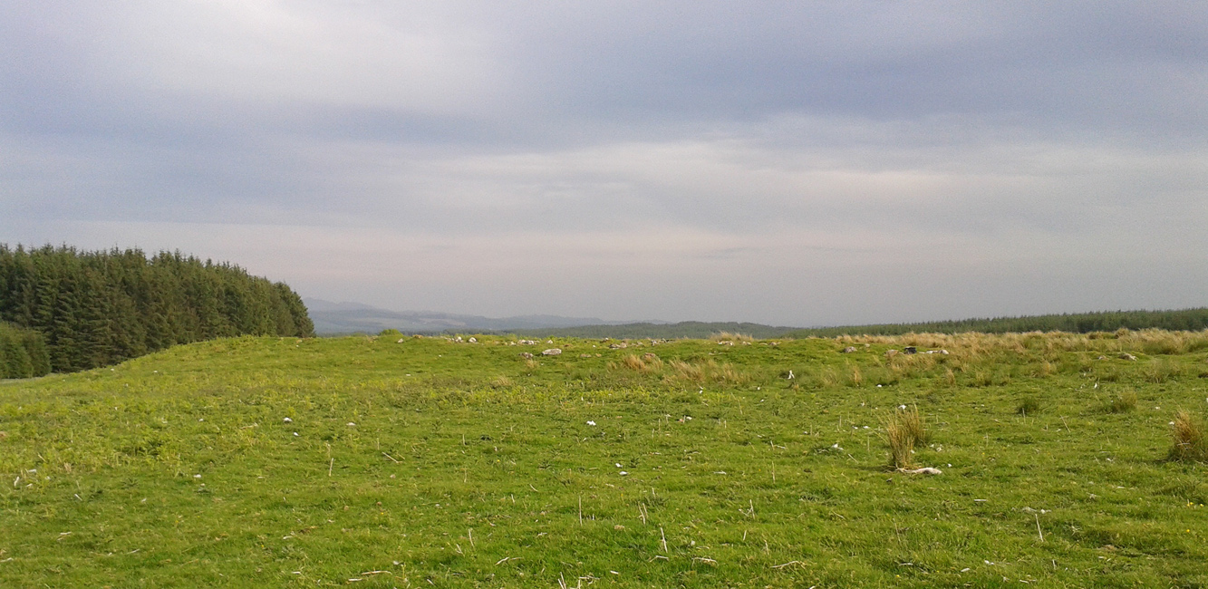
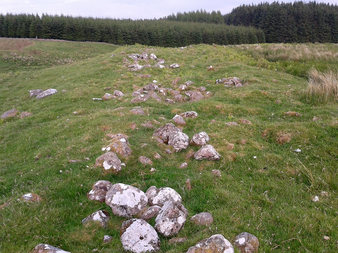
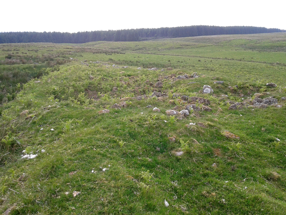
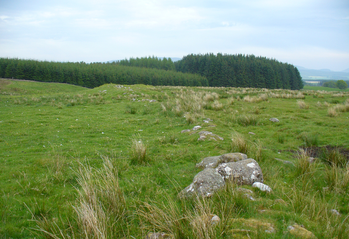
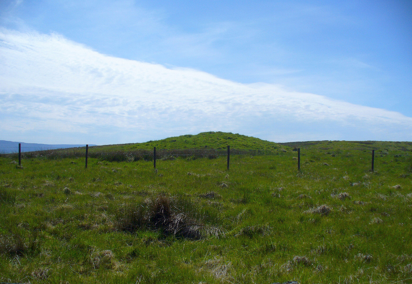
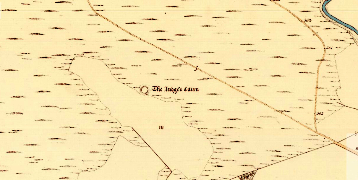
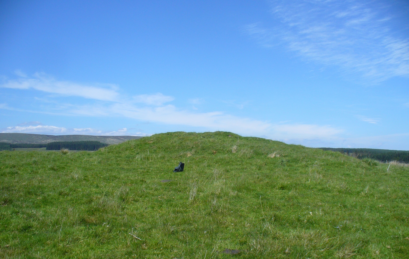
Highlighted on the first Ordnance Survey map of the area in 1862, this is a large rounded prehistoric cairn of some considerable size, whose position in the landscape allows for an impressive 360° view way into the distance in several directions—a deliberate ingredient, no doubt, when it came to building this probable tomb. I say “probable”, as there has never been a dig (not an ‘official’ one anyway) into the heart of this overgrown rocky mound.
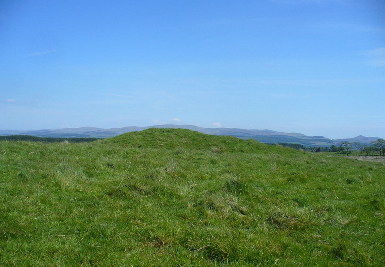
More than 60 feet in diameter at its greatest and 6 feet high, with a circumference of 67 yards (61m), the top of the mound has been disturbed and, clearly, has been dug into at some time in the distant past—but archaeohistorical accounts are silent on this matter. The first description of the Judge’s Cairn seems to have been in Peter Stewart’s (1839) notes on the local antiquities of Dunblane, where he described it most simply as:
“The Judges Cairn, yet undispersed, a circular heap of rough mountains stones covered with furze, on the farm of Bowie, barony of Kilbride.”
Along with the Ordnance Survey lads who came here in 1862, all subsequent visits gave rise to only short notes about the place. Odd, considering its size and distinct vantage point. And yet it remains hidden from view unless you come from the north, from whence that archetype of a fairy mound raises itself above Nature’s fair body into the eyes of any ambling wanderer…. A wonderful place to sit and dream for a while…
Folklore
We enquired with a local whose family had been resident here since the mid-18th century about the name and folklore of the site, but he said he knew of nothing. However, in earlier times it was said to be a place where the local sheriff held court and dispensed justice. Mr Mackay (1984) told that the site “has been connected with the Judge’s Seat at Severie” nearby. It seems possible that, as “it is just outside the parish boundary” between Doune and Dunblane, this may have been a moot site in ancient times, from whence laws were dispensed. Old perambulation records may, perhaps, prove fruitful…
References:
- Barty, Alexander, The History of Dunblane, Eneas MacKay: Stirling 1944.
- Mackay, Moray S., Doune – Historical Notes, Forth Naturalist: Stirling 1984.
- Royal Commission on the Ancient & Historical Monuments of Scotland, Archaeological Sites and Monuments of Stirling District, Central Region, Society of Antiquaries of Scotland 1979.
- Shearer, John E., “Prehistoric Man and Prehistoric Remains in Britain,” in Transactions of the Stirling Natural History & Archaeological Society, 1907.
- Stewart, Peter G., Essay on the Dunblane Mineral Springs, Hewit: Dunblane 1839.
© Paul Bennett, The Northern Antiquarian