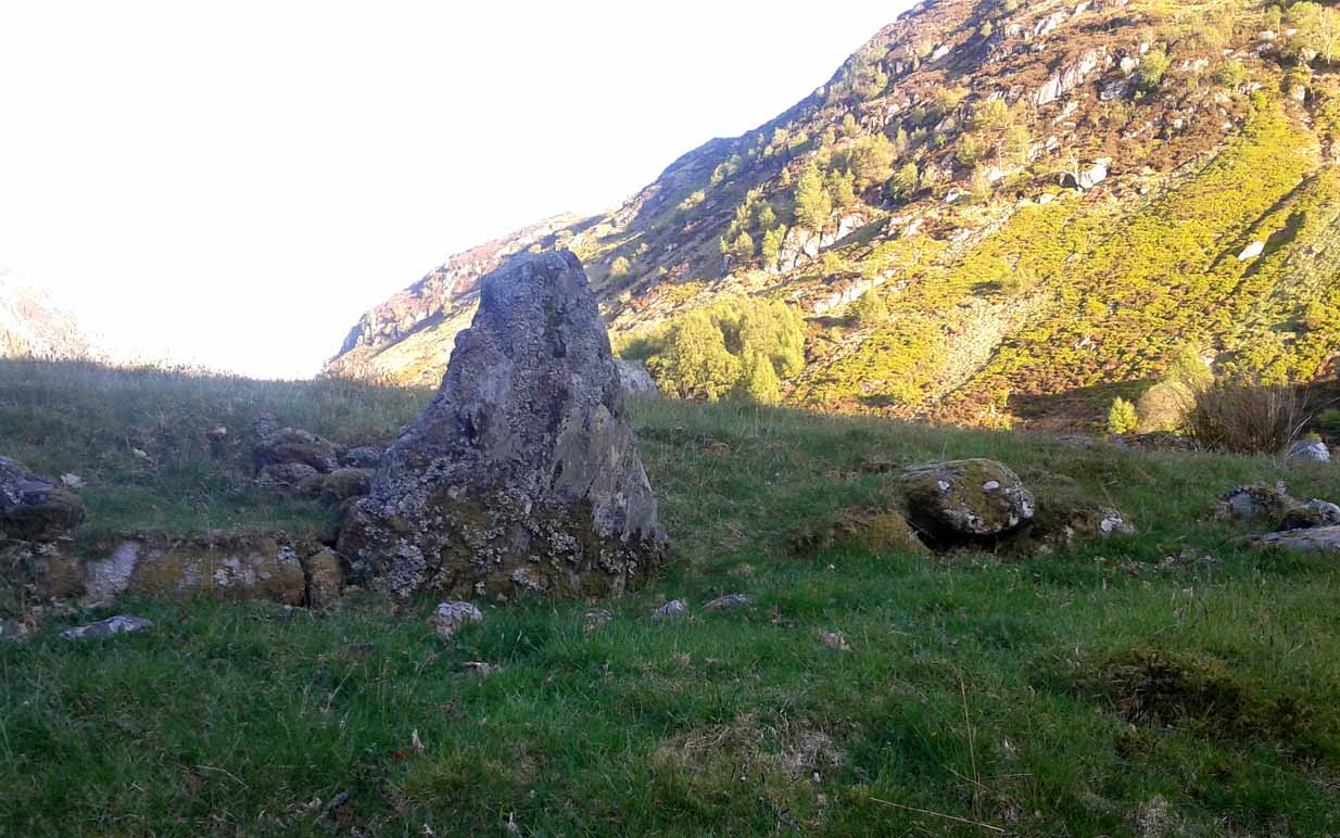
Get yourself to the Baile Mhargaite Enclosure 1 and walk less than 150 yards southeast. Keep your eyes keenly peeled on the ground as you can easily miss this one!
Archaeology & History
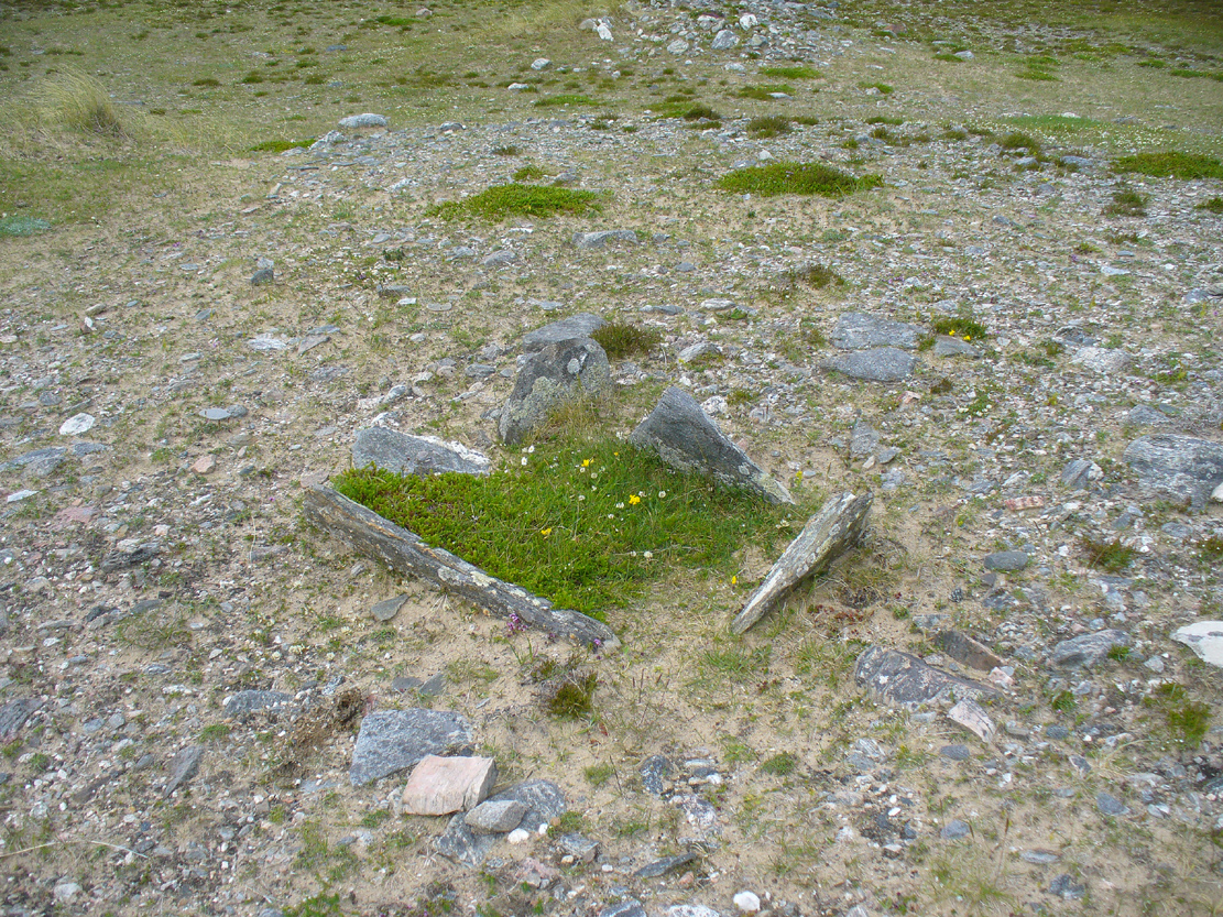
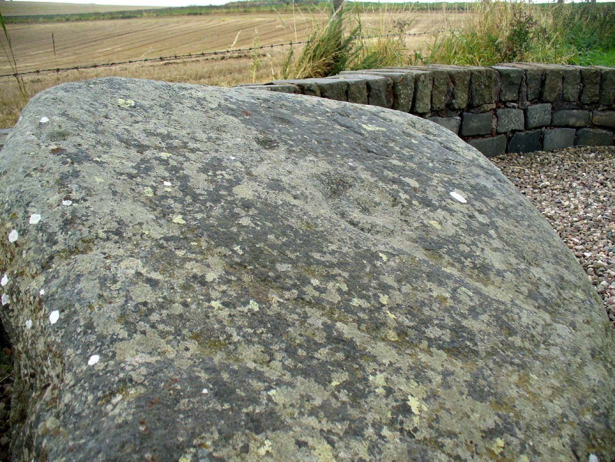
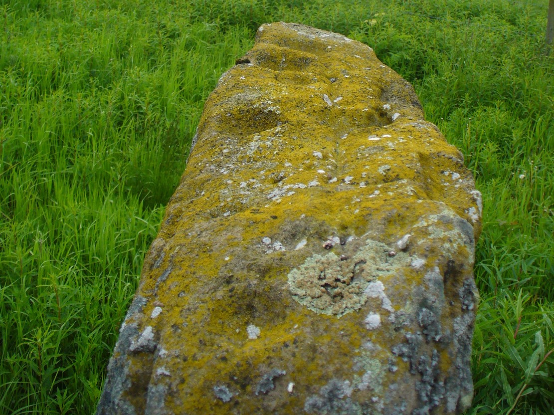
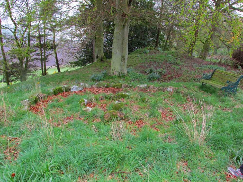
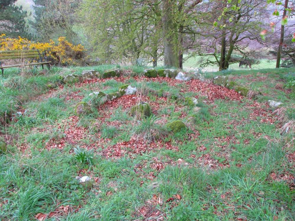
One of Baile Mhargaite’s cists
The only archaeological note I can find of this small singular prehistoric grave is in the Canmore entry, which is far from clear as to the position and situation of many sites hereby. They described this small sand-filled grave (which they describe as ‘Cist b’) as being “on a gravel ridge and is oriented N-S. It measures 0.8m by 0.6m.” That’s it!
Looking down on the tomb
But saying that, it is a small single little thing amidst a huge mass of material. It may well have been covered by a larger cairn at an earlier date, as there are many such monuments on this elevated sandy plain and the slight surround of smaller stones at, and just beneath the surface may validate this. It is also possible that this was the spot where “beaker fragments…found in a cist at Bettyhill” came from, but the archaeological records (Abercromby 1912; Mitchell 1934) are not accurate. Two other cists close by are the other potential candidates!
Take the A836 road west through Bettyhill and downhill, turning right and going over the small bridge at the bottom. From here, go over the gate on the right-hand side of the road and follow the edge of the river towards the sea. Crossing the large extensive sands, you’ll reach a large rise ahead of you and, to the left (west) a burn tumbles down from the hills above. Walk up it and head to the rocky rise on the level 50 yards past the burn. You’re here!
Archaeology & History
Once you’ve clambered the rocky hill to reach the broch, you’ll be damn impressed. This is a real beauty – although from the outside it looks nothing of the sort. The outer wall is a veritable jumbled mass of rocks piled on top of each other in a manner that looks as if human hands once fumbled them in some sort of order, long since fallen away. Around the western side of the structure, faint remains of steps lead up towards more ordered-looking walling ahead of you. Before you walk up the remains of steps, notice the more structured walling, about three feet high to your right, curving around the large structure you are already inside the edges of.
Whether you walk up the stepped remains or simply up the outer walling, once you see the internal stone walling of this high cliff broch, you’ll be impressed. It’s a big bugger – and in damn good condition when you consider that it’s probably 2000 years old, or more! A large round walled structure, about three feet high all round, well sheltered from the wind and rains, measures some 30 feet across.Arc of outer western wall
The internal living quarters
Eastern section of the broch
The site is still known by some local people as a “Pictish Tower” and was described as such on the 1878 Ordnance Survey map (see above) and its Gaelic name is Ca an Duin(Mackay 1906). The probability of the brochs as being Pictish in origin is more than likely. Tradition up here speaks of them as such – and we know that such traditions go back many centuries in these isolated areas. An early mention of this Pictish Tower was given in James Horsburgh’s (1870) essay, but it wasn’t described in any real detail until the Royal Commission (1911) fellas looked at the site. They wrote:
“On the summit of the hill which rises to the W of the gravelly plateau opposite Bettyhill, and on the N side of the track which leads from Strathnaver to Torrisdail, is situated a broch. It is called the “Sandy Dun”. The wall is probably erect for a considerable height, but the interior is largely filled up with blown sand. The entrance is from the SW. The interior diameter is 29 feet and the thickness of the wall 12 feet. Near the top of the wall in the interior is a projecting ledge, about 10 feet wide, running all around. The slabs which form it are an integral part of the structure and the wall is thicker below than above. The outer face of the wall is much ruined…”
Gazing NE from inside the broch
Although some of the internal walling has been taken away since the 1911 survey, the interior of the site has been cleaned up by local people and it is presently in a very good condition indeed. The broch may have been built onto an earlier fortified structure, rising above the stunning prehistoric settlements and necropolis on the sandy plateau immediately below. It would make sense – as many earlier Neolithic and Bronze Age remains look up at the prominent rock pinnacle it’s built upon from the sandy plain below, almost as if it was a natural temple in the animistic traditions of the earlier peoples.
If you visit this gorgeous region, the Baile Mhargaite broch should definitely be on your list of sites to see.
Folklore
Old lore told that this broch was attacked by outside invaders many centuries ago. Mr Horsburgh (1870) told that,
“an old woman hid a croc of gold previous to the dun being attacked, and measured the distance from it with a clew of thread.”
MacKie, E W., The Roundhouses, Brochs and Wheelhouses of Atlantic Scotland c.700 BC-AD 500 – volume 2, British Archaeological Report: Oxford 2007.
o’ Reilly, Kevin & Crockfird, Ashley, What to See Around Bettyhill, privately printed 2009.
Royal Commission on Ancient & Historical Monuments, Scotland, Second report and inventory of monuments and constructions in the county of Sutherland. HMSO: Edinburgh 1911.
Acknowledgements: Immense thanks go to Aisha Domleo and Unabel Gordon for their help getting me up here. This site profile would not exist without their encouragement.
This ancient fort could once be seen in the ancient woodlands on the western side of the Mill Glen, above the village, going into the Ochils—but it was completely destroyed, as usual, by the Industrialists when they quarried the entire structure out of existence. It was a big thing too, by all accounts. When Stewart Cruden (1964) saw it, shortly before its final demise, it was still impressive to look at. He told that the fort consisted of a deep rock-cut ditch with a stone wall on the inside and the remains of a stony rampart on the outside. Although damaged it still measured 300 feet across. Its interior contained an almost precise circular enclosure, more than eighty feet across inside the remains of a large stone wall some twelve feet thick.
Nearly a hundred years earlier, Miss Christian MacLagan (1875) told it to be much bigger! Not only did she report how locals remembered a stone roof on top, but it possessed three concentric circular walls, thirty-five apart, with the central area eighty feet in diameter—much as Cruden later reported. However, even in MacLagan’s day, she told how many of the stones from the fort were being used to construct sheepfolds. This destruction was being lamented by the local historian William Gibson (1883), who wrote:
“On the west side of the burn, and overtopping the village, stands the beautiful Castle Craig, wooded to the top, and on which stood, in ancient times, a round Pictish fortress, the traces of which can still be distinctly seen. This craig is, I think, one of the most picturesque objects on the Alva estate, and it is a very great pity that it should be so disfigured by the extensive quarrying operations that are being at present carried on at it.”
On the top of the quarry edges can still be found old walled remains crumbling at the edge of the huge cliffs, but these are unlikely to have been attached to the ancient fortress, and may just be the fragmentary memories of the sheepfolds built from the old fort.
Folklore
Tradition told that this was one of the old forts of the Picts who lived in the Ochils. If it was a fort, then the Pictish tradition is probably true. Old lore also told that some of the stones from the fort were used in the construction of Stirling Castle, 7.8 miles (12.6km) to the west.
References:
Corbett, L., et al., The Ochil Hills, Forth Naturalist & Historian 1994.
Cruden, Stewart H., “Castle Craig, Tillicoultry,” in Discovery & Excavation Scotland, 1964.
Feacham, Richard, Guide to Prehistoric Scotland, Batsford: London 1977.
Maclagan, Christian, The Hill Forts, Stone Circles and other Structural Remains of Ancient Scotland, Edinburgh 1875.
Royal Commission on the Ancient & Historical Monuments, Scotland, Inventory of Monuments and Constructions in the Counties of Fife, Kinross and Clackmannan, HMSO: Edinburgh 1933.
Royal Commission on the Ancient & Historical Monuments, Scotland, The Archaeological Sites and Monuments of Clackmannan District and Falkirk District, Society of Antiquaries of Scotland 1978.
Watson, Angus, The Ochils: Placenames, History, Tradition, PKDC: Perth 1995.
Travel north towards Brechin on the B9134, and cross the River South Esk at Stannochy Bridge. Immediately after crossing the bridge, go through the double tubular steel gates to your right, descend the steep slope and walk along the boundary fence dividing the riverside field from the sloping woodland until you reach a tubular steel pedestrian gate. Go through this gate, over the burn and keep walking 150 yards or so to the right and St. Ouret’s Well is seen near the top of the slope.
Archaeology & History
Alexander Penrose Forbes, Bishop of Brechin wrote in 1872 :
“Ouret – Close to Brechin, on the north bank of the Esk, near the Stannochy Bridge, is S.Ouret’s Well.”
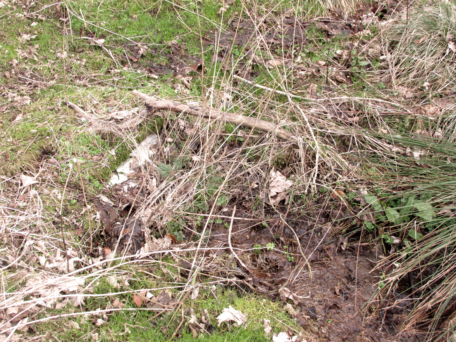
The spring flows south into a burn then into the river South Esk
Perusal of the 25″ OS map of 1865 shows an enclosure marked ‘spring’ with a short pathway to the north-east, as the only water feature answering the written description. My field visit just over a century and a half later found a spring issuing at that point from the embankment, with the remains of old rough stone walling on either side of the spring. There was no sign of the pathway. The walling around an otherwise unremarkable spring located away from habitation would imply to me that this is the Saint’s Well.
As the good Bishop mentions the Well as the last entry in the Auctaria of his 1872 book—an afterthought as you will—it seems reasonable that the knowledge of St. Ouret and his well may have been at that time on the point of oblivion. The well is not noted as such by the earlier Ordnance Survey map, nor can I find his name in any other of the hagiographies at my disposal.
Old walling still visible low down
Intriguingly, ‘Ouret’ is a modern Basque surname, and while it is tempting to think of a Basque Holy Man walking the Pictland, the name is more likely a transliteration into Scots from a now lost Pictish or Gaelic name. There is a mysterious ‘Uoret’ named in the inscription (as interpreted by Elisabeth Okasha) ‘DROSTEN : IRE UORET [E]TT FORCUS’ on the Drosten Stone at St Vigeans, who may be our saint, but this Uoret has been interpreted by Thomas Clancy as the Pictish King Uurad, son of Bargoit, who ruled from 839 to 842. I know of no reference as to where Forbes obtained his information on Ouret or his well, but is it reasonable to hypothesise that the information was passed to him orally and what he wrote down as ‘Ouret’ may have been meant to be the very similar sounding ‘Uoret’? Or alternately was King Uurad subjected to local canonisation as St Uoret/Ouret after his death? Can anyone add more?
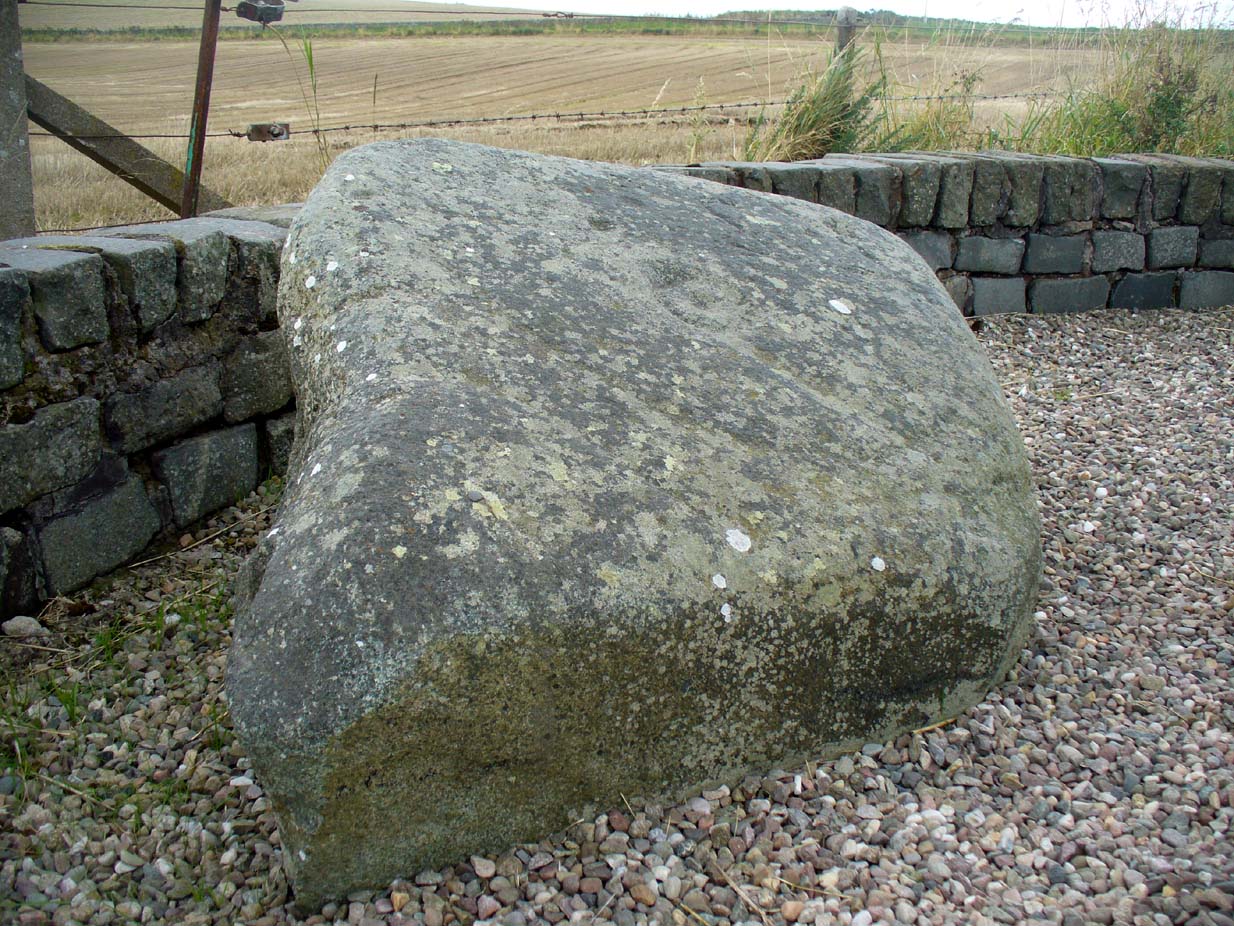
From The Square in Letham village, go north up Auldbar Road and out of the village for 0.6 miles (1km). Shortly before reaching the road junction at the top, on the left-side of the road is a recess with a stone and a small aging plaque telling you that you’ve reached the Girdle Stane.
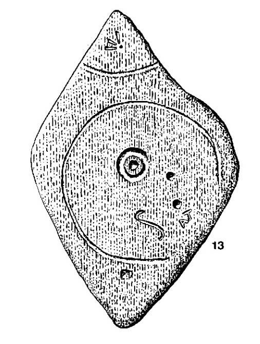
Archaeology & History
The Girdle Stane
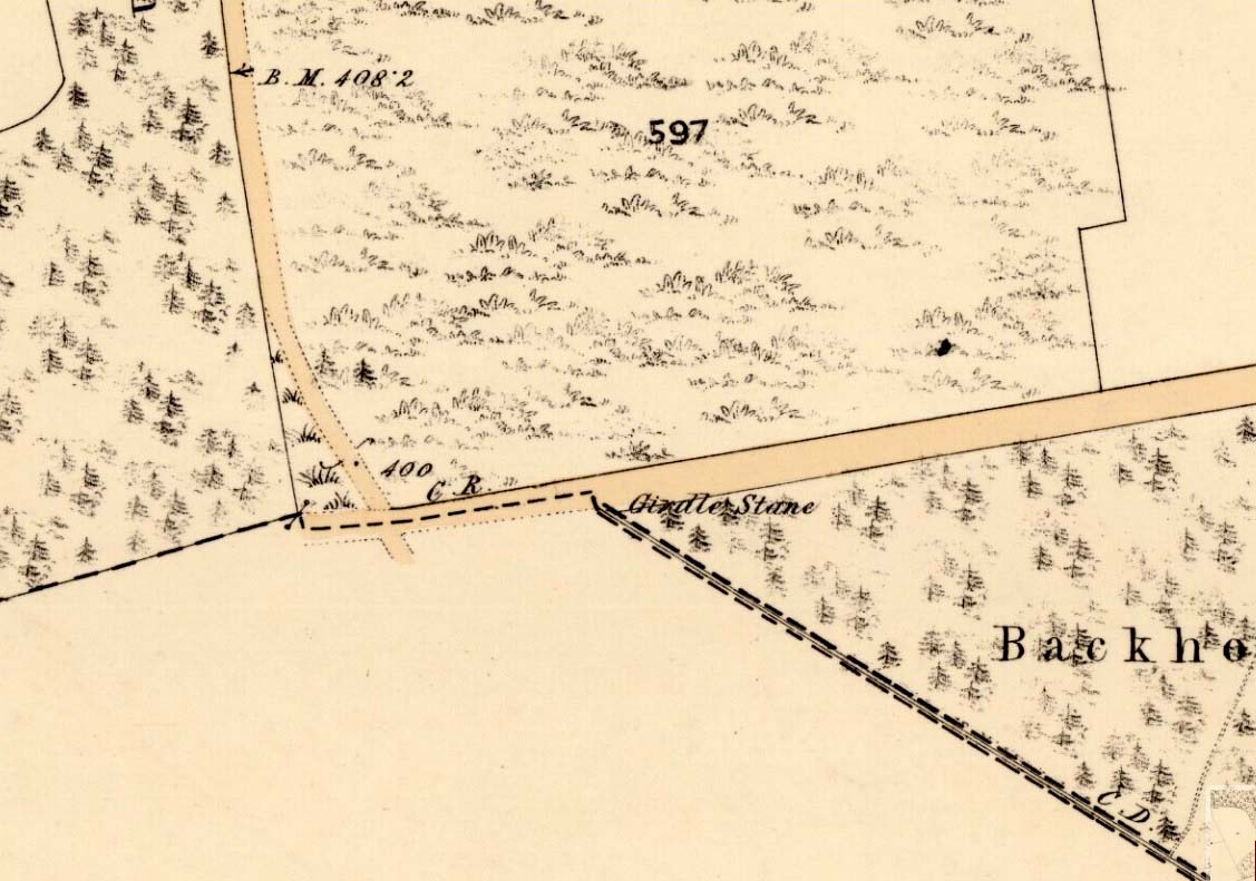
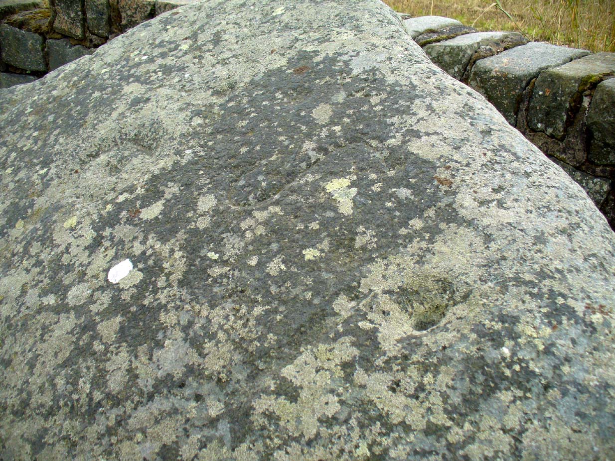
This cup-and-ring stone is not in its original position. Although we know from Ordnance Survey records in the 1860s that it was located about 130 yards north of here, close to the road junction, even that is unlikely to have been its original position—but we know not where that might have been! It is an undoubted multi-period carving, with the earliest section being our typical neolithic or Bronze Age cup-and-ring near the centre of the stone, with several outlying cup-marks toying with our intellect as per usual! The central cup-and-ring may have an incised line running down out of it, although this isn’t highlighted on John Sheriff’s (1995) drawing of the stone.
Girdle Stane on 1865 map
Surrounding the central archetype, by some distance, is a much wider carved ring that almost reaches to defines the edges of the stone itself. This large encircling motif and other features of the petroglyph—including a large elongated “S” and marks that were probably executed by the Ordnance Survey lads at the bottom corner—were ingredients which prompted Sir James Simpson (1867) to question the veracity of the Girdle Stane’s antiquity. He wrote:
“The so-called ‘Girdle-stone’ in the…parish of Rescobie, about four feet long and three broad, is cut on its surface with two circles, the largest of which is above two feet and a half broad, and hence does not, I believe, belong to the class which we are considering in this essay”—
More recent “S”-shaped motif
Close-up of cups, ring and lines
i.e., neolithic or Bronze Age petroglyphs. And you can see his point! My first impression when Prof Paul Hornby and I visited the site a few days ago, after the initial “that’s a cup-and-ring in the middle”, was to proclaim: “that bit’s much more recent, maybe Pictish?” But it probably isn’t even Pictish. This “more recent” carved element is a distinct large elongated “S”, which may have been marked onto it when the stone was used as a township boundary marker between the local parishes. The grand historical writer Alex Warden (1882) talks about this in his magnum opus, saying:
“At the junction of two roads, a little to the northeastward of Letham, there is a rough boulder, about five feet long by three in breadth, having on its face a circle of about thirty inches in diameter, and another smaller circle about six inches across. It is called the Girdle Stane of Dunnichen, from the larger circle resembling the utensil called the girdle, s.c. This stone marks the boundaries between the parishes of Dunnichen and Rescobie, also between the lands of Dunnichen and Ochterlony (Balmadies). It is probably the Grey Stone referred to in a note on the marches of Dunnichen, about 1280.”
Folklore
The folklore of the stone indicates how its origins are rooted in prehistory, despite the later additional symbols. Alex Warden (1882) tells the all-too-familiar creation myth, usually symptomatic of giant prehistoric cairns:
“Tradition says a witch was carrying this boulder from ‘the Crafts’ of Carmylie in her apron, when the strings broke, and the stone fell where it now lies.”
Carmyllie Hill is 5 miles (8km) to the south and is a place rich in fairy-lore and vandalized prehistoric sites.
References:
Coutts, Herbert, Ancient Monuments of Tayside, Dundee Museum 1970.
Kidd, Scott, The Churches of the Parish of Dunnichen, David Winter: Dundee 1995.
Simpson, James, Archaic Sculpturings of Cups, Circles, etc., Upon Stones and Rocks in Scotland, England and other Countries, Edmonston & Douglas: Edinburgh 1867.
A singular reference to this site appears in James Horsburgh’s (1870) early article on the prehistoric remains of Sutherland. It seems he was on an early road-trip (or dirt-track-trip as it would have been in those days, as there were no real ‘roads’) and as his journey took him along the remote tracks in the far North, visiting places that are still intact and mentioning those which, oral tradition told, had passed into memory, local folk told him about a couple of brochs that had recently met their demise. This was one of them. He wrote:
“Between Farr and Tongue, after crossing the Naver Ferry… some miles on, near Borgie-farm house, there was a Pictish tower, now demolished, and on the side of the old road to Tongue, another.”
In asking the lady who lives here if she knew anything about the broch, she told that although she didn’t, she’d ask some old locals to see if they knew of any folk remnants about the place. It would have stood a short distance above the little-known Borgie souterrain. If we receive any additional info, the site-profile will be updated. (the grid-reference for this broch is an approximation)
Venture along the A822 Crieff to Dunkeld road, turning down into the gorgeous Sma’ Glen. Nearly 1 mile past Ossian’s Stone, just past where the road crosses the River Almond, walk along the track on your right where the big boulder sits. Past the boulder, walk up the grassy slope to the left. A standing stone will catch your attention, which sits in the walling. Y’ can’t really miss it!
Archaeology & History
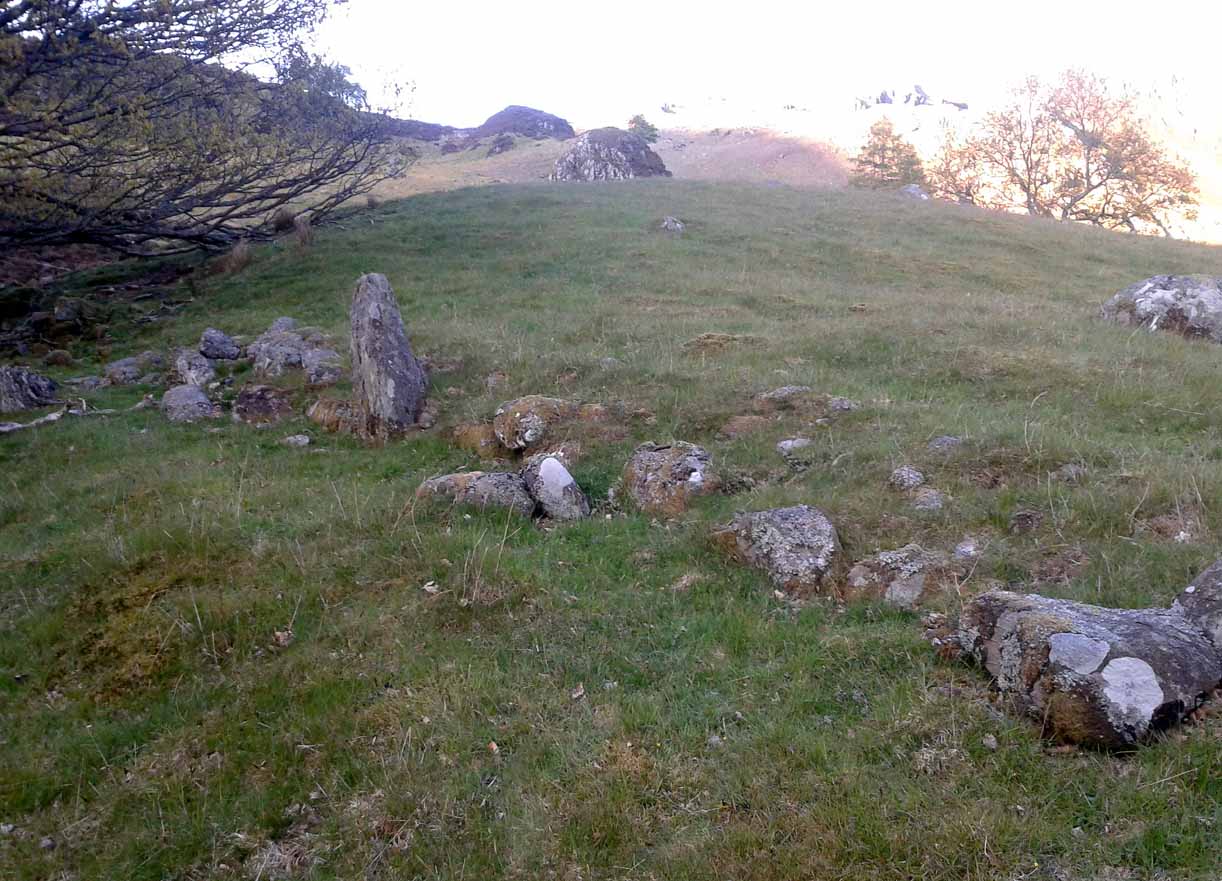
Rediscovered by Paul Hornby in 2015 at the end of a day’s excursion to the neolithic sites a few miles west of here, I can find no references at all to the denuded remains of what seems to be a typical prehistoric enclosure.
Looking down the west wallThe southwestern walls
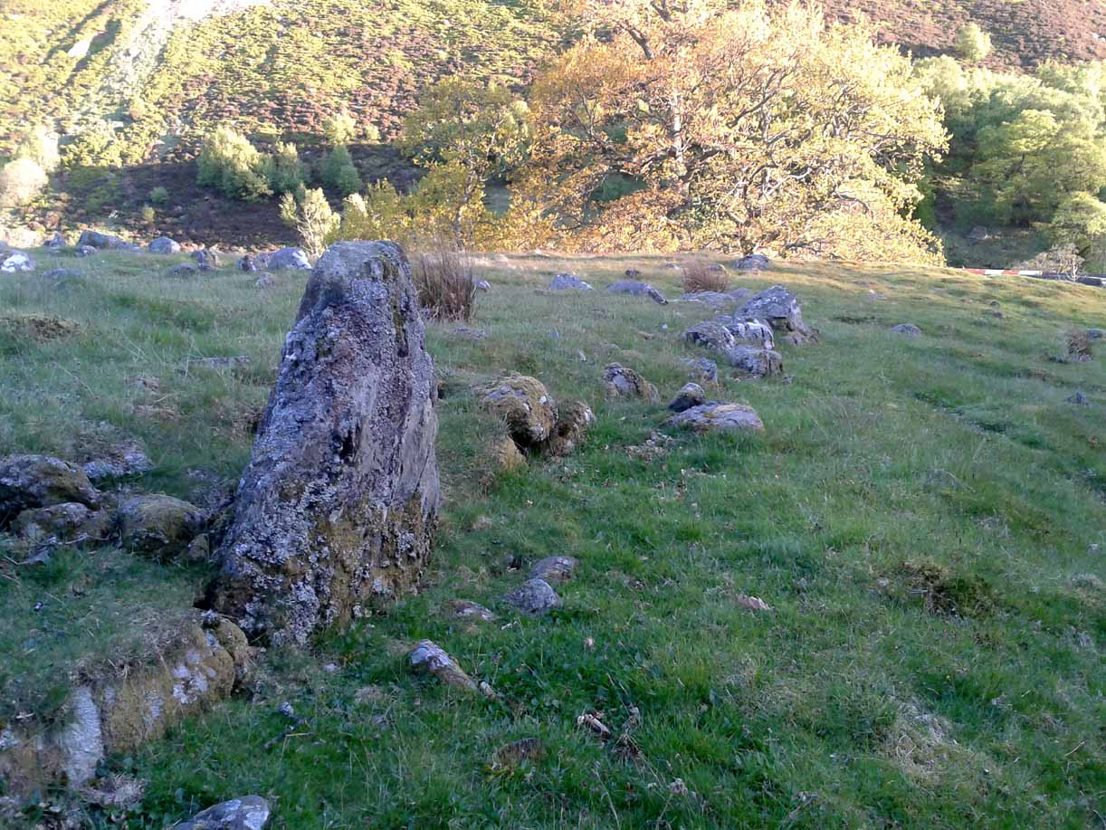
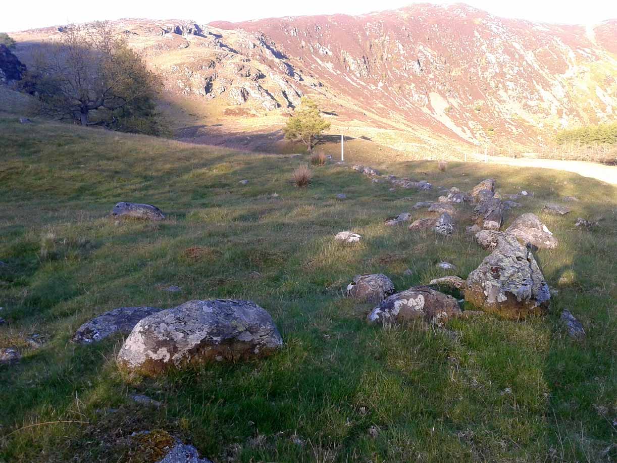
Constructed around a natural rise in the land 60-70 yards above the River Almond, the enclosure has that ‘Iron Age’ look about it (it may be earlier). Shaped like a giant ‘D’ (and clearly visible on GoogleEarth), the extensive walling that makes up the site—about a yard wide all the way round—is far from small, measuring some 60 yards (54.8m) at its greater longer axis roughly north-south, by 54 yards (49.5m) east to west, with a circumference of about 170 yards (155.5m). The much-denuded walling that defines the perimeter is comprised of a number of large stones with thousands of smaller packing stones that are mainly overgrown. A large ‘standing stone’ about 3 feet tall is the most notable feature nearly halfway along the western wall.
Small standing stone in wall
In all probability this enclosure would have been in use since its construction in the Iron Age period all the way through to the coming of Fuadach nan Gàidheal (the Highland Clearances) in the 19th century, as the people here were pragmatists who made best use of what was around them. It is likely to have ended its days as an area where cattle was contained.
Acknowledgements: Huge thanks to Paul Hornby for his assistance with site inspection, and additional use of his photos.
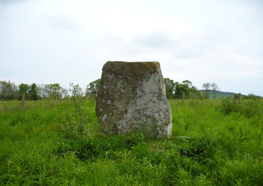
The easiest way to find this is by going along the B9113 road that runs from the east side of Forfar, out to Montreathmont Forest. Along this road, pass the Rescobie Loch and keep going for another mile or so, until you hit the small crossroads. Go left here as if you’re going to Aberlemno. Barely 100 yards up, opposite the newly-built Westerton house, the standing stone is on the rise in the field.
Archaeology & History
The carved west-facing side
A truly fascinating heathen stone in a parish full of Pictish and early christian remains, with the faint remains of an intriguing carving that can still, thankfully, be discerned on the southwestern face of the upright….amongst other things…
Marked as a singular stone after the Ordnance Survey lads visited here in 1901, early mentions of the site are very scant indeed. In Sir James Simpson’s (1866; 1867) early masterpiece on prehistoric rock art, in which he named the place as the “Circle of Turin,” he related how his friend and associate Dr Wyse told him how this stone “once formed one of a fine circle of boulder stones at Nether Turin,” but said little more. (Simpson was the vice president of the Society of Antiquaries of Scotland, a professor of medicine, as well as being one of Queen Victoria’s chief physicians.) The “Dr Wyse” in question was very probably Thomas Alexander Wise, M.D., who wrote the little-known but informative and extravagent analysis of prehistoric sites and their folklore in Scotland called A History of Paganism in Caledonia (1884). Therein he told us:
“At Turin, in Forfarshire, there is a large boulder which had formed one of the stones in a circle. On the flat top are several cups arranged irregularly, and without any enclosing circles. This boulder stone is on the NW face of the circle. The other side was towards the SE, facing the rising sun.”
As a result of these early references the site is listed and documented, correctly, as a “stone circle” in Aubrey Burl’s (2000) magnum opus. We do not have the information to hand about who was responsible for the circle’s desctruction—but it was likely done by the usual self-righteous industrialists or christians. It is a puzzle therefore, why Barclay & Halliday (1982) sought to reject an earlier “megalithic ring” status as mentioned by Sir James and Dr Wise, with little more than a flippant dismissal in their short note on the Westerton stone. Unless those two writers can offer vital evidence that can prove that the Westerton standing stone was not part of a megalithic ring, we can of course safely dismiss their unsubstantiated claim.
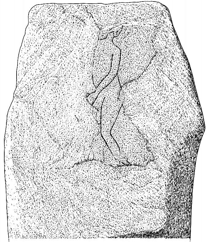
Despite this however, they do give us an intriguing description of a curious carving, faintly visible, of an upright male figure etched onto the west side of this standing stone. The carving has unfortunately been damaged—probably by intruding christians or puritans of some sad form. You’ll see why I’m blaming them in a minute! In their short account of the carving, Barclay & Halliday (1982) state:
“Much of the original surface of the SW face of the stone has scaled off, but, on the surviving portion, there is a part of a human figure…apparently naked, outlined by grooves, measuring between 5mm and 15mm in breadth and up to 7mm in depth. Of the head, only the lower part of the jaw and neck can be identified, and a second groove at the back of the neck probably represents hair or some form of head-covering. The left arm passes across the body into the lap and the arch of the back is shown by a groove which detaches itself from the upper part of the arm. The left leg is bent at the knee and is lost below mid-calf; from mid-calf to jaw is a distance of some 0.85m”
In interpreting this carving the authors make a shallow, if not poor attempt to describe what he may be doing, saying:
“The figure is viewed from its left side and is turned slightly towards the observer. The position of the left arm and leg may be compared with those of a fighting figure depicted on the Shandwick Stone, Easter Ross…but they may also reflect a riding posture; no trace of a mount, however, has survived.”
Damaged carving of a man doing summat with his cock!
Well – that is intriguing. But we have to recognise that our authors work for the Royal Commission, which may have effected their eyes and certainly their minds—as everyone else sees something not drawn out of Rorscharch’s famous psychology test! When I put the drawing you can see here (left) onto various internet archaeology group pages (including the Prehistoric Society, etc) the response was virtually unanimous, with some comical variants on what the carved man is doing — i.e., masturbating, or at least committing some sort of sexual act, possibly with another creature where the rock has been hacked away by the vandals. But a sexual act it is! Although such designs are rare in Britain, they are found in prehistoric rock art and later architectural carvings in most cultures on Earth. The nearest and most extravagant examples of such sexual acts can be found in the Scandinavian countries, where fertility images are profuse, often in tandem with typical prehistoric cup-and-ring designs. (see Coles 2005; Gelling & Davidson 1969, etc)
Line of cup-marks on top of stone
…And, on the very top of the stone, running along its near-horizontal surface, a line of six cup-markings are clearly visible. Intrusions of natural geophysical scars are also there, but the cup-marks are quite distinct from Nature’s wear, all on the west side of the natural cut running along the top. These cup-marks were first mentioned in Simpson’s (1866; 1867) early tome, where he told how his “esteemed friend Dr Wyse discovered ‘several carefully excavated cavities upon its top in groups, without circles.'” Whether these neolithic to Bronze Age elements had any association with the later Pictish-style wanking fella (fertility?) is impossible to know, sadly…
References:
Barclay, G.J. & Halliday, S.P., “A Rock Carving from Westerton, Angus District,” in Proceedings of the Society of Antiquaries, Scotland, volume 112, 1982.
Burl, Aubrey, The Stone Circles of Britain, Ireland and Brittany, Yale University Press 2000.
Coles, John, Shadows of a Northern Past, Oxbow: Oxford 2005.
Gelling, Peter & Davidson, Hilda Ellis, The Chariot of the Sun and other Rites and Symbols of the Northern Bronze Age, J.M. Dent: London 1969.
Sherriff, John R., “Prehistoric Rock Carvings in Angus,” in Tayside & Fife Archaeological Journal, volume 1, 1995.
Simpson, James, Archaic Sculpturings of Cups, Circles, etc., Upon Stones and Rocks in Scotland, England and other Countries, Edmonston & Douglas: Edinburgh 1867.
Wise, Thomas A., History of Paganism in Caledonia, Trubner: London 1884.
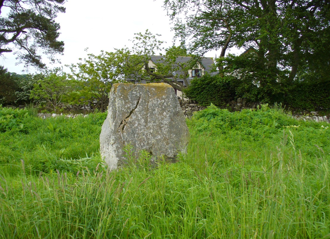
A variety of ways to get here, all depending on which directions you’re coming from, obviously! Simply get to the sleepy old hamlet of Brunton, SW of Creich Castle ruins, and at the north end of the village where the road hits a T-junction, turn left and stop at the next house (hidden amongst trees) a coupla hundred yards along on the right-hand side. Knock on the door of The Manse (marked as such on the OS-maps) and ask. The fella who we met here, Liam, was very helpful and guided us to the site up the far end of his garden.
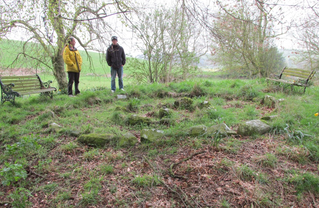
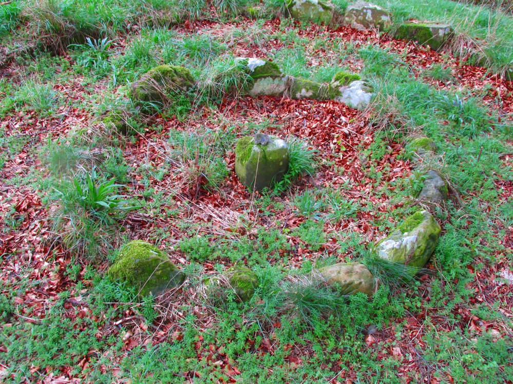
Archaeology & History
The small central ring
A truly fascinating and enigmatic arena for a host of reasons. The small and well-preserved ring of stones up the slope behind Creich Manse — looked after and recently cleared of covering vegetation by the present tenant — wasn’t born here, but originally lived more than a mile to the southwest, on the grounds of Luthrie House near the OS grid-reference NO 313 195. They were apparently under threat of being damaged and so, as James Taylor (1875) told, a “Mr Lawson got them removed, and placed them in a wood behind his manse in the very form in which they were found.”
Curiously omitted from the giant surveys of Aubrey Burl (2000) and other modern academics, the place was first mentioned in the New Statistical Account of the parish by Alexander Lawson. It told that in 1816 “trenching operations” were being undertaken in Luthrie village when, at some point, the men came across a curious group of stones that seemed to have faint carvings upon them — in the centre of a ring of stones! The land-owner and parish minister were called to the site and they found that a double stone circle had been unearthed. The account told:
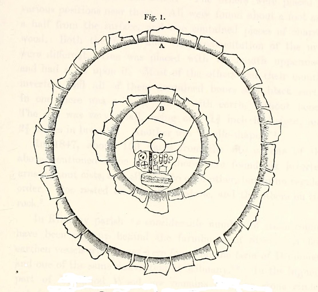
“In the centre was placed, in an upright position, a cylindrical sandstone, one foot two inches high, and having the diameter of its base one foot. Around this stone, as a centre, at the distance of three feet, were sixteen other stones, placed also in an upright position, and in the form of a circle. The stones of which it was composed were of various sizes, from fifteen to twenty inches in height; from eight to eighteen in breadth, and from four to nine in thickness. Due south of the centre, and between it and the inner circle, there were placed in a horizontal position, two stones containing hieroglyphics in alto relievo, very entire. The remaining space between the centre and the circle was laid with pavement. At the distance of seven feet and a half from the same central pillar, there was another circle of stones, thirty-two in number, placed in an upright position, and very much resembling those of the inner circle. The stones in both circles were placed close together. Between the circles there was neither pavement nor stone of any description. Neither were perfect circles, the diameter of one from north to south, being fifteen feet one inch, while its diameter from east to west was only fourteen feet nine inches; in the same manner, the diameter of the other, from east to west, was five feet ten inches, while from north to south it was it was six feet one inch.”
Ground-plan of the circleCreich ring, looking west
The account went on to describe there being a deposit of “burned human bones and charcoal” at the centre, below the larger of the two petroglyphs. Additionally, in one of those peculiarly common traits found at a number of megalithic remains, the Royal Commission (1933) lads pointed out that “it is remarkable that all the stones of the inner circle were of sandstone, which is not found nearer than Cupar, seven miles away, while those of the outer circle were of the local whinstone.”
Another description of the site was given in James Campbell’s (1899) updated and revised magnum opus on the parish of Balmerino, where some additional remarks were made about the petroglyphs. He told:
“Under one of the sculptured stones were found small burnt human bones and ashes. They were not enclosed in a cist, nor was there any building under the surface. Certain of the figures cut on one of the slabs of this monument are very similar to the figures on the sculptured slab of the one already mentioned. There are what appear to be representations of the soles of a pair of shoes, a circle with a cross within it — the limbs of the cross being: at right angles to each other — which may be intended to represent a wheel. On one of the stones is the figure of a spade. What the other figures represent is more uncertain. The sculptures raise difficult questions in regard to the time of the erection of these monuments. It is evident that cremation had been then practised at Creich, though the degree of culture and art indicated by the sculptures seems to point to a time subsequent to the abolition of this pagan custom elsewhere.”
Creich Circle petroglyphsCreich Ring, looking east
The carvings illustrated here are pretty unique in terms of them being standard prehistoric petroglyphs, as they seem to comprise more of a mix of Iron Age and Romano-British designs – though potentially we must take into account that they could be a form of Pictish. This region is littered with the remains of Picts, in place-names, folklore and archaeology. As such, it would be very helpful if someone qualified in Pictish studies could examine these designs. We do find petroglyphs of similar forms to this in Bronze Age Scandinavia and Iberia − but not Fife!
Folklore
In the only account of any folklore relating to this site, James Campbell (1867) told that local people said the place was “supposed to have marked the tombs of distinguished chiefs.”
References:
Burl, Aubrey, The Stone Circles of Britain, Ireland and Brittany, Yale University Press 2000.
Campbell, James, Balmerino and its Abbey – Volume 1, William Blackwood: Edinburgh 1899.
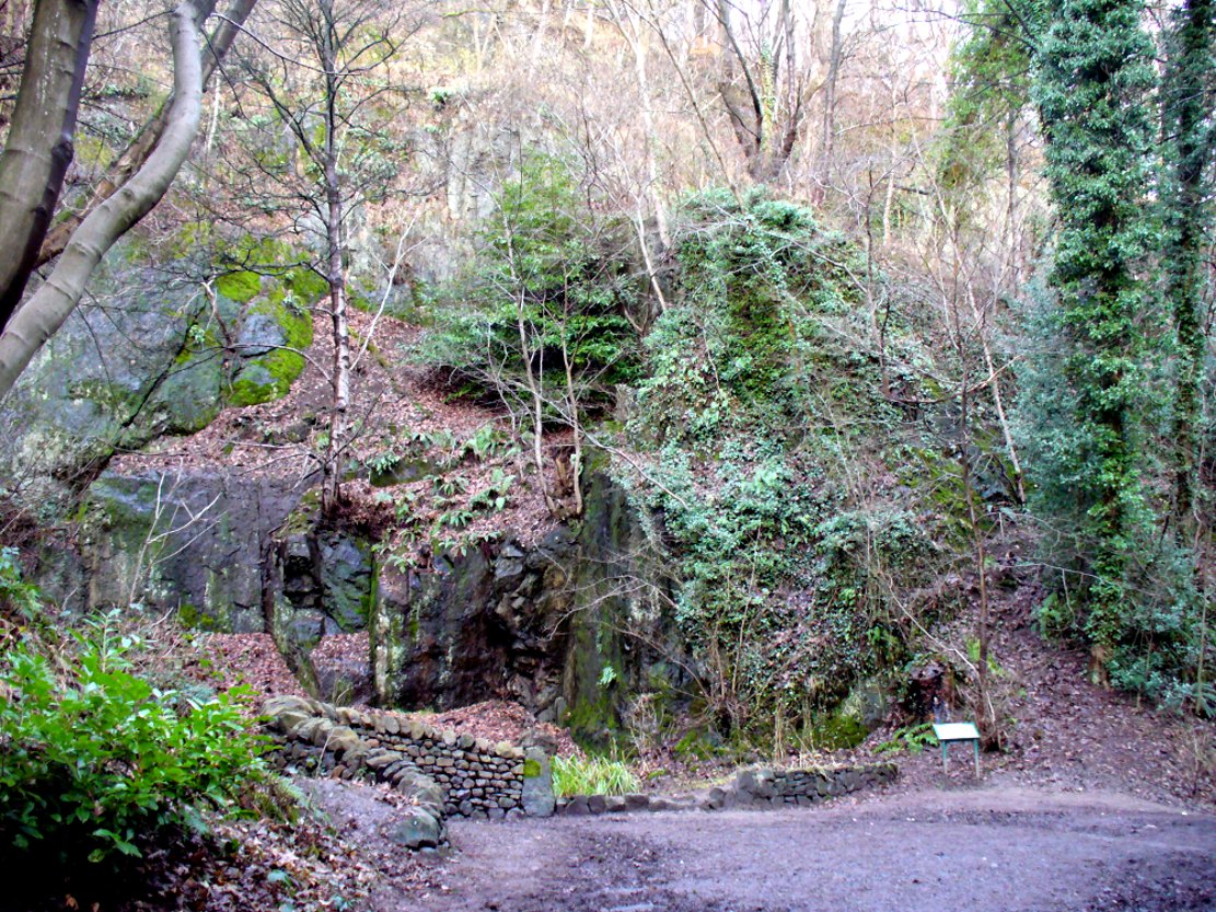
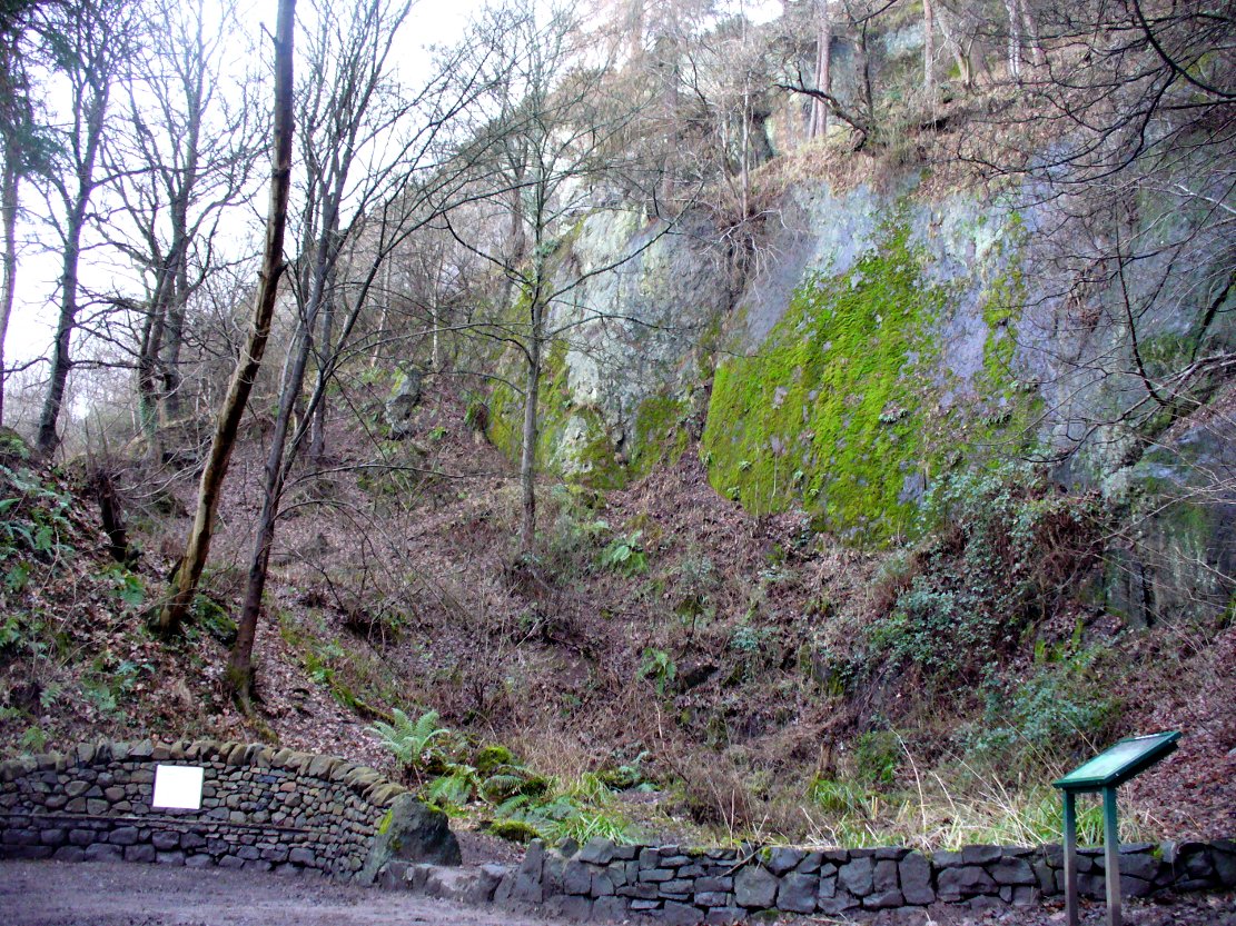
From the main street through Alva, between the Co-op and the corner shop, go up the small road at the side of the Johnstone Arms Hotel (Brook Street) and, at the small crossroads, straight across as if following the sign to the golf course. Stay along the track parallel with the Alva Burn waters and as you go into the trees a hundred yards or so along, to your left is a disused quarry, with a couple of plaques telling you its brief history. This is the spot!
Archaeology & History
This is a truly fascinating site for a number of reasons. Sadly, we can no longer see what had been here for oh so many thousands of years thanks, as usual, to the industrialists destroying the land here. Although in this case, without them we’d be unaware of its very existence. Additionally, there is a twist to the industrial’s find, which seems to have stopped further quarrying by some local people….
The tomb was somewhere in the left-middle
Listed in the relative Royal Commission accounts (1933; 1978), without comments, the tale is a simple one, but was narrated in some detail by J.G. Callander (1914) in Scotland’s prodigious Society of Antiquaries journal. During some quarrying operations over the Christmas period of 1912, James Murdoch “uncovered the remains of a human skeleton which had been buried in a natural cavity in the rock.” Three weeks later, local police officer George Donald and Dr W.L. Cunningham of Alva, accompanied Mr Callander to the site and made a detailed assessment of what had been found. He wrote:
“The quarry in which the grave was found is situated at the mouth of Alva Glen, a few yards distant from the right bank of the burn which flows through it. The body had been placed in a cavity or rock shelter in the face of the cliff, about 40 feet from the base, and about 200 feet above sea-level, and a rough, curved wall of dry-stone building, about 1 foot in thickness, had been built across the opening, which faced the east, the ends of the wall being still in situ when I visited the site. The space enclosed measured about 4 feet 6 inches from north to south, and about 5 feet from east to west. Subsequent to the burial the whole face of the rock and the walling had been covered, to a thickness of probably some 6 feet, by soil and detritus washed down from the hill face above. The greater part of the floor of the cavity was formed of clean, broken, angular stones, but the space on which the body was placed had been covered with a thin layer of soil preparatory to the burial. No charcoal or charred wood, which is so often seen in prehistoric graves, was found in this deposit. The skull lay in the north end of the grave, on its right side, facing the rock to the west, the vertebrae and ribs followed a line to the south, and the nether limbs were inclined towards the interior of the cavity. The whole face, including all the teeth and the lower jaw, was a-wanting. Apparently the body had been placed in a flexed position, half on its side and half on its back. Nothing else was found in the grave but a quantity of snail shells, probably twenty or thirty, which were nearly all broken, the few complete examples being in a very fragile condition.
“Elsewhere it has been stated that these formed a necklace, but while they were strewn out in front of the skeleton for a distance of over 3 feet, none of them showed any signs of artificial perforation. The species of Helixis is probably hortensis, the common garden snail.”
Mr Callander then included a lengthy description of the body itself, some of whose bones were fractured. He told that a certain
“Professor Bryce states that the skeleton is that of a dwarf of about 4 feet 2 inches in stature. The epiphyses are all fully united, although the line of union is visible on the surface at some points. Growth must therefore have been completed, and the person must have been, if the union of the epiphyses of the long bones had pursued its normal course, over twenty-one years of age…”
Regarding the sex of the dwarf, Mr Bryce wasn’t 100% certain, but told:
“The calvaria shows the general characters of a female skull, but it cannot be stated definitely that the individual was a woman, because the cranial characters are such as might have been present in a dwarf of the male sex. The calvaria is of moderate size, and is well formed.”
Bryce concluded as a whole that this person was in reasonably good health and, from the condition of the bones, showed “there was no evidence of the disease known as rickets.” In his final remarks he told:
“The general conclusions to which a careful examination of the skeleton leads, is that we have here to do, not with a representative of a dwarfish race, but with an individual who from premature union of the epiphyses was to a remarkable degree stunted in growth. The condition is a well-known one, and the class of dwarfs, in which this individual must be included, is well recognised.”
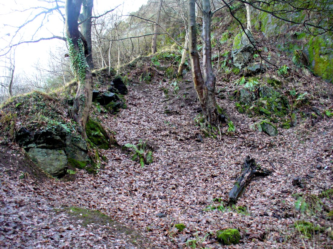
Probable spot of the lost tomb
The exact spot of the tomb appears to have been destroyed, or at the very least is certainly covered over and no longer visible. The section of the quarry looking east, into which the tomb was built, is all-but gone and no initial evidence prevails to show its exact location. However, it would seem from the description to have been close to the tops of the tree-line, perhaps giving a clear view to the rising sun in the east. Perhaps…
The position of this tomb, enclosed high up in the cliffs, hidden away at the entrance to the deeply cut ravine of the Alva Glen, is intriguing in that it is a rarity. Ravines like this are always peopled by olde spirits in animistic tribal traditions — and this dangerous glen with its fast waters and high falls would have been no different, especially to the Pictish people who we know were still here even after the Romans had buggered off. Is it possible that this figure was a guardian to the Glen itself, a medicine woman or shaman, whose very Glen was her home? We know from traditional accounts in many of the North American tribes that dwarves were accessories to the spirit worlds, and some were shamans. (Park 1938) In northern and central European lore, these small people are “the mysterious craftsmen-priests of early civilizations.” (Motz 1987) Whilst in Scottish lowland lore, the ‘Brown Man of the Muirs’ was a dwarfish creature described by Briggs (1979) as “a guardian spirit of wild beasts”, or watered-down shaman figure. There is more to this burial than meets the eye of dry academia…
Folklore
The Alva Glen—in addition to being beautiful and home to the Ladies Well—was long known to be one of many places in the Ochils that were peopled by the faerie folk. (Fergusson 1912) Local people still say this place is haunted by the spirit of a dangerous witch called Jenny Mutton.
It’s worth reiterating the words of Mr Callander (1914) regarding the finding and subsequent death of the man who uncovered this fascinating tomb, as some folk (then as now) think his demise was as inevitable as the man who planned on building turbines in Glen Cailleach:
“On the 24th December last, while quarrying stone for road metal in a quarry at the foot of the Ochils, at Alva, James Murdoch uncovered the remains of a human skeleton which had been buried in a natural cavity in the rock. Two days later he was killed at the same spot by the fall of a mass of overhanging rock, a tragic sequel, which not long ago would have been considered a judgement on him for disturbing the dead.”
References:
Briggs, Katherine M., A Dictionary of Fairies, Penguin: Harmondsworth 1979.
Corbett, L., et al., The Ochil Hills, Forth Naturalist & Historian 1994.
Drummond, A.L., “The Prehistory and Prehistoric Remains of the Hillfoots and Neighbouring District”, in Transactions Stirling Natural History & Antiquarian Society, volume 59, 1937.
Fergusson, R. Menzies, The Ochil Fairy Tales, David Nutt: London 1912.
Gimbutas, Marija, “Slavic Religion,” in Encyclopedia of Religion – volume 13 (editor M. Eliade), MacMillan: New York 1987.
Motz, Lotte, “Dvergar,” in Encyclopedia of Religion – volume 4 (editor M. Eliade), MacMillan: New York 1987.
Park, Willard Z., Shamanism in Western North America: A Study in Cultural Relationships, Evanston: Chicago 1938.
Royal Commission on the Ancient & Historical Monuments, Scotland, Inventory of Monuments and Constructions in the Counties of Fife, Kinross and Clackmannan, HMSO: Edinburgh 1933.
Royal Commission on the Ancient & Historical Monuments, Scotland, The Archaeological Sites and Monuments of Clackmannan District and Falkirk District, Society of Antiquaries of Scotland 1978.