Cup-and-Ring Stone: OS Grid Reference – NO 52808 49737
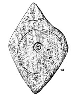
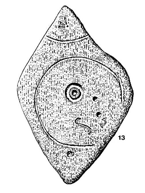
John Sheriff’s 1995 drawing of Girdle Stane
Also Known as:
- Canmore ID 34662
- Dunnichen 1
- Girdlestane
- The Girdle Stane of Dunnichen
- Girdle Stone
Getting Here
From The Square in Letham village, go north up Auldbar Road and out of the village for 0.6 miles (1km). Shortly before reaching the road junction at the top, on the left-side of the road is a recess with a stone and a small aging plaque telling you that you’ve reached the Girdle Stane.
Archaeology & History
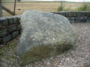
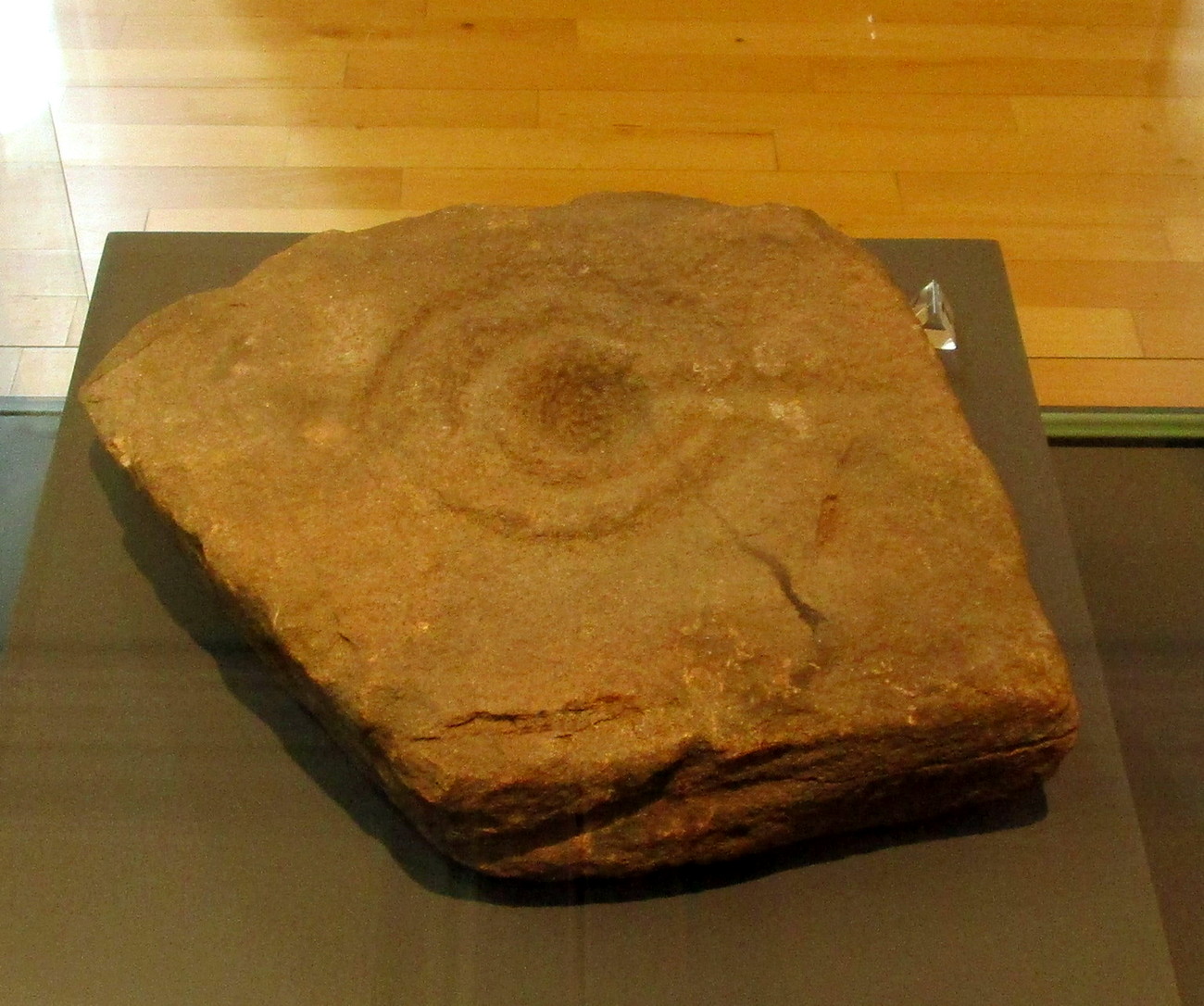
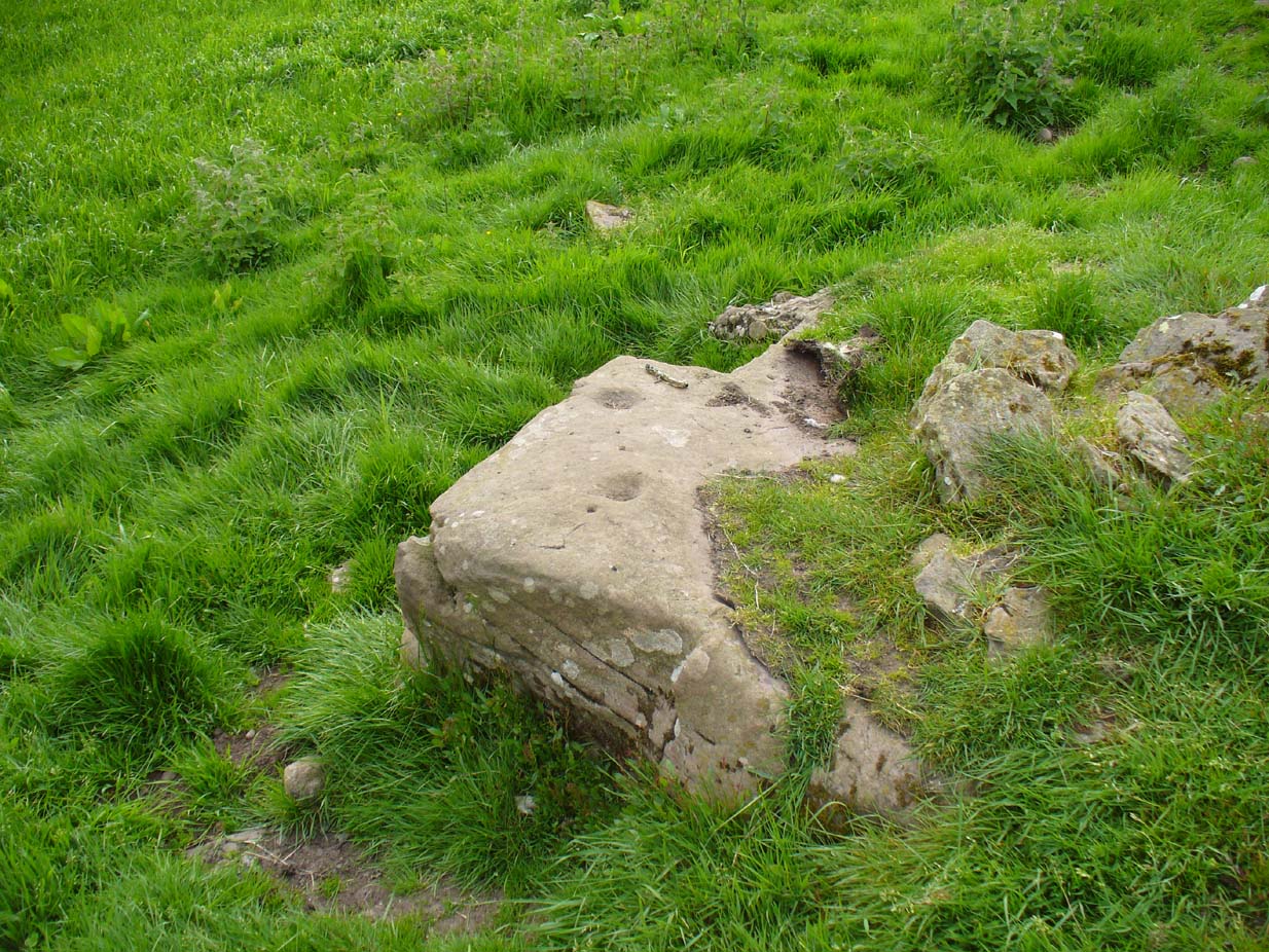
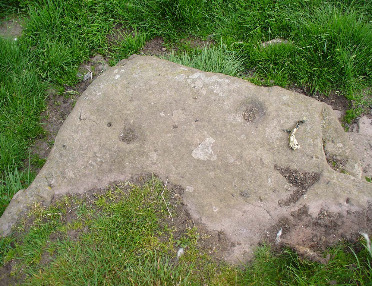
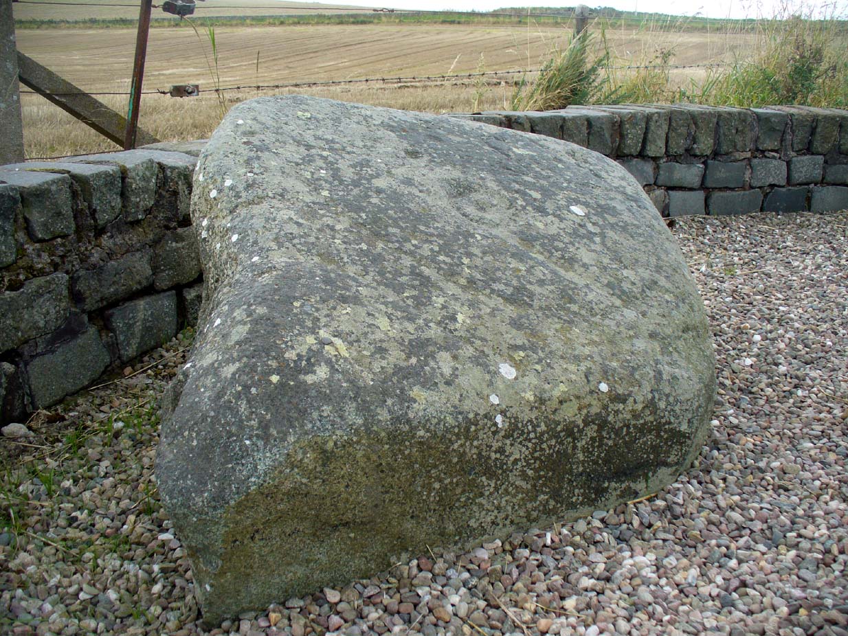
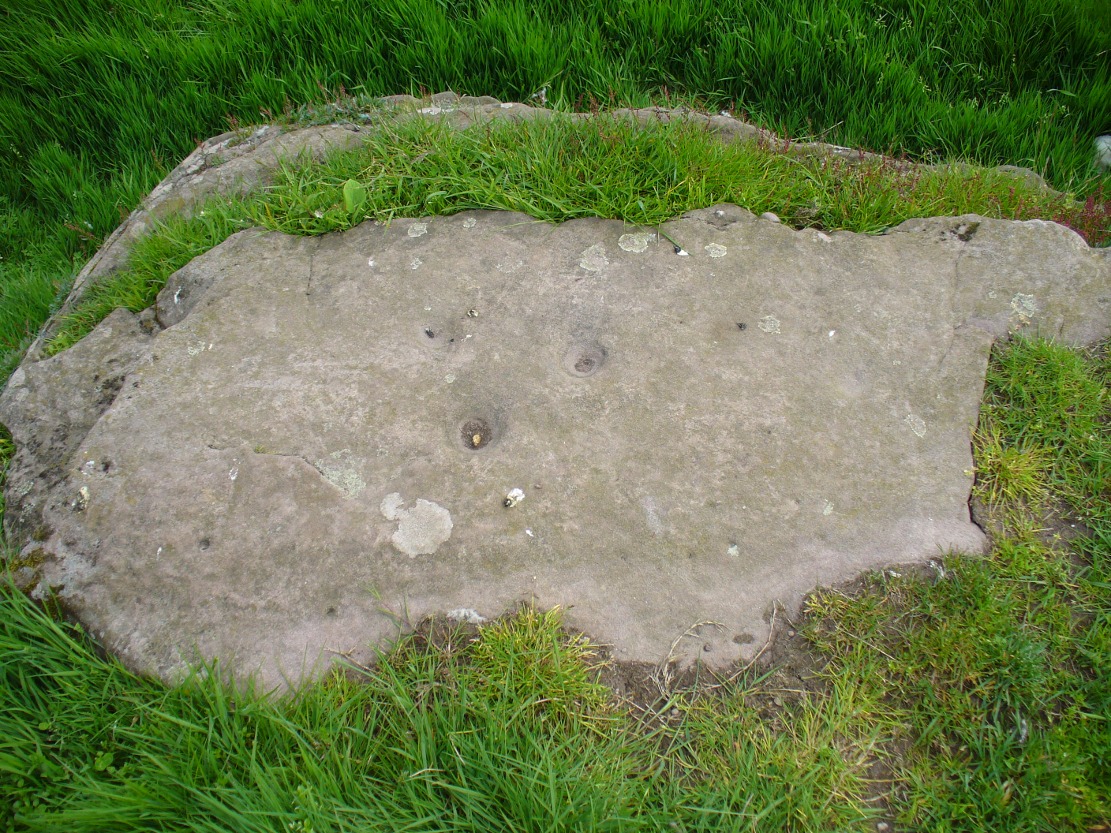
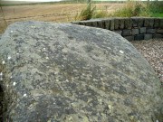
The Girdle Stane
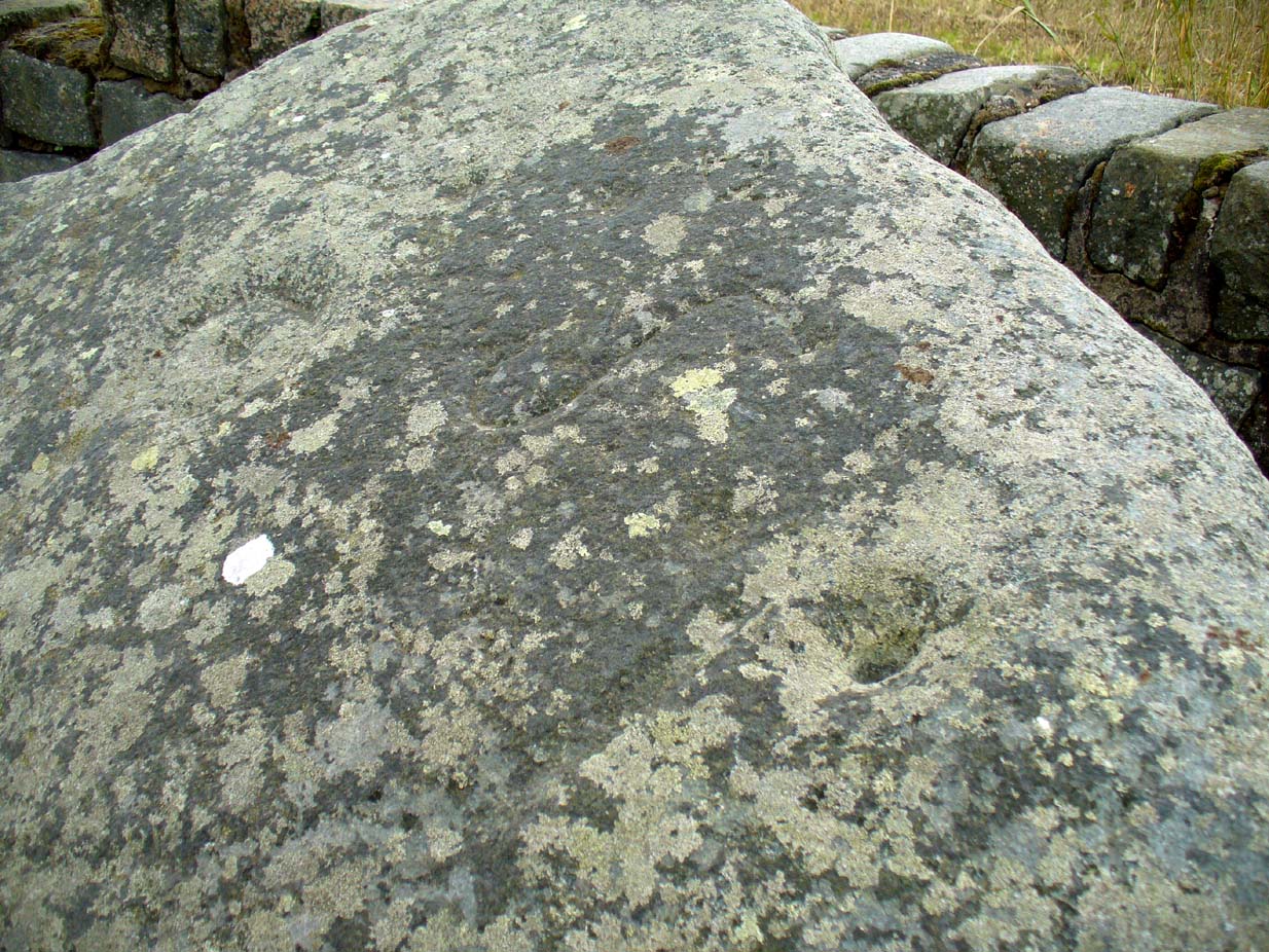
This cup-and-ring stone is not in its original position. Although we know from Ordnance Survey records in the 1860s that it was located about 130 yards north of here, close to the road junction, even that is unlikely to have been its original position—but we know not where that might have been! It is an undoubted multi-period carving, with the earliest section being our typical neolithic or Bronze Age cup-and-ring near the centre of the stone, with several outlying cup-marks toying with our intellect as per usual! The central cup-and-ring may have an incised line running down out of it, although this isn’t highlighted on John Sheriff’s (1995) drawing of the stone.
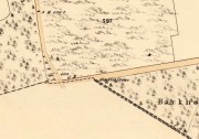
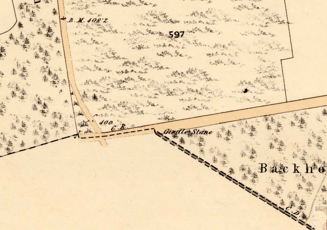
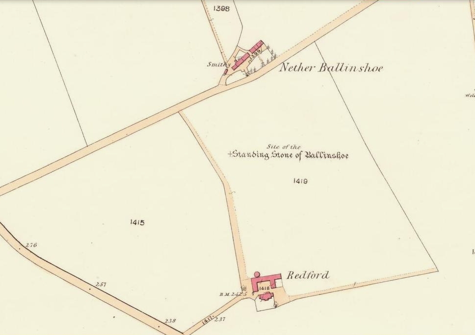
Girdle Stane on 1865 map
Surrounding the central archetype, by some distance, is a much wider carved ring that almost reaches to defines the edges of the stone itself. This large encircling motif and other features of the petroglyph—including a large elongated “S” and marks that were probably executed by the Ordnance Survey lads at the bottom corner—were ingredients which prompted Sir James Simpson (1867) to question the veracity of the Girdle Stane’s antiquity. He wrote:
“The so-called ‘Girdle-stone’ in the…parish of Rescobie, about four feet long and three broad, is cut on its surface with two circles, the largest of which is above two feet and a half broad, and hence does not, I believe, belong to the class which we are considering in this essay”—

More recent “S”-shaped motif
Close-up of cups, ring and lines
i.e., neolithic or Bronze Age petroglyphs. And you can see his point! My first impression when Prof Paul Hornby and I visited the site a few days ago, after the initial “that’s a cup-and-ring in the middle”, was to proclaim: “that bit’s much more recent, maybe Pictish?” But it probably isn’t even Pictish. This “more recent” carved element is a distinct large elongated “S”, which may have been marked onto it when the stone was used as a township boundary marker between the local parishes. The grand historical writer Alex Warden (1882) talks about this in his magnum opus, saying:
“At the junction of two roads, a little to the northeastward of Letham, there is a rough boulder, about five feet long by three in breadth, having on its face a circle of about thirty inches in diameter, and another smaller circle about six inches across. It is called the Girdle Stane of Dunnichen, from the larger circle resembling the utensil called the girdle, s.c. This stone marks the boundaries between the parishes of Dunnichen and Rescobie, also between the lands of Dunnichen and Ochterlony (Balmadies). It is probably the Grey Stone referred to in a note on the marches of Dunnichen, about 1280.”
Folklore
The folklore of the stone indicates how its origins are rooted in prehistory, despite the later additional symbols. Alex Warden (1882) tells the all-too-familiar creation myth, usually symptomatic of giant prehistoric cairns:
“Tradition says a witch was carrying this boulder from ‘the Crafts’ of Carmylie in her apron, when the strings broke, and the stone fell where it now lies.”
Carmyllie Hill is 5 miles (8km) to the south and is a place rich in fairy-lore and vandalized prehistoric sites.
References:
- Coutts, Herbert, Ancient Monuments of Tayside, Dundee Museum 1970.
- Kidd, Scott, The Churches of the Parish of Dunnichen, David Winter: Dundee 1995.
- Sherriff, John, “Prehistoric rock-carving in Angus,” in Tayside & Fife Archaeological Journal, volume 1, 1995.
- Simpson, James, Archaic Sculpturings of Cups, Circles, etc., Upon Stones and Rocks in Scotland, England and other Countries, Edmonston & Douglas: Edinburgh 1867.
- Warden, Alex J., Angus or Forfarshire – volume 3, Charles Alexander: Dundee 1882.
© Paul Bennett, The Northern Antiquarian