Holy Well, Nether Heyford, Northamptonshire

Holy Well (lost):  OS Grid Reference – SP 66 59 (approximate)

Archaeology & History

In George Baker’s (1822) massive regional history work he spoke of the village being “well supplied with springs, one of which, called Holywell, is medicinal.”  But it would seem to have fallen foul of that thing called progress, as no one has spoken of it since then.  When the Northampton historian, Beeby Thompson, looked for the site early in the 20th century, his enquiries drew a blank and he reported simply that “at the present time no one in the village appears to know of such a well.”  A field-name survey of the area may prove worthwhile…

References:

  1. Baker, George, The History and Antiquities of the County of Northampton, J.B. Nichols: London 1822.
  2. Harte, Jeremy, English Holy Wells – volume 2, HOAP: Wymeswold 2008.
  3. Thompson, Beeby, “Peculiarities of Waters and Wells,” in Journal Northamptonshire Natural History Society, volume 17, 1914.

© Paul Bennett, The Northern Antiquarian
St. Ann’s Well, Harrogate, North Yorkshire

Holy Well (lost):  OS Grid Reference – SE 298 548

Archaeology & History

Very little is now known about this sacred site that was once found “a few hundred yards east from the New Church at Low Harrogate.” (Hunter 1830)  Even most of travellers and medical experts who wrote about the numerous Harrogate wells in the 18th and 19th century bypassed its quietude; and by the time Mr Hunter wrote about it in his great descriptive catalogue, its healing or medicinal qualities had been forgotten.

He told that “the spirit in the water…or that with which it is infused, has long been most actively engaged in adding real or fancied comforts to the (Harrogate) Fair, and is now in much more general use” than the two other holy wells in the town. It was, he said, “the best water for making tea and more extensively used for that purpose than any in the neighborhood of Harrogate.”  It would also appear to have been built over at some time in the not-too-distant past…

Folklore

St Ann (saint’s day – July 26) was a giant in early christian and Islamic myths.  An apocryphal figure, She was the Great Mother of the mother of Christ—the Virgin Mary—and was Herself a Virgin until, in Her old age, after seeing a bird feeding a chick, decided She wanted a child and so eventually gave birth to Mary.  An old woman giving birth when the Springtime appears (when birds and other animals become fertile) is the same motif found in the lore of the Cailleach in Ireland and Scotland (and parts of northern England).  Pre-christian lore at this old well would seem evident here.

References:

  1. Hunter, Adam, The Waters of Harrogate and its Vicinity, Langdale: Harrogate 1830.

© Paul Bennett, The Northern Antiquarian
Burnt House Well, Tunbridge Wells, Kent

Healing Well (covered):  OS Grid Reference – TQ 6000 3963

Archaeology & History

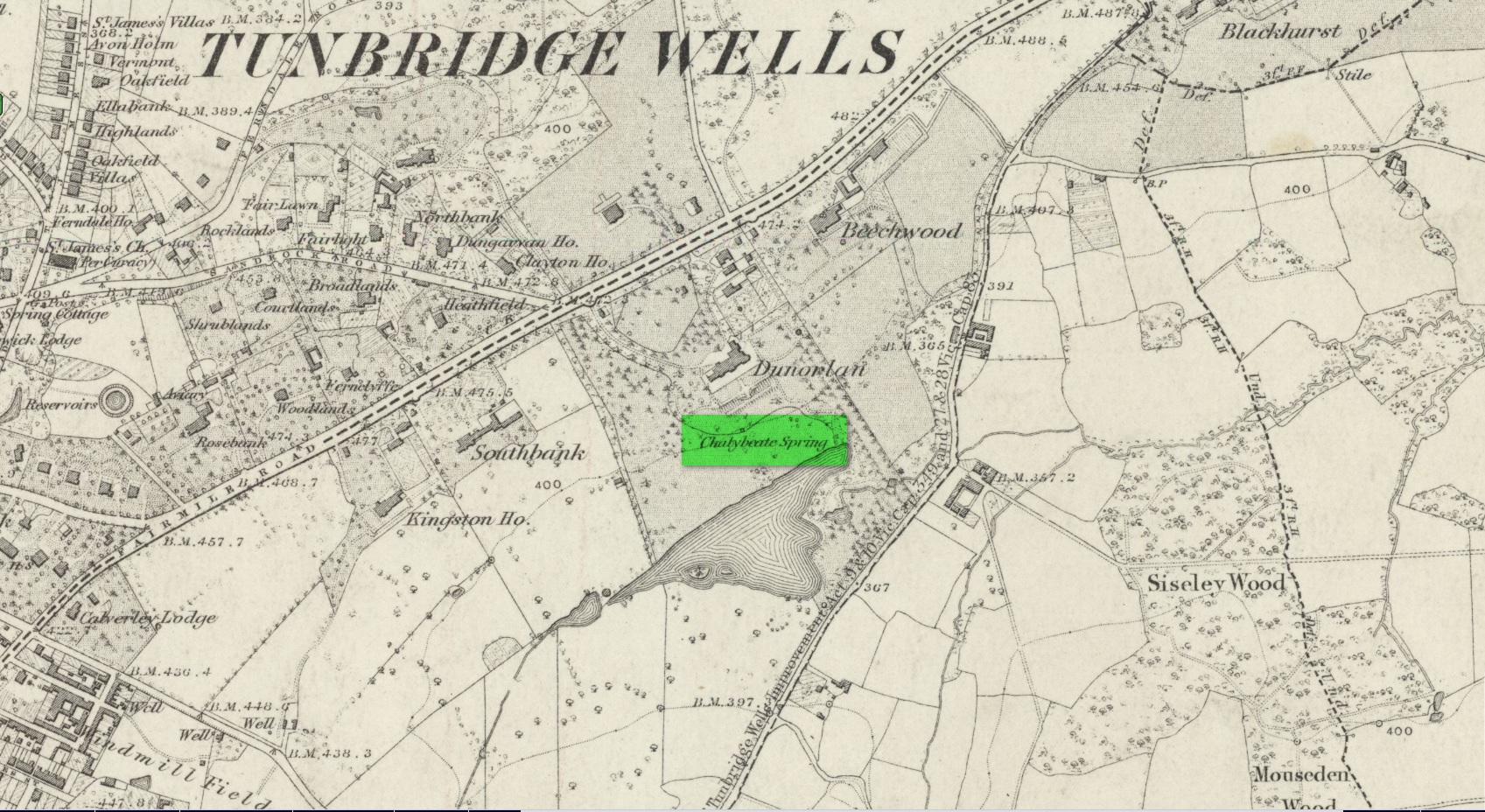
Shown on early OS maps as a chalybeate spring, the denuded remains of this site can still be seen in Dunorlan Park, between the tearoom and the lake, where the spring can be seen on the left beneath a large tree.  It was first described in John Britton’s (1832) famous account of the area, who told us:

Site shown on 1872 map

“There is a spring, called Burnt House Spring, situated in a little dell, in a romantic spot to the right of the road leading from Tunbridge Wells to Pembury. It is a good chalybeate, and the iron is in a state of carbonate. This spring rises rapidly into a stone basin, placed in the centre of a circular excavation, about ten feet in diameter and six or eight feet deep, which is bricked round, and with the remains of stone steps leading down to the basin at the bottom. This spring, therefore, has clearly been, at some time, made use of as a medicinal water. It was accidentally discovered choked up with rubbish. The country about Tunbridge Wells abounds with springs of this character.”

The spring was cleaned up some time ago and its waters rise in a square stone-lined chamber—accessed by four stone steps—into a circular stone basin, before flowing down a short channel and into the drains.  I’ve no idea whether or not the water is still drinkable.

References:

  1. Britton, John, Descriptive Sketches of Tunbridge Wells and Calverley Estate, Longman: London 1832.

© Paul Bennett, The Northern Antiquarian
Holy Well, Aston, Oxfordshire

Holy Well:  OS Grid Reference – SP 35833 02611

Archaeology & History

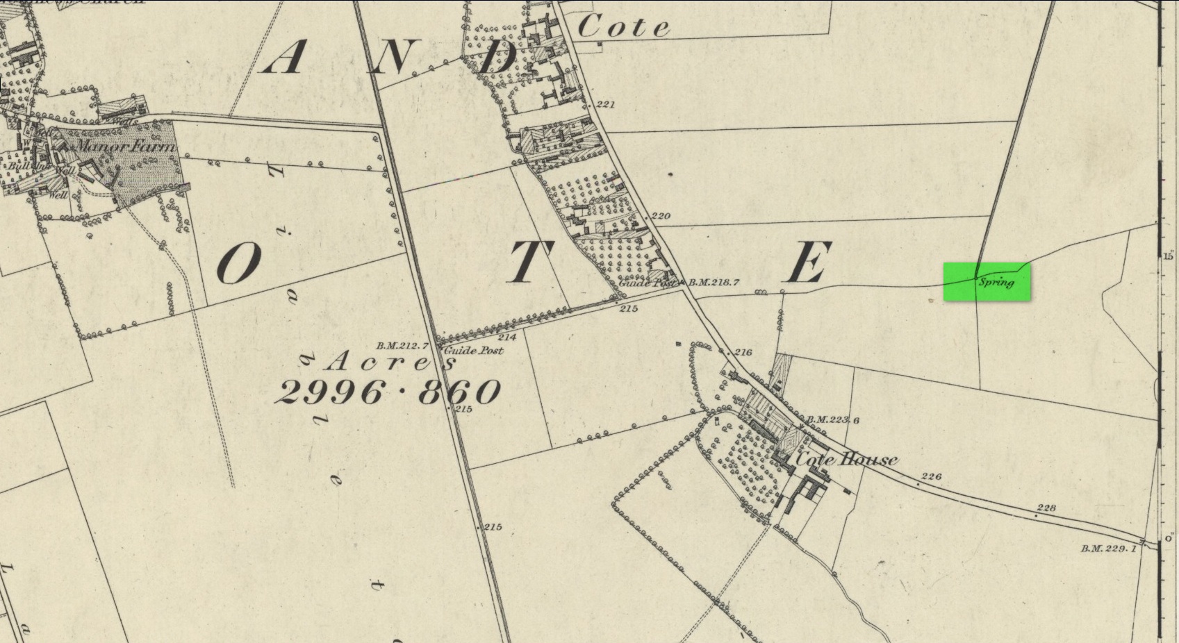
‘Spring’ marks the holy well

First mentioned as the field-name Holywellefield in the Court Roll of 1432, there is a possibility that this seemingly lost site still exists.  It was mentioned briefly in John Giles’ (1848) old history book of the area where he told us that, “a field beyond Cote House on the road to Shifford is still called ‘Holy-well field’, (but) no legend has been recorded.”

If we go 400 yards northeast across the field on the other side of the road from Cote House, a “Spring” that was shown on the early OS-maps would still seem to be actively feeding a dyke that runs roughly north from here.  This is probably the holy well that was described in those Court Roll records—and it still seems to exist.

References:

  1. Gelling, Margaret, The Place-Names of Oxfordshire – volume 2, Cambridge University Press 1954.
  2. Giles, J.A., History of the Parish and Town of Bampton, privately published: Bampton 1848.

Acknowledgements:  Huge thanks for use of the Ordnance Survey map in this site profile, reproduced with the kind permission of the National Library of Scotland. 

© Paul Bennett, The Northern Antiquarian
Chalybeate Well, Inverkeithing, Fife

Healing Well:  OS Grid Reference – NT 1486 8466

Archaeology & History

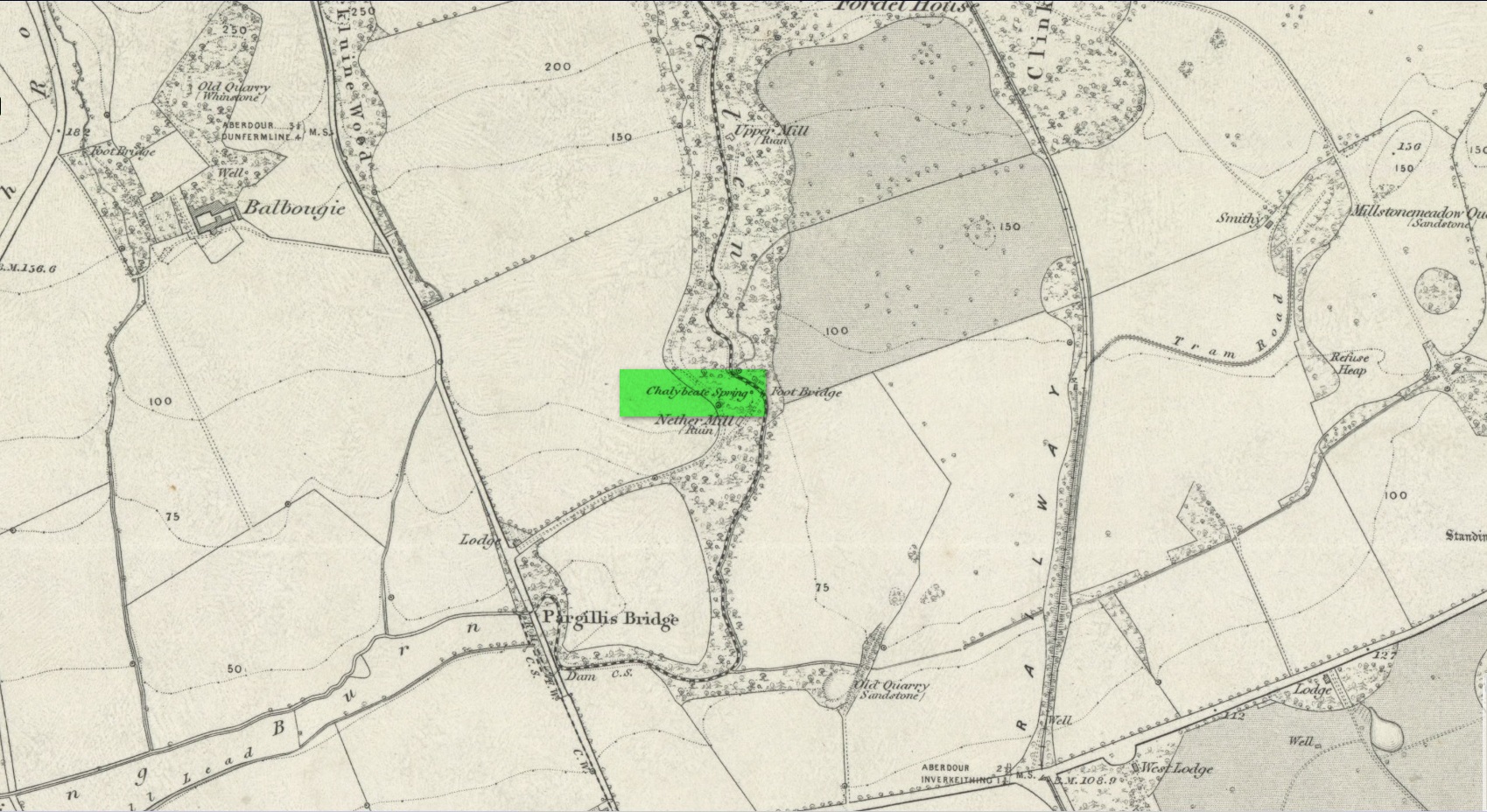
Site shown on 1856 map

This little-known iron-bearing spring takes some finding!  It’s all but lost beneath a mass of invasive rhododendrons that cover the slopes here (it needs to be severely cut back) and will only be found by the truly adventurous amongst you.  In notes of this site by Ordnance Survey in 1854, they told that “there was formerly a fountain to protect the Spring, but the fountain has been allowed to go to ruin” and I could see no remnants here on my visit.

In a detailed and lengthy analysis of the spring water that was done by W. Robertson in 1829, the principal minerals in it were found to be iron, magnesia and lime, but the spring was said to have no medicinal renown locally.

References:

  1. Robertson, W., “Analysis of the Water of a Spring on the Estate of Fordel near Inverkeithing,” in Edinburgh New Philosophical Journal (ed. Robert Jameson), volume 14, 1829.

Acknowledgements:  Huge thanks for use of the Ordnance Survey map in this site profile, reproduced with the kind permission of the National Library of Scotland. 

© Paul Bennett, The Northern Antiquarian
St. Martin’s Well, Looe, Cornwall

Holy Well:  OS Grid Reference – SX 2569 5407

Archaeology & History

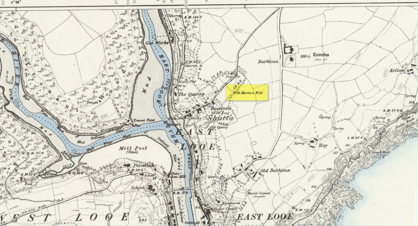
St Martins Well on 1888 map

An early dedication to the St Martin of this well is from the 13th century, when referring to the “church of sanctus Martinus” in 1282, whose building is a half-mile to the north.  The well itself is located on the old parish boundary, on the footpath today known as the North View.

In earlier days, the water from this site came “flowing out of a rock” giving birth to St Martin’s stream (Quiller-Couch, 1894).  “It was much used by the villagers,” they wrote, “because of the excellent quality of the water; now it is covered in with an ordinary wooden lid, and is used to supply the town of Looe with water.”

Things hadn’t changed when Mr Lane-Davies (1970) visited the place, who was far from pleased at its status.  “The spring,” he told, “has been enclosed in an ugly shed and the water piped away.”

Despite this, when Meyrick (1982) came here, he thought the site had “a romantic and grotto-like air” to it, but he was equally displeased by barbed wire preventing folk from easily accessing the waters and “spoilt by a certain amount of rubbish.”  Unfortunately due to a dreadful accident here in 1993, when a young child fell into the waters and drowned, the site is now completely enclosed by railings to prevent this happening to anyone else.

References:

  1. Bond, Thomas, Topographical and Historical Sketches of the Boroughs of East and West Looe, J. Nichols: London 1823.
  2. Lane-Davies, A., Holy Wells of Cornwall, FOCS: St Ives 1970.
  3. Meyrick, J., A Pilgrims Guide to the Holy Wells of Cornwall, Falmouth 1982.
  4. Quiller-Couch, M. & L., Ancient and Holy Wells of Cornwall, C.J. Clark: London 1894.
  5. Straffon, Cheryl, Fentynyow Kernow: In Search of Cornwall’s Holy Wells, Meyn Mamvro: Penzance 1998.

© Paul Bennett, The Northern Antiquarian
Heugh Well, Blairgowrie, Perthshire

Healing Well:  OS Grid Reference – NO 17103 46984

Also Known as:

  1. Mineral Well

Archaeology & History

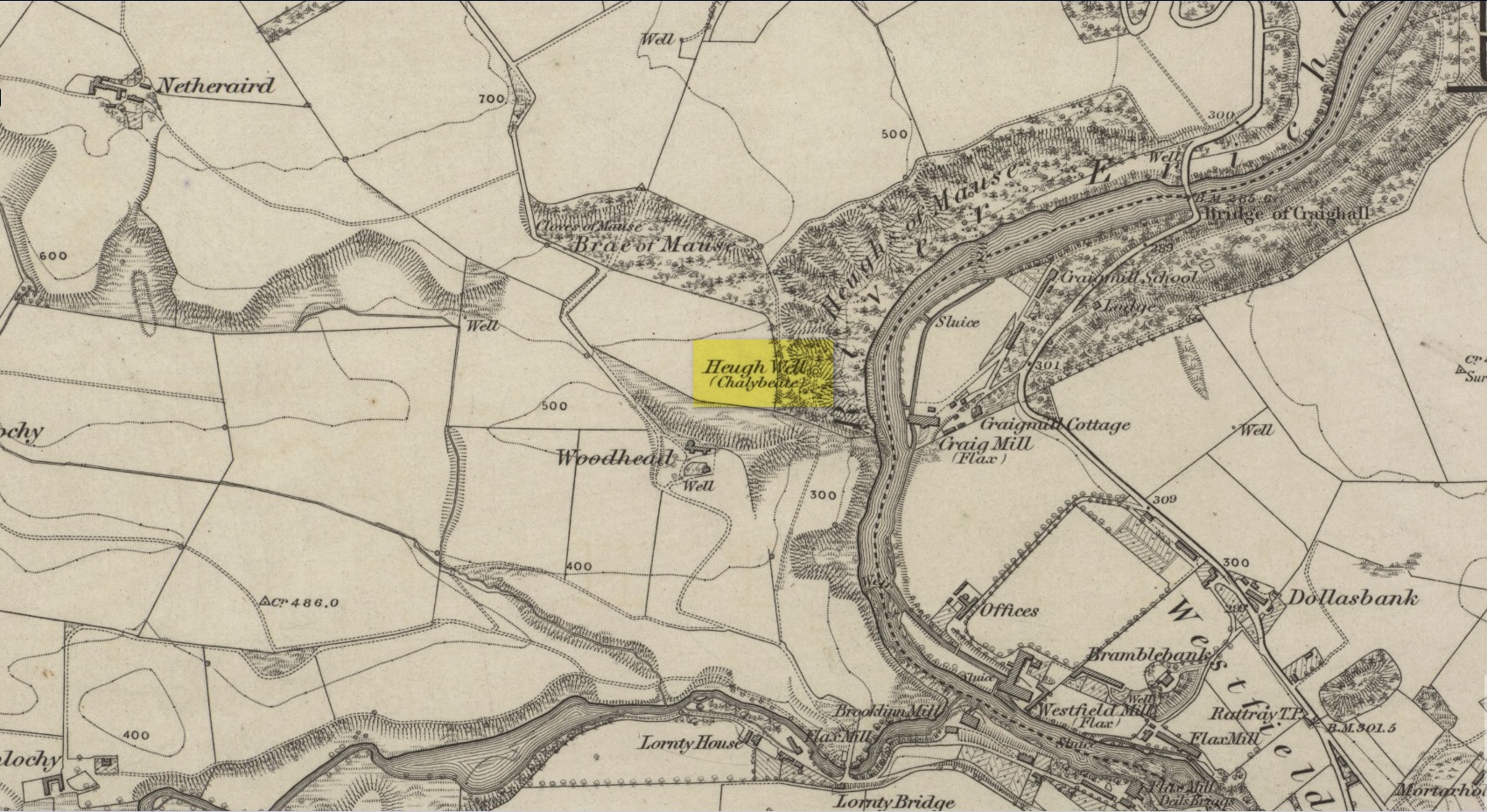
This little-known iron-bearing spring can still be found in the woodland known today as the Heugh of Mawse, a mile north of Blairgowrie.  It was included in the Object Name Book of 1863, where they referred to an earlier account in the New Statistical Account, which told that,

“On the south end of it is a chalybeate spring much resorted to by the people of the locality. “There are one or two chalybeate springs in the parish; but they have never been chemically analyzed. There is one very fine spring called the “Heugh Well” It springs from the face of the “Heughs of Mause” (a mortar cliff of singular appearance; which descends abruptly into the bed of the river with an almost perpendicular declivity of about 200 feet) and judging from its colour, contains a considerable quantity of ferruginous matter. The use of its water has been found to be very beneficial in cutaneous eruptions, & affections of the Stomach.””

Heugh Well on 1867 map

Subsequently highlighted on the 1867 OS-map, a singular footpath led to the site and no further.  It was mentioned by the regional historians J.G. McPherson (1885) and John MacDonald (1899), albeit briefly, where they respectively told that its waters were “formerly much resorted to by persons in the neighbourhood.”  It possessed considerable medicinal properties which, according to tradition, were “found very beneficial for skin diseases and derangement of the stomach”!  Doubtless such attributes will still be effective.

References:

  1. MacDonald, John A.R., The History of Blairgowrie, Advertiser Office: Blairgowrie 1899.
  2. McPherson, J.G., Strathmore: Past and Present, S. Cowan: Perth 1885.

© Paul Bennett, The Northern Antiquarian

St. Ninian’s Well, Blairgowrie, Perthshire

Holy Well (destroyed):  OS Grid Reference – NO 180 452

Archaeology & History

The Well Meadow in the middle of Blairgowrie was once the place where the 5th century Apostle of the Southern Picts, or St Ninian, baptised local folk into the so-called “new faith”.  It’s long since gone.  The local historian John MacDonald (1899) told that it was located opposite the buildings on the north-side of the square, adding:

“St Ninian, one of the earliest Christian Celtic missionaries, on his tour through Scotland, pitched his camp where the Wellmeadow now is, and quenched his thirst at an old well or spring which ever afterwards bore the name of “St Ninian’s Well,” until it was covered in and the water led into the town drains.”

Surely this is a good case for restoration?

Old Ninian’s saint’s day is September 16.

References:

  1. MacDonald, John A.R., The History of Blairgowrie, Advertiser Office: Blairgowrie 1899.

© Paul Bennett, The Northern Antiquarian

Holy Well, Trelawne, Cornwall

Holy Well (lost?):  OS Grid reference – SX 2258 5311

Archaeology & History

This spot is where an old field-name has preserved the memory of an all-but-forgotten holy well, known as the “Holywell Ground.”  Although it may have fallen back to Earth, there are two possible spots regarding its position: i) a spring that was marked on the 1882 OS-map at SX 2258 5315, and ii) a “Well” that’s shown on the recent OS-maps (SX 2257 5306).  Hence, the grid-reference I’ve given to this place is the halfway spot between them both. (it has to be pointed out that the “well” on recent maps occurs right next to an old quarry, which are well known to bring forth water sources that were previously deep underground)  Whether or not Sclerder Abbey—about 400 yards west of here and only built in 1843—had anything to do with the sanctifying this well, we can but guess…

© Paul Bennett, The Northern Antiquarian

Small Wells, Louth, Lincolnshire

Sacred Wells (destroyed):  OS Grid Reference – TF 32603 87555

Also Known as:

  1. Little Wells

Archaeology & History

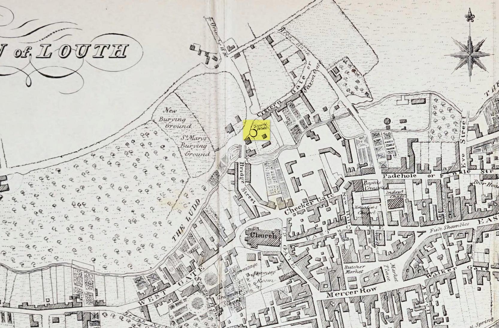
Small Well on 1834 map

Of the three wells in old Louth around which local ceremonies occurred, the Small Wells were apparently the least impressive.  Its ritualised compatriots south of the River Lud in St. Helen’s Well and the Ash Well (the Aswell in modern Louth place-names) were reportedly the much better water supplies in bygone times.  The site was highlighted on a map of the town in Robert Bayley’s (1834) history of the area, showing it as a small pool just below the Cistern Gate road; but when the Ordnance Survey lads came here later in the 19th century it had already gone.

It’s category here as a “sacred” well is due to it being annually decorated with garlands of flowers, commonly known today as well-dressing.  Such wells tend to be places of pre-christian rites, attended by local people at dawn usually at Beltane or at Midsummer (St John’s Eve); but I’ve been unable to find out which was the sacred day when the waters here were honoured.  All that we have left to tell us of the rites is from old township notes that said how,

““The small wells,” a cluster of little springs on the north of the town, shared in the honours of green boughs and popular huzzahs” the traditions held at the wells of St. Helen and Aswell a half-mile to the south.

A brief 16th century account told of a local man being paid for the adornment of the Small Wells: one “Henery Forman received for dressing small wells for a yeare – xiid” – or 12 pennies in old money.  Not bad at all in them days!

References:

  1. Bayley, Robert S., Notitiae Ludae; or Notices of Louth, W. Edwards 1834.

© Paul Bennett, The Northern Antiquarian