Overton Down Tomb, West Overton, Wiltshire

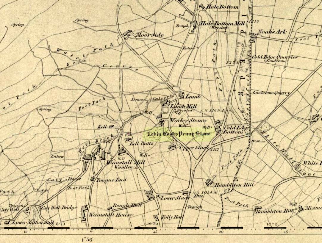
Cairn:  OS Grid Reference – SU 1305 7052

Getting Here

Overton Down cairn (image © Pete Glastonbury*)

From the Avebury stone circle, walk out eastwards and straight up the ancient Ridgeway for about a mile until it levels out and meets up with the adjoining track upon the hilltop. Instead of going left or right, go straight across and onto the footpath that crosses Overton Down, until you reach the wide horse-racing track lookalike called ‘the Gallops.’  Stop – don’t go on it – and follow the fence down for a coupla hundred yards till you’ll see the fenced-off rise with a modern ‘barrow’ enclosed within. You’re very close! From here, go another 100 yards or so down and keep your eyes on the rise of land with rocks scattered around it.  That’s it!

Archaeology & History

From all accounts, there’s been nowt of any consequence written about this site — which is bloody incredible to be honest!!  We came here on a fine day (that’s Mikki, Geoff and June) in the company of the local Avebury magus, Pete Glastonbury.  Crossing Overton Down towards an experimental “barrow” that some archaeo’s have knocked-up, the rise in the land here stands out quite clearly, saying (at the very least), “look at me!”  But until Pete Fowler (2000) first described this “unrecorded kerbed round barrow” a few years back, it had escaped the noses of all previous archaeological surveys!  How!?

What the hell do archaeologists in the Avebury area do with themselves if they can’t pick this sorta monument out!?  But anyway…

Overton Down cairn – looking NW

This is quite a large rounded cairn structure by the look of it.  At least 30-feet across, probably kerbed from the initial look (only for a few minutes, sadly).  Local writer Terence Meaden has apparently found the site of some importance in his studies (not yet published).  Its position here in the landscape was what caught my attention more than anything: it stands on the crest of the hill and has superb uninterrupted views far across the Avebury landscape.  This siting was obviously quite deliberate. Less than 100 yards due north of here are two curiously placed stones which may ‘frame’ the cairn for a southern lunar alignment.  I had no time to look at this really, so it would be good if some local Avebury dood could check this out.  The outlying stones may be merely fortuitous, but it’d be good to know for sure!

The site has been plotted amidst a mass of landscape changes dating from the neolithic to medieval periods.  It seems probable, on first impression, that the ‘cairn’ is of Bronze Age in character (though could be earlier), but until detailed analysis has been made we obviously won’t know for sure. A short distance to the south we have the much-denuded Overton Down site X1: another Bronze Age burial that yielded three beaker graves when Fowler excavated the place in the 1960s.

For those of you into geomancy, meditation and the subjective realms of genius loci, this one really grabbed me.  Give it a go and lemme know what you get.  But please, no stupid pagan or New Age offerings — the site doesn’t need that sorta thing.

References:

  1. Fowler, Peter, Landscape Plotted and Pierced: Landscape History and Local Archaeology in Fyfield and Overton, Wiltshire, Society of Antiquaries: London 2000.

* Pete Glastonbury is a Wiltshire-based photographer specialising in Landscapes, Astronomy, Archaeology, Infra-Red, Experimental Digital Photography and High Dynamic Range Panoramic photography.

© Paul Bennett, The Northern Antiquarian


Pots and Pans Stone, Greenfield, Lancashire

Legendary Rocks:  OS Grid Reference – SE 01008 05072

Also Known as:

  1. Druid Stone

Getting Here

Pots & Pans on 1854 OS-map

Dead easy! From the townships of Grasscroft, Uppermill, or Greenfield, take the legendary moorland road up to Saddleworth tops (A635), keeping your eye on the modern obelisk on the hilltop to your left and you’ll see a large rock outcrop almost next to it.  That’s where you’re heading.  Once you reach near the moorland level, walk in whatever way you see fit towards the obelisk and large stones.  Enjoy…!  I s’ppose though, it’d be better for you if you started from the valley bottom at Uppermill and walked up the hill.

Folklore

Seemingly a ritual place of the sun, this fine site was known by the local folk-name of the Druid Stones, according to Jessica Lofthouse. (1976)  But more importantly in legend, this great rocky outcrop was the abode of an old giant called Alphin, who had a rival called Alder who also wandered the moors here.  Both these giants vied for the hand of a lady called Rimmon, who preferred Alphin to Alder. In good old fashioned ways they contested for her hand, throwing giant rocks across the moors at each other, but “Alphin was hit and killed, with Rimmon looking on.”  His grave lies on these moors somewhere, seemingly unfound.   …And intriguingly it seems that we’ve actually located a prehistoric tomb which may account for the legend of Alphin’s death! (Watch this space!)

A slight variation on the tale describes the Lady Rimmon to be of fairy stock, named ‘Raura Peena’ (a phonetic spelling of a local dialect name), who in one account from the Notes & Queries journal, 1850, tried luring a local man into her magickal recess of the Fairy Holes, on the slopes beneath the Pots and Pans Stone.

Local tradition also tells that the naturally-worn ‘bowls’ atop of the rocks held magical properties — water being collected from them was said to be good to cure eye problems.  This is a curative theme we find at some bullauns, cup-marked stones and old cross-bases and would strongly indicates that pre-christian practices did once take place here.

References:

  1. Lofthouse, Jessica, North Country Folklore, Robert Hale: London 1976.

© Paul Bennett, The Northern Antiquarian


Torrisholme Barrow, Morecambe, Lancashire

Tumulus:  OS Grid Reference – SD 4596 6425

Getting Here

Various ways up this old hill, visible from all angles it seems.  I came up via the housing estate near where us friend lives, near Bare Lane Station, through the houses and up the footpath.  But you can just as easy (if not easier) walk up from the country lane and fields beneath its eastern side.  Much nicer!

Archaeology & History

Torrisholme Barrow
Torrisholme Barrow

As many northerners will tell: gerrin information from the Lancashire archaeologists about prehistoric sites is troublesome (must be Southerners running the show!).  There’s tons of stuff in this good county, but archaeo-info is pretty poor on the ground.  This great old tomb for example, is designated as a “round barrow” on the Lancashire County Council monuments and records listing, but there’s no other info telling when it was dug, who by, the size of the tomb, what was found here, etc.  Pretty poor to be honest (c’mon chaps – get yer fingers out!).  The best info on-line comes from the more dedicated amateur enthusiasts.

A local historian told us that there was nowt up here, but my nose told me otherwise — so up we tramped!  It was pretty obvious once we’d got to the top here, that some ancient mound had been built up.

“This has all the hallmarks of a tomb,” I said.

Torrisholme Barrow, looking SW

The spirit of the ancestor herein (whoever s/he was) had excellent views and flights to numerous important hills 360° all round here.  A perfect place for a tomb! And when we returned into the Darklands of our Yorkshire abodes, we found this notion to be true.  Marked on early OS-maps as a tumulus, next to the tell-tale giveaway route of Barrow Lane, there are passing mentions of it in a couple of old local history books I’ve come across, but I’ve yet to find much more about it.  It’s a fine mound and of decent size, well worth checking out if you’re in the area.  Once I get more details of the archaeological finds from here, I’ll add the data to TNA (but based on past performances and responses from Lancashire archaeo’s, I wouldn’t hold your breath…)

And for any Morecambe historians who might be able to find more: what — if anything — is known of the ‘Fartle Barrow’, now swallowed by the encroachment of the sea, just a few hundred yards west of here?

Early OS-map showing barrow

Folklore

In days of olde, this site was an old moot or meeting hill: one of the northern Law or council meeting hills.  Quite how far back this gathering tradition up here goes, aint known.  We do know however that there was a christian tradition enacted here, at Easter, of local church doods taking a cross up the top of the hill (does anyone know the story behind the old Cross Hill, half-a-mile south of here?).  There’s obviously quite a lot more pre-christian activities occurrent round here than has been previously thought.

© Paul Bennett, The Northern Antiquarian


Standingstone Hill, Lesmahagow, Lanarkshire

Standing Stone (destroyed): OS Grid Reference – NS 759 351

Archaeology & History

The name of the place sort of gives the game away, but sadly we’ve got nowt to see anymore as the forest has covered it. The Royal Commission lads came here in 1971 and couldn’t find it, but later told that it “formerly stood on the summit” of the said hill. An important geomantic spot without any shadow of a doubt, probably having some relationship with an old tomb, either here or around the tree-covered summit of Tod Law, due east of here.

There’s a great deal more that’s been forgotten about up and about this region which will come to light as visits unfold.

References:

  1. Royal Commission on the Ancient & Historical Monuments of Scotland, Lanarkshire, HMSO: Edinburgh 1978.

© Paul BennettThe Northern Antiquarian


Robin Hood’s Penny Stone, Wainstalls, West Yorkshire

Stone Circle (destroyed):  OS Grid Reference – SE 046 288

Archaeology & History

The Pennystone on 1852 map

All remains of this site, first mentioned as a stone circle in 1836, have gone. The place could be found by the appropriately named Stone Farm at the top end of Wainstalls and was first mentioned by John Watson (1775), who strangely said nothing about any circle here.  However, this changed when John Crabtree (1836) arrived and described a ring of stones surrounding a large boulder in the centre (illustrated here). The boulder itself was actually called the Robin Hood Penny Stone.

Folklore

Watson's 1775 drawing
Watson’s 1775 drawing

This was one of the many legendary sites from where our legendary outlaw practiced shooting his arrows.  He was also said to have picked up and thrown a large standing stone from this spot, until it landed three-and-a-half miles away on the hillside on the other side of the Calder Valley. (this was known as the Field House, or Sowerby Lad Standing Stone)

References:

  1. Bennett, Paul, The Old Stones of Elmet, Capall Bann 2001.
  2. Crabtree, John, Concise History of the Parish and Vicarage of Halifax, Hartley & Walker: Halifax 1836.
  3. Dobson, R.B. & Taylor, J., Rymes of Robyn Hood, Alan Sutton: Gloucester 1989.
  4. Faull, M.L. & Moorhouse, S.A., West Yorkshire: An Archaeological Guide (4 volumes), WYMCC: Wakefield 1981.
  5. Varley, Raymond, “A Stone-Axe Hammer, Robin Hood’s Penny Stone and Stone Circle at Wainstalls, Warley, near Halifax,” in Yorks. Arch. Journal 69, 1997.
  6. Watson, John, The History and Antiquities of the Parish of Halifax, T. Lowndes: London 1775.

© Paul Bennett, The Northern Antiquarian


Nursery Knot, Appletreewick Moor, North Yorkshire

Sacred Hill:  OS Grid Reference – SE 081 636

Also known as:

  1. Nursa Knott
  2. Nursery Hill

Getting Here

Dead easy.  Follow the Grassington-Pateley Bridge road (B6265) east and about 2 miles past Hebden village, the craggy hill rises to the left-hand side of the road, as you can see in the photo below.  Simple!

Archaeology & History

Nursery Knott hill
Nursery Knott hill

When fellow rock-art freaks Graeme Chappell, Richard Stroud and I were exploring the cup-and-ring stones in the area just south of here a few years back, this hill kept calling out with some repeated awe. “There’s summat about that place,” were the remarks we kept saying – but we could never put our finger on it. (still haven’t if truth be had!).  Between here and the awesome Simon’s Seat to the south, a whole panoply of neolithic and Bronze Age remains scatter the land — and if ritual landscape has any validity, this hill is undoubtedly enmeshed in the mythic framework of such a paradigm. But without any folklore I didn’t feel right to include it here…

At the northern or rear-end of this great outcrop (SE 082 640) is a scattering of many boulders, one of which in particular at Knot Head was explored by a Mr Gill in 1955 and found to have a number of Mesolithic worked flints all round it. Seems as if folk have been up to things round here for even longer than we first thought.  Microlith or flint-hunters would probably do well on the moors up here!

Folklore

It’s the old pen of our Yorkshire topographer Edmund Bogg which brings the lost folktale of this place back to life – and it’s typical of aboriginal creation myths from elsewhere in the world. In his Higher Wharfeland he had this to say of old ‘Nursa Knott’, as it was locally known:

“The old legend is that the devil, for some reason anxious to fill up Dibb Gill,* was carrying these ponderous crags in his apron when, stumbling over Nursa Knott, the strings broke and the crags fell. Legend also says, should the crags be removed they will be carried by some invisible power back to their original position.”

He then reminds us of links with old Wade, plus the settlement of old Grim, a short distance to the north.

Across the road down the track running south to Skyreholme, Jessica Lofthouse ( 1976) told the tale of a ghostly horseman, seen by her great-grandfather no less! Suggesting he may have been ‘market merry’ (i.e., pissed!), she told how he “struck out at a spectral white horse at the Skyreholme three-land ends near Appletreewick – and his stick passed through it!”

References:

  1. Bogg, E., Higher Wharfeland: The Dale of Romance, James Miles: Leeds 1904.
  2. Lofthouse, Jessica, North Country Folklore, Hale: London 1976.
  3. Walker, D., ‘A Site at Stump Cross, near Grassington, Yorkshire, and the Age of the Pennine Microlithic Industry,’ in Proceedings of the Prehistoric Society, 1956.

* Dibb Gill is nearly a mile due west of here – and Dibble’s Bridge which crosses the beck was also known as the Devil’s Bridge, with a few typical creation myths of its own attached.

© Paul Bennett, The Northern Antiquarian


Nixon’s Station, Ilkley Moor, West Yorkshire

Cairn:  OS Grid Reference – SE 11468 45224

Getting Here

The denuded remains of a once giant tomb

This is the highest point of the moors, 1320 feet up. There’s various ways of getting there: I’d favour the wander up to Twelve Apostles then taking the 15 minute walk west to the triangulation point which marks the spot.  If you reach the large rocky outcrop of the Thimble Stones, you’ve gone too far; although you can walk past the Thimbles, if you’ve started your walk from the two radio masts atop of the moor where the old Roman road hits the dirt-track.  Either way, unless you’re damn stupid, this is an easy spot to find!

Archaeology & History

Although today there’s little to be seen, when Collyer & Turner (1885) described the place it was 175 yards in circumference! Bloody huge! When Harry Speight got here in 1900, it had shrunk slightly to 150 yards. Now however, almost all the stones have been robbed.  I first came here when I was just 11 years old and remember it was a decent size even then – at least as large as the Little Skirtful and Great Skirtful of Stones more than a mile to the east.  Today however, unless you knew it was once a giant cairn, you wouldn’t give it a second look.

It’s quite appalling what’s happened to this site thanks to the sheer ignorance and neglect of the local archaeologist in tandem with his paymasters at Bradford Council: 90% of the site has been utterly vandalised and destroyed as a result of these incompetent idiots in the last 20 years.  Nowadays, all you can make out here is the raised earth for about 10 yards surrounding the trig-point.  It seems that most of the stones that comprised this giant cairn have been taken for use in walling, and to prop up the stupid paved footpaths which the local Council and its affiliated halfwits are slowly building o’er these hills.*  Morons!

Aar Dave on top o’ t’ moors

I’m not quite sure why it was called Nixon’s Station.  It was J. Atkinson Busfield (1875) who mentioned this name, quite casually in his fine local history work, as if local folk had known it as such for sometime.  There was also an inference of it being the resting place of some old general, but I’ve found nor heard anything more along such lines — though worra superb place for your spirit to roam free…..

If anyone has any old photos of this once giant prehistoric site, it would be good to see it in its old glory once again.  When I wandered up here as a kid, I never carried things like a camera about (being a Luddite by nature!).

References:

  1. Busfield, J.A., Fragments Relating to the History of Bingley Parish, Bradford 1875.
  2. Collyer, R. & Turner, J.H., Ilkley, Ancient & Modern, Otley 1885.
  3. Speight, Harry, Upper Wharfedale, London 1900.

© Paul Bennett, The Northern Antiquarian

* Anyone know exactly which idiots are responsible for the stone footpaths being laid over the moors here? They’re damn stupid and cause even more erosion and damage to the environment and prehistoric heritage up here, as anyone with an ounce of common sense can see. Can someone please get them stopped!?


Black Hill Long Cairn, Low Bradley, Skipton, North Yorkshire

Cairn:  OS Grid Reference – SE 0092 4756

Also Known as:

  1. Black Hill Long Barrow
  2. Bradley Moor Long Barrow
  3. Bradley Moor Long Cairn
  4. King’s Cairn

Getting Here

Follow the same directions for getting to the Black Hill Round Cairn.  It’s less than 100 yards away – you can’t miss it!

Archaeology & History

This is a superb archaeological site — and it’s bloody huge! It’s big and it’s long and it sticks out a bit – which is pretty unique in this part of the Pennines, as most other giant cairns tend to be of the large round variety.  Although the site was originally defined by Arthur Raistrick (1931) as a long barrow, J.J. Keighley (1981) told how, “it was found to be a round cairn imposed on a long cairn.”  And it’s an old one aswell…

Near the SE end of the giant cairn
Close-up of the main cist

More than 220 feet long and 80 feet in diameter at its widest southeastern end, as we walk along the length of the cairn to its northwestern edge, its main body averages (only!) 45 feet in diameter.  Made up of tens of thousands of rocks and reported by Butterfield (1939) to have had an upright stone along its major axis, the “height varies from 4-8ft, but the cairn has been much despoiled and disturbed,” said Cowling in 1946. He also told how,

“Excavation revealed that almost in the centre of the mound were the remains of a cist made of roughly dressed stone flags and dry walling, covered by a large stone. Under a stone slab, laid on the floor of the cist, were fragments of (burnt and unburnt) bone and a small flint chipping.”

This is a very impressive site and deserving of more modern analysis. The alignment of the tomb, SE-NW, was of obvious importance to the builders, believed to be late-neolithic in character.  The tomb aligns to two large hills in the far distance in the Forest of Bowland which we were unable to identity for certain.  If anyone knows their names, please let us know!

Folklore

The older folk of Bradley village below here, tell of the danger of disturbing this old tomb. In a tale well-known to folklorists, it was said that when the first people went up to open this tomb for the very first time, it was a lovely day. But despite being warned, as the archaeologists began their dig, a great storm of thunder, lightning and hailstones erupted from a previously peaceful sky and disturbed them that much that they took off and left the old tomb alone. (I must check this up in the archaeo-records to see if owt’s mentioned about it.)

References:

  1. Ashbee, Paul, The Earthen Long Barrow in Britain, Geo Books: Norwick 1984.
  2. Butterfield, A., ‘Structural Details of a Long Barrow on Black Hill, Bradley Moor,’ in YAJ 34, 1939.
  3. Cowling, E.T., Rombald’s Way, William Walker: Otley 1946.
  4. Keighley, J.J., ‘The Prehistoric Period,’ in Faull & Moorhouse’s West Yorkshire: An Archaeological Survey, I, WYMCC: Wakefield 1981.
  5. Raistrick, Arthur, ‘Prehistoric Burials at Waddington and Bradley,’ in YAJ 30, 1931.

© Paul Bennett, The Northern Antiquarian