Firbrush Point, Killin, Perthshire

Dun (destroyed):  OS Grid Reference – NN 603 337

Archaeology & History

Not to be confused with the ‘fort’ shown on modern OS-maps on the wooded slopes a few hundred yards to the south, the denuded remains of this site were shown on an 18th century map of the area (the Breadalbane estate plans). Probably Iron Age in nature, the local historian William Gillies (1938) described the place in his fine work,

“According to the atlas of 1769 there were ruins of an ‘Ancient Castramentation’ at Firbrush Point on the farm of Auchmore. An examination of this little peninsula revealed the foundation of a very thick wall that at one time ran across its neck, and formed a defence on the landward side. It is probable that the stones were removed for the erection of the small pier and harbour close by.”

An assessment of the site by some of the Scottish Royal Commission lads in the late 1970s found no remains of the thick walling and it seems all remains of this fort have sadly been destroyed.

References:

  1. Gillies, William A., In Famed Breadalbane, Munro Press: Perth 1938.
  2. Royal Commission on the Ancient & Historical Monuments of Scotland, Archaeological Sites and Monuments of Stirling District, Central Region, Society of Antiquaries of Scotland 1979.

© Paul Bennett, The Northern Antiquarian 
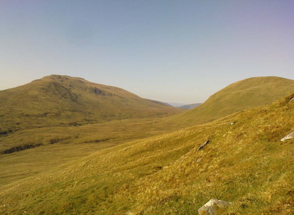

Duncroisk, Glen Lochay, Perthshire

Dun (lost): OS Grid Reference – NN 539 386 (approximation)

Looking towards Laraig Bhreislich, from the south

Also Known as:

  1. Dun croisgh
  2. Lairig Breisleich
  3. Laraig Bhreislich

Archaeology & History

Although this site doesn’t appear in the modern records, the remote situation of the place suggests that some remains of the site could remain and be uncovered by diligent explorers and students. It is one of several lost “circular forts” that were described in William Gillies’ (1938) detailed historical text, that were first highlighted on a map of 1769. His brief description of this old fort told,

“The name ‘Duncroisg’ in Glenlochay, bears witness to the fort that once stood at the southern entrance to Laraig Bhreislich, the pass leading over the mountain to Glenlyon.”

There is is the possibility that some of the remote shielings clustered on the level at Airigh Allt an Eilein and Riabhaich used stones from this ancient site for their construction. On the level to the south of here are the overgrown remains of a prehistoric cairn, not included in archaeological surveys.

Note – Huge sections of prehistoric man-made walling have been located in the area, comprised of gigantic boulders, more reminiscent of enclosure walling.  The remains are extensive and huge, but severely overgrown in this remote landscape.  Watch This Space!

Folklore

Although not named specifically, this site would have been another of the Forts of the Fiann, or tribes of the hero-figure, Finn. The valley immediately adjacent to the location of the fort is still known as Fionn Ghleann, with the waters of Allt Fionn Ghleann strongly flowing through.

References:

  1. Gillies, William A., In Famed Breadalbane, Munro Press: Perth 1938.

© Paul Bennett, The Northern Antiquarian