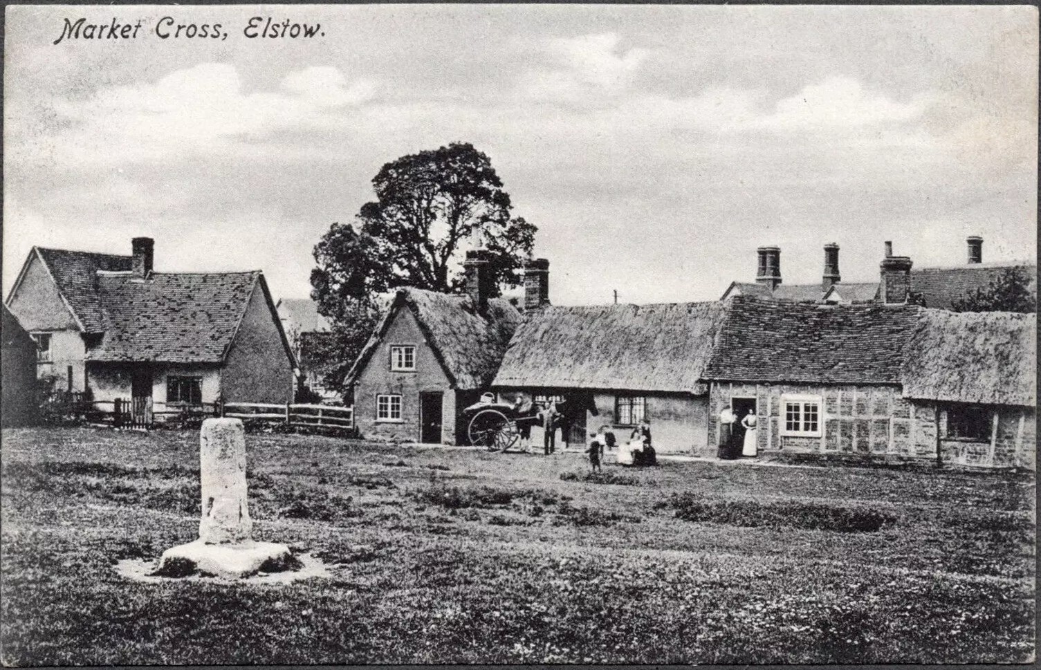
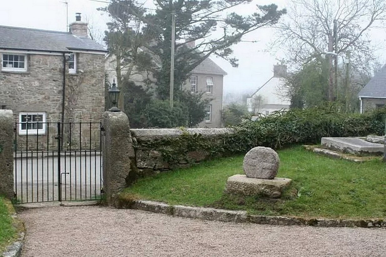
Sitting quietly “on the village green, where the fair is still held,” wrote Wigram (1885), “stands the base of the old market-cross, reduced to a shapeless stump, but still bearing traces of leaden setting.” Thought to be mediaeval in age, it was described as a sundial on some of the early Ordnance Survey maps which, perhaps, it may have been used as for a short period (although records are silent on the matter). Standing just three-feet tall, this old stone pillar still lives on its ancient spot, as quiet as always, keeping itself to itself…
References:
Wigram, S.R., Chronicles of the Abbey of Elstow, Parker & Co.: Oxford 1885.
Stone Circle (destroyed): OS Grid Reference – NY 549 182
Archaeology & History
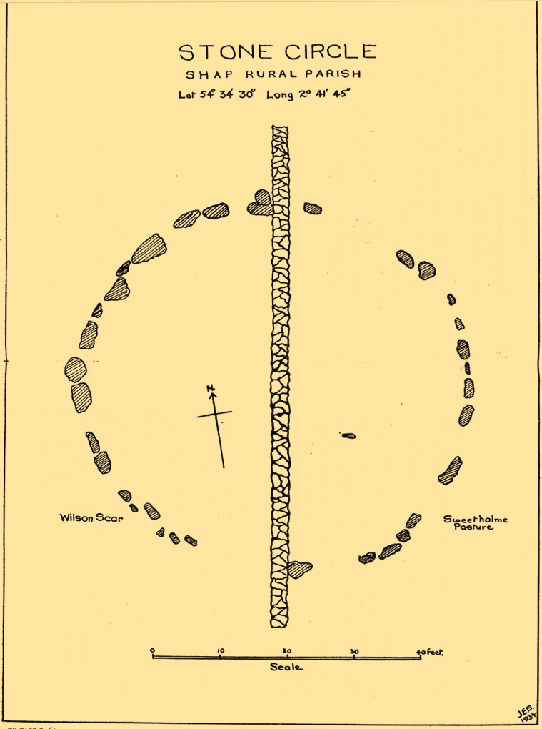
This site has been completely destroyed by the huge eyesore of a quarry that we all see when we’re travelling up the M6 north, above Shap. John Waterhouse (1985) told that “a rescue excavation” was carried out here with help from the kids at Penrith Queen Elizabeth School, shortly before its destruction in 1952, but now there is no trace left of it. When it was first described by J.E. Spence (1935), the circle had already been damaged by a wall that cut right through its centre. He told:
Spence’s 1935 plan
“The circle, which is 6o feet in diameter, is composed of 35 stones, 20 being on the west and 15 on the east side of the boundary wall running through the circle from north to south. The stones of which the circle is composed are Borrowdale erratics, a large number of which are scattered over the adjoining ground on both sides of the wall but more thickly in Sweet Holme Pasture. The stones, which vary up to 5 feet 9 inches by 3 feet, are larger and more numerous in the north-west quadrant where the tallest stands 1 foot 8 inches above the level of the turf. The ground within the circle is level, but to the south and west it slopes gently down from the edge of the circle in such a manner as to suggest that the area within the circle has been levelled.”
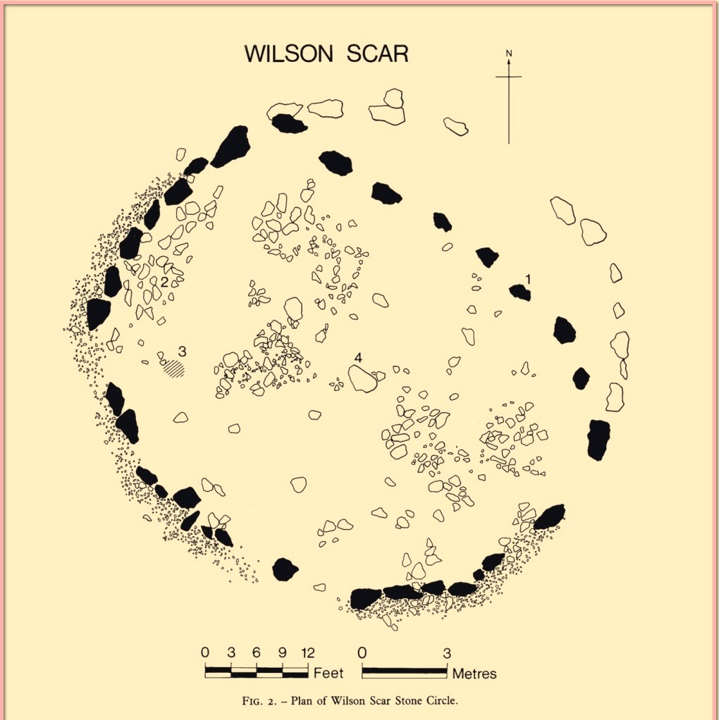
1952 plan laid over Spence’s 1935 plan
Spence told that an ancient “sunken trackway” led outwards from the circle to the south-west in the direction of Rosgill, but when the 1952 excavation occurred, no remains of such a track were found; nor was the wall that had cut through it; and the north-easterly section of the circle had been cut into and re-laid, presumably by the quarrymen. It was quite plain, wrote G.G. Sieveking (1984), “that this portion of the monument was encroached upon in the summer of 1952, and hastily reconstructed for the benefit of the archaeologists.”
Their excavation found that some internal sections of this ring had been paved with thin limestone slabs and they also uncovered two small cairns, neither of which possessed anything. However, they did find four funerary deposits within the monument: one at the northeastern section of the circle (no.1); another near the centre (no.4); and remains of a cremation west of centre (no.3); but the most complete find was at the western side of the ring, where a “disarticulated inhumation burial was lying immediately beneath the turf line in a shallow grave 1.35 m long, surrounded by a setting of small boulders.” It was a near complete human skeleton. This place was obviously, at times, used in ceremonies for the dead.
Shortly after the archaeological examination of the site, it was blasted away by quarrying. Gone!
References:
Barnatt, John, Stone Circles of Britain– volume 2, BAR: Oxford 1989.
Burl, Aubrey, The Stone Circles of Britain, Ireland and Brittany, Yale University Press 2000.
Farrah, Robert W.E., A Guide to the Stone Circles of Cumbria, Hayloft: Kirkby Stephen 2008.
Seton, Ray, The Reason for the Stone Circles in Cumbria, privately published: Morecambe 1995
Sieveking, G.G., “Excavation of a Stone Circle at Wilson Scar, Shap North 1952,” in Transactions Cumberland & Westmorland Antiquarian & Archaeological Society, volume 84, 1984.
Spence, J.E., “A Stone Circle in Shap Rural Parish,” in Transactions Cumberland & Westmorland Antiquarian & Archaeological Society, volume 35, 1935.
Waterhouse, John, The Stone Circles of Cumbria, Phillimore: Chichester 1985.
Holy Well (destroyed): OS Grid Reference – SP 8234 9542
Also Known as:
Our Lady’s Well
Archaeology & History
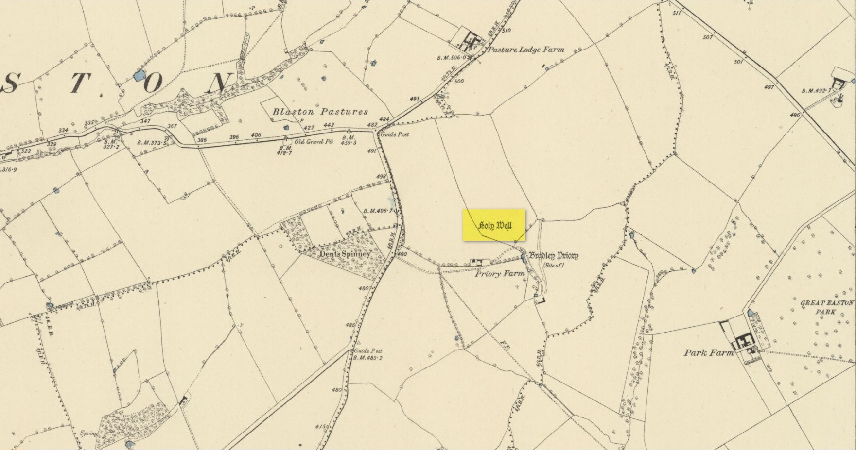
Site shown on 1885 map
There seems to be very little known about this site. It was located in fields just above the site of the Augustinian Priory of St Mary, founded in 1220 CE, where now is Priory Farm, but there seems to be no trace left of it. The great Leicestershire antiquarian John Nichols said the well had been dedicated to Our Lady, the Virgin Mary. This was echoed in John Curtis’ (1831) survey, who told that, “where the Priory formerly stood, a Dwelling House has been erected; and near it is a Well called Our Lady’s Well.” He told that it was deep and “walled below the surface.”
References:
Curtis, John, A Topographical History of the County of Leicester, W. Hextall: Ashby-de-la-Zouch 1831.
Rattue, James, ‘An Inventory of Ancient, Holy and Healing Wells in Leicestershire’, in Transactions Leicestershire Archaeological & Historical Society, volume 67, 1993.
Trubshaw, Bob, Leicestershire and Rutland’s Holy Wells, Heart of Albion: Nottingham 2024.
Acknowledgements:Huge thanks for use of the Ordnance Survey map in this site profile, reproduced with the kind permission of the National Library of Scotland.
From near Skipton town centre, at the Cross Keys Inn along Otley Road, go up Short Bank Road all the way to the very top and then into the trees onto the Dales High Way footpath. Walk up for literally ¼-mile (0.4km) and where the path bends and heads ENE, notice here a footpath that takes you over the wall. Once on the other side, the path splits with one heading SE and the other roughly alongside the walling to the SW, which is where you need to go. About 200 yard on, go through the gate into the field and then another 375 yards on you’re into another field (copse of trees in front of you). Just as you’ve gone into this field, walk immediately left, uphill, by the walling for about 100 yards, over the marshy dip, then head into the field where, about 75 yards in, you’ll see some rocks scattered about…
Archaeology & History
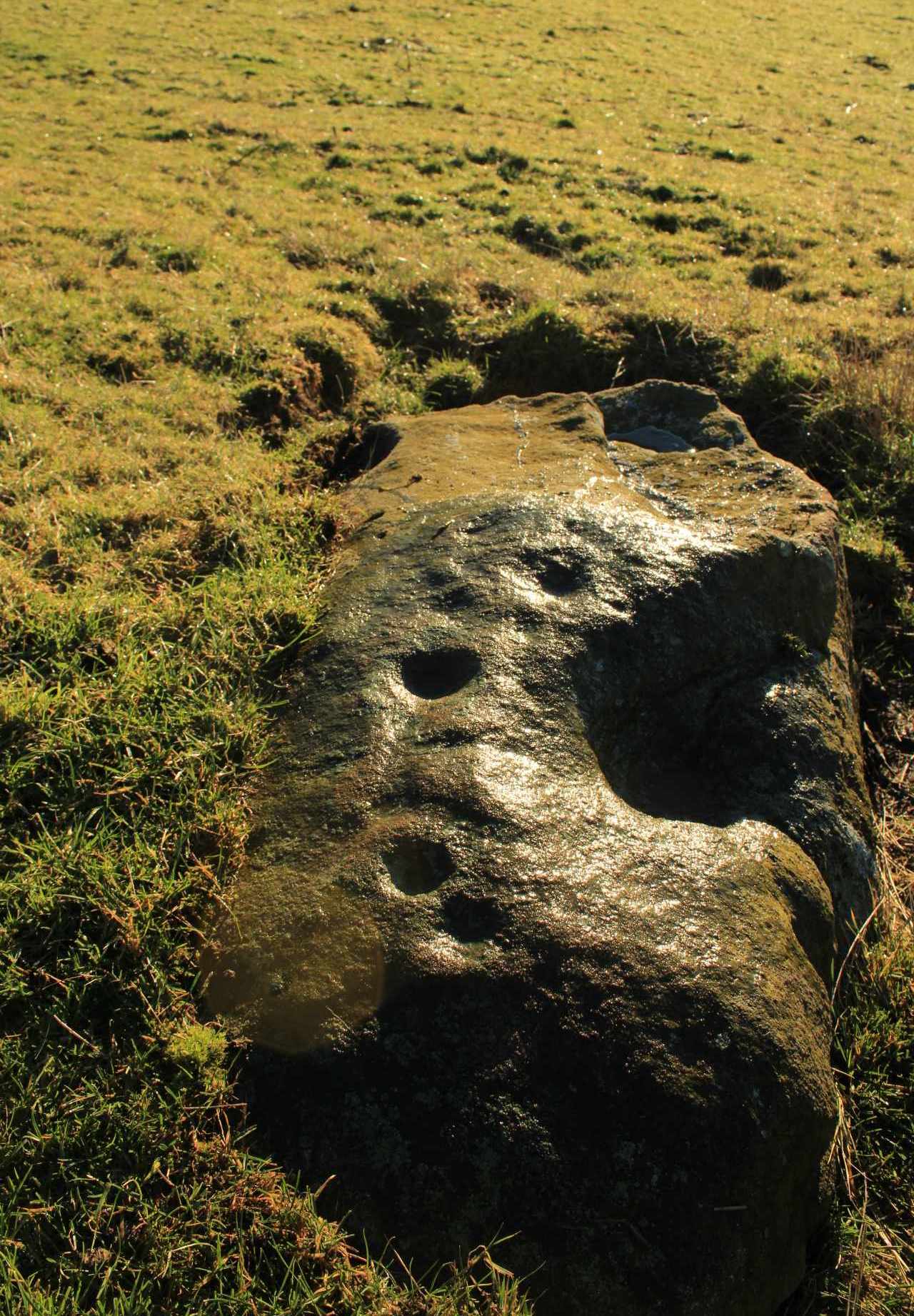
Cleland Stone, looking S
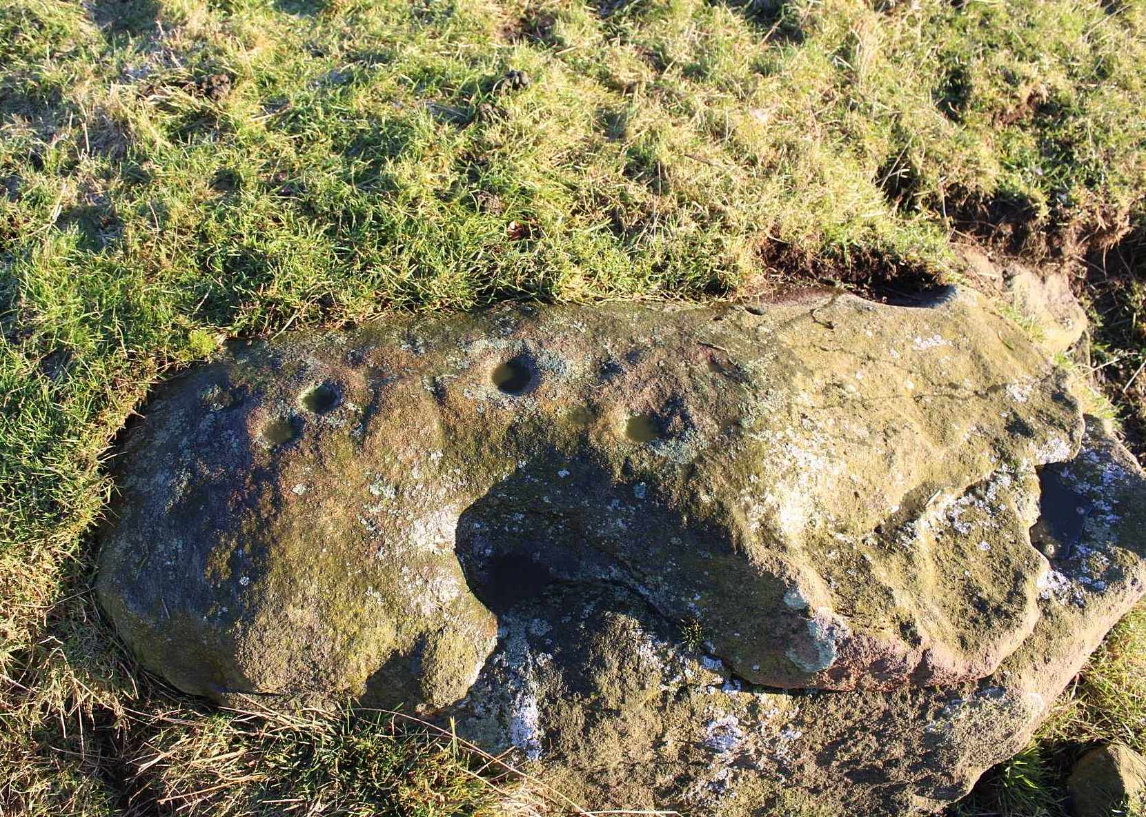
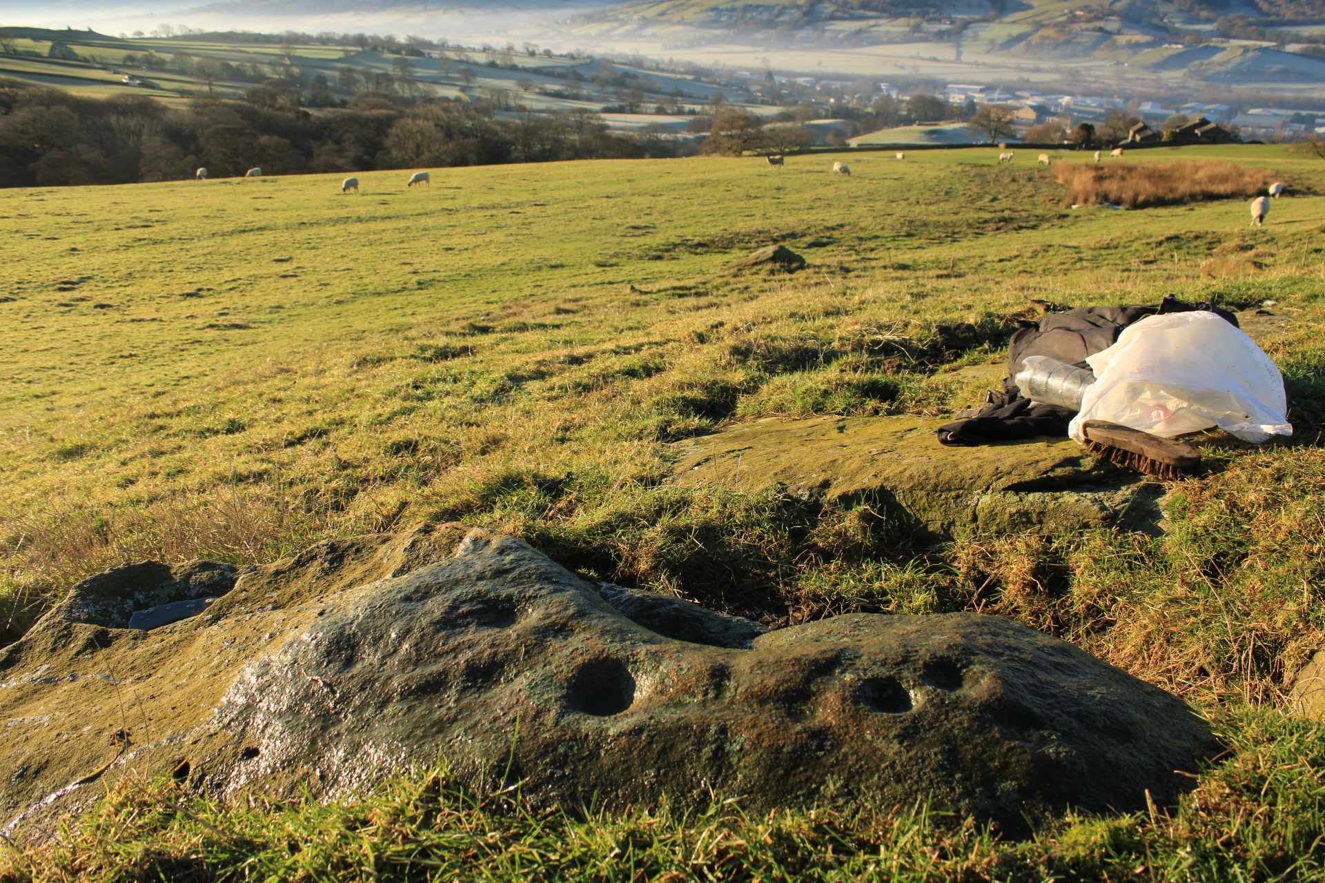
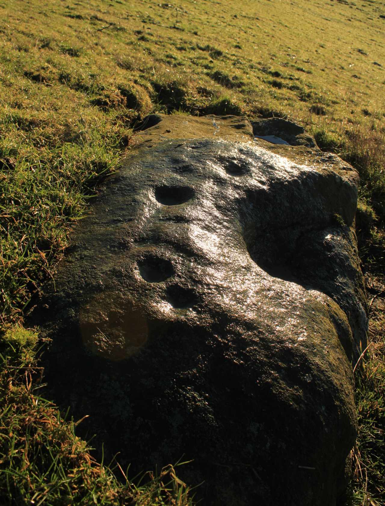
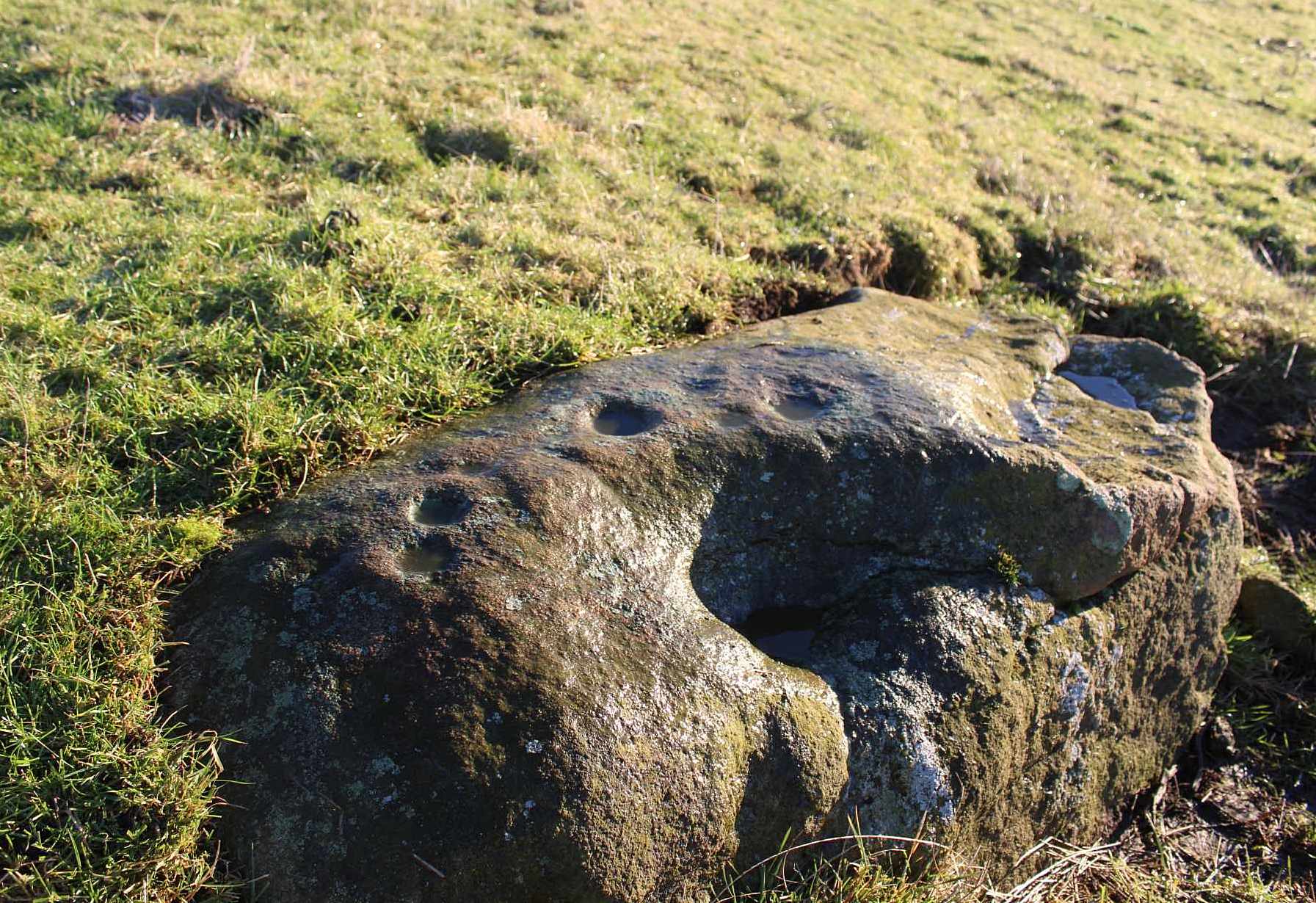
In an area that’s had some considerable quarrying done to it, we’re lucky to find that this carving still exists. It was rediscovered by Thomas Cleland (hence its name!) in the summer of 2024. It consists of four distinct cups, with a possible fifth (and maybe more?) on its smooth elongated surface. The cups, as we can see, are quite deep and unmistakable. An incomplete ring seems to be around at least one of the cups; and there seems to be a carved straight line running between another two of them. A simple but distinct design and in a lovely setting gazing cross the Airedale valley from here.
There are very few other carvings in this neck o’ the woods (the Great Laithe Wood carving aint too far away), but the fact that this has been found would suggest that others are probably hiding away in the undergrowth. Check out the Iron Age Horse Close Hill enclosure while you’re up here too.
Acknowledgements: A huge thanks to Thomas Cleland, not only for finding the carving, but also for allowing use of his photos in this site profile.
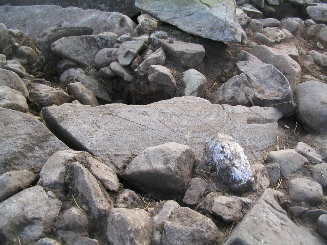
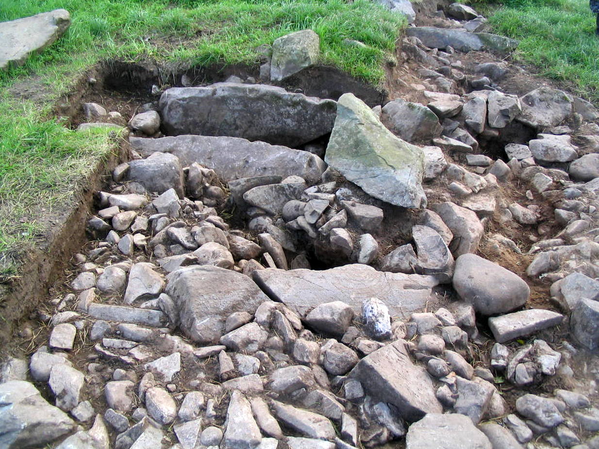
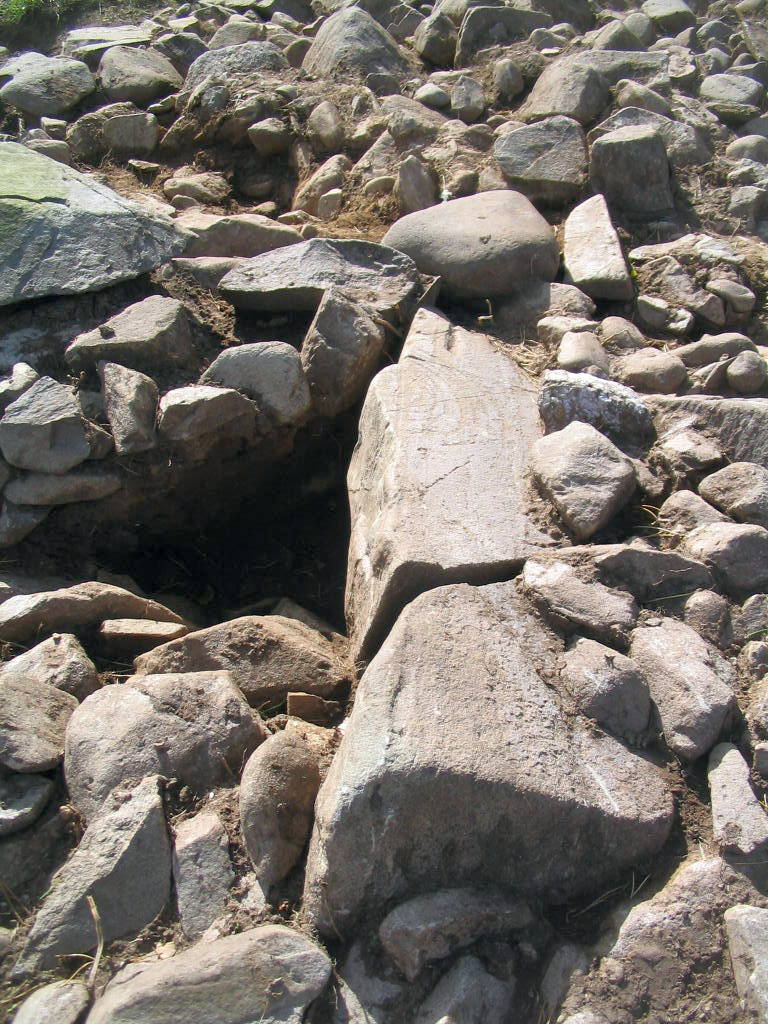
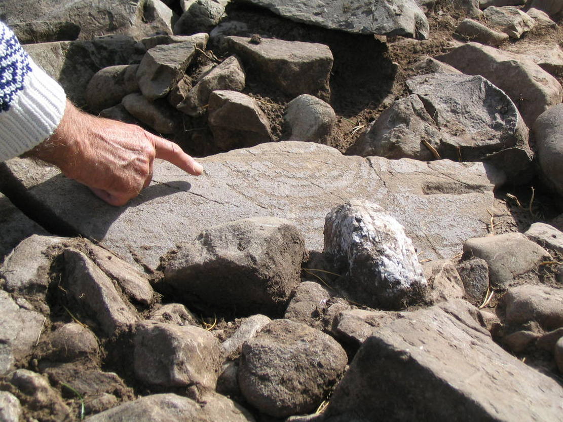
A little-known multiple ringed carving was discovered a few years ago during the excavation of a prehistoric cairn just immediately east of the A701 roadside, several miles south of Broughton. The cairn itself had been recognised many years prior to the recent excavation, when one of two cists inside it was noted by R.B.K. Stevenson (1940), and which was subsequently described in slightly more detail in the Royal Commission Inventory (1967). But when the modern investigation was undertaken by the Biggar Archaeology Group in 2008, a damaged but impressive carving was uncovered that somehow hadn’t been noticed before. It was described in Tam Ward’s (2008) excavation report where he told that,
Carving in situ (photo courtesy Jim Ness)
Carving looking N: courtesy Jim Ness
“lying almost immediately on the east side of Cist 1 is an angular rock…measuring 1m long and over 0.3m wide on the uppermost face, itself lying at an angle facing SW and away from the cist. The rock has fractured due to weathering in post deposition times, as indeed several other surface stones had, but on the widest part of the upper surface are at least seven concentric lines faintly pecked into the smooth flat surface of the stone. The lines are up to 10mm wide and appear to have been intended to form semi ovals on the edge of the rock. The outer ring forms an arc of c270mm on the long axis by c140mm on the short one (the former measurement being straight between the ends of the lines and the latter being a radius across the design). The terminals of the inner curved line are about 80mm apart. The lines are slightly irregular in distance from one another. Although it is far from certain, it does not appear that the rock has been part of a larger one with a more complete design on it, rather the pecking appears not to have been finished since the surface of the rock is similar in appearance overall while the abrasion of the carving varies.”
Fractured design (photo courtesy Jim Ness)
The carving remains in place with the cist, which was covered back over when the excavation had been finished.
Carvings such as this are uncommon in this neck o’ the woods; although less than a mile downstream from here, on the other side of the river, another petroglyph—known as the Drumelzier carving—accompanied another prehistoric tomb. Apart from this, there’s a great scarcity of carvings scattering the Lowlands—although it’s likely that there are others hiding away, waiting to be found on these hills…
References:
Royal Commission on the Ancient & Historical Monuments, Scotland, Peeblesshire – volume 1, Aberdeen University Press 1967.
Stevenson, R.B.K., “Cists near Tweedsmuir,” in Proceedings Society Antiquaries, Scotland, volume 74, 1940.
Holy Well (destroyed): OS Grid Reference – SP 9848 0822
Also Known as:
St. James’ Well
Archaeology & History
Site shown on 1897 map
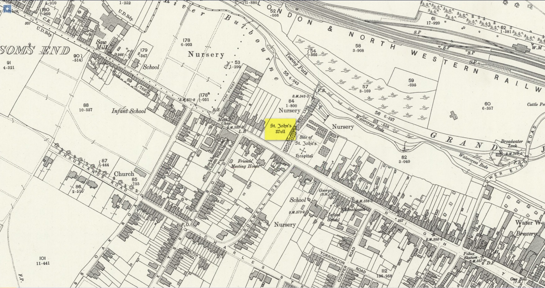
Shown on the early Ordnance Survey maps of the town, Berkhamsted’s holy well was a place of some renown in bygone centuries. Today it is barely remembered. It was initially dedicated to St. James, as it was associated with a chapel dedicated to that saint close by, but it had a change of name when the legendary Brotherhood of St. John the Baptist became the new caretakers, so to speak. As a result of this, its history can be a little confusing to some folk!
In the late 12th century, pagan worship at this site came to the attention of Hugh of Grenoble, the Bishop of Lincoln, who visited the place to stop local folk performing their animistic practices (although the exact nature of such rites were not described, sadly). It didn’t work, obviously; as once the bonkers bishop had gone, local folk would have continued in their old ways, no doubt wondering who the hell the odd incomer had been who was telling them to stop doing what they had always done here at the cost of no one. And so the waters continued to be used under the mythic cover of old St James—for the time being at least.
The well later became a centre of pilgrimage and and a hospital was been built close by dedicated to St James, where leprosy was treated and the curative waters from this well were used. St James’ Day was July 25 and an annual fair was held in Berkhamsted thanks to a Royal Charter of James I in 1619. Hertfordshire traditions relating to St James Day are described in Miss Jones-Baker’s (1974) fine survey on the customs of the county. But change was a-coming when a local monk had a dream that the waters of this “pagan spring” needed to be blessed and dedicated to the virtues of St. John the Evangelist and a shrine built where pilgrims could worship and be healed. And as Jones-Baker (1977) told us,
“The water of St John’s Well were thought to cure a variety of diseases; among these leprosy and scrofula (the King’s Evil) as well as sore eyes. There was also a persistent belief that clothing washed in its waters would impart good health to the wearers.”
In the period when the Protestant Reformation occurred, the well and its immediate surrounds apparently became derelict and overgrown. The Old Ways returned and local folk began to visit the waters again at night and the animistic rituals that would have been taken to other secret places returned to St. John’s Well. In this period a local physician, a Dr. Woodhouse, used the sacred waters as part of magickal rites to exorcise evil spirits!
In spite of the local authorities declaring in 1865 that the water was “unfit for drinking”, local folk later told otherwise. Its waters were still being used in the 20th century and its traditions no doubt retained. As the local writer Dora Fry (1954) told us:
“The families dwelling in the cottages at the Bulbourne end of the lane, just below St John’s Spring, were all remarkably healthy… Some time after the town got its first waterworks (and) the local authorities declared that the well’s water was to be used only for the gardens… but I remember as a child drinking the water from the main spring and its coolness and freshness were delectable on a hot summer afternoon.”
The well was still visible up until the 1930s, when its waters ran down a shallow channel along St John Well’s Lane, but then a shop was built above the site and the well has been lost forever.
References:
Bord, Janet & Colin, Sacred Waters, Granada: London 1985.
Acknowledgements:Huge thanks for use of the Ordnance Survey map in this site profile, reproduced with the kind permission of the National Library of Scotland.
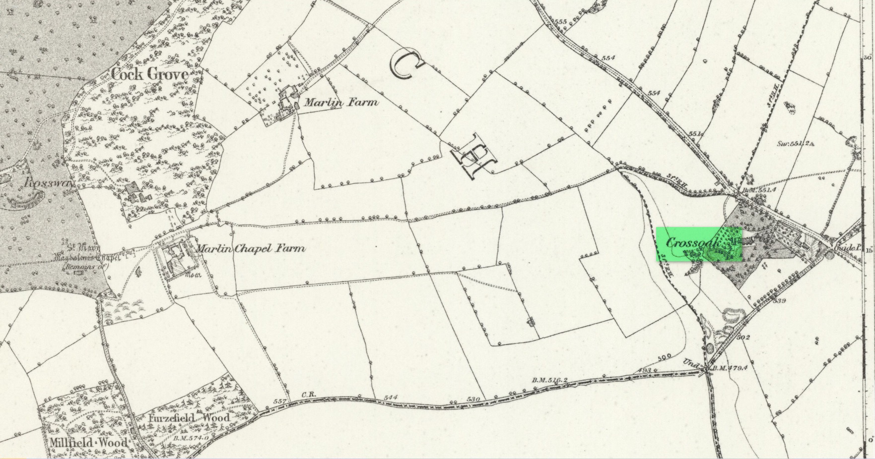
About mile south of Northchurch, on the far side of the A41 dual carriageway, somewhere past the old crossroads (or perhaps even at the crossing) an ancient tree lived—and truly lived in the minds of local people, for perhaps a thousand years or so. Mentioned in the Lay Subsidy Rolls in 1307, the Cross Oak gave its name to the old building that once stood in the trees and the hill itself, at the place now known as Oak Corner. Whether or not a “cross” of any form was set up by this old oak, records are silent on the matter. Its heathen ways however, were pretty renowned! (a plaque should be mounted here)
Folklore
The first reference I’ve found of this place is in William Black’s (1883) folklore survey where he told that “certain oak trees at Berkhampstead, in Hertfordshire, were long famous for the cure of ague”—ague being an intense fever or even malaria. But a few years later when the local historian Henry Nash (1890) wrote about this place, he told that there was only one tree that was renowned for such curative traditions, that being the Cross Oak. He gave us the longest account of the place, coming from the old tongues who knew of it when they were young—and it had it’s very own ritual which, if abided by, would cure a person of their malady. “The legend ran thus”, wrote Mr Nash:
“Any one suffering from this disease was to proceed, with the assistance of a friend, to the old oak tree, known as Cross Oak, then to bore a small hole in the said tree, gather up a lock of the patient’s hair and make it fast in the hole with a peg, the patient then to tear himself from the tree, leaving the lock behind, and the disease was to disappear.
“This process was found to be rather a trying one for a weak patient, and by some authority unknown the practice was considerably modified. It was found to be equally efficacious to remove a lock of hair by gentle means, and convey it to the tree and peg it in securely, and with the necessary amount of faith the result was generally satisfactory. This is no mere fiction, as the old tree with its innumerable peg-holes was able to testify. This celebrated tree, like many other celebrities, has vanished, and another occupies its place, but whether it possesses the same healing virtues as its predecessor is doubtful. It is however a curious coincidence, that the bane and the antidote have passed away together.”
The lore of this magickal tree even found its way into one of J.G. Frazer’s (1933) volumes of The Golden Bough, where he told how the “transference of the malady to the tree was simple but painful.”
Traditions such as this are found in many aboriginal cultures from different parts of the world, where the spirit of the tree (or stone, or well…) will take on the illness of the person for an offering from the afflicted person: basic sympathetic magick, as it’s known. Our Earth is alive!
References:
Black, William G., Folk Medicine, Folk-lore Society: London 1883.
Frazer, James G., The Scapegoat, MacMillan: London 1933.
Jones-Baker, Doris, The Folklore of Hertfordshire, B.T. Batsford: London 1977.
Nash, Henry, Reminiscences of Berkhamsted, W. Cooper & Nephews: Berkhamsted 1890.
Acknowledgements:Huge thanks for use of the Ordnance Survey map in this site profile, reproduced with the kind permission of the National Library of Scotland.
Tumulus (destroyed): OS Grid Reference – SX 0309 5227
Archaeology & History
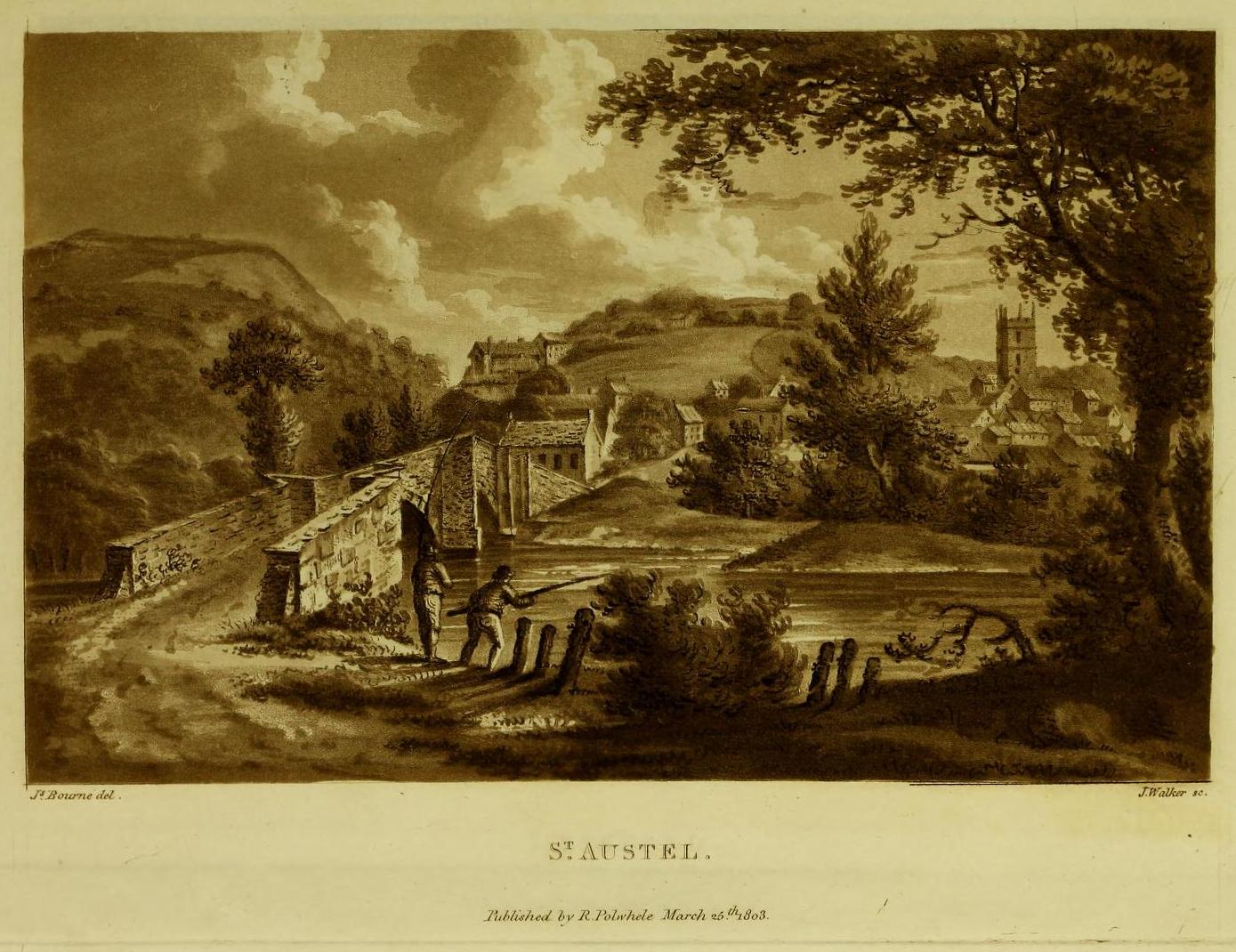
More than two hundred years ago, an impressive prehistoric burial mound lived in an area that used to be known as Gwallon Down, not far from the impressive Long Stone monolith, about half-a-mile west of Charlestown on the southern edges of St. Austell, but it was completely destroyed in 1801. Thankfully there was a lengthy account made of the site in John Whitaker’s (1804) huge work, but there seems to be little else known of it. He told us:
“In the middle of that extended waste, the downs of St. Austle, was, what was called One Barrow. This waste, in 1801, was resolved to be enclosed, and the barrow was obliged to be levelled. In this operation, the single workman came near the centre, and there found a variety of stones, all slates, ranged erect in an enclosure nearly square. The stones were about one foot-and-a-half in height, apparently fixed in the ground before the formation of the barrow. The stones were all undressed, but had little stones carefully placed in the crevices at the joints of the large, in order to preclude all communication between the rubbish without and the contents within. On the even heads of these stones was laid a square freestone, which had evidently been hewn into this form, which seemed to rest with its extremities on the edges of the others, and was about eighteen or twenty inches in diameter. The summit of the barrow rose about eight or ten feet above all. In the enclosure, the leveller found a dust, remarkably fine, and seemingly inclining to clay. On the surface it was brown, about the middle downwards it took a dark chestnut colour, and at the bottom it approached towards a black. On stirring it up, a multitude of bones appeared, different in the sizes, but none exceeding six or seven inches in length. Among them were some pieces about the largeness of a half-crown, which, from their concave form, convinced him they were parts of a skull. The whole mass of bones and ashes might (he thought) be about one gallon in quantity. On touching the bones, they instantly crumbled into dust, and took the same colour with the same fineness as the dust in which they were found. They were exceedingly white when they were first discovered, but remarkably brittle; the effect assuredly of their calcination in a fire, antecedent to their burial. Much in fineness and in colour with these ashes, appeared several veins of irregular earth on the outside of the enclosure; which, from their position without, yet adjoining, and from the space occupied by them there, he conjectured to have been bodies laid promiscuously upon the funeral pile, but which I conjecture to have been only the ashes adhering to the ground, and not possible to be separated from it, for a burial with the rest within the enclosure. They had nothing of sand in them, but seemed inclining to clay, and even more so (from the adhering soil probably) than the dust of the enclosure. And, as the workman was fully convinced of what every one else must acknowledge, that the ashes and the bones of the enclosure had once belonged to a human body, he very properly took up the whole with care, placed the stones nearly in their original posture within an hedge contiguous, then in building, placed also the bones with the ashes within their original enclosure there, and even placed the covering-stone over both.”
One wonders where precisely the hedgerow happened to be where the stones were placed “nearly in their original posture”, and if this reconstruction was ever recovered.
The site was subsequently mentioned in Polwhele’s (1816) massive survey, reiterating Whitaker’s description, simply telling how:
“With respect to the monumental remains in the neighbourhood of St Austel, a very ingenious correspondent says in one of the mounds of earth on our downs which was lately levelled a kind of urn was discovered which evidently contained human ashes many of the bones were entire but appear to have been calcined I am well acquainted with the man who dug this up.”
References:
Borlase, William Copeland, Nænia Cornubiæ, Longmans Green Reader: Truro 1872.
Hammond, Joseph, A Cornish Parish: Being an Account of St. Austell, Skeffington & Sons: London 1897.
Polwhele, Richard, The History of Cornwall – volume 2, Law & Whittaker: Truro 1816.
Whitaker, John, The Ancient Cathedral of Cornwall – volume 2, John Stockdale: London 1804.
Nice ‘n easy: get into the village and walk through the church gates and there, on your left on the grass verge, a plinth and the cross-head sits before thee!
Archaeology & History
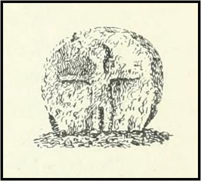
When the great Arthur Langdon (1896) wrote about Crowan’s cross-head, he was puzzled. At the time it was in the garden of a local surveyor in the nearby village of Praze-an-Beeble, but its origins seemed mysterious. The surveyor in question, a Mr William Carah, wrote to Langdon and said,
“It seems a mystery where the cross we have originally came from. A friend of mine, living abroad at present, saw it, I think, at a farm-place, being used as a bottom for a beehive. He asked the people for it, intending to fix it somewhere. At any rate, when he left England he had not done so, and at my request they gave the cross to me.”
The condition of the cross-head wasn’t too good and Langdon suggested it had “received some very rough treatment” – no doubt when it was hacked from its shaft. With his usual precision he gave the dimensions of the cross-head as follows:
“Height, 1 ft. 6 in.; width, 1 ft. 8 in.; thickness: at the bottom 6½ in., at the top 5½ in.
Front. — Part of a small conventional figure of Christ, extending to the knees, at which point the fracture occurred which separated the head from the shaft.
Back. — The remains of a mutilated Latin cross in relief.”
The stone shaft or menhir that once supported this carved head has, it would seem, long since been destroyed.
References:
Blight, J.T., Ancient Crosses and other Antiquities in the West of Cornwall, Simpkin Marshall: London 1858.
Courtney, R.A., The Evolution of the Wheel Cross, Beare & Sons: Penzance 1914.
Doble, Gilbert H., A History of the Parish of Crowan, King Stone Press: Shipston-on-Stour 1939.
Langdon, Andrew, Stone Crosses in West Cornwall, Federation of Old Cornwall Societies 1999.
Langdon, Arthur G., Old Cornish Crosses, Joseph Pollard: Truro 1896.
Holy Well (destroyed): OS Grid Reference – SP 4506 4055
Archaeology & History
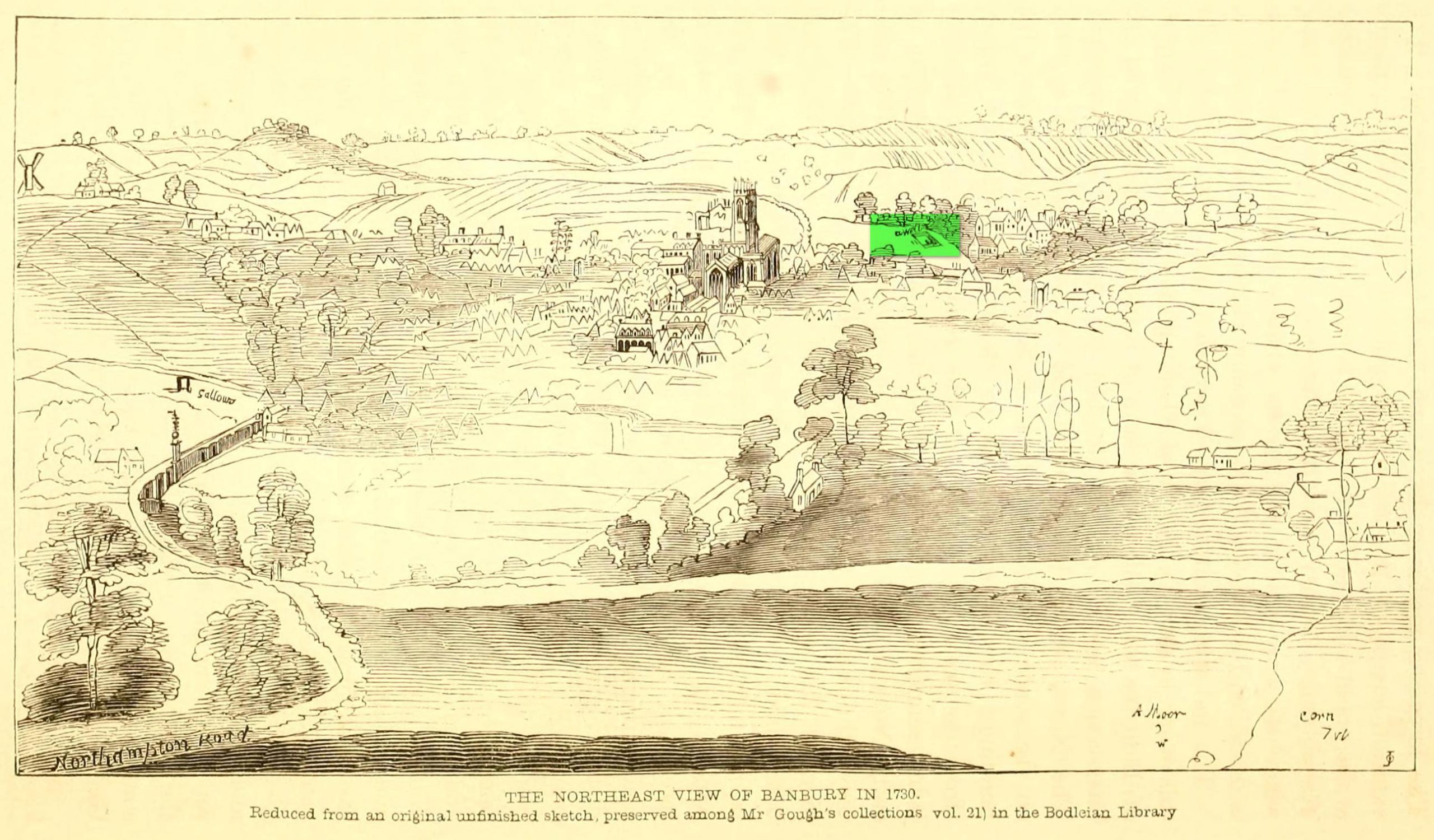
Well highlighted, in 1730
The holy well of Banbury seems to have been destroyed sometime in the second-half of the 19th century, when the industrialists built over the area. When the historian Alfred Beesley (1841) wrote about it, the waters were still running. He told it to be, “a chalybeate spring, well-known and still often visited, situated on the west side of the town, a little north of the footway leading to North Newington.”
The footpath is obviously long gone—as is the well. It’s iron-bearing (chalybeate) properties would have given the waters good fortifying properties, perhaps of some renown to local people yet, according to Mr Beesley, it was a slow-flowing spring. In his brief history of the site, he also gave us the results of a chemical examination of its healing waters, telling us:
“This is called St. Stephen’s Well in a plan of Sir John Cope’s property at Banbury made in 1764. It also appears prominently as “A Well ” in an unfinished view of Banbury made in 1730 (illustrated above)….
The water of this spring is perfectly clear and colourless, having a brisk and slightly chalybeate taste. The stone channel is coated with a light red deposit, and a scum of the same colour appears on the water in parts where stagnant. The spring discharges from half a gallon to one gallon in a minute. In 32 oz. of the water at 60° are,
Carbonic Acid gas, 5 cubic inches
Hydrochlorate Magnesia, 0.21 grains.
Chloride Sodium or common Salt, 0.54
Sulphate Lime, 1.5
Carbonate Lime, 3.8
Protoxide Iron, 0.024
Silica a trace
Total weight of solid contents – 6.074″
Folklore
St. Stephen is an odd character. His annual celebration or feast day in Britain is December 26. (in eastern countries it’s a day later) Rites connected to this character are decidedly heathen in nature. From the 10th century, in England, St Stephen’s Day has been inexorably intertwined with horses, bleeding them on his feast days, apparently for their own health. Water blessed by priests on this day would be kept for the year and used as a medicine for horses during that time. Also on this day, young lads would “hunt the wren” and, once caught, impale it on top of a long pole and take it from house to house. Despite this curious motif being a puzzle to folklore students, Mircea Eliade (1964) explained how this symbolism is extremely archaic and “the bird perched on a stick is a frequent symbol in shamanic circles.”
Eliade, Mircea, Shamanism – Archaic Techniques of Ecstasy, Princeton University Press 1964.
Harte, Jeremy, English Holy Wells – volume 2, Heart of Albion press: Wymeswold 2008.
Johnson, William P., The History of Banbury, G. Walford: Banbury 1860.
Acknowledgements:Huge thanks for use of the Ordnance Survey map in this site profile, reproduced with the kind permission of the National Library of Scotland.