Cup-and-Ring Stone (destroyed): OS Grid Reference – SE 133 389
Archaeology & History
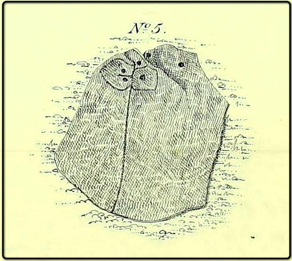
The lost carving of Brackenhall, in 1888
I first came across a description of this lovely-looking cup-and-ring carving during some research I was doing in the archives at Bradford Central Library in the 1980s—and decided there and then that I had to find it! It was described and illustrated for the first time by William Glossop (1888) when he made a short survey of some of the prehistoric sites on Baildon Hill and Shipley Glen. He told that it was one amidst “a cluster of rocks on Bracken Hall Green”—but was seemingly destroyed not too long after he wrote about it. There was some discussion in the late-1980s that it may have been a petroglyph that was cataloged by John Hedges as carving ‘BM14’ (at SE 13272 38924), due to it possessing a similar ‘artistic’ element (or motif, as some like to call it) and which is also along the Brackenhall plateau by the roadside about 160 yards below the entrance to the Brackenhall centre—but it turned out not to be the case.
A few years after Mr Glossop uncovered this carving, a short note by J.H. Turner (1894) described two cup-marked stones, “both now destroyed” that could be seen in the same area just as you entered “the plateau where the Easter fair is now held”. And his description closely fitted Glossop’s sketch. Turner wrote:
“The cups were three inches in diameter, and one inch deep, in an oblong 18 by 12 inches, with line 6 feet long towards the east. The second oblong, same size, had also an eastern pointer and one cup in the centre. These have both disappeared since June, 1889; I fear by wanton mischief.”
This would seem to be the same carving illustrated by Glossop, although it’s still difficult to say with any accuracy where it was located. The great historian W.Paley Baildon (1913) thought it may have been the same carving which Harry Speight (aka Johnnie Gray) described at the Glen Gate—and it does sound similar, but until we are able to ascertain (i) where Glen Gate was; and (ii) whether it coincided with the location of “where the Easter fair” was held, we must err on the side of caution. Tis an intriguing mystery… (Note: the grid-reference given for this site profile is an educated guesstimate!)
References:
Baildon, W. Paley, Baildon and the Baildons – volume 1, Adelphi: London 1913.
Glossop, William, ‘Ancient British Remains on Baildon Moor,’ in Bradford Antiquary, no.1, 1888.
Gray, Johnnie, Through Airedale from Goole to Malham, Walker & Laycock: Leeds 1891.
Turner, J. Horsfall, ‘Cup Marks, Shipley Glen,’ in Yorkshire County Magazine – volume 4, J.E. Watmough: Idel 1894.
Cup-and-Ring Stone (lost): OS Grid Reference – SE 1347 3882
Also Known as:
Carving no.143 (Boughey & Vickerman)
Archaeology & History
In Johnnie Gray’s (aka Harry Speight) early work on Airedale (1891), he described a number of the prehistoric sites on and around Baildon Moor and Shipley Glen. Almost all of the things he wrote about have been identified, but a cup-and-ring stone at “Glen gate” (as he called it) remains elusive. He wrote:
“After crossing the stream from the Glen gate, and going about thirty paces, we come upon…an incised stone, whereon are a number of circling lines and cup-like cavities — one at each corner, with a long line branching off to the north-east; but this stone unfortunately has got broken, and lying on the main path is much defaced.”
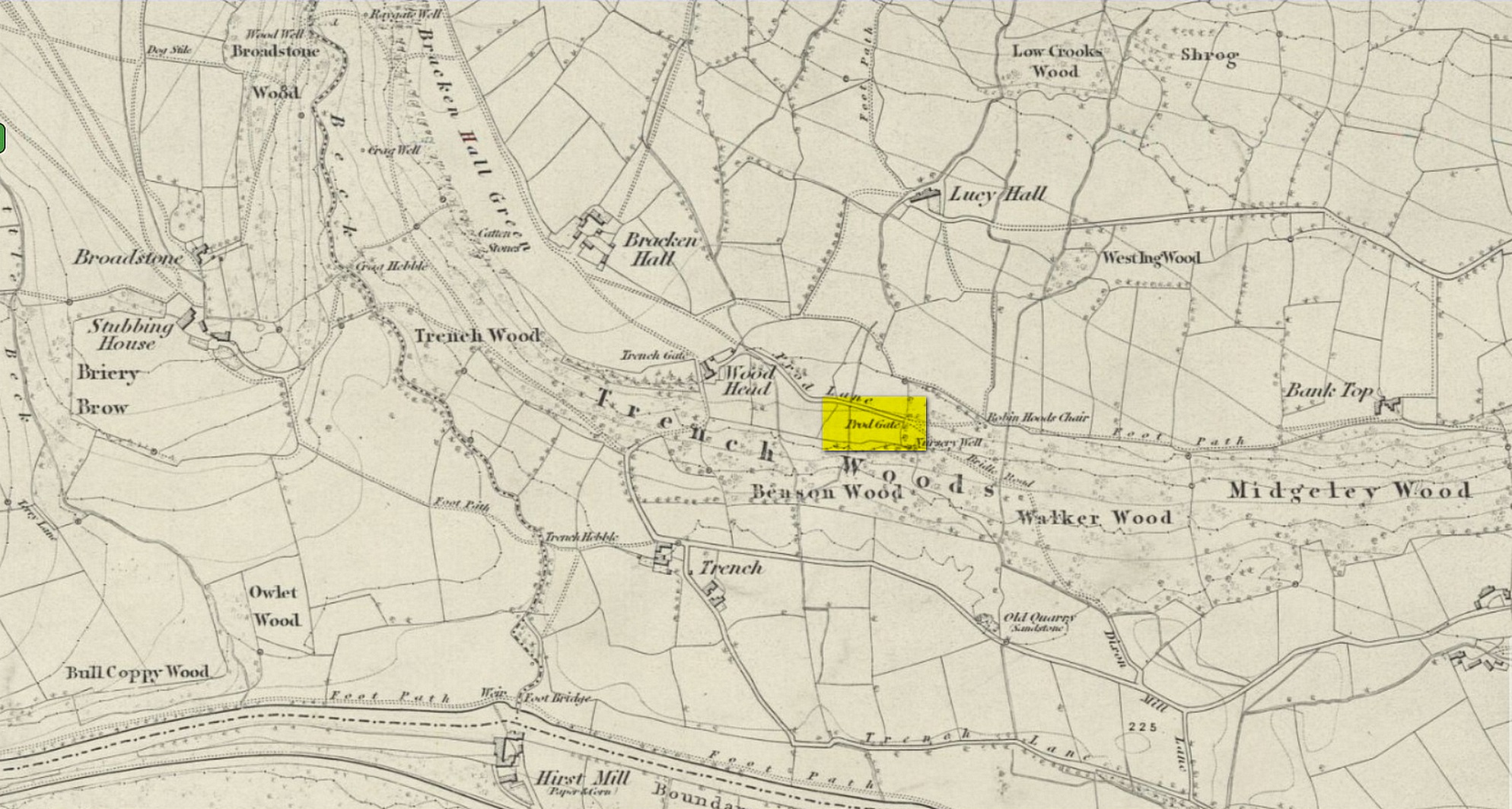
Prod Gate on 1852 map
The exact location of this has proven difficult as the name ‘Glen gate’ was obviously a local one as it wasn’t included on the Ordnance Surveys of the period. There are two named “gates” hereby: one is Prod Gate at the east end of Prod Lane, and the other is Trench Gate a few hundred yards west at the other end of Prod Lane. But the most likely gate of the two would be Prod Gate. When Speight wrote his words, a stream existed that crossed the track about 70 yards west of Prod Gate, whereas no such water-course existed anywhere close to Trench Gate. And so we assume that he was writing about “the stream from the Glen (Prod) Gate.”
Having said all that, there are no known petroglyphs like the one that Speight described anywhere hereby. There are a couple of so-called “carvings” that have been included in so-called official surveys (Boughey & Vickerman 141 and 142; aka ERA- 2445 and ERA-2446) another 150 yards or so on the left-side of the road that could have been regarded as contenders, but these stones have just a mix of modern and natural markings and can be discounted. In all likelihood, this impressive-sounding petroglyph was broken up and destroyed when the proper road was laid in the middle of the 20th century; or perhaps broken up and stuck into one of the garden walls along the roadside. Either way, the carving seems long lost.
References:
Boughey, K.J.S. & Vickerman, E.A., Prehistoric Rock Art of the West Riding, WYAS: Leeds 2003.
Gray, Johnnie, Through Airedale from Goole to Malham, Walker & Laycock: Leeds 1891.
Acknowledgements:Huge thanks for use of the Ordnance Survey map in this site profile, reproduced with the kind permission of the National Library of Scotland.
Along the B6265 old road between Keighley and Bingley, at Riddlesden go up Granby Lane, bending left into Banks Lane. About a mile up you’ll reach the moorland road. Turn left at the junction and nearly half-a-mile along there’s a layby on y’ right. From here walk along the footpath on the edge of the ridge, half-mile along bending slightly above Rough Holden Farm until, a coupla hundred yards on, you hit the dirt-track. There’s a long straight stretch of walling on your left: follow this for a few hundred yards, go through the gate and here walk on the other (left) side of the wall (if you’ve reach a derelict farm, you’ve gone too far). Some 60 yards or so down here, keep your eyes peeled on the long earthfast stone right near the walling. An alternative is to start at the steep hairpin bend up Holden Lane and follow the footpath into the woods. Walk along here (parallel with the stream below) for about 600 yards until you hit the bridge crossing the stream. Don’t cross over: instead double-back up the field on your right, go diagonally across and through the gate into the next field, and walk up along the walling to your right. 160 yards up, go through the gate and walk about 30 yards along the side of the walling again. Tis there!
Archaeology & History
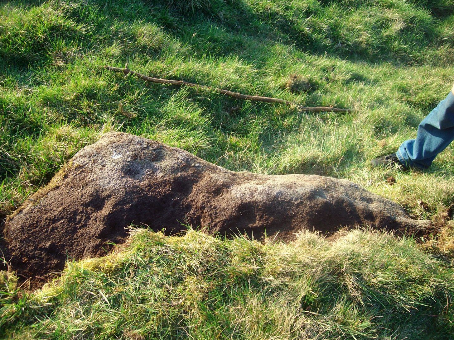
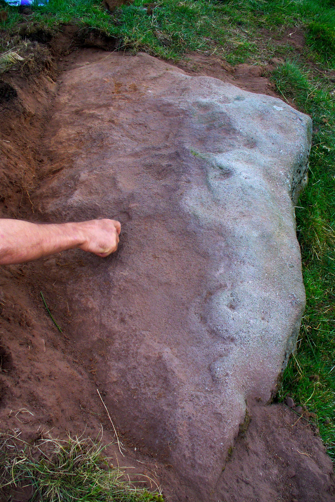
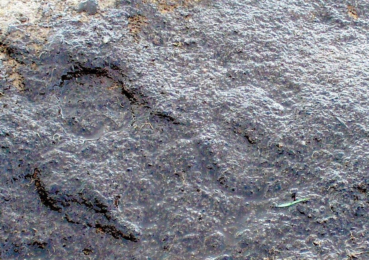
Unveiling the Sunset Stone
This is a fascinating carved stone on the western edge of Rombald’s Moor that I was fortunate to find in 2008. It’s found in association with two other cup-marked stones, north and south of it. I first noticed it when I was walking along the footpath by the side of the wall and saw that on a small exposed part of the rock a single cup-marking carved close to the vertical edge of the stone—and I’m glad that I stopped to give it more attention. The stone was very deeply embedded and the covering soil so tightly packed that I could only shift a small part of it—but the section that I managed to uncover and, importantly, the time of day when I did this, brought about an intriguing visage with subtle mythic overtones.
Carved arc on edgeEarly photo in low light
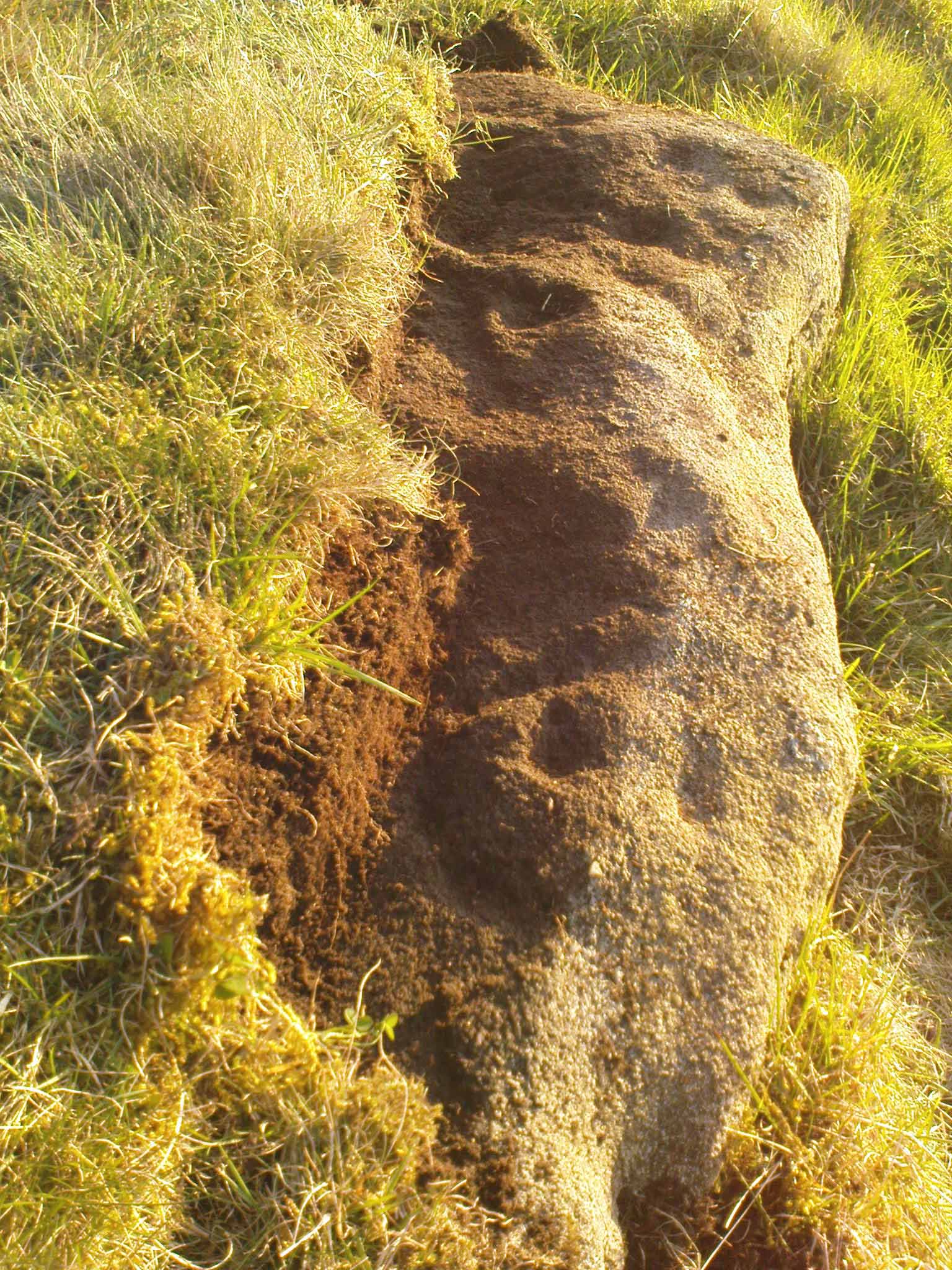
The carving was found near the end of the day just as the sun was setting and touching the far horizon. I noticed there was a cup-and-half-ring to the side of where I’d sat for a rest, near the northern edge of the stone, and the clear but soft light of the evening caught this element and almost brought it to life! As I gazed down at the half-ring, the sun highlighted it even more and I saw that some extended carved lines continued and dropped over the near vertical edge of the stone, becoming an unbroken elongated ‘ring’ that stretched twice the length of the half-ring on the flat surface. Not only that, but a faint cup-mark seemed to be inside this extended vertical ring and, as I saw this, a dreaming epiphany hit me that the symbolism behind this was a representation of the setting sun that I was watching at that very moment. It was quite beautiful and the carving seemed to come to life. The thought, nay feeling, that this part of the carving symbolized a setting sun not only slotted easily into a common animistic ingredient, but hit me as common sense too! However, as my ego and rational sense rose back to the fore (I had to get mi shit together and walk a few miles home before night fell), I saw that this impression may be a completely spurious one; but, as the rock-face inclines west, towards the setting sun, the name of Sunset Stone stuck. As I carefully fondled beneath the heavy overgrowth of vegetation covering the stone, I realised that I needed to come here again and uncover more of it, as additional cups and lines seemed to be reaching out from the mass of soil.
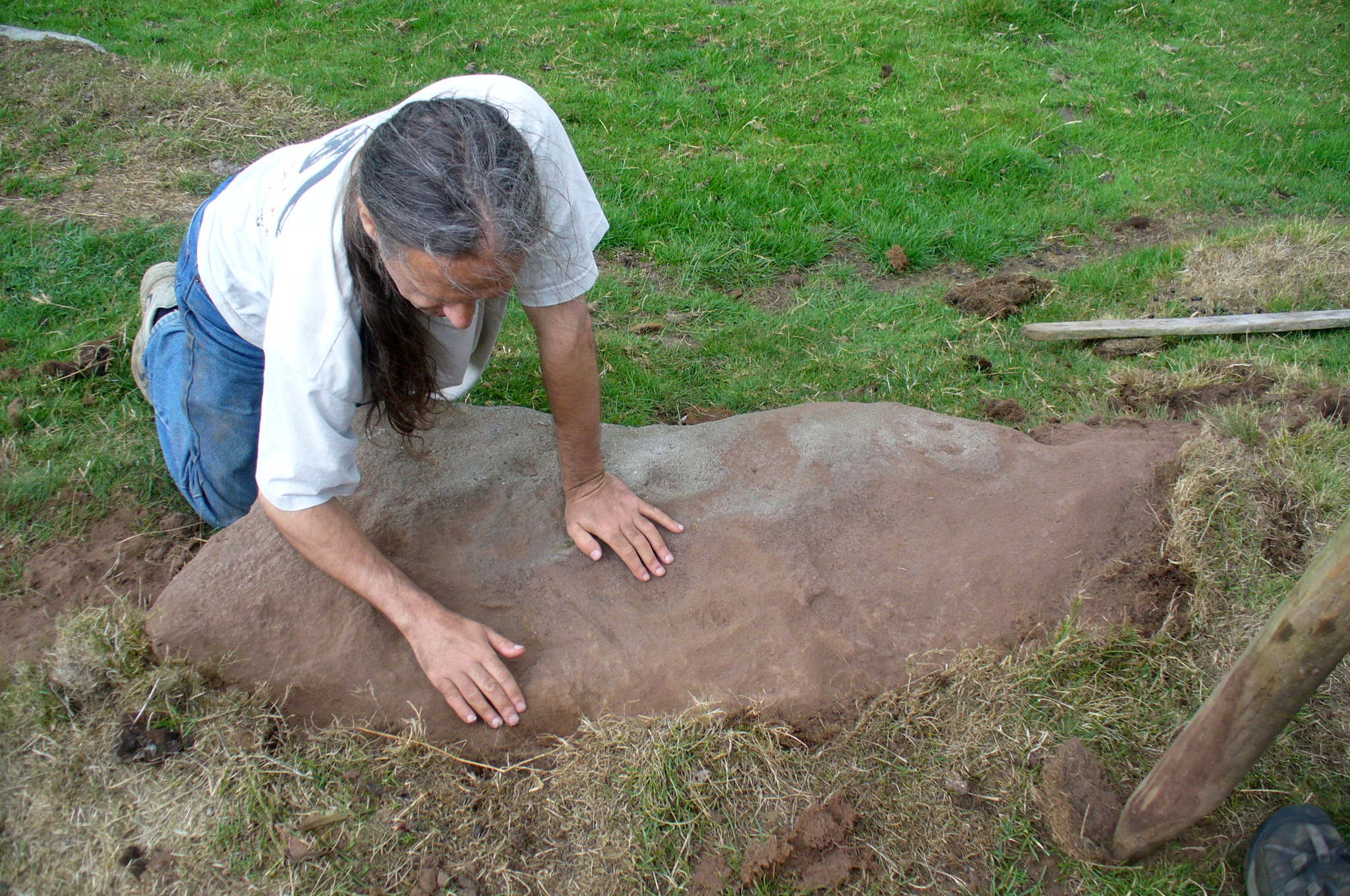
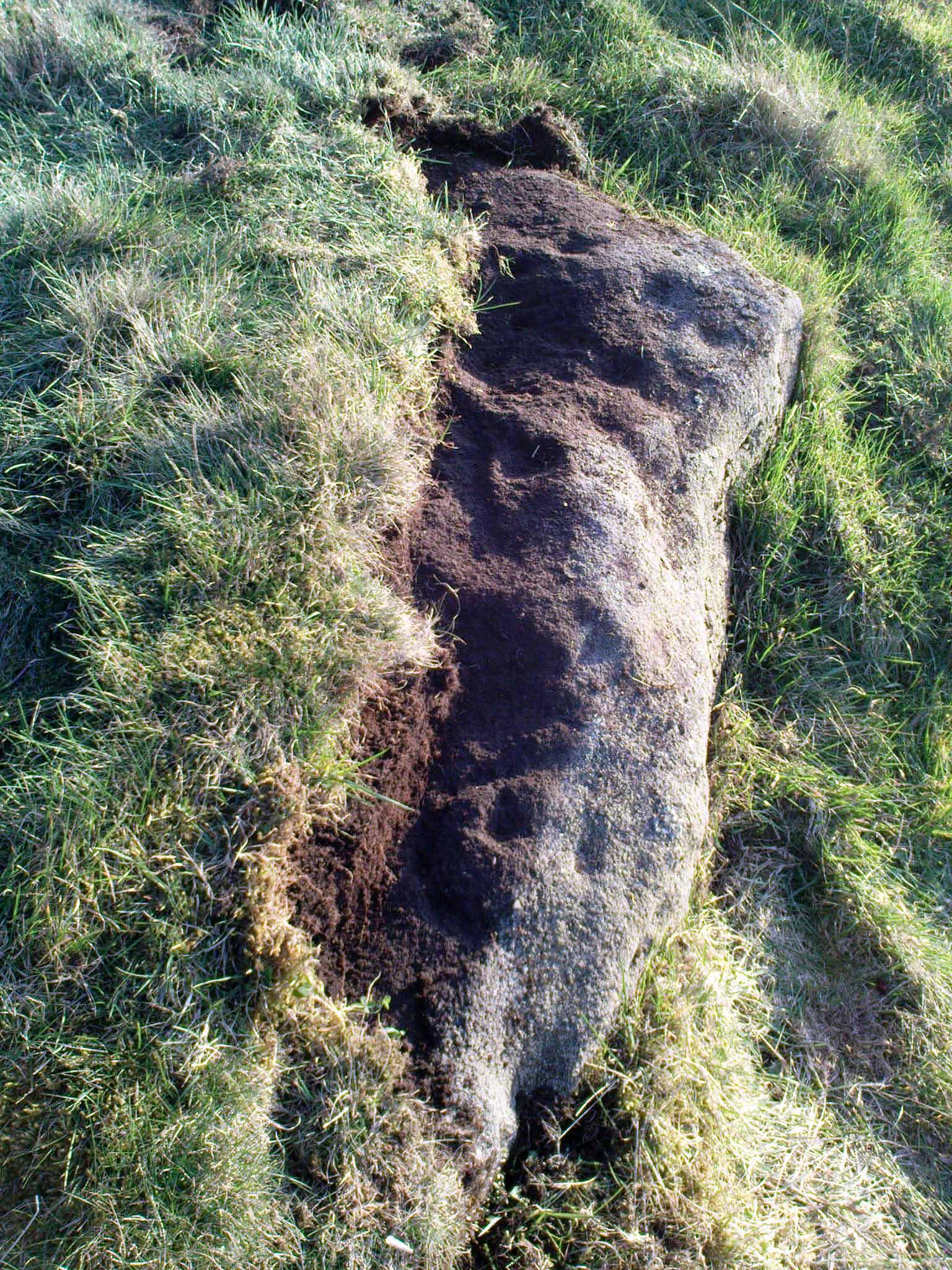
Cups near the S edgeClose-up of ring-edge
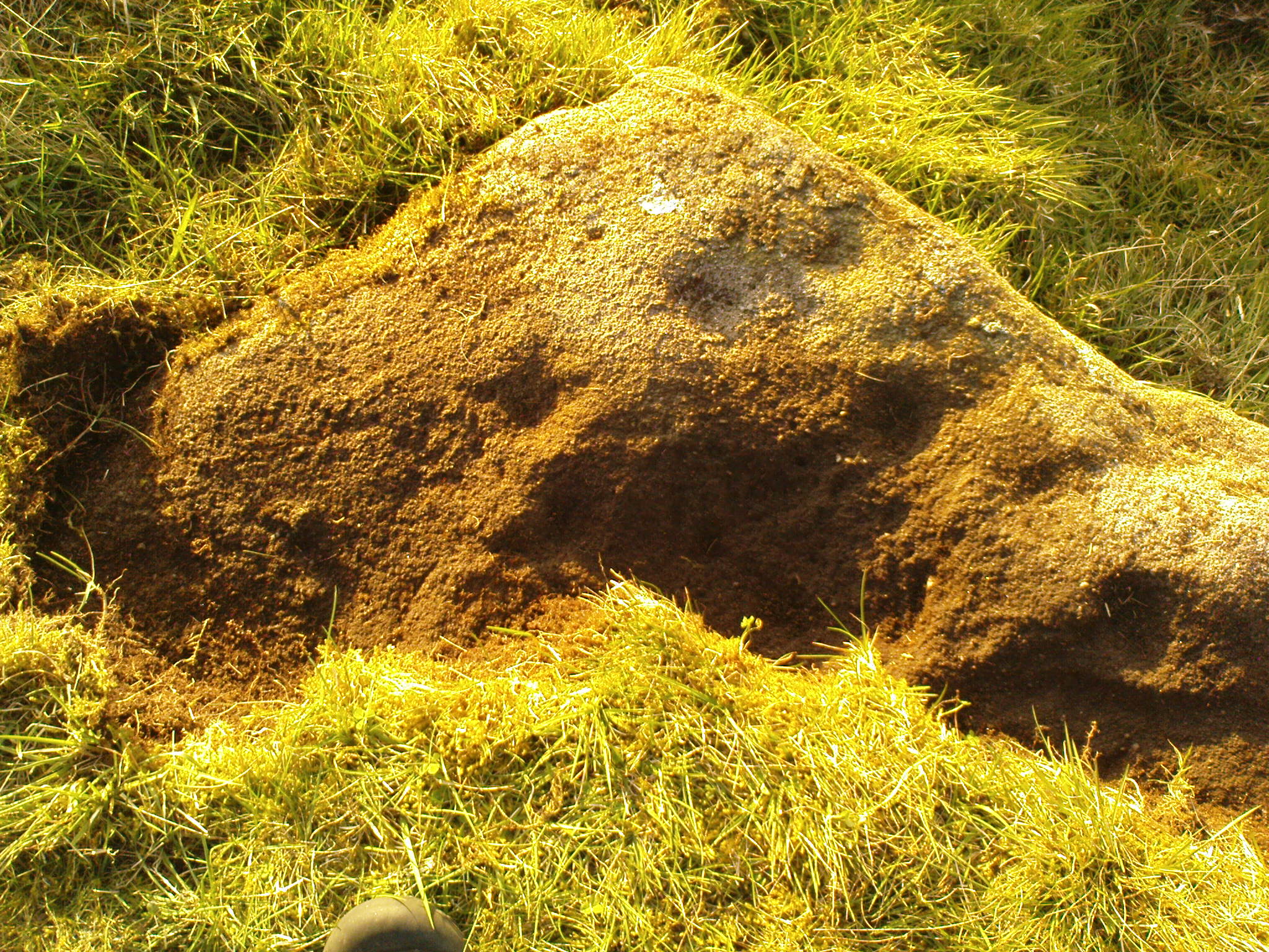
I returned to the stone a few times, but several years passed by before I revisited the site with the intention of uncovering more of the design in the company of Richard Hirst and Paul Hornby on August 4, 2013—and it took considerable effort to roll back the turf that covered the stone. But it was worth it! For it soon became obvious that much of the stone that was covered over had been unexposed for many centuries: as Richard pointed out, the edge of the rock was very smoothed by weathering, whilst the covered section of the stone that we were revealing was still quite rough and misshapen all across the surface, lacking weather and water erosion. Much of this design therefore, highlighted itself to us as it was when the mason first carved the stone. And it turned out to be a pretty curious design!
Faded photo of the carvingFaint proto-ring nr centre
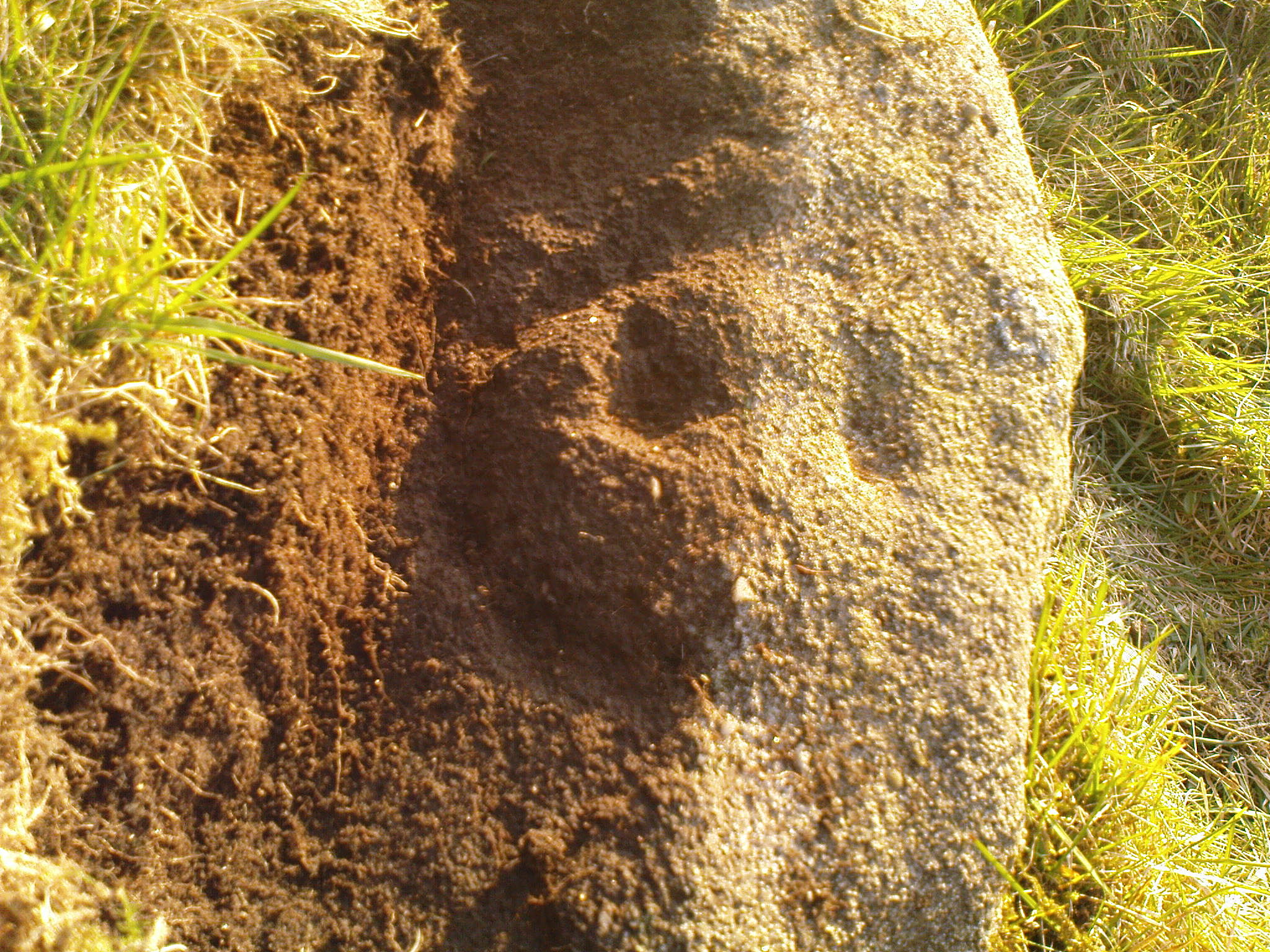
Our first impression was that the design comprised of two cup-and-rings near the middle of the rock, with another cup-and-drooping-ring near the northern edge of the stone, and between ten and twelve typical cup-markings, many on the western exposed side. But curiously near the middle were also a couple of rings whose edges had been defined, but the hollowed-out ‘cup’ in the middle remained uncut or unfinished, being a proto-ring, so to speak. Also, lines leading from these unfinished ‘cups’ were also pecked and laid out, but they were also unfinished. Some sections of the unfinished lines ran onto the western edge of the stone and were very faint, but they were undeniably there. Unfinished cups is an unusual feature for carvings on Rombald’s Moor.
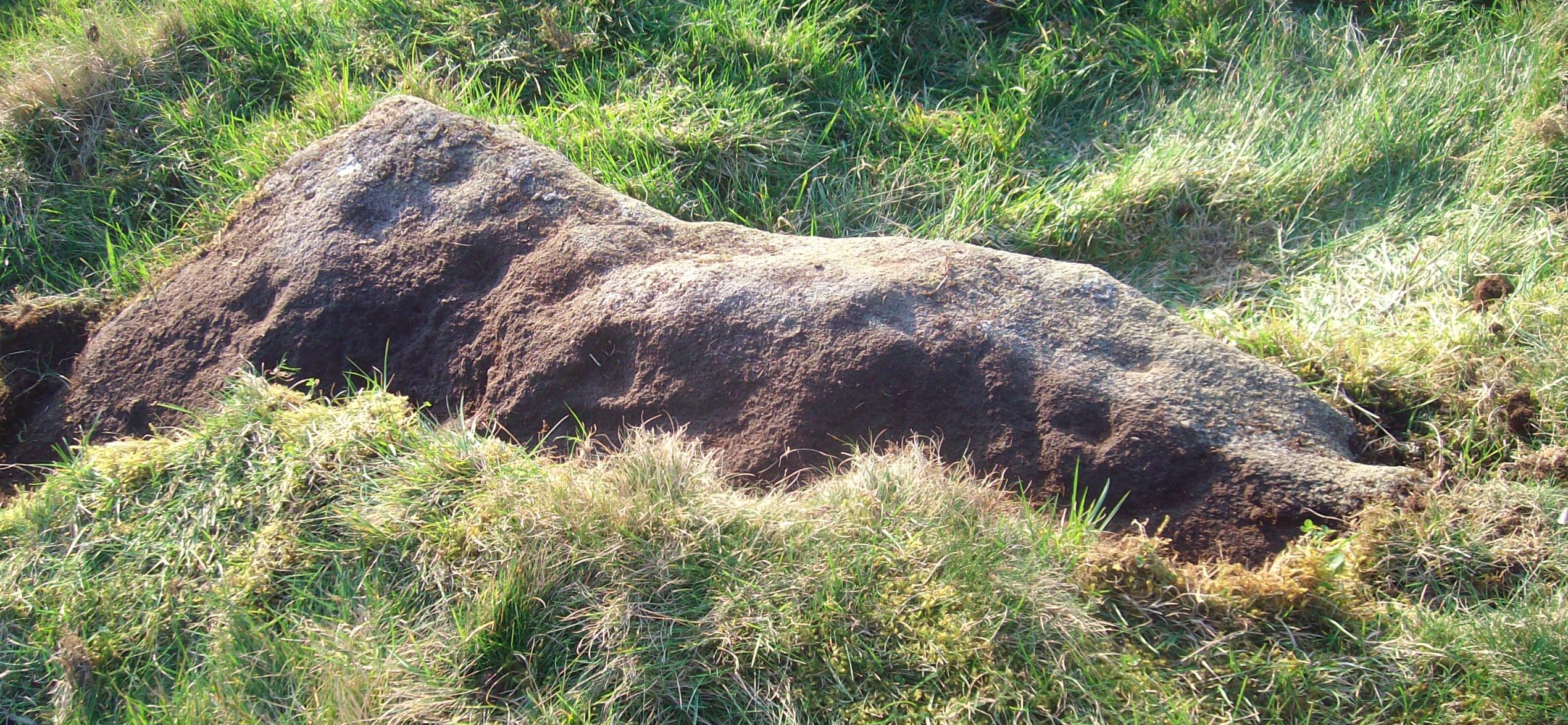
Mr Hirst’s clearanceCups & curves on edge
But the most interesting element in the fainter, seemingly unfinished carved lines, was what may be a small spiral that started above the two faint cup-and-rings. This then continued in a sharp arc which doubled-back on itself. In the other direction, the lines curve round and go down to the vertical face of the rock, before bending back up onto the level surface again, then disappearing. The topmost cup-and-half-ring is also a curious feature. When you visit here you’ll see how this aspect of the design looks for all the world like a simply cup-and-half-ring near the edge of the stone. But, as I’ve already mentioned, closer examination shows that this “half-ring” has a larger oval body beneath it on the vertical face of the stone, very worn due to its exposure to the elements and very much in the shape of a bell—and within this large cup-and-ring ‘bell’ is a much fainter complete cup-and-ring, just below the topmost cup-marking. I know that I’ve already mentioned this, but I’m giving it added emphasis as it’s a unique design element for carvings on these moors.
Early photo of the carvingEdge of the carving
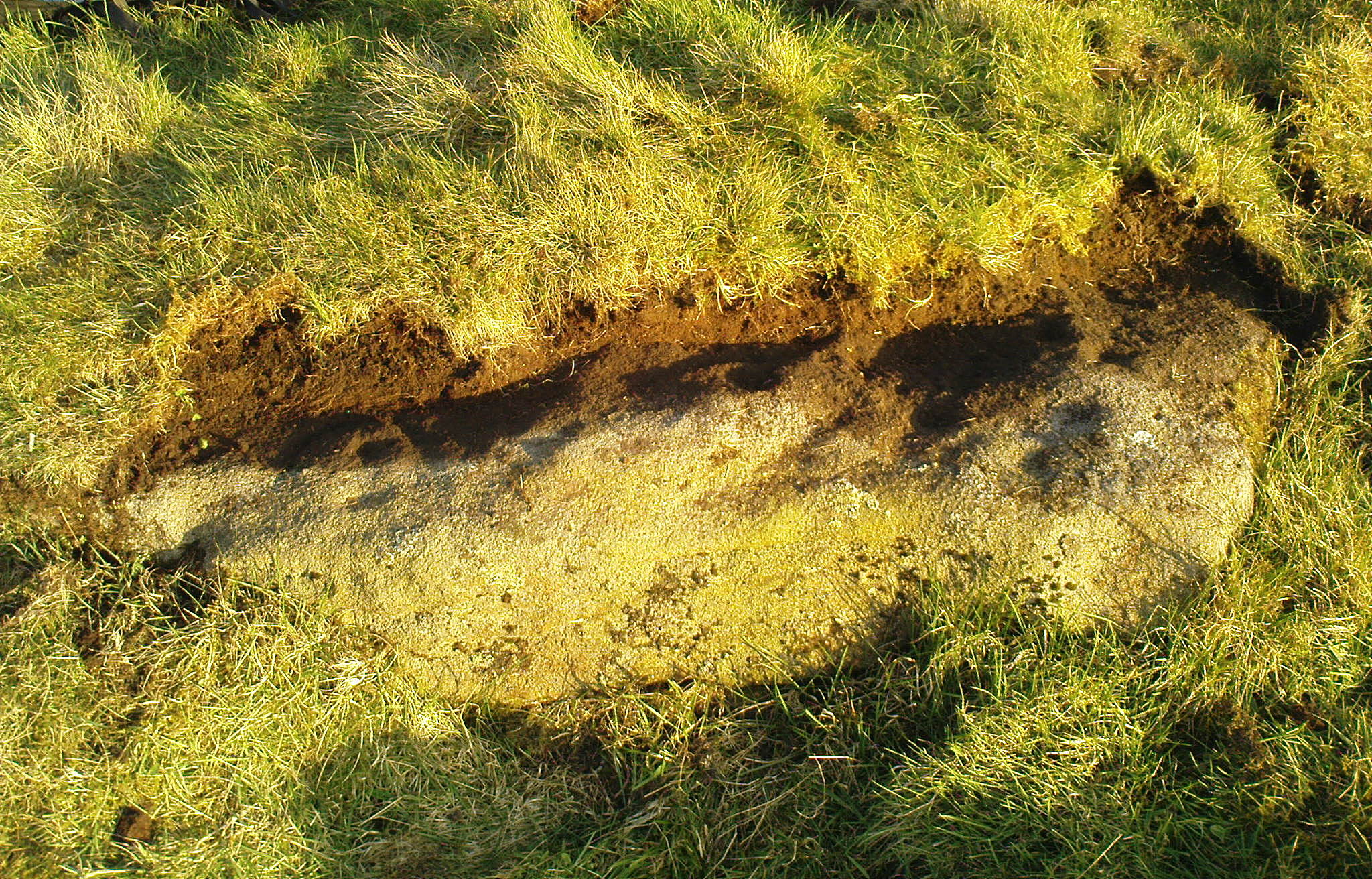
The Sunset Stone really requires more attention, when the daylight conditions are just right, so that all of these intriguing aspects can be highlighted with greater lucidity. There is also the potential that more carved ingredients remains hidden beneath the compacted soil.
What seems to be a more trivial single cup-marked stone can be seen roughly 20 yards to the north.
Acknowledgements: Massive thanks to Richard Hirst of Hebden Bridge, and Prof. Paul Hornby, for their help in bringing this carving to light.
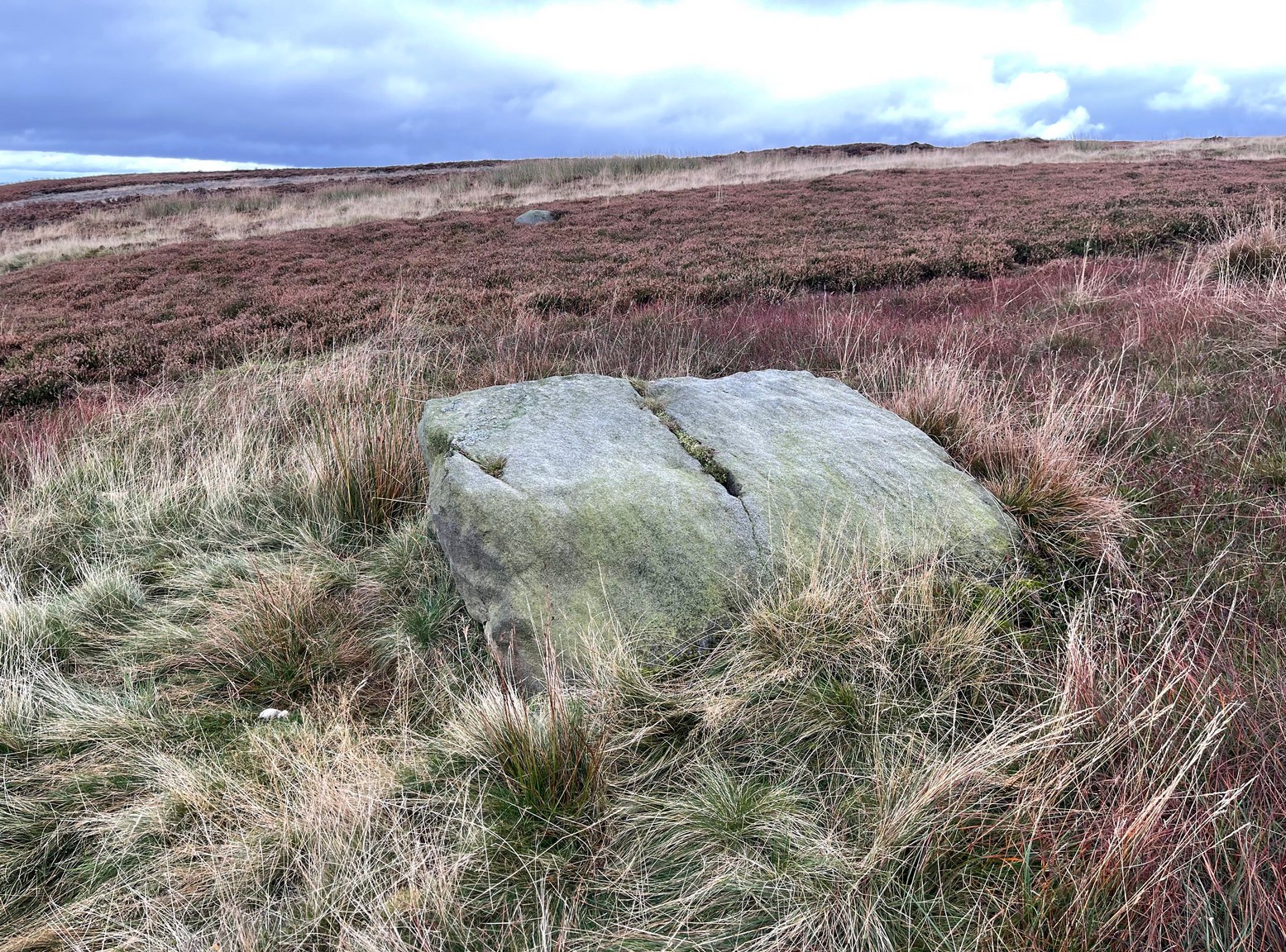
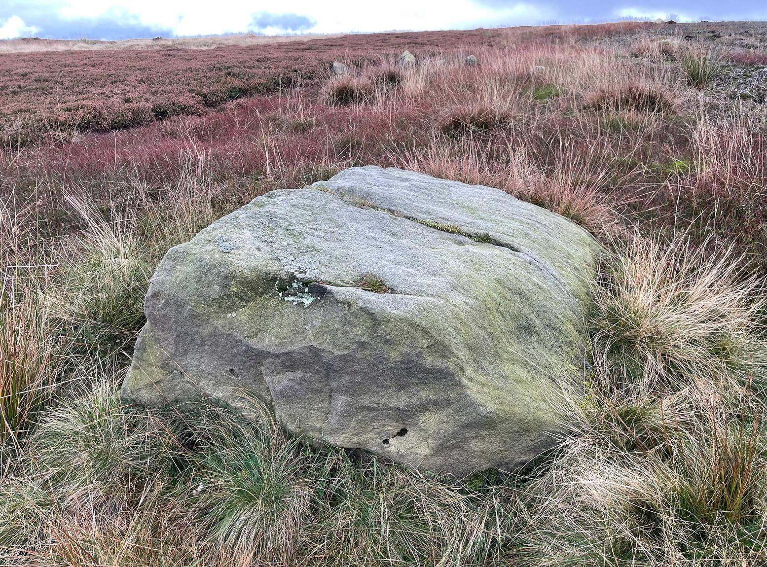
From Cow & Calf Rocks, walk up the steep footpath and turn left (southeast) when it levels out on the edge of the moor. Walk 250 yards along and, where the main path veers down to the road, just keep walking along in the same direction along the footpath that runs gradually uphill until, after 650 yards (595m) you’ll eventually meet up with the footpath that runs along the moorland proper. Where these two paths meet-up, then head upwards (south) into the heather for 55 yards (50m) until you see a good-size sloping block of stone with a crack roughly down the middle. If you hit the Little Haystack Rock (a big conspicuous stone) you’ve gon too far!
Archaeology & History
Shallow cupmarks visible
This is one of the many basic cup-marked stones you’ll find scattered all over these moors possessing (as it does) only two distinct cup-marks on its more northern half, although a possible faint third one needs looking at in better light. When we were kids exploring this and other areas, single and double cup-marked stones like this seemed ten-a-penny and we’d flippantly pass them by after quick perusal, looking for more impressive designs.
The carving here seems to have been missed in the surveys of Hedges (1986) and Boughey & Vickerman (2003), despite the rock standing out quite distinctly. I can only assume that they checked it out when the skies were grey and dull, making the cup-marks difficult to see. A number of other prehistoric remains can be found close to this carving, including cairns and sections of enclosure walling.
Folklore
Tradition tells that the indigenous Britons had a battle with the Romans on the plain where this carving is found.
From Ilkley, take the same directions to reach the Haystack Rock; then walk east along the edge of the moor, past the Pancake Stone and keep along the footpath for more than 800 yards till you see the large cairn above-right of the footpath by about 20 yards, a short distance before you’d hit the Rushy Beck. Walk to the cairn, and then past it along the path (west) heading onto the moor for another 30-40 yards, checking the rocks on the ground thereby. You’ll find it!
Archaeology & History
Scruffy sketch I did of the stone, c.1982
Described in John Hedge’s (1986) survey as a “long, low, smooth grit rock, partly covered with heather. Seven clear cups”, we first found this carving when we were out bimbling on one of our hundreds of ventures on these moors as kids—on this occasion, as I recall, seeking out a cup-and-ring stone that Stuart Feather discovered and mentioned in an early Yorkshire Archaeology Journal. Less than a yard away from the one which Mr Feather described (the overgrown cup-and-ring stone no.375) was this curvaceous female rock, with seven simple cup-markings, mostly on its northeastern side.
When the heather is low in this area, you can clearly make out extensive remains of prehistoric walling 11 yards east of the cup-marked stone, running north-south. This eventually meets up with another line of walling that runs east-west and bends back around on the western sides of the carving about 20 yards away, seemingly encircling it. This enclosure will be described in greater detail at a later date.
References:
Hedges, John (ed.), The Carved Rocks on Rombalds Moor, WYMCC: Wakefield 1986.
Boughey, Keith & Vickerman, E.A., Prehistoric Rock Art of the West Riding, WYAS: Wakefield 2003.
Fom Burley train station, take the road uphill onto the moor edge, turning right for a coupla hundred yards where the road runs up the side of the Coldstone Beck. Walk up the stream until you hit the footpath that takes you onto the moor proper, on the righthand (west) side. Once on the level, note scatter rocks on the near horizon above you and the faded track that runs up towards them. Walk up here, keeping your eyes peeled for the small chair-shaped rock immediately left of the pathway. You can’t really miss it.
Archaeology & History
One of an increasing number of carvings that I’m finding have curiously not been included in the general rock art surveys of the region (Boughey & Vickerman, 2003; Hedges 1986). We first found this—Jon Tilleard and I—when we were foraging for such carvings in the 1970s and early ’80s and the scruffy drawing here is taken from one of my early notebooks (1981) that explored the archaeological remains on these moors.
Scruffy drawing of the stone, c.1982Close-up of cup-marks
The name of the stone comes from the slightly chair-like shape of the rock on which the blatantly obvious cup-markings can be seen. There are at least six of them, with a possible seventh near the top of the rock. Some curious eroded markings can still be to the left-side of the main cups, but I’m unsure as to their nature and they may be just geophysical. Above and around this rock are a number of medieval pit workings, quarrying and scatterings of other rocks, none of which have been found to possess cup-and-rings.
References:
Bennett, Paul, Of Cups and Rings and Things, unpublished: Shipley 1981.
Follow the same directions as if you’re gonna visit the Idol Stone carving. From here, keep walking uphill until your reach the rocky crags on the slope above. Go left (southeast) along the small footpath that runs along the top of this ridge for 350 yards (320m) and, where the path begins to very gradually slope back downhill a little, go sharp left, downhill for 50 yards, where a couple of large rocks stand out. Before one of these, low down in the heather, you’ll find this curious cup-and-ring stone.
Archaeology & History
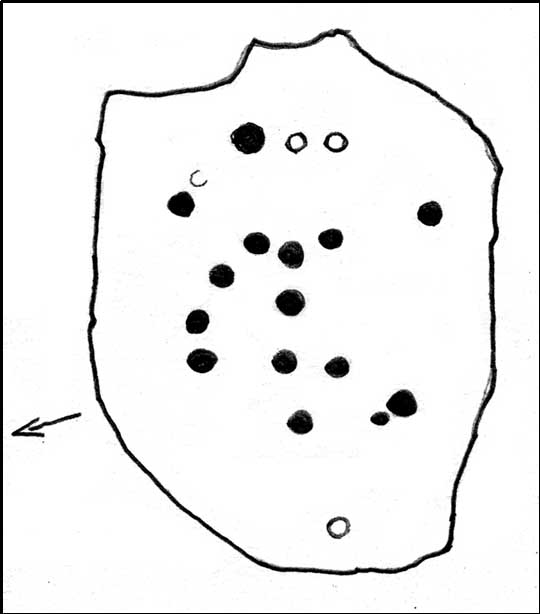
This is a lovely cup-and-ring stone, seemingly recorded for the first time by fellow rock-art student Stuart Feather (Radford 1968) in one of his numerous ramblings over these moors. It’s a difficult habit to break once the bug bites! The rock itself is unusual, possessed of undulating geophysical waves or ripples across its surface, similar to a cluster of others a couple of miles west near the very top of Rombald’s Moor. The curvaceous feature alone would have given this stone a spirit-nature of its own, different from the others in this area — though we may never know what that might have been.
Primary design (after Hedges)
The cups carved onto this rock are cut much deeper than most other prehistoric carvings along this ridge and, for some reason or other, give an immediate impression of having been painted and coloured in lichens or other natural dyes, to encourage or awaken the mythic history within and around the stone. It’s a formula that occurs worldwide and needs serious consideration, not just here, but at many other outcrop carvings in Wharfedale and much further afield.
The carving was described in John Hedges’ (1986) fine survey as a,
“Fairly small flat rock, level with the ground, sloping slightly in heather and crowberry, its surface layered in waves which appear to have been incorporated in the design which covers the rock. About 25 cups, some very deep and some showing pick marks, three are enclosed in rings, one of which has three cups in its circumference and a groove leading from it to edge of rock.”
Many other carvings scatter the moorland plain of Woofa Bank — some recorded, others not — in a region rich in Bronze Age and probably earlier cairns. We’ll add all their profiles here as time floats by…
References:
Bennett, Paul, Of Cups and Rings and Things, unpublished: Shipley 1981.
Boughey, Keith & Vickerman, E.A., Prehistoric Rock Art of the West Riding, WYAS: Wakefield 2003.
Hedges, John (ed.), The Carved Rocks on Rombalds Moor, WYMCC: Wakefield 1986.
Radley, J. (ed.), “Yorkshire Archaeological Register, 1968,” in Yorkshire Archaeological Journal, volume 42: part 166, 1968.
Cup-Marked Stone: OS Grid Reference – SE 1380 4521
Archaeology & History
Buried Stone carving
One of this regions many simple cup-marked stones, this example is another that is not in the archaeological records as it was rediscovered on March 1, 2012, by one-time rock art student, Michala Potts of Keighley. Found in association with one of the many prehistoric cairns in the landscape, it is a small flat rock, that was mainly covered over in dead bracken remains. There are two very distinct archetypal cup-marks etched on the westernmost half of the stone, with a possible faint third in-between the two. The larger of the two cups measures 2 inches across and is a half-inch deep; the other cup being 1½ inch across and roughly the same depth. Several other cup-and-ring stones can be found close by.
Buried Stone, when dry
The curious-looking inverted ‘F’ beneath the two cups is somewhat of a dilemma, as part of it appears to have been carved and has the hallmark of a typical boundary marker. However, the top line is almost certainly a natural feature on the rock, but the vertical and second horizontal line may have been cut into the rock at a later date. There are remains of some medieval workings just 10 yards away from this stone, which may account for the enhanced lines; but we could do with a decent geologist to have a look and tell us one way or the other!
Cup-Marked Stone: OS Grid Reference – SE 1395 4517
Getting Here
Sketch of the main design
Once you’re on Ilkley moorland itself, head over to the Little Skirtful of Stones giant cairn. From here, walk due east for 115 yards where you’ll come across an overgrown dried-up (usually) dyke cut into the heath, which runs roughly north-south. Walk over the dyke onto its eastern side and just a few yards in front of you, in a slight dip, you’ll found a female oval-shaped boulder amidst the heather.
Archaeology & History
Rediscovered on Tuesday March 6, 2012, this medium-sized rounded (female) rock has somehow evaded all previous archaeological evaluations. It is one of at least five previously unrecorded cup-marked stones found close to each other on the eastern section of Rombald’s Moor near the Little Skirtful of Stones. The rock measures roughly 2 yards by 1½ yards and possesses at least 15 cup-marks that cover most of its surface. Each cup-mark averages about 2 inches across and are less than ½-inch deep. There is a natural ‘bowl’ in the southern section of the rock with a typical cup-mark in it and a smaller one in close association.
Dyke Stone cupmarksand from another angle
The other cup-markings found close by, appear to be associated with the prehistoric cairns but this stone — the largest of the group — lacks any immediate relationship with such monuments. Further ground explorations are required at other potential spots close by; plus we could do with getting back here when the sunlight’s better, so we can get some clearer photos!
From the Idol Stone carving, keep walking along the footpath that takes you up the hill and further onto the moor. Keep walking for another few hundred yards until you reach the old pits at Lanshaw Delves. Walk due east through the heather for 250 yards or so, until you hit the flat-topped cup-and-ring marked Lanshaw Stone. Walk 50 yards NNE from here, and keep diligent. You’ll find it!
Archaeology & History
…and from another angle
This is another carving which is troublesome to locate when the heather’s fully grown. Like other cup-and-rings scattered along this geological ridge, it is associated with additional prehistoric features which local archaeologists have never bothered plotting: a real peculiarity, as this is a truly rich archaeological arena. Low walling and cairns are close by, all from the Bronze Age and possibly earlier. When we were children exploring this section of the moor, we also found a few flints scattered about (we threw ’em back into the peat, where they probably still remain). The carving itself may be neolithic, but in all honesty until we get a decent archaeologist in the area willing to truly focus on our ancient monuments, we’ll never know the time periods of the remains here with any certainty.
When Boughey & Vickerman (2003) recorded this and other carvings nearby, they described it simplistically as:
“Medium-sized, rounded, triangular rock of medium grit, up to height of heather at centre. Two cups, of different size, and perhaps another.”
I’m not too sure about another to be honest, but I’d love to be wrong! A curious straight line may run parallel to the cups, but this too may be natural. I reckon the carving’s only gonna be of interest to the real rock-art fanatics out there. But nearby, as you’ll find, are more impressive archetypal cup-and-rings…to be described later…
References:
Boughey, Keith & Vickerman, E.A., Prehistoric Rock Art of the West Riding, WYAS: Leeds 2003.