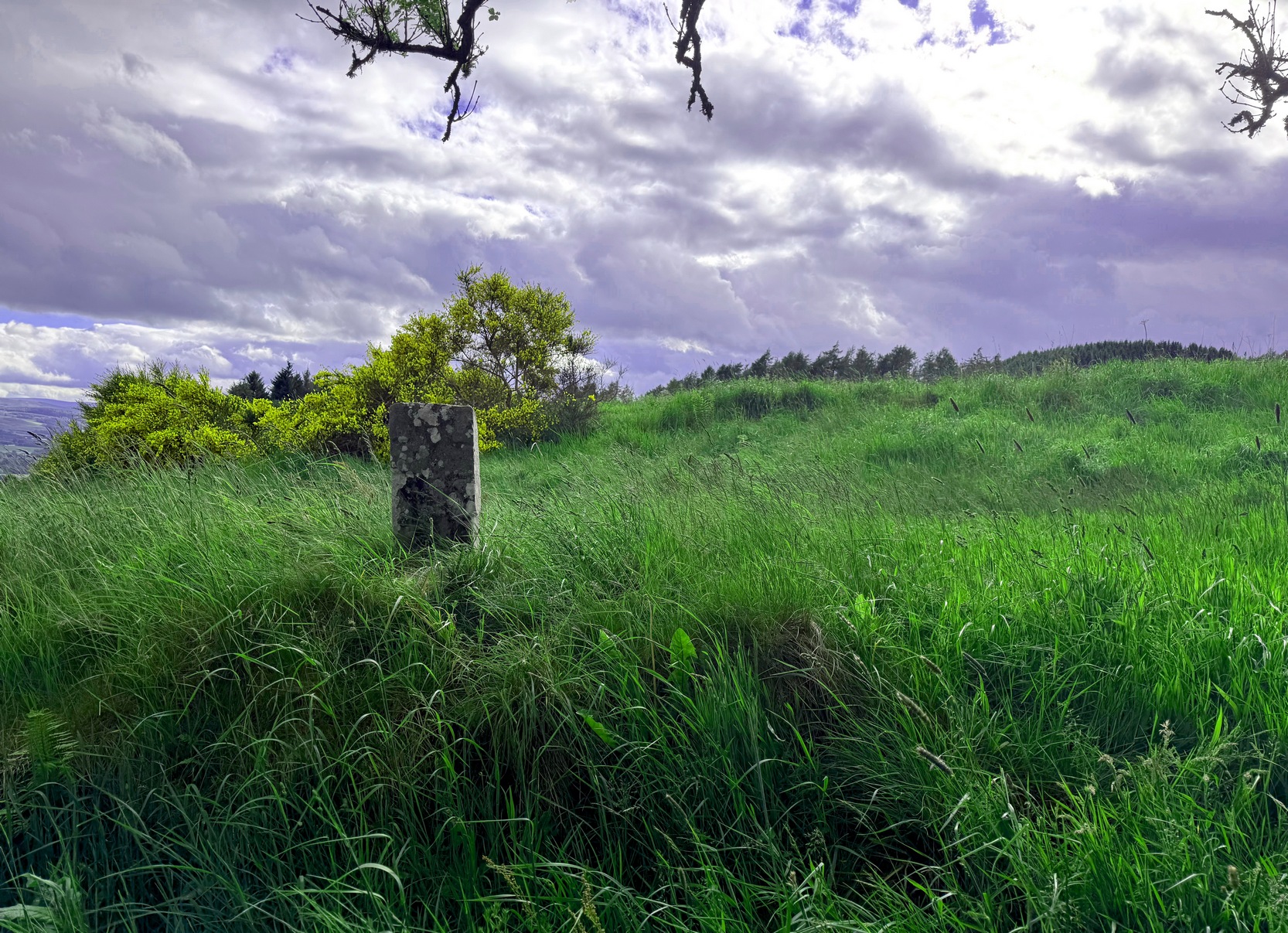
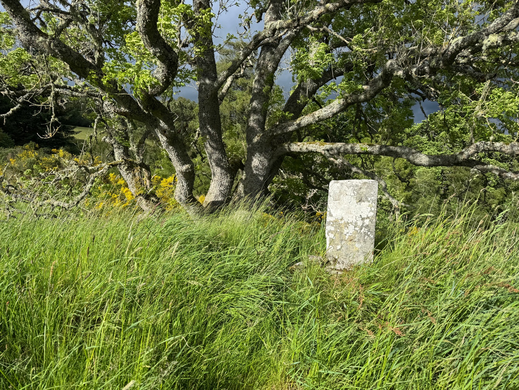
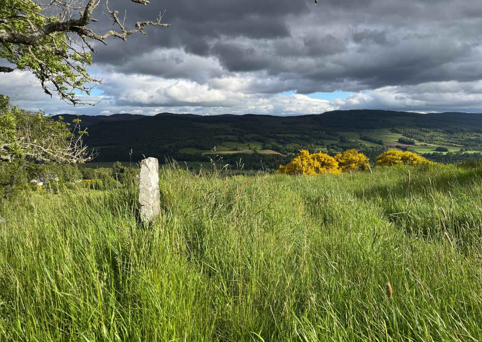
From the red phone-box at the road junction in Strathtay village, walk aling the road, east (slightly downhill) for less than 50 yards then turn left and walk up the track. After 70-80 yards, keep your eyes peeled for the footpath that runs up the slope into the tgrees (don’t head to the house in front of you). After a half-mile you reach the gorgeous old Tullypowrie farmhouse on your left; keep walking uphill for another 300 yards until your reach a large tree on your left, above which, sat on some very low walling, you’ll see a small upright stone.
Archaeology & History
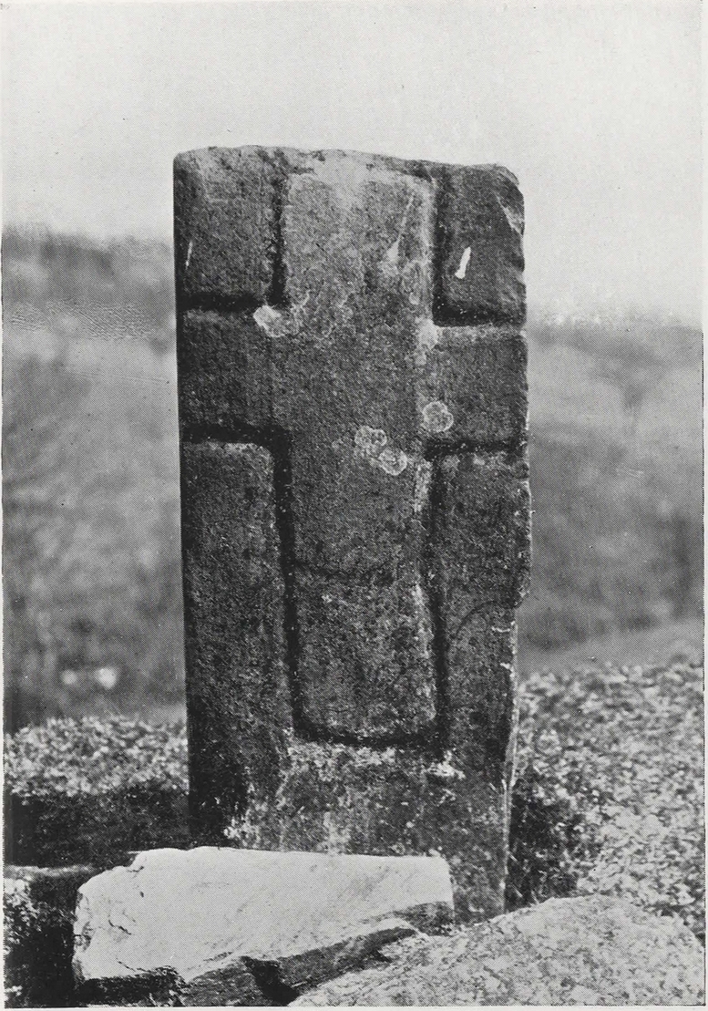
Faint cross on western face
This little-known early christian carved stone, sitting on the vague remains of an old Roman Catholic church, located on what local folks used to call “the route to the stones” (meaning to the Clachan an Diridh, much to the minister’s considerable disdain), has had less said of it than the more ancient stone circle a little further up the footpath. But then, not much is known of either the carving or the church itself, whose remains can barely be seen amongst the grasses. But the upright ‘cross’ at least proclaims itself to the eye.
On our recent visit here, the crosses (on both side of the stone) were somewhat faint, as my photos show. But it wasn’t always this way. During a visit to nearby Aberfeldy in September 1900, the antiquarian Dave Landsborough (1901) found himself ambling about “among the ruins of a small hamlet” that was the olde settlement of Tullypowrie and came upon this little-known monument. He subsequently wrote an excellent description of the stone, which cannot be equalled. “The cross,” he told,
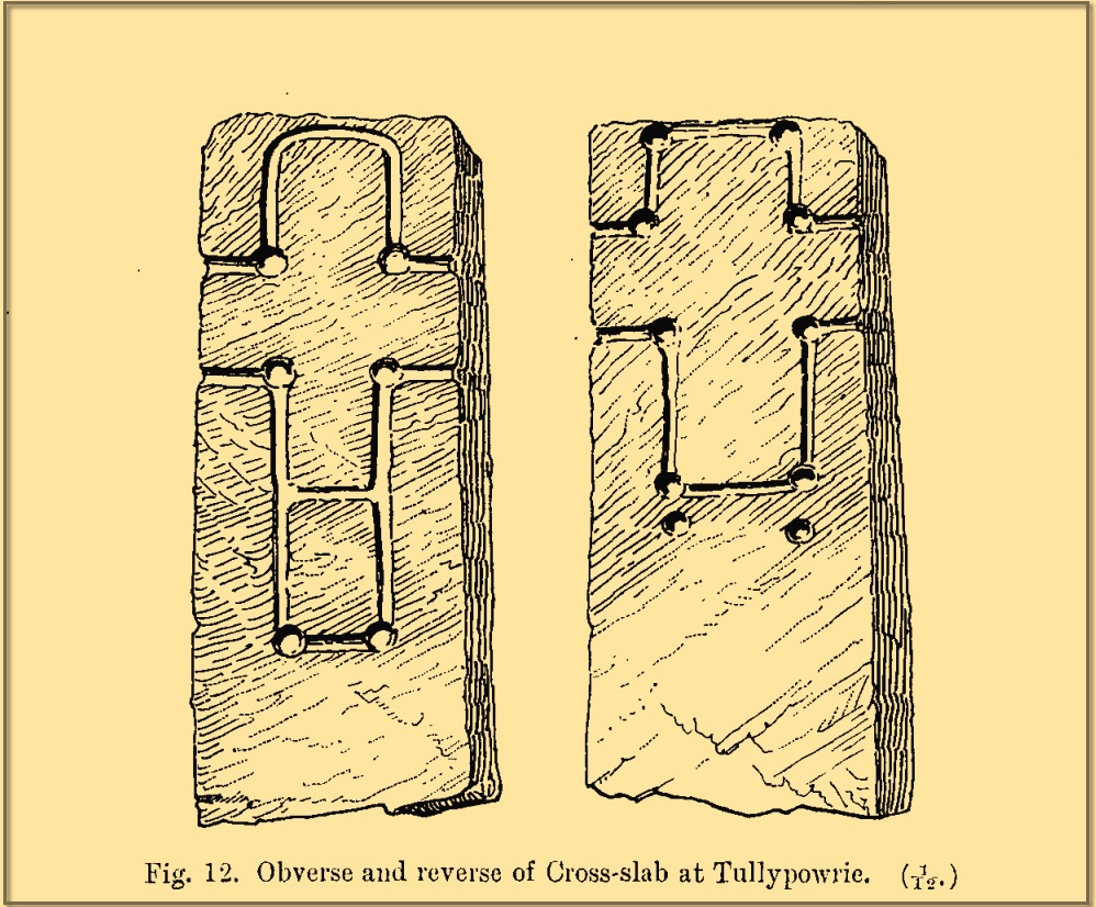
Landsborough’s sketch
“is of the rudest character, consisting of a schistose slab 30 inches in length, 11⅜ inches in width at the top, about half an inch wider at the bottom, and about 4½ inches in thickness. It is roughly squared at the top and sides, but at the bottom the base is unsquared, one side being longer than the other. On both faces of the slab a cross is formed by a shallow incised sinking, a little more than an inch in breadth, with circular sinkings slightly deeper than the rest of the outline at each corner of the shaft and summit of the cross, and at the intersections of the arms with the shaft and summit. The cross on the east face of the stone has its top almost level with the top of the slab, but the shaft does not reach nearly to the bottom. The top part of the cross above the arms is 4½ inches high by 4½ inches in width. The arms reach across the whole width of the slab, and the shaft is little more than the length of the part above the arms, the base being somewhat rounded. Below the termination of the shaft are two slight circular sinkings almost in line with the perpendicular outlines of the sides, but at unequal distances from their terminations, the one being 1½ inches and the other 2½ inches below the similar sinkings which mark the corners of the shaft. The cross on the west face of the slab is in every way similar, except that the shaft is longer, reaching to a length of 10½ inches below the arms, and the circular sinkings at the top are nearly effaced. It has, however, the curious feature of a slight cut-off at about the same length as the shaft of the other cross, but the circular sinkings occur at the top and bottom, and at the intersections as in the case of the other cross.
“The slab is not fastened in a socket, but is kept nearly erect leaning against a large stone, while smaller stones keep it firm at the back. I have since been told by the Rev. Mr McLean of Grandtully that the place where it stands is the site of an old and very little chapel, the south wall of which may still be recognised by its remaining foundations.”
Tullypowrie cross looking SDixon’s old photo
On the other side of the burn from here was the great Whooping Cough Well, with the heathen Clach na Buidseach against the wall of Tullypowrie Farm just below (subsequently moved to the field west of the cross). These sites (and others nearby) and the animistic traditions associated with them, probably had something to do with the positioning of the church here, and the cross would be the attempt to give a Christian veneer to usurp the more archaic natural practices. We don’t know that for sure, but it’s more than likely. The old Logierait schoolmaster James Kennedy (1927) makes constant references to the animistic lore of the region, which was legion until quite recently.
No additional lore, sadly, is known of this old cross, which is deemed to be medieval in origin. Both Mitchell (1923) and Dixon (1925) make mention of the monument in their respective guidebooks, but add no further information.
References:
Dixon, John H., Pitlochry, Past and Present, L. Mackay: Pitlochry 1925.
Kennedy, James, Folklore and Reminiscences of Strathtay and Grandtully, Munro Press: Perth 1927.
Landsborough, David, “Rubbings of both Faces of an Erect Incised Cross-slab, at Tullypowrie, near Grandtully, Perthshire,” in Proceedings Society of Antiquaries, Scotland, volume 35, 1901.
Mitchell, Hugh, Pitlochry District: Its Topography, Archaeology and History, L. Mackay: Pitlochry 1923.
From the Port Appin ferry onto the northern tip of the island, go along the B8045 road for literally 3.5km (2.17 miles) and, shortly after passing Achuaran, a single small white house is on your right. Just yards before here is a small raised rocky knoll. …Or from the Achnacroish ferry, up the road for nearly a mile, then turn right along the B8045 road to Clachan. A half-mile past the hamlet, go past the old School House, then past Mountain View cottage, and the next small white house on the left has a rocky knoll just past it. Just over the wall from the road, a sign points out the legendary Chair that you’re seeking!
Archaeology & History
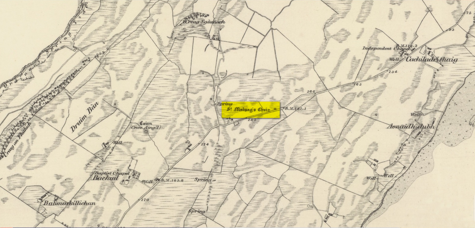
Site shown on 1875 map
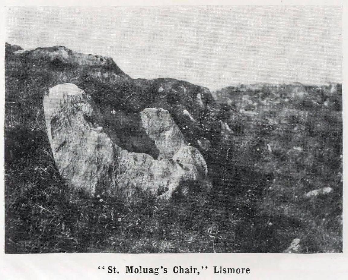
St Moluag, a contemporary of the renowned St Columba, was a 6th century Irish saint who came to reside on Lismore—“the sacred isle of the western Picts”—and here taught the early christian doctrines, fused with indigenous animistic traditions. He used sites of Nature as places of reflection and meditation and this chair-shaped boulder came to be a place renowned as one of his ritual sites, not far from his church. It was described in Frank Knight’s (1933) huge work as possessing healing properties:
“To sit in it used to be considered a sovereign remedy for rheumatism.”
The site was highlighted on the earliest Ordnance Survey map of the island and its lore was remembered by local people of the time. The chair had wider ‘arms’ until the beginning of the 20th century when in widening the road, they were accidentally broken off by one of the workmen.
References:
Knight, G.A. Frank, Archaeological Light on the Early Christianizing of Scotland – volume 1, James Clark: London 1933.
Acknowledgements:Huge thanks for use of the Ordnance Survey map in this site profile, reproduced with the kind permission of the National Library of Scotland.
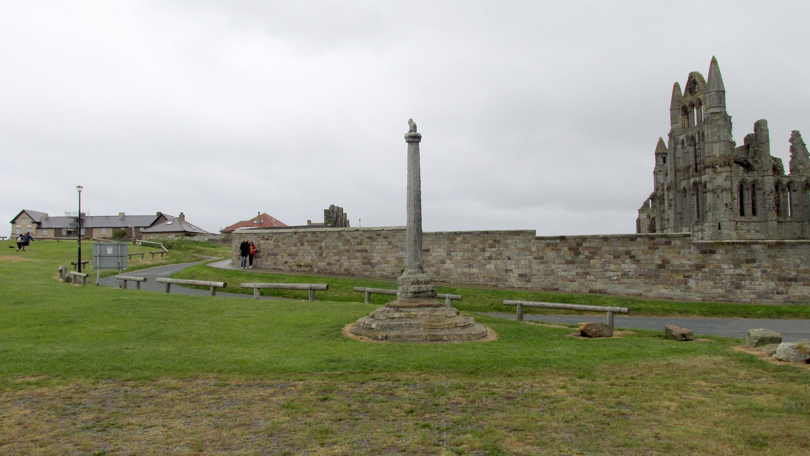
Pretty easy to find: from Whitby town centre, head uphill to the great ruins of Whitby Abbey. You go past Caedmon’s Cross and past the more recent church and graveyard to the car-park at the top, outside the abbey. At the edge of the car-park on the grass, you’ll see this tall hard upright, nice and erect!
Archaeology & History
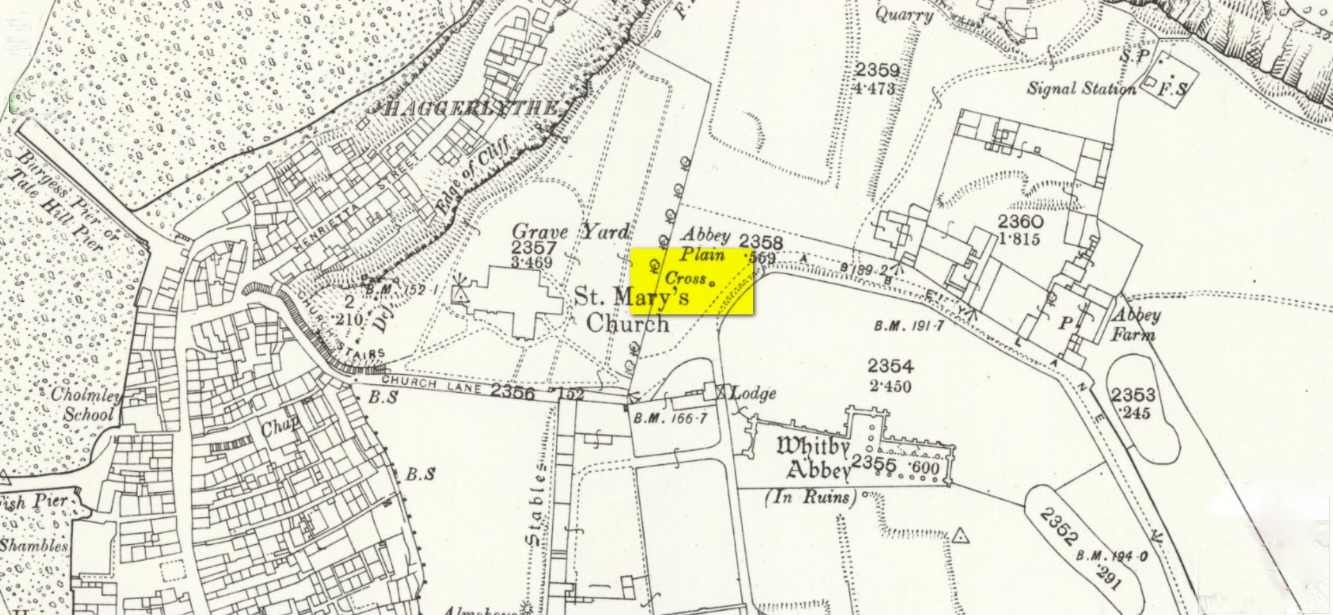
Cross shown on 1894 map
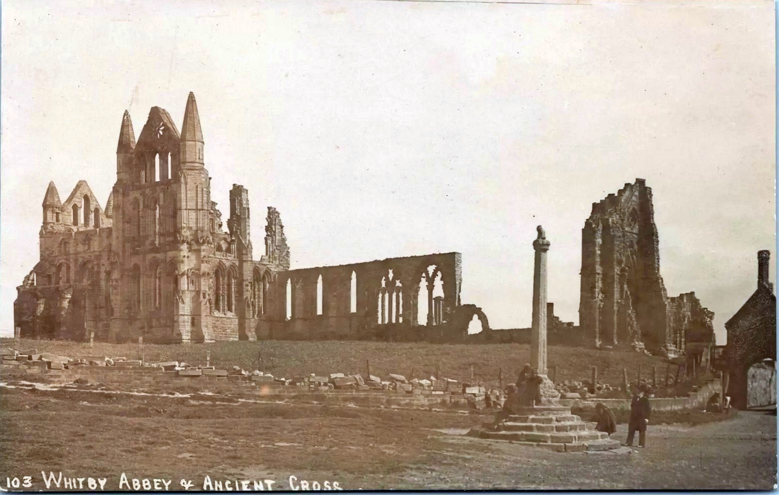
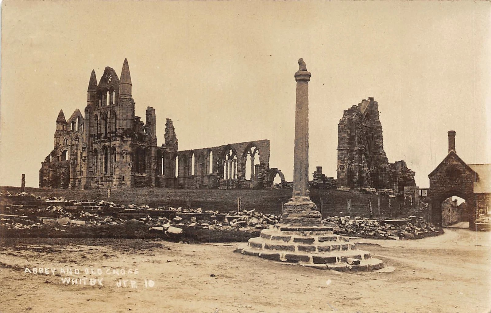
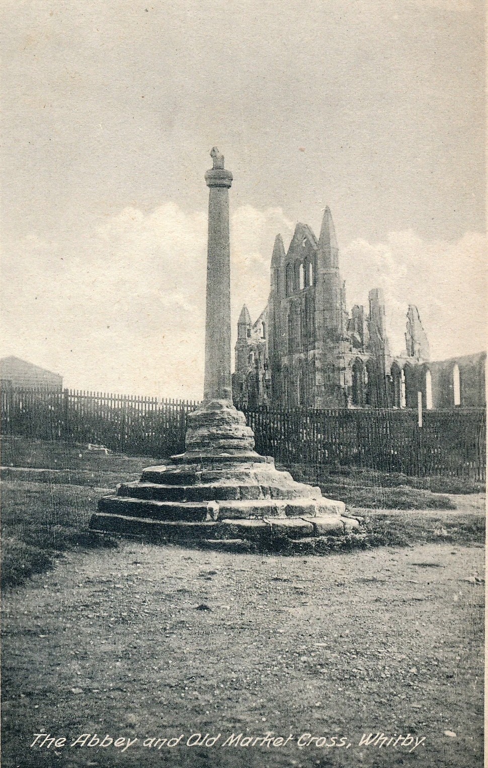
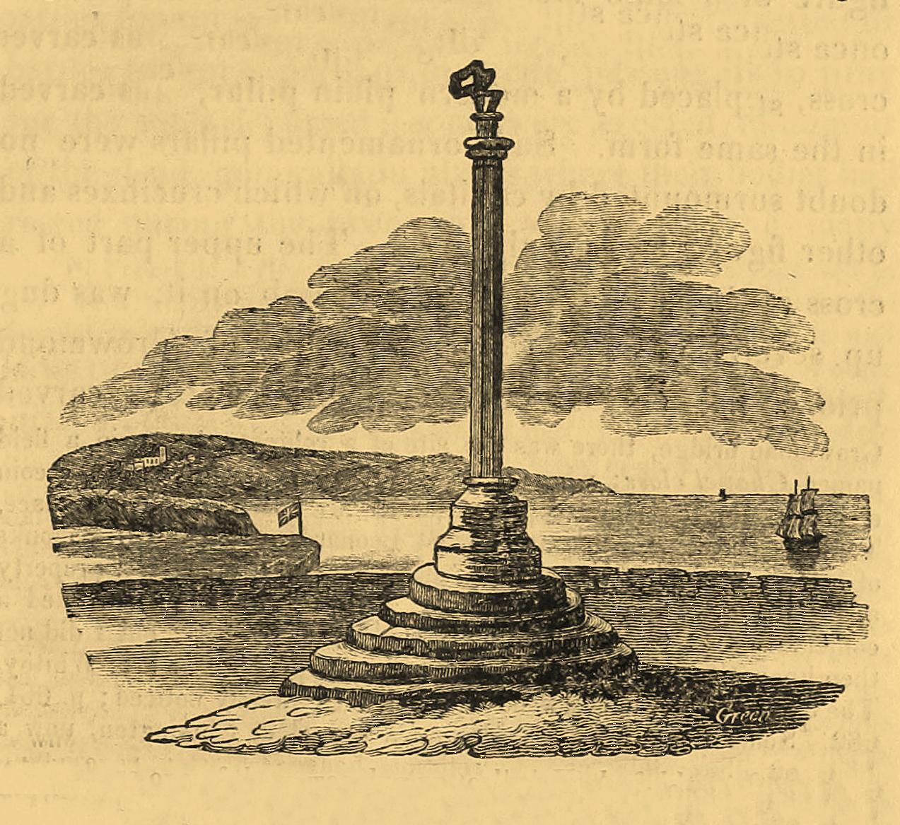
Highlighted on the earliest OS-maps and not to be confused with the nearby and more modern Caedmon’s Cross, this tall large monolith stands upon a stepped plinth comprising of six steps (originally five), about 18 feet high. The top of the cross was knocked off a century or two ago, when it was reported to have been twenty feet! Initially it stood about fifty yards closer to the Abbey, but was removed to its present position following the Dissolution.
The brief history regarding its origin was described in George Young’s (1817) major work, in which he told that in 1474, on John Nightingale, rector of Sneaton parish, in his will “appointed his burial to be on the north side (of the Abbey), before the cross,” which was already standing at that time. Young wrote:
“By this it would appear that the ancient cross, now standing in the abbey plain was then within the cemetery of the abbey.”
Abbey Cross, c.1900Young’s 1817 sketch
This has subsequently been taken as the standard regarding its origin. Tradition also told that it was an old market cross, but this was treated with considerable scepticism by George Young, who believed that the monks here simply wouldn’t have allowed such a thing at the edge the abbey and burial ground. He found evidence to indicate that it “was at the port or harbour of Whitby that corn was bought or sold, that here were kept the standard bushels for measuring corn, and that here the market-clerk had his station.” In spite of this, T.H. Woodwark (1934) reported that fairs had been held at the cross early in the 20th century. In a thoroughly profane way, electrical wiring was wrapped around the bottom of the cross and led to a generator, along with washing-lines running from it to a caravan! Mr Young would have been apoplectic!
References:
Atkinson, J.C., Memorials of Old Whitby, MacMillan: London 1894.
Holt, Robert B., Whitby, Past and Present, Copas: London 1890.
Woodwark. T.H., The Crosses on the North York Moors, Whitby Literary & Philosophical Society 1934.
Young, George, A History of Whitby and Streonshalh Abbey (2 volumes), Clark & Medd: Whitby 1817.
Acknowledgements:Massive thanks to Lindsay (wherefore art thou…?) Mitchell for getting us up here… Huge thanks for use of the Ordnance Survey map in this site profile, reproduced with the kind permission of the National Library of Scotland.
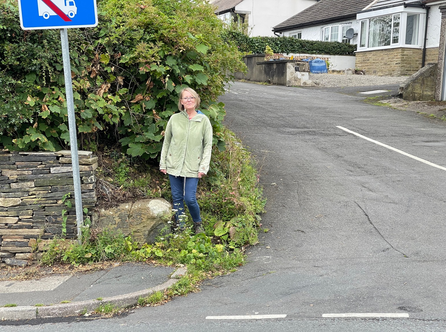
Nice ‘n easy: from Huddersfield central, take the A641 road north to Brighouse, but barely a half-mile out of town turn left up the Halifax Old Road. Go on here for nearly a mile, then keep your eyes peeled for the aptly-named South Cross Road on your right. Go up here all the way to the end where it meets with Cowcliffe Hill Road. Here, at the junction, right by the roadside at the edge of the wall, is the remains of the old cross-base, all but covered in vegetation. You’ll see it.
Archaeology & History
The little-known remains of a post-medieval cross base can still be seen, albeit very overgrown, right by the roadside. The upstanding stone cross that once stood upon it has long since gone (perhaps broken up and built into the wall). It may have been one of two such crosses relatively close to each other: as this one is found at South Cross Road, there may have been another one at the nearby North Cross Road, but history seems to be silent on the matter.
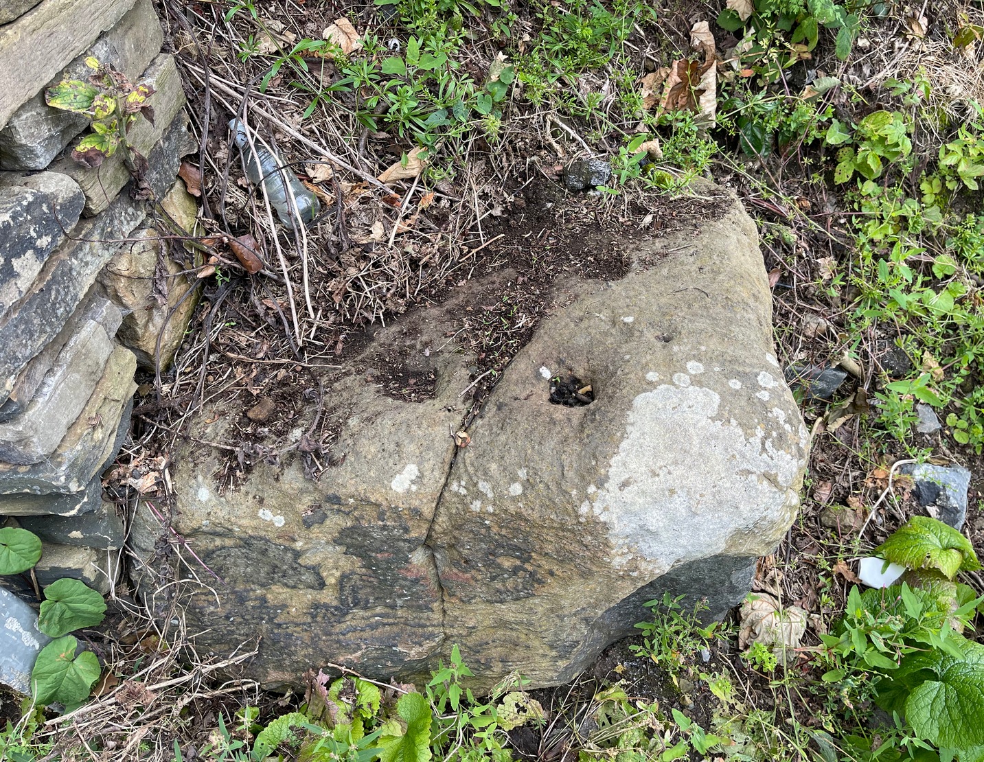
Top of the cross-base
The cross-base itself has several holes cut into it where the standing stone cross was fixed upright. Very little seems to be known about this monument. George Redmonds (2008) told simply that, “the base of a cross survives on Cowcliffe Hill Road, no doubt marking the ancient crossroads. It explains the names North and South Cross Roads.” He added that, “The base of the cross survives, partly hidden in the undergrowth, and it is the only visible evidence we have of several similar crosses in the township.”
References:
Redmonds, George, Place-Names of Huddersfield, GR Books: Huddersfield 2008.
Acknowledgements: Huge thanks to Liz Sykes for helping out big-time to uncover the base from beneath the mass of herbage.
In John Bridges’ (1791) account of the parish of Aynho, he made mention of an old market cross that stood in the village, but even in his day it had been removed and so we know little about it. Chris Markham (1901) included it in his inventory of crosses, but could find no additional details to those provided by Mr Bridges. He told us:
“In the seventeenth year of Edward II (1323-4) John de Clavering was lord of the manor of Eynho, and obtained the King’s charter for a weekly mercate, or market, to be held every Tuesday, and a yearly fair on the vigil and day of St. Michael and two days following. This market was continued until the twentieth year of James I (1622-3), when Richard Cartwright obtained a new charter for holding the market and fair, with the addition of another yearly fair on the Monday and Tuesday after Pentecost. Bridges, however, writing about 1700, says that the market had been discontinued for some sixty years, and that the market cross had been then long since taken down. Since then the fairs have also sunk into desuetude.”
References:
Bridges, John, The History and Antiquities of Northamptonshire – volume 1, T. Payne: Oxford 1791.
Charles Pooley (1868) gave a somewhat vague description of this site, telling that, “there is authority for believing that at one time a Cross was set up in the village.” I can find no other reference to this monument which, I presume, has been destroyed. (the grid reference cited is an approximation near the centre of the village, where village crosses were usually located)
References:
Pooley, Charles, Notes on the Old Crosses of Gloucestershire, Longmans Green: London 1868.
Cross (destroyed): OS Grid Reference – SO 9674 1321
Archaeology & History
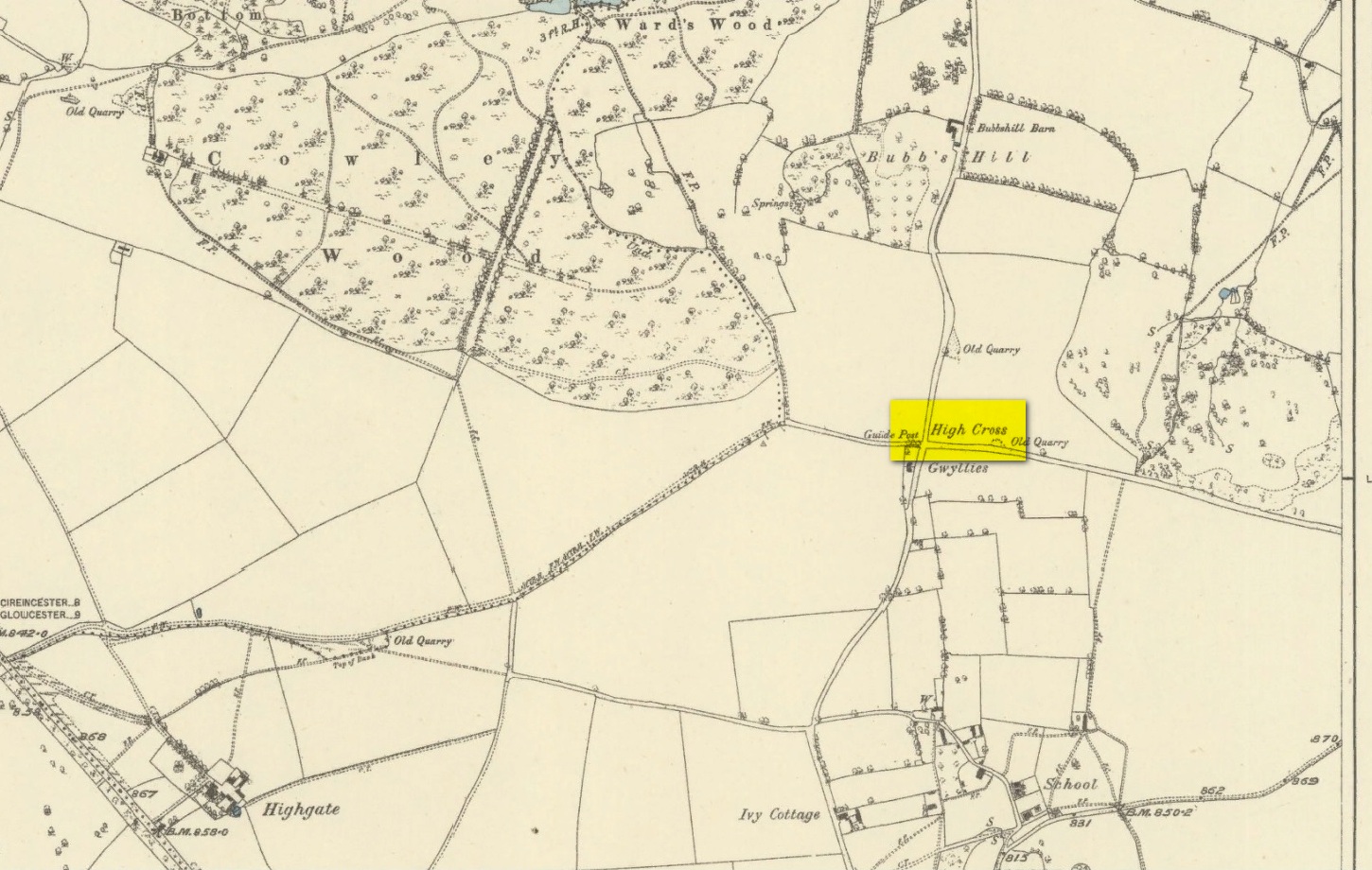
High Cross on 1883 map
First shown on a 1775 map of the region, this long-lost site is preserved in several place-names near the old crossroads a half-mile north of Elkstone village. It is mentioned, albeit briefly in Charles Pooley (1868) county survey, where he told that, “in former times a very handsome and lofty High Cross stood in this parish.” However, there’s the possibility that the name ‘High’ cross may here derive simply from a cross located at a high point in the landscape.
An old ‘Guide Post’ marked on the early Ordnance Survey map at the same spot has been suggested by Danny Sullivan—and not without good reason—to be a prehistoric standing stone. He may be right.
References:
Pooley, Charles, Notes on the Old Crosses of Gloucestershire, Longmans Green: London 1868.
Sullivan, D.P., Old Stones of the Cotswolds and the Forest of Dean, Reardon: Cheltenham 1999.
In days of olde, Charles Pooley (1868) told us that “an old cross formerly stood in the Market-place” in the centre of the town where the old crossroads meet—as was customary for crosses and maypoles—just outside the church of St. Lawrence. Pyramidal in form, it was mentioned in an old manuscript cited by Adin Williams (1888), which told us,
“Leland saith that in his days there was a Piramid of Stone at ye west end of ye Church, whose foundations are to be seen near Slaughter’s Well, which is said to be medicinal water.”
And although we don’t know when the cross was erected, we know when it was destroyed. Williams again tells us:
“About 1770, Sir Jacob Wheate pulled down this cross. He is said to have taken the stones to the house he was building.”
References:
Pooley, Charles, Notes on the Old Crosses of Gloucestershire, Longmans Green: London 1868.
Williams, Adin, Lechlade: Being the History of the Town, Manor and Estates, The Priory and the Church, E.W. Savory: Cirencester 1888.
In Charles Pooley’s (1868) definitive account of Gloucestershire county crosses, he informs us that,
“there was formerly a Cross erected in this village, but it has long since disappeared.”
He gives no further information about its history, but we must surmise that it was either associated with the ancient priory on the north side of the village, or in the traditional place at the centre of the the village. The grid-reference cited places the lost cross in the grounds of the priory.
References:
Pooley, Charles, Notes on the Old Crosses of Gloucestershire, Longmans Green: London 1868.