Cup-Marked Stone: OS Grid Reference – SE 0791 4422
Archaeology & History
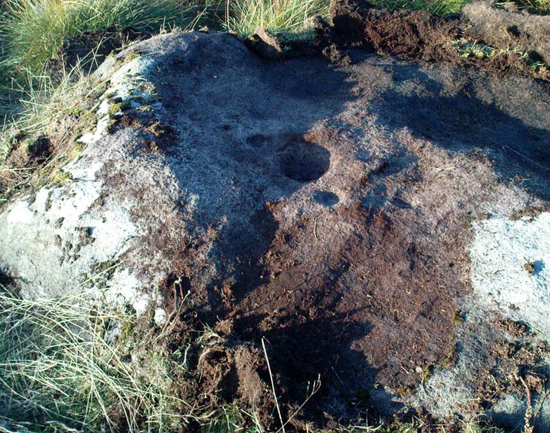
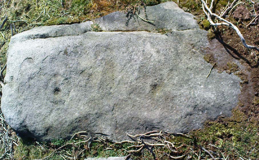
Ant Stone, uncovered
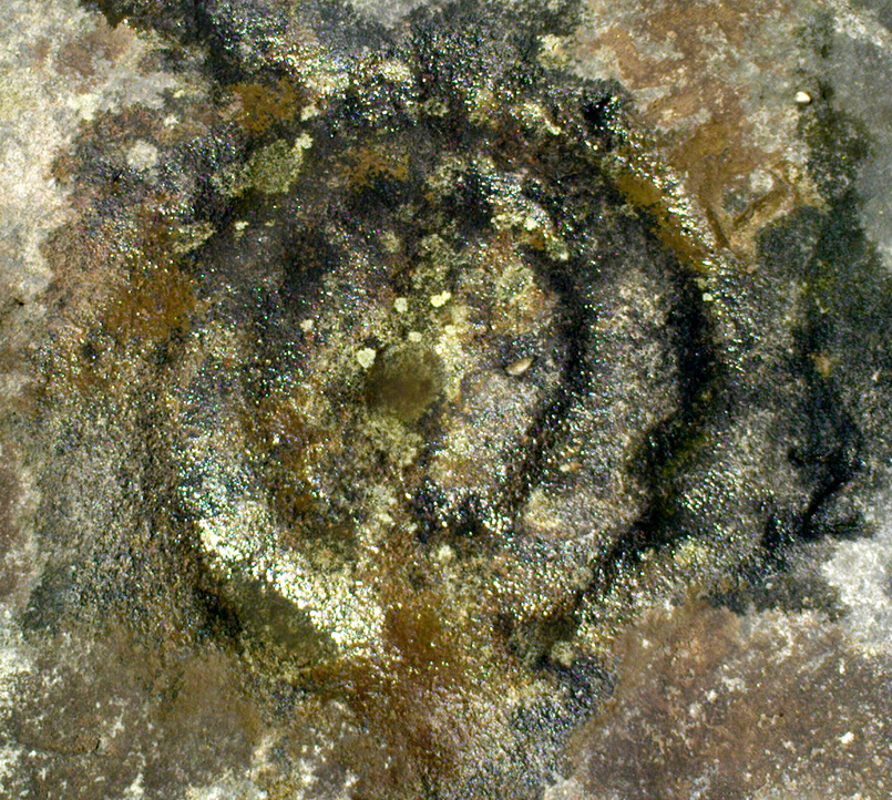
Discovered today, amidst a cluster of other carvings not previously catalogued. This was hidden beneath a mass of vegetation, but after cutting and digging into the peat on top of the stone, several cup-marks became evident. By the side of the rock, measuring roughly 8 feet by 5 feet, was a small ant’s nest — hence the convenient name of the carving.
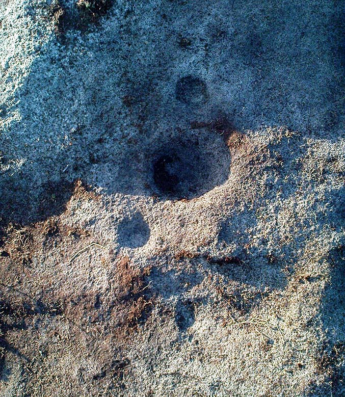
Central design of the carving
The main feature is the large, perhaps natural cup-mark, about 3 inches across. But three distinct artificial cup-markings were etched around the edges of this larger ‘cup’. When we found this stone, the daylight was nearing its end and we were unable to ascertain any further features carved onto the rock. Several other carvings were close by, none of which were included in the survey by Boughey and Vickerman. (2003) After we’d finished here, we covered the stone back over with its peaty quilt and hoped that the ants weren’t too pissed off about us disturbing them…
Long Barrow (destroyed): OS Grid Reference – SS 5848 9227
Also Known as:
Cae Bryn-y-garn
Archaeology & History
Described in 1925 in a report by the Royal Institute of South Wales as “the remains of a long barrow,” it seems that all remains of this old site have been destroyed. Where the long tomb once stood are now some bungalows (anyone know if they’re haunted!?).
The tomb was quite an impressive one from all accounts: aligning north-northeast, it was some 20 yards long and 10 yards wide (at its widest), standing between 6-8 feet tall. When building operations started here in 1959, a disturbed mound of stones was noticed, but by 1965 the bungalows had been built where once rested the ancient dead.
The field-name to its immediate east — Cae Bryn-y-garn — tells us the old name of the cairn, as known to local folk. Quite what its folklore may have been, I’ve yet to hear…
References:
Royal Commission on the Ancient & Historical Monuments, Wales, An Inventory of the Ancient Monuments in Glamorgan – Volume 1, HMSO: Cardiff 1976.
Cup-Marked Stone (lost): OS Grid Reference – SE 060 440
Getting Here
This carving is somewhere between Rivock’s western woodland edge, into the meadowlands next to it, down towards Robin Hood’s Wood. Good luck if you find it!
Archaeology & History
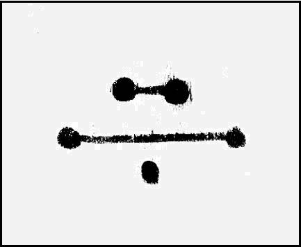
The lost Abacus Stone design
I found this carved ‘design’ when I was but a nipper, as they say! I was up all day, bimbling abaat checking out the stones and stuff, with notepad and pencil and found a number of cup-marked stones that I hadn’t come across in Stuart Feather’s surveys (the Hedge’s [1986] survey hadn’t been published at the time). I’ve been back up round the Holden and Robin Hood’s Wood district several times in recent months, hoping to re-locate this carving — but without success. I recall that when I found it all those years ago, how the design itself seemed almost ‘numeric’ in quality to look at (hence its title) and was hoping to come across it again, but the little fella’s hiding away somewhere!
The faded design was etched onto a small, slightly raised natural stone, no more than 3ft x 3ft and about 2 feet high. I thought that it might have been Boughey & Vickerman’s carving number 53 (Hedges survey, no.17), but it wasn’t to be. If anyone finds it again, I’d love to know!
References:
Bennett, Paul, Ramblings of Archaeological Remnants in West Yorkshire, unpublished: Shipley 1984.
Follow the same directions to find the Lunar Stone. Once here, walk just 20 yards southwest and keep your eyes peeled! This is a long flat stone which can easily get overgrown in the heather, so you might need to search around till you find it.
Archaeology & History
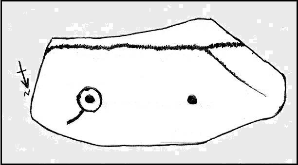
Ringtail Stone, Stanbury Hill
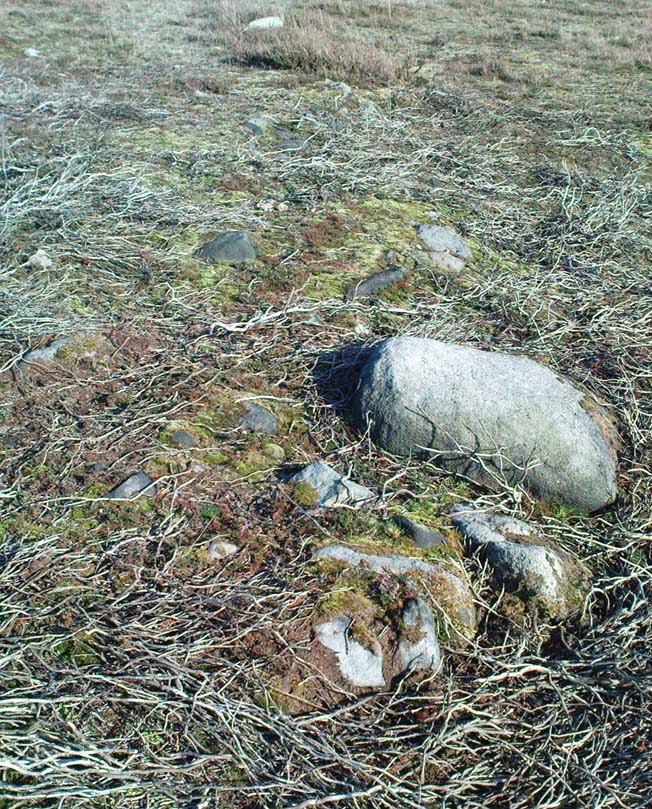
Thought to be another carving first located by Stuart Feather in 1978, though we can’t bne totally sure on that. Curiously omitted from Hedge’s (1986) survey, this old glyph comprises of a single cup-mark near the western end of the stone and a complete cup-and-ring at the eastern-end. It was first illustrated in Boughey & Vickerman’s (2003) fine survey, but they missed seeing a quite distinct line or ‘tail’ coming out the northern side of the cup-and-ring. Nowt special in archaeological terms, but of obvious relevance to the dood who carved it! They thought there may have been two faint cups in the ring, but it isn’t clear by any means.
As with the other carvings nearby, we find it amidst a scattering of prehistoric walling and the remnants of old cairns.
References:
Boughey, Keith & Vickerman, E.A., Prehistoric Rock Art of the West Riding, WYAS 2003.
Follow the same directions as to find the Lunar Stone, Spotted Stone, etc. Go thru East Morton village up the steep moorland road, east, and where the road levels out there’s a right turn and a trackway on your left which leads onto the moor. Go ½-mile up this track till you hit a moorland ‘footpath’ signpost. Stop here and walk due west (left) for a coupla hundred yards. If the heather’s grown back you aint much chance of finding owt – but if there’s only low growth, amble about zigzagging – and keep your eyes peeled!
Archaeology & History
Section of cairn rubble & walling
Although there’s been no written record of the Stanbury Hill remains until very recently, it seems quite probable that Mr Stuart Feather would have come across at least parts of these remains when he uncovered the rock-art in the same vicinity, but he never made public his finds. He was a diligent researcher and finder of cup-and-ring stones, nose to the ground sorta chap, and it would be odd for him to miss the other remains on this hill. For as we now know, there are undeniable evidences of considerable neolithic and/or Bronze Age walling scattered along (mainly) the southern side of Stanbury Hill, running mainly along an east-west axis, but there are also examples of the walling running roughly north-south. In at least one position near the western end of the ridge, halfway down the south-facing slope, is what seems to be the unmistakable trace of an enclosed hearth. At the time of writing a series of archaeological digs are, slowly, being done hereabouts, so it will be good to read their final evaluations.
Very close to some parts of the walling we find the remains of old cairns, and at least one cup-and-ring stone has been carved along the axis of one line of walling (it reminded me very much of the Bronze Age settlement remains found at Snowden Moor, over the northerly horizon, in the Washburn Valley). Several other previously unreported cup-marked stones have also been found here (we’ll highlight them on TNA in the coming weeks).
Upon first impression the remains found upon and around Stanbury Hill seem more related to mortuary practices than what we’d call ‘domestic’ living practices, as the prevelance of carvings and cairns indicates. But we’ve gotta be cautious here, as in many sites the dead were kept with the living; and as we find in many traditional or aboriginal cultures, the land of spirits and that of the living are much more closely allied than in our profane ‘Western’ paradigm.
Same direction as the Lunar Stone: from East Morton village take the moorland road, east, up the steep hill. Where the road levels out there’s a right turn and a trackway on your left which leads onto the moor. Go up this track and keep walking till you hit a moorland ‘footpath’ signpost. Stop here and walk due west (left) onto the gently sloping rise of Stanbury Hill. Keep walking for a 250 yards or so, where the land has sloped gently down to the end of the spur; and just 50 yards before it drops down to the stream below, you’ll find a cluster of rocks scattered about. One of the stones here is this one!
Archaeology & History
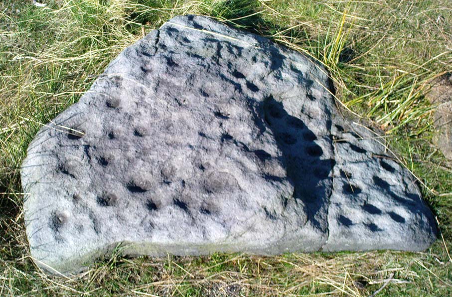
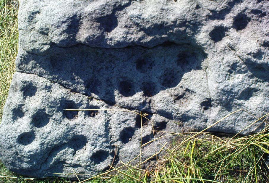
First reported by Stuart Feather in 1977, this is an excellent carving with an apt title suiting its appearence. Just 13-14 yards west (towards the cluster of other carvings very close by) are the denuded remains of what looks like a robbed cairn. Initially I thought that the archaeologists had been here and turned it over – but it seems not!
Spotted Stone – looking westClose-up of NE section
There are between 55 and 61 cup-markings etched onto this stone, with several short lines and ringlets; with one small ridge of two curves ‘arching’ over a couple of cups giving the impression of owl’s eyes! (O.G.S. Crawford would have loved this one in his book, The Eye Goddess!) The stone gave me the distinct impression that it had either once stood upright, or else was part of a burial; and the finding of a prehistoric cairn just a few yards to the west reinforced this thought (although, gotta be said, knowing that cup-&-rings and death is a common theme upon these moors, it’s likely to sometimes afflict my ability to see these carvings with fresh eyes each time I come across them). Added to this is that the carving is in a very good state of preservation, with a considerable lack of general erosion on the cup-marks (as found on the majority of carved rocks on these moors) adding considerably to the thought that this might have once served part of a tomb, or perhaps cist cover and only been brought to the surface in quite recent years. This seems undeniable.
Unless, of course, this carving was etched sometime in the last century…
References:
Boughey, Keith & Vickerman, E.A., Prehistoric Rock Art of the West Riding, WYAS 2003.
Hedges, John (ed.), The Carved Rocks of Rombald’s Moor, WYMCC: Wakefield 1986.
From East Morton village, take the moorland road, east, and up the steep hill. Where the road levels out there’s a right turn, plus (more importantly!) a trackway on your left which leads onto the moor. Go up this traclk and keep walking till you hit a moorland ‘footpath’ signpost. Stop here and walk due west (your left) onto the gently sloping rise of Stanbury Hill. Keep walking for a 250 yards or so, where the land has sloped gently down to the end of the spur; and just 50 yards before it drops down tot he stream below you’ll find a cluster of rocks scattered about. One of the stones here is this one!
Archaeology & History
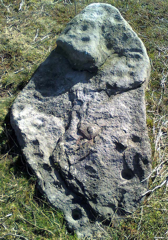
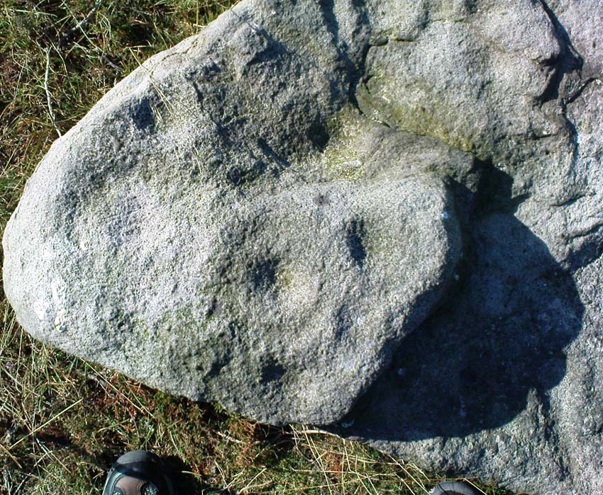
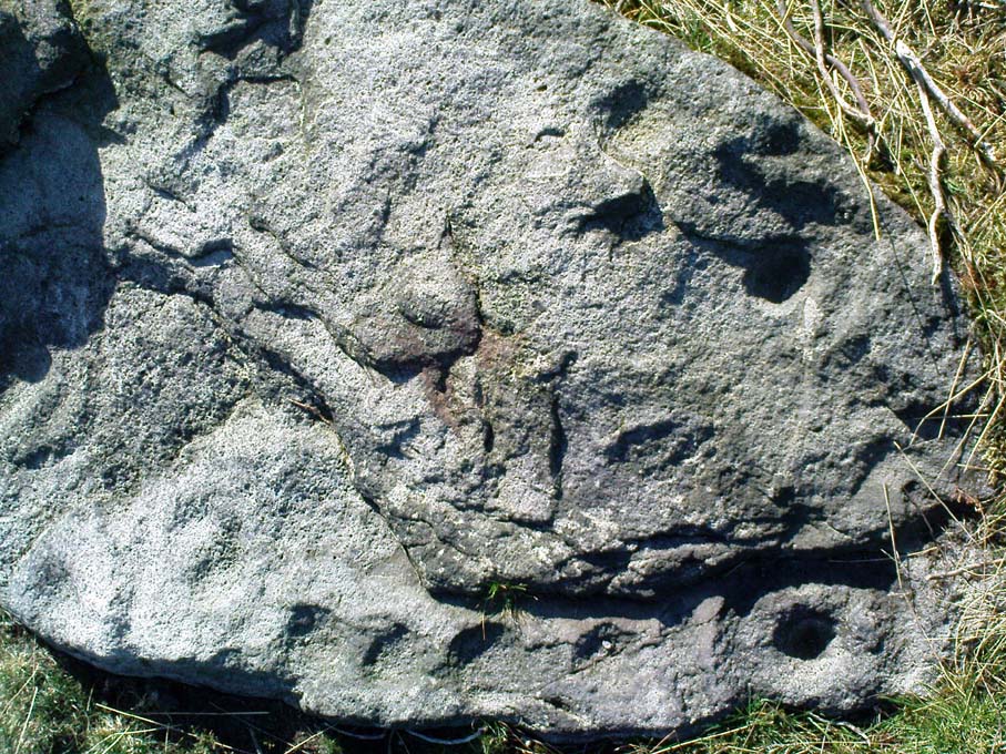
This is an excellent carving first recorded, it seems, by Stuart Feather in 1977, as cited in the Yorkshire Archaeology Journal’s ‘Listings’ for 1978. It can be found some 27 yards west of a prehistoric cairn near the top of the ridge (14 yards east of the same cairn is the Spotted Stone carving).
Lunar Stone carvingSoutheast section, with 3 cup-and-rings?
We have to assume that when Mr Feather first located this stone that the faint cup-and-rings on the topmost southeast section of the rock had been exposed to the elements from Day 1, so to speak: as the designs here are quite faint and well-worn. Another not unreasonable assumption is that Mr Feather then proceeded to dig away at the rest of the rock, exposing other features on the stone which had laid under the soil for countless centuries, as the northernmost part of the carving has minimal erosion effects on it. Indeed, unless this is true, we have to start thinking that the carving was made over quite lengthy periods of time, due solely to the greater and lesser effects of weathering on different sections of the stone.
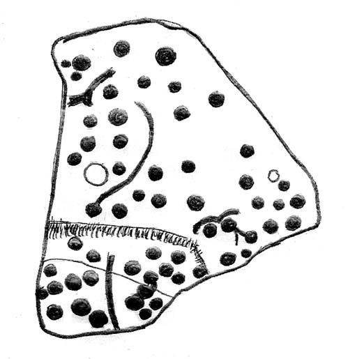
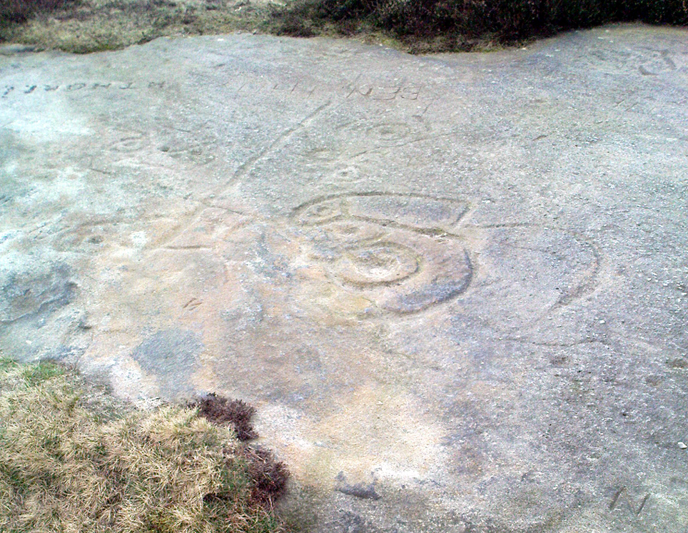
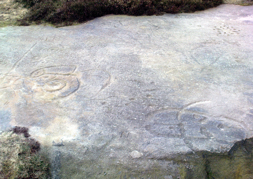
As seen in both the diagram and photos, this is a quite extravagent design. Consisting of several cup-and-rings, aswell as a double-ring, it is found amidst a small cluster of equally impressive, albeit very different carved rocks, all appearing to have a quite specific relationship with death and ritual. This and the other stones are found on the western end of a small serpentine ridge of land (Stanbury Hill), with streams flowing on the north and western sides and small remains of marshland to the south. The geomantic feature here, if relevant, relates to movements between the Earth, water, death and the setting sun: quite potent and important issues in the lives of the neolithic and Bronze Age peoples who lived hereby.
Northern section of carving – with calendrical cups?
The title of this stone carving — the Lunar Stone — should be quite evident: the design has all the hallmarks of celestial lunar movements around the ridge of the heavens; or here, pictured along the edges of the rock (symbolic of the firmament), upon and amidst which the moon travels in its rhythmic motion through the heavens. But don’t take that too seriously: it’s just an imaginative flutter that struck my otherwise distraught inability to know what I’m talking about!
References:
Hedges, John (ed.), The Carved Rocks of Rombald’s Moor, WYMCC: Wakefield 1986.
From East Morton village, take the moorland road, east, and up the steep hill. Where the road levels out there’s a right turn, plus (more importantly!) a trackway on your left which leads onto the moor. Go up here, past the top of the tree-line; on for another 100 yards or so, then turn left into the heather. You’ll notice the upright stone from the path, even if the heather’s deep. Check it out!
Archaeology & History
Todmoor Stone – looking eastTodmoor Stone – looking south
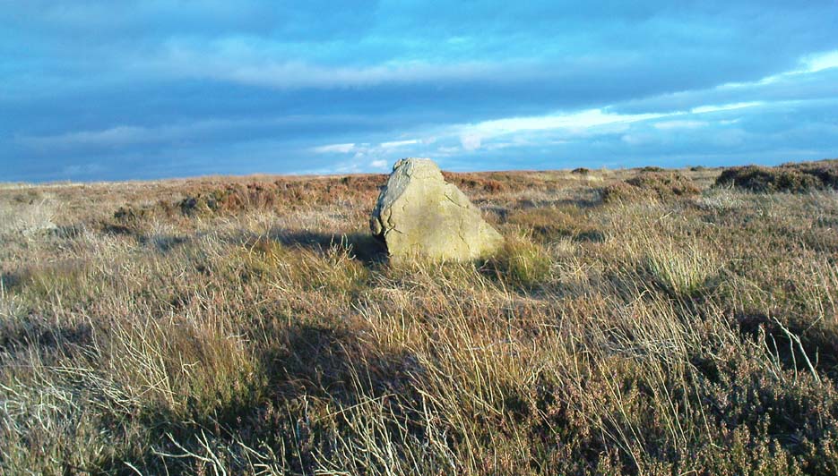
Nowt’s been said of this stone elsewhere — probably cos it’s in that halfway height between being classed as an authentic monolith, and that other of ‘dubious status’ (hence the reason I’ve highlighted this in inverted commas!). But an additional reason that this three-foot-tall stone needs describing is the close association it has with cup-and-ring stones very close by; along with some previously unrecognised prehistoric walling and at least one Bronze Age cairn some twenty yards to the north. We even find two distinctly archetypal ‘standing stone’ characters laid down in the heather 10 yards to the north, more than 4-feet long. It’s a good looking stone and has a chunkier upright bedfellow in the heather some twenty yards to the west. Along with the adjacent prehistoric remains here, the stone’s worth checking out!
The word Todmor was earlier spelt as ‘Todmerstones’ (1849) and is thought to relate to it being, in some form or another, ‘the boundary stones of the fox/es’. The nearest boundary line is about 100 yards west of here.
References:
Smith, A.H., The Place-Names of ther West Riding of Yorkshire – volume 4, Cambridge University Press 1961.
Head up to the Cow & Calf Rocks and walk to the large disused quarry round the back (west). You’ll notice a scattered copse of old pine trees on the edge where the hill slope drops back down towards Ilkley; and there, two raised hillocks (unquarried bits) rise up where the pine trees grow. The carvings are on the flat rocks atop of one of the two hillocks. If you’re walking up from Ilkley, once you’ve crossed the cattle-grid in the road and the moorland slope opens up above you, just walk uphill towards the copse of trees and watch out for the rock outcrop in the picture here.
Archaeology & History
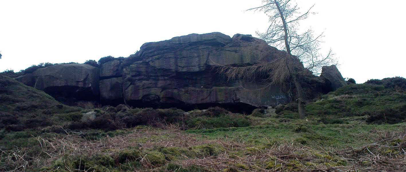
Very well-known to locals, folklorists and archaeologists alike, the remains of these old glyphs have caught the attention of artists, historians and Forteans alike for the images and tales surrounding them. It was obvious that in times past, that the carved remains that we see today would have extended considerably further, but the quarrying destroyed much of it. Indeed, we’re lucky to have this small section of carved rock still intact!
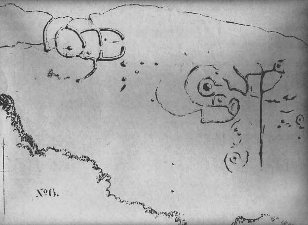
The rocks were first described as the Hanging Stones in the local parish records of 1645, and their name probably derives from the old-english word hangra, meaning ‘a wood on a steep hill-side,’ which is very apt here. The first known description of the site as possessing cup-and-rings appears to have been in a small article in the local Leeds Mercury newspaper in 1871. Several years later J. Romilly Allen (1879) wrote a lengthier descripton of the site:
“The crags from which these masses have been detached are known by the name of hanging stones, and at their eastern extremity is a large quarry. Between this quarry and the overhanging edge of the cliff a portion of the horizontal surface of the rock was some years ago bared of turf, thereby disclosing the group of cup and ring sculptures shown on the accompanying drawing. It will be seen that the design consists of twenty-five cups of various sizes, from 1 to 3 inches in diameter. Seven of the cups are surrounded by incomplete rings, many of them being connected by an irregular arrangement of grooves. The pattern and execution are of such a rude nature as almost to suggest the idea of the whole having been left in an unfinished state. The sides of the grooves are not by any means smooth, and would seem to have been produced by a process of vertical punching, rather than by means of a tool held sideways.”
Allen and other archaeologists from this period saw some considerable relevance in the position of this and the many other cup-and-rings along this geological ridge, telling:
“The views obtained from all points over Wharfedale are exceedingly grand, and this fact should not be lost sight of in studying remains that may have been connected with religious observances, of which Nature worship formed a part.”
J. Romilly Allen’s 1879 drawing of the carvingsWater-assisted double-ring on eastern rock
A common sense point that seemed long-lost to many archaeologists, adrift as they went in their measurements of lithics and samples of data charts for quite a number of years. In recent years however, this animistic simplicity has awakened again and they’ve brought this attribute back into their vogue. Let’s hope they don’t lose sight of it again!
There are tons of other archaeological references to this fine set of carvings, but none add anything significant to anyone’s understanding of the nature of the designs. We must turn to psychoanthropology, comparative religion and folklore if we want to even begin making any realistic ‘sense’ (if that’s the right word!) of this and other cup-and-rings. Curiously, the nature of this and other carvings is a remit archaeology has yet to correctly engage itself in.
Hanging Stones with “21st century informal unauthorised carvings”
On a very worrying note, we need to draw attention to what amounts to the local Ilkley Parish Council officially sanctioning vandalism on the Hanging Stones, other prehistoric carvings and uncarved rocks across Ilkley Moor. As we can see on a couple of photos here, recent vandalism has been enacted on this supposedly protected monument. Certain ‘officials’ occasionally get their headlines in the local Press acting as if they’re concerned about the welfare of the ancient monuments up here, but in all honesty, some of them really don’t give a damn. The recent vandalism on this stone and others has now been officially recognised as an acceptable “tradition” and a form of — get this! — “twentieth / twenty-first century informal unauthorised carving” and has been deemed acceptable by Ilkley Parish Council as a means to validate more unwanted carving on the moorland “in the name of art”! Of course, their way of looking at this has been worth quite a lot of money to a small group of already wealthy people. But with Tom Lonsdale and Ilkley Council validating or redesignated ‘vandalism’ as “twenty-first century informal unauthorised carvings”, this legitimizes and encourages others to follow in their shallow-minded ignorant footpath, enabling others with little more than a pretentious ‘care’ for both environment and monuments to add their own form of ‘art’ on cup-and-ring carvings, or other rocks on the moors.
Hanging Stones with more “21st century informal unauthorised carvings”
You can see in some recent vandalism — sorry, traditional “twentieth / twenty-first century informal unauthorised carving” — at the top-right of the Hanging Stones photo to the side, a very ornate ‘Celtic’-style addition, akin to the quality carved by well-known stone-mason Pip Hall who, coincidentally, has now been granted a lot of money to “officially” carve her own work on another stone further down the valley from here. With Miss Hall, Mr Lonsdale, poet Simon Armitage and Ilkley Parish Council each playing their individual part in encouraging what is ostensibly vandalism…errr…sorry – I keep getting it wrong – I mean traditional “twentieth / twenty-first century informal unauthorised carving” on the Hanging Stones monument and other cup-and-ring stones on the moor, we can perhaps expect a growth industry in this field…..especially if you’re wanting to make more money for yourself in the name of art or poetry. And if you apply to Rachel Feldberg of the Ilkley Arts Festival, you may get good money for your work… Seriously! (this is no joke either)
Please contact Ilkley Parish Council and other relevant authorities and express your dismay at their lack of insight and concern for the knock-on effects of their decisions on this matter. Other plans to infringe even further onto Ilkley Moor are in the business pipeline…
Folklore
Just underneath the carved overhanging rocks (walk off the knoll to the bottom of the rocks, facing the town), is a small recess or sheltered cavity which, told Harry Speight (1900),has
“From time immemorial (been) known as ‘Fairies’ Kirk’, and traditions of it having been tenanted by those tiny sprites, the fairies, still exist among old people in the neighbourhood.”
Tradition goes on to tell that when the Saxons arrived here, they were wont to build a christian church by the Hanging Stones, but the little people strongly resented this and fought hard against the invading forces. As the Saxons started building the edifice of the new religion, during the night the fairy folk took down the stones and moved them into the valley below. In the morning when the Saxons found this had happened, they carried the stones back up to begin building again; but each night, the fairy folk emerged and again took the stones to the valley bottom again. Eventually, after much hardship, the Saxon folk gave up the idea of building on the Fairie’s Kirk, as it was known, and the church that still remains in Ilkley centre was decided as an easier place to build their edifice.
Traditions such as this (of fairies moving stones back to whence they came, or away from ancient archaeological sites) are found throughout Britain and appear to be simple representations of the indigenous peasant hill-folk who strongly objected to their own sacred sites (rocks, trees, wells, etc) being supplanted by the invading religious force.
In more recent years the observation of curious light phenomena over these rocks have been seen, both over here and the Cow & Calf Rocks…
References:
Allen, J.R., ‘The Prehistoric Rock Sculptures of Ilkley,’ in Journal of the British Archaeological Association, vol.35, 1879.
Bennett, Paul, The Old Stones of Elmet, Capall Bann: Milveton 2001.
Bogg, Edmund, Higher Wharfeland, James Miles: Leeds 1904.
Collyer, Robert & Turner, J. Horsfall, Ilkley: Ancient and Modern, William Walker: Otley 1885.
Gelling, Margaret, Place-Names in the Landscape, Phoenix: London 2000.
Hedges, John (ed.), The Carved Rocks of Rombald’s Moor, WYMCC: Wakefield 1986.
Leeds Mercury, ‘Prehistoric Remains at Ilkley’, 20 April, 1871.
Michell, John, The Earth Spirit: Its Ways, Shrines and Mysteries, Thames & Hudson: London 1975.
Size Nicholas, The Haunted Moor, William Walker: Otley 1934.
Smith, A.H., English Place-Name Elements – volume 1, Cambridge University Press 1956.
Speight, Harry, Upper Wharfedale, Elliott Stock: London 1900.
Stone Circle (destroyed): OS Grid Reference – SP 470 464?
Also Known as:
Ringstone Well
Archaeology & History
In 1239 CE we find records of a field-name site called “Ringstoneswelle.” Although the place-name writer Margaret Gelling (1954) initially ascribed this as the watering-place of some dood called Hringstan, it is in fact the only record that I’ve found of a “stone circle by a well” in the village. This etymological root is confirmed in A.H. Smith’s English Place-Name Elements (vol.1, p.265) as a probable stone circle.
Folklore
There is also the curious field-name legend of a place in Cropredy called Kirk or Church Piece, where a christian church was being built, but in the morning all the stones had been uprooted & moved back from whence they came. This happened several times according to the folktale – a story that has with all the hallmarks of a megalithic site. (see Grinsell’s Folklore) To me it seems likely that the nearby Cup and Saucer Stone also had something to do with this lost stone circle.
In the same area we have another intriguing bit of folklore that was reported in an early edition of the Banbury Guardian (1932) which told that,
“on one of the top stones of a wall in front of one of the farmhouses is what is supposed to be the Devil’s footprint and there are nail-marks in the stone, but how it gots it name is a puzzle. At the back of the vicarage gardens is a small jetty called HellHole, the old ‘Old Man’ must have visited this village a time or two.”
Are there any local antiquarians or historians who can throw further light on this seemingly lost megalithic ring?
References:
Anonymous, ‘Cropredy and its Legends,’ in Banbury Guardian, December 29, 1932.
Bennett, Paul & Wilson, Tom, The Old Stones of Rollright and District, Cockley: London 1999.
Gelling, Margaret, The Place-Names of Oxfordshire – volume 2, Cambridge University Press 1954.
Grinsell, Leslie V., Folklore of Prehistoric Sites in Britain, David & Charles: London 1976.
Smith, A.H., English Place-Name Elements – Part 1, Cambridge University Press 1954.