Esholt Lane Carving, Esholt, Bradford, West Yorkshire

Cup-Marked Stone:  OS Grid Reference – SE 1743 3975

Also Known as:

  1. Carving no.10 (Boughey & Vickerman)

Getting Here

Seemingly not visible anymore, but directions given by a Miss N. Hutchinson in the early 1960s worked for me and Dave Pendleton when we checked this out at the end of our teens.  We had to look around till we found it, based on the following directions.  The carving was found “on top of a low dry wall on Esholt Lane, Esholt…on the stretch of road from the junction of Gill Beck with the River Aire to the stone-built barn on the left-side of the road, that is, going towards Esholt.”

Archaeology & History

Esholt Lane Carving, Bradford

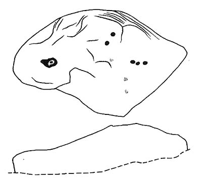
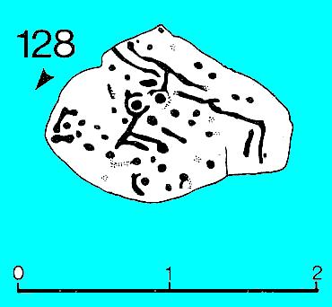
First described by Miss Hutchinson in a letter she sent to Sydney Jackson (1964), editor of Bradford Archaeology group newsletter.  When we first found this small carving (not far from where we grew up) we were at the end of our teens, and followed the directions cited in the Cartwright Hall Archaeology Group Bulletin (see above).  The carved design was typical of the primary arcs found in many of the Baildon Moor cup-and-ring carvings a bit further up the hill, but with two other small faint cup-markings on it.  According to Boughey & Vickerman (2003), the carving’s now been hidden in a section of walling that’s been rebuilt.  The drawing here is from one of my unpublished notebooks. (1984)

References:

  1. Bennett, Paul, Ramblings of Archaeological Remnants in West Yorkshire, unpublished: Shipley 1984.
  2. Boughey, Keith & Vickerman, E.A., Prehistoric Rock Art of the West Riding, WYAS 2003.
  3. Jackson, Sydney, ‘Cup-Marked Rock – Esholt Discovery,’ in Bradford Cartwright Hall Archaeology Group Bulletin, 9:4, 1964.

© Paul Bennett, The Northern Antiquarian

Skyreholme Wall Stone, Appletreewick, North Yorkshire

Cup-and-Ring Stone:  OS Grid Reference – SE 0772 6231

Also Known as:

  1. Carving no.413 (Boughey & Vickerman)

Getting Here

Skyreholme Wall Carving
Skyreholme Wall Carving (after Boughey & Vickerman)

Various ways here, but for the sake of newcomers I’d say it was best following directions from Burnsall.  From here, take the Appletreewick road thru the village, past the left turn a few hundred yards along, and another 500 yards or so there’s a split in the road: take the one on your right!  Follow this up, keeping right (don’t turn into Perceval Hall, tempting though it may be!) and park-up where the road turns into a track.  Walk up the track, past the haunted junction, bearing left uphill up Black Hill Road until you reach the very peak of the track where, in the walling on your left, you’ll see this big boulder.  If you can’t see it, you’re bloody close!

Archaeology & History

This is at the very peak of Black Hill Road, with excellent views of Simon’s Seat climbing to the immediate south, the prominent and rounded Nursery Knot Hill immediately north, and grand views to peaks east and west. It is very likely this position had something to do with it being deemed worthy of relevance.  The rock itself defines a point along the old boundary line.

Skyreholme Wall Boundary carving

One peculiarity on this boulder is the deep cup-mark with a strange ‘lip’ to it, which has been mentioned by others in the past.  This is surrounded by at least five others cups — not dissimilar to some of the ‘rosary-designs’ of cup-and-rings further north.

The rock art student’s Boughey & Vickerman’s (2003) drawing of this design is pretty accurate — where they call it stone 413 — though it doesn’t actually give this carving the justice it deserves.  They also erroneously tell that some of the cups here are doubtful.

Check it out for y’self.  This is an excellent stone for cup-and-ring lovers! (with plenty of other sites scattered about all round here)

References:

  1. Boughey, Keith & Vickerman, E.A., Prehistoric Rock Art of the West Riding, WYAS 2003.

© Paul Bennett, The Northern Antiquarian


Currer Woods Stone, Steeton, West Yorkshire

Cup-and-Ring Stone:  OS Grid Reference – SE 0251 4384

Getting Here

On the opposite side of the road (B6265) from Airedale General Hospital, Steeton, you’ll notice a footpath going up the field into some woods.  Go up here.  Once you come out the top of the woods, follow the dodgy path on your right (west) along the rocky edges for 250 yards, following the edges of the field walling.  You’ll eventually reach the field with lots of rocks in it.  It’s the field before this one, close to the walling.  Look around!

Archaeology & History

I’ve been a little cautious about putting this carving on TNA simply because it seems to be an isolated example and was a little unsure about its veracity.  If I’d have found the stone on the edges of Ilkley Moor, Rivock Edge, or the heights above Askwith, I wouldn’t have hesitated.  The fact that no other carvings occur nearby has been my main trouble.  But I suppose if the carving turns out to be nowt of the sort, I can discard it at a future date and, of course, make sure that a lot of other cup-and-ring stones are disregarded at the same time (there are a number of other designs much less defined than this one which have been okayed by archaeo’s who’ve been into this subject for much shorter periods of time than myself).  But less of the waffle!

Currer Wood Carving, Steeton

When we first found this, in April 2009, I was out looking for the remains of an old well (called Jane Well, a few hundred yards west of here).  The heaven’s opened and I ended up in the woodland and then found the field full of large rocks, some seemingly used by man in more recent centuries, atop of the woods, and so had to check them out!  But this was one of the first stones we found.

Currer Woods Stone
Currer Woods Stone

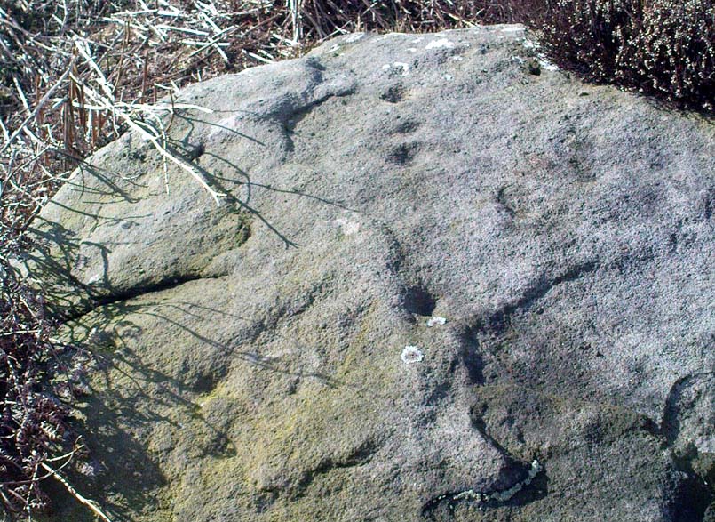
The rock itself, as the photo shows, appears to have had one end of it split or broken off (not unlike one edge of the Hanging Stones, Ilkley Moor) at some time in the past, intruding on the arc, or line, beneath which are two distinct ‘cups’.  A possible third cup-marking and other linear aspects seem apparent, with the design giving the distinct impression of a face.  I keep meaning to go back and get a rubbing of the carving, but aint got round to it yet.  When (if!) I gerrit done, I’ll add it onto this profile.

And although there are said to be no other prehistoric remains close to this old carving, the fields a coupla hundred yards west used to be called the Barrow Fields, where tombs were once found; and a little further along the same geological ridge atop of the excellent Kirk rocks, possible cup-markings scatter the edges of two sections — but they’re a little dubious; then there’s the Dragon Stone and associated cup-marked stone not far away.  In the adjacent woods are the remains of old walling, but I’ve not found other carvings hereabouts.  However, the rule tends to be: “where there’s one, there are more!”

Watch this space!

© Paul Bennett, The Northern Antiquarian

Pathway Stone, Holden, Silsden, West Yorkshire

Cup-Marked Stone:  OS Grid Reference – SE 07021 44884

Also Known as:

  1. Rough Holden CR-9

Getting Here

Pathway Stone, Holden, Rivock

Follow the footpath running from the Rivock TV mast northwest, where it cuts diagonally across the field, heading towards the drystone wall.  About 200 yards before the walling – stop! It’s just to your right-hand side, very close by!

Archaeology & History

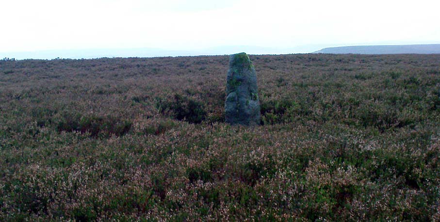
First discovered in July 2009 when Keighley volunteer, Michala Potts of Bracken Bank, did further ramblings amidst the long grasses hereabouts.  Its name comes from the fact that it’s found just next to the footpath that cuts across Rough Holden from the TV mast beneath Rivock.  The carving’s a very simple plain design, as the photos show, with just three faded cup-markings etched onto the stones northeast face.

Close-up of cup-markings

This stone aint too far from the cup-marked Dump Stone and the nearby Rough Holden design, but all across the Holden Rough grasslands are the faded remains of old pit-workings.  It makes you wonder just how many other carvings once existed across this flatland.  The fact that this and the other ones nearby still remain is damn fortunate!

© Paul Bennett, The Northern Antiquarian

Balnakeilly Stone, Moulin, Pitlochry, Perthshire

Standing Stone:  OS Grid Reference – NN 9463 5943

Getting Here

As you go through Pitlochry’s main street, watch out for the right-turn up the A924 road.  Go up here for perhaps a mile.  You’ll know you’re getting close as you pass the Moulin pub and the seeming avenue of trees opens on either side of the road.  A coupla hundred yards up into the trees, there’s the left-turn up the Balnakeilly driveway.  Stop! It’s on your left.

Archaeology & History

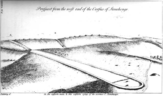
The Balnakeilly Monolith

Knocking on for nine-feet tall, there’s some debate as to the archaic authenticity on this standing stone.  Ian Armit and his mate (1998) certainly wondered whether this was an ancient stone or not and, gotta say, when I came up here a coupla weeks back, I got the same impression.  It doesn’t have that feel about it which comes from the real olde ones; but this could be due to it having been moved in the not-too-distant past.  Though when Alan Reid wrote about it in 1911 he told us that,

“it bears marks of having been…worked slightly into shape by some pointed tool whose traces are plainly seen on several of its angles.”

Not something you’d find on monoliths that are a few thousand years old!  But if this stone was moved when the entrance to Balnakeilly drive was done, or the road widened, this could account for such markings.  We could do with digging into any archives that may exist about Balnakeilly or the Pitlochry roads to see if there’s any record of this stone to end the debate once and for all.  Tis a good site to visit though – check it out!

References:

  1. Armit, I. & Johnson, M., ‘Balnakeilly (Moulin parish), ‘modern standing stone’,’ in Discovery and Excavation in Scotland, 1998.
  2. Reid, Alan, ‘Monumental Remains in Pitlochry District,’ in PSAS 46, 1911-12.

© Paul BennettThe Northern Antiquarian


Hollin Tree Hill, Askwith Moor, North Yorkshire

Standing Stone:  OS Grid Reference – SE 16611 50818

Getting Here

Follow the directions to reach the Man Stone carving.  Walk up the sloping hillside from there until you reach the top.  From there, walk down the slope heading slightly to your left.  You’ll find it!

Archaeology & History

A small upright stone, less than three feet tall, but once a little taller as you’ll see that it’s head has been knocked off in the not-too-distant future and lies on the ground by its side.  A small scatter of what seems like possible cairn-material lies around its base, but not enough to imply that a tomb of any sort was ever here (aswell as that, the position on the slope seems wrong).

A curious little thing, without archaeological companions.  When we came here the other day, we explored the ground all round the stone as all the heather had been burnt back; but there was nothing anywhere near it to give a hint as to why it stands here, alone, at what seems like a strange spot two-thirds the way up a moorland slope. It’s been speculated that in the middle of its more north-facing side there is a cup-mark on it, but this is very dubious and, in my opinion, should be discounted as such.  The marking is a gun-shot wound – and more recent ones have just been added, as seen  in the photo.

© Paul Bennett, The Northern Antiquarian

Yarmer Head, Nidd, North Yorkshire

Standing Stone (destroyed):  OS Grid Reference – SE 299 612

Also Known as:

  1. Temple Yarmer

Archaeology & History

It was the legendary Harry Speight who described this in his monumental historico-topographical exploration of the Nidd valley in the 1890s.  Nothing else, it seems, has been said of the place, though something of considerable archaeological importance was once here.  Not only does he tell of the previous existence of “a large circular enclosure…the outer ditch having a circumference of nearly 1000 yards” at Yarmer Head, but,

“In the hollow on the east side of this hill was formerly a large natural marsh or lakelet, near which remains the base of an immense menhir or standing monolith, erected doubtless in heathen days to commemorate a great victory, or perhaps a treaty.”

The stone is not shown on the early OS-maps (although they did miss quite a lot of sites), and whatever its reason for being here might never be known as all traces of this giant monolith appears (yet again) to have vanished. There is an ancient boundary line immediately below the hill, on its eastern side, so perhaps the stone was an ancient marker along this.  Do any local folk round Nidd know owt more about this once important megalithic site?

References:

  1. Speight, Harry, Nidderdale and the Garden of the Nidd, Elliot Stock: London 1894.

© Paul Bennett, The Northern Antiquarian

Dump Stone, Holden, Silsden, West Yorkshire

Cup-Marked Stone:  OS Grid Reference – SE 0705 4490

Getting Here

Top view of cup-marks

Follow the same directions as to reach Holden’s Buttock Stone, then north over the field and through the gate towards the Rough Holden Carving.  As you approach here, keep your eyes peeled for a clump of boulders a little further down the field which stand out.  That’s where you wanna be!

Archaeology & History

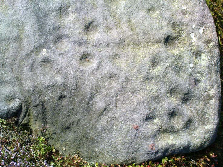
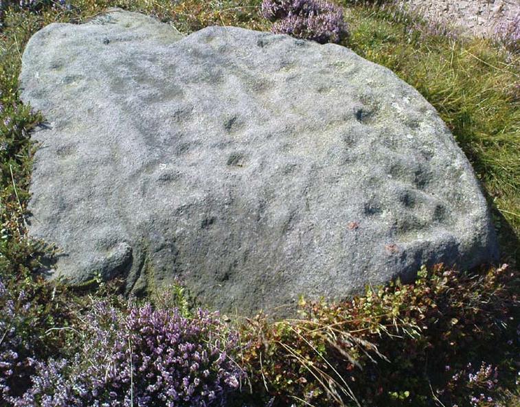
Found by the old Keighley volunteer, Michala Potts of Bracken Bank, a few weeks back (Friday, June 12, 2009), this previously undiscovered cup-marked boulder is amidst a scatter of boulders piled-up with each other following a field-clearance in recent years.  It doesn’t seem to be in its original position, but obviously came from the fields hereby.

Cup-Marks on vertical face
Side view of cup-marks

The first view we got indicated 2 or 3 cup-markings on its upper surface; but then as we wandered round it and the adjacent rocks, it seemed that several others appear to have been etched on the vertical face, as shown in one of the photos.  The light wasn’t too good by the time we found this (it was one of those days where cloud and sun kept the cup-marks hidden at times!) and then a drizzle came along and stopped a sketch of the stone.  But it’s obvious there are 3-4 cup-markings on the upper surface and at least 3 carved on its side.  Next time up there we’ll hopefully get better light!

One of the land-owners or tenant farmers hereby has little respect for the prehistoric remains in this area and, in all honesty, I’d expect a number of the petroglyphs to be destroyed in the coming years.

© Paul Bennett, The Northern Antiquarian

Torrisholme Barrow, Morecambe, Lancashire

Tumulus:  OS Grid Reference – SD 4596 6425

Getting Here

Various ways up this old hill, visible from all angles it seems.  I came up via the housing estate near where us friend lives, near Bare Lane Station, through the houses and up the footpath.  But you can just as easy (if not easier) walk up from the country lane and fields beneath its eastern side.  Much nicer!

Archaeology & History

Torrisholme Barrow
Torrisholme Barrow

As many northerners will tell: gerrin information from the Lancashire archaeologists about prehistoric sites is troublesome (must be Southerners running the show!).  There’s tons of stuff in this good county, but archaeo-info is pretty poor on the ground.  This great old tomb for example, is designated as a “round barrow” on the Lancashire County Council monuments and records listing, but there’s no other info telling when it was dug, who by, the size of the tomb, what was found here, etc.  Pretty poor to be honest (c’mon chaps – get yer fingers out!).  The best info on-line comes from the more dedicated amateur enthusiasts.

A local historian told us that there was nowt up here, but my nose told me otherwise — so up we tramped!  It was pretty obvious once we’d got to the top here, that some ancient mound had been built up.

“This has all the hallmarks of a tomb,” I said.

Torrisholme Barrow, looking SW

The spirit of the ancestor herein (whoever s/he was) had excellent views and flights to numerous important hills 360° all round here.  A perfect place for a tomb! And when we returned into the Darklands of our Yorkshire abodes, we found this notion to be true.  Marked on early OS-maps as a tumulus, next to the tell-tale giveaway route of Barrow Lane, there are passing mentions of it in a couple of old local history books I’ve come across, but I’ve yet to find much more about it.  It’s a fine mound and of decent size, well worth checking out if you’re in the area.  Once I get more details of the archaeological finds from here, I’ll add the data to TNA (but based on past performances and responses from Lancashire archaeo’s, I wouldn’t hold your breath…)

And for any Morecambe historians who might be able to find more: what — if anything — is known of the ‘Fartle Barrow’, now swallowed by the encroachment of the sea, just a few hundred yards west of here?

Early OS-map showing barrow

Folklore

In days of olde, this site was an old moot or meeting hill: one of the northern Law or council meeting hills.  Quite how far back this gathering tradition up here goes, aint known.  We do know however that there was a christian tradition enacted here, at Easter, of local church doods taking a cross up the top of the hill (does anyone know the story behind the old Cross Hill, half-a-mile south of here?).  There’s obviously quite a lot more pre-christian activities occurrent round here than has been previously thought.

© Paul Bennett, The Northern Antiquarian

Cunninghar, Tillicoultry, Clackmannanshire

Stone Circle (destroyed):  OS Grid Reference – NS 9256 9709

Also Known as:

  1. Druidical Temple

Archaeology & History

A stone circle was once to be found on the elevated piece of ground above the north-side of the main road between Tillicoultry and Dollar, but it was sadly destroyed sometime in the 19th century.  Listed in Aubrey Burl’s (2000) magnum opus, we have very little information about the place; though an account of the site was described in the Scottish Royal Commission report (1933) which told us that a —

“Stone circle, measuring about 60 feet in diameter, once stood here but was completely removed many years ago, when the stones, which are said to have been 5½ feet in average height, were taken to cover a built drain at Tillicoultry House”!

Site shown on 1866 OS-map
Stone at the destroyed site

Unbelievable!  Any decent local folk nearby wanna find out where this drain is, see if the stones are visible (though I doubt they are), so we can plan to uproot it and move the stones back somewhere nearby. There are a few decent spots on the slopes above where it would look good!

When visited by researchers in the 1890s, parts of an embankment which surrounded the destroyed circle were still visible.  Also, indicating there was some ritual funerary nature to the site, a local teacher called Mr Christie found the remains of an ornamented urn protruding through the ground next to where one of the monoliths had stood.  Unfortunately in his attempts to remove the urn, much of it crumbled away.

Further examinations thereafter found that a burial was (seemingly) beneath the centre of the circle; and excavations here found that a covering stone of the tomb was covered in intricate cup-and-ring designs (see the Tillicoultry House Carving for further details).  Other prehistoric remains were found a little further up the hill from here.

References:

  1. Burl, Aubrey, The Stone Circles of Britain, Ireland and Brittany, Yale University Press 2000.
  2. Morris, Ronald W.B., The Prehistoric Rock Art of Southern Scotland, BAR 86: Oxford 1981.
  3. Robertson, R., ‘Notice of the Discovery of a Stone Cist and Urns at the Cuninghar, Tillicoultry…’, in PSAS 29, 1895.
  4. Royal Commission on the Ancient & Historical Monuments of Scotland, Fife, Kinross and Clackmannan, HMSO: Edinburgh 1933.

© Paul BennettThe Northern Antiquarian