Cup-and-Ring Stone: OS Grid Reference – NN 81305 44422
Getting Here
From Kenmore go east up the steep mountain road towards Glen Quaich, or if you’re coming from Amulree, go west along the same glen. After 2½ miles (4km) up the Kenmore route (nearly 9 miles on the Amulree route) you’ll reach a small lochan on your left (you’ve got a very small parking spot a coupla hundred yards before the loch). A gate and stile past the loch takes you east along a track into the moors. More than a mile on, the track splits, but you need to keep to the left and follow the track along the wall-side for another 400 yards or so, where you’ll see a small crag of rocks 100 yards down the slope on your right. Once here, the deformed triangle-shaped stone to the left-side of the cluster is the one you’re looking for.
Archaeology & History
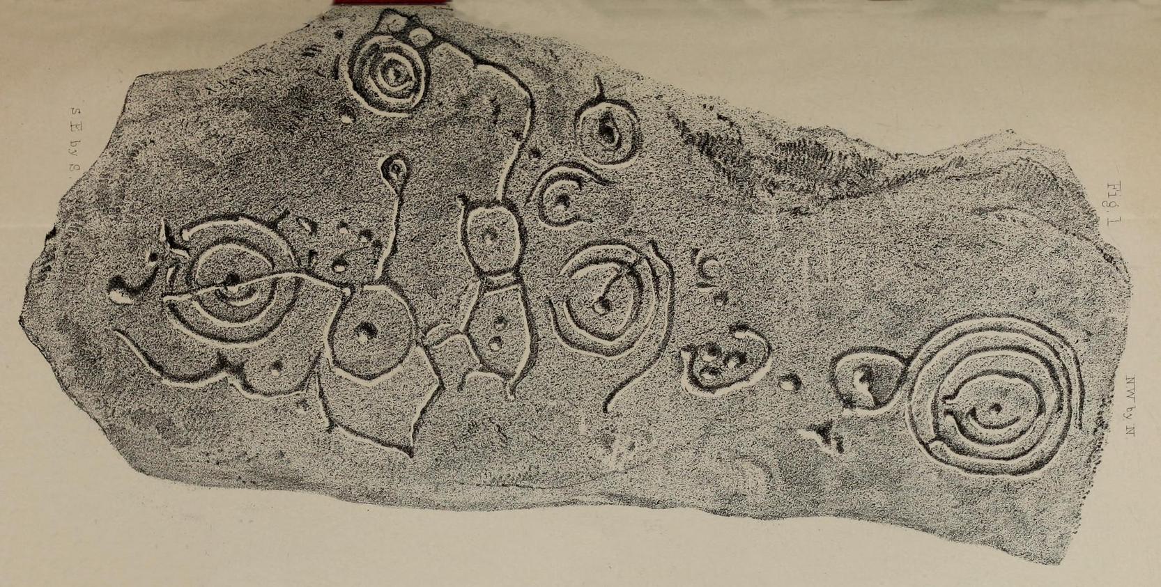
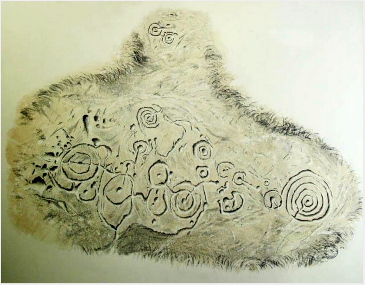
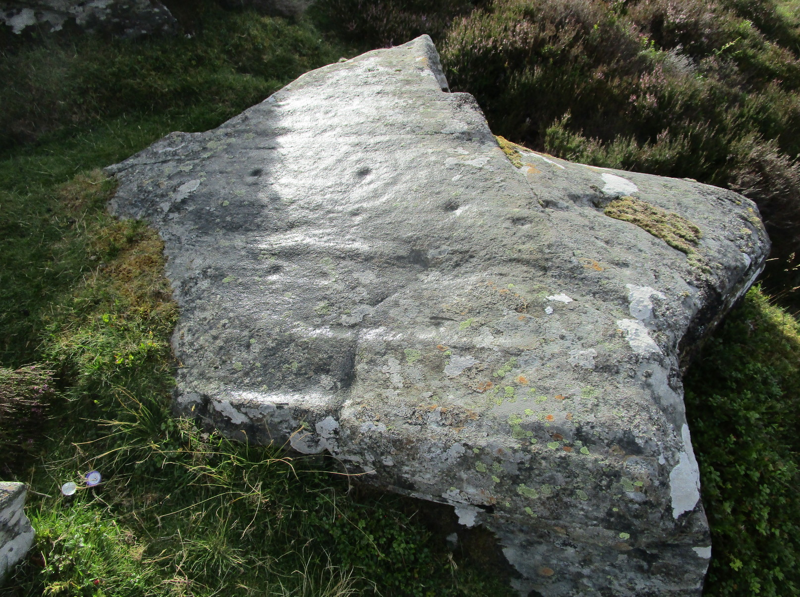
About four yards west of the Craig Hill cluster (3) carving, this gently smooth sloping rock was initially noted to have between six and seven cup-marks on it. Under the grey skies it was difficult to see any of this clearly, and so we wet the surface when Nature gave us some short bursts of light through the clouds which then enabled us to get a much better look at the design—but it’s still far from clear.
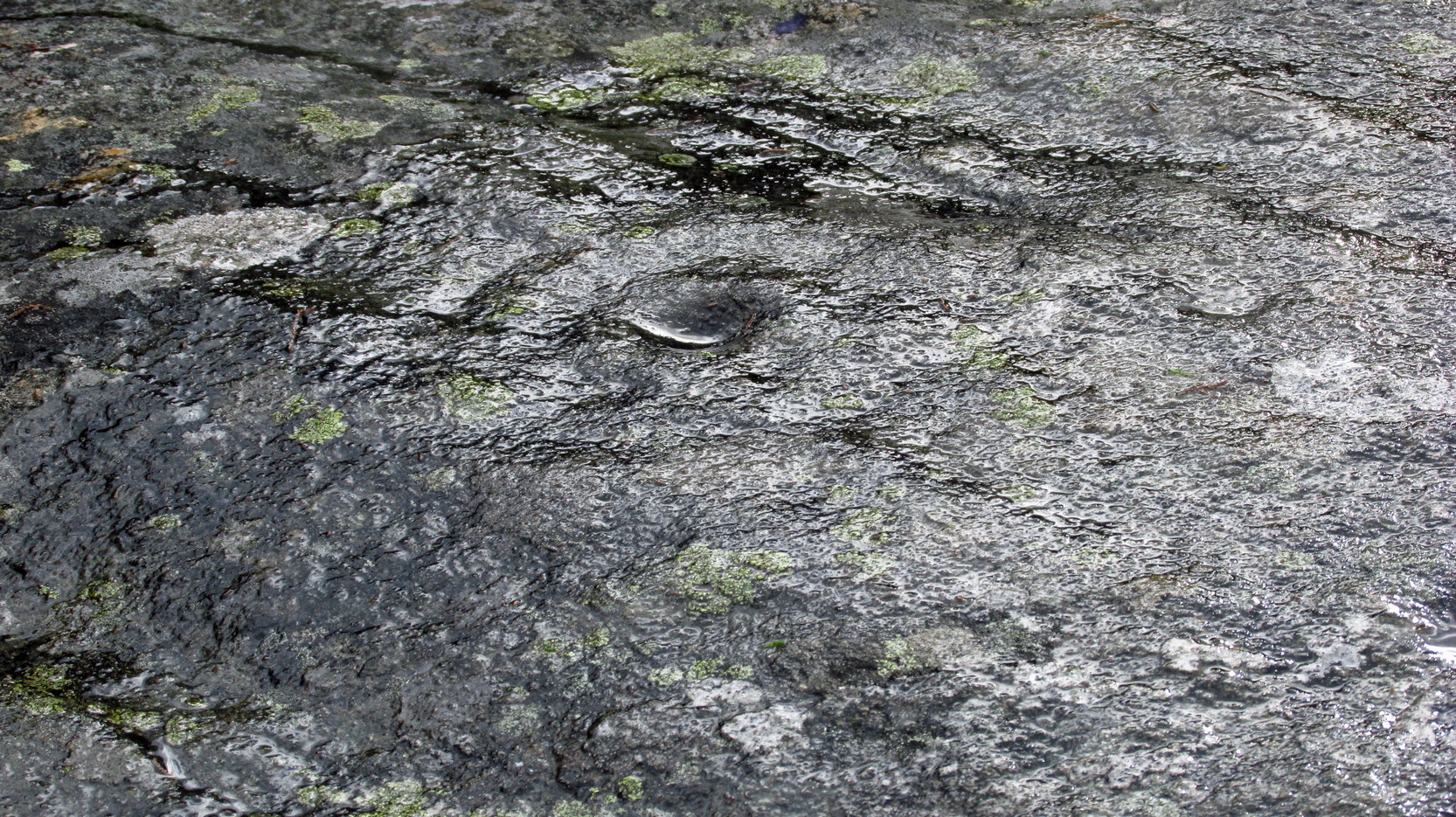
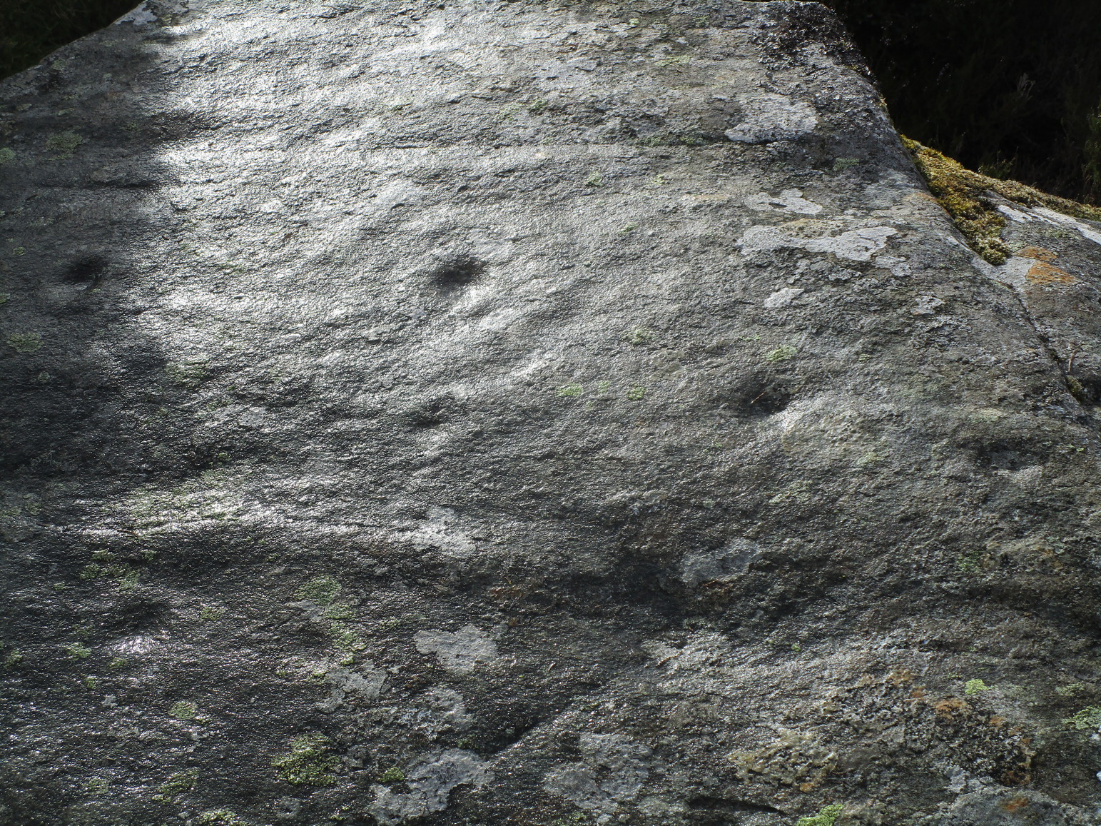
We found at least eight cups on here, two of which had single rings: the one near the top of the stone seems to be complete, whilst the other nearest the bottom of the stone looks to be incomplete. Another cup had a curious double ring; whilst the one nearest the middle of the stone has what may be three rings, with what could be a carved line running from its centre—but it’s very difficult to say with certainty until we’ve made another visit. I have little doubt that there’s more to this petroglyph than we could make out beneath the grey skies. On the west-side of the stone, the “curious” double-ring has, as its outer surround, an “eye” motif, or lozenge, which is also found on the Craig Hill cluster (3) stone a few steps away. The eye motif on both stones have the same levels of erosion and, I would suggest, were carved within a century or two of each other; perhaps even around the same time.
This one’s well worth checking out!

Acknowledgements: Huge thanks to Prof Paul Hornby for use of his photos in this site profile; and to Myrna Hurley for getting us up there. Cheers doods. 😉
© Paul Bennett, The Northern Antiquarian