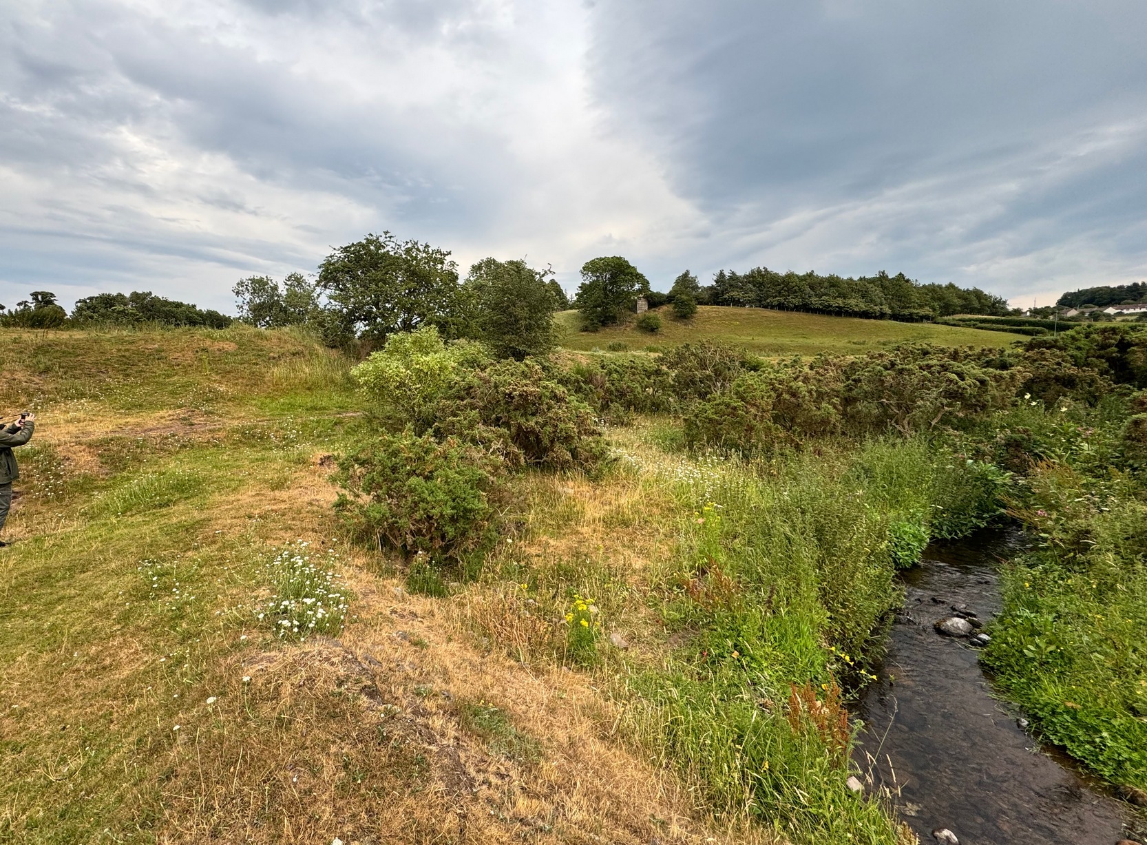
From Wooler High Street, walk east past Market Place and then down The Peth, across the A697 road, go over the river bridge and then left up the long dead straight Brewery Road. It bends left about half-a-mile up and just over 100 yards past the bend (just where another sharp bend in the road occurs), make sure to take the hidden footpath that runs into the shrubs. 700 yards along, the path levels-out as you hit the edge of the moor and you reach a ‘crossroads’ of paths. Bear left (NE) and walk another 800 yards (past a gate or 2) where you hit a small woodland; keep walking straight along the same path until you hit the next copse of trees on your left, and here walk sharp right, through the field for 300 yards (past some more trees), through the gate and another 100 yards or so through the next gate. Ahead of you is a covered rocky ridge with some gorse bushes. Look around!
Archaeology & History
…from another angle
We were fortunate on our first visit here. For, in spite of what several tomes and local guides have said of this carving—i.e., “the site is hard to find as it’s covered by gorse bushes”—local folk have cleared it and made it accessible and much easier to find. Thank fuck! For on the day we came here, in spite of considerable cloud cover, it was very hot and humid—and the last thing I needed was working to rummage through vegetation on a day like that!
It was certainly in a crappy state when the old rock art writer Maarten van Hoek (1982) came here: “covered by sheep dirt” as he called it! But he cleaned it up – and thankfully the tradition amongst the local folks continues.
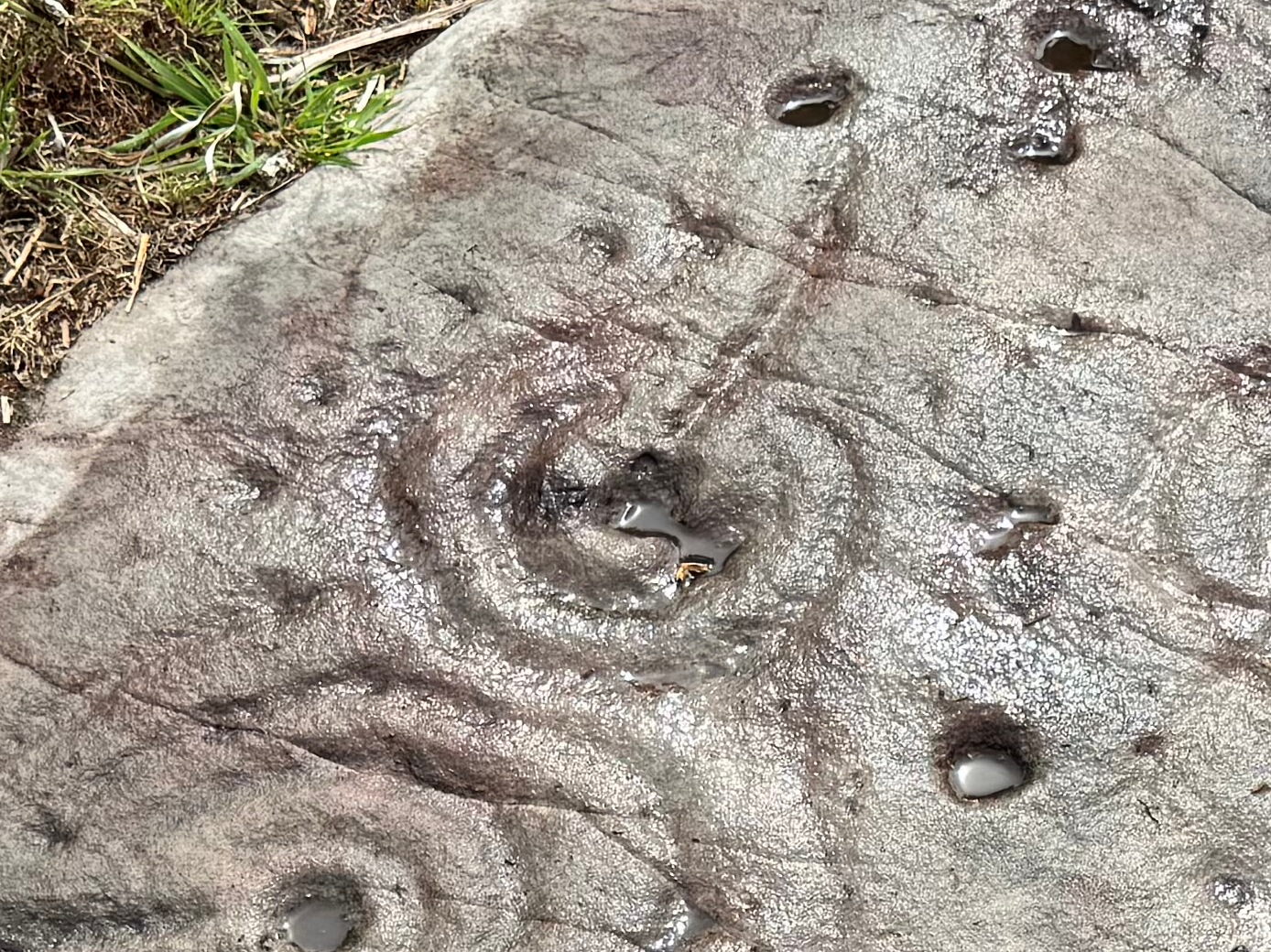
Arc of cups & double-ringClose-up of main design
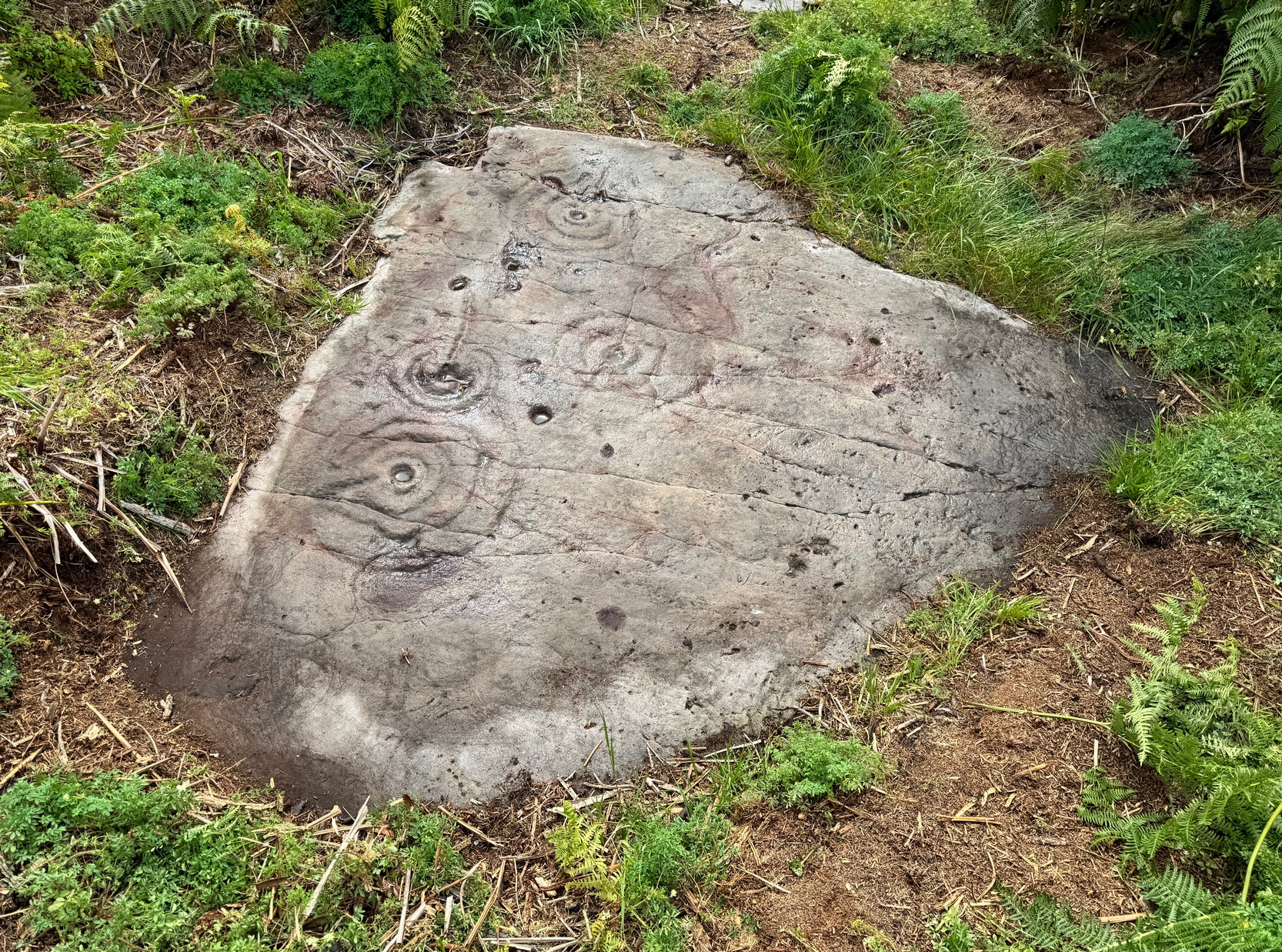
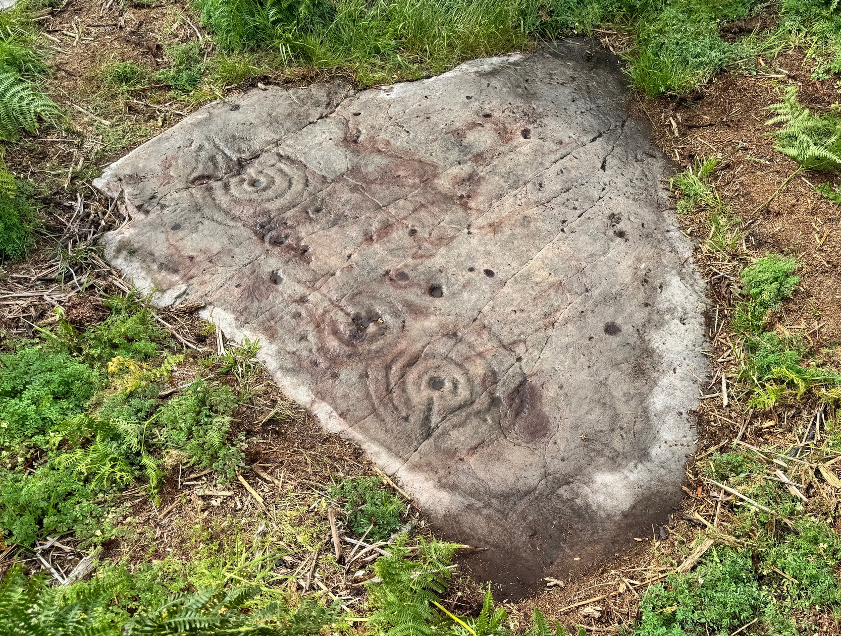
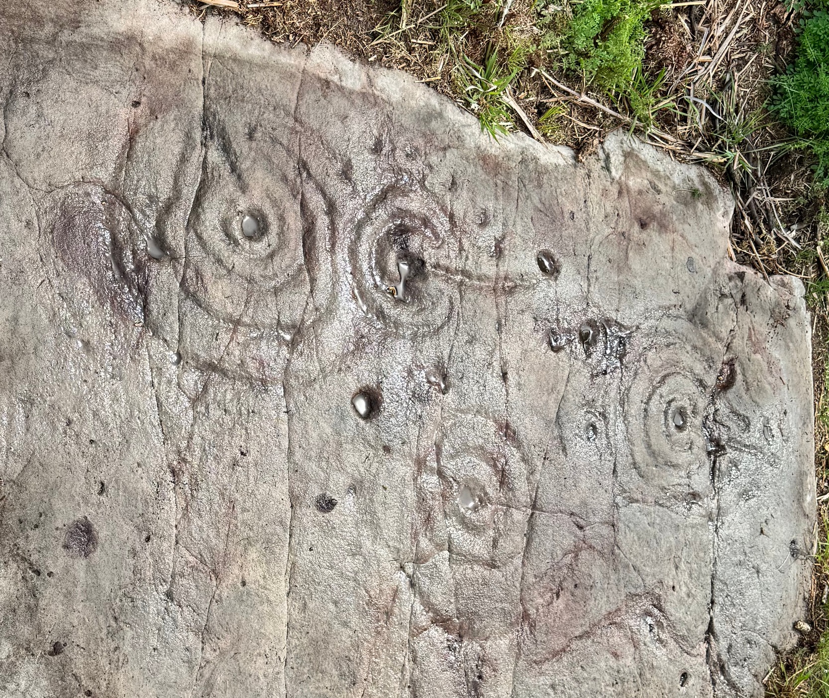
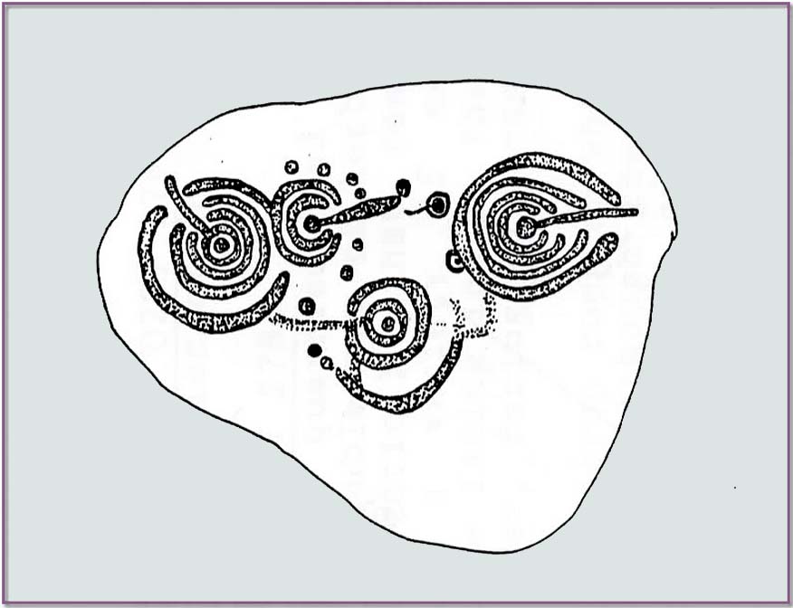
Cut into a rounded triangular-shaped flat rock are a series of multiple cup-and-ring designs, each with lines running in various directions to, or from, the central cup-mark. One of them—the smallest of the lot near the top-middle of the stone—is an incomplete double-ring, and all round the outer south- and western edge is a semi-circle of eight or nine cup-marks which, from my unconscious mind, brought about feelings of lunar phases defined by the cups as the Moon moved through the heavens—and then back on itself along the same movements through the skies. This simple ‘flash’, so to speak, was the unconscious of my youthful astronomical mind that brought it to the fore—and although ‘time’ in the neolithic was defined by the Moon (menstrual rites & all…), this impression, this ‘dreaming’ lacks consensus recognition and so, in the social Darwinian paradigm of modern archaeology, would be promptly put to bed! I still like the impression though; but it begs the question as to what mythos might underlie the rest of the design!
No such impression seems to have hit Maarten van Hoek (1982) upon his visit here. He described the carving thus:
van Hoek’s 1982 sketchBeckensall’s 1991 sektch
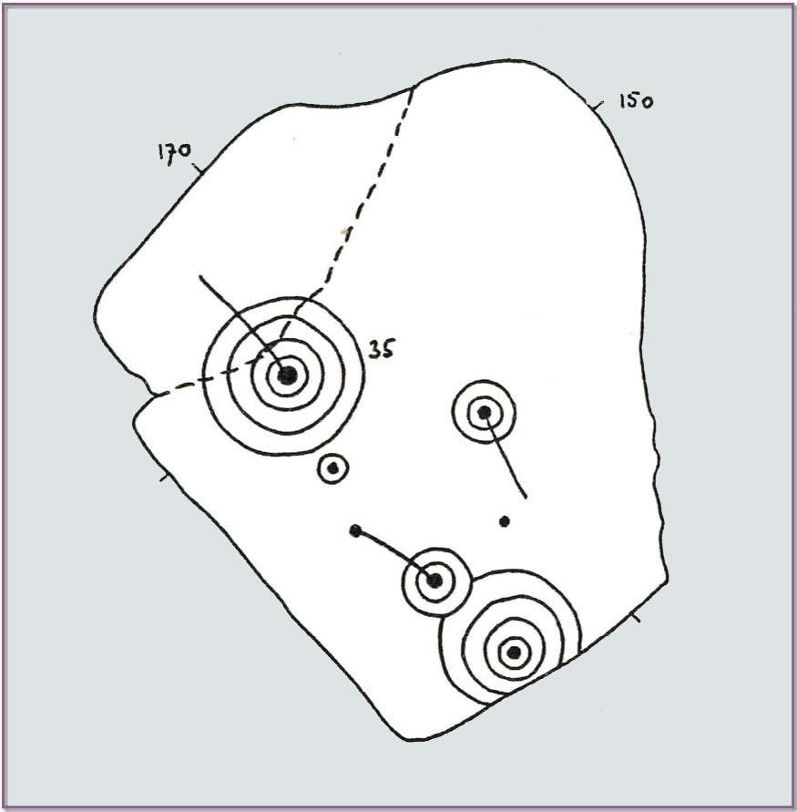
“7 cupmarks, 5 of them surrounded by rings. On the N part is a cup and 4 rings with a tail from the cup running to the NW. Through this carving runs a large crack in the rock. Almost touching its outer ring to the S is a small cup and 1 ring. Further E is a cup and 2 rings with a tail from the cup running SE. Near the end of this tail is a single cupmark.
On the S part is a more complex figure: it is a cup and 4 rings, the two outer rings broken off at the edge of the rock. The outer ring is gaped to the NW to enclose the outer ring of a cup and 2 rings. From the central cup of this cup and 2 rings runs a tail to the NW ending in another cupmark.”
On van Hoek’s visit, it was obviously a cloudy grey day, as there are some obvious ‘extras’ on the design that he missed (somehow missing the distinct arc of cups surrounding the double-ring for one thing!). Beckensall (1983) wrote about the carving a year later and picked-up on the omissions, and subsequently updated the details in his later (1991) tome—as we can see from their respective drawings (above); although he too missed a cup or two along the same arc. It’s easily done…
References:
Beckensall, Stan, The Prehistoric Carved Rocks of Northumberland, Frank Graham: Newcastle-upon-Tyne 1974.
Beckensall, Stan, Northumberland’s Prehistoric Rock Carvings – A Mystery Explained, Pendulum: Rothbury 1983.
Beckensall, Stan, Prehistoric Rock Motifs of Northumberland – volume 1, Abbey Press: Hexham 1991.
Beckensall, Stan, Prehistoric Rock Art in Northumberland, Tempus: Stroud 2001.
van Hoek, Maarten, The Carved Rocks near Wooler, privately printed: Oisterwijk 1982.
Cup-and-Ring Stone (lost): OS Grid Reference – NT 98491 28424
Archaeology & History
Highburn House C&R, 2015
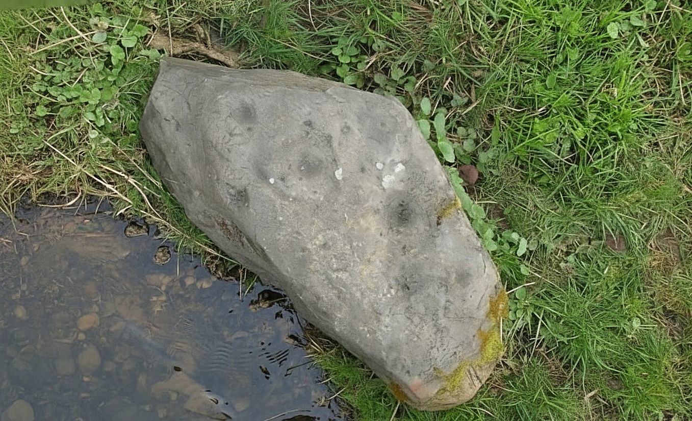
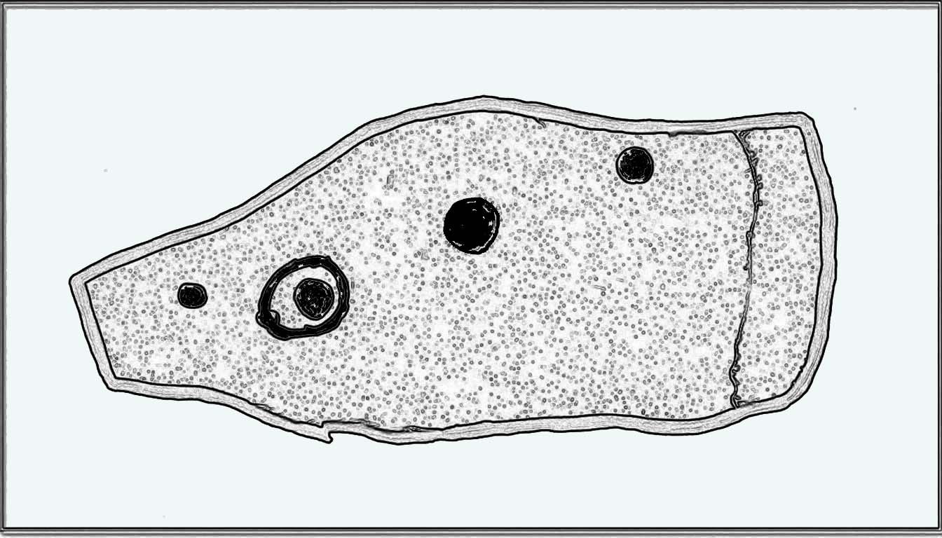
This carving was rediscovered by rock art explorer Jan Broewer in September, 2007, a few hundred yards out of Wooler on the way to Akeld and Kirknewton, in the field on the right-hand side of the road, on the embankment just a few inches above the waters of the High Burn. On a recent visit here by Tom Cleland and I, despite us rummaging amidst the gorse and other herbage all along the edge of the waters, we were unable to locate the carving and presume that it has either been destroyed or re-housed in someone’s garden, living a more comfortable life. We certainly hope it’s the latter!
Sketch of the designHome of the lost carving
It’s design is nothing special: merely a singular, albeit scruffy cup-and-ring, with two other distinct pecked cup-marks and, possibly, a third shallow one just to the side of the cup-and-ring (but this is, in my opinion, highly suspect). The stone was obviously not in its original position when Jan first found it, and would seem to have come originally from the slope above the stream where a number of earthfast stones can be found. The numerous scratches across its surface shows that it’s been hit a few times by some (probably) metallic objects, or perhaps horses hooves, thus dislodging it from the slope above and rolling into the spot where Jan found it. Anyhow, we presently don’t know where it is or what’s become of it. Does anyone in Wooler know where it’s living?
Acknowledgements: Huge thanks to Pete Chattaway for use of his photo; and to Tom Cleland for helping the search party!
We took the B6348 road up east, from Wooler, turning left 2 miles up and crossing the small river bridge, going past Weetwood Hall where the road bends to the right and goes uphill for about a mile where, just before West Horton farm, there’s a a dirt-track on your left. 200 hards up, walk past the farm up and along the dead straight track for another 400 yards until you hit the field. Diagonally ahead of you (NW) less than 100 yards away, a small hillock rises in the field where a large metal animal feed-trough sits. Once there, the slope to your right (east) is where the stone lives. If you potter about you’ll find it.
Archaeology & History
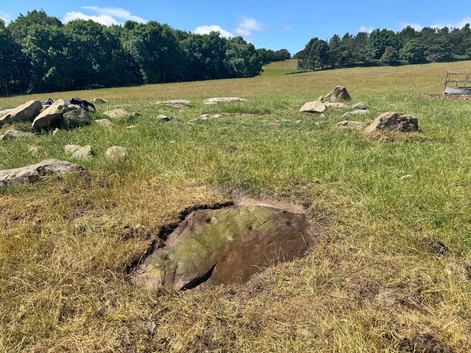
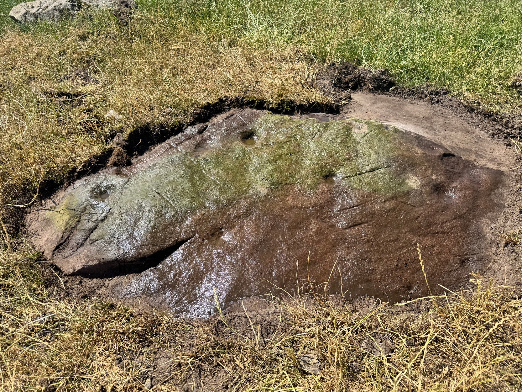
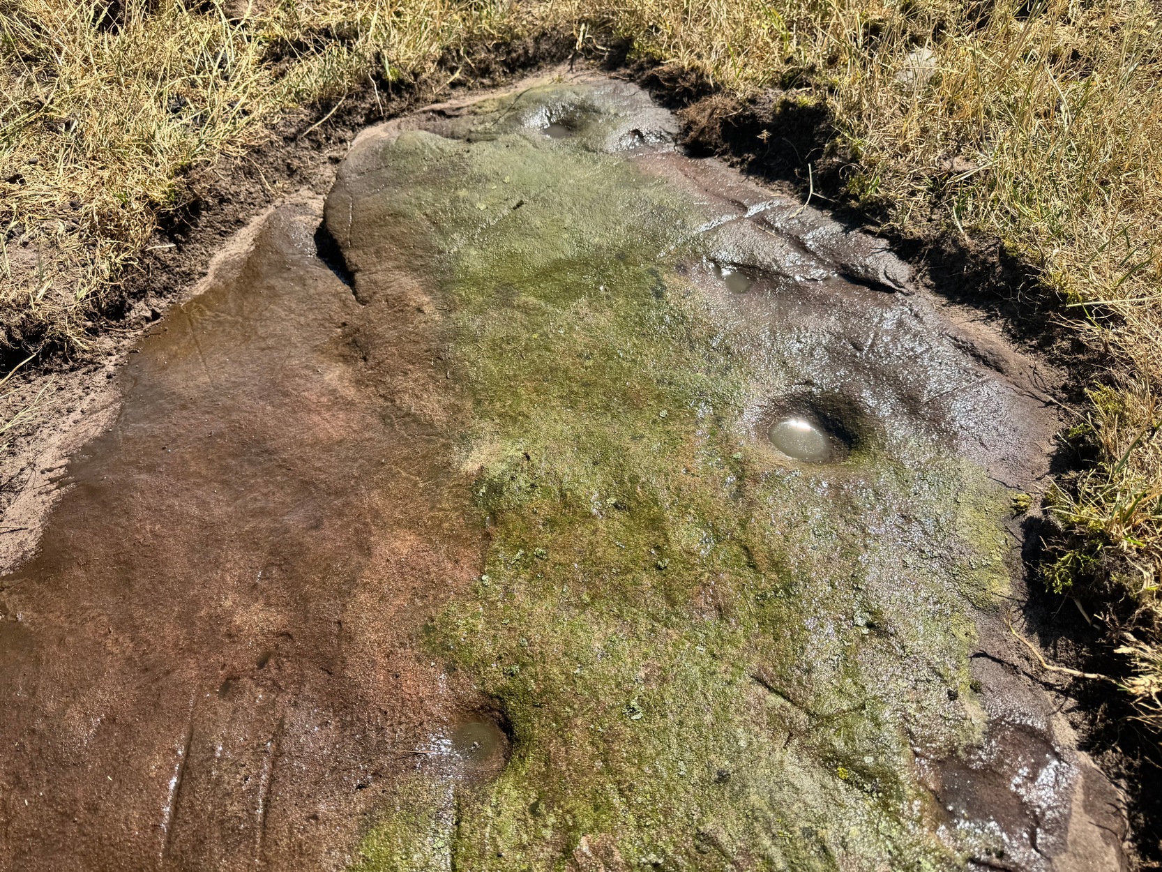
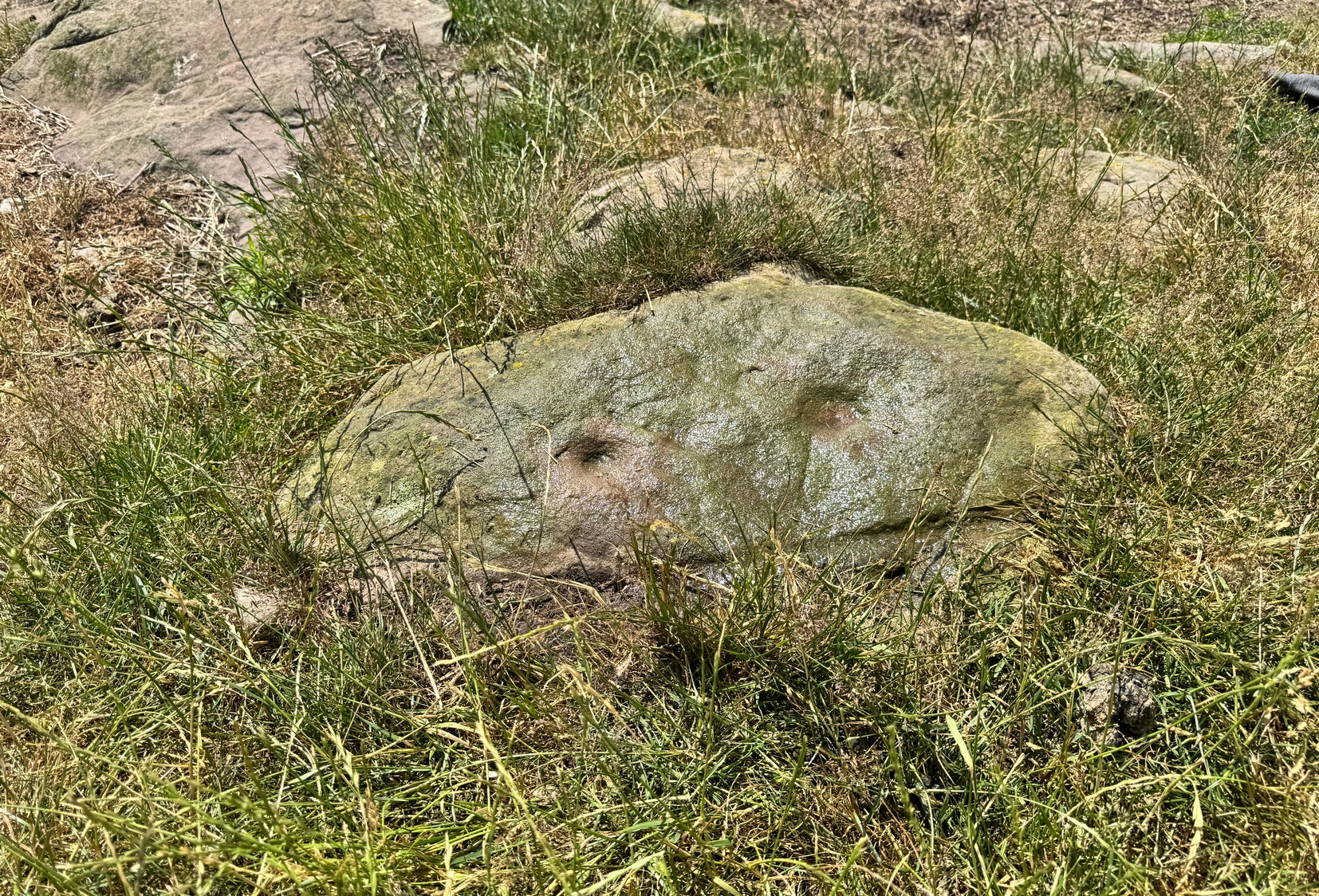
On a visit to the impressive West Horton carvings on one of the searing hot days recently, Tom Cleland and I thought to check on an otherwise unimpressive petroglyph on a rocky rise of land before heading to the beauties 250 yards northwest of here. The covering soil around a scatter of earthfast rocks on this rise in the land had been eroded by cattle and on one of them we noted what seemed to be a distinct cup-marking. And, as happens when you look closer, a more expansive design came into being.
Main design from aboveFaint ring round the cup
On the east-sloping-face of this rock are between six and seven cup-marks, most of them quite distinct. The topmost of the cups has a faint incomplete ring round it which you can just make out in a couple of the photos. It seemed that there was another even fainter ring around one of the other cups, but on the day we visited this the heat was taking its toll of me and I could only stand a short time before we had to move, so we left without getting any good images of the other ring.
More recent cup-marks
It’s more then likely that other unrecorded carvings are hiding beneath the soil which, no doubt, the cattle will slowly help uncover as the years go by. 🙂 A little further up the slope from here, approaching the West Horton (1b) carving, a small oval-shaped rock has what looks like a single cup-mark on it and another, more recent marking at its side. This impression is likely due to an incision made by the metal legs of one of the animal feeders and is unlikely to be prehistoric.
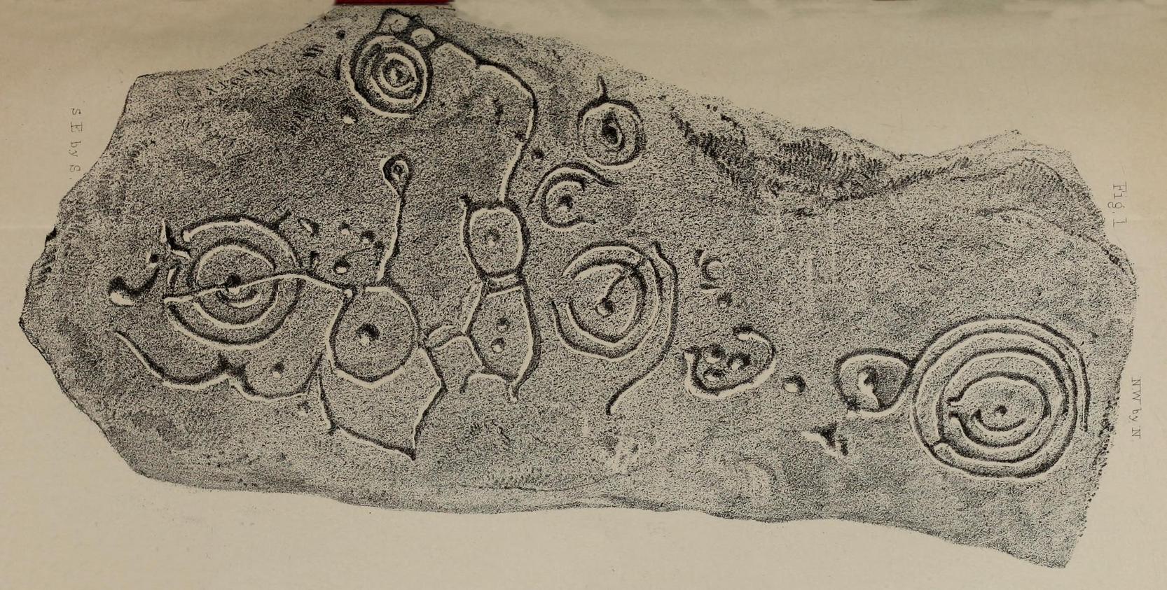
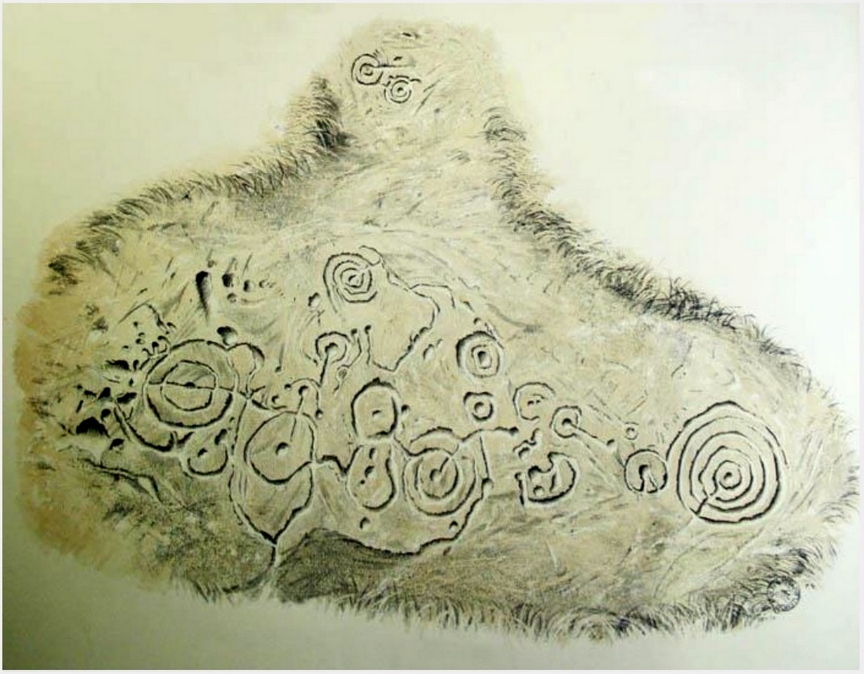
In 1863, a bunch of reputable Victorian authors and antiquarians met with the Duke of Northumberland in Alnwick Castle to discuss the matter of making decent images of the petroglyphs which, at the time, had only just been rediscovered in the area. At one of their meetings, the floor in one of the Castle rooms was covered with rubbings of carvings that they’d made—this one included. I’d loved to have been there! Subsequently, from that meeting, sketches of this carving were done and included in the works by George Tate (1864; 1865) and then a few years later in J. Collingwood Bruce’s (1869) rare tome that had been published with the help of dosh from the Duke.
Found along a raised geological ridge running roughly east-west, a number of other carvings are close by and well worth looking at when you visit here. The basic (and first) description of the site by Tate told that here,
Tate’s 1864 sketchJ.C. Bruce’s 1869 image
“on a high ridge on Hunter’s Moor, a large surface of rock, some forty yards by twenty, having a gentle slope to the northward, is partially uncovered. In one part, which has been entirely cleared of turf, fourteen figures are scattered over an area of 15 feet by about from 5 to 7 feet. Some of the figures are of the common type, one of which is 28 inches in diameter; but others present new features; and several are curiously united by straight and curved grooves. Across the entire diameter of a group of four concentric circles, runs a groove connecting them with other combined figures. An irregularly shaped, rounded, angular figure, encloses two hollows or cups; and united to this is a broad oval figure. One figure around four cups approaches to the reniform.”
When the modern rock art expert Stan Beckensall wrote about this site, he mentioned how his own picture of the carving consisted of a number of elements that weren’t included by the 19th century pioneers—which isn’t unusual.
References:
Beckensall, Stan, Northumberland’s Prehistoric Rock Carvings – A Mystery Explained, Pendulum: Rothbury 1983.
Beckensall, Stan, Prehistoric Rock Motifs of Northumberland – volume 1, Abbey Press: Hexham 1991.
Bruce, John Collingwood, Incised Markings on Stone; found in the County of Northumberland, Argylshire, and other Places, privately printed: London 1869.
Tate, George, “The Ancient British Sculptured Rocks of Northumberland and the Eastern Borders,” in Proceedings of the Berwickshire Naturalists Club, volume 5, 1864.
Tate, George, The Ancient British Sculptured Rocks of Northumberland and the Eastern Borders, Henry Hunter Blair 1865.