Holy Well (destroyed): OS Grid Reference – NT 3190 3339
Also Known as:
- St Bryde’s Well
Archaeology & History
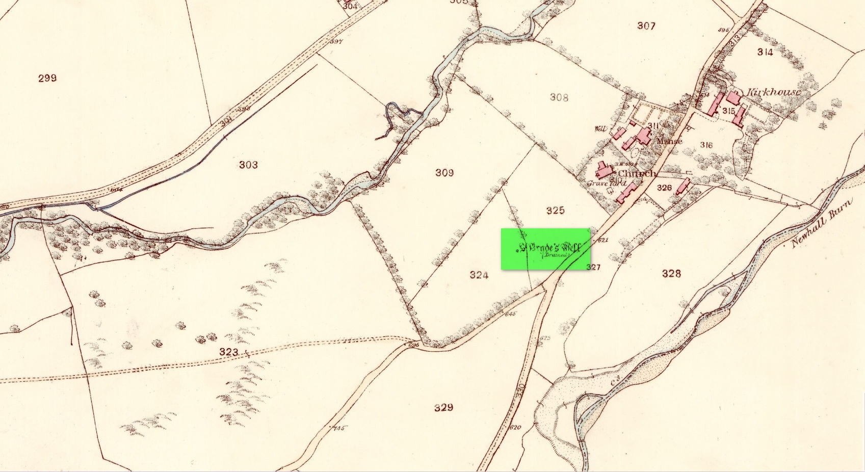
Two hundred years ago, located halfway between Traquair’s present parish church and that of the demolished (apparently) 12th century church of St. Bride to the southwest, were the flowing waters of this once sacred water source. But it’s long since been destroyed. It was drained sometime prior to when the Ordnance Survey lads came here in 1856 and its water taken to supply the nearby manse. Subsequent surveys by the Royal Commission (1967) and Mr & Mrs Morris (1982) affirmed its demise. It was listed in the early Scottish holy well surveys, without comment, and I can find no local history accounts of the place.
References:
- Hallen, A.W. Cornelius, “Holy Wells in Scotland,” in The Scottish Antiquary, volume 9, 1895.
- Morris, Ruth & Frank, Scottish Healing Wells, Alethea: Sandy 1982.
- Royal Commission on the Ancient & Historical Monuments, Scotland, Peeblesshire – volume 2, Aberdeen University Press 1967.
- Walker, J. Russel, “‘Holy Wells’ in Scotland,” in Proceedings of the Society of Antiquaries of Scotland, volume 17,, 1883.
Acknowledgements: Huge thanks for use of the Ordnance Survey map in this site profile, reproduced with the kind permission of the National Library of Scotland.
© Paul Bennett, The Northern Antiquarian