Foldys Cross, Towneley, Burnley, Lancashire

Cross:  OS Grid Reference – SD 8523 3066

Also Known as:

  1. Foldy’s Cross

Getting Here

To get to Towneley Park head to the south side of the town close to a junction of two roads heading towards Todmorden and Bacup, from here the park and hall are signposted. The old cross stands 300 metres south-west of Townley Hall in the centre of some pathways leading in the direction of Todmorden road (the A671).

Archaeology & History

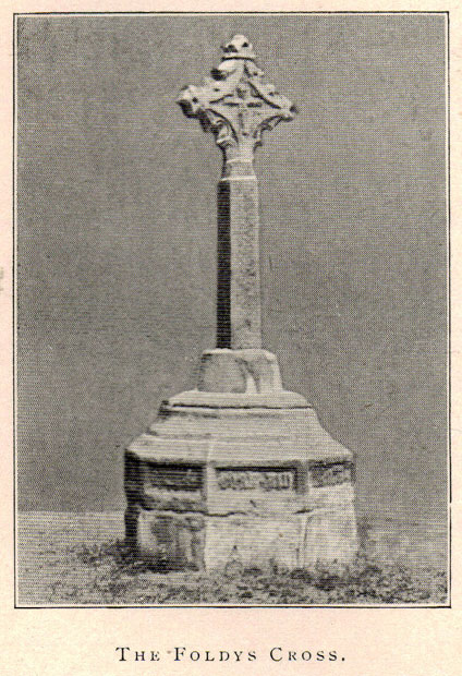
Foldys Cross, Burnley (Taylor, 1906)

Foldy’s Cross is a tall slender monument on a carved circular pedestal which sits upon a set of seven square-shaped steps. It dates from 1520 when it stood at the south side of St Peter’s parish church, Burnley. It was set up to commemorate a chaplain of St Peter’s church by the name of John Foldy or Foldys, and was then the town’s market cross or St Peter’s churchyard cross. In 1780 it was badly damaged by a Puritan mob, but the Towneley family rescued it and had it brought to their estate where it was repaired in a haphazard way and placed at the north-eastern side of the hall on the Avenue. In 1911 Burnley Borough Council had the cross completely restored for its Jubilee Year celebrations with various sandstone pieces added to replace sections of the cross including the plinth and set of seven steps – which are thought to be an exact copy of the original ones. The cross was then placed in its current position 300 metres to the south-east of Towneley Hall at an intersection of footpaths leading towards Todmorden road.

The original design of Foldy’s Cross was of the Gothic style which can be seen in the cross-head. It is made of sandstone and has an octagonal shaft with a moulded plinth with sunken panels. These panels contain lettering in the Gothic script. The cross-head is very nice with its decorated four arms, one of which is sunk into the shaft to support the head itself; this appears to be the original moulded head or cap with nicely carved emblems and fleurons on the collar – all typically Gothic in style. In the middle of the cross-head is a rather crude crucifix scene and on the other side the letters “IHS”. On the plinth the inscription reads in Latin:

‘Orate pro anima Johannes Foldys, capellani qui istam crucem fieri fecit Anno Domini MCCCCCXX’

— which when translated reads as, “Pray for the soul of John Foldys, chaplain who caused this cross to be made in the year of Our Lord 1520”.

The cross is now grade II listed and the English Heritage Building identity number is 467232.

References:

  1. Peace, Richard, The Curiosities of England – Lancashire Curiosities, The Dovecot Press Ltd 1997.
  2. Taylor, Henry, The Ancient Crosses and Holy Wells of Lancashire, Sherratt & Hughes: Manchester 1906.

© Ray Spencer, 2011


Whalley Crosses, Whalley, Lancashire

Crosses:  OS Grid Reference – SD 7326 3616

Also Known as:

  1. Paulinus Crosses

Getting Here

Site of church & crosses

Dead easy to find.  Get to the centre of Whalley and walk into the churchyard.  Don’t confuse it with the ruins of the old abbey, or you won’t find the place!

Archaeology & History

I here wish to draw your attention to the three standing crosses in the churchyard (the crosses do not stand in their original positions having being ‘thrown down’ during the Commonwealth and used amongst other things as farm gate-posts):

1) THE EASTERMOST CROSS (Taylor ‘C’):  Standing opposite the chancel door (Priest’s Door, early 13th century retaining the original ironwork and bronze head knocker) is a much-worn cross shaft that only under certain lighting conditions that can any decoration is made out. It has scrollwork as pat of its ornament and a pelleted border. Two figures, heads surrounded by halos, can be made out just above the shaft centre. The head of the cross is not original but of the late 14th century. The cross originally stood over 11ft in height (see drawing reconstruction). Fragments of this cross are built into the fabric of the church, the top section of the shaft and parts of the cross head are held in Blackburn Museum. One fragment can be made out in the outside Chancel wall displaying the pelleted border and some scrollwork. Another fragment is built into the back wall of the Sedilia and is in good condition. A further fragment is built into the back wall of the Bishops Throne, last stall, south side, east adjacent the Sanctuary.

The shaft is set in a broken oblong base that one may have held two or more shafts in the form of a ‘Calvary’.

Cross no.2 in 1904 (after Taylor, 1906)

2) THE WESTERMOST CROSS (Taylor ‘A’):  Originally panelled crosses of this type were brightly painted in red, yellow, green, blue and white. All four sides are decorated but only the east face survives clearly enough to be made out. The shaft was divided into seven panels with roll-mouldings running along each of the panels, of which only six now exist (part of the upper panel, displaying the hallowed head of a figure and cross arm are held by Blackburn Museum). The two lowest panels and the top panel contain geometric and interlace patterns. Halfway is a sculptured panel containing a hallowed human figure, arms akimbo (raised as if giving a blessing). Either side of the figure are two serpents with open mouths. This design is repeated on the side face of the shaft along with two interlace panels. Above the figure panel is one depicting the figure of a bird (an eagle or pelican in her piety?). The lower panel shows that of a beast (a dog or a lion?).

Crosses 1  and 2 clearly show Hiberno-Norse influences, so named after the second and third generation Irish Norwegians who settled Lancashire in the 10th century whose artistic culture became dominant.

Cross no.3 in 1904 (after Taylor, 1906)

3) THE CROSS OPPOSITE THE PORCH (Taylor ‘B’):  This magnificent cross is in a fair state of preservation, although a portion of the upper shaft and three arms of the head are missing. Originally it would have stood at around 10ft in height and is the oldest of the crosses being no later than the late 10th century. The central cross shaft measures approximately 2.2m high and is socketed into a square base stone carved with dog-tooth decoration. It is rectangular in cross section and tapers towards the top where it has been broken. A piece of the shaft about 0.75m in length is missing. All four sides of the shaft depict well-preserved late 10th century decoration comprising foliated scrollwork. The principal ornamentation is on the east and west faces and consists of a central rounded shaft or pole rising from the apex of a gable. At the top of the shaft are the mutilated remains of the carved central boss of the cross head.

Whalley’s Cross 3

The central rounded column forms the axis mundi (cosmic axis, world pillar), being a ubiquitous symbol that crosses human cultures. The image expresses a point of connection between the heavens and earth where the four compass directions meet. At this point travel and correspondence is made between higher and lower realms. Communication from lower realms may ascend to higher ones and blessings from higher realms may descend to lower ones and be disseminated to all. The spot functions as the omphalos (navel), the world’s point of beginning.

The axis mundi image appears in every region of the world and takes many forms: a hill or mountain (Pendle), a tree (Tree of Life, World Ash Tree, etc), a vine, a ladder (Jacob’s Ladder), a stone monolith, a maypole, Sufi whirling, etc. The foliated swirls represent interactive movement along the axis – transmission, unity within multiplicity.

The axis mundi concept has its origins in Indo-European shamanism, and a universally told story is that of the healer traversing the axis mundi to bring back knowledge (benefits/blessings, etc) from the ‘other world’. The Sufi concept of baraka and the Hindu mystical concept of akasha are akin to this.

All three crosses had cross heads of four arms of equal length, each widening at the outer end in an axe shape so that their rims nearly form a circle.

Editor’s Note:  Henry Taylor (1904) described the “remains of other pre-Norman crosses” at the point marked ‘D’ on his map of the church, adding:

“The Bishop of Bristol thus describes the fragments of other crosses at Whalley: ‘A pretty and delicate fragment forms part of the back of the sedilia; there is at least one piece in the south wall of the chancel, outside, and there are fragments lying on the ground.  One of these, showing a system of oval buckles, as it were, with straps through them, closely resembles a stone found — but now lost — at Prestbury…”

Folklore

Taylor mentions how the Whalley crosses were long known as the Paulinus Crosses, “who is said to have been made Archbishop of York in the year 627, and who, it is alleged, preached and baptised in the wild districts far removed from that capital, even in such remote places as Whalley… His name is also attached to an ancient cross…on Longridge Fell.”

References:

  1. Taylor, Henry, The Ancient Crosses and Holy Wells of Lancashire, Sherratt & Hughes: Manchester 1906.
  2. Whitaker, Thomas Dunham, An History of the Original Parish of Whalley and Honor of Clitheroe, Nichols, Son & Bentley: London 1818.

© John Dixon, 2010


Stones Farm, Todmorden, West Yorkshire

Standing Stones:  OS Grid Reference – SD 92520 23593 and SD 92256 23800

Getting Here

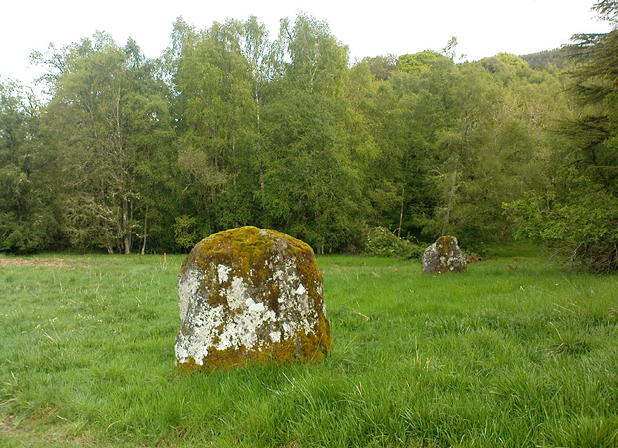
One of the Stones monoliths, looking west

If you wanna drive here, be prepared for a long uphill winding haul, with very poor turning, single-track roads and no parking spots.  It’s dodgy as hell!  But, if y’ must – from the central roundabout in Todmorden, take the road diagonally across as if you’re going to the train station, and barely 50 yards up, take the right turn under the railways arches, bearing sharp left, then up the very steep zigzagging dangerous road for a mile or so.  You’ll eventually reach Stones Lane on your left.  Go down this, nearly to the end, slowly – and keep your eyes peeled until you see the big one!  You can’t miss it!  If you want walk up (a much safer, healthier and preferable route), take the Calderdale Way route up past Dobroyd Castle, and where you get to the top of the hill and the fields open up ahead of you, look down the slope into the field for one stone, and up past the shrubs to Centre Hill.  You can’t miss them!

Archaeology & History

Three 'stones' on 1911 map
Three ‘stones’ on 1911 map

This is a quite extraordinary sight to those who visit here for the first time.  Moreso because, until very recently, the place was excluded from all text-books and surveys.  But if you like your megaliths, this place is well worth the trek up the hill.  You’ll be amazed!  The tallest and largest of these giant monoliths was recorded when a team from Ordnance Survey mapped the area in 1844, but gave no antiquated note to it.  When another Ordnance Survey team re-surveyed the area again in 1911, they noted two other ‘stones’ three fields away to the northeast.  More than a decade later, the industrialist historian Abraham Newall (1925) described them at some length in his fine work on the region.

Stone 1, looking NW
Stone 2, at top of hillock (soz about the crap picture)

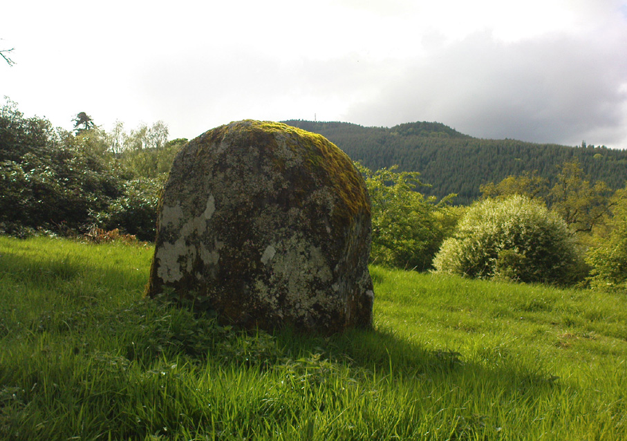
The first thing generally noticed is the 12-foot tall standing stone near the bottom of the field (stone 1). Then you’ll see the curiously-worked thin standing stone, nearly as tall, on the hillock at the top of the same field (stone 2). This stone has been surmounted onto an old millstone and the hillock itself was once an old beacon hill.  Then on the other side of the road a few hundred yards along, another stone just over 4-feet tall can be seen (stone 3); and in the same field is another one laid down at the side of a well (stone 4). This stone used to stand just where the water appears.  It’s seems probable that other standing stones may once have been in close attendance, but have been destroyed over time.

Stone 3, looking south
Stone 3, looking west

Stone 1 is hemmed in at the base by several stones, giving the impression that it was resurrected at some time in the recent past. Several local stories attest to this. Stone 2 was once further down in the same field but was moved to its present position in the 19th century and was, it is alleged, moved there to commemorate the Battle of Waterloo.  Several local historians contest this.  Stone 3 has nothing said of it; apart from by the local farmer who said it once had a companion (as illustrated on the early map, above).  We were told that this companion (stone 4) was uprooted and a spring of water appeared where it stood, so they laid it down in the position it still occupies, just by the spring 10 yards into the field.

If you’re into megaliths and live in Yorkshire or Lancashire, check these beauties out! Just respect the local farmer – he’s not into ignorant tourists clambering over walls. (don’t say you’ve not been warned!)

References:

  1. Bennett, Paul, The Old Stones of Elmet, Capall Bann: Milverton 2001.
  2. Newell, Abraham, A Hillside View of Industrial History, J. Bentley: Todmorden 1925.

© Paul BennettThe Northern Antiquarian


Nafferton Slack, Driffield, East Yorkshire

Standing Stone (destroyed):  OS Grid Reference – TA 040 587

Archaeology & History

Information on this stone is sparse and the grid-reference cited is a close approximation of its precise location.  And were it not for the records of Victorian folklorists, its existence may have been completely lost.  The first reference I’ve found of it is in Nicholson’s East Yorkshire (1890) survey, but I am hoping that someone, somewhere, made archaeological notes of the site (am I hoping for too much here…?)  The stone appears to have stood upon, or was very close to, the local boundary line between Nafferton and Driffield—which means there could be a record of it in any perambulation accounts of the region.

Folklore

John Nicholson (1890) told us the following intriguing bitta folklore about this stone, saying:

“About half way down the hill forming the eastern slope of Nafferton Slack, by the roadside, to prevent waggons leaving the roadway, stood a large stone, which was believed to have wonderful powers.  At night, at certain seasons, it glowed like fire, sometimes it seemed but the portal of a well-lighted hall; and one old stone-breaker declared he had heard wonderful music issuing therefrom, the like of which he had never heard before; while on one occasion he had seen troops of gaily-dressed elfins repairing thither, some on foot and some on carriages, and they all went into this mysterious hall.  The old man is dead, the stone is gone, and the fairies have departed.”

Some twenty years later, Mrs Gutch repeated the story, but added no further details.  One wonders whether the information about a fairy hall implied the former existence of a mound or tumulus next to the old stone (a few hundred yards south, just off the same boundary line, we find the remains of the curiously named tumulus of Cheesecake Hill).  Any further info would be most welcome…

References:

  1. Gutch, Mrs E., Examples of Printed Folk-lore Concerning the East Riding of Yorkshire, David Nutt: London 1912.
  2. Nicholson, Folk-lore of East Yorkshire, Simpkin Marshall: London 1890.

© Paul Bennett, The Northern Antiquarian


Ralph Cross, Westerdale Moor, North Yorkshire

Cross:  OS Grid Reference – NZ 67724 02092

Also Known as:

  1. Ralph’s Cross
  2. Young Ralph’s Cross

Getting Here

The cross stands high-up on Danby High Moor between Hutton-le-Hole and Castleton, just by the junction of two moorland roads to Rosedale and Westerdale, in north Yorkshire.  The monument stands on private land. (Ed. – though in Yorkshire, many of us ignore such signs)

Archaeology & History

Mr Woodwark’s 1930s photo of Young Ralph

First described in old deeds from the early 13th century, Ralph’s Cross stands nine feet high on a solid stone base.  There is uncertainty about its age; the present-day cross could date from the 18th century though some historians date it to around 1200, certainly the base could date from that time.  It seems likely that a much older cross once stood on this site — perhaps an Anglo-Saxon one that was actually made of wood.  At that time it may have been referred to as ‘The Roda Cross’ (Rude Cross).  More than likely the cross acted as a medieval highway marker because it stands at the junction of two moorland roads. Originally there were some letters carved on the cross, one in particular, being the letter “R” for Ralph was carved on the south face.

Over the centuries the cross has suffered damage and vandalism by being knocked down, particularly in the 1960s and again in 1984 after which it lay in two pieces. However, in 1985 the cross was lovingly restored and re-erected by some local men, Mr Robert Dixon, Mr Tom Rudd and Mr Michael Smith, at the English Heritage Commission’s stone masonry workshop at Mount Grace Priory.  The middle section of the cross was made from new stone from nearby quarries; the top section was not badly damaged, but a section of delta metal was inserted inside the shaft to make a secure link between the sections and the cross-head.  The cross is a listed monument.

A few hundred yards to the south stands another cross called ‘Old Ralph’ which is just 5 feet high and is located on Blackey Ridge. This cross dates from the beginning of the 13th century and is perhaps a memorial to Ralph, bishop of Guisborough.

Folklore

According to legend, the cross was set up to mark the resting place of a monk from Farndale and a nun from Rosedale.  They would often meet here and a romantic liason of sorts occurred, but they were found out by their superiors and came to a nasty end, possibly with their deaths.  But the most common folk-tale tells us that a farmer called Ralph from Danby found the dead body of a traveller at this spot.  He was so moved by this that he decided to erect a cross in memory of this poor unfortunate traveller, who had starved to death and was found to be penniless.  Ralph had a hollow carved into the top of the cross so that more wealthy travellers, those on horseback, might place a few coins for the benefit of any less fortunate travellers, or as a thanksgiving for having reached this point on their journey. The poor traveller was able to take a coin, if he/she could reach the hollow, and buy a hot meal at the nearest inn.  Ralph then vowed that such a terrible thing would never ever happen again, and it seems to have worked, thanks to him.

References:

  1. Ford, Joseph, Some Reminiscences and Folk-Lore of Danby Parish & District, Horne and Son: Whitby 1953.
  2. Ogilvie, Elizabeth & Sleightholme, Audrey, An Illustrated Guide to the Crosses on the North Yorkshire Moors, Village Green Press: Thorganby 1994.
  3. Woodwark, T.H., The Crosses on the North York Moors, Whitby Literary & Philosophical Society 1934.

© Ray Spencer, 2011


Fairy Knowe, Bridge of Allan, Stirlingshire

Tumulus:  OS Grid Reference – NS 79616 98191

Also Known as:

  1. Ben Rhi
  2. Canmore ID 45986
  3. Fairy Knowe of Pendreich
  4. Hill of Airthrey
  5. King’s Hill

Getting Here

Fairy Knowe, looking north

Various ways to get here.  Probably the easiest is via the golf course itself, walking up towards the top where the trees reach the hills, but keeping your eyes peeled for the large archetypal tumulus or fairy mound near the top of the slope.  Alternatively, come up through the wooded slopes from Bridge of Allan and onto the golf course, keeping your eyes ready for the self same mound sat in the corner by the walls.  You can’t really miss it to be honest!

Archaeology & History

This is an impressive-looking burial mound sat, intact, on the edge of those painful golf courses that keep growing over our landscape — and you can see for miles from here!  It would seem to have been placed with quite deliberate views across the landscape, reaching for countless miles into the Grampian mountains north and west across the moors of Gargunnock and Flanders towards Lomond and beyond…

Fairy Knowe, facing west
Sir Armstrong’s old drawing

The Fairy Knowe was first excavated in 1868 by Sir J.E. Alexander and his team, when their measurements found it to be some 80 yards in circumference, 78 feet across and 21 feet high — compared to less than 60 feet across and only 8 feet tall today.  The findings were recorded in one of the early PSAS reports, and more recently a synopsis of the account was made of it by the Royal Commission (1963) lads who summarized his early findings and told:

“The excavation revealed a cist in the centre of the cairn, laid on the original surface of the ground and measuring 2ft 6in in length, 1ft 6in in breadth and 3ft in depth.  Its walls were formed partly of upright slabs and partly of small stones laid horizontally, while the floor and the roof each consisted of a single slab.  Within it there was a deposit, 6in in depth, of black earth, charcoal and fragments of human bone among which pieces of a skull were conspicuous.  The cist was covered by a heap of large stones, 8ft in diameter and 13ft in height, and this in turn was covered with earth, in which there were charcoal, blackened stones, fragments of human and animal bones and unctuous black earth.  Among these remains were found six flint arrowheads, a fragment of what was once thought to be a stone spear-head, and a piece of pine which, it was suggested, might have formed part of a spear-shaft.”

Also, near the top of the cairn in the fairy mound, Sir Alexander’s team located a prehistoric beaker vessel and fragments of what they thought were other beakers pots.  Archaeologist Richard Feachem (1977) also mentioned this site in his gazetteer, simply copying the words of previous researchers.

Other prehistoric cairns can be found nearby: one in Cuparlaw Woods less a mile north; plus the Pendreich cairns on the edge of the moors just over 1 mile to the northeast.

Folklore

Obviously an abode of the faerie folk in bygone times, the tales of the place are sadly fading from local memory… Mr Alexander (1868) thought this place may have been an important site for the Pictish folk, and he may well have been correct, as the legendary hill of Dumyat (correctly known as Dun Myat) 2  miles east of here has long been regarded as an outpost of one Pictish tribe.

The main piece of folklore attached to this place relates to its very name and how it came about.  In R.M. Menzies (1912) rare work on the folklore of the Ochils, he narrates the local tale that used to be spoken, which describes a procession here from the Fairy Well, just over a mile to the east.  Whether this folktale relates to some long lost actual procession between the two sites, we don’t know for sure.  Mr Menzies told:

“Once upon a time, when people took life more leisurely, and when the wee folk frequented the glens and hills of Scotland, there was one little fairy whose duty it was to look after certain wells renowned for their curative properties.  This fairy was called Blue Jacket, and his favourite haunt was the Fairy Well on the Sheriffmuir Road, where the water was so pure and cool that nobody could pass along without taking a drink of the magic spring.  A draught of this water would have such a refreshing effect that the drinker could go on his journey without feeling either thirsty or hungry.  Many travellers who had refreshed themselves at the Fairy Well would bless the good little man who kept guard over its purity, and proceed upon their way dreaming of pleasant things all the day long.

“One warm day in June, a Highland drover from the Braes of Rannoch came along with a drove of Highland cattle, which he was taking to Falkirk Tryst, and feeling tired and thirsty he stopped at the Fairy Well, took a good drink of its limpid water, and sat down beside it to rest, while his cattle browsed nearby.  The heat was very overpowering, and he fell into a dreamy sleep.

“As he lay enjoying his noonday siesta, Blue Jacket stepped out from among the brackens and approaching the wearied drover, asked him whence he came.  The drover said:

“‘I come from the Highland hills beside the Moor of Rannoch; but I have never seen such a wee man as you before.  Wha’ may you be?’

“‘Oh,’ said the fairy, ‘I am Blue Jacket, one of the wee folk!’

“‘Ay, ay man, ye have got a blue jacket, right enough; but I’ve never met ony o’ your kind before. Do ye bide here?’

“‘Sometimes; but I am the guardian of the spring from which you have just been drinking.’

“‘Weel, a’ I can say is that it is grand water; there is no’ the likes o’t frae this to Rannoch.’

“‘What’s your name?’ asked the fairy.

“‘They ca’ me Sandy Sinclair, the Piper o’ Rannoch,’ was the reply.

“‘Have you got your pipes?’ asked Blue Jacket.

“‘Aye, my mannie, here they are.  Wad ye like a tune?  Ye see there’s no’ a piper like me in a’ Perthshire.’

“‘Play away then,’ said Blue Jacket.

“Sandy Sinclair took up his pipes and, blowing up the bag, played a merry Highland reel.  When he finished, he was greatly surprised to see above the well a crowd of little folk, like Blue Jacket, dancing to the music he had been playing.  As he stopped they clapped their little hands and exclaimed, ‘Well done Sandy! You’re the piper we need.’

“Thereupon Blue Jacket blew a silver whistle, which he took from his belt, and all the wee folk formed themselves into a double row.  Blue Jacket then took the Highland piper by the hand, led him to the front of the procession, and told him to play a march.  Sandy felt himself unable to resist the command of the fairy, and, putting the chanter into his mouth, blew his hardest and played his best, marching at the head of the long line of little people, who tripped along, keeping time to the strains of the bagpipes.  Blue Jacket walked in front of the piper, leading the way in the direction of the Fairy Knowe.

“Sandy Sinclair never marched so proudly as he did that day, and the road, though fairly long, seemed to be no distance at all; the music of the pibroch fired his blood and made him feel as if he was leading his clansmen to battle.   When the Fairy Knowe was reached, the wee folk formed themselves into a circle round the little hill, and sang a song the sweetest that ever fell upon the ears of the Highlandman.  Blue Jacket once more took his whistle and, blowing three times upon it, held up his hand, and immediately the side of the knoll opened.  Bidding the piper to play on, Blue Jacket led the procession into the interior; and when all were inside, the fairies formed themselves into sets, and the piper playing a strathspey, they began dancing with might and main.

“One dance succeeded another, and still Sandy played on, the wee folk tripping it as merrily as ever.  All thoughts of Sandy’s drove had gone quite out of his head, and all he thought of now was how best to keep the fairies dancing: he had never seen such nimble dancers, and every motion was so graceful and becoming as made him play his very best to keep the fun going.  Sandy Sinclair was in Fairyland, and every other consideration was forgotten.

“Meanwhile his cattle and sheep were following their own sweet will, the only guardian left to take care of them being his collie dog.  This faithful animal kept watch as well as he could, and wondered what had become of his master.  Towards evening another drover came along with his cattle for the same tryst.  He knew the dog at once, and began to pet the animal, saying at the same time, ‘Where’s your master, Oscar? What’s become o’ Sandy?’

“All the dog would do was to wag his bushy tail, and look up with a pleading air, as if to say, ‘I don’t know; will you not find him?’

“‘My puir wee doggie, I wonder what’s come over Sandy?  It’s no like him to leave his cattle stravaiging by the roadside.  Ay ay man; and at the Fairy Well too!  Indeed, this looks unco bad.’

“The newcomer, who was also a Highlander, made up his mind to spend the night with his own drove and that of Sandy Sinclair, thinking that the missing man would turn up in the morning.  But when the morning came there was no sign of Sandy.

“Taking Sandy’s collie and leaving his own dog in charge of the combined droves, he said, ‘Find master, Oscar!’  The wise beast sniffed around for a little and then trotted off in the direction taken the day before by Sandy Sinclair and the fairies.  By and by they reached the Fairy Knowe; but there was nobody there as far as the drover could see.  The dog ran round and round the knoll, barking vigorously all the time, and looking up into the face of the drover as if to say, ‘This is where he is; this is where he is.’  The drover examined every bit of the Fairy Knowe, but there was no trace of Sandy Sinclair.  As the drover sat upon the top of the Fairy Knowe, wondering what he should do next, he seemed to hear the sound of distant music.  Telling the faithful dog to keep quiet, he listened attentively, and by-and-by made out the sound of the pibroch; but whether it was at a long distance or not, he could not be certain.  In the meantime, the dog began to scrape at the side of the mound and whimper in a plaintive manner.  Noticing this, the drover put his ear to the ground and listened.  There could be no mistake this time: the music of the pibroch came from the centre of the Fairy Knowe.

“‘Bless my soul!’ exclaimed Sandy’s friend. ‘He’s been enticed by the fairies to pipe at their dances.  We’ll ne’er see Sandy Sinclair again.’

“It was as true as he said.  The Piper of Rannoch never returned to the friends he knew, and the lads and lasses had to get another piper to play their dance music when they wished to spend a happy evening by the shore of the loch.  Long, long afterwards, the passers-by often heard the sound of pipe music, muffled and far away, coming from the Fairy Knowe; but the hidden piper was never seen.  When long absent friends returned to Rannoch and enquired about Sandy Sinclair, they were told that he had gone to be piper to the wee folk and had never come home again.”

References:

  1. Alexander, J.E., “Opening of the Fairy Knowe of Pendreich, Bridge of Allan,” in Proceedings of the Society of Antiquaries, Scotland, volume 7, 1868.
  2. Feachem, Richard, Guide to Prehistoric Scotland, Batsford: London 1977.
  3. Fergusson, R. Menzies, The Ochil Fairy Tales, David Nutt: London 1912.
  4. Roger, Charles, A Week at Bridge of Allan, Adam & Charles Black: Edinburgh 1853.
  5. Royal Commission on the Ancient & Historical Monuments Scotland, Stirling – volume 1, HMSO: Edinburgh 1963.
  6. Stevenson, J.B., Exploring Scotland’s Heritage: The Clyde Estuary and Central Region, HMSO: Edinburgh 1985.

© Paul Bennett, The Northern Antiquarian


Causeway Edge, Littleborough, Lancs

‘Standing Stone’:  OS Grid Reference – SD 97239 17135

Getting Here

Causeway Edge stone, looking east

Get up to the Aiggin Stone and turn your back to Robin Hood’s Bed and Blackstone Edge, facing (roughly) north.  There’s a small path just to the left of the Aiggin Stone, running northwest (don’t take the more pronounced footpath on its right, or you’ll get a bit lost).  Walk down this path for about 60-70 yards and you can’t miss it!

Archaeology & History

Initially I thought this was the stone described in James Maxim’s (1965) exploratory study of the ancient route of the Long Causeway, not far from the Aiggin Stone, running up between Littleborough and Sowerby Bridge, across the Yorkshire border — but I quickly realised my error!  Maxim’s upright was one of the boundary markers and is a good 100 yards away from this little fella, seemingly divorced from history.  But he’s a curiosity that could do with an explanation…

Standing Stone; and Robin Hood’s Bed on horizon

The stone is less than a metre tall but appears to have had been a little taller in earlier days, having the top of it knocked off — either accidentally or otherwise (someone suggested that the small stone on the ground by its side was once the top of the stone).  It stands just a yard to the side of an old causeway running from the disused quarries a few hundred yards away, up to the Aiggin Stone.  It may have been an old wayside marker stone.  It’s certainly old and nobody seems to have said owt about it, so I thought that I’d highlight it here.  Any further info on the little fella’s history would be most welcome!

In the heathlands above here we found remains of old walling in the edge of the ancient peat, some of it cutting through into view and some of it still beneath the surface.  There wasn’t much of it (though we weren’t here for long), but it looked familiar and old…  How old is hard to say at the moment.  Who built them?  How much more can be found nearby?  Were they part of the quarrying operations, or destroyed by them? Anyone know owt more?

References:

  1. Maxim, James L., A Lancashire Lion, J.L. Maxim Trustees: Leeds 1965.

© Paul Bennett, The Northern Antiquarian


Peg o’ Nell’s Well, Clitheroe, Lancashire

Sacred Well:  OS Grid Reference – SD 7355 4257

Also Known as:

  1. St. Margaret’s Well

Getting Here

Peg o’ Nells Well

The well is located in the grounds of Waddow Hall close by Brungerley Bridge, near Waddington, in the Ribble Valley. The hall is just off the B 6478 road about three-quarters of a mile south-east of Waddington village. It is on private land, but you can see the well by walking along a footpath at the western side of the hall running along the banks of the River Ribble at the southern side of the hall grounds.

Folklore

The legend originates from the 18th century although the well is a pre-Christian spring. According to this most often told ‘legend’ Peg O’ Nell was a servant girl at Waddow Hall.  However, she often fell out with her masters, the Starkie family, often quarreling with and being disobedient to them. One night, in particular, Peg had a blazing row with Mistress Starkie after saying she didn’t want to fetch water from the well; the mistress was so enraged that she shouted at the servant saying “I hope you fall and break your neck”. At a later date this came true when on a particularly icy night Peg went to fetch water from the well, but on her way there she slipped on some ice and fell into the River Ribble, at a treacherous spot, and did indeed break her neck. From that time on there seems to have been a curse on the Starkie family – anything and everything that happened at the hall was blamed on Peg, or her ghost, which was now haunting the house and grounds. Mistress Starkie became so fed up with the curse that she took an axe and chopped off the head of a statue that had earlier been placed beside the well in memory of poor Peg. Thinking that by doing this the curse would come to an end, and it seems to have done just that, because afterwards peace and quiet seems to have come upon the hall.

Peg o’ Nells Well on 1884 map

Another legend or tale says that Peg dwelt by the well, perhaps as a kind of sprite, but that she caused a local Puritan preacher to fall into the River Ribble.  As a punishment for this dastardly trick the head of the statue was chopped off.  Folklore says that a water spirit or “sprite” lived in the well which was connected underground to the nearby River Ribble.

But the truth about this seems to be that the headless statue is that of St Margaret of Antioch who was beheaded for her faith in the early centuries of Roman rule. St Margaret’s feast day was on 20th July. Apparently, her statue was brought to Waddow Hall from either Sawley Abbey or Whalley Abbey where it had stood in its own niche, or possibly it came from a local Catholic church. The headless statue appears to be holding a bible in one hand; so it was probably placed at the side of the well in order to make the well holy and sacred to pilgrims who used to visit the site for healing purposes on the saint’s day. The head of the statue used to reside in an upstairs room at the hall, but it was lost for a time, only to be re-discovered and embedded into a wall at Brungerley farm not far from the bridge.

But we may never know what really did happen here because legend and folklore have become mixed in with other tales that may, or may not, be true. The holy well stands in a meadow in the hall grounds and is a square-shaped hollow in the ground where water still flows, possibly fed by the river close by. The statue still stands at the side; and fencing now surrounds this sacred site. The hall and grounds are still said to be haunted by a ghost, but whether it is Peg’s ghost we do not know, because this particular ghost is said to be hooded ? The curse itself used to claim a victim once every seven years; the screaming spirit of Peg would rise up from the murky waters of the river on stormy nights – an animal could apparently suffice as a victim, rather than a human.   This story was almost certainly made-up probably to frighten the Starkie family who it was originally aimed at.

Waddow Hall is now a Training and Activity Centre, but it used to be a Centre for girl guides and during the second world war it was an isolation hospital.

References:

  1. Bord, Janet & Colin, Sacred Waters, Paladin Books 1986.
  2. Hilton, J.A., “Return to Peggy’s Spout”, in NEM 70, 1997.
  3. Nelson, Carole, “Peg o’ Nell’s Well, Clitheroe, Lancashire,” in Source No.6, Summer 1998.
  4. Harte, J., “Death by Water – Rivers and Sacrifice,” in White Dragon 1998.
  5. Taylor, Henry, The Ancient Crosses and Holy Wells of Lancashire, Sherratt & Hughes: Manchester 1906.
  6. Whitaker, Terence W., Lancashire’s Ghosts and Legends, Robert Hale: London, 1980.

© Ray Spencer, 2011


Hades Hill, Whitworth, Lancashire

Cairn:  OS Grid Reference – SD 909 202

Getting Here

The Hades hill cairn/barrow is located high on the moors some 3 miles north-east of Whitworth and the smaller village of Facit, near Rochdale. Its exact location is close to a footpath halfway between Hades hill and Rough hill, though it is not mentioned on modern OS maps. It is quite difficult to get to so be ready for a long hard walk.

Archaeology & History

This small, low barrow or cairn — a couple of miles north of the little-known Man Stone — measures 15 metres north to south, 13 metres east to west and is 0.9 metres high (about 3 feet in height). But not a great deal can be seen today.

It was excavated in 1898 when a number of artefacts were discovered near the centre of the barrow. The most famous of these ancient artefacts was a Celtic two-tiered urn (of the Pennine type) which had rope imprints and chevrons; inside this urn were the burnt bones of a female, flints, a scraper and a fine pointed borer. Other stuff that came out of the barrow included animal bones, charcoal, flint implements and an arrow head. The urn was placed in the hands of The March Collection at The Rochdale Free Library (now known as Touchstones). A more recent excavation was carried out in 1982 but nothing was recorded at this time. In Dr Whitaker’s History of Whalley, he described there being “the remains of a large beacon, with the foundations of a large circular enclosure” on Hades Hill.

References:

  1. Abraham, John Harris, Hidden Prehistory around the North West, Kindle 2012.
  2. Barrowclough, David, Prehistoric Lancashire, Oxbow: Oxford 2008.
  3. Whitaker, Thomas Dunham, An History of the Original Parish of Whalley – volume 2, George Routledge: London 1876.

© Ray Spencer, 2011


Emmott Cross, Colne, Lancashire

Cross:  OS Grid Reference – SD 888 401

Also Known as:

  1. Touch Cross

Archaeology & History

The Emmott Cross

At the north side of St Bartholomew’s church-yard, Colne, stands the medieval Emmott Cross or Touch Cross. It was re-erected here in 1967 by local historian Mr Wilfred Spencer and a team of volunteers having being removed from the grounds of Emmott Hall, Laneshawbridge, when the old hall was being pulled down. The cross had stood for centuries close to the famous Hallown Well, both of which were highly venerated by pilgrims travelling between Whalley Abbey and Yorkshire. It appears that originally the cross had stood at the side of the Stanbury to Haworth road over Herders, close by Emmott.

The cross shaft stands 7 feet tall and is referred to as of the English Gothic style, probably 13th century. It stands in an octagonal socketed stone base which is 2 foot high and 4 foot square. Its slender octagonal shaft tapers away towards the top where there is a carved capital or corona – this may once have held a cross head or some other religious object. There used to be some faint lettering on the shaft but this has now worn away. A local historian Dr Whitaker described the lettering as “I.H.S.” along with the Greek omega symbol.

Taylor’s 1906 sketch

It was to all intent and purposes a preaching cross to which pilgrims would congregate and listen to the word of God and many would be baptised in the Hallown Well at the same time. In the penal times of the 16th century the cross was in great use, but by the 17th century it was being referred to as a “papist cross”.  During this period in history it suffered damage and the shaft broken in two places; the cross-head taken away and smashed. For safety reasons the cross-shaft was removed to Colne church-yard but returned to the grounds of Emmott Hall in 1728 when relative calm had returned.

The slender cross shaft and its hefty base are said to weigh about 2 tons and I have no doubt it does. It is now grade 11 listed.

Folklore

The name Touch Cross probably comes about in the sense that pilgrims touched the cross in the hope of a safe pilgrimage, or the name may be something to do with a troop of soldiers who were stationed at the hall in the past. They touched the stone too, but for different reasons – that they would live to fight another day in battle.

References:

  1. Byrne, Clifford H., “A Survey of the Ancient Wayside Crosses in North East Lancashire,” unpublished manuscript, 1974.
  2. Taylor, Henry, The Ancient Crosses and Holy Wells of Lancashire, Sherratt & Hughes: Manchester 1906.
  3. Whitaker, Thomas Dunham, An History of the Original Parish of Whalley and Honor of Clitheroe, Nichols, Son & Bentley: London 1818.

© Ray Spencer, 2011