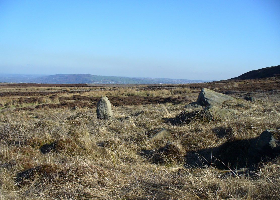
Follow the directions to reach the impressive Woofa Bank prehistoric enclosure. You need to find the walling that constitutes the enclosure itself and walk along to its eastern side where you’ll reach an ‘opening’, as if it may once have been an entrance at that side of the enclosure. A reasonably large sloping rock is on one side of this ‘entrance’. You can’t really miss it!
Archaeology & History
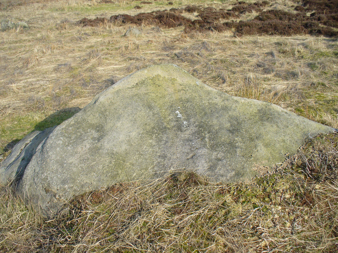
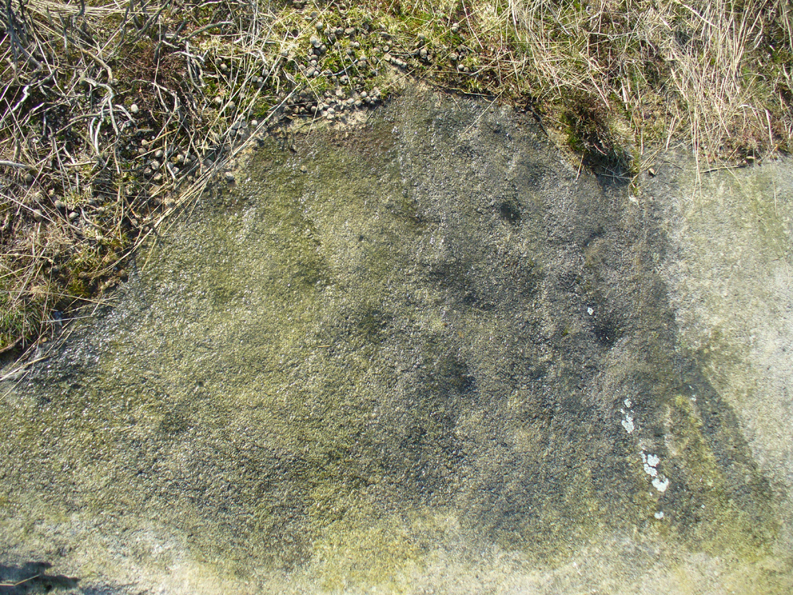
Unlike many of the other petroglyphs found within the Woofa Bank enclosure, the design on this one is faint — very faint indeed (much like the recently uncovered triple-ring petroglyph by the Thimble Stones). Comprising simply of a small cluster of cup-marks, you’ll struggle to see this one — unlike its compatriot on the western wall of the enclosure.
Looking down on the rockSome very faint cupmarks
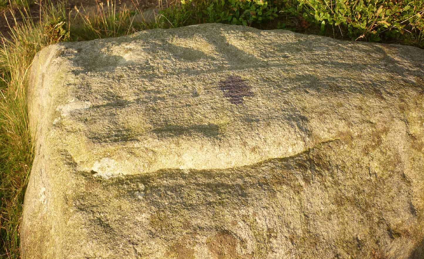
It consists of a single cup-mark on the northern edge of the stone, whilst on the sloping southern part of the rock are a number of very faint cups, eroded by them there millenia of Nature’s wind and weathering. One or two of the cups are just visible in good lighting, but what are almost certainly a few more can be seen when the rock is wet and in low daylight hours. It’s a design that’s probably only of interest to the hardcore petroglyph fanatics, but without doubt this is yet another carving within this obviously important prehistoric enclosure.
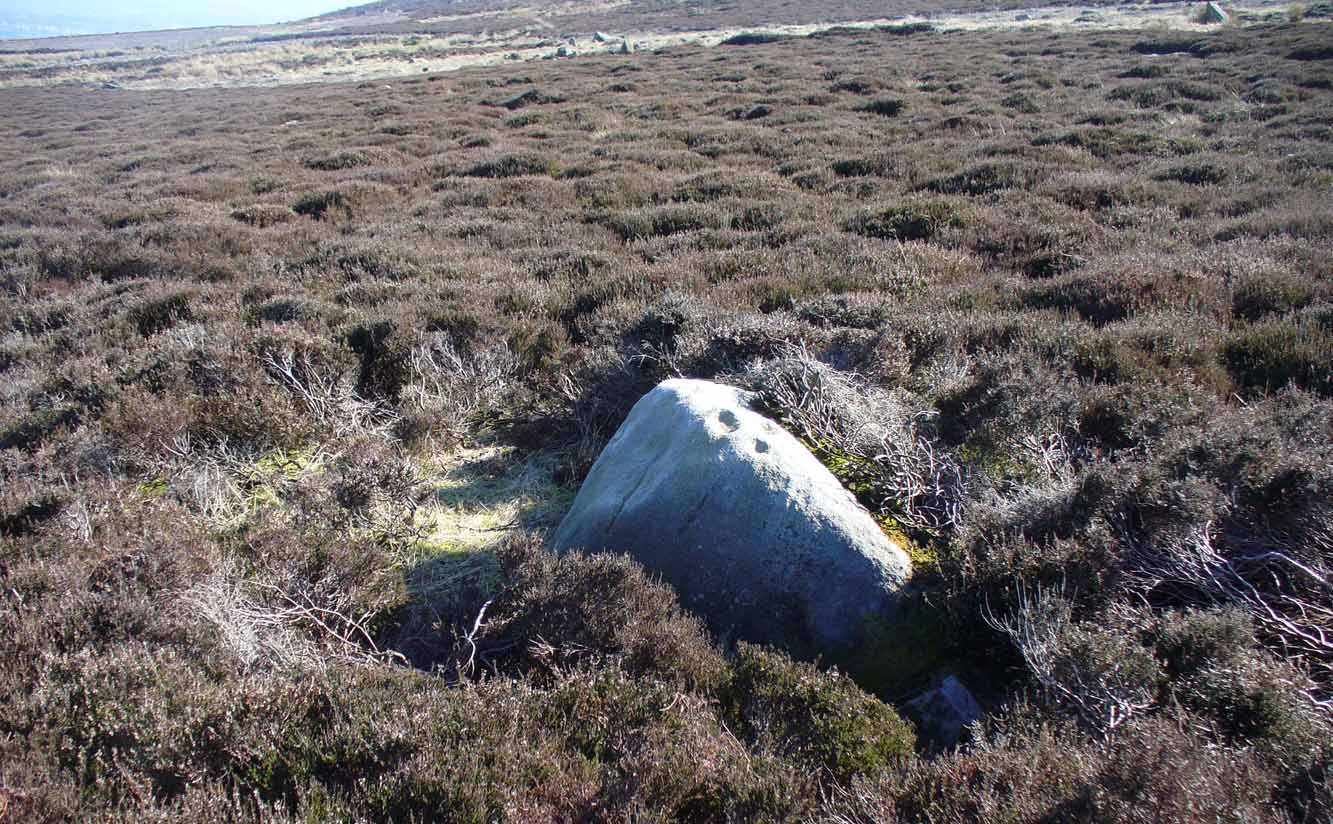
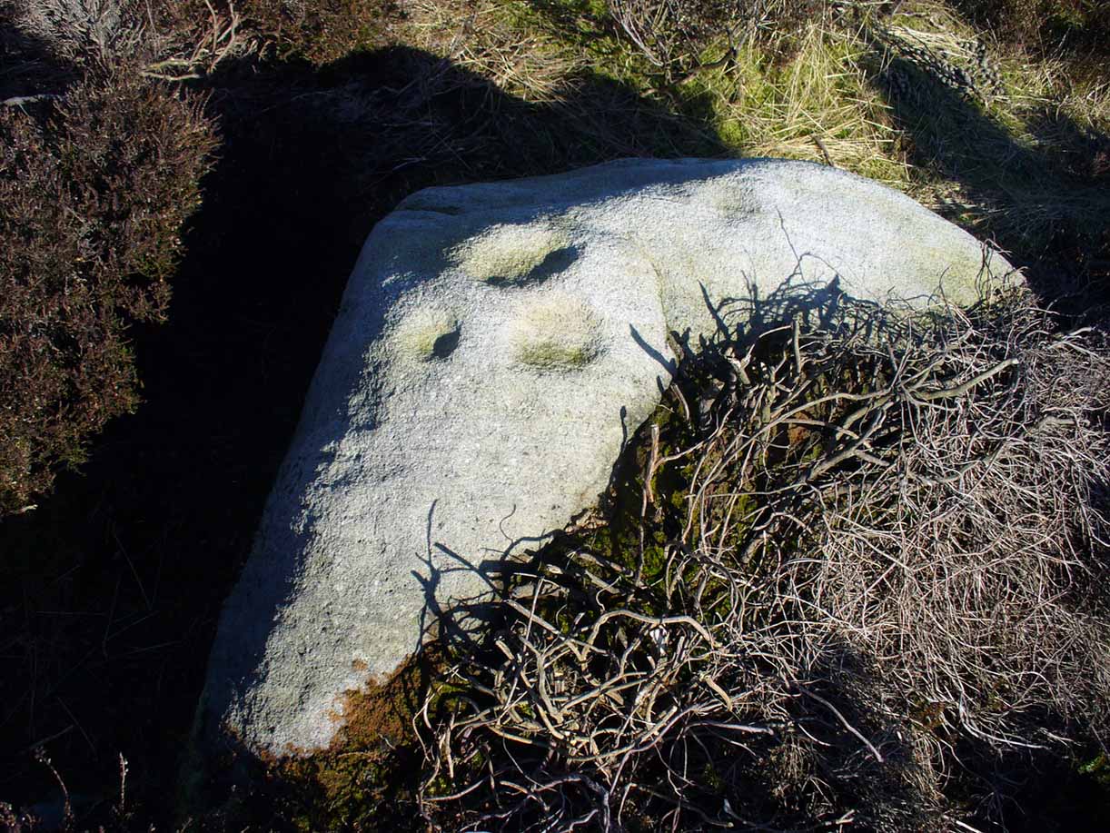
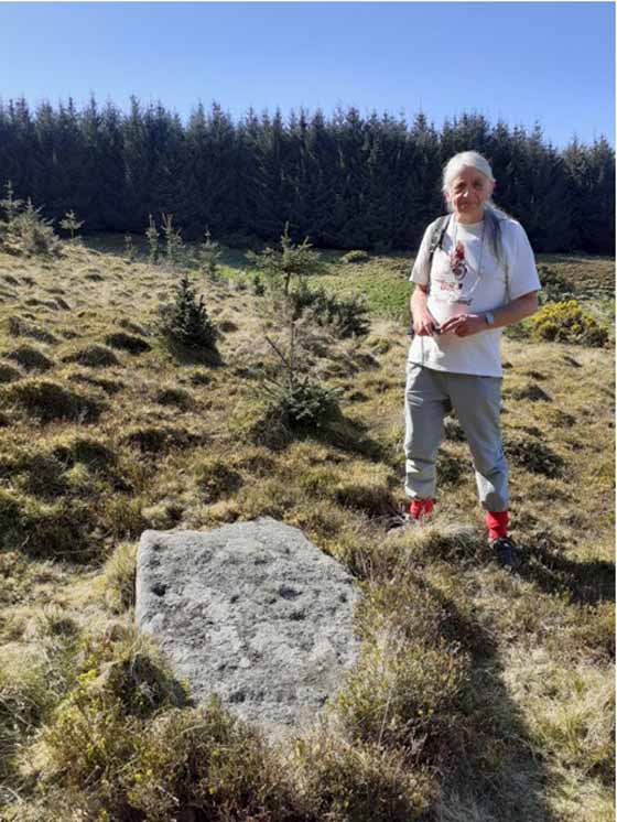
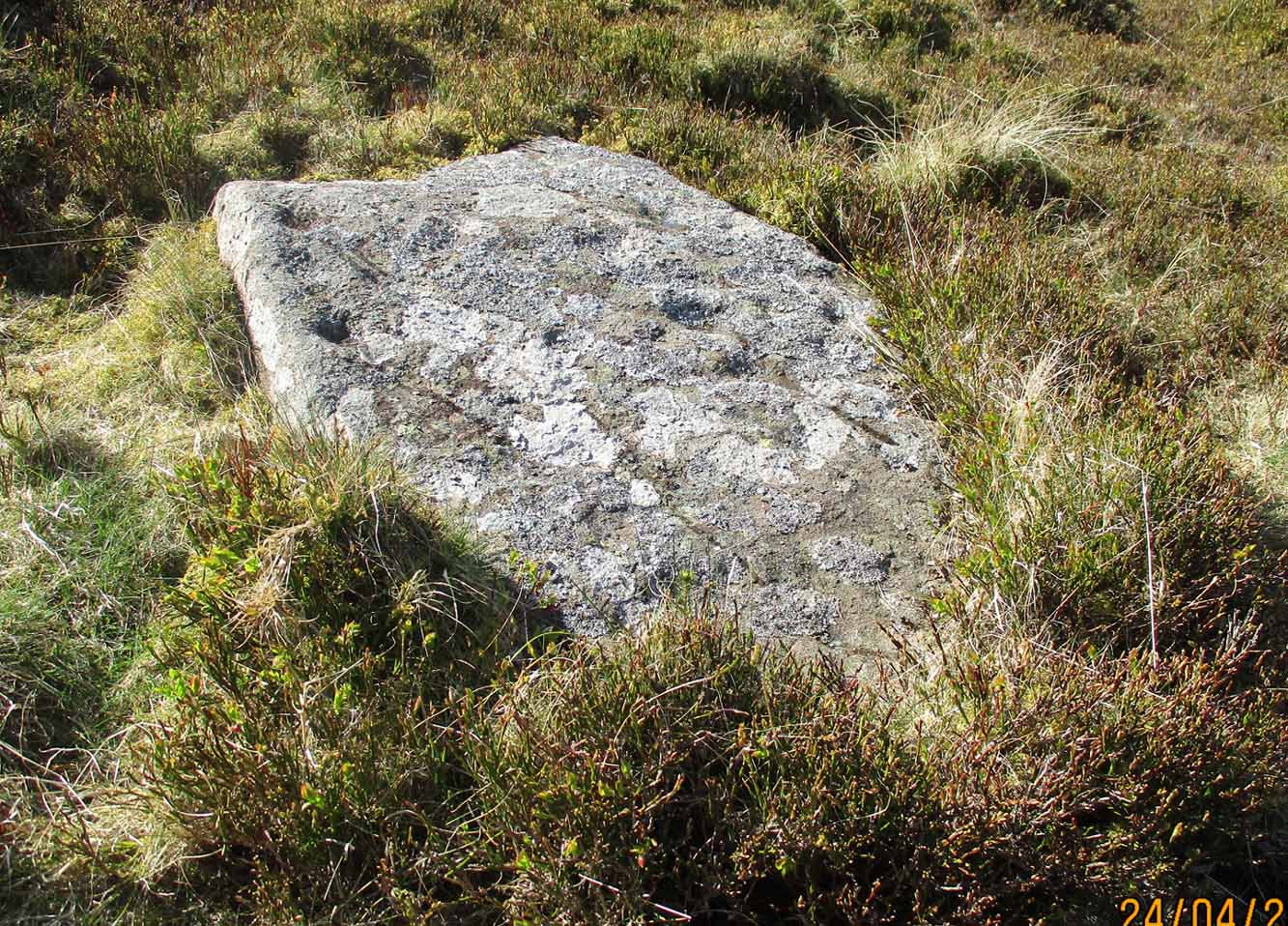
The easiest way to find this is to take the same directions to reach the Woofa Bank settlement. Get your compass out and make sure that you’re at the northern edge of the settlement walling. From here, walk about 60 yards northwest and keep your eyes peeled for a rock about 2 feet high, curved and elongated with its top surface above the heather. You’ll find it.
Archaeology & History
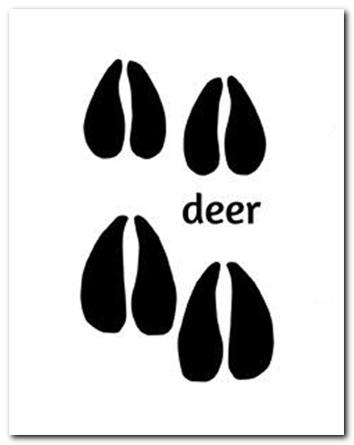
The name I’ve given to this stone is a conjectural one based entirely on comparative petroglyph designs elsewhere in the world. Or to put it more simply: elsewhere in the world we find examples of prehistoric rock art showing animal tracks and rituals relating to hunting animals, and in the design of this petroglyph on Ilkley Moor I wondered if we might be looking at something similar. Internationally respected anthropologists, archaeologists, geologists and rock art specialists such as Lawrence Loendorf (2008), Polly Schaafsma (1980), Dennis Slifer (1998) and many others show examples of animal tracks in the US and Mexico (examples exist throughout the world), and it’s not unlikely that some of the petroglyphs in the UK represent such things. But, like I say, this particular carving may have nowt to do with such a thing and the idea is entirely conjectural on my part and is probably way off the mark.
Deer-print motif & cup
Located less than 60 yards (54m) northwest of the impressive Woof Bank enclosure, it’s possible that the first literary note of this was by Stuart Feather (1968) when he made note of five cup-and-ring marked rocks (which) have been revealed by erosion in 1968,” telling us that some of the motifs on the rocks included cups with and without rings, channels and eye-shaped marks (occuli)— the latter of which may relate to this stone.
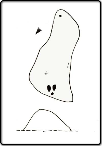
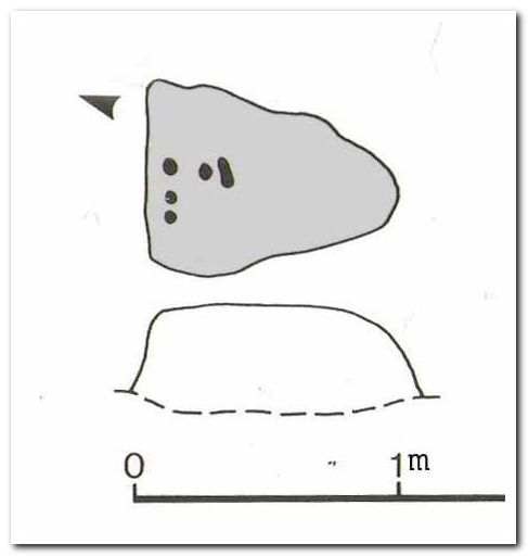
A more definite description of the stone was made in John Hedges (1986) survey where he described it in that usual simplistic form, telling us: “Long rock, its surface on two levels, sloping N to S in heather. Two large oval cups and one cup at N end. One clear cup at S end.”
Hedges’ 1986 sketch
It is these two elongated cups that have the distinct appearance of deer tracks. (another animal with a similar footprint is the goat) The cup-mark in front of them and the one at the back of the rock may be something relative to the animal. But more important than this is to recognise that, in lots of cultures, animal tracks are represented in some petroglyphs. That’s more important to think about when you look at British rock art, than the improbability of this design being such a thing…
References:
Boughey, Keith & Vickerman, E.A., Prehistoric Rock Art of the West Riding, WYAS: Wakefield 2003.
Feather, Stuart, “West Yorkshire Archaeological Register – Ilkley (WR) Green Crag Slack,” in Yorkshire Archaeology Journal, volume 42, 1968.
Hedges, John, The Carved Rocks on Rombalds Moor, WYMCC: Wakefield 1986.
Loendorf, Lawrence L., Thunder and Herds – Rock Art of the High Plains, Left Coast: Walnut Creek 2008.
Schaafsma, Polly, Indian Rock Art of the Southwest, University of New Mexico Press 1980.
Slifer, Dennis, Signs of Life – Rock Art of the Upper Rio Grande, Ancient City: New Mexico 1998.
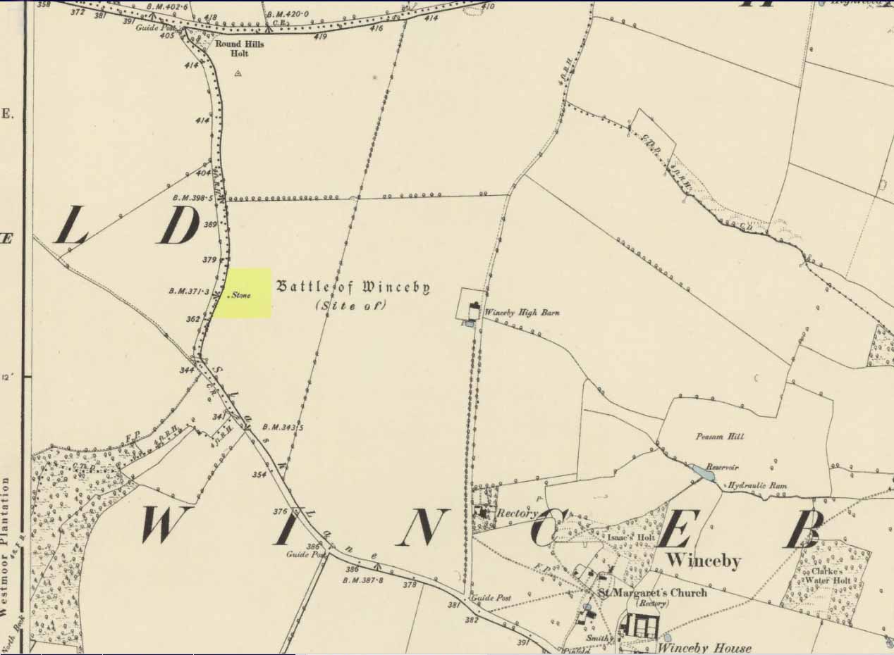
There is no specific archaeological information about this stone. However, we must take note of the so-called “devil’s footprint” that was on the boulder. In some parts of the UK, some devilish and other mythic footprints on stone are prehistoric cup-markings; but we have no idea whether this impression was such a carving or—more probably in this case—Nature’s handiwork. The field in which the stone existed was said to be the place where the so-called Battle of Winceby occurred.
Folklore
The stone was mentioned in several old tomes, with each one generally repeating the same familiar story, and with motifs that will be familiar to antiquarians and folklorists alike. In an early edition of Notes & Queries we were told of,
“the large stone in Winceby field, where soldiers had sharpened their swords before the battle. This was a stone of fearful interest, for much treasure was supposed to have been buried under it. Numerous attempts have been made to get at this treasure, but they were always defeated by some accident or piece of bad luck. On the last occasion, by ‘yokkin’ several horses to chains fastened round the stone, they nearly succeeded in pulling it over, when, in his excitement, one of the men uttered an oath, and the devil instantly appeared, and stamped on it with his foot. “Tha cheans all brok, tha osses fell, an’ tha stoan went back t’ its owd place solidder nur ivver; an’ if ya doan’t believe ya ma goa an’ look fur yer sen, an’ ya’ll see tha divvill’s fut mark like three kraws’ claws, a-top o’ tha stoan.’ It was firmly believed the lane was haunted, and that loud groans were often heard there.”
The tale was retold in Grange & Hudson’s (1891) essay on regional folklore. In Mr Walter’s (1904) excellent local history survey, there was an additional shape-shifting element to the story which, in more northern climes, is usually attributed to hare; but this was slightly different. The stone, as we’ve heard,
“was supposed to cover hidden treasure, and various attempts were made at different times to remove it, sometimes with six or even eight horses. At one of these attempts, his Satanic Majesty, having been invoked by the local title of ‘Old Lad’ appeared, it is said, in person, where upon the stone fell back, upsetting the horses. On another occasion a black mouse, probably the same Being incarnate in another form…ran over the gearing of the horses, with a similar result. Eventually, as a last resort, to break the spell, the boulder was buried, and now no trace of the boulder, black mouse, or Satan’s foot-print remains.”
Sadly we have no sketches of the devil’s ‘footprint’; and if local lore is right, we’ll never know. For tis said that a local farmer in the 1970s dug down and removed the stone completely. All that he found were numerous broken ploughshares around the rock, indicating that many tools had been used to shift the stone. In much more recent times however, a fellow antiquarian has said that it can still be found: so, if you can get a good photo of it, stick it on our Facebook group.
References:
Grange, Ernest L. & Hudson, J.C. (eds.), Lincolnshire Notes and Queries – volume 2, W.K. Morton: Horncastle 1891.
Gutch, Mrs & Peacock, Mabel, Examples of Printed Folklore Concerning Lincolnshire, David Nutt: London 1908.
Walter, J. Conway, Records, Historical and Antiquarian of Parishes around Horncastle, W.K. Morton: Horncastle 1904.
Acknowledgements:Huge thanks for use of the Ordnance Survey map in this site profile, reproduced with the kind permission of the National Library of Scotland.
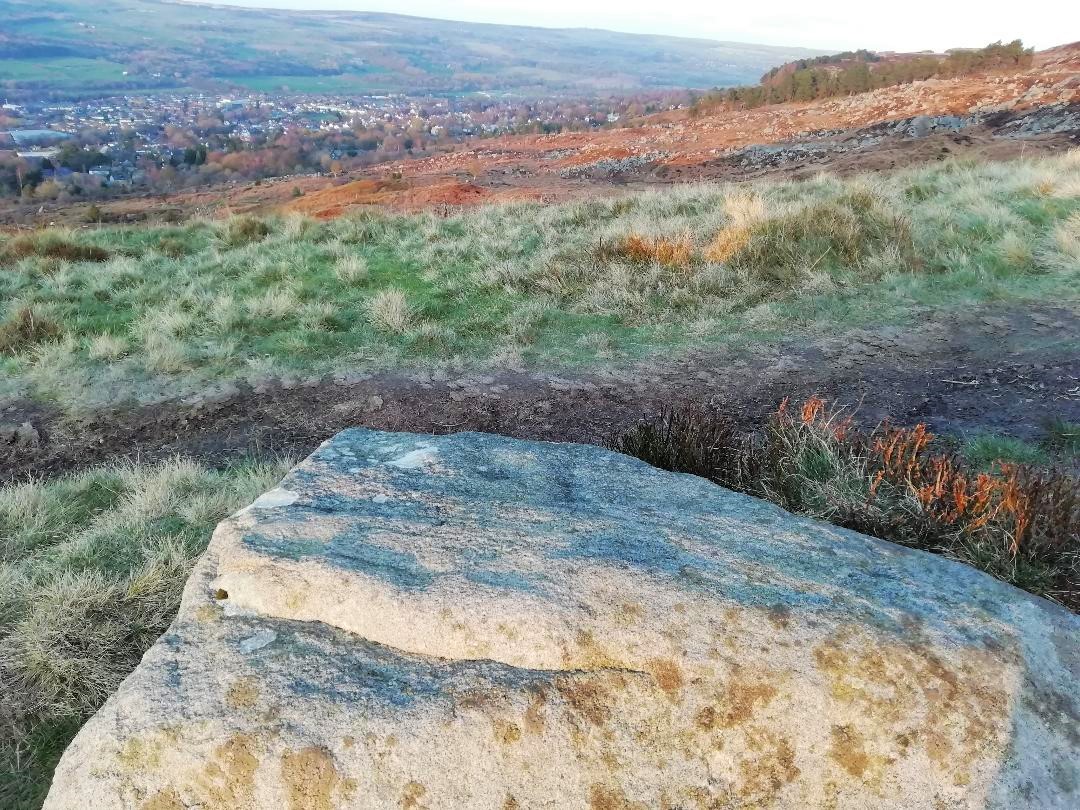
In the middle of Bridge of Earn village, take the Heughfield Road until, ⅓-mile on you hit the T-junction. Turn left along Forgandenny Road and go along the curvaceous road for just over a mile where you need to keep your eyes peeled for the small left turn that takes you up the dead straight road. At the top, turn left at the junction and go ⅔-mile, turning right at the next junction until after 400 yards you reach the houses on your right. Go up the footpath opposite the houses (south) until, after nearly 400 yards, it splits. Bear right and zigzag up the track for nearly a mile till you reach a large opening in the forest. 40 yards up the slope to your left is the stone—at last!
Archaeology & History
After the trail to get here, you might not be overly impressed by what you see – and it’s nothing special to look at to be honest. But its location is a good one: reasonably high up on a sloping plateau which would have given good views were it not for the surrounding forestry plantations. The only literary description of the site was the brief one in Discovery & Excavation Scotland, shortly after being rediscovered. Mrs Johnson (1960) wrote:
Close-up of the carving
“A cup-marked stone was found by Mr. J. R. Morrison on the N side of West Dron hill. The stone measures approx. 4ft long by 1ft 9in broad.
There are 17 cup-marks: five of which have channels, and two of which are joined in the form of a dumb-bell. The stone lies with its longer axis NE-SW, and its broad face uppermost.”
Its seeming isolation is a peculiarity that I don’t buy. Other carvings are going to be in the locale, probably on the same north- or north-east facing ridges – but due to the dense forestry, any other petroglyphs will remain hidden for quite some time…
References:
Johnson, M., “Dron, Perthshire,” in Discovery & Excavation Scotland, SRG 1960.
Acknowledgements: Huge thanks to Theresa Hughes for the use of her photos of this carving.
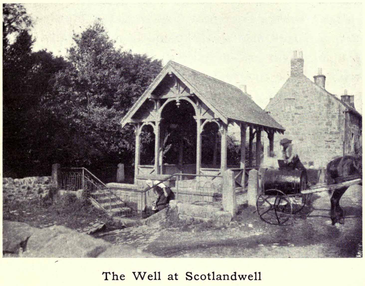
Whichever way you come into the hamlet—be it along the A911 from either Milnathort or Glenrothes, or up the B920 from Ballingry side—the only little carpark to use is about 20 yards from the main road junction, on the west-side of the road, appropriately named Well Road. The site is unmissable beneath the small well-house at the end of this short cul-de-sac.
Archaeology & History
When a village is named after a well, you know that its waters held some considerable importance! Mentioned as early as 1218 as “de fonte Scotie” and subsequently many variations thereof in centuries thereafter, the place-names authority Simon Taylor (2017) thinks it may have been mentioned as early as 1090 CE.
Scotland Well in 1915The clear cold waters
Although there has never been a direction dedication of the Scotland Well to any saint, as J.M. MacKinlay (1904) and others have pointed out, in the village itself was an ancient medieval hospital that belonged to “the Trinity or Red Friars” that was built for the benefit of the poor by the Bishop of St. Andrews, some 22 miles to the east. The hospital was at first dedicated to St. Thomas and subsequently to the Virgin, or St Mary. Holy wells dedicated to both saints are renowned the world over as having great medicinal properties, but no extant written document relates either saint to the well.
Folklore
The main reason for this site maintaining such an honourable place in Scottish history is its association with the two great Scottish heroes, Sir William Wallace and King Robert the Bruce. In the pseudonymous Historica’s (1934) literary rambles, he told that, after coming down out of the Lomond Hills,
“We descend the narrow defile—the Howgate—into Scotlandwell—Fons Scotia—famous for its medicinal springs, where tradition says King Robert the Bruce came to take the waters for scrofula and leprosy in 1295. The great Sir William Wallace—according to ‘Blind Harry’—also has associations here. His famous swim to the Castle Island, for a boat to take over some of his men to capture the english on St. Serf’s, took place from below Scotlandwell.”
In Ruth & Franks Morris’ (1982) fine survey of Scottish wells, they told that upon their visit to the Scotland Well, three people they met still thought highly of its curative properties. “Of these three people,” they said,
“one was a sufferer from cancer which was the cause of a painful skin rash. He had been persuaded to try the water and found that it did him so much good that he was driven from Edinburgh to the well, a round trip of some 80 miles, at at regular intervals to drink the water and take back with him two demi-johns of it.”
According to the man concerned, it did him the world of good and cleared the stubborn body rash he’d been suffering!
References:
Day, J.P., Clackmannan and Kinross, Cambridge University Press 1915.
Historicus, Historic Scenes within our Limits, Kinross-shire Advertiser: Kinross 1934.
MacKinlay, James M., Influence of the Pre-Reformation Church on Scottish Place-Names, William Blackwood: Edinburgh 1904.
Morris, Frank & Ruth, Scottish Healing Wells, Alethea: Sandy 1982.
Taylor, Simon, The Place-Names of Kinross-shire, Shaun Tyas: Donington 2017.
Acknowledgements: Big thanks for being able to use the 1st edition OS-map for this site profile, Reproduced with the kind permission of the National Library of Scotland.
From Ilkley, go up to White Wells (ask a local if y’ get stuck) and walk round the back of the building. Walk to the trees and then follow the footpath up onto the moors; but after 70 yards a small footpath on your right goes up the slope. Take this and after about 90 yards it veers round to your left, following the contours up towards the copse of trees. Another 100 yards up it meets with another path and once here, just yards in front of you, right by the side of the footpath, is the stone in question.
Archaeology & History
First described in John Hedges (1986) survey, this simple cup-marked stone typifies many petroglyphs on these moors: a barely visible design much eroded by centuries of wind and water, with markings perhaps only of interest to the devoted student and explorer. But at least it’s a good place to sit, rest and watch the valley below.
Looking down at the cupsHedges 1986 sketch
This old fella looks to have only five cupmarks on its supper surface, one of which is elongated, as shown in Hedge’s drawing. However, when he saw this, he thought the elongated ‘cup’ consisted of three of them in a line, all linked up. He saw a “medium sized smooth grit rock standing in grass, its surface triangular in shape, with flat top sloping slightly N to S. Three cups connected by a groove, c. four other cups, all shallow and worn.”
This description was echoed in Boughey & Vickerman’s survey (2003), where they thought that the “triangular top surface has about seven worn cups, three connected by a short groove.” But if the light isn’t quite right, this can be very difficult to see.
References:
Boughey, Keith & Vickerman, E.A., Prehistoric Rock Art of the West Riding, WYAS: Wakefield 2003.
Hedges, John (ed.), The Carved Rocks on Rombalds Moor, WYMCC: Wakefield 1986.
Cup-and-Ring Stone: OS Grid Reference – NS 8551 8819
Archaeology & History
Looking down on C-7c
Near the northwestern end of the small geological ridge that runs to the west of Castleton farmhouse, close to an awesome nine-ringed carving, we find this more simplified triple-ringed petroglyph. And although the carving is easy enough to describe, its labelling (as ‘Castleton 7c’) is rather troublesome. As with other carvings in this locale, the name of the stone is based on a survey done by Maarten van Hoek in the mid-1990s. But van Hoek’s sketch of Castleton 7c and the one shown in our photos, whilst very similar, possess attributes that aren’t on van Hoek’s drawing. Now this isn’t too odd, as many petroglyphs look different when lighting conditions change; to the point where some features you can see one day are almost invisible the next. But this carving has attributes that are very difficult to miss – and van Hoek’s detailing tended to be good. But, all this aside: until we can verify with certainty one way or the other and despite my suspicions that this isn’t what van Hoek described, I’m still entering this carving as Castleton 7c. So – now that bit’s out of the way…!
When we visited the site two years ago the day was dark and overcast, so we didn’t really have good conditions for seeing any faint carvings. But this wasn’t faint, thankfully. It was completely buried beneath soil and gorse bushes, but thankfully Paul Hornby managed to unearth the one you can see in the photos. If it is the Castleton 7c petroglyph, it was rediscovered by van Hoek on one of his ventures here in 1985.
Carving showing wavy lines on right…and from another angle
When we visited the site we only managed to uncover a small section of the stone, as the roots of the surrounding gorse prevented us from seeing more. (it’s tough stuff unless you’ve got the right gardening equipment!) The section we uncovered consisted of a cup-and-triple-ring. This is consistent with van Hoek’s sketch and description; but we also found there were two very notable ‘arcs’ on the outer edge of the rings—nearly opposite each other—as if another, fourth ring had been started. You can’t really miss these elements – and even in the poor lighting conditions we had, these outer arcs are very evident on a number of photos – especially when they are expanded to full-scale. However, as I mentioned, we were unable to uncover all the rock; but when van Hoek was here there was far less herbage. What he saw on this carving was as follows:
“Deturfing part of this ridge revealed a fine cup with three rings with a broadly pecked tail; one solo cup; one large oval ring with small central cup; and a faint cup with two rings, the outer one incomplete. The rock slopes 12º ENE.”
Crap drawing done in crap lightingvan Hoek’s 1996 sketch
The “broadly pecked tail” he mentions is also not really clear in any of the 60 photos we took. There is a faint line that runs through the three rings, into the central cup and out the other side: a single curving line no less. It’s certainly visible, but it’s far from broad. But there are a number of other lines coming out of the rings. These maybe just natural scratch marks, or even scratches acquired from farming activity. It’s difficult to say. In the poor light that we had, there as looked to be a single cupmark a few inches away from the rings, but this isn’t consistent with the position of the cupmark on van Hoek’s sketch.
There’s a simple solution to all this: we need to revisit the site and expose more of the rock. At least that will tell us once and for all whether this is the same as van Hoek’s stone, or whether we’ve found yet another new carving. Watch this space, as they say! 😉
References:
van Hoek, Martin A.M., “Prehistoric Rock Art around Castleton Farm, Airth, Central Scotland,” in Forth Naturalist & Historian, volume 19, 1996.
Follow the directions to reach the faint but impressive Allt a’ Choire Chireinich (04) petroglyph. Standing here, you’ll notice the large boulder that looks as if it’s fallen down the slope immediately to your left. You can’t really miss it.
Archaeology & History
Beneath the gorgeous excess of ancient lichens you can make out at least three cup-marks on the south-facing sloping rock-face in the top-half of the boulder. There may be some other faint cups on here, but due to the lichens they are very difficult to see, so I’m erring on the side of caution regarding their veracity. This is another one of those carvings likely to be interest only to the most ardent petroglyphic nuts amongst you.
Follow the directions to reach the faint but impressive Allt a’ Choire Chireinich (04) petroglyph. Standing here, look straight down at the dried-up burn barely ten feet below you, where you’ll see a small sloping rock. That’s it!
Archaeology & History
Nothing much to see here apart from a single shallow cup-marking. Most likely of interest only to the most ardent petroglyphic explorer, but worth looking at when you’re visiting the more impressive carvings nearby.
Holy Well (destroyed): OS Grid Reference – T 2481 8173
Archaeology & History
Highlighted on the 1838 OS-map, Grogan and Kilfeather (1997) report that there are “no visible remains” to be seen of this holy well. The cult of St Patrick is still celebrated in Ireland every year on 17 March.
References:
Grogan, Eion & Kilfeather, Annaba, Archaeological Inventory of County Wicklow, Stationery Office: Dublin 1997.
Lynch, Geraldine, “The Holy Wells of County Wicklow,” in Wicklow History and Society (edited by K. Hannigan & W. Noland), Dublin 1994.