Cup-and-Ring Stone (destroyed?): OS Grid Reference – SE 314 537
Archaeology & History
The chances of this carving still being alive, so to speak, are pretty slim. It was reported by a Mr. Sullivan to the old Yorkshire petroglyph researcher Stuart Feather back in 1965, in the days when English archaeologists didn’t really give a shit about rock art. Sad but true. The carving was found in the grounds of what used to be the ICI Fibres Research Centre, in the present landscape of Hornbeam Business Park, a hundred yards or more west of Hookstone Beck. According to Feather’s report, the carving consisted of “a single-ringed cup and a groove” surrounding “two short pecked grooves and a meandering groove leading off,” all with clear signs of being pecked and carved in the old-school manner. All trace of the carving has vanished and it was probably destroyed by the Industrialists. (the grid-reference to this site is an approximation)
Easiest way is to park up at the Askwith Moor car-park spot, turn right and walk along the road for about 350 yards until you reach the gate on the right (not the one across the road!). You then need to head to the Death Head’s Stone carving about 450 yards across the moor to the east. It’s pretty conspicuous. From here, walk through the heather 80-odd yards northwest. You’ll walk past some extensive rubble walling (whose nature yet eludes us) before you get there.
Archaeology & History
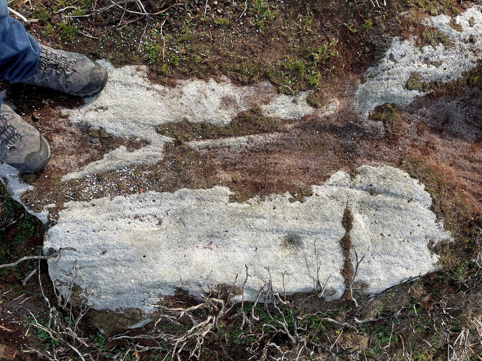
Looking down at the cups
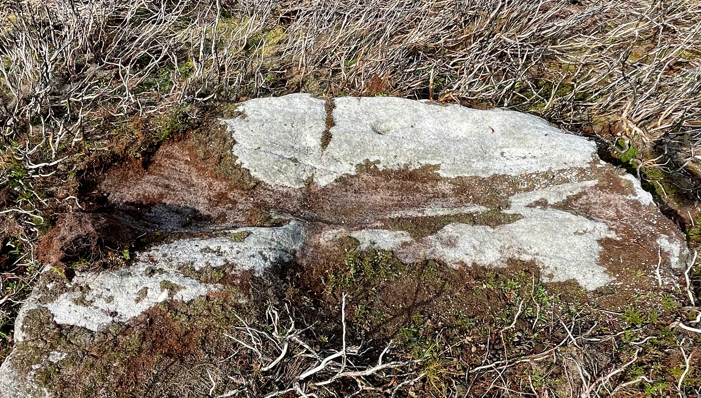
Discovered recently by Sarah Walker on a venture to see the extensive settlement and graveyard around Snowden Crags, this petroglyph is a simple basic design cut into a relatively large flat stone just above ground level. Found less than 100 yards east of the dubious Snowden Carr (565)carving, there are two large cup-marks on this one: one of them is an inch deep and two-inches across and may originally have been geophysical in nature, but has subsequently been worked by human hands. To its side is another much fainter and shallower cup-mark about the same width. On some photos there’s what appears to be a very faint large ring surrounding the faint cup, but until visits are made at low sun and the stone brushed with water, we cannot be sure whether it’s real or just a trick of the light. There may be more cups on this stone beneath the peat. We didn’t brush it all off.
Some 30-40 yards to the east is the rubble of an extensive prehistoric man-made structure, the nature of which has yet to be discerned. The Snowden Moor cairnfield begins immediately to the northwest, with the first tomb barely 50 yards away.
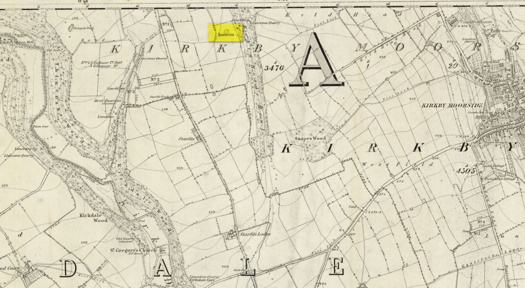
Tumulus (destroyed): OS Grid Reference – SE 6803 8695
Also Known as:
Robin Hood’s Howl
Archaeology & History
Site on the 1856 OS-map
There once stood a very impressive prehistoric burial mound here, a few hundred yards east of the roadside, just above the wooded valley known curiously as Robin Hood’s Howl. Highlighted on the 1856 Ordnance Survey map as an elongated structure, it was suggested in McDonnell’s (1963) work to have been a long barrow, measuring roughly 70 feet long by 50 feet across and more than six feet in height. It was seemingly written about for the first time by William Eastmead (1824) in his lengthy history of the area and was, he told,
“a tumulus of considerable dimensions (that) was lately opened at a place called the Hag, about a mile northwest of Kirkby-Moorside, in which was found an urn… Great numbers of human bones were also dug out…; and from the immense size of it, a great number of bodies appear to have been burnt indiscriminately, and the ashes of some particular person deposited in the urn.”
The urn would seem to have been either lost or destroyed—as has the tumulus. It was apparently still intact, albeit very denuded, twenty years ago, but has since been ploughed out.
References:
Eastmead, William, Historia Rievallensis: containing the history of Kirkby Moorside, R. Peat: Thirsk 1824.
McDonnell, J. (ed.), History of Helmsley, Rievaulx and District, Stonegate: York 1963.
Acknowledgements:Huge thanks for use of the Ordnance Survey map in this site profile, reproduced with the kind permission of the National Library of Scotland.
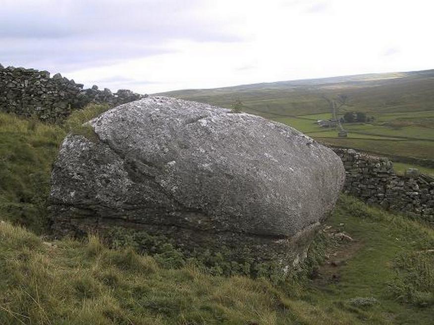
From the small town of Bainbridge, head south down the Carpley Green Road. Less than a mile before the end, look to the west-facing slope of Addlebrough Hill and this huge Devil’s Stone can be seen resting halfway up the slope, just by the wall. Y’ can’t miss it!
Archaeology & History
The Devil’s Stone
Highlighted on the 1856 Ordnance Survey map, one of the legends of this place suggested there might be cup-and-ring markings on the stone, but the curious markings on top of the rock seem to be natural. It’s a superb stone though, dropped here no doubt by some great glacier as it retreated north, in ages truly olde…
There’s a lot of archaeology around here that’s yet to receive the attention of the archaeology textbooks. But if you’ve ventured to see this, have a gander across to the massive prehistoric tomb known as Stony Raise, less than a mile southeast of here.
Folklore
One legend tells that long ago Addlebrough was the home of a great unnamed giant — but a friendly giant by all acounts. However, one day the devil turned up and wanted possession of the giant’s hill and so a fierce row broke out between them. Perched on the top of the crag — which is the rough ridge to the west of here — the giant who lived there hurled huge boulders down at the devil, but they fell short and landed at the side of Lake Semerwater (itself an important spot in local prehistory). In return, Old Nick himself began throwing boulders back — and one of those which the devil threw landed here, halfway up the western flank of Addlebrough Hill (a couple of the large boulders which the giant threw can be seen on the edge of Semerwater and are known as the Carlow and Mermaid stones). Hence it’s name of the Devil’s Stone!
In Edmund Bogg’s Richmondshire (1908), he told how, “the curious markings on (the Devil’s Stone) are accounted due to the pressure of the devil’s fingers” which were caused when he threw this giant stone from somewhere to here.
Site shown on 1856 map
This is a theme we find at countless other stone sites, i.e. the Devil burning holes into rock — and in some cases these devil’s “fingerprints” have turned out to be prehistoric cup-markings. Such tales relate to the pre-christian Creation Myth of a place and would, before the “devil” was supplanted onto a site, have had wider significance in the landscape as a whole, in a manner known only to local people. Devils usually replaced legendary giants, or the hero-figures who created the land in primordial times in the myths of our ancestors. A greater examination of the nearby sites in association with the folklore of the region would no doubt be quite profitable…
References:
Bogg, Edmund, Richmondshire, James Miles: Leeds 1908.
Romney, Paul (ed.), The Diary of Charles Fothergill, 1805, Yorkshire Archaeological Society: Leeds 1984.
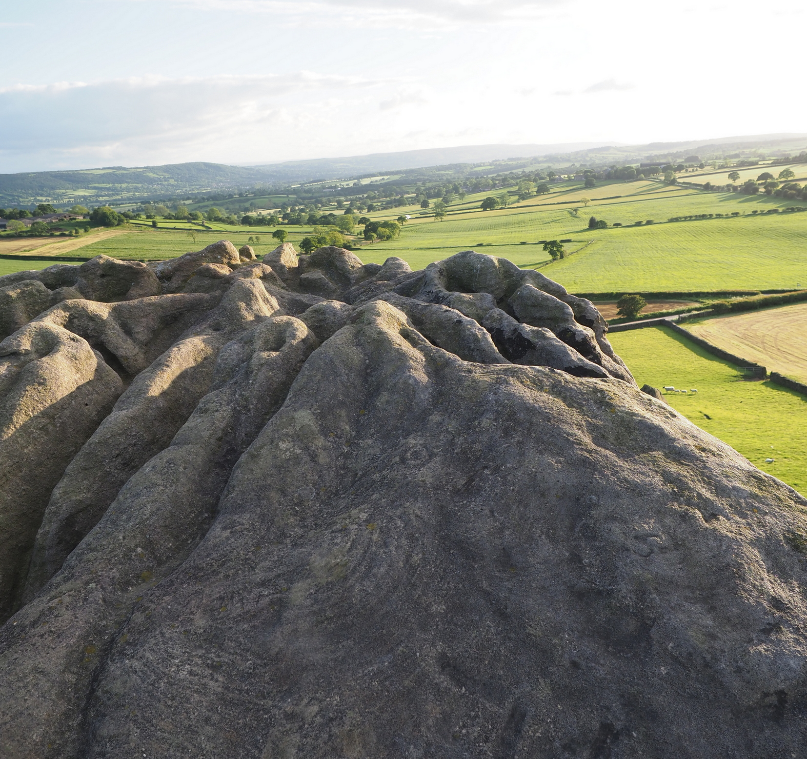
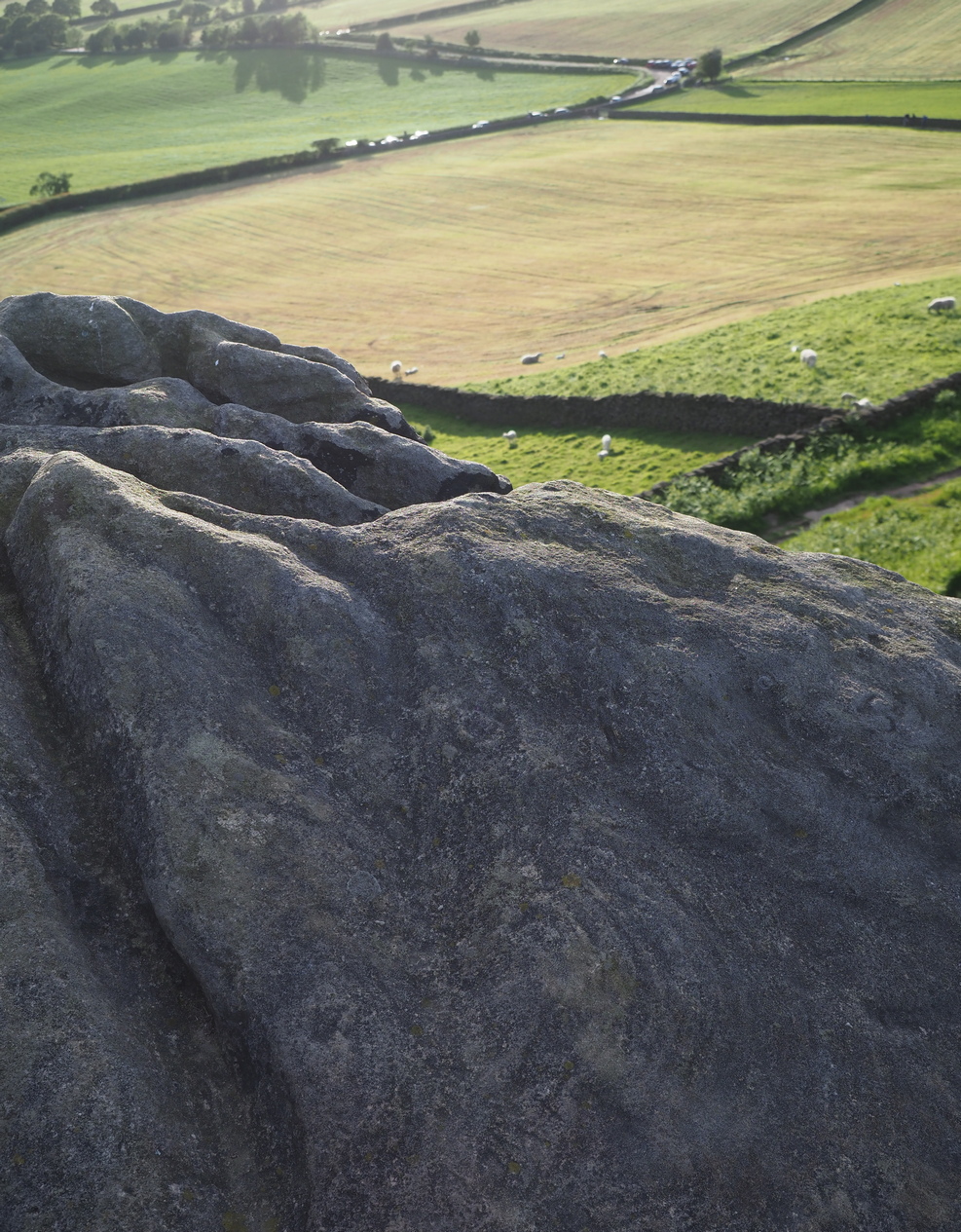
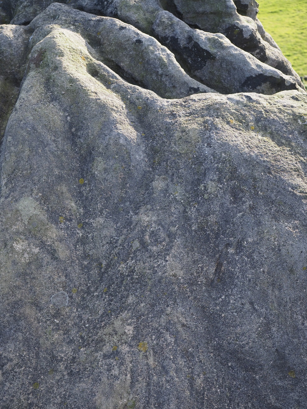
This is an outstanding site visible for miles around in just about every direction – so getting here is easy! If you’re coming from Harrogate, south down the A658, turn right and go thru North Rigton. Ask a local. If you’re coming north up the A658 from the Leeds or Bradford area, do exactly the same! (either way, you’ll see the crags rising up from some distance away) As you walk to the main crags, instead of going to the huge central mass, you need to follow the line of walling down (south) to the extended cluster of much lower sloping rocks. Look around and you’ll find it!
Archaeology & History
On the evening of May 27, 2024, I received a phone call from a Mr James Elkington of Otley. He was up Almscliffe Crags and the wind was howling away in the background, taking his words away half the time, breaking the sentences into piecemeal fragments. But through it all came a simple clarity: as the sun was setting and the low light cut across the rocky surface, a previously unrecorded cup-and-ring design emerged from the stone and was brought to the attention of he and his compatriot Mackenzie Erichs. All previous explorations for rock art here over the last 150 years had proved fruitless—until now!
Looking northwestCentral cup-&-ring
On the east-facing slope of the stone, just below the curvaceous wind-and-rain hewn shapes at the very top of the boulder, is a singular archetypal cup-and-ring. It’s faint, as the photos show, but it’s definitely there. What might be another cup-and-ring is visible slightly higher up the sloping face, but the site needs looking at again when lighting conditions are just right! (you can just about make it out in one of the photos) But, at long last, this giant legend-infested mass of Almscliffe has its prehistoric animistic fingerprint, bearing fruit and giving watch to the countless heathen activities going back centuries. Rombald’s wife Herself might have been the mythic artist of this very carving! (if you want to read about the many legends attached to the major Almscliffe rock outcrop, check out the main entry for Almscliffe Crags)
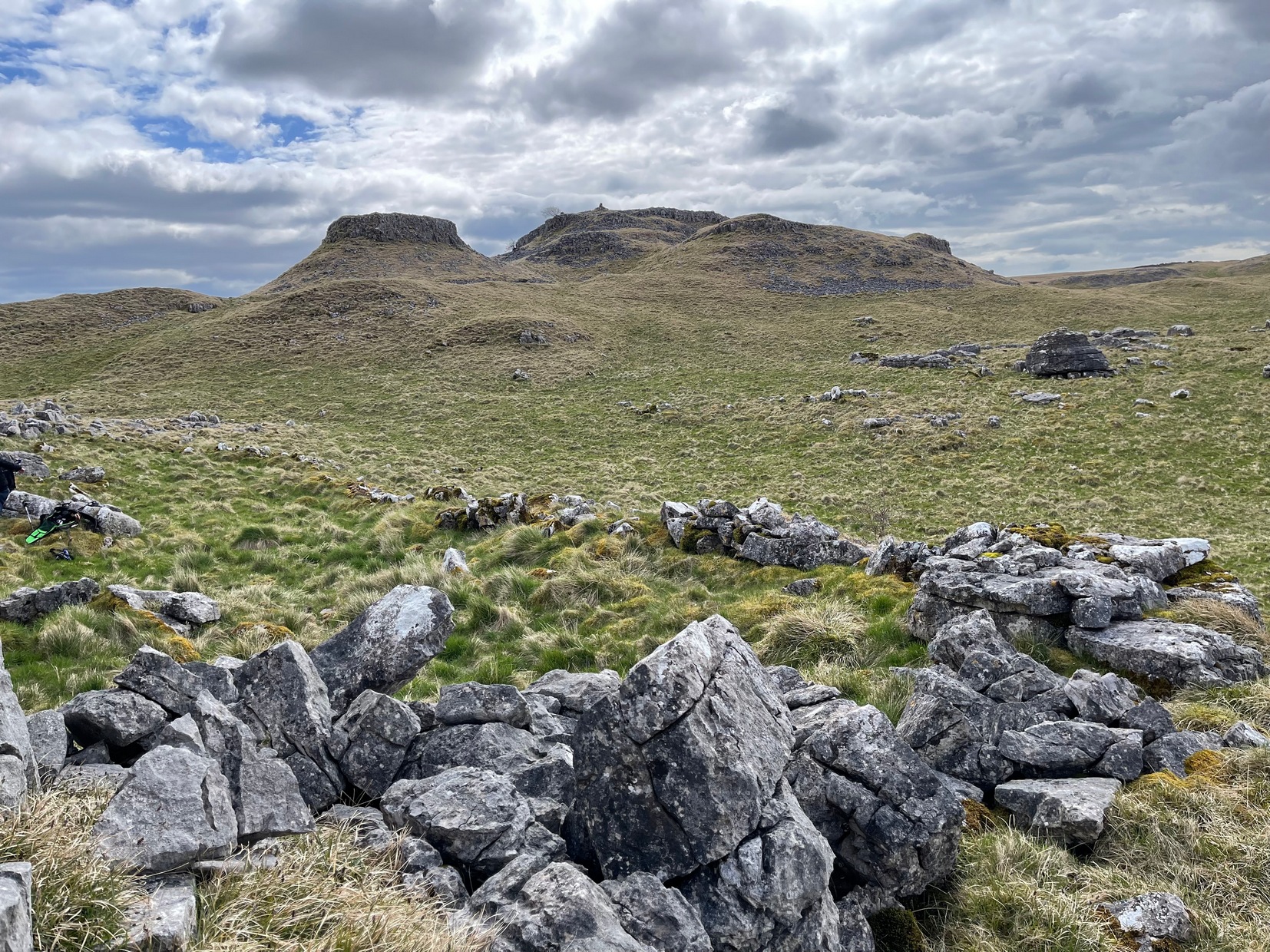
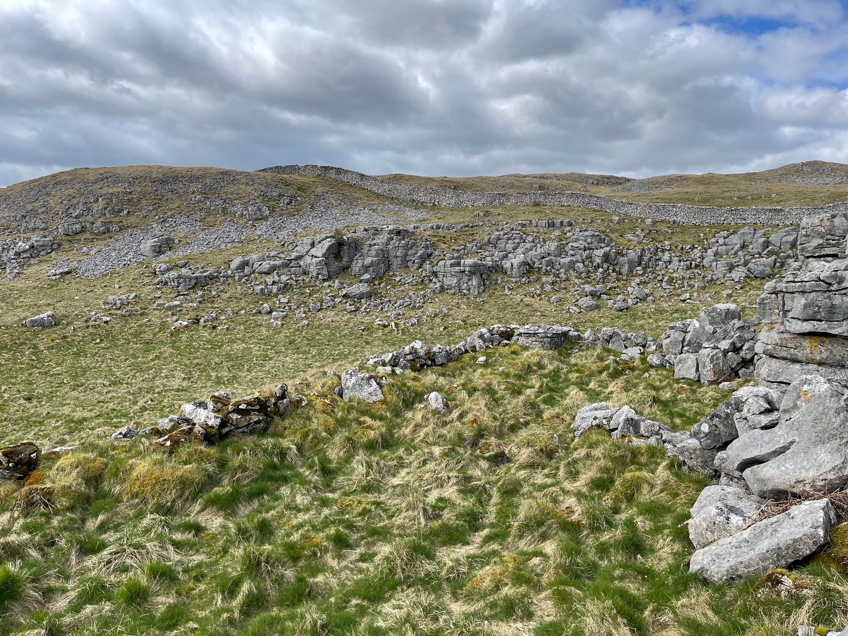
Going along the B6160 road from Grassington to Kettlewell and taking the little road to Arncliffe on your left just a few hundred yards past Kilnsey Crags, after ¾ of a mile keep your eyes peeled for the small parking spot on the left-side of the road, with the steep rocky stream that leads up to the Sleet Gill Cave. Walk up this steep slope, following the same directions to reach the Sleets Gill Top enclosure. From here you’ll notice a large gap in the rocky crags about 200 yards WSW that you can walk through. On the other side of this gap, along a small footpath about another 200 yards along you’ll reach a large ovoid rock. Just before this, on your right, is a long rocky rise with distinct drystone walling below it. That’s the spot!
Archaeology & History
Walled section, looking S
Encircling a slightly sloping area of ground that stretches out beneath a long line of limestone crags is this notable walled enclosure running almost the full length of the rocky ridge. Measuring 40 yards (36m) in length by 10 yards (9m) across at its greatest width, this elongated rectangular enclosure has all attributes of being Iron Age in origin, much like many others in this area. However, in comparison with the others close by, this is a pretty small construction and—if used for human habitation, as is likely—would have housed only two or three families.
Western end of enclosure
Within the enclosure itself, near its western end, we find an internal line of walling that creates a single room: enough for a single family, or perhaps even where animals were kept. Only an excavation would tell us for sure.
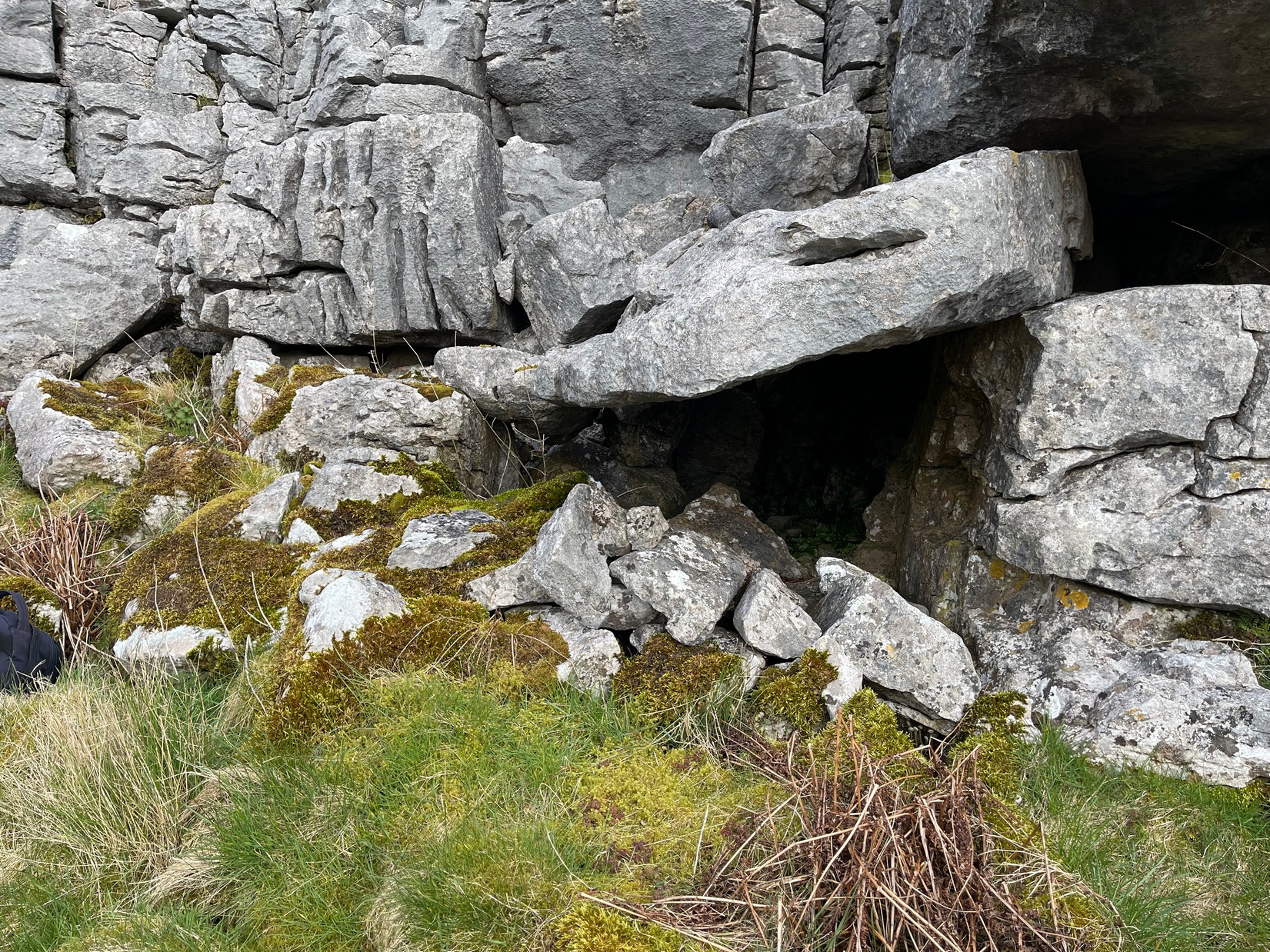
Curious stone ‘cupboard’
One notable interesting feature exists roughly halfway along the enclosure, up against the crag itself: here is small man-made stone “cupboard” of sorts, akin to some modern pantry. You’ll get an idea of it in the photo. At first I wondered if this would have been a sleeping space, but, unless it was where a shaman liked to encase him/herself inside a domestic household cave (highly improbable), it would have served a simple pragmatic function. Make up your own mind.
I liked this place. It’s surrounded by crags on almost all sides with some ancient spirit-infested rocky hills very close by, giving it a beautiful ambience. Immediately below the enclosure is what looks to be a large dried-up pool, which was probably well stocked with fish. A perfect living environment. Check it out!
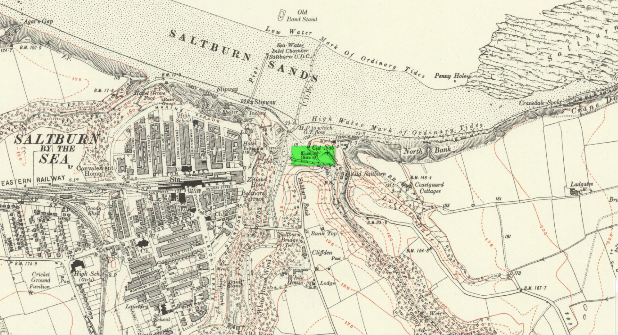
Tumulus (destroyed): OS Grid Reference – NZ 6692 2154
Archaeology & History
Location on 1930 OS-map
This long lost burial mound was first located by the local antiquarian William Hornsby in the early 20th century. It had been constructed close to the summit of the prominent rise of Cat Nab, immediately east above Saltburn. Its position was shown on the 1930 OS-map of the area. Destroyed by quarrying, it was thankfully excavated by Hornsby in 1913; and although his finds were never published, he left notes which told us that,
“there were two cremations and the sherds of at least three vessels: a collared urn, a pygmy cup and a vessel with an everted rim.” (Crawford 1980)
Crawford (1980) told that these finds could been seen in the Middlesborough Collection.
References:
Crawford, G.M., Bronze Age Burial Mounds in Cleveland, Cleveland County Council 1980.
Acknowledgements:Huge thanks for use of the Ordnance Survey map in this site profile, reproduced with the kind permission of the National Library of Scotland.
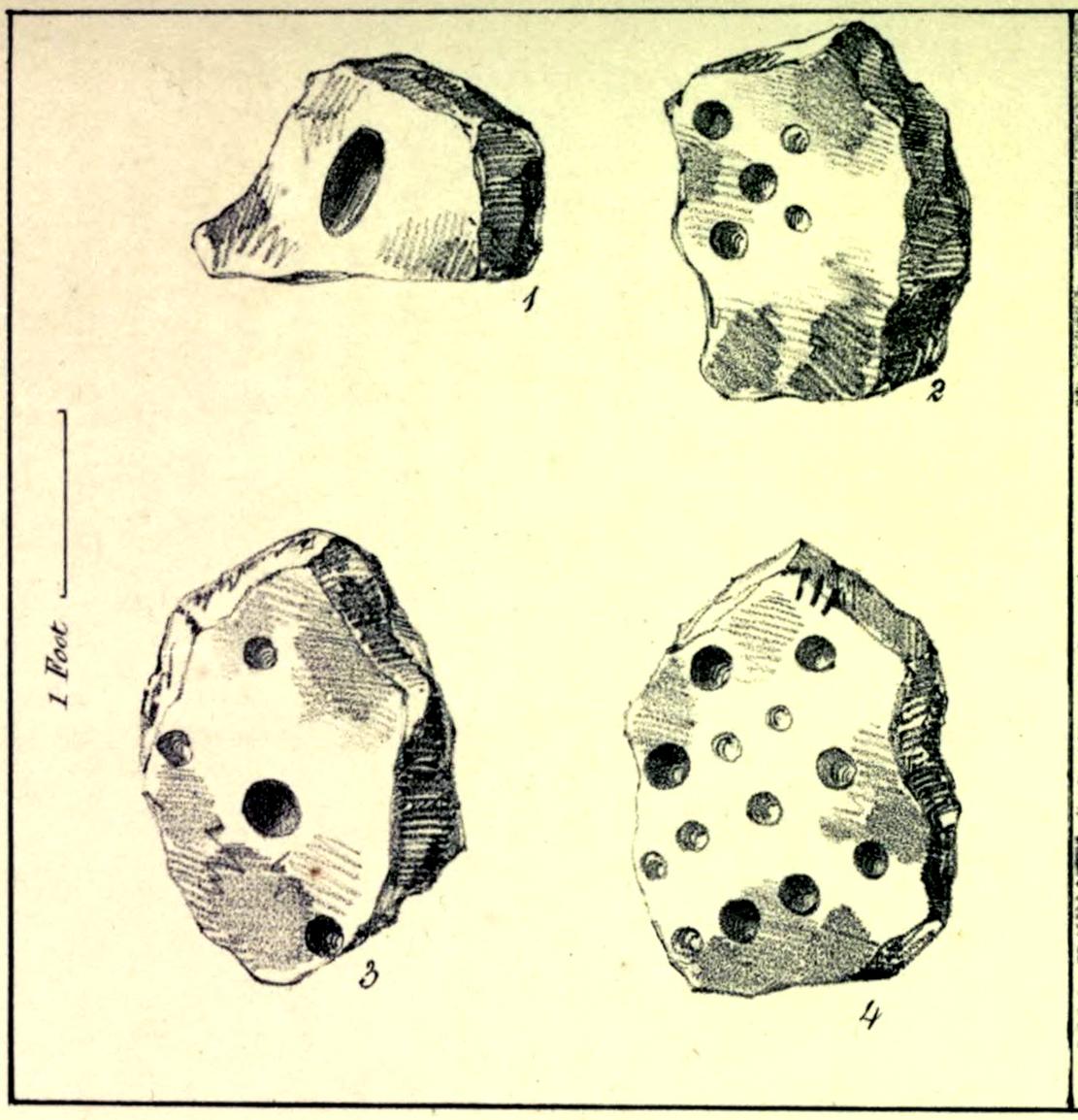
Cup-Marked Stones (lost): OS Grid Reference – SE 9657 8840
Archaeology & History
In the autumn of 1848, antiquarian John Tissiman (1850) and his associates took to uncovering two burial mounds amidst a large cluster of them on the eastern edge of West Ayton Moor. This one at Way Hagg was quite a big fella, measuring 36 yards across. When they cut into its northern edge towards the centre, 8-10 feet in, they came across an upright stone, nearly two feet high, on which five cup-marks had been cut. (see sketch, no.2) Slightly beyond this were three other stones (in sketch, nos.1, 3 & 4), each with cup-marks on them, beneath which was a tall urn. Whether or not the carvings had been deliberately positioned to cover the urn, we do not know. Nonetheless, we can be reasonably assured that these petroglyphs had some mythic association with death when they were placed here.
Tissiman gave us the following detailed measurements of the respective carvings:
“1: Nearly even surface. Length, from 16 to 18 inches; breadth, 10 to 20 ditto; depth, 8 to 9 ditto; with large oval hole cut in the centre, 7½ inches long, 4 inches broad, and 3½ inches in depth. On the opposite side are three holes, from 2 to 3 inches in diameter, and from 1 inch to 1½ deep. 2: Uneven surface. Length, 23 inches; breadth, 14 inches; depth, 13 inches; with five holes, from l½ to 3½ inches in diameter, and 1 to 1½ inches in depth. 3: Uneven surface. Length, 33 inches; breadth, 22 inches; depth, 10 inches, with four holes, the largest being 4½ inches in diameter and 3 inches deep; the others, from 1½ inches to 2 inches in diameter, and 1 to 1½ inches deep. 4: Uneven surface. Length, 27 inches; breadth, 23½ inches; depth, 10 inches, with 13 holes, from 1½ inches to 5 inches in diameter, and ¾ of an inch to 3 inches in depth; also three lines at the end of the stone.”
The carvings were included in Brown & Chappell’s (2005) fine survey, but they weren’t able to find out what happened to them after Tissiman’s excavation. They remain lost. If anyone has any information as to where they might be, please let us know.
References:
Brown, Paul & Chappell, Graeme, Prehistoric Rock Art in the North York Moors, Tempus: Stroud 2005.
Tissiman, John, “Report on Excavations in Barrows, in Yorkshire,” in Journal British Archaeological Association, April 1850.
Acknowledgements:Huge thanks for use of the Ordnance Survey map in this site profile, reproduced with the kind permission of the National Library of Scotland.
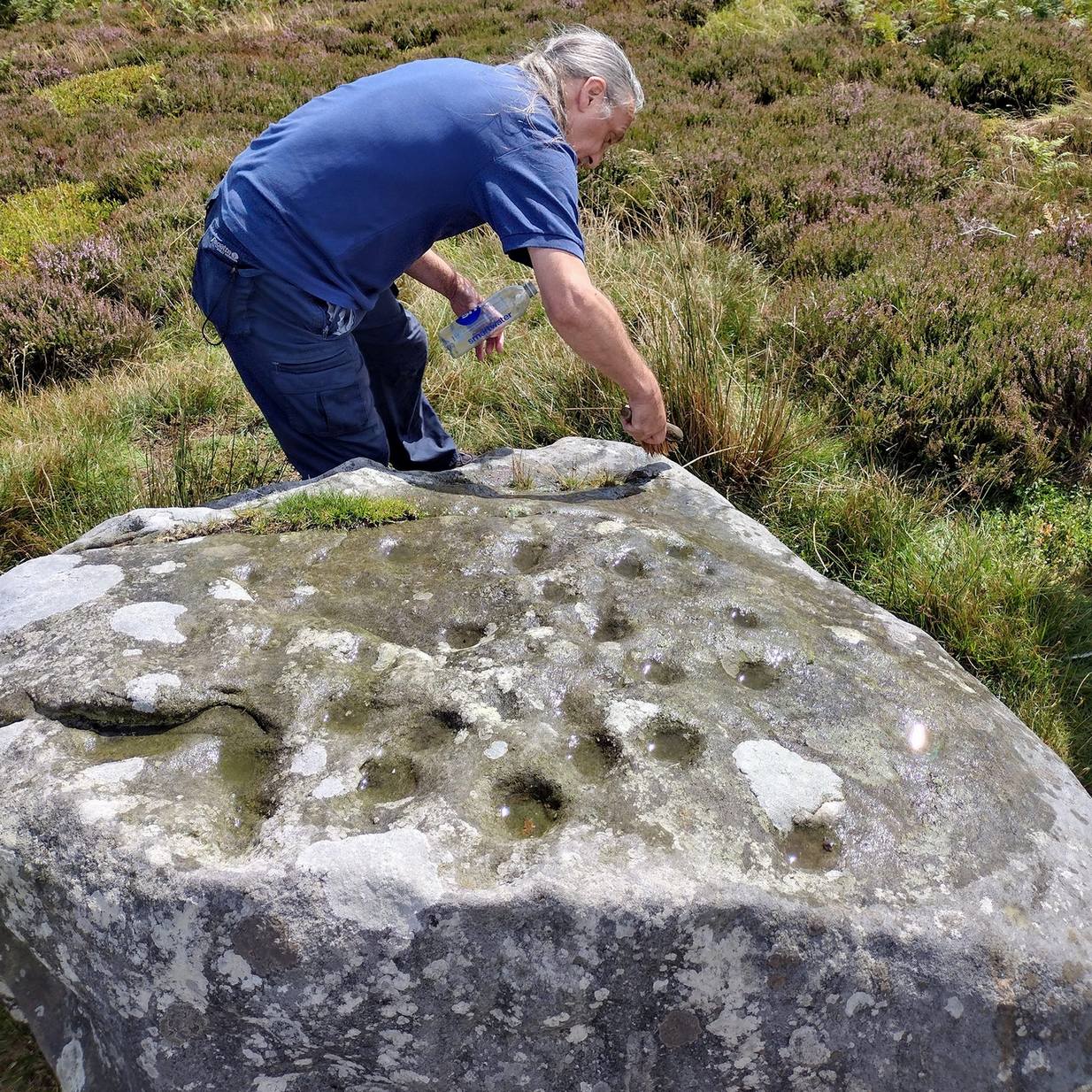
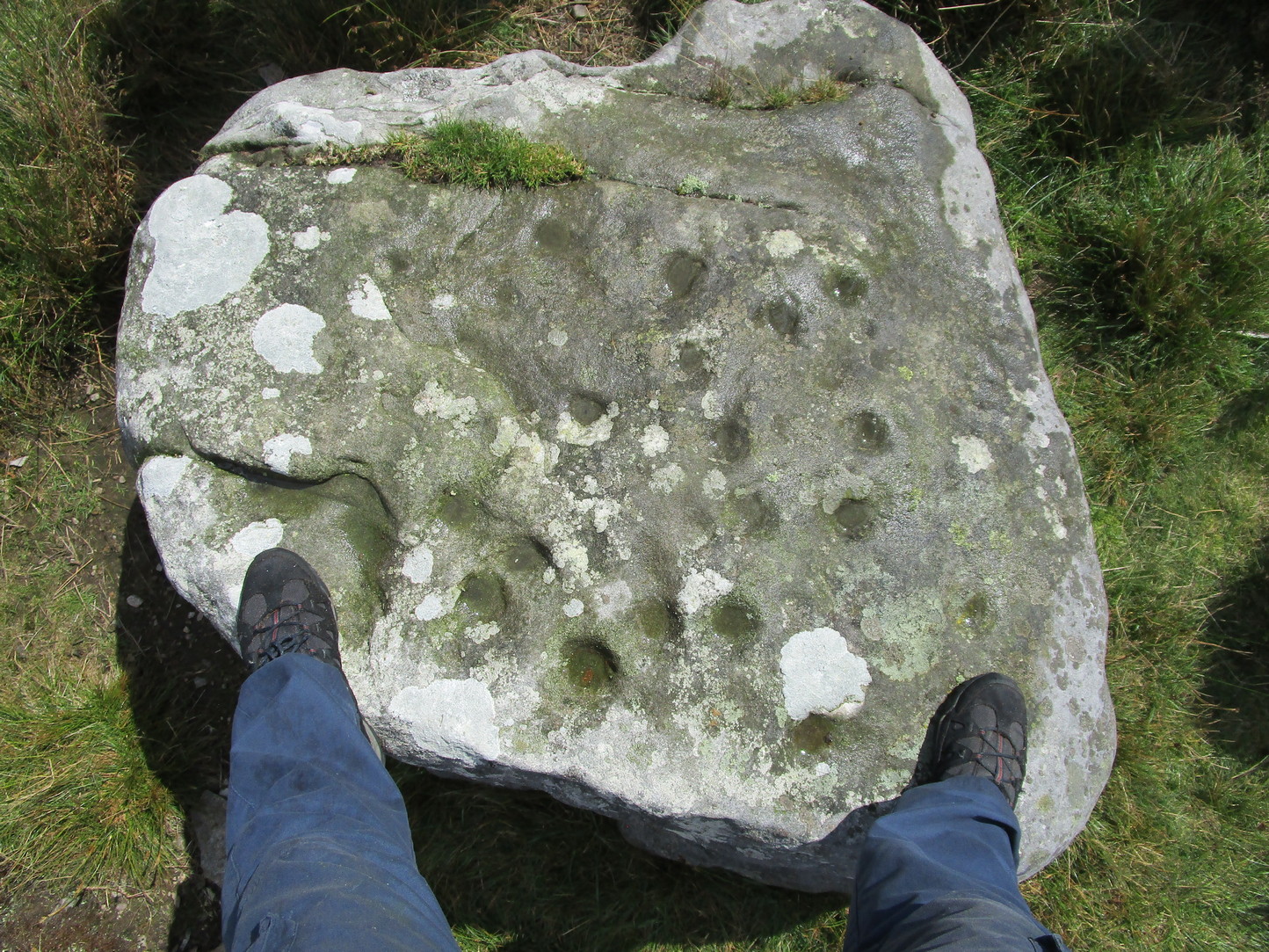
Take the A59 road from Harrogate and Skipton and at the very top of the moors near the Gill Head Enclosures, take the small Kex Ghyll road up past the disused quarry works north for a mile or so. At the junction go left for about 1½ miles where, on your left, is Burnt House farm. A hundred yards past here is a small spot to park on the right-hand side of the road, opposite the gate to Rocking Hall House (make sure you leave enough room for tractors to pass you!). Across the road is the track to Rocking Hall and, 2 miles along the track, look out for the copse of trees ½-mile NE. Head towards it and, as you get close to the wall, walk slowly downhill towards the stream where a single block of stone lives. You’ll find it!
Archaeology & History
Design from above
Rediscovered on Rocking Moor by Rod Chambers on August 15, 2023, this reasonably large sloping block of stone has between 21 and 24 cups cut quite deeply and scattered erratically into it, very similar to one some 200 yards to the northwest (Raven Stones carving 559). It seems pretty obvious that some of these cups were Nature’s handiwork, but have been modified by human hands. There’s nothing complex about it, but there may be a semi-circular arc around one of the cups, centre-left of the natural crack that cuts across the top of the stone, but this is very faint and could be just a trick of the eyes. Going there at sunrise and wetting the stone might tell us for sure.
Acknowledgements: Big thanks to Rod Chambers for use of his photo in this site profile.
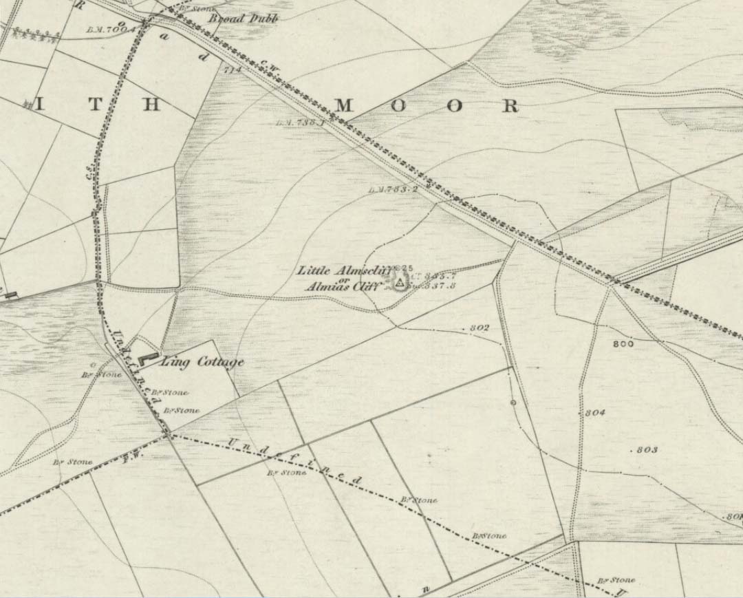
Coming from Harrogate, take the B6162 and B6161 road to Beckwithshaw, through the village and, 4-500 yards on, turn right onto Norwood Lane. 2 miles along, keep your eyes peeled on your left for a gravelled parking spot and you’ll see the large rock outcrop 200 yards south of the road. …Otherwise, from Otley: go over the river bridge and turn right up Farnley Lane and follow the B6451 for a few miles, thru Farnley village up the Washburn valley, past Norwood and at Bland Hill, turn right along Broad Dubb Road for 1¾ miles where you’ll reach that same gravelled parking spot.
Archaeology & History
Very much the ‘little brother’ of Great Almscliffe, 3 miles (4.83km) to the southeast, this site would be more of interest to the travelling geologist, perhaps, than to antiquarians. But that depends what tickles y’ fancy I s’ppose.
In 1702 when the northern antiquarian Ralph Thoresby mentioned this and its big brother to the southeast, he described the “two famous crags of Almes Cliff—in some old writings called Aylmoys ut dicitur—but have seen nothing memorial of it, saving its remarkable lofty situation.” He missed the cup-and-ring carving on the east-side of the crags, obviously, which indicates that it had some form of animistic sanctity in ancient times.
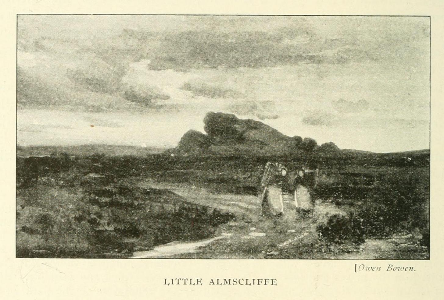
The location on 1851 mapLittle Almscliffe c.1900
Little Almscliffe was one of many impressive places located within the ancient Forest of Knaresborough; and although it wasn’t on the original boundary line, a perambulation (i.e., annual ritual walking to the old stones, trees and wells defining the region) of the area written in 1770, in what Mr Grainge called “the Copyhold Forest”, was undertaken by the Enclosure Commissioners. It differed from the more ancient perambulation rite, in that the newer one included a mention of,
“five bounder stones also marked F to an earth-fast stone, lying northeast of Little Almes Cliffe, marked also with an F; (and) from thence by other four bounder stones marked F to Sandwith Wath…”
The letter ‘F’ here signifying the word ‘forest’, as in the Forest of Knareborough.
William Grainge (1871) also believed these crags to have been a place of druidic worship. He wasn’t the only one. Many other writers of the time thought the same thing; and although we have no concrete evidence to prove this, it is highly likely that these rocks would have served some ritual purpose in pre-christian days. Certainly in more recent times (during the 1980s and ’90s) we know that ritual magickians used this site for their workings. On a more mundane level, the crags were previously used as a site for for beacon fires. One was erected here in 1803 when the first Bonaparte threatened to invade England; but I can find no written accounts of earlier beacons here.
References:
Bennett, Paul, The Old Stones of Elmet, Capall Bann: Milverton 2001.
Bogg, Edmund, From Eden Vale to the Plains of York, James Miles: Leeds 1895.
Bogg, Edmund, Higher Wharfeland, James Miles: Leeds 1904
Cowling, E.T., Rombald’s Way, William Walker: Otley 1946.
Grainge, William, History & Topography of Harrogate and the Forest of Knaresborough, J.R. Smith: London 1871.
Parkinson, Thomas, Lays and Leaves of the Forest, Kent & Co.: London 1882.