Stone Circle (destroyed): OS Grid Reference – SD 664 655
Archaeology & History
I have found no archaeological references whatsoever to this site (though to be honest, the Lancashire archaeological fraternity are pretty poor when it comes to finding and recording sites). The place has its existence preserved in the aptly-named Ringstones Lane and the farmhouse, Ringstones.
Michala Potts found several records of the place in the 17th century, and the site is shown on the 1844 OS-map with the same name, but we have been unable to ascertain when/if any standing stones were here. The place may well have been a burial-site of some sort, as found at other Ringstone place-names in Lancashire. But we can clearly see on aerial imagery that there is a large, distinct, circular outline in the heavily ploughed fields about 100 yards north of the farm. There is what may be the remains of a second circle above this, but the outline is faint; but it appears that an enclosure of some sort, ovoid in shape and a couple of hundred feet across, was also evident in the same field where the more distinct circular outline is seen.
My favourite outline however, is a large linear mark on the ground stretching for several hundred yards running roughly north-south, starting in the field between Aikengill and Ringstones and going dead straight, bypassing the circle and crossing Ringstones Lane, where it seems to disappear and is no longer visible. The curious ‘ground line’ is roughly 100 feet across. Cursus anyone!?
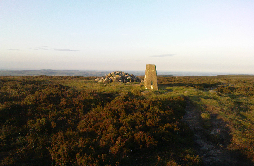
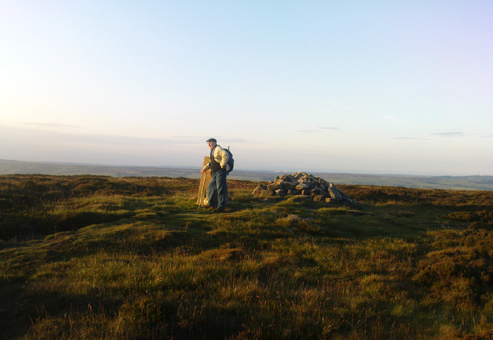
This is the highest point of the moors, 1320 feet up. There’s various ways of getting there: I’d favour the wander up to Twelve Apostles then taking the 15 minute walk west to the triangulation point which marks the spot. If you reach the large rocky outcrop of the Thimble Stones, you’ve gone too far; although you can walk past the Thimbles, if you’ve started your walk from the two radio masts atop of the moor where the old Roman road hits the dirt-track. Either way, unless you’re damn stupid, this is an easy spot to find!
Archaeology & History
Although today there’s little to be seen, when Collyer & Turner (1885) described the place it was 175 yards in circumference! Bloody huge! When Harry Speight got here in 1900, it had shrunk slightly to 150 yards. Now however, almost all the stones have been robbed. I first came here when I was just 11 years old and remember it was a decent size even then – at least as large as the Little Skirtful and Great Skirtful of Stones more than a mile to the east. Today however, unless you knew it was once a giant cairn, you wouldn’t give it a second look.
It’s quite appalling what’s happened to this site thanks to the sheer ignorance and neglect of the local archaeologist in tandem with his paymasters at Bradford Council: 90% of the site has been utterly vandalised and destroyed as a result of these incompetent idiots in the last 20 years. Nowadays, all you can make out here is the raised earth for about 10 yards surrounding the trig-point. It seems that most of the stones that comprised this giant cairn have been taken for use in walling, and to prop up the stupid paved footpaths which the local Council and its affiliated halfwits are slowly building o’er these hills.* Morons!
Aar Dave on top o’ t’ moors
I’m not quite sure why it was called Nixon’s Station. It was J. Atkinson Busfield (1875) who mentioned this name, quite casually in his fine local history work, as if local folk had known it as such for sometime. There was also an inference of it being the resting place of some old general, but I’ve found nor heard anything more along such lines — though worra superb place for your spirit to roam free…..
If anyone has any old photos of this once giant prehistoric site, it would be good to see it in its old glory once again. When I wandered up here as a kid, I never carried things like a camera about (being a Luddite by nature!).
References:
Busfield, J.A., Fragments Relating to the History of Bingley Parish, Bradford 1875.
Collyer, R. & Turner, J.H., Ilkley, Ancient & Modern, Otley 1885.
* Anyone know exactly which idiots are responsible for the stone footpaths being laid over the moors here? They’re damn stupid and cause even more erosion and damage to the environment and prehistoric heritage up here, as anyone with an ounce of common sense can see. Can someone please get them stopped!?
Although very little of this cursus can be discerned on the ground, the scar of the monument is clearly visible from the air (as the GoogleEarth image shows, below). In 1989 the great archaeo-geomancer, Paul Devereux, visited the place hoping to see the monument, but said that no remains were visible at ground level, although noted how its western end is marked by the Long Bredy burial mound. Sitting amidst a mass of later neolithic and Bronze Age ceremonial remains, this old cursus aligned SE to NW. Devereux told how,
“the extended axis of the cursus…to the east, goes through a group of round barrows on the crest of a ridge on Black Down about a mile away. If diagrammatic material published by an investigating archaeologist is accurate, the alignment continues to the Nine Stones circle…immediately by the roadside a short distance west of Winterbourne Abbas.”
The monument has been measured at be at least 130 yards (100m) long and 28 yards in diameter at its greatest point.
References:
Pennick, Nigel & Devereux, Paul, Lines on the Landscape, Robert Hale: London 1989.
The faded remains of this old burial mound can vaguely be seen just off the right-hand (east) side of the B1248, across the road from the track which leads down to Burdale North Wold farmhouse, between Fimber and Wharram-le-Street.
Archaeology & History
Known as Towthorpe Barrow No.1 in the Mortimer survey (1905), there are a number of prehistoric tombs and other remains close to this site (which will be described on TNA as time goes by). Some of you might think the lengthy description here a little unworthy, but I believe the extensive archaeological notes on this site by an archaeological legend, J.R. Mortimer, is a good indicator of the dedication and interest to which he gave each and every tomb that he opened (this’ll be the first of many). His slightly edited account told:
“This mound is situated near the centre of the (Towthorpe) group, close to High Towthorpe. Here the green lane…is crossed by the high road from Malton (B1248), through Wharram-le-Street… Part of this road, for some distance south and north of the barrow, is called ‘High Street’ by the old inhabitants of the neighbourhood…
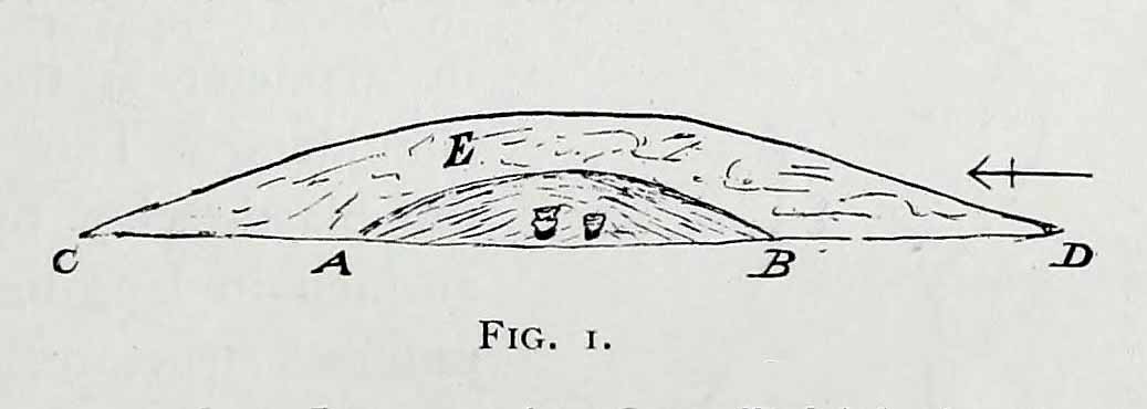
“On 4 May, 1863, the writer, with the assistance of R. Mortimer and two workmen, commenced to open this mound. It was the first British barrow he had the pleasure of examining. A trench 10 feet wide was cut across its centre from the northern to the southern margin…
“The upper portion E, to a depth of 16 inches, consisted chiefly of the surface soil of the neighbourhood, the bottom part of which was reddened as if by the action of fire. Close below this was a stratum of wood and ashes and other dark matter, 2-3 inches in thickness; and then a lenticular bed of tough drab-coloured clay, 29 feet in diameter, and 12-14 inches thick in the centre, gradually thinning towards the circumference. The upper part of this bed of clay, which was in contact with the stratum of wood ashes, was reddened by fire; its under surface had a similar appearance and rested upon what seemed to be a second stratum of burnt and decayed matter, 2-3 inches in thickness, similar to that already described. The clay forming this lenticular bed contained numerous small fragments of grey flint, characteristic of the chalk of the neighbourhood. It must have been obtained from one of the valley bottoms (either Burdale, Wharram-le-Street or Duggleby), in which are exposures of the Kimeridge clay. In these places, angular pieces of flint and chalk crumble from the hillside, and mix with the clay, imparting a greyish colour to it. This is especially the case at Burdale, where there is a fine spring at the base of the chalk, and a small pond resting on the Kimeridge; and it is probably from this place that most of the clay for the construction of this barrow was obtained. It is not easy to explain the method by which the clay was transported, but several tons had evidently been used in this case. Many other instances in which material from a distance has been used in the erection of the barrows of this neighbourhood are recorded in (the Yorkshire Wolds).
“In the centre of the mound, at the base of the lenticular bed of clay and below the ashes (which probably represent the residue of a funeral pyre) stood two food vases, close together, and near to these, decayed bones (the remains of a human body) and a chipped flint. The smaller and more ornamented vase was situated to the south of its fellow. It measures 4.5 inches in neight, 5.5. inches in diameter at the top, and about the same across the shoulders. The ornamentation had been impressed on the plastic clay by a thin square-ended tool, about half-an-inch in length, which showed in the impression of a fine notched structure, and was equally divided into ten ridges about the size of the indentations on the milled edge of a shilling, and almost as truly cut. In the lower groove which runs round the vase are four pierced projections.
“The other vase is about 5 inches high and about 6 inches in diameter at the top and across the shoulders. Three encircling lines of short vertical cuts, rudely and apparently hastily made, previous to baking the vase, represent its entire ornamentation.
“During the excavation we collected from the material of the mound a dozen hand-struck flint flakes of various sizes, and a small splinter from the cutting-edge of a green-stone celt.”
Mr Mortimer returned to do further excavations here on Christmas Eve and Christmas Day in 1865, with the hope of finding more — but apart from a finely-cut knife made of black flint, nothing else was located. This was the first of Mortimer’s hundreds of diggings into the tombs and dykes of East and North Yorkshire.
References:
Marsden, Barry M., The Early Barrow Diggers, Tempus: Stroud 1999.
Mortimer, J.R., Forty Years Researches in British and Saxon Burial Mounds of East Yorkshire, A. Brown: London 1905.
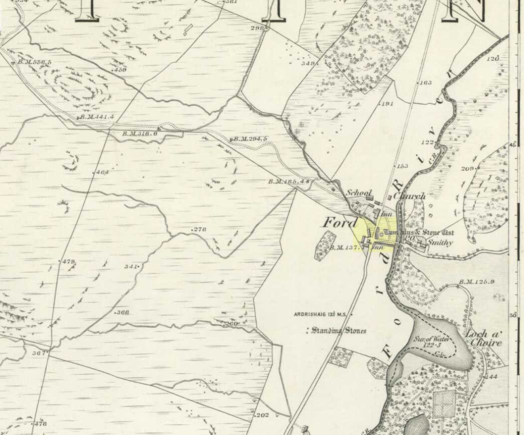
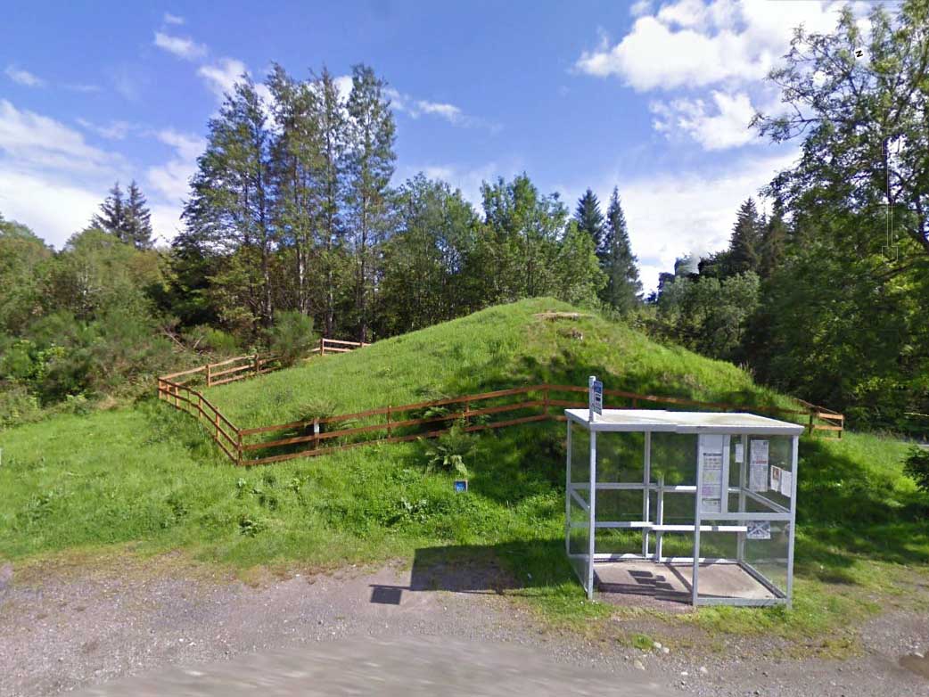
Although I describe this site in association with the township of Kilmartin, it is in fact several miles north of there – but I reckoned that if I say it’s near Kilmartin, then those of you who don’t really know this region, will have some idea of its locale. So – from Lochgilphead, go up north thru Kilmartin, another coupla miles on, till you reach the small road to your right (signposted ‘Ford’). Just keep driving for a couple more miles until you hit the village. If you park by the only shop, you’re just past the old tomb. Diagonally across on the opposite side of the road from the Ford Hotel, right by the road-junction, just before the little shop, you’ll see a notable rounded mound overgrown in shrubs. Embedded in this are the remains of an old tomb.
Archaeology & History
Ford tumulus (photo, couresty J. Reid)
This typical-looking fairy-mound just by the road junction in the village is where me and my daughter used to scramble around, sometimes playing and sometimes seeing if we could find anything of note in this ancient hillock, but all trace of any prehistoric stonework seems to be well-buried. When excavators explored the site in bygone times, a small stone cist was found, which aligned (yet again) north-south and measured internally, roughly, 3ft x 2ft. Only small!
A food vessel in Edinburgh’s central museum, “found in a cist in the neighbourhood of the lower end of Loch Awe” is thought to have come from this tomb.
References:
Royal Commission on the Ancient & Historical Monuments of Scotland, Argyll – volume 6: Mid-Argyll and Cowal, HMSO 1988.
An old stone-lined burial cist could once be seen in this locale: reported in 1953 to have been “discovered in the southwest corner of a field south of Druimyeonbeg farmhouse.” When it was uncovered by the farmer, the covering capstone was missing. Any relics that may have been there were destroyed and there’s now no trace of anything.
References:
Royal Commission on the Ancient & Historical Monuments of Scotland, Argyll – Volume 1: Kintyre, Glasgow 1971.
Easy one this! Go up thru Baildon, on towards Baildon Moor over the cattle-grid. Take your first left and go up for several hundred yards past the reservoir until you reach the track on the left which takes you onto the Low Plain, Baildon Moor.
Archaeology & History
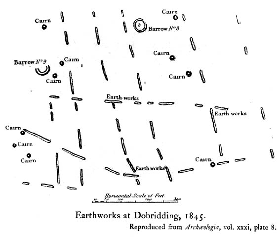
1845 plan of Cairns & Earthworks on Baildon Moor (after J.N.M. Colls)
In the year 1845, on the Low Plain on the western side of Baildon Hill, an intrepid archaeologist and historian, Mr. J.N.M. Colls, came across extensive earthworks and a number of prehistoric tombs in a very small area. Upon excavation, the ‘earthworks’ were found to be what sounds like neolithic walling running parallel to each other in a roughly north-south direction (north is the traditional direction for death). Scattered amidst these lines he found more than a dozen cairns and barrows, along with remains of “a circle, or ring.” Although the majority of what Colls wrote about has been destroyed, leaving only scanty remains of a once considerable archaeological arena, his lengthy description deserves being reprinted in full. He wrote:
“This level (the Low Plain) bears numerous traces of earthworks or other embankments running in many cases parallel with one another, at distances varying from 50 to 80 yards apart, and intersected by other works of similar construction. These earthworks can be remembered to have been from four to five feet in height; their bases nearly invariably appear to have been eight feet in diameter, composed of loose blocks of calliard, or close-grained sandstone, and earth. The greater part of the stone has been torn away to make and repair the roads of the neighbouring district; and the surface of the earth has been so nearly levelled that it is only by the scattered and disfigured remains, carefully delineated upon my plan, that any idea can be formed of their original character.
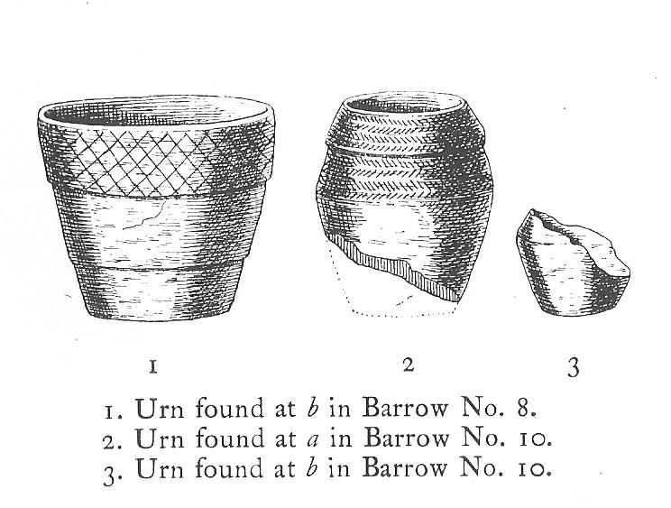
“In connection with these earthworks, and upon the north side of them, immediately above a steep fall to the next lower level (approx SE 1372 4020, Ed.), is a circle, or ring, formed originally of earthworks of precisely similar character, size and construction to those I have just described. The diameter of this ring is about fifty feet; its interior area is perfectly level; but the earthwork forming its circumference has been defaced and torn up for a considerable extent for the stone it contained. Circles of this nature have generally been termed druidical, from their presumed use as places of worship or sacrifice. I therefore opened its centre, in the hope of finding some trace of fire confirmatory of its character; and commenced clearing away a layer of peat earth, of from 10-11 inches in depth. I then found a layer of calliard boulders one-and-a-half feet in depth, the lower ones slightly burned, and resting upon a deposit of peat-ashes three inches in depth and from 2-3 feet in diameter (see Barrow No.8 in plan, Ed.). This I should have concluded to be the remains of a beacon fire, but, upon continuing the excavations, I found about three feet SSE of this deposit of ashes (at point b on the plan) a rude urn standing in an upright position, at a depth of two feet from the surface, a layer of calliard stones having been removed from above it, one of which appeared to have covered it. This urn was 12 inches in diameter and 9-10 inches in depth, of a circular or bowl shape, the upper stage of it being rudely ornamented by incised lines crossing each other at acute angles: it was filled with calcined bones (some remaining tolerably perfect), ashes and charcoal; and I selected some half-dozen of them as specimens, which Mr Keyworth, surgeon and lecturer on anatomy at York, has examined… He is of the opinion that they belonged to a very young subject, perhaps from 9-12 or 13 years of age; he thinks it possible however, that they may all have belonged to the same subject… The urn in which the were placed appears to have been rudely formed by the hand, without the assistance of a lathe; in substance about half-an-inch…it appears pretty evident that this urn has been formed of the black earth of the mountain and coal measures of which Baildon Hill is formed…
“A little to the west by south of the circle…are the almost obliterated remains of another circle (fig.9 on the plan), which I had not an opportunity of thoroughly examining; the slight traces remaining bear strong testimony of its character being similar to that of fig.8.
“Scattered over the surface of the Plain, and at irregular distances, cairns or heaps of stones, composed of bare sandstone and calliards (and not mixed with earth), frequently occur; they are generally about twenty feet in diameter and appear to have been originally 4 or 5 feet in height: these remains still require examination. In passing over them, I remarked that some of the stones of which they and the earthworks near them were constructed, had marks, or characters, but so rude that a doubt remains whether they may not have been caused by the action of the atmosphere on the softer portions of the stone.”
Urns found near Dobrudden
This final remark seems to be the very first written intimation of the cup-and-ring marked stones which can still be found amidst the grasses in the very area Mr Colls described. Sadly, much of the other remains shown in the drawing have been all but obliterated, or grown over. However, the decent concentration of cup-and-ring stones in this small area (see other Baildon Moor entries), highlights once again an associated prevalence of these carvings with our ancestor’s notions of death.
Sadly, year by year, the important neolithic and Bronze Age english heritage remains across this upland ridge are slowly being destroyed. The lack of attention and concern by regional archaeologists and local councillors, and the gradual encroachment of human erosion are the primary causative factors. Hopefully there are some sincere archaeologists in the West Yorkshire region who will have the strength to correctly address this issue. Under previous archaeological administrators, Bradford Council have allowed for the complete destruction of giant tombs, stone circles and other important prehistoric remains in their region—a habit that seems not to be curtailed as they maintain a program of footpath “improvements” on local moors without any hands-on assessment of the archaeology on the ground.
…to be continued…
References:
Baildon, W. Paley, Baildon and the Baildons – volume 1, St. Catherine Press: Adelphi 1913.
Barnes, Bernard, Man and the Changing Landscape, Eaton Press: Wallasey 1982.
Colls, J.N.M., ‘Letter upon some Early Remains Discovered in Yorkshire,’ in Archaeologia, volume 31, 1846.
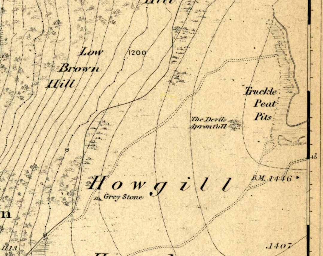
An excellent spot with fantastic views. There’s many ways to approach the place, but a good one is from the roadside by Howgill, then following the track uphill until you reach the moor, then head towards the spectacular and legendary, Simon’s Seat (which folklore ascribes to be named after the great druid, Simon Magus). You’ll pass an old Grey Stone (two large rocks) from which you can espy the old tomb if you stand on top of ’em. Keep walking uphill and it’s about 100 yards off the footpath to your right. A large boulder is nestled just beneath the tomb itself, which stands out on a ridge.
Archaeology & History
When Harry Speight visited here (1900) he described it as being 40 yards in circumference. He also described “an upright stone below the cairn” with apparent cup-markings on the west-side. I’m not quite sure where this has got to – but the site has shrunk somewhat since Speight’s day. It’s only about 20 feet across now, and the middle of it has been hollowed into a grouse-shooting butt for the toffs!
About 100 yards southeast (towards the Truckle Stones) are the remains of some neolithic walling in a straight line.
Folklore
One of many old tombs in our northern hills said to have been created by the devil who, as usual, accidentally dropped some stones he was carrying. The old folklorist Thomas Parkinson (1888) said the following of this place:
“The Apronful of Stones is a group of rocks heaped together in delightful confusion, their disorder and name being thus explained: Once upon a time—whether when he built the bridge over the valley, or at some other time, the record saith not—the Devil was determined to fill up the ravine, or gill, of the Dibble. For this purpose he was carrying these enormous crags in his apron, when, too intent upon his object to properly observe where he placed his feet, he caught with one foot upon the top of Nursa Knott, and, stumbling, the strings of the apron broke, and the contents were thrown upon the ground as they now appear. It is also said of them that if any of them, even now, were to be removed, they would certainly be brought back to their original place during the succeeding night.”
Another legend tells that the Devil’s Apronful is also the grave of some local unnamed hero.
References:
Parkinson, Thomas, Yorkshire Legends and Traditions – volume 1, Elliott Stock: London 1888.
Speight, Harry, Upper Wharfedale, Elliott Stock: London 1900.
In Thomas Pennant’s A Tour in Scotland and Journey to the Hebrides, 1772 (1790:226), he described there being three prehistoric cairns about four-hundred yards west of Ardminish, or a couple or hundred yards north of the Achamore Standing Stone, on Cnoc na Croise, but they seem to have been destroyed. At least two of them were between 4 and 5 yards across and contained cists. A search for the site by the Royal Commission lads in the 1960s found nothing—although they may have been looking in the wrong place (the grid reference given above is an approximation). Does anyone know anything more about these seemingly lost sites?
References:
Royal Commission for Ancient & Historical Monuments of Scotland, Argyll – volume 1: Kintyre, HMSO 1971.
Best way to get up here is to start from the old hall and haunted bridge at Wycoller. From here walk upstream, on the footpath on the south side. It wibbles about following the waters for a half-mile until the moors open up when you reach an old stile, past which is another bridge over the stream. Walk past this (keep on the same side) for another 50 yards, then walk up the hillside where, if the vegetation is low, you can just see a decent-sized collection of rocks. This is the old cairn.
Archaeology & History
I don’t think the site is in the Lancashire archaeological register, but it’s described in John Bentley’s fine local history work, Portrait of Wycoller from 1975. He told that,
“a suspected Bronze Age burial mound at Brink Ends in Wycoller was excavated by Stanley Cookson in 1971 and 1972. Although no interment was discovered, the remains of a fire was found in the centre of the mound with half-burnt twigs and coal.”
Brink Ends Cairn, Wycoller
It’s not unlike some of the giant cairns on Ilkley Moor and elsewhere, though not as big, nor as high, being only about 22-24 feet across. Some of the stones have evidently been taken for use in the local walling, and the ‘cairn’ is in a pretty abject state. It’s a bittova odd spot to be honest. Not 100% sure what to make of it – though flints, arrowheads and similar implements have been found on the moors here close by. Bentley (1975) also told how “Stanley Cookson had strong suspicions that an Iron Age settlement existed in this area, but only time and further exploration will tell.” A sentiment I tend to agree with. And on our first and only visit here — during one helluvan awesome downpour all day — what seemed like an Iron Age hut circle was noted a few hundred yards to the south; though we got so saturated that day that we decided to turn for home soon after looking at this cairn.
Cookson and Hindle (1985) later described this site as a “middle Bronze Age burial cairn of 1400 to 900 BC, adding:
“The 34ft diameter inner circle was excavated during 1956-58 disclosing flints, a hearth with an abundance of charcoal, and four pieces of coal on a round, heavily burnt stone.”
More visits to these moors to check for other archaeological sites are needed in the near future to see what else might be on these unexplored moors.
References:
Bentley, John, Portrait of Wycoller, Nelson Local History Society 1975.
Cookson, Stanley & Hindle, Herbert, Wycoller Country Park, H.Hindle: Colne 1985.