Standing Stone (lost): OS Grid Reference – NN 795 168
Archaeology & History
When Fred Coles (1911) visited the giant impressive Dunruchan standing stones, he told that “some distance to the east” of the Dunruchan E stone, “near the unnamed stream…my friend Mr James Simpson has seen another great Stone, but lying prostrate.” When he visited the area the weather beat him back (easily done up here!) and prevented him “from wandering far over the moor, and therefore this Stone was not observed.” It remains lost. (the grid-reference given for this site is an approximation)
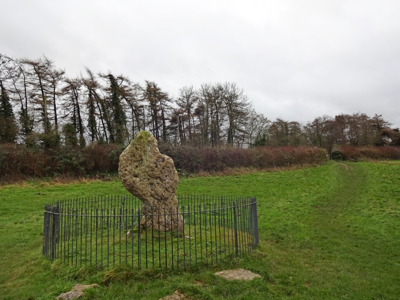
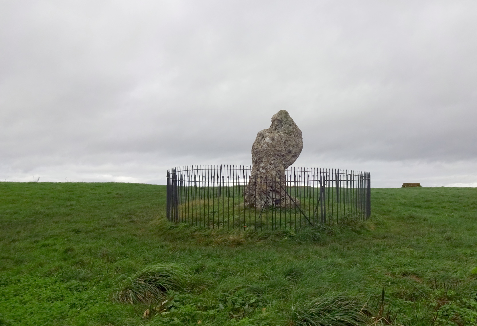
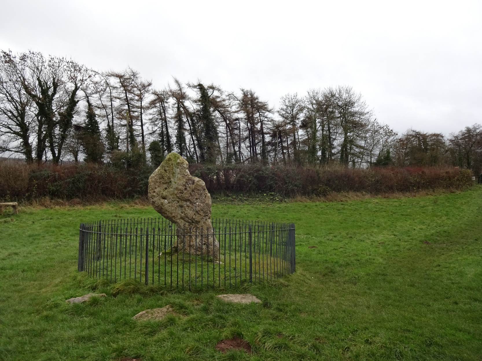
The King Stone of Rollright (photo by Sir Wilson III)
If you’ve reached the impressive Rollright Stone circle, simply cross the road, go through the gate and into the field, then up the gentle slope to your right. Y’ can’t miss it! If though, by any chance, you can’t find the Rollright Stones, get to Chipping Norton and ask a local!
Archaeology & History
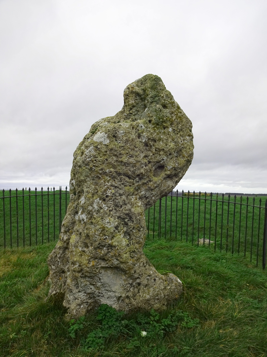
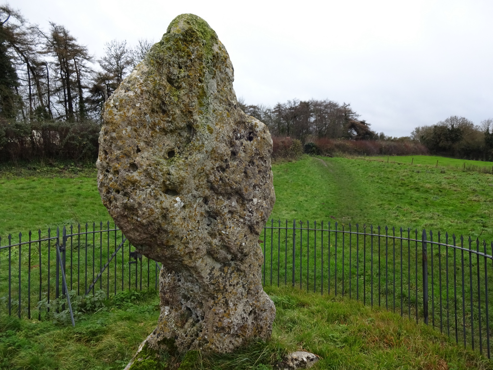
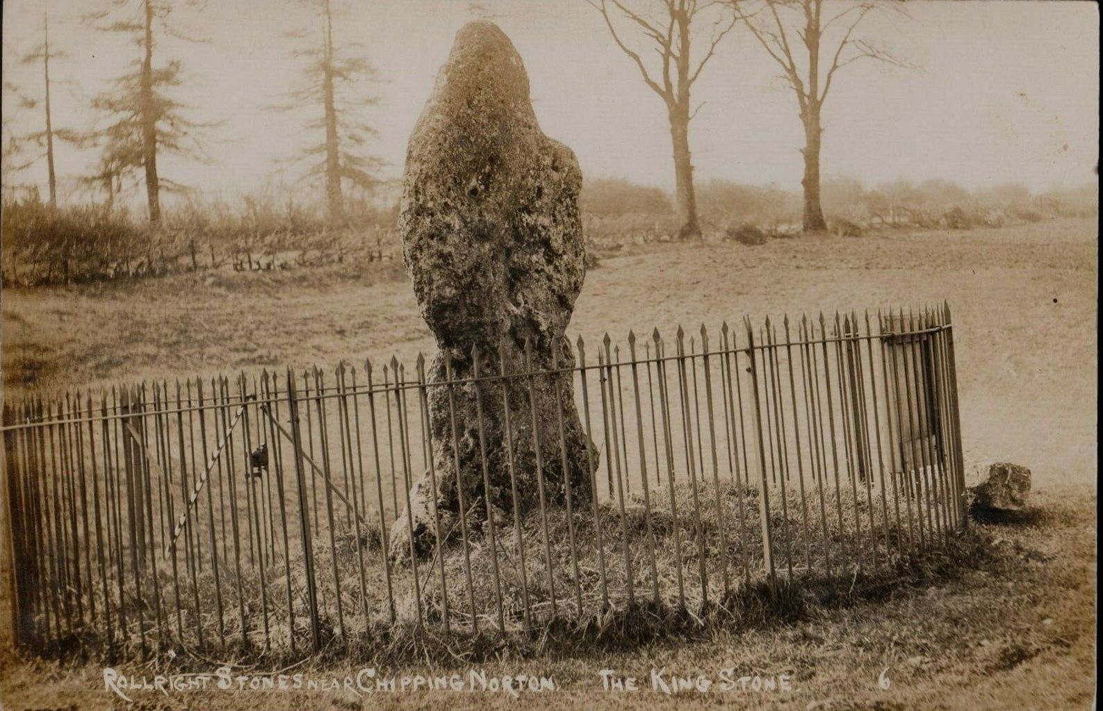
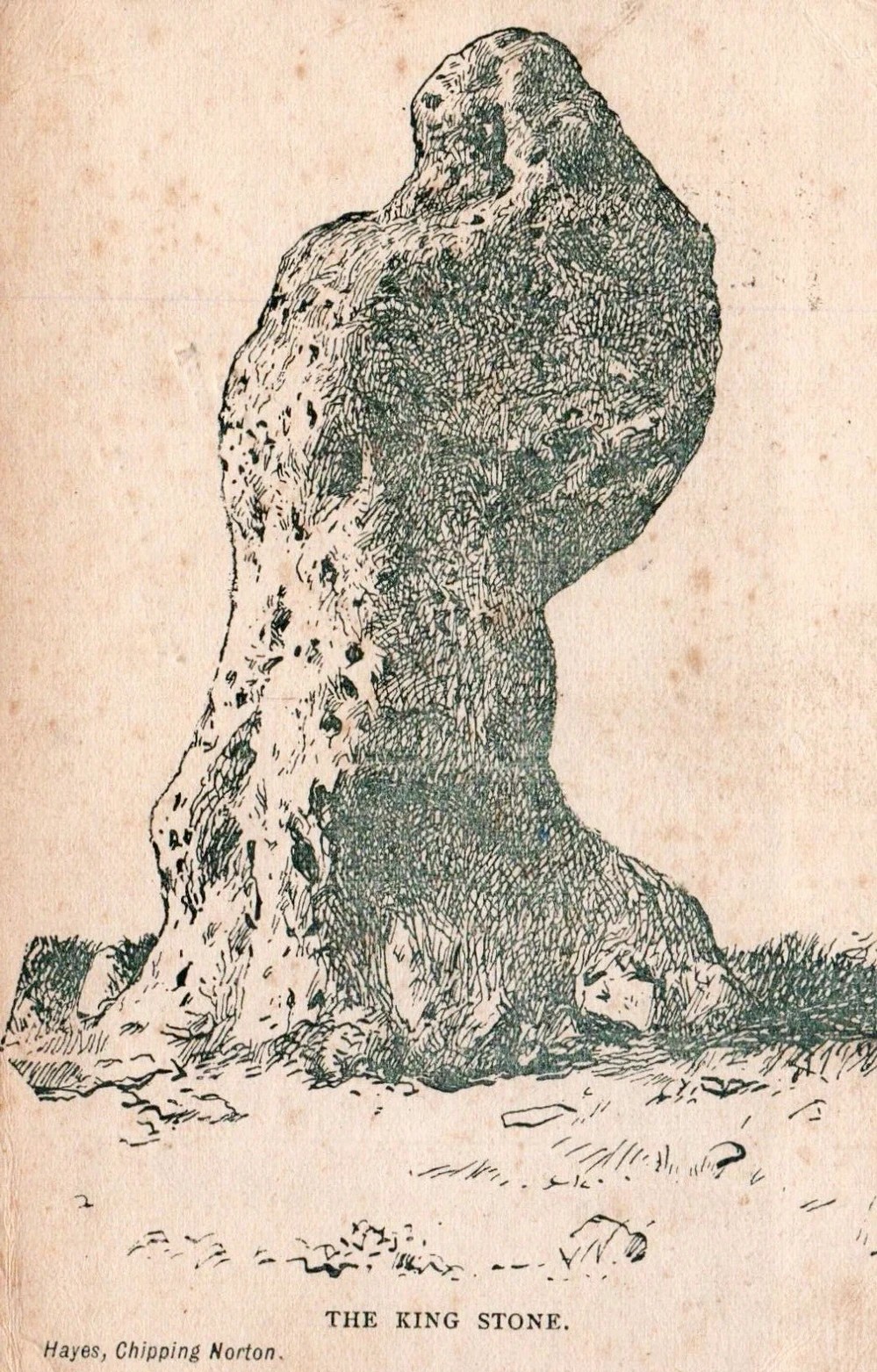
An integral part of the Rollright Stones complex, this gnarled almost moth-eaten-looking standing stone, whose edges were cut away for medicinal properties in earlier centuries, still awakes each morning beside the small rise in the field, long thought to have been the remains of an ancient tomb — much to the archaeologist’s opinionated disdain in bygone years. Yet they had to swallow their pride…
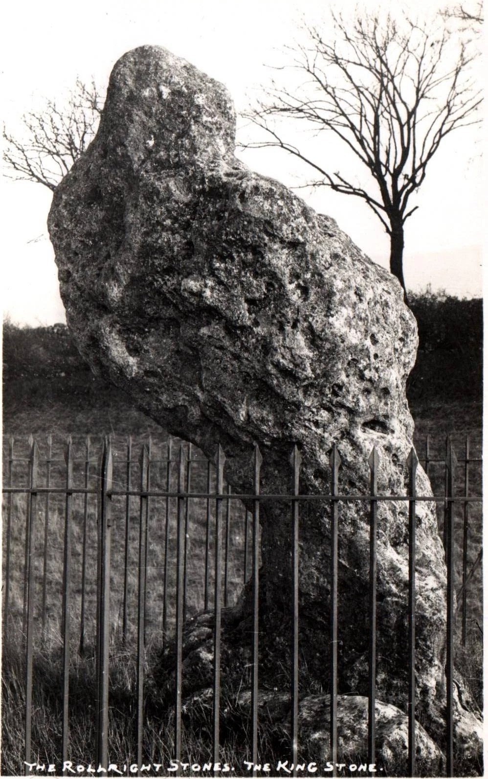
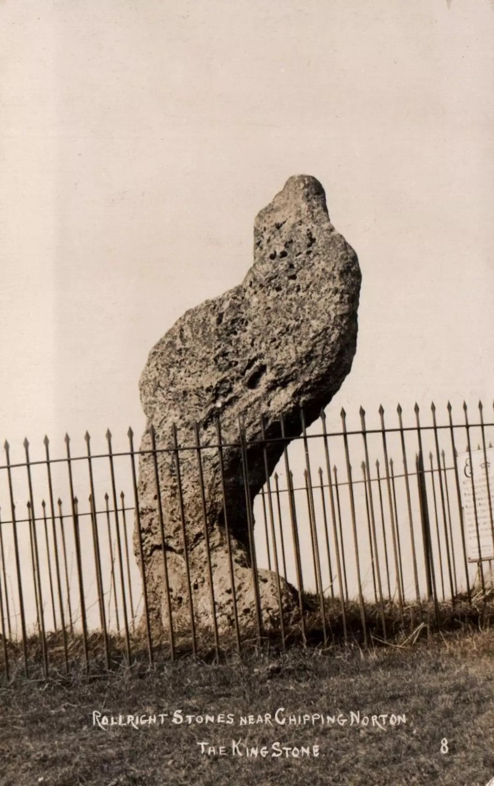
This is an eight-foot-tall standing stone made from the same local oolitic limestone as the King’s Men and overlooks the village of Long Compton on the northern side of the ridge. It actually stands besides an artificial mound which has been identified as a Bronze Age cairn—known in times past as the ‘Archdruid’s Barrow’— and suggested by Lambrick to date from around 1800 BCE. More recently however, the world’s leading authority on stone circles, Professor Aubrey Burl, has given the King Stone a more probable construction date of 3000 BCE. The date is consistent with other Neolithic finds in the adjacent fields. This old standing stone has suffered much down the centuries, with bits of it being chipped away to such an extent that it has been reduced to the novel shape we see today.
Looking up at the King (photo by Sir Wilson III)The King in dance
A little-known but important piece of megalithic history took place here in the 1970s and ’80s. It centred around an idea to investigation so-called “mysterious events” that are commonly reported at standing stones—and the King Stone has its own CV when it comes to such things. Curious stories have been described by people from all walks of life. Down the years, a number of people have told me of feeling some strange and powerful ‘energy’ at these places and stories of such things have filled many volumes, along with being the subject of many a folktale. So one evening in November, 1977, the then editor of The Ley Hunter, Paul Devereux, convened a meeting where twenty people from differing backgrounds gathered. At this first meeting were people from a variety of professional backgrounds: archaeologists, dowsers, chemists, biochemists, biologists, electronic engineers, geochemists, geophysicists, zoologists—and ley hunters of course. It was time, they thought, to address this issue of anomalous energies at stone circles and other ritual sites.
After some discussion about what they should call their investigations, “the long association of the dragon with some kind of earth force made it a fitting symbol.” And so, the Dragon Project (DP) was born…
On the misty morning of Saturday, 24 October, 1978, research scientist Don Robins—in the company of his dog and young son—drove the hundred miles from London to the Rollright Stones armed with a simple ultrasound detector. He didn’t know what he would find there, and his scientific training told him there shouldn’t really be anything untoward.
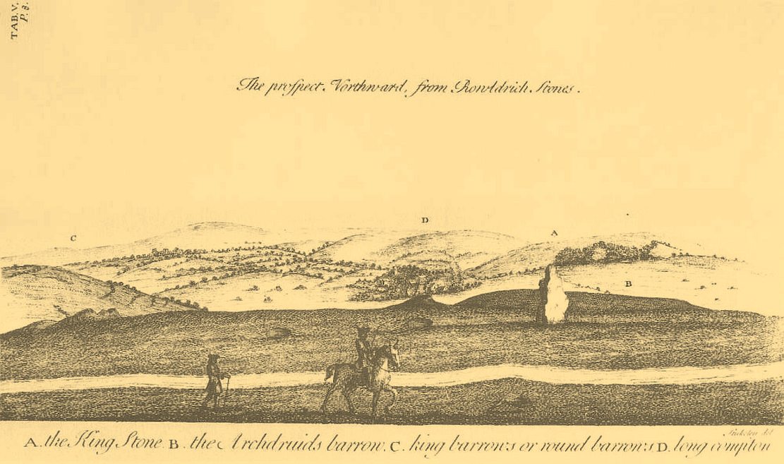
King Stone, looking W (photo by Sir Wilson III)Stukeley’s 1743 sketch showing the King Stone
Arriving around dawn, Robins took several background readings along some of the lanes a mile or so away and found the usual expected background levels (on a scale of 1-10, the background flickers between 0 and 1). When he eventually walked into the Rollright stone circle with his ultrasound monitor, no undue perturbations were found. He spent thirty minutes here, but at no time did he record anything other than background readings. So he crossed the road and tried the same at the King Stone—where a big surprise awaited him.
Switching on the detector he found an anomalously high reading, beating every minute or so, not unlike a heartbeat, more than five times above the background ultrasound!
“This was really peculiar,” he wrote, “in that the pattern was spread over about a minute and then commenced again after about 10 seconds, endlessly repeated.” Robins spent some time here and found that the strange ‘pulse’ wasn’t solely confined to the King Stone, but spread some distance around the old standing stone and onto the road itself.
Investigation of potential radiation anomalies was another avenue of enquiry explored by the Dragon Project, and although thousands of hours of monitoring were done at the three focal sites, there were few anomalies to write home about. Two however, were recorded in March and August, 1981, when radiation levels were twice the normal background rate for short periods of just a few minutes each. More puzzling was the finding—which can still be verified today—of radiation levels three and four times above background on the road between the circle and the King Stone.
Next on the list was an attempt to monitor the Rollright stones with infrared devices. This proved to be a potential goldmine, as there was the chance of photographic imagery. So early one morning in April, 1979, Paul Devereux readied himself at the King Stone. He took a number of photos at five minute intervals either side of sunrise. This time of day was chosen because of the repeated anomalous ultrasound emissions from the King and it was thought that this, if any, would be the best time to capture something on film.
“When the first roll of black-and-white IR film was professionally developed,” he wrote, “I was astonished to see a curious ‘glow’ effect around the King stone on the frame taken at sunrise.” His first account of it appeared in The Ley Hunter, where he described how “a hazy glow can be seen clinging to the sides and upper parts of the megalith. This glow becomes much stronger at the top of the stone where it looks like a cap of light.” Although the sun had risen, it was off to the left of picture and apparently no satisfactory explanation can be given to the effect on the plate. Research physicist Simon Hasler—who worked for Kodak—closely studied the negatives of this image and found the evidence for a simple explanation “weak.” A possible explanation of the mysterious glow was propounded by Don Robins, who suggested that an emission of microwaves from the stone may have been responsible, and although this sounds promising it has yet to be proven.
Folklore
(photo by Sir Wilson III)
Amidst the mass of modern lore, dowsed energy lines exceed here — although to be honest, most of them are little more than bullshit. Old school alignments in the form of leys that can be walked along are more credible, and one or two have been noted here. Dowser Laurence Main found a ley running between Broughton Church, “the old White Cross, the Victorian Cross and the old Bread Cross in Banbury. In the other direction the line led straight to the King Stone.” Although this line accurately links up these sites, other ‘ley points’ are utterly necessary between Broughton Church and the King Stone to give the alignment any real credibility. In a concise survey of the megalithic remains of this region made by Tom Wilson and myself, no other ley-points were found along the line.
In more traditional animist-based folklore, the creation myth here is well known. The famous, oft-repeated tale recites how a King and his men were marching across the land intent on conquering it when he came across an old hag, or witch near Rollright who offered the regal figure a magickal challenge. Some accounts name the witch as Mother Shipton—not the famous Yorkshire seer of the same name, but her less powerful (obviously!) southern counterpart. The old witch said to the King:
“Seven long strides thou shalt take, and
If Long Compton thou can’st see,
King of England thou shalt be.”
His majesty took this as a simple task and, with contempt, said to the old witch:
“Stick, stock, stone,
As King of England I shall be known.”
From where he was standing (which is never told, but presumed by most as the stone circle) the King then took seven long strides in the direction of Long Compton. As he was taking his seventh step the witch made the ground in front of him rise up, hence blocking his view of the village in the valley below. The old hag then said:
“As Long Compton thou canst not see,
King of England thou shalt not be.
Rise up, stick, and stand still, stone,
For King of England thou shalt be none;
Thou and thy men hoar stones shall be
And I myself an eldern tree.”
Thereupon, the King’s men who were waiting behind their master, the five knights in the field who were said to be conspiring against his majesty, and the King himself, were all turned into stone where they stood. The elder tree that the old witch turned herself into, was said to have grown along the old boundary close to the roadside, but this can no longer be verified. The folklorist Arthur Evans described several spots where the famed elder tree was said to have grown: one in the field close to the Whispering Knights, and another in the same field as the King Stone, close by another large stone that has long since gone.
When William Stukeley visited the area in the 18th century and heard about the legendary origin of these great monoliths, he told how “the country people for some miles round are very fond of, and take it very ill if anyone doubts it,” telling later, “The people who live at Chipping Norton and all the country round our first described temple of Rowldrich affirm most constantly, and as surely believe it, that the stones composing this work are a king, his nobles, and Commons turned into stones.
Another piece of animistic lore tells how the King Stone and the Whispering Knights venture, at midnight, less than half a mile south to drink from a spring in the small woodland at Little Rollright Spinney—although it is difficult to ascertain precisely which of the two springs the stones are supposed to visit. In some accounts, the stones reputedly drink from the well every night, but others tell that they only go there at certain times of the year, or on saint’s days. When Arthur Evans wrote of these tales he described there being a “gap in the bushes… through which they go down to the water,” but the terrain has altered since his day.
A variation of the same tale was told by T.H. Ravenhill, who wrote:
The old King c.1945King Stone, c.1920
“The Lord of the Manor of Little Rollright desired to possess the King’s Stone in order to bridge Little Rollright brook. So he dug it up and tried to cart it away, but found that he had not enough horses. He hitched on more, and yet more, and still he found that he could not move the stone. Finally he succeeded and hauled the stone away to the Manor House. The same night he was alarmed by strange sounds about the house, which he attributed to the presence of the King’s Stone, and decided, therefore, to replace it on its mound. No sooner had he harnessed the first horse to the cart than it galloped away up hill with ease, taking with it the stone, which leapt to position on reaching its resting place.”
Evans also wrote about an eighty-year-old local woman who told that her mother visited the King Stone on Midsummer’s Eve, along with many other locals, when the elder was in full bloom and they would stand in a full circle around the tall monolith. Ritual of a sort was performed then the elder tree was cut and, as it bled, “the King moved his head.” This annual rite was said to partially disempower the witch of her magickal hold over the King when her blood trickled from the tree. Some locals believed that if but a pin-prick of the witch’s blood was drawn, she would lose her power for all eternity.
Beneath both the Rollright stone circle and the King Stone, legend reputes there to be such a cavern where the little people live. In some accounts they are said to dance around the old King.
Arthur Evans told how one local man, Will Hughes, actually saw the faerie dancing round the King.
“They were little folk like girls to look at,” he said.
Old postcard, c.1910Sketch from 1904
Will’s widow, Betsy Hughes, told Evans that “when she was a girl and used to work in the hedgerows, she remembered a hole in the bank by the King Stone, from which it is said the fairies came out to dance at night. Many a time she and her playmates had placed a flat stone over the hole of an evening to keep the fairies in, but they always found it turned over next morning.” This curious entrance was a neolithic burial mound. Mark Turner described how the little people were “supposed to come out and dance around the stones by moonlight.”
As we have already seen, people used to take chippings off some of the old stones here—primarily the King—supposedly for luck, protection and good fortune. Local people used to blame Welsh workers more than anyone, but they wouldn’t be the only ones! Although those who took such chippings believed the pieces brought them luck, more often than not it was the opposite that happened. One local woman told Evans about her son who went to India as a soldier in the 19th century with a piece of the King Stone in his possession, but it did him no good whatsoever. He died of typhus! The Oxford archaeologist George Lambrick (1988) highlights in his book on the Rollright stones the extent of damage that has been done to the King Stone since 1607.
References:
Anonymous, The Rollright Stones: Theories and Legends, privately printed, n.d.
Bennett, Paul & Wilson, Tom, The Old Stones of Rollright and District, Cockley: London 1999.
Bloxham, Christine, Folklore of Oxfordshire, Tempus 2005.
Cowper, B.H., ‘Oxfordshire Legend in Stone,’ Notes & Queries (1st series), 7, January 15, 1853.
Devereux, Paul, ‘Is This the Image of the Earth Force?’ in The Ley Hunter 87, 1979.
Devereux, Paul, ‘Operation Merlin,’ in The Ley Hunter 88, 1980.
Devereux, Paul, ‘Operation Merlin 2,’ in The Ley Hunter 89, 1980.
Devereux, Paul, ‘The Third Merlin,’ in The Ley Hunter 92, 1981.
Devereux, Paul, Places of Power, Blandford: London 1990.
Devereux, Paul, The Sacred Place, Cassell: London 2000.
Evans, Arthur J., ‘The Rollright Stones,’ in Trans. Bristol & Glouc. Arch. Soc., 40, 1892.
Evans, Arthur J., ‘The Rollright Stones and their Folklore (3 parts),’ in Folklore Journal, 1895.
Lambrick, George, The Rollright Stones: The Archaeology and Folklore of the Stones and their Surroundings, Oxford Archaeology Review 1983. (Reprinted and updated in 1988.)
Michell, John, Megalithomania, Thames & Hudson: London 1982.
Pennick, Nigel & Devereux, Paul, Lines on the Landscape, Hale: London 1989.
Ravenhill, T.H., The Rollright Stones and the Men Who Erected Them, Little Rollright 1926.
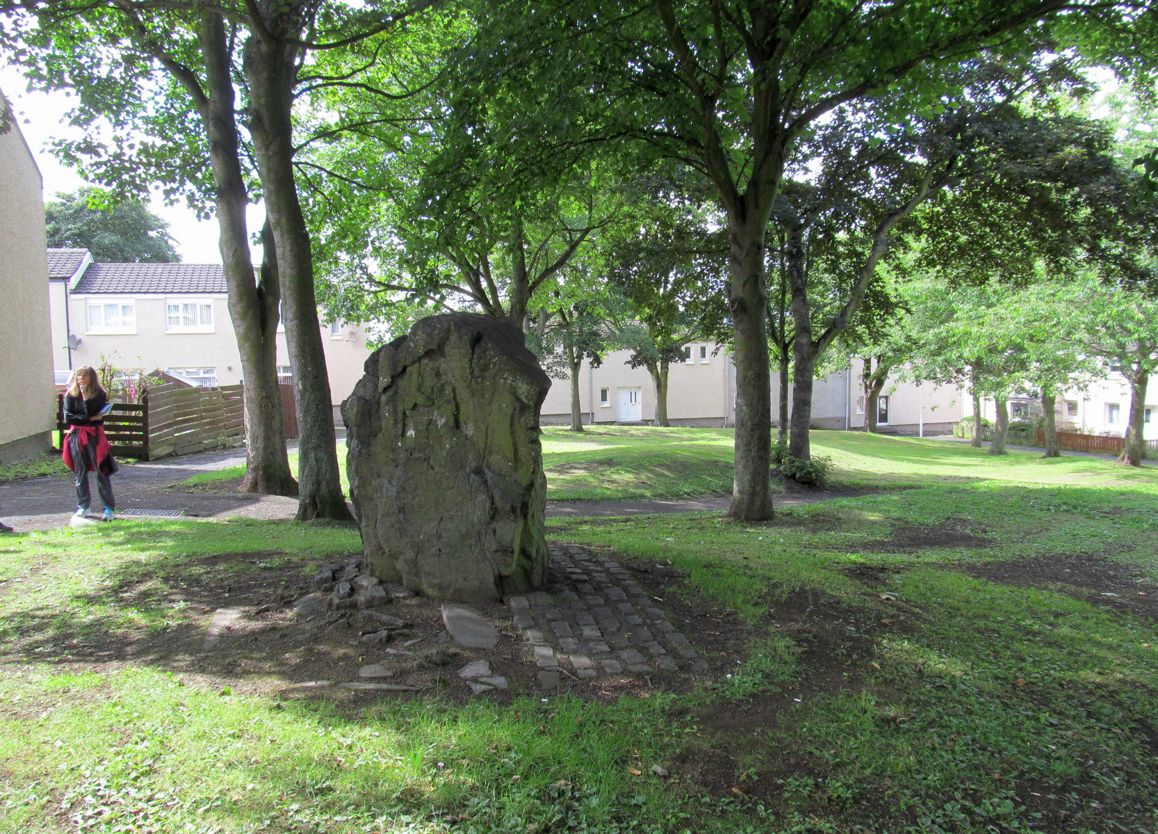
If you’re coming south out of Dunfermline, or north towards Dunfermline, make sure you go along the A823 Queensferry Road. About a mile short of the town centre you need to turn east along the B916 Aberdour Road. Nearly 1 mile along here, shortly past the Tesco supermarket, turn left along Tweeddale Drive. About 50 yards down here, turn left again along Walls Place. About 120 yards along you’ll find a small ginnel/path that runs between two rows of flats on the council estate. Walk down here for a short distance and the stone will magically appear on your right.
Archaeology & History
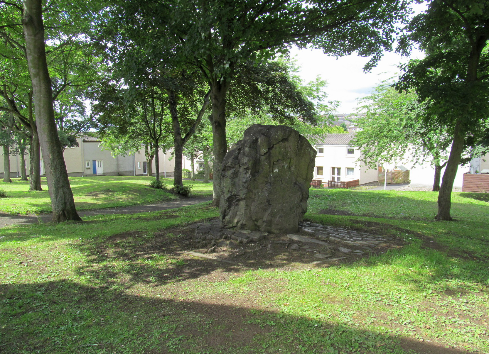
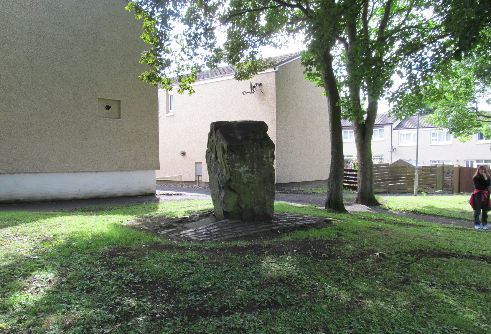
This is a bit of an odd one! Early accounts of the monolith are scarce and, on my first visit here, I was somewhat sceptical of its prehistoric provenance. To be honest, I still am. The erosion levels on the stone give the impression that it’s a much more recent erection (calm down… 😉 ), almost as if it was only quarried a century or two ago. Anyhow, that aside. It’s a nice bulky standing stone, nearly six feet tall and erected where the rising land levels out in the middle of the modern housing estate. It was included in the Royal Commission (1933) survey, who said of it:
Pitcorthie, looking SWPitcorthie, looking West
“About 200 yards north of the farm of Easter Pitcorthie, in a field adjoining the north side of the roadway from Dunfermline to Burntisland, stands a roughly rectangular block of sandstone, which presents the appearance of having been subjected to fire or heat. It is set with its main axis due north and south on the crest of slightly rising ground… There are some indications that it has been packed at the base, but what appears to be packing may be no more than a collection of loose stones which have accumulated round it during the years in which the surrounding area has been cultivated. It rises to a height of 5 feet 10 inches above the ground level, but shows no traces of any sculpturings. At 3 feet from the ground its girth if 11 feet 10 inches.”
It would be good if there were other prehistoric remains close by that could erode my slight scepticism about its age, but I think the nearest other Bronze Age monument is the cairn more than half-a-mile to the south-east.
References:
Royal Commission on the Ancient & Historical Monuments, Scotland, Inventory of Monuments and Constructions in the Counties of Fife, Kinross and Clackmannan, HMSO: Edinburgh 1933.
Swarbrick, Olaf, A Gazetteer of Prehistoric Standing Stones in Great Britain, BAR: Oxford 2012.
Stone Circle (destroyed): OS Grid Reference – NN 857 489
Archaeology & History
In an early essay on the rock art around Aberfeldy, Hugh MacMillan (1884) remarked on what he thought was a tumulus on the southern slope above the town and where a large old petroglyph once lived. Subsequently (MacMillan 1901), in his beautiful artistic foray through upper Tayside, he revised his earlier remarks telling that:
“On the side of a high, tree-covered hillock, rising up abruptly behind the central part of Aberfeldy, called the Tullich, there was once a Druidical circle, one of the huge stones of which, called the Clachmore, forms part of a garden wall on the old military road passing along its base.”
The circle was mentioned in Mackay’s (1954) excellent work, albeit in the past tense, and he could add no more to it other than his memory of the whereabouts of the Clach Mhor (as it was more accurately known), on which were numerous cup-markings. (Note: the grid-reference to this site is an approximation)
Folklore
In bygone times the people of Aberfeldy observed the celebration of Samhain, the old pre-christian New Year’s Day—a.k.a. Hallowe’en—on November 11th. Interestingly for us, “bonfires were numerous and there was always a great blaze on the Tullich,” said Dr John Kennedy. (1901) Considering the small area of The Tullich, it would be unusual if such festivities did not have some relationship with the stone circle. Samhain relates primarily to the passing over of the dead in the cycle of the year: the spirits of the ancestors moving through the worlds. If this circle had such a relationship with the bonfires, it may have been a ring cairn and not a free-standing stone circle.
References:
Kennedy, John, Old Highland Days, Religious Tract Society 1901.
Mackay, N.D., Aberfeldy Past and Present, Town Council: Aberfeldy 1954.
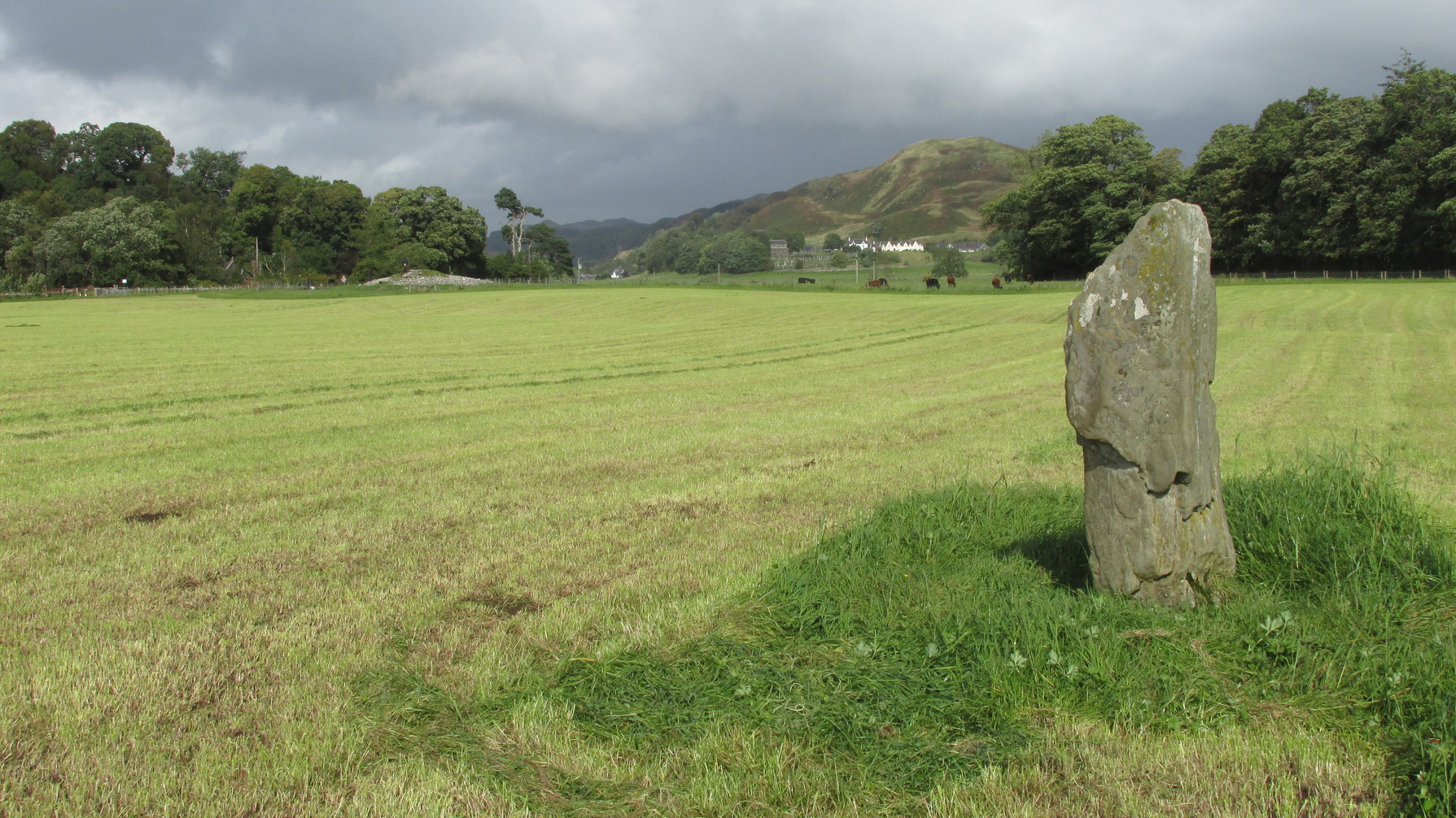
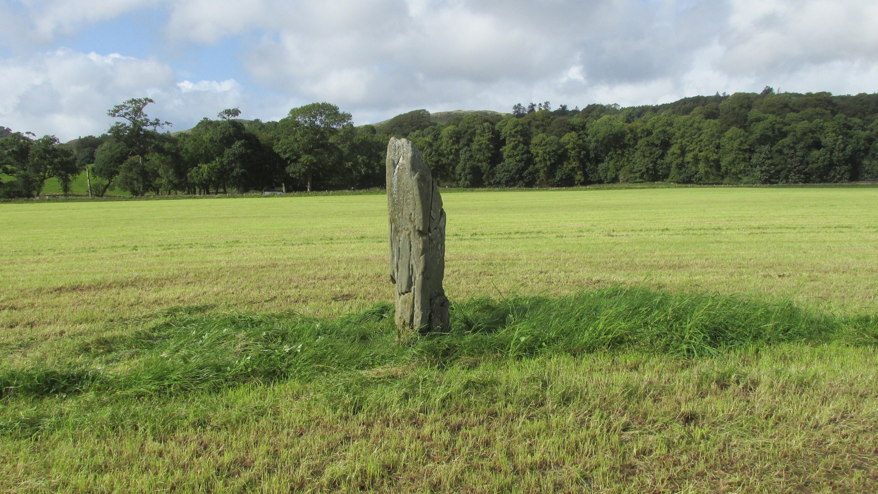
Along the A816 road, just less than a mile south of Kilmartin, take the right-turn on the B8025 Tayvallich road. Barely 50 yards along here, park up on the left-side of the road. Cross the road and walk along the well-marked footpath to the mighty megalithic Kilmartin ‘X’. The path continues to Temple Wood but you’ll see, in the field to your right, this single standing stone. (you’ll see the mighty Netherlargie South cairn in the field beyond)
Archaeology & History
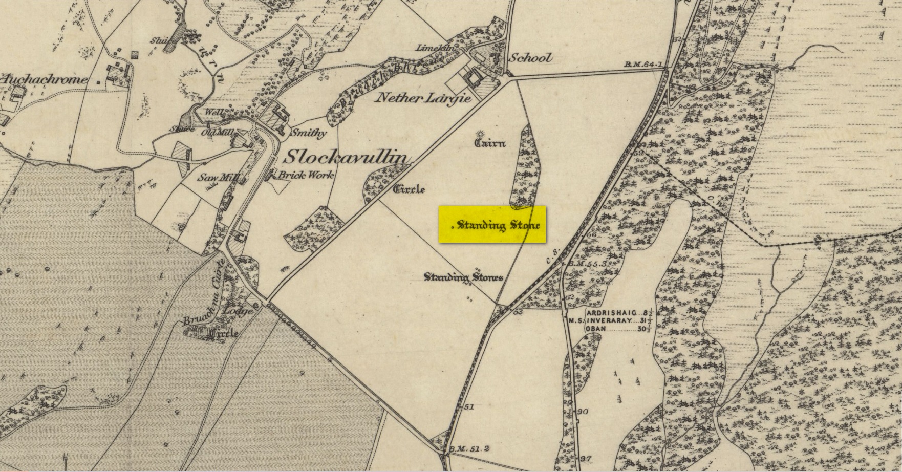
Stone on the 1874 OS-map
First illustrated on the 1874 Ordnance Survey map, this solitary stone (though it may once have had companions) stands some 200 yards south-east of the Temple Wood circle and 355 feet north-west of the northernmost stone in the Kilmartin ‘X’ megalithic complex. When Alexander Thom surveyed this area, despite finding astronomical alignments at many of the standing stones nearby, he could find no heavenly association at this solitary monolith. Its function remains hidden for the time being, although everyone assumes it had some relationship with the giant tombs close by. It makes sense.
Looking W to Temple WoodLooking to the southwest
Despite being referenced in a number of prehistoric surveys, archaeological circles say very little about it. When the Royal Commission lads (1988) visited here they told how it was, at the time, leaning to the south-east. It fell over a few years afterwards but has thankfully been resurrected. When the archaeologists fondled around the base of where it had stood, apart from a few packing stones at one side of the monolith, nothing was found.
Pearson, Jane, Kilmartin – The Stones of History, Famedram: Alexandria 1975.
Ritchie, Graham, The Archaeology of Argyll, Edinburgh University Press 1997.
Royal Commission on the Ancient & Historical Monuments of Scotland, Argyll – Volume 6: Mid-Argyll and Cowal, HMSO: Edinburgh 1988.
Ruggles, Clive, “The Stone Alignments of Argyll and Mull,” in Records in Stone (ed. C.L.N. Ruggles), Cambridge University Press 1988.
Thom, Alexander, Megalithic Lunar Observatories, Oxford University Press 1971.
Acknowledgements:Huge thanks for use of the Ordnance Survey map in this site profile, reproduced with the kind permission of the National Library of Scotland.
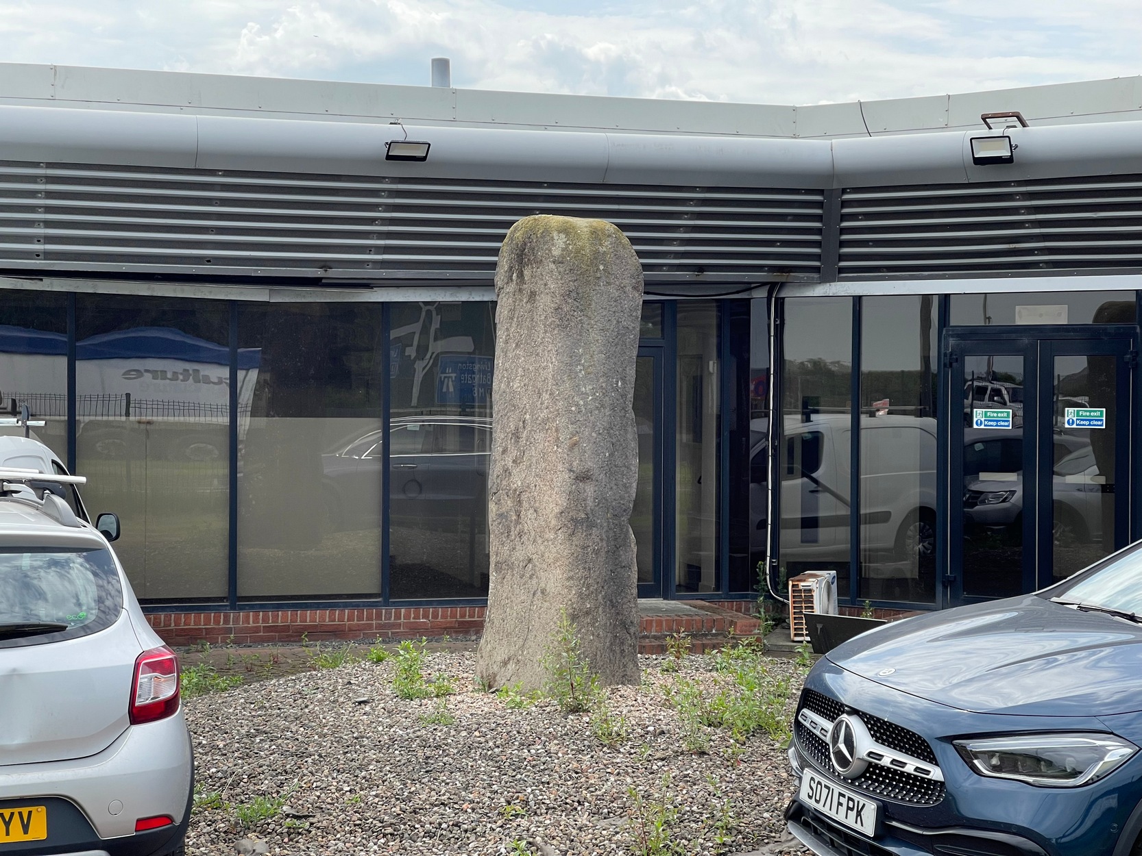
Coming out of Edinburgh along the main A8 Glasgow road, literally yards before you join the M9 near Ratho Station, on the left-side of the road where the last building stands (a company called Element), you need to look through their high metal fence. Just in front of the large windows, you’ll see this tall standing stone (if you’re coming here via public transport, there’s a bus-stop less than 100 yards away on both sides of the dual carriageway). Y’ can’t really miss it!
Archaeology & History
A prehistoric site which, today, has lost all value in terms of its original ambience. The traffic and aircraft noise here is non-stop and prevents all forms of quietude and refection. Added to this is the fact that it’s behind the high fencing of the warehouse, stopping you getting close to it. But, I suppose, at least it’s still standing after all these centuries. In many other parts of Britain, it would have been destroyed long ago…
It seems to have been mentioned for the first time, albeit briefly in John Smith’s (1862) early survey of the local prehistoric sites. He told it to be a,
“large standing stone…of coarse greenstone,” which “bears no inscription or sculpturing of any kind, and measures about 10 feet in height from the surface of the ground.”
Old stone, new home
Many years later when the Royal Commission (1929) this way ventured, they weren’t much more descriptive, but postulated, not unreasonably I might say, that it functioned as a deliberate outlier from the impressive Newbridge megalithic complex 350 yards to the west. They may be right. “In shape it is an irregular four-sided prism,” they wrote, “measuring 9 feet 3 inches in height and 10 feet 6 inches in girth.” The local megalith surveyor Adam MacLean (1977) pointed out that, relative to the prehistoric complex 350 yards away, “it is in the right position to act as an equinox sunrise marker.”
References:
MacLean, Adam, The Standing Stones of the Lothians, Megalithic Research Publications: Edinburgh 1977.
Royal Commission Ancient & Historical Monuments of Scotland, Inventory of Monuments and Constructions in the Counties of Midlothian and West Lothian, HMSO: Edinburgh 1929.
Swarbrick, Olaf, A Gazetteer of Prehistoric Standing Stones in Great Britain, BAR: Oxford 2012.
Acknowledgements:Huge thanks for use of the Ordnance Survey map in this site profile, reproduced with the kind permission of the National Library of Scotland.
Cross (replaced): OS Grid Reference – SD 8936 2883
Archaeology & History
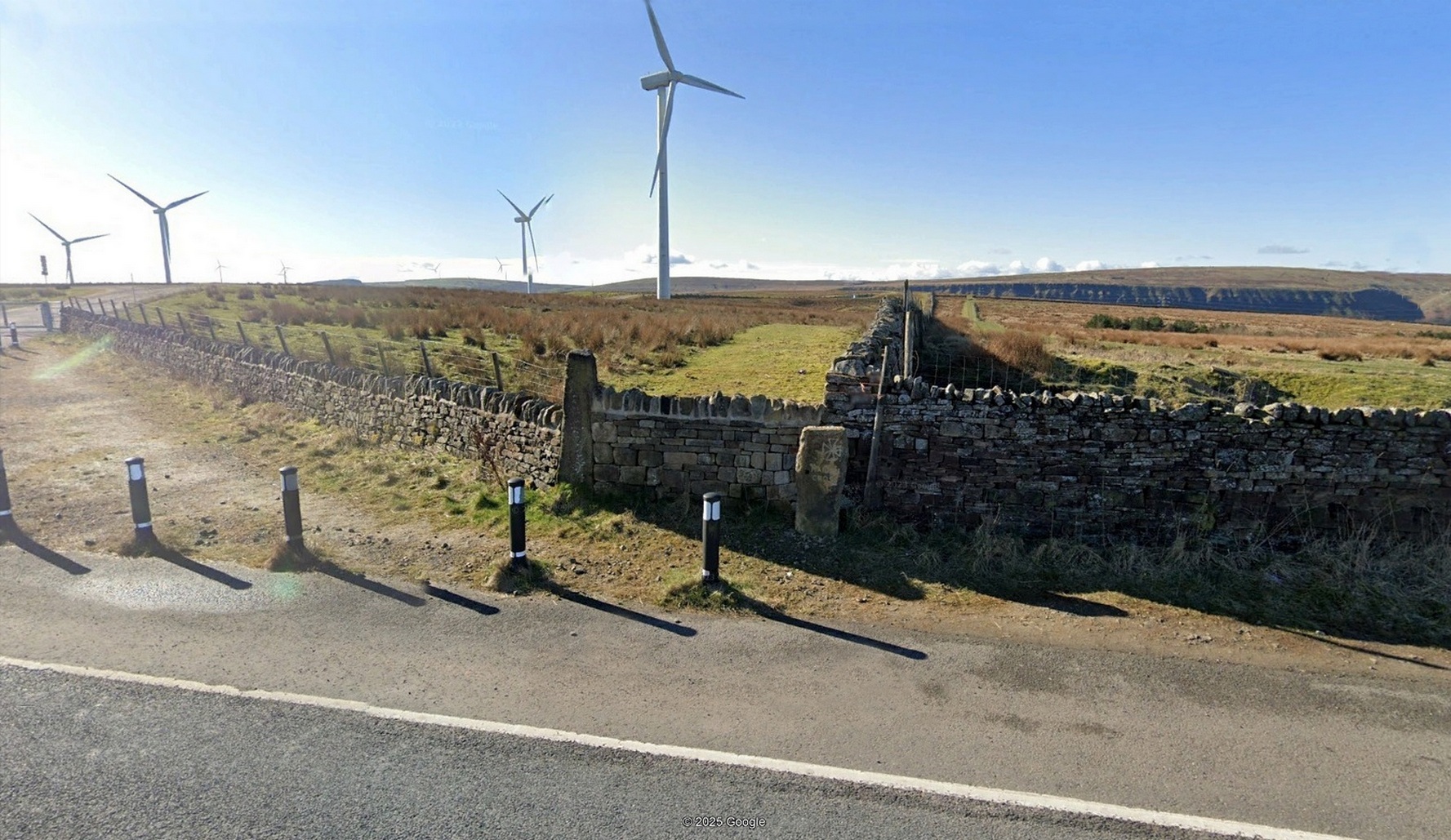
“Maiden Cross” stone
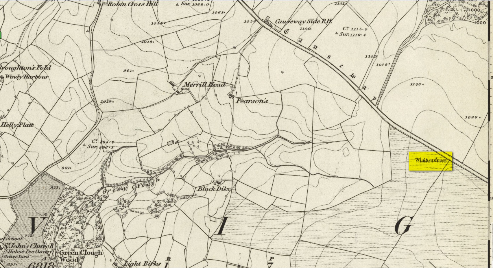
Highlighted on the 1848 Ordnance Survey map, the original stone ‘cross’ has apparently been moved from its location up against the walling 30-40 yards away and placed by the roadside, just as you’re going into where the windmills are, right at the very crown of the hill, across from the car-park. I’m not so sure it’s the original one to be honest—but I may be wrong. Clifford Byrne (1974) certainly thought this is the original stone. He may be wright. Byrne told that “the Marquis of Colne had a photograph of the stump of the cross in situ,” which would be good to compare. It’s nowt special to look at, but at least the site has been remembered, so to speak.
Site shown on 1848 map
The Maiden Cross was one in a series of wayside crosses along this ancient high road—known as the Long Causeway—not only marking it out when the snows covered it in the old Winters that we used to get, but also possessing religious importance to travellers. It was first moved sometime in the 19th century and “utilised as a gatepost into Maiden Cross colliery”—itself long gone.
Folklore
The name given to the ‘cross’ comes from a story that’s found at a number of other ‘maiden’ place-names. There may be an element of truth in it. It was told to the great historian and folklorist T.T. Wilkinson by his grandfather in 1766 and, according to him, his grandfather before that! J.A. Waddington (1884) subsequently wrote down the tale that Wilkinson told him:
“During the time of the great rebellion, this was the trysting-place of a young shepherd with his lady love. Often did they meet to pledge their simple vows at this lonely place, until one day a messenger came from Towneley to collect as many young men as he could get to swell the ranks of Rupert when he passed through this part to join the Royal forces at York, a march which ended with the disastrous fight at Marston Moor, on whose bloody sod lay stretched the chivalrous Towneley, and a many of his followers, including this young man, the victims of a tyrannical and ambitious king. For many a long year after this tragical event the poor demented maiden would repair to this hallowed spot, repeating with a sorrowful voice his promise to return.”
This was curiously described by Ormerod (1906) as “a pathetic tradition”! He much preferred the simple idea of this (and the other crosses along the road) as merely serving “the capacity of guideposts to the traveller (overtaken in a mist or by the swiftly lowering shades of light) who might be traversing these lonely roads”, as Waddington put it. Ormerod cited a conversation he had with “an old road mender” which for him confirmed the idea:
“Asked if he had heard what was the object of these crosses, he said, that “Joonas Lee said as they were put up 250 yer sin, for guideposts for’t pack horses, between Halifax and Brunshaw” (Burnley), adding, as if to give more weight to the authority he had quoted: “An he wur a far larned chap wur Joonas—he wur a preycher.”’
Walter Bennett (1941) meanwhile, thought its name derived from the Virgin Mary and this cross, at least, possessed religious importance.
References:
Bennett, W., The History of Burnley – volume 1, Burnley County Council 1946.
Byrne, Clifford, A Survey of the Ancient Wayside Crosses in North-East Lancashire, privately printed 1974.
Holden, Joshua, A History of Todmorden, Manchester University Press 1912.
Waddington, J. Arthur, ‘The Crosses in and Around Burnley’, in Transactions Burnley Literary & Scientific Club, volume 1, 1884.
Acknowledgements:Huge thanks for use of the Ordnance Survey map in this site profile, reproduced with the kind permission of the National Library of Scotland.
On the A816 road, a mile-and-a-bit north of Kilmartin, take the small road (east) to Ford—passing the Creagantairbh stone on your right, then a bit further on the Auchinellan stone on your left. Go through Ford village, making sure to stick to the road that goes along the north side of Loch Awe — as if you’re heading to Dalavich. Just fractionally over a mile out of Ford village, just where the road begins to swerve into a large bend, there’s a small left-turn that takes you to some houses. Just 60-70 yards along this little road, take the trivial little path on your right that takes you straight to a piece of manicured scrubland. If you walk into it, and bear left, you’ll see what you’re looking for. It’s unmissable!
Archaeology & History
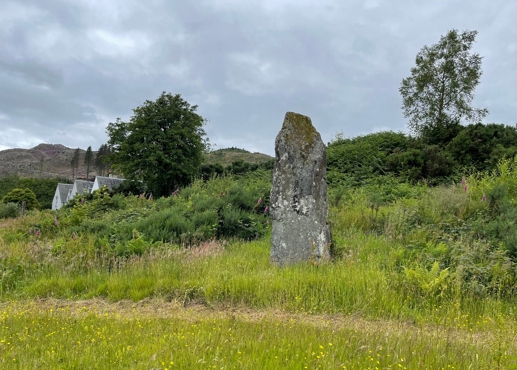
When I first visited here in the 1990s, a farm building stood by this huge standing stone and there were no other houses nearby. How things change—but thankfully our old sentinel stone is still living here.
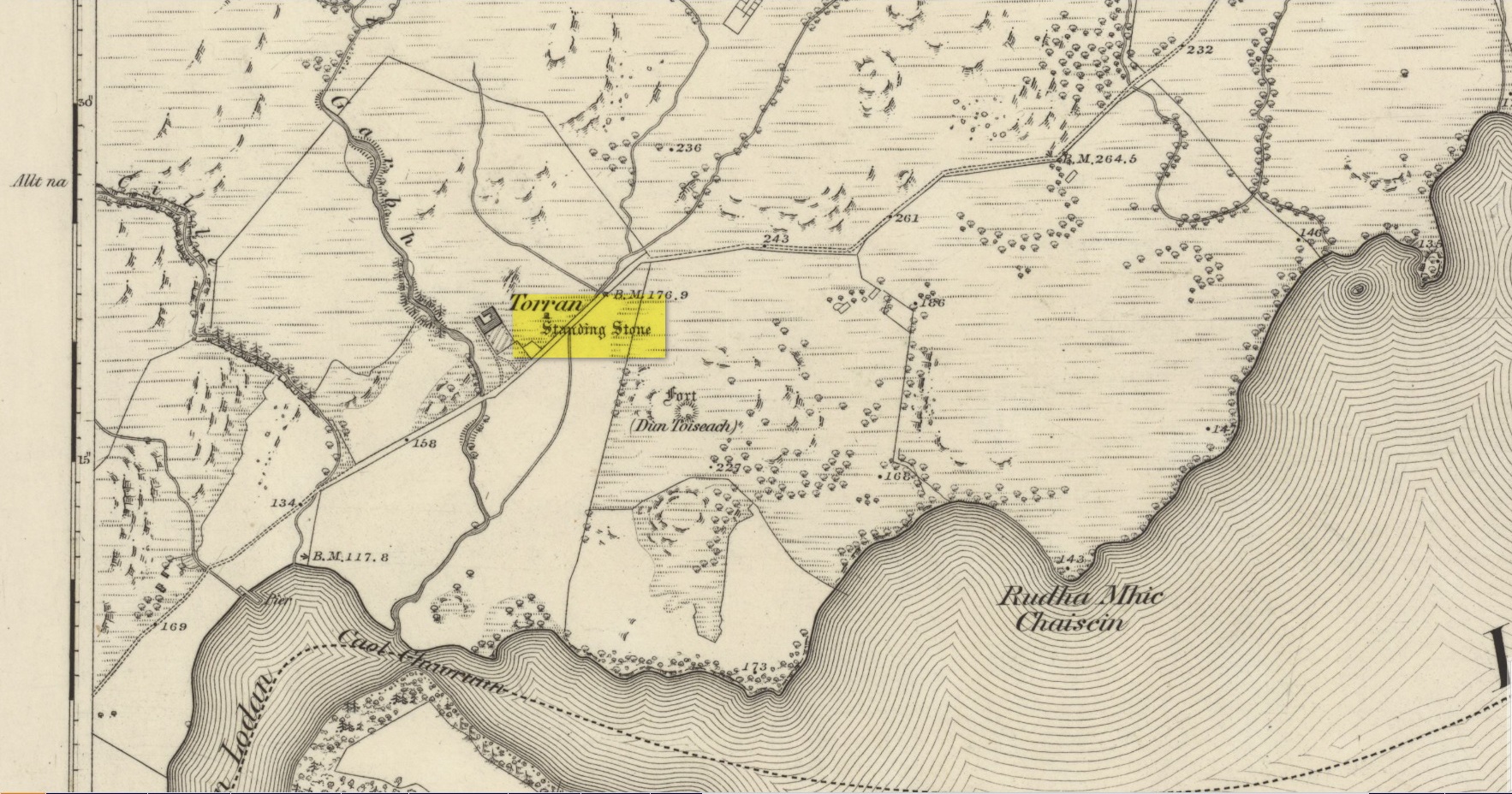
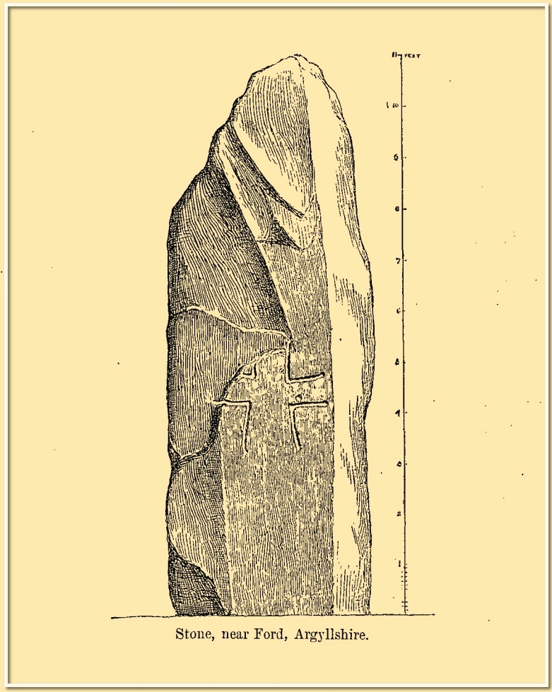
Site shown on 1875 mapRomilly Allen’s 1880 sketch
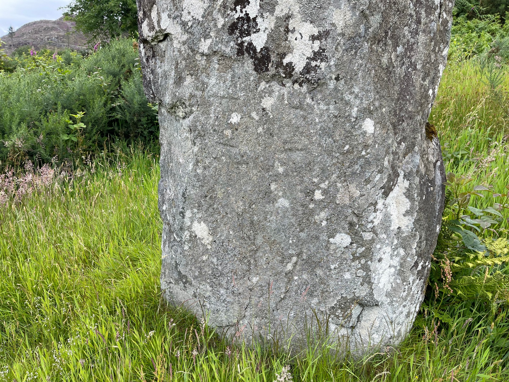
It was highlighted by the Ordnance Survey lads on their early map of the area, and visited a few years later by the great petroglyphic pioneer J. Romilly Allen. (1880) Standing eleven feet tall and more than four feet across at the base, Allen noticed that, about four feet above ground-level, someone had carved an old cross onto the northeast face of the stone (you can just make it out in the attached photos). It had obviously been carved many centuries ago, by a wandering christian no doubt—although it was incomplete and never finished. Perhaps the person who carved it was chased away by local folk, who would have obviously and rightly seen such an act as outright vandalism. The cross was deemed by Ian Fisher (2001) and the Royal Commission (1992) to be medieval in nature. Apparently there’s another, much fainter cross that was first mentioned by Marion Campbell etched on the other side of the stone, but in all the times I came here I was never able to make it out.
Old faint cross carvingSmall person, big stone!
But even further back in time someone had carved a cup-marking on the stone—and the cross was etched onto the same spot, enclosing the cup-mark. When I lived nearby, I made a sketch (long since lost) of what seemed to be two other faint cup-marks at one end of the extended arms of the cross, but on our recent visit here these were very hard to make out. When Ron Morris (1981) mentioned the stone in his survey, he mentioned its proximity to other cup-and-ring carvings immediately to the southeast and a hillock thereby, wondering whether there was “an astronomical complex” going on here. I doubt it—but I like the idea!
But it’s the size of the stone that’s most impressive here and keeps up with the tradition of similar megaliths in and around the Kilmartin area. Check the place out when you’re hunting the other stones nearby. You won’t be disappointed!
Folklore
Local tradition ascribed this great stone as marking the grave of an ancient warrior. The full folk tale seems to have been lost.
Fisher, Ian, Early Medieval Sculpture in the West Highlands and Islands, RCAHMS: Edinburgh 2001.
Morris, Ronald W.B., The Prehistoric Rock Art of Southern Scotland, BAR: Oxford 1981.
Royal Commission on the Ancient & Historical Monuments of Scotland, Argyll – Volume 6: Mid-Argyll and Cowal, HMSO: Edinburgh 1988.
Royal Commission on the Ancient & Historical Monuments of Scotland, Argyll – Volume 7: Mid-Argyll and Cowal: Medieval and Later Monuments, HMSO: Edinburgh 1992.
Ruggles, Clive, Megalithic Astronomy, BAR: Oxford 1984.
Swarbrick, Olaf, A Gazetteer of Prehistoric Standing Stones in Great Britain, BAR: Oxford 2012.
Acknowledgements:Huge thanks for use of the Ordnance Survey map in this site profile, reproduced with the kind permission of the National Library of Scotland.
Standing Stone (destroyed): OS Grid Reference – SK 5779 0644
Also Known as:
Little John’s Stone
Archaeology & History
Nichols 1804 drawing
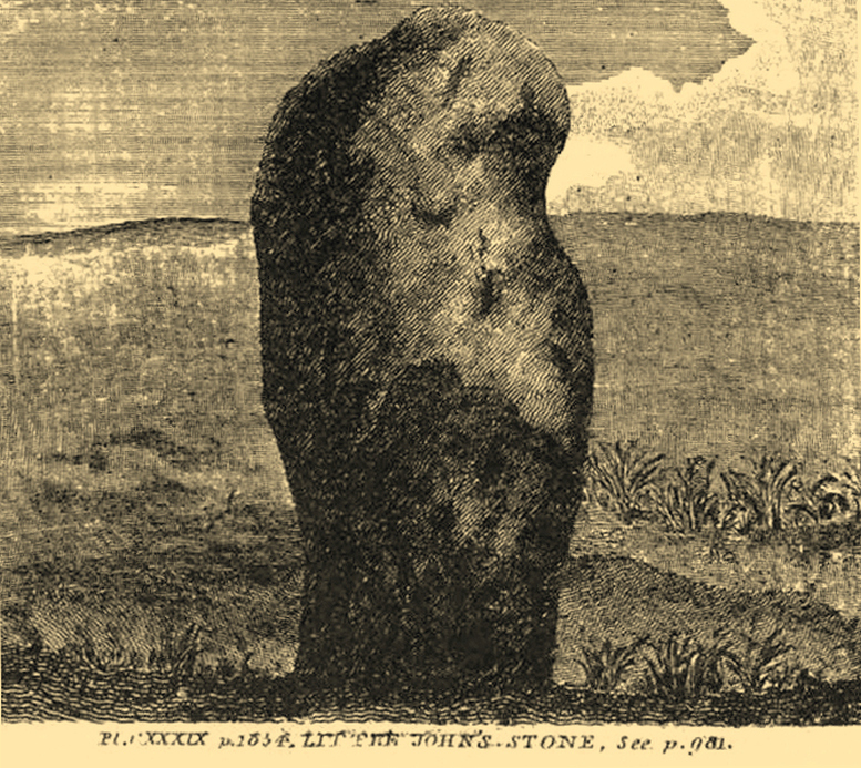
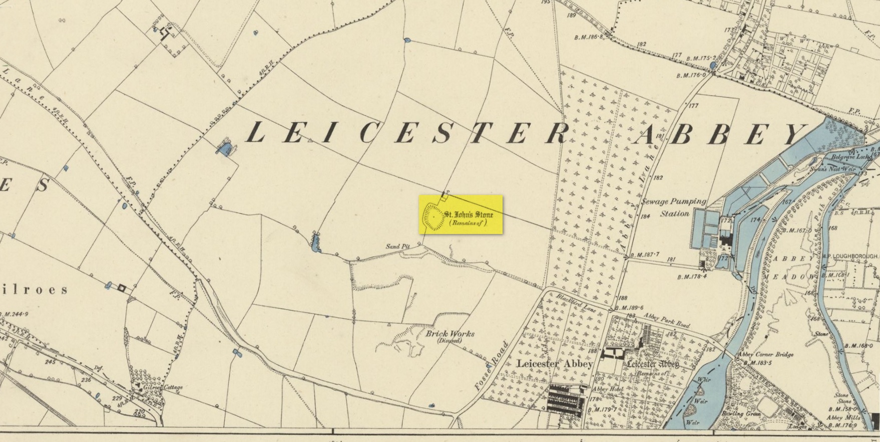
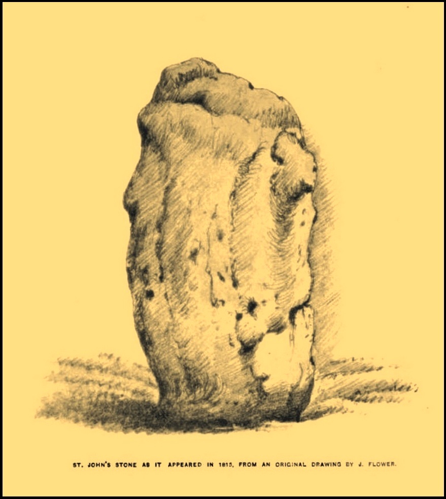
This once impressive megalithic site was first mentioned in 1381, giving its name to the field Johnstone Close. Shown on the early Ordnance Survey maps standing on a raised portion of land in an area north of the modern town centre, not far from the Abbey, its destruction had been a slow one until it finally disappeared about a hundred years ago. One of the early descriptions of it was by John Nichols (1804) in his immense series of works on the county. He called it ‘Little John’s Stone’* and gave us the first known illustration of the monolith (right), telling it to be “7 feet 2 inches high, and 11 feet 3 inches wide”—although he obviously meant circumference and not ‘wide’, as his illustration clearly shows. Although this slight error was perhaps the reason that Historic England proclaimed the stone to have been little more than “a natural feature”—which it clearly wasn’t.
Stone shown on 1885 mapJohn Flower’s 1815 sketch
The stone stood in what Nichols called “a kind of amphitheatre”, and what James Hollings (1855) subsequently called a sloping hollow which, he thought, had “been excavated by the hand of man.” It was located “in a meadow, a little to the west of the Fosse-way,” he said, “not far from the ancient boundary wall of the Abbey of St. Mary de Pratis.” There’s little doubt it was a prehistoric standing stone. Hollings described it as standing erect and told it to be one of those “monolithic erections, or hoar stones, anciently sanctified by the rites of Druidic worship,” comparing it to “similar rude columns” in Cornwall, Scotland and just about everywhere! He also told that it was a place of summer solstice gatherings, being
“in the memory of many living, annually visited about the time of Midsummer by numerous parties from the town in pursuance of a custom of unknown antiquity.”
When James Kelly (1884) wrote about the stone, little was left of it save at ground level. He repeated much of what Hollings had previously written, but had a few notes of his own. One related to the local mayor and MP for Leicester, Mr Richard Harris, dated January 1853, who told him:
“When a boy, he had frequently played on the spot where it was customary for the children to resort to dance round the stone (which he thought was about eight feet high), to climb upon it and to roll down the hill by which the stone is in part, encircled. The children were careful to leave before dark, as it was believed that at midnight the fairies assembled and danced round the stone.”
More than fifty years later when Mrs Johnson (1906) wrote about the place she said that only a small section of the stone still remained, just “a few inches above the earth.” It had been incrementally “broken to pieces down to the surface of the ground and used to mend the road.” (Kelly 1884) Alice Dryden (1911) lamented its gradual demise in size, summarizing:
“At the beginning of the nineteenth century it was about 7 feet high, but by the year 1835 it had become reduced to about 3 feet. In 1874, according to the British Association’s Report, it was about 2 feet high, and it has now completely disappeared.”
Local tradition tells that some small pieces of St John’s Stone were moved to the nearby St. Luke’s church, where bits of it can still be seen. Has anyone found them?
More recent lore has attributed St John’s Stone to have been aligned with the Humber Stone (SK 62416 07095) nearly 3 miles to the east, in a summer solstice line—but it’s nowhere near it! A similar astronomical attempt said that the two stones lined up with the Beltane sunrise: this is a little closer, but it still doesn’t work. The equinox sunrise is closer still, but whether these two stones were even intervisible is questionable.
* this was probably the name it was known by local people who frequented the nearby Robin Hood public house (long gone); its saintly dedication being less important in the minds of Leicester’s indigenous folk.
References:
Cox, Barrie, The Place-Names of Leicestershire – volume 1, EPNS: Nottingham 1998.
Devereux, Paul, “The Forgotten Heart of Albion,” in The Ley Hunter, no.66, 1975.
Dryden, Alice, Memorials of Old Leicestershire, George Allen & Sons: London 1911.
Hollings, James Francis, Roman Leicester, LLPS: Leicester 1855.
Kelly, William, Royal Progresses and Visits to Leicester, Samuel Clarke: Leicester 1884.
Nichols, John, The History and Antiquities of Leicestershire – volume 3: part 2, J. Nichols: London 1804.
Trubshaw, Bob, Standing Stones and Markstones of Leicestershire, Heart of Albion Press 1991.
Acknowledgements:Huge thanks for use of the Ordnance Survey map in this site profile, reproduced with the kind permission of the National Library of Scotland.
Stone Circle (destroyed): OS Grid Reference – NX 8657 6668
Archaeology & History
Little is known about this stone circle, which had apparently been destroyed sometime in the first half of the 19th century. The local Rev. J. Gillespie spoke about it with the great Fred Coles (1895), who told that it was “near the manse of Kirkgunzeon.” The site was listed in Burl’s (2000) magnum opus, where he wondered if it might have been a cairn; and interestingly, when the Ordnance Survey lads came here, they spoke with a Mrs J. Moffat, the oldest inhabitant in the area, who told that,
“a circle of stones c.30 ft in diameter with a small mound in the centre stood on flat ground at NX 8657 6668. Over the years successive farmers have removed the larger stones and now only the slight mound, c.4.0 m diam. x 0.3 m high, with several clearance stones on top, survives to mark the site of the stone circle.”
References:
Burl, Aubrey, The Stone Circles of Britain, Ireland and Brittany, Yale University Press 2000.
Coles, Fred, “The Stone Circles of the Stewartry of Kirkcudbright”, in Proceedings Society Antiquaries, Scotland, volume 29, 1895.