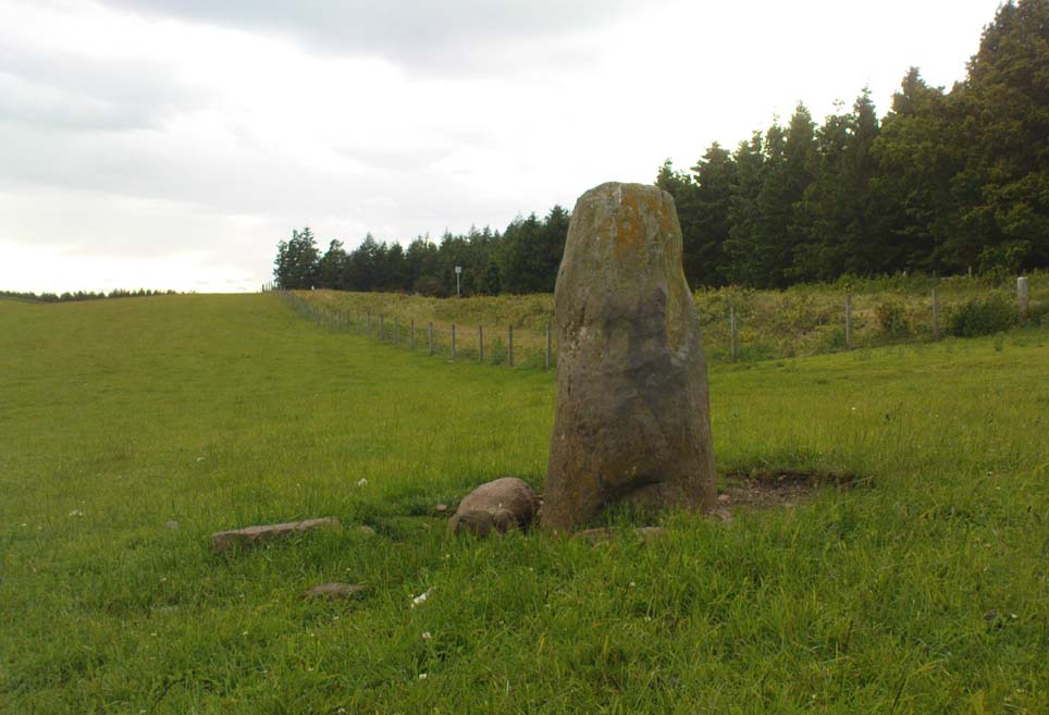
St. Mungo’s Well, Gleneagles, Perthshire

Holy Well:  OS Grid Reference – NN 9376 0719

Also Known as:
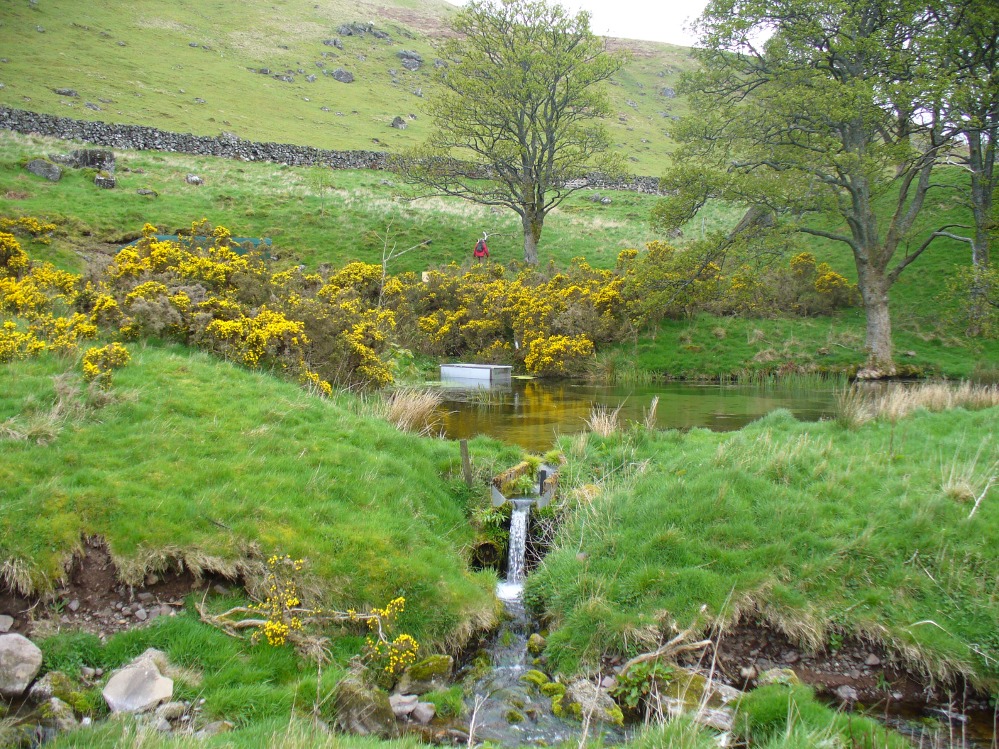
  1. Canmore ID 25905

Getting Here

St Mungo's Well, Gleneagles
St Mungo’s Well, Gleneagles

The best way here is to walk a mile to find it.  All the way up the road from Gleneagles Standing Stones to Glendevon, right at the very top where the two glens meet, there’s a small road heading to the Fishery. 100 yards along, park up. Then take the old green road back down the Glen, north towards Gleneagles, parallel with the new road. A mile or so down you’ll reach the farmhouse, but a coupla hundred yards before this, in a wooden gap in the electric fence, you can walk straight downhill to the large pool below you. Y’ can’t really miss it!

Archaeology & History

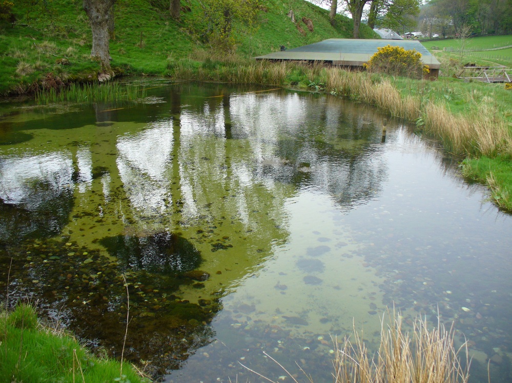
The strong cold spring of water known as St Mungo’s Well, now gathers into a large crystal clear pool and is gorgeous to drink and very refreshing!  All around the edges are the brilliant yellow masses of gorse, held amidst widespread vivid hues of green in this most rocky of landscapes.  Tis a gorgeous setting here….
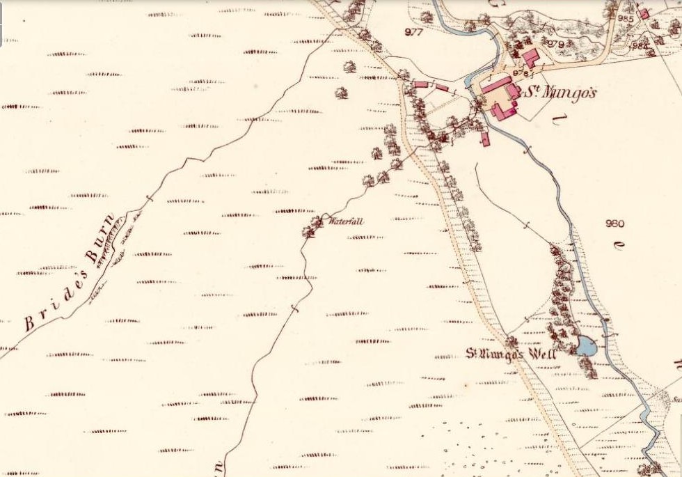
St Mungo's Well, 1860 map
St Mungo’s Well, 1860 map

Unfortunately there is no literary information that tells us why this spring of water, amongst the many others all around these hills, gained the ‘blessing’ of one of those roaming christians and was deemed to be ‘holy’.  The greatest likelihood, as usual, is that the waters had some important heathen association which our peasant ancestors would have been able to tell us about if their animistic tales hadn’t been outlawed and demonized by the incoming cult — but we’ll probably never know for sure.  As a result, we know nothing now of its medicinal qualities or old stories.

The transference of its old name (whatever it may have been) to their ‘St. Mungo’ may date from when the character was wandering with his christians in the 7th century, but we have no literary account proving as such.  The name ‘St Mungo’ was an alternative name (a nickname if y’ like) of St. Kentigern — or at least that’s what the church historians tell us.  There is no history of Kentigern or St Mungo up the glen, but we do have a more prosaic account that tells of a Mr Mungo Haldane of Gleneagles, a member of the Scottish parliament in 1673 onwards; he was succeeded by another Mungo Haldane MP in 1755.  However, it’s highly unlikely that these political characters gave their name to the well.
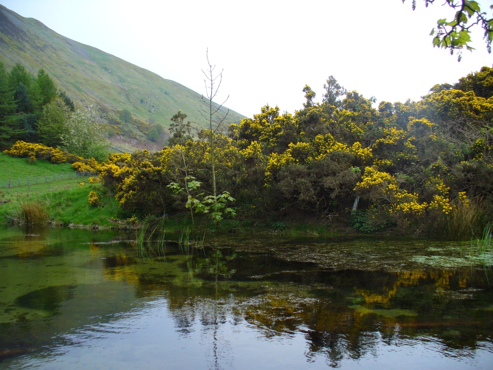
The clear waters, looking south
Crystal clear perfect drinking water

Even the Scottish holy wells surveys are pretty silent on this beautiful site.  It was mentioned in Morris’ (1981) survey, but with no real information.  The earliest account seems to come from an article written in the Perthshire Advertiser in 1856, and thankfully reproduced in the otherwise tedious genealogical history of the Haldane (1880) family; but even here, the narrative simply mentions the presence of the well and no more.  Described in a walk up Gleneagles, it told:

“Journeying westward along the desolate moor…we soon came in front of Gleneagles, a narrow picturesque glen in the Ochils, through which the old road from Crieff leads into Kinross-shire.  The hills here, as throughout the whole range, are strictly pastoral, but in no place more so than Gleneagles.  Crowning the heights on both sides of the glen, we have craigs ragged and bare enough; but their show of beetling hard sterility is as nothing to the winding receding mass of grassy heights that bound the view. In looking on that quiet, sunny, Sabbath-like retreat, one would be apt to deem the name a misnomer, and yet it is not much above a hundred years since the monarch of birds had a home among its cliffs.  There, too, the Ruthven Water that dashes past Auchterarder has its rise — not in a scarcely seen bubbling spring almost covered with moss, but issuing at once into daylight at the bottom of yonder steep in volume sufficient to drive a mill.  In ancient times, as now, it must have been an object of mark, as it is called St. Mungo’s Well; but who this St. Mungo or St. Magnus was — whether the ghostly patron of Glasgow, Auchterarder old chapel, or the guardian saint of this particular spot, we cannot tell.  But he seems to have relished cold water; and it is satisfactory to know that he must have got his fill of it there, if his cell happened to be in the vicinity.”

The well was mentioned in passing in the Object Name Book in 1860 and shown on the earliest Ordnance Survey maps.

Folklore

Apart from the fact that the waters here never run dry, we have no other folklore. However it should be noted that St. Mungo’s Day was January 14th — which may have been when the qualities of the spring were deemed most efficacious, or when olde rites were enacted here.  However, a hundred yards down we pass the stream known as Bride’s Burn, probably in honour of the heathen Queen St. Brigit, whose name and myths are integral to our great Earth goddess, the Cailleach and whose celebration date is only two weeks later than that of Mungo.  Hmmmmmmm…..

References:

  1. Attwater, Donald, Penguin Dictionary of Saints, Penguin: Harmondsworth 1965.
  2. Haldane, Alexander, Memoranda Relating to the Family of Haldane of Gleneagles, C.A. MacKintosh: London 1880.
  3. MacKinlay, James M., Folklore of Scottish Lochs and Springs, William Hodge: Glasgow 1893.
  4. Morris, Ruth & Frank, Scottish Healing Wells, Alethea: Sandy 1982.
  5. Watson, Alexander, The Ochils – Placenames, History, Tradition, Perth & Kinross District Libraries 1995.

© Paul Bennett, The Northern Antiquarian


Gleneagles ‘B’, Blackford, Perthshire

Standing Stone:  OS Grid Reference – NN 92431 09804

Also Known as:

  1. Blackford
  2. Canmore ID 25924
  3. Loaninghead
  4. Peterhead Farm

Getting Here

19th century drawing of the old stone

Along the A9 dual carriageway between Blackford and Auchterarder, take the A823 road south, up Glen Eagles towards Pool of Muckhart and Dunfermline.  Less than 100 yards up the road, turn immediately right and park-up. On the overgrown grassy land on the right-hand side of the road, you’ll see this solid monolith calling for your attention.  You can’t really miss it!

Archaeology & History

Looking south, to the fairy-haunted Ben Shee

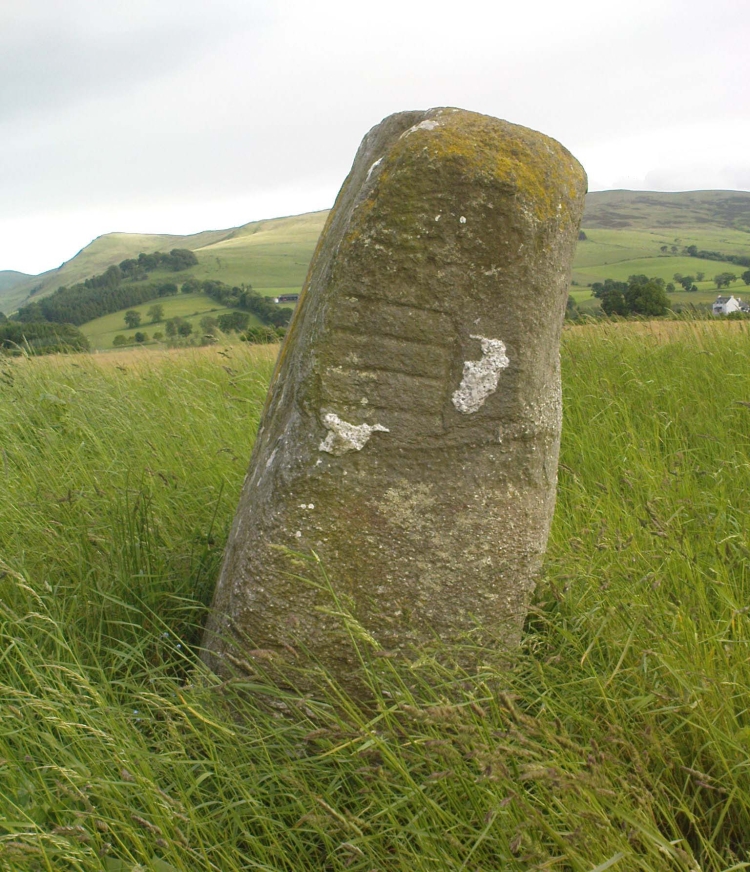
Described by archaeologists as a Class 1 Pictish Symbol Stone (and shown on OS maps as such), this is a fine solid standing stone more than 5 feet tall, with a lovely view up Gleneagles to the fairy mountain of Ben Shee beckoning in the distance.  Immediately north on the other side of the dual carriageway, the tree-lined mound 100 yards away is an ancient fort (which we’ll deal with in another entry); and of course we have the nearby companion of the Gleneagles A standing stone a coupla hundred yards west.  Whether or not this stone and its western companion ever had anything to do with the lost stone circle of Gleneagles, we might never know.

Close-up of the carved designs
Charles Calders drawing of the carvings

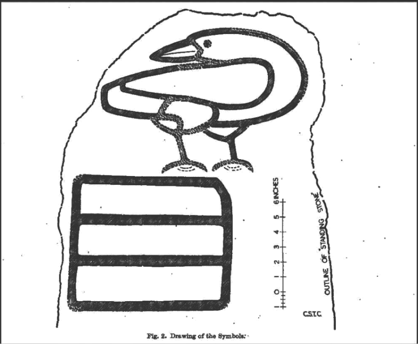
Although it seems consensus opinion that the standing stone here is prehistoric, the monolith was of some venerable importance to the Pictish people of the Ochils, who, according to the Royal Commission lads (1999) carved on this stone “the faint symbols of a goose and rectangle.”  The rectangle, however, is in fact a parallelogram—as the images here clearly show.  Archaeologist Richard Feachem (1977) thought the design was in fact “a double-sided comb.”  I have my doubts (a much smaller and probably more recent parallelogram design was recently identified on the upright face of the large Dunruchan D standing stone, about 10 miles WNW of here).  The ‘goose’ is carved above this geometric form and is much fainter, which may imply it was carved much earlier.  In Elizabeth Sutherland’s (1997) survey, she suggests the bird may be an eagle.  It is equally possible that it is a swan.

The earliest detaied account of this stone and its companion is in Mr Hutchison’s (1893) fine essay, where he wrote:

“On the south side of the road from Blackford to Auchterarder, about 150 yards west from Loaninghead where the line of the road is crossed by that from Gleneagles to Crieff, stands a fine stone of Highland grit.  It measures 4ft. 10in. in height above ground, 10ft. in girth at the base, and 6ft. 9in. in circumference at top.  It shows four sides of nearly equal measurement:— that facing north being 2ft 4in., south 2ft. 8in., west 2ft 5in., and east 3ft.  On the north is an incised figure in the form of an parallelogram, 10in. broad by 9in. high, divided into three equal portions by two horizontal lines.”

References:

  1. Calder, Charles S.T., “Notice of Two Standing Stones (one with Pictish Symbols) on the Lands of Peterhead Farm, near Gleneagles, Perthshire,” in Proceedings of the Society of Antiquaries, Scotland, volume 81, 1947.
  2. Feachem, Richard, Guide to Prehistoric Scotland, Batsford 1977.
  3. Finlayson, Andrew, The Stones of Strathearn, One Tree Island: Comrie 2010.
  4. Hutchison, A.F., “The Standing Stones of Stirling District,” in The Stirling Antiquary, volume 1, 1893.
  5. Royal Commission on the Ancient & Historical Monuments of Scotland, Pictish Symbol Stones: A Gazetteer, Edinburgh 1999.
  6. Sutherland, Elizabeth, A Guide to Pictish Stones, Birlinn: Edinburgh 1997.

© The Northern Antiquarian


Boat Stone, Blackford, Perthshire

Standing Stone (fallen): OS Grid Reference – NN 87202 07286

Getting Here

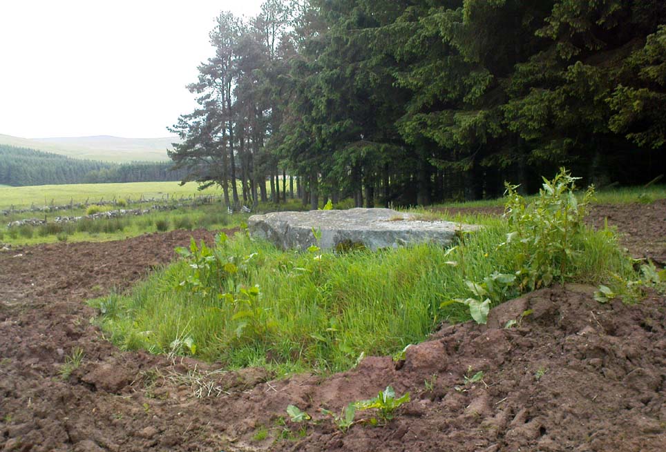
Fallen monolith in the grass

From Blackford on the north side of the A9, cross over and take the small B-road which quietly runs up and over Sheriffmuir towards Dunblane.  After a mile, keep your eyes keen for the approaching woodland on your right-hand side; for in the field just before the woods, you’ll see a patch of grass near the corner of the field with a long stone poking out of it. That’s it!

Archaeology & History

It seems that very little has been written about this monolith in any of the archaeology texts, but it’s ascribed locally to be a fallen standing stone.  The site’s described in Finlayson’s (2010) fine local megalith guide where he points out how it’s in line with other nearby standing stones at Gleneagles and the White Stone – and the line is damn close!

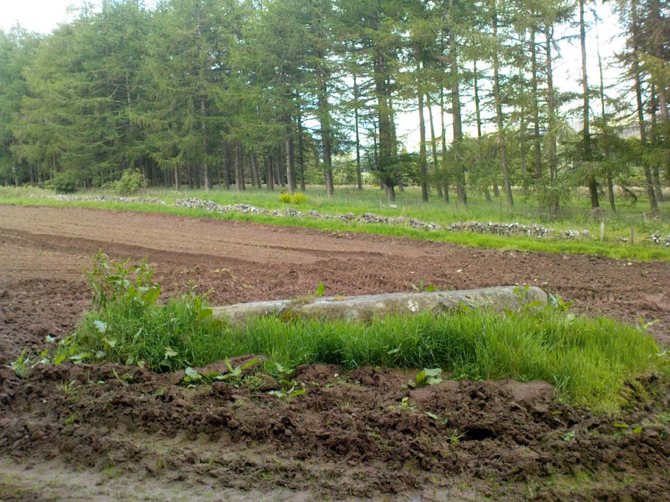
…and from another angle…

With a quartz vein running through it, the stone lays some thirteen feet long and was, at some time in the not-too-distant past, readied to be quarried, as evidenced by the chisel-marks cut into it, prior to the usual destruction. But this time, for some reason, someone must have come to the rescue and prevented its demise…thankfully…

The farmer annually cuts around the fallen stone, shaped like a long boat (hence the name), near the top corner of the field. It would have looked damn good when stood upright, standing about ten feet in height and visible for a good distance. But today it’s quite forlorn laid here, seemingly alone, in this quiet part of the country, and is probably only one of interest to hardcore megalithomaniacs amongst you!

References:

  1. Finlayson, Andrew, The Stones of Strathearn, One Tree Island: Comrie 2010.

© Paul Bennett, The Northern Antiquarian


Gleneagles Stone Circle, Blackford, Perthshire

Stone Circle (lost):  OS Grid Reference – NN 93 08

Also Known as:

  1. Canmore ID 25929

Archaeology & History

Virtually nothing is known of a stone circle that was described in the 18th century old Statistical Account of Scotland, where a ring of stones was seen “in the parks of Gleneagles.”  Its exact whereabouts remains unknown and the grid-reference given for the circle is an approximation.  The writer told that this was “supposed to have been places of Druidical worship,” and it is mentioned alongside the megalithic sites at nearby Sheriffmuir and the Glebe.

The circle is mentioned without further details on the Canmore website.  A number of stones above St. Mungo’s Well looked promising when I was bimbling in the area the other week — and as the landscape levels out above the well towards Glen Devon, we have a promising panorama, but there was nothing there.  It would be good to have a team of us bimbling round here to see what could be found.  However, the site may well have been destroyed.  Any further information about this site would be hugely welcome!

References:

  1. Sinclair, John, The Statistical Account of Scotland, 1791-1799 – volume 3, EP: Wakefield 1979.

© Paul Bennett, The Northern Antiquarian

Gleneagles ‘A’, Blackford, Perthshire

Standing Stone:  OS Grid Reference – NN 9211 0962

Also Known as:

  1. Blackford
  2. Loaninghead
  3. Peterhead Farm

Getting Here

Standing Stone near Peterhead Farm

Along the A9 dual carriageway between Blackford and Auchterarder, take the A823 road south, up Glen Eagles towards Pool of Muckhart and Dunfermline.  Less than 100 yards up the road, turn immediately right and go past the standing stone of Gleneagles B for a coupla hundred yards or so, where there’s a left turn (down to Peterhead Farm). Stop here and look into the field in front of you.  You can’t really miss it!

Archaeology & History

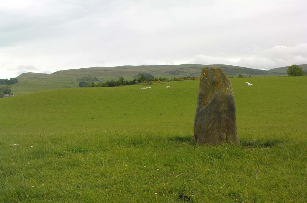
Gleneagles A stone, looking west

This short standing stone, more than 3ft tall, has an elegance about it which megalith lovers alone will understand!  Maybe it’s the setting; maybe the feel of the land; or maybe something else.  I dunno… On my first visit to the site, Nature was wearing a grey overcast cloak, but the site and I didn’t seem to care; and although the view from here doesn’t have the same grandeur of Glen Eagles to view as its companion stone a few hundred yards to the east might have, there felt a greater welcoming at this smaller stone.  Odd, considering this monolith had been knocked over and re-positioned by the farmer in the not-too-distant past.  Anyway…less of this subjective nonsense of feelings from the landscape and megaliths!  Utter drivel all of it!

The earliest measured account of the stone is to be found in Mr Hutchison’s (1893) essay, where he notes this and its companion close by, giving us the dimensions of this monolith:

“This (stone) is roughly columnar in shape, but wider at the base than above. Its height is 3ft above ground; circumference at base 6ft. 5in., diminishing to 4ft. 2in at the top. It is of metamorphic schist.  The line of direction between these two gives a horizontal angle of 260°.”

Since that day, in the mass of archaeology essays that have been scribed, this smoothed upright gets only a minimal description.  Charles Calder’s (1947) account is typical, saying simply that it is,

“Somewhat cylindrical in form with a girth of 7 feet at the base, it rises with a decided tilt towards the west to a height of 3 feet 10 inches above ground-level.”

The stone fares better in Andrew Finlayson’s (2010) fine local survey of megalithic ruins, where he points out that this and its compatriot stone Gleneagles B, are in an alignment with the fallen Boat Stone and the upright White Stone, a few miles to the southwest.  This line works on 1:50,000 map, but when transferred to larger-scale surveys, the alignment misses each outlying site by 20-30 yards here and there.

References:

  1. Calder, Charles S.T., “Notice of Two Standing Stones (one with Pictish Symbols) on the Lands of Peterhead Farm, near Gleneagles, Perthshire,” in Proceedings of the Society of Antiquaries, Scotland, volume 81, 1947.
  2. Feachem, Richard, Guide to Prehistoric Scotland, Batsford 1977.
  3. Finlayson, Andrew, The Stones of Strathearn, One Tree Island: Comrie 2010.
  4. Hutchison, A.F., “The Standing Stones of Stirling District,” in The Stirling Antiquary, volume 1, 1893.

© Paul Bennett, The Northern Antiquarian

Wester Biggs, Dunblane, Perthshire

Stone Circle:  OS Grid Reference – NN 863 061

Also Known as:

  1. Canmore ID 25219
  2. Seven Stanes

Getting Here

From Dunblane, head out east up and along Glen Road up towards Sheriffmuir. Turn left at the junction of the Sheriffmuir Inn and keep going for about 3 miles, keeping your eyes peeled for the TV mast on the left-hand side of the road. 100 yards past this, you can park-up.  Walk down the road another 100 yards until you get to the next gate in the fence. According to Ordnance Survey, the circle is/was across the road from here.

Archaeology & History

Although local tradition and historical accounts tells of a circle of seven stones nearby, there’s little to be seen at the position shown on the OS-map. On one side of the road, just above the embankment, there are hardly any rocks at all to even remotely ascribe as being touched by humans – i.e., there’s nowt there!  On the other side of the road, close to the parking spot, we do find a small cluster of rocks, perhaps hinting at a cairn structure, and then another longer stone embedded in the embankment 20 yards further down – but even these ‘remains’ (if you could call them that) seem flimsy evidence indeed of any megalithic structure here.  There is also a small arc of small stones by the roadside in the same area — but even these would be stretching imagination into psilocybe realms to call them a stone circle!  So I’m not sure what’s happened here.  My gut feeling told me that the position of this ‘stone circle’ shown on the OS-map was wrong, but that some remains of it would be found nearby.  But that could be bullshit.

Nevertheless, there are what seems to be the remains of prehistoric walling and possible enclosures close by, so a greater examination and bimble in the heathlands here is on the cards in the coming weeks.  If anyone living close by has further information on this spot, or fancies walking back-and-forth through the boggy moors (it’s arduous and not for the faint-hearted) in search of such sites, lemme know!  I have the feeling that there’s more to be found along this stretch of countryside.

Whether this site was the “druidical circle” mentioned in the Old Statistical Account of Scotland “in the heights of Sheriffmuir,”(vol.3, p.210), or the lost Harperstone Circle, we cannot be sure.  But an early account of this lost circle was written in John Monteath’s (1885) collection of Dunblane folktales.  He told:

“About two miles south-west of the village of Blackford, on the Sheriff-muir road, and near to the farm-house of Easter-Biggs, is an arch of stones, seven in number, called the “Seven Stanes,” varying from perhaps a ton to two tons each. One of these is of a round prismatical shape, and stands in an erect position. Beside these lies a large bullet of stone, called “Wallace’s Puttin’ Stane,” and he is accounted a strong man who can lift it in his arms to the top of the standing one, which is about four feet high, – and a very strong man who is able to toss it over without coming in contact with the upright one.  At one time few were to be found of such muscular strength as to accomplish this – not so much from the actual weight of the stone itself, as from the difficulty of retaining hold of it, it being very smooth and circular. This difficulty, however, was obviated about seventy years ago, by the barbarous hand of a mason, to enable himself to perform the feat, since which time a person of ordinary strength can easily lift it…”

It would seem there are or were additional prehistoric sites scattering the eastern edges of the Ochils within a few miles of each other along this ridge, as several accounts from both local newspapers and learned journals talk of a number of places, of differing dimensions.  The lost Harperstone Circle is a case in point; and another ‘circle’ mentioned by A.F. Hutchison in 1890, measuring just “10 – 12ft in diameter, of 5 or 6 stones, each about 2ft high” (probably a small cairn circle) differs from Monteath’s description on the Wester Biggs ring.

Folklore

In Monteath’s (1885) account of local Dunblane traditions, the following narrative was given which local people held dear as a truthful statement of these ancient stones:

“Some antiquaries might suppose the ‘Seven Stanes’ to have been, in former times, a Druidical place of worship; but tradition contradicts this, in a manner so distinct and pointed, that none, in anyway acquainted with the connection which, in Scotland in particular, exists between oral testimony and written records, but must be struck with the plausibility of the story which tradition affords…

“The “Seven Stanes” then, instead of being the remains of a Druidical place of worship, tradition informs us, are intended to commemorate a glorious victory obtained by an army of Scottish patriots under Wallace over an English army 10,000 strong, who were taken by surprise and cut to pieces. Wallace, who was not less remarkable for the celerity of his movements than the strength of his arm, determined not only to intercept it, but formed, at the same time, the most daring plan of cutting off their retreat, as if already assured of victory. For this purpose he divided his brave followers into three divisions; one of which he dispatched in the night to the “Seven Stanes” – another was stationed at the Blackhill of Pendreigh, to fall upon the rear – and Wallace himself, with his division, lay on the Muir of Whiteheadston.”

References:

  1. Hutchinson, A.F., “The Standing Stones of Stirling District,” in The Stirling Antiquary, volume 1, 1893.
  2. Monteath, John, Dunblane Traditions, E. Johnstone: Stirling 1885.

© Paul Bennett, The Northern Antiquarian