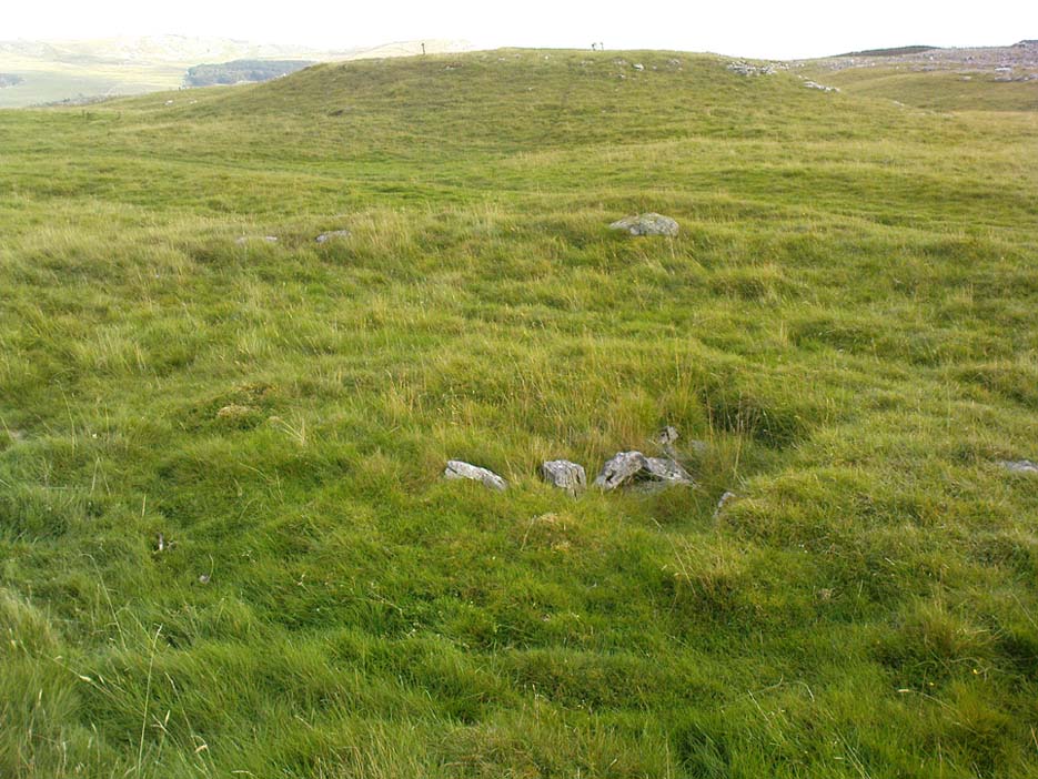
Fancarl Top, Appletreewick, North Yorkshire

Stone Circle:  OS Grid Reference – SE 06432 63048

Also Known as:

  1. Appletreewick Stone Circle

Getting Here

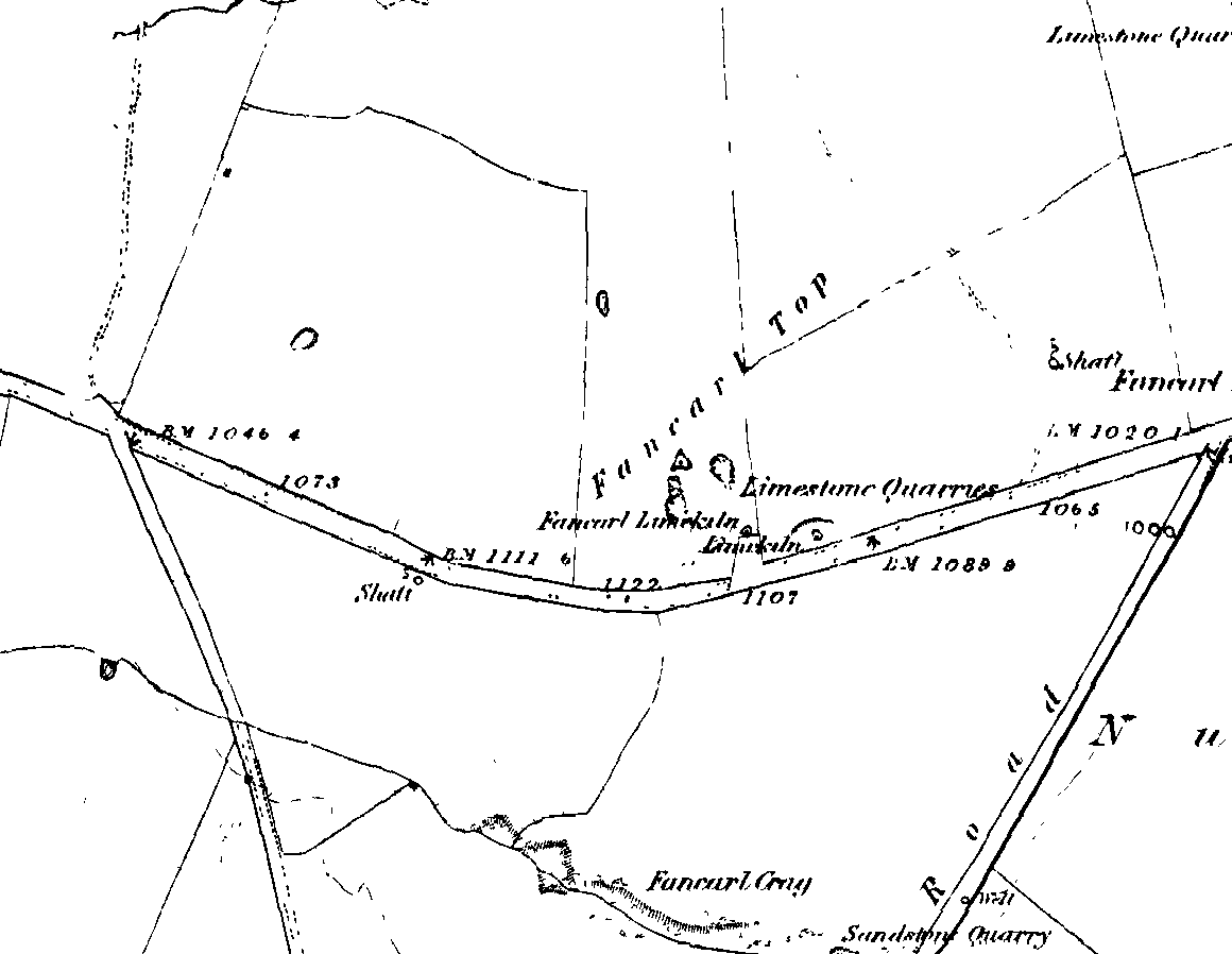
1st edition OS-map - the unmarked circle's near the middle
1st edition OS-map – the unmarked circle’s near the middle

Along the B6265 road between Grassington and Pateley bridge, heading east, past the hamlet of Hebden, a mile or so on where the road goes uphill, stop where it levels out a bit (before it goes further uphill to Stump Cross), a half-mile before the rocky outcrop of Nursery Knott on the left (north) side of the road.  A gate into the field on the same side is what yer after, with a small disused quarry therein.  Go up here to the quarry-top and then walk uphill for literally 100 yards and the curious small ring is right there.

Archaeology & History

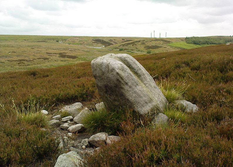
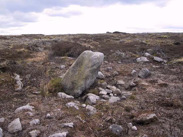
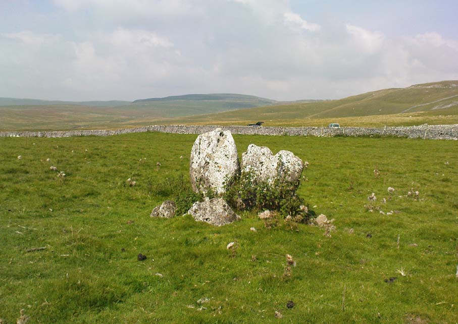
Appletreewick stone circle (courtesy Paul Daw)

This small stone circle sitting on the grassy ridge overlooking the ritual rocks of Simon’s Seat and central Wharfedale to the south and the Yorkshire heathlands east and west, is probably not what it once was.  Overcome by the excess of industrial workings in the fields and moors all round here, it is probable that its present condition is far from its original state.  Indeed, if we move back to the 18th century, we find that place-name and map evidences tell us the site was a tomb.  The 1771 Greenwood map names the site as the Fancairn — an etymological curiosity in itself, possibly deriving from the ‘Windy Cairn’, which makes sense.  The place-name fell into its present title of ‘Fancarl’ after the great Ordnance Survey chaps came, heard dialect and went on their way…
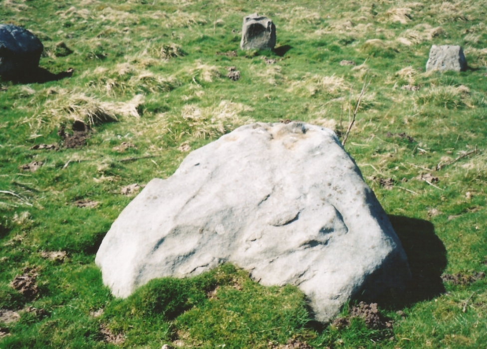
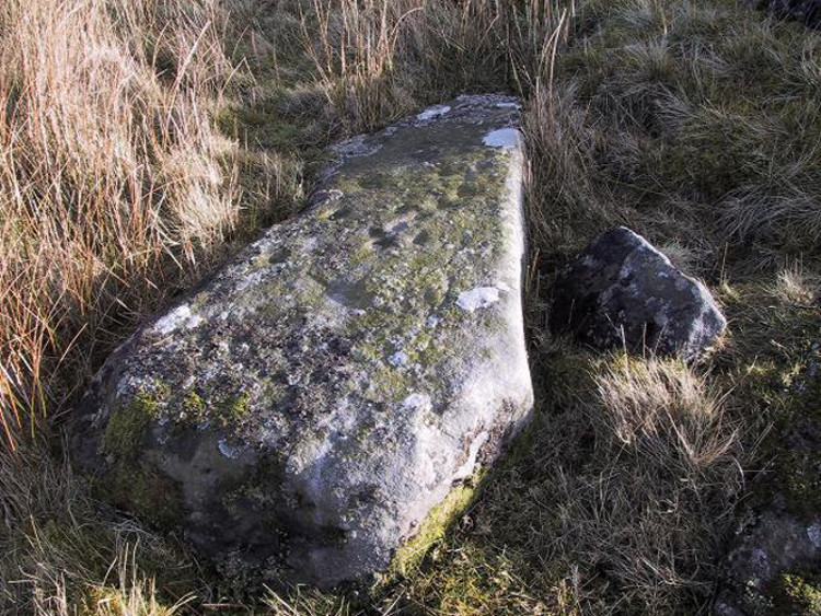
The largest rock in the ring (courtesy Paul Daw)

The circle doesn’t appear to have been noted by the great Yorkshire historians Harry Speight and Edmund Bogg in their literary rambles here (rather odd), but was brought to our attention first of all (in a literary sense anyway) by Arthur Raistrick. (1965) He first “surveyed” the site in 1950, but said little until a short remark was printed in the Yorkshire Archaeological Journal, where the notes told it to be one of “two stone circles, one with clear standing stones, 30ft in diameter, and the other a double circle of small recumbent stones, 12ft in diameter.”
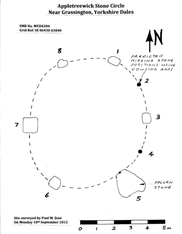
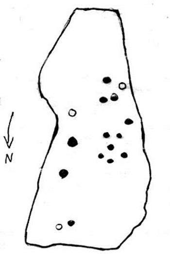
Ground-plan & missing stones (by Paul Daw)

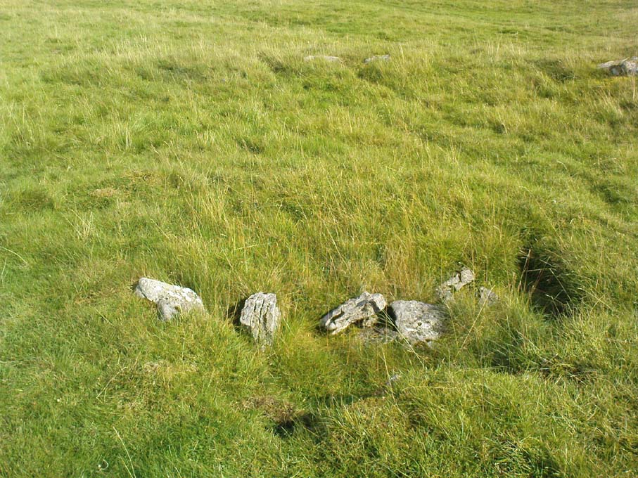
The second, smaller double circle he mentions is probably a hut circle or cairn, faint traces of which are seen in the adjacent field.  Remains of a prehistoric enclosure were also once evident in the same field; and thankfully to the south (across the road) we can still find many examples of cup-and-rings at Skyreholme.

John Barnatt (1989) and Aubrey Burl (2000) include the site in their relative major surveys, with both of them citing the circle, of six small stones, to measure 8.5m by 7.5m.  The survey shown of this small stone ring was done by Paul Daw following his visit to the site on Monday 10th September 2012.

Folklore

Although we can only see six stones in this ring today, when the surveyor Paul Daw (2012) did a ground-plan of the place, he also did a dowsing survey of the site and found there were originally two extra stones on the eastern side of the circle. An archaeological dig would be interesting to see if post-holes or the remains of these two additional stones are under the turf.  He wrote:

My dowsing survey revealed that the stone circle measured 7.7 metres diameter (N-S) and 7.0 metres (E-W).  A reaction was received over the centres of stones 1, 3, 6, 7 and 8 indicating that they are still standing in their original positions, but stone number 5 to the south-south-east of the circle had a reaction at its northern end, which indicates that it was once standing but had fallen outwards. It is not therefore an earthfast stone, as speculated by A. Raistrick, when he visited the site.  The stone measures 1.65 m x 1.65 m x 800 mm and fans out like a shell from bottom to top. It would have been an impressive stone when standing, but was top heavy, and the most likely stone to fall.

Stones 1, 3, 6, and 8 are all of a similar size, are much more stable, and stand at about 500 mm high.  Stone 7 in the western sector is 800 mm high, and measures 950 mm x 850 mm, and looks like a rectangular block, with slightly rounded edges.

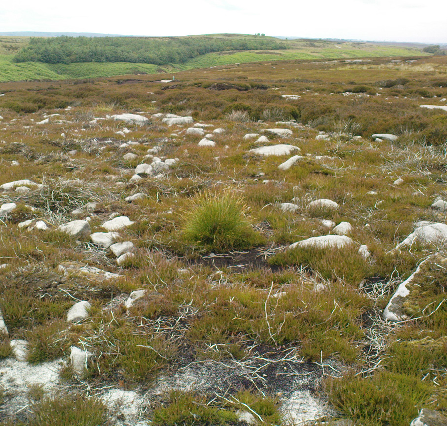
I also obtained a reaction at positions 2 and 4, indicating that there were once stones standing in these positions. To the north of the stone circle there are a number of stones lying on the surface.  A. Raistrick suggested that there may have been another small stone circle in this area, but my dowsing rods did not detect anything, and it is probable that these are random stones lying on the surface.

This entire region is bedevilled with faerie, goblin and giant lore, plus creation myths of our peasant ancestors (Sutcliffe 1929) — some still living if you’re lucky enough to talk with the old folk, who might tell you a thing or two, or might not, depending on how you smell.

References:

  1. Barnatt, John, The Stone Circles of Britain – 2 volumes, BAR: Oxford 1989.
  2. Burl, Aubrey, The Stone Circles of Britain, Ireland and Brittany, Yale University Press 2000.
  3. Daw, Paul M., “Appletreewick Stone Circle, Yorkshire Dales,” unpublished survey report 2012.
  4. Raistrick, Arthur, ‘Yorkshire Archaeological Register 1964: Appletreewick, W.R.,’ in Yorkshire Archaeology Journal, volume 41, 1965.
  5. Smith, A.H., The Place-Names of the West Riding of Yorkshire – volume 6, Cambridge University Press 1963.
  6. Sutcliffe, Halliwell, The Striding Dales, Frederick Warne: London 1929.

AcknowledgementsHuge thanks to Paul Daw for his photos and survey of the site, and for sharing details of his dowsing results here.

© Paul Bennett, The Northern Antiquarian
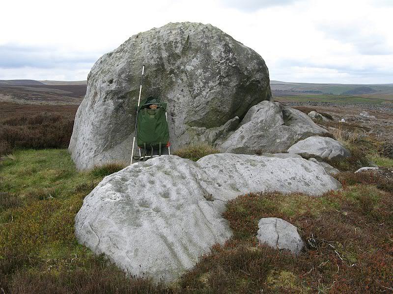

Raven Stones (559), Thruscross, North Yorkshire

Cup-Marked Stone:  OS Grid Reference – SE 11835 58006

Getting Here

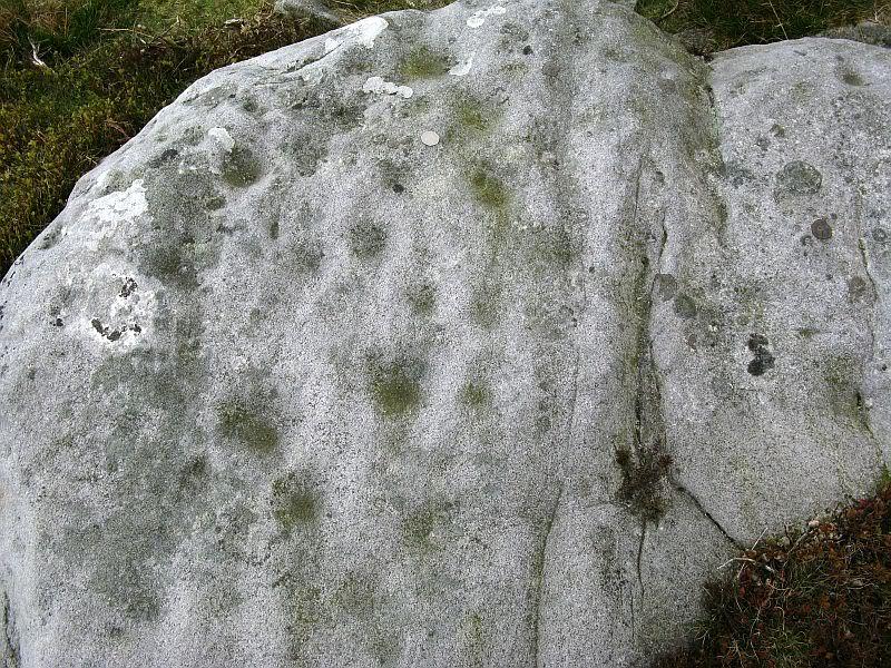
Heavily cup-marked Raven Stone (after QDanT)

Take the A59 road from Harrogate and Skipton and at the very top of the moors near the Gill Head Enclosures, take the small Kex Ghyll road up past the disused quarry works north for a mile or so. At the junction go left, past the Outdoor Centre, thru West End up Whit Moor Road, then go left down to Brays Cross Farm and over the ford. Note the clump of trees on the moors to the west and take the path there. Once here, a large outcrop of rocks will be seen about 150 yards on the moor to the west. That’s the spot! Otherwise, follow the directions of the legendary wandering Teddy!

Archaeology & History

This dramatic looking outcrop of rocks rising out of the ground a half-mile due west of Bray farmhouse has long been known as the rocks of the ravens: oracular birds of ill-omen in all peasant traditions, yet carrier birds of shamans in their Underworld ventures, from accounts in Russia and Scandinavia, through the Scottish highlands and into Yorkshire’s northern hills, as folklore records show.  Whether such mythical figures used the Raven Stones here for such magick, we have no firm accounts; but the existence of the many cup-markings on this particular rock (and others in the outcrop) show that animistic traditions of some form or another occurred here in prehistoric times at the very least.

Looking across the stone
Looking down on the cups (after QDanT)

Records of this place as an archaeological spot are scant indeed.  It is passed with barely a mention by those Victorian antiquarian giants, Bogg, Grainge and Speight.  The rock art students Boughey & Vickerman (2003) give the wrong grid reference here, but added the site to their inventory, saying only that it is “long, low, exposed bedrock. 22-25 cups; some very weathered and smooth.”  A series of channels runs down the slope of the stone, but there are probably natural.  However, a cup-and-line does occur on the eastern side of the carving.

References:

  1. Armstrong, Edward A., The Folklore of Birds, Collins: London 1958.
  2. Boughey, Keith & Vickerman, E.A., Prehistoric Rock Art of the West Riding, WYAS: Wakefield 2003.

Links:  

  1. Teddy Tour Teas

Acknowledgements:  Huge thanks for QDanT & Teddy for the fine photos of the Raven Stone carving!

© Paul Bennett, The Northern Antiquarian 


High Green (407), Skyreholme, North Yorkshire

Cup-Marked Stone:  OS Grid Reference – SE 07508 62599

Getting Here

Skyreholme Cup-marked rock 407

Take the B6265 east out of Grassington, thru Hebden, for another 2 miles till you pass the tiny road down to Skyreholme on the right.  Another few hundred yards on, past Nussey Farm and Dry Gill house, park up and look for the track going south into the moors. Go down the track called Black Hill Road for a few hundred yards till y’ reach the gate on the right. A track bends downhill to the psilocybin-rich pastures of Nussey Green. Several hundred yards on, to the right-hand side of the track, we find this and its companions. Look around!

Archaeology & History

Quick sketch of design

This medium-sized, recumbent standing-stone-shaped boulder has perhaps fifteen cup-markings on it.  It’s a plain carving with others of a similar ilk in the area.  First described by Stuart Feather in 1970 as one of “two cup-marked rocks” he found when ambling around; in Boughey & Vickerman’s (2003) survey they give it the wrong grid reference, though describe it correctly as a “long flat rock of irregular outline (with) fourteen to sixteen cups.” A cluster of other carvings are nearby, though some have been destroyed through mining operations.

References:

  1. Boughey, Keith & Vickerman, E.A., Prehistoric Rock Art of the West Riding, WYAS: Wakefield 2003.
  2. Feather, Stuart, “Appletreewick, W.R.,” in Yorkshire Archaeological Register, 1969, Yorkshire Archaeological Journal, part 168, 1970.

© Paul Bennett, The Northern Antiquarian

Batty Wife Hole, Ribblehead, North Yorkshire

Ring Cairn (lost):  OS Grid Reference – SD 7622 7895

Getting Here

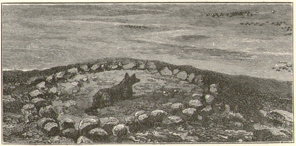
Old circle near Ribblehead (after Harry Speight)

The great Yorkshire historian Harry Speight (1892) gave the directions for this place, which I’ve not located.  On his walk down the southern side off Whernside, he told us to “follow the road which runs between Gunnerfleet and the white house at Winterscales, going under the long viaduct and round by Batty Wife Hole onto the main road at Ribblehead….” About 100 yards or so down the road, look over the walling into the field on the left-hand side. It’s there…..somewhere!

Archaeology & History

In an area that is pretty rich in prehistoric sites, one of our great Yorkshire antiquarians, Harry Speight (1892) seems to have described a site which our archaeologists have yet to get round to finding.  He told that,

“nearer the wall there are indications of a rude, double circle, artificially formed of these dark weathered grits.  The inner circle is about 20 yards in diameter and the outer one forms a narrow aisle surrounding it, with an outlet to the north; but some of the stones have been removed, probably to build and repair the adjoining fences.  The situation is open and commands the country on all sides between the lofty moors and summits that hem in the dale-head.  On the opposite side of the road are the remains of a couple of large cairns.  They are presumably Danish.  One was opened about a century ago (c.1790), and found to cover a rude stone coffin containing an entire human skeleton.  The other large pile does not ever appear to have been examined. It is more than probable that many a furious battel has been waged here, as the possession of this prominent ridge, which dominates so many particular outlets, must have been of capital importance to every hostile tribe.”

Although the Victorian christian beliefs of ‘rudeness’ in everything and rampant hostile tribes, has long since subsided in the view of our ancestors.  This area described by Speight does sound like an old burial ground.  But from which age – and where now are the sites he described?

References:

  1. Speight, Harry, The Craven and Northwest Yorkshire Highlands, Elliot Stock: London 1892.

© Paul BennettThe Northern Antiquarian


West Agra, Gollinglith Foot, Colsterdale, North Yorkshire

Standing Stone:  OS Grid Reference – SE 1516 8167

Getting Here

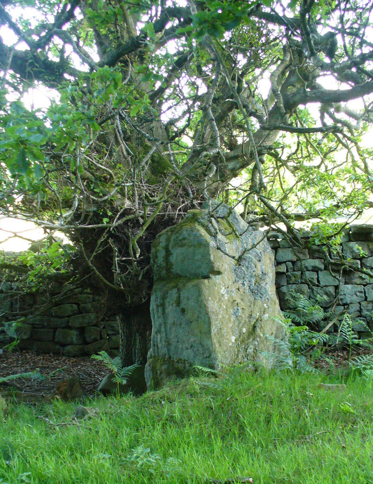
The forgotten standing stone of Agra Woods

Take the same directions as if you’re visiting the multiple-ringed Agra Woods petroglyph (West Agra 8).  From just below here, keep to the woodland side, and follow the line of tall drystone walling along to the east for a hundred yards or more, keeping your eyes peeled for the stone in question, just in front of a nice oak tree.  You can’t really miss it!

Archaeology & History

Not too far away from the scattered cluster of West Agra’s cup-and-ring stones, can be found this very bulky six foot tall standing stone, near the edge of the old walling on the inner-side of the Agra Woods.  It was rediscovered by Paul Hornby on a Northern Antiquarian outing in May 2011, who told it to be “quite a massive thing!”  (I’ve yet to visit the site so can’t give my personal impressions of the site)

© Paul BennettThe Northern Antiquarian


Gill Head, Blubberhouses Moor, North Yorkshire

Enclosures:  OS Grid Reference – SE 1338 5493

Getting Here

Upright stone in prehistoric walling

ON the A59 Harrogate to Skipton road, right on top where it crosses the barren moors, get to the parking spot right near where the road levels out at the highest point (2-300 yards past the turning to the derelict Dovestones Quarry). From here, go thru the gate onto the moor for about 100 yard. Then turn straight east (left) for another few hundred yards till y’ reach the spot marked as Gill Head Peat Moor on the OS-map. This small standing stone (right) is where you need to start – the other remains continue east of here.

Archaeology & History

Richard’s original photo, with walling clearly visible

The discovery of this site began in April 2005, when rock art student Richard Stroud and I were exploring the moors here and he called our attention to what seemed like a singular upright standing stone, some 3 feet high, with a debatable cup-marking on top, standing amidst a scatter of smaller stones running north and south from here, implying that the stone may have been a part of some much denuded walling from our ancient past.  But we weren’t sure—and simply noted its location (at SE 13378 54924) and carried on our way.  But in revisiting this site after looking at some old archaeology papers, Paul Hornby and I chanced to find a lot more on the burnt heathland running east of here.

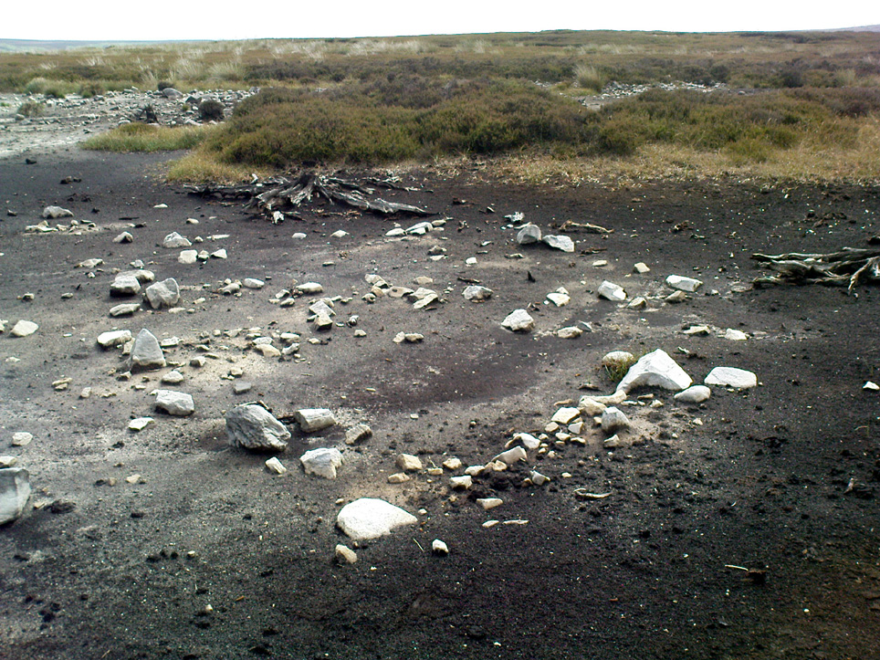
The upright stone found by Mr Stroud is certainly part of some ancient walling, but it is much denuded and falls back into the peat after only a short distance.  A short distance west of this stone is a small cairn which seems of more recent origin; but due east, along the flat plain on the moorland itself, the burnt heathland showed a scattering of extensive human remains, comprising mainly of walling, hut circles and possible cairns—lots of it!

One issue we have to contend with on this moorland is the evidence of considerable peat-cutting in places, which was being done on a large scale into the Victorian period.  Scatterings of medieval work are also found across this moor, in places directly interfering with little-known Bronze Age monuments in the middle of the remote uplands.  There is no doubt that some of these medieval and later workings have destroyed some of the uncatalogued prehistoric archaeological remains on this moor.  But thankfully, on the ridge running west to east along Gill Head to above the source of the Black Dike, scattered remains of human habitation and activity are still in evidence.  The only problem with what we’ve found, is the date…

Two rows of straight walling, with stone scatter all round
Another overgrown curve of walling

In 1960, Mr J. Davies first mentioned finding good evidence of flint-workings at a site close by; then described his discoveries in greater detail in the Yorkshire Archaeological Journal (1963) a few years later — but contended that the remains were of mesolithic origin.  A few years earlier, Mr D. Walker described a similar mesolithic “microlith site” a bit further north at Stump Cross.  Earlier still, Eric Cowling (1946) and others had made similar finds on these and adjacent moors.  Yet all of them missed this scatter of habitation sites, perched near the edge of the ridge running east-west atop of the ridge above the A59 road.  It’s quite extensive and, from the state of the walled remains, seems very early, probably neolithic in origin.

A number of small hut circles, 2-3 yards across, are scattered amidst the heather, with lines of walling—some straight, some not—broken here and there by people who came to gather their peat for fuel.  The walling and hut circle remains are very low to the ground, having themselves been robbed for stone it would seem.  The area initially appeared to be little more than a mass of stones scattered across the Earth (and much of it is), but amidst this are very clear lines of walls and circles, although they proved difficult to photograph because of the excessive growth of Calluna vulgaris.

Curious man-made structure in dried peat-bog

A couple of hundred yards south there are remains of one of the many dried black peat-bogs—with one large section that has been tampered with by humans at some point in the ancient past.  Over one section of it there has been built a small stone path, or possible fish-trap; plus elsewhere is a most curious rectangular walled structure (right) obviously made by people a long time ago.  Also amidst this dried peat-bog are the truly ancient remains of prehistoric tree-roots emerging from the Earth, a few thousand years old at least – and perhaps the last remnants of the ancient forests that once covered these moors.

How far back in time do all these walled remains take us?  Iron Age? Bronze Age?  Or much much further…?  Excavations anyone!?

References:

  1. Cowling, Eric T., Rombald’s Way, William Walker: Otley 1946.
  2. Davies, J., “A Mesolithic Workshop in Upper Wharfedale,” in Bradford’s Cartwright Hall Archaeology Group Bulletin, 5:1, 1960.
  3. Davies, J., “A Mesolithic Site on Blubberhouses Moor, Wharfedale,” in Yorkshire Archaeological Journal, part 161 (volume 41), 1963.
  4. Walker, D., “A Site at Stump Cross, near Grassington, Yorkshire, and the Age of the Pennine Microlith Industry,” in Proceedings of the Prehistoric Society, volume 22, 1956.

© Paul Bennett, The Northern Antiquarian 

Healey Stone Circles, Masham, North Yorkshire

Stone Circles (destroyed):  OS Grid Reference –  SE 170 810

Archaeology & History

I was hoping to get a Northern Antiquarian team to explore this arena before moving to Scotland, as I lived in hope that we might uncover some remains of an important cluster of megalithic rings in this quiet North Yorkshire area — but we didn’t manage to get here.  So this short profile is one based purely on texts.

A mile east of the standing stone and impressive cup-and-ring carvings of West Agra, was once to be found several stone circles — according to John Fisher (1865), who told us about them in his magnum opus on the history of the region.  Not to be confused with the giant Druid’s Temple a couple of miles south, Fisher was contextualizing them with the “huge circles of upright stones” which our great heathen ancestors built.  Although he made some mistakes trying to link the local place-names with these stone circles (a common pastime of Victorian writers), his remarks still make interesting reading. He told that,

“In this parish there are places which fully answer to this description, as well in situation and appearance, as in the names which they still bear. I refer more especially to Healey-Baals, Beldin Gill, and Baal Hill, which latter place is situate either upon or near to the range of hills known by the name of Healey-Baals.  The very name of Baal-Hill, without reference to its appearance or locality, indicates that the place is a hill dedicated to the worship of the heathen god Baal; and the name Healey-Baals, according to the interpretation which I put upon these words, is, if possible, still more conclusive of the matter. I take it that the name of Healey is derived from Heil, holy or sacred, and ley, land consisting of fallow-ground, pastures, or meadows. If, therefore, I am right in my interpretation of the name of Healey, then Healey-Baals means simply land sacred to Baal. This supposition is strengthened by the circumstance of circles of upright stones having recently existed near to the place, and from ancient relics which have been found within the parish, and at but a short distance from Healey and Healey-Baals, which are supposed to have been used in the mystical rites of the Druids or priests of Britain, for at least antiquaries can assign no other use to them…”

There are very few other references I can find that tell of these lost stone circles.  Edmund Bogg (1906) mentioned them briefly, saying that between Fearby and the hamlet of Healey a mile west, “there were formerly circles of upright stones and other relics suggestive of druidical origin.” But there’s little more.

In exploring the local field-names we find that three of them here carried the name “Standing Stones” – which seems to tell us where once we could find these old stones.  It may be possible that some of the stones were removed into the hedgerows at the sides of the fields.

Folklore

Fisher told of the local tradition of quarterly fire ceremonies close by, which he thought may have related to religious practices at the stone circles, telling:

“There are traditions, too, which have been handed down to us, to the effect that the heathen custom of making feasts and Baal-fires (which although unknown to the persons making them, were in truth so made in honour of Baal) have been continued until very recent times in this district — and especially in Nidderdale — the remembrance of which is transmitted to us in the annual feast which is still held at Healey.”

References:

  1. Bogg, Edmund, Richmondshire and the Vale of Mowbray, James Miles: Leeds 1906.
  2. Cunliffe-Lister, Susan, Days of Yore, privately printed: Bath 1978.
  3. Fisher, John, The History and Antiquities of Masham and Mashamshire, Simpkin Marshall: London 1865.
  4. Smith, A.H., The Place-Names of the North Riding of Yorkshire, Cambridge University Press 1928.

© Paul Bennett, The Northern Antiquarian

Hammond Close Stone, Threshfield, North Yorkshire

Standing Stones:  OS Grid Reference – SD 95161 65209

Getting Here

Standing stones near Bordley with human for scale

From Threshfield, go up Skirethorns Lane for about 1/2 mile, where the lane takes a sharp right. Continue uphill for nearly 2 miles to a metal gate. Go through the gate into the fields on your left where you’ll see this pair of curious standing stones ahead of you (if you keep walking uphill in the same direction, you’ll reach the impressive Hammond Close enclosure above you).

Archaeology & History

There seem to be no references in either archaeology or geology texts about this site which, when you approach it and consider the prevalence of other prehistoric sites all round you, strongly suggests that they are either archetypal standing stones, or the remains of a collapsed cairn, with the surrounding mound removed.  This is certainly the case at the Druid’s Altar or Bordley Circle visible a few hundred yards west of here, on the same grassland plain.

The stones alone, looking north

As you can see in the photos, the stones here are 4 feet tall and stand in isolation from the excess of neighbouring settlements and enclosures.  A scatter of small stones—perhaps packing stones, perhaps the remains of cairn-spoil—is evident at the foot of the stones.  It was initially thought that the uprights here could have been the remains of enclosure or settlement walling, as we find an excess of such remains on the hills here, but this isn’t the case.  Other unrecorded prehistoric remains scatter this part of the countryside.

© Paul Bennett, The Northern Antiquarian 

Sheep Scar Circle, Giggleswick, North Yorkshire

Ring Cairn:  OS Grid Reference – SD 80519 66474

Also Known as:

  1. Borrins Top

Getting Here

Sheep Scar cairn circle, looking east

From Settle, take the same direction as if you’re visiting the giant Apronful of Stones cairn.  Walk past it, keeping to the walling for 350 yards (319m) until you reach the gate on your right.  Go through this and walk along the grassy footpath ahead of you for 75 yards (68.5m) and there, right by your left-hand side, you’ll see this low grassy circular embanked monument, or cairn circle.

Archaeology & History

This gorgeous, little-known cairn circle, hiding almost unseen beside the ancient grassy pathway that leads down to the haunted Borrins Wood, sits innocently, forgotten by those who would claim its importance.  When this overgrown ring of stones was first built, the trees of Borrins Wood grew around the sacred court of this monument, watching rites committed to the ancestors, annually no doubt at the very least, under guidance of the Moon.  But now such ways have been swept from the memory of those living, into worlds made-up of artifacts, linear time and dualist ideals, and our thoughts when brought here are encloaked by beliefs not worthy of such a place.  Like many other small rings of stone, this was important for the rites of the dead.  For here we can see a small stone-lined cist (grave) near the middle still growing from the Earth, with the small outer ring encircling the place of rites.  It was obviously of ‘religious’ importance to those who lived here, probably even centuries after initial construction.

Embankment and central ‘grave’
Central & southern section of the ring

Similar in size and structure to the Roms Law Circle on Burley Moor, this site on the hills above Giggleswick seems to be Bronze Age in nature.  From outer-edge to outer-edge the rough circular monument measures approximately 14½ yards (13m) north-south, by 15½ yards (14m) east-west, with an outer circumference of about 49 yards (43m).  The edges of the ring, as you can see in the photos, is made up of an embankment of thousands of small stones and rubble, measuring between 1-2 feet high and between 2-3 yards across.  The old cist in the middle of the ring—about 1 yard by 2 yards—has been dug into at some time in the past and a small mound of stones surround this central grave.  The entire monument is very much overgrown, but still appears to be in relatively good condition.  A new excavation of this and nearby prehistoric monuments would prove worthwhile.

The ruined circle has a tranquil spirit, enclosed within a rich green panoramic landscape, enhanced with the breaking of old limestone and gnarled hawthorns.  Other prehistoric cairns can be found nearby and the remains of a previously unrecorded prehistoric enclosure stands out on a small rise 164 yards (150m) southeast.  We’ve found other unrecorded prehistoric remains in this arena which will be added to TNA, as and when…

References:

  1. Speight, Harry, The Craven and Northwest Yorkshire Highlands, Elliott Stock: London 1892.

Links:

  1. Images & Walk to the Sheep Scar Circle and Nearby Sites

© Paul Bennett, The Northern Antiquarian

Snowden Carr Carving (569), Askwith Moor, North Yorkshire

Cup-and-Ring Stone:  OS Grid Reference – SE 17746 50923

Getting Here

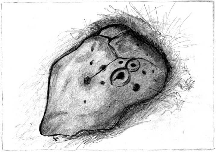
Inma’s Drawing of the Carving

Takes a bitta finding unless you’ve got a GPS system, or someone like me to show you where it is! The best way’s probably via the Askwith Moor Road car park, up the road 160 yards till you hit the straight line cut into the moor on your right, where the landscape’s been damaged.*  Walk along this for less than 100 yards, then walk right, through the heather and onto the singular tree roughly 200 yards away.  From here, walk 75 yards (strides) north from the tree.  You’re damn close!

Archaeology & History

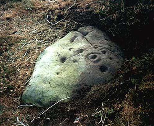
About 20 feet from a line of ancient walling in an area pretty rich in prehistoric sites, is this medium-sized stone with a lovely cup-and-ring design.  The carving was first recorded by fellow antiquarian, Eric Cowling (1937), in his short survey of other carved stones in the area.  He called this ‘carving no.7’ and described it, thus:

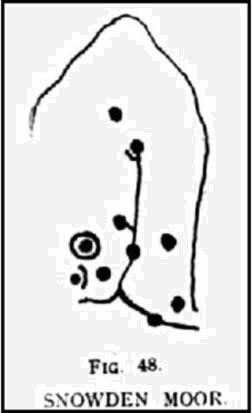
“In the central area of Snowden Carr is a barrow group, which occupies a slight ridge running from the edge of the bog to the east, almost to the moor road on the west.  The ridge is almost devoid of vegetation except at the higher end.  Here, on a heather-covered boulder, is marking no.7.  The cups are smaller than usual, and only one ring completely surrounds a cup.  The lines linking the cups are only lightly incised, and the whole marking has a delicate appearance.”

Old photo of the carving
Cowling’s 1937 sketch

I first visited this stone in the 1980s with fellow rock art student and author, Graeme Chappell, and for some reason it has always impressed me (I recall Graeme laughing whilst I made joyous noises and stroked the rock, reverentially!).  Cowling’s description of the stone as ‘delicate’ is appealing, as the stone and its design has a nurturing aspect to it, female in nature. (forgive me — but many of these stones tend to capture me in such ways!)  The stone was described more clinically in Boughey & Vickerman’s (2003) more recent survey, in the way that archaeologists tend to do, saying plainly:

“Fairly large, flat, smooth grit rock with crack.  Up to seventeen possible cups, one with complete ring, one with partial ring, one with possible ring; connecting groove.”

Doesn’t quite capture the feel of the place, which I’m sure they’d admit.  The next time I’m up here, I’ll get some better photos of the carving.

References:

  1. Boughey, Keith & Vickerman, E.A., Prehistoric Rock Art of the West Riding, WYAS 2003.
  2. Cowling, E.T., ‘A Classification of West Yorkshire Cup and Ring Stones,’ in Yorkshire Archaeological Journal 1940.
  3. Cowling, E.T., Rombald’s Way: A Prehistory of Mid-Wharfedale, William Walker: Otley 1946.
  4. Cowling, E.T. & Hartley, C.A., ‘Cup and Ring Markings to the North of Otley,’ in Yorkshire Archaeological Journal 33, 1937.

ACKNOWLEDGEMENTS: Huge thanks to one of my fine ladies, Inmaculada Ibanez-Sanchez, for the drawing! Cheers Inma!

* A pipeline was laid across the moor here, and subsequent work (I presume by the same company) was done again in early 2011, cutting through and damaging several prehistoric monuments and destroying at least one prehistoric cairn.  An archaeological survey of the region should have been done before any work proceeded here, but I’m unaware of any such excavations, or archaeological reports preceding or concurrent to the ecological and historical damage performed.

© Paul Bennett, The Northern Antiquarian