St. Helen’s Well, Eshton, North Yorkshire

Holy Well:  OS Grid Reference – SD 93096 56992

Also Known as:

  1. Helen’s Well

Getting Here

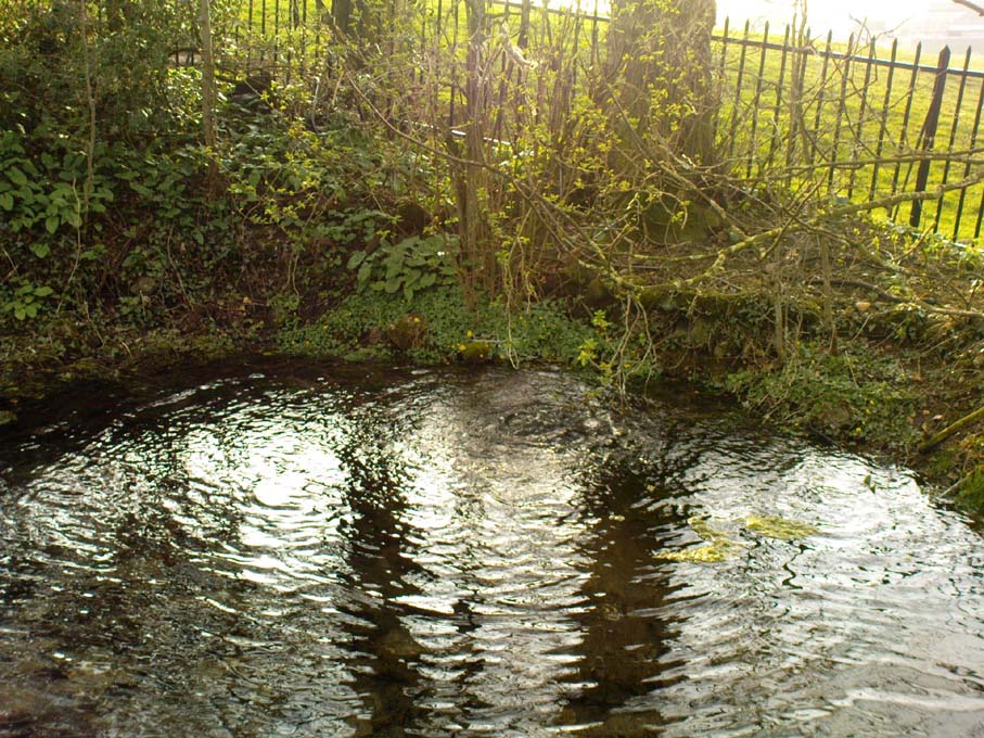
St. Helen’s Pool, Eshton

On the A65 road from Skipton to Gargrave, just at the eastern end of Gargrave, take the small Eshton Road running north over the canal. Go through Eshton itself, making sure you bear right at the small road a few hundred yards past the old village.  Keep your eyes peeled a few hundred yards down as you hit the river bridge and stop here.  Just 50 yards before this is a parking spot where some Water Board building stands.  Walk back up the road barely 20 yards and you’ll see, right by the roadside, a small clear pool on your left, encircled by trees.  Go through the little stile here and you’re right by the water’s side!

Archaeology & History

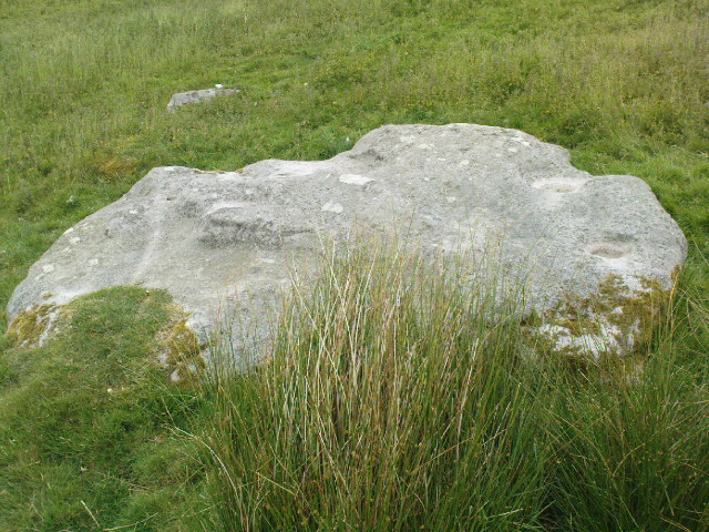
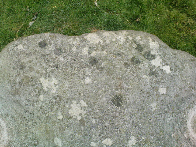
This is actually a listed monument (unusual for wells up North!), just off the roadside between Nappa Bridge and Eshton Hall. Two or three old stone heads (deemed to be ‘Celtic’ in age and origin, though I had my doubts) have recently been stolen from this holy pool close to where the water emerges from the ground, just beneath the surface. You can see where the water bubbles up strongly from the Earth when you visit here, forming the small pool in front of it, around which at certain times of year people still attach ‘memaws’ (an old word for ritual ‘offerings’) on the small shrubs.  If you drink from here, just where the water bubbles up (careful not to fall in!), it’s freezing — but tastes absolutely gorgeous!  And better than any tap-water you’ll ever drink!

Mentioned briefly in Mr Hope’s (1893) fine early survey; the earliest description of this site in relation to the mythic ‘Helen’ dates from 1429, where T.D. Whitaker (1878) described the dedication to an adjacent chapel, long gone.  Whitaker’s wrote:

“…One of the most copious springs in the kingdom, St. Helen’s Well fills at its source a circular basin twenty feet in circumference, from the whole bottom of which it boils up without any visible augmentation in the wettest seasons, or diminution in the driest.  In hot weather the exhalations from its surface are very conspicuous.  But the most remarkable circumstance about this spring is that, with no petrifying quality in its own basin, after a course of about two hundred yards over a common pebbly channel, during which it receives no visible accession from any other source, it petrifies strongly where it is precipitated down a steep descent into the brook.  To this well anciently belonged a chapel, with the same dedication; for in the year 1429, a commission relating to the manor of Flasby sat “in capella beate Elene de Essheton; and on the opposite side of the road to the spring is a close called the Chapel Field.  This was probably not unendowed, for I met with certain lands in Areton, anciently called Seynt Helen Lands.”

When the old countryman Halliwell Sutcliffe (1939) talked of this healing spring, his tone was more in keeping with the ways of local folk.  Sutcliffe loved the hills and dales and old places to such an extent that they were a part of his very bones.  And this comes through when he mentions this site. Telling where to find the waters, he continued:

“Its sanctuary is guarded by a  low mossy wall.  Neglected for years out of mind, it retains still clear traces of what it was in older times.  An unfailing spring comes softly up among stones carved with heart-whole joy in chiselling.  Scattered now, these stones were once in orderly array about what is not a well, in the usual sense, but rather a wide rock-pool, deep here and shallow there, with little trees that murmur in the breeze above.  Give yourself to this place, frankly and with the simplicity is asks.  It does not preach or scold, or rustle with the threat of unguessed ambushes among the grassy margin.  Out of its inmost heart it gives you all it knows of life.”

Old well in the field

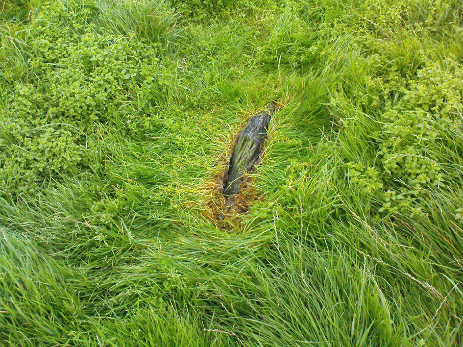
In the field across the road where the chapel was said to have been, we find another stone-lined fresh-water well bubbling from the ground into a stone trough (at grid-ref SD 93118 56958).  The waters here are also good and refreshing.  But whether this fine water source had any tales told of it, or curative properties (it will have done), history has sadly betrayed its voice.

Folklore

The waters here have long been reputed as medicinal.  R.C. Hope (1893) said “this well was a certain cure for sore and weak eyes.”  Whitaker and others told there to be hangings of rags and other offerings (known in Yorkshire as ‘memaws’).  Sutcliffe described,

“The pilgrims coming with their sores, of body and soul… The Well heard tales that were foul with infamies of the world beyond its sanctuary.  Men came with blood-guilt on their hands, and in their souls a blackness and a terror.  Women knelt here in bleak extremity of shame.  The Well heard all, and from its own unsullied depths sent up the waters of great healing.  And the little chant of victory began to stir about the pilgrims’ hearts…and afterwards the chant gained in volume.  It seemed to them that they were marching side by side with countless, lusty warriors who aforetime had battled for the foothold up the hills.  And, after that, a peace unbelievable, and the quiet music of Helen’s Well, as her waters ran to bless the farmward lands below.  All this is there for you to understand today, if you will let the Well explain the richness of her heritage, the abiding mystery of her power to solace and to heal.”

And so it is with many old springs… The rite of memaws enacted at St. Helen’s Well is a truly archaic one: whereby a person bringing a cloth or stone or coin — using basic principles of sympathetic magick — asks the spirit of the waters to cleanse them of their illness and pass it to the rags that are tied to the adjacent tree; or perhaps some wish, or desire, or fortune, be given in exchange for a coin or something if personal value.  The waters must then be drunk, or immerse yourself into the freezing pool; and if the person leaving such offerings is truly sincere in their requests, the spirit of the water may indeed act for the benefit of those concerned.

Such memaws at St. Helen’s Well are still left by local people and, unfortunately, some of those idiotic plastic pagans, who actually visit here and tie pieces of artificial material to the hawthorn and other trees, which actually pollutes the Earth and kills the spirit  here.  Whilst the intent may be good, please, if you’re gonna leave offerings here, make sure that the rags you leave are totally biodegradable.  The magical effectiveness of your intent is almost worthless if the material left is toxic to the environment and will certainly have a wholly negative effect on the spirit of the place here.  Please consider this to ensure the sacred nature of this site.

…to be continued…

References:

  1. Hope, Robert Charles, Legendary Lore of the Holy Wells of England, Elliott Stock: London 1893.
  2. Smith, A.H., The Place-Names of the West Riding of Yorkshire – volume 6, Cambridge University Press 1961.
  3. Sutcliffe, Halliwell, The Striding Dales, Frederick Warne: London 1939.
  4. Whelan, Edna, The Magic and Mystery of Holy Wells, Capall Bann: Chieveley 2001.
  5. Whelan, Edna & Taylor, Ian, Yorkshire Holy Wells and Sacred Springs, Northern Lights: Dunnington 1989.
  6. Whitaker, T.D., The History and Antiquities of the Deanery of Craven, Joseph Dodgson: Leeds 1878.

© Paul Bennett, The Northern Antiquarian

Eastwoods Rough 3, Dacre, North Yorkshire

Cup-Marked Stone:  OS Grid Reference – SE 1850 6177

Getting Here

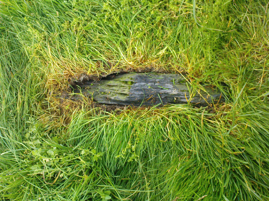
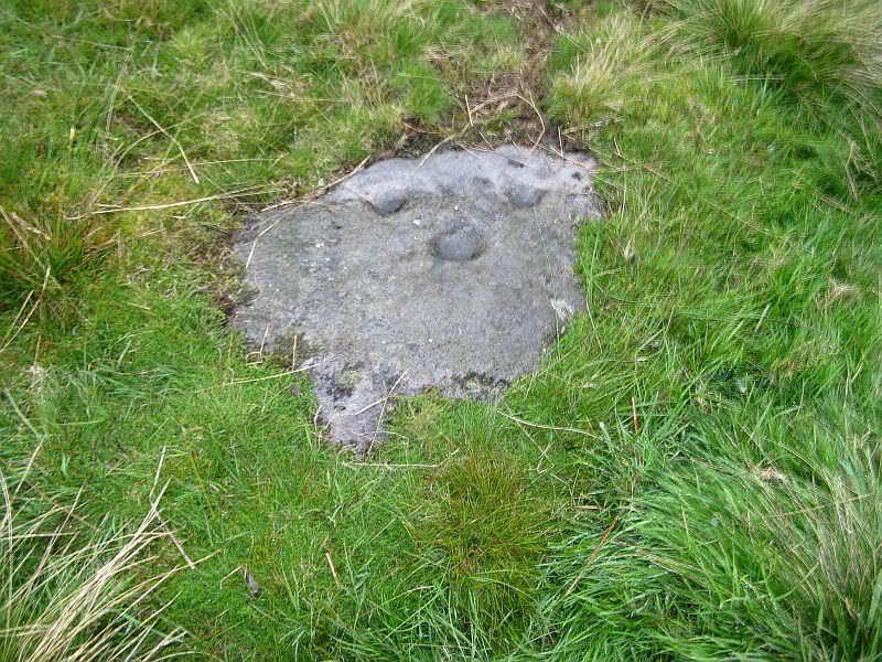
Cup-marked stone

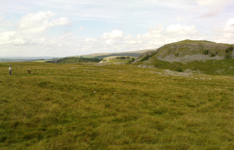
Follow the same directions as if you’re going to the excellent Morphing Stone cup-and-ring carving.  From the carving, look up the field to the where the dirt-track is and, by the closest gate with a tree near it, walk straight towards it.  Roughly halfway between the Morphing Stone and the gate you’ll find — eventually — the small stone in the photo with well-defined cups on it.  You might need to wander back and forth until you find it, as there’s many rocks to check out here!

Archaeology & History

Possible cup-marked rock

This small cup-marked stone was rediscovered by Danny Tiernan in the late afternoon of Thursday, August 18, 2011, just as the heavens opened and the rains poured down!  With at least one well-defined cup-mark and another two near the edge of the stone where the grasses had grown, this stone probably needs another look at it, as there may be more beneath the surface, much like when we first found at Morphing Stone.

Danny also found and photographed another larger boulder, a bit further up the field closer to the fence, where what may be a single cup-mark is clearly seen living on top of the rock.  It’s one of those dodgy English Heritage ones though, so I’ll let those ‘qualified’ chaps check this one out and give it their expertise!  It could well be another unrecorded cup-marked stone though…

Links:

  1. Eastwoods Rough & other Nearby Sites

ACKNOWLEDGEMENTS: Thanks to ‘QDanT’ for him & Teddy’s photos, above.

© Paul Bennett, The Northern Antiquarian

Sheep Scar Cairn, Giggleswick, North Yorkshire

Cairn:  OS Grid Reference – SD 80678 66436

Getting Here

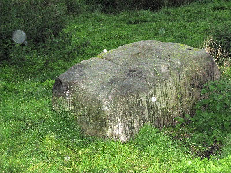
Paul Hornby on the old mound

Follow the same directions as if you’re visiting the Apronful of Stones giant cairn, above Giggleswick.  Walk past the giant cairn for a coupla hundred yards until you reach the large section of fallen walling, which you can clamber over and head towards the small rise of the Sheep Scar enclosure 100 yards in front of you.  Walk to the far end of this walled enclosure and look down the slope to your left, for 50-60 yards where you’ll see a small rocky mound rising above the edge of the hollow footpath.  That’s it!

Archaeology & History

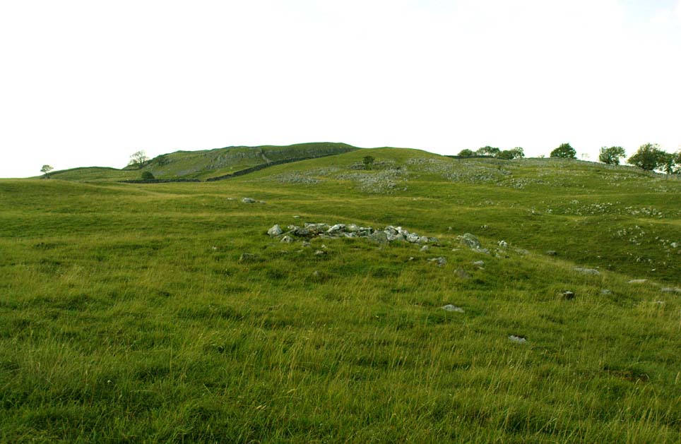
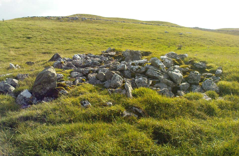
This lovely old overgrown prehistoric cairn seems to one of what were once the remains of many other old tombs that scattered this grassy rocky plain, on the western ridge between Stainforth and Settle.  Although there are what seems to be the remnants of others nearby, this particular stone heap, its edges buried beneath centuries of earth, is a fine little-known specimen that deserves attention after so long a period in the sleep of ignorant moderns.  The cairn is found within an area that Harry Speight (1892) called the “Field of the Dead”, where he came across “traces and remains of human graves which carry us back to the far dim ages of unwritten history.”  Whether he saw this particular cairn rising up above the edge of the old track that winds up from Borrins in the valley below, he doesn’t say — but I’d be amazed if the diligent Speight missed it!

The overgrown cairn, looking NW
Cairn centre, with Sheep Scar enclosure above

Standing more than a yard high, when Paul Horby and I paced this old ruin, it measured 10 yards by 12 yards across — though so much loose and overgrown stone was beneath the surface that it could be much bigger.  The top of the cairn had come loose, perhaps explored by some antiquarian in times gone by, exposing a considerable mass of small rounded and misshapen rocks, typical of such constructions.  When Harry Speight found the place more than a hundred years earlier, he described the situation much as we’d found it, telling of,

“other mounds of similar and smaller dimensions within the same area, some of which have been examined, but others do not appear to have been disturbed.  Many of the barrows or ‘raises’ have at some time or other been carelessly dug into in the hope of finding valuables, and as doubtless in most cases nothing was found but rude chests or coffins, containing bones, these were tossed aside and no record of them deemed worthy of preservation.”

A situation we find still prevalent thanks to the ignorance of some archaeologists in some regions of Yorkshire to this day (despite what they tell folk).  We could see nothing of any note in our brief look at this old cairn, except that it had the usual hallmarks of prehistory in its form, probably Bronze Age.  Possible remains of other similar-sized cairns can be seen a little further up the slope on the northeastern edges of the enclosure.  The prehistoric Sheep Scar Cairn Circle and other ancient remains scatter the fields all round here; something indicated by the place-name Borrins found in the woods below the ridge, meaning simply, ‘burial place.’ (Smith 1956: 57-8)

References:

  1. Smith, A.H., English Place-Name Elements – volume 1, Cambridge University Press 1956.
  2. Speight, Harry, The Craven and Northwest Yorkshire Highlands, Elliott Stock: London 1892.

© Paul Bennett, The Northern Antiquarian


Rye Loaf Hill, Settle, North Yorkshire

Cairn:  OS Grid Reference – SD 86419 63309

Also Known as:

  1. Inglehow

Getting Here

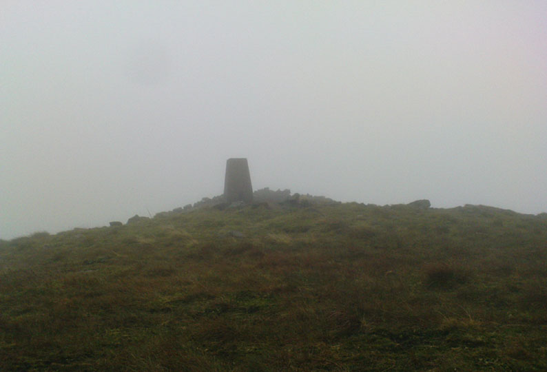
Triangulation & cairn atop of Rye Loaf Hill on a truly foggy eve

Best way is to take the Settle to Kirkby Malham road: a tiny little thing running steep from Settle up and around the hills, making sure you don’t miss the turn-off to Kirkby and head down to Airton instead.  About 100 yards along from the road-junction to Kirkby, there’s a small copse of trees and a gate just before it.  Walk up through that and head right to the top of the nice hill a mile or so ahead of you to the north.  It can be boggy, slippy and well good!  A decent Barmy Bennett expedition this way lies!  Get to the top of the hill and you can’t miss the cairn!

Archaeology & History

First shown on the 1771 Greenwood map, this is another intriguing little-known antiquity in our Yorkshire hills.  It’s intriguing as the precise age and nature of the site doesn’t appear to have been ascertained.  On top of this lovely rounded hill is not only a stunning view for many miles in all directions (unless you climb it on a very cloudy foggy day, like we did!), but the rock-pile which someone in recent years has turned into a wind-break has been taken from a much larger, and much older rock-pile on the very summit.

The cairn stands about a yard tall at the highest and measures roughly 12 yards in diameter, but the edges of the site seem to disappear further beneath the peat and vegetation on the hilltop.  A section in the middle of the cairn has obviously been dug into, probably to create the stone shelter on its southern side, but it also gives the impression of having been dug into by treasure-seekers in the past — similar to the trenches found in the Snowden Crags cairn circle, the Great Skirtful of Stones and other prehistoric tombs.

The site has been marked on Ordnance Survey maps as a simple marker cairn (non-antiquated writing on the maps), but I have strong suspicions after visiting this peak that the cairn in question is a lot older than has previously been assumed.  So I contacted local archaeologist Robert White and asked if he knew of any archaeological data about the cairn, but he said there was nothing that he knew.  However, an additional piece of information that adds potential to the antiquity of the cairn came from the awesome pen of Harry Speight (1895) who told that,

“The original name of this eminence is Inglehow, which suggests like Ingleborough and ancient look-out post or beacon hill.”

The suffix how or howe is well-known to place-name students in northern England and beyond as a burial mound or tumulus.  We must be cautious however, for as Gelling (1988) says, the word “is frequently applied to a tumulus, but it can refer to a natural hill.” But Speight’s idea that the name may have had something to do with beacons was mentioned — albeit without reference to Rye Loaf Hill, whose history and features he ignored — in Thomas Whitaker’s (1878) huge survey, where he wrote:

“In this parish was an immemorial custom, continued within the memory of many persons yet alive, of kindling fires on the tops of the surrounding hills on St. Laurence’s Eve, the 9th of August.  This night was called the Kennel or Kennelk night; and the tradition of the place is, that the fires were intended as a memorial of the beacons kindled by the Saxons to alarm their countrymen on the sudden approach of the Danes.”

The parish in question that Whitaker described was Giggleswick, which is right next door to Settle, in whose parish Rye Loaf Hill lives.

On the southern edge of Rye Loaf are a couple of other archaeological place-names that need looking at.  We have a couple of ‘Stone Haws’, which are probably cairns, close to which we find extensive evidence of human activity at some time in the past.  But close to one of these piles of stones is another, far more fabled rock whose history appears to have long since been neglected: the Dragon Stone of Scosthrop Moor.  Never heard of it?  That’s not surprising…

References:

  1. Gelling, Margaret, Signposts to the Past, Phillimore: Chichester 1988.
  2. Smith, A.H., English Place-Name Elements – volume 1, Cambridge University Press 1956.
  3. Speight, Harry, Tramps and Drives in the Craven Highlands, Elliot Stock: London 1895.
  4. Whitaker, Thomas Dunham, The History and Antiquities of the Deanery of Craven in the County of York, (3rd edition) Joseph Dodgson: Leeds 1878.

© Paul Bennett, The Northern Antiquarian

Kirkmoor Beck Farm, Fylingthorpe, North Yorkshire

Cairn Circle:  OS Grid Reference – NZ 9253 0306

Also Known as:

  1. Kirk Moor Beck Farm
  2. Kirkmoorbeck Farm

Archaeology & History

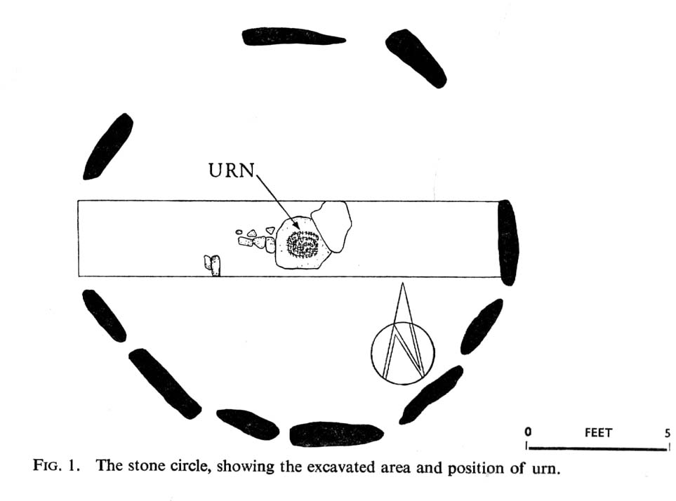
Plan of Kirkmoorbeck circle (after Radley 1969)

Although originally classed as a stone circle, this site should more accurately be described as a form of cairn circle, as burial remains were found in the middle.  This is noted by both Aubrey Burl (2000) and John Barnatt (1989), who thought it to be a kerbed cairn.  It’s only a small circle aswell, about 5 yards across and is found not far from other burial cairns in the neighbourhood.

First discovered around Easter in 1965 by the then owners of the farm, Mr & Mrs K. Jarman, parts of the circle were dug into by their children, who subsequently informed Sheffield City Museum of their finds.  Subsequently, the circle was then described in a short article by J. Radley (1969) in ‘Notes on Archaeological Finds’ for the Yorkshire archaeology group.  He wrote:

“The circle is 15ft in diameter and is made of ten stones which protrude a few inches above the turf cover.  Inside the circle the ground is slightly concave.  A two-feet wide trench was dug across the circle and a large stone was revealed at the centre. On the stone was a fragmented urn, remains of a cremation, and one fragment of flint. There are signs of burning on the stone, and also under the stone, but no other burial has been discovered.  The whole burial was so shallow that it was in the root zone of the overlying grass.  The survival of many pieces of bone in such a wet location suggests that the area must have been protected by a mound until quite recent times…

“The urn is too fragmentary to be restored.  Of the hundreds of fragments, only a few retain both faces, and these are generally one centimetre thick.  The urn appears to have been made of a fine clay with large grits and has a smooth brown surface marked in places with impressions of blades of grass. The urn may have been biconical in form with bands of horizontal grooves around the upper part, with vertical grooves below them.”

References:

  1. Barnatt, John, The Stone Circles of Britain – volume 2, British Archaeological Reports: Oxford 1989.
  2. Burl, Aubrey, The Stone Circles of Britain, Ireland and Brittany, Yale University Press 2000.
  3. Radley, J., “A Stone Circle on Kirkmoor Beck Farm, Fylingdales,” in Yorkshire Archaeological Journal, part 167, volume 42, 1969.

© Paul Bennett, The Northern Antiquarian

Sheep Scar Enclosure, Giggleswick, North Yorkshire

Enclosure:  OS Grid Reference – SD 80648 66374

Getting Here

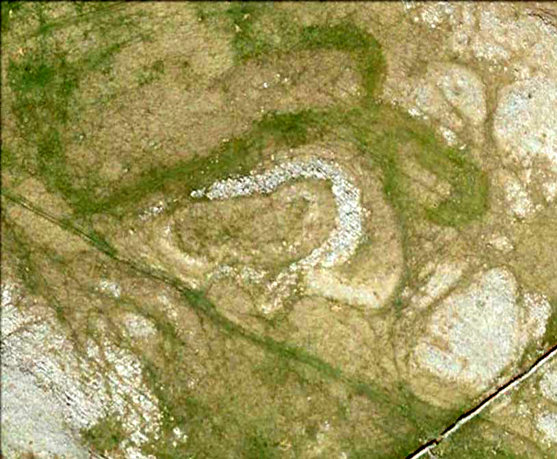
Aerial view of enclosure

To reach here, follow the same directions to get to the Apronful of Stones giant cairn.  Walk on the footpath past the cairn for about 200 yards until you reach a large gap where the old walling has collapsed.  Go through this and walk across the limestone rocks, towards the small rocky hillock rising up 100 hundred yards in front to your east (not the more rounded one to the north).  That’s it!

Archaeology & History

This is a most intriguing find, and one to which I can find no other literary reference (though I aint checked Brayshaw’s Giggleswick).  An undeniably large natural hillock has been modified and added to by people at some considerable time long ago and at some considerable effort!  Measuring more than 47 yards (43m) roughly east-west, and 21 yards (19m) north-south, the most definable man-made remains here is the length of elliptical walling on the southern and western edges.  The internal circumference of the enclosure measures roughly 113 yards (103m) all round the edges.  The northern and eastern sides of the hill would appear to be mainly natural, but seem to have been modified a little — not unlike the mass of settlements and enclosures a few miles to the east, like Torlery Edge, Lantern Holes and others around Malham Moor and district.

The site needs professional assessment: first to ascertain its period (which seems Iron Age on first impression, but could be much later), and second to ascertain its nature.  On the ridges close by we find a veritable mass of archaeological remains, ranging between Bronze Age to Medieval in nature.  The giant Apronful of Stones is only 172 yards (158m) south; the Sheep Scar cairn circle 156 yards (143m) northwest; and one of the remaining Sheep Scar cairns only 58 yards (53m) away.  And hopefully when we return to the place next week (fingers crossed!), we’ll be able to get some more photos of the walling you can see that define some edges of the site…

…to be continued…

References:

  1. Brayshaw, Thomas & Robinson, Ralph M., A History of the Ancient Parish of Giggleswick, Halton & Co.: London 1932.

© Paul Bennett, The Northern Antiquarian

Feizor Thwaite, Lawkland, North Yorkshire

Ring Cairn:  OS Grid Reference – SD 79798 67473

Getting Here

Feizor Thwaite circle (after ‘QDanT’)

From Feizor village, take the dirt-track south that cuts up between the two cottages and walk onto the level.  From here, the walling bends round and a small cut runs up the slope on your left.  Go up here and onto the top, bearing left again when you reach the footpath near the top of the slope.  Walk along here until the hills open up before you and less than 100 yards along, just on the right-hand side of the path, you’ll notice the overgrown outline of a ring just by the side.  Don’t miss it (like I did!).

Archaeology & History

Danny, Paul and I visited here a few weeks back on a fine sunny day and, my attention caught by some nearby rocks that got mi nose twitching, I just about walked past the place until Danny called me back and said, “Oy – ‘ave y’ not seen this?”  Right under my nose no less!

Feizor Thwaite circle, looking northwest

The site’s a little known circular monument east of Feizor village, less than a mile northwest of the cairnfield above Stackhouse (where lives the Apronful of Stones and other prehistoric friends).  Marked on modern OS-maps as an ‘enclosure,’ the site here is in fact an overgrown cairn circle, typical in size and form of the ones found at nearby Borrins Top, Burley Moor, Askwith Moor and elsewhere in the Pennines.  Measuring (from outer edge to outer edge) 66 feet 6 inches east-west and 59 feet north-south, the remains here consist of a raised embankment of stones, encircling an inner flatter region consisting of many smaller stones beneath the overgrowth of grasses and vegetation.  Locals told me that the some of the cairns up here were explored early in the 20th century by a local man called Tot Lord, but I’m unsure whether he looked at this one.

There are a couple of other smaller circular remains on the same grassland plain, clearly visible from aerial imagery, along with other crop-marks of human activity on this part of the Feizor Thwaite landscape.  More antiquarian analysis could do with focussing here to see what can be found!

Links:

  1. Feizor Thwaite & other nearby prehistoric sites
  2. Feizor Thwaite Computer Art

© Paul Bennett, The Northern Antiquarian

Feizor, Lawkland, North Yorkshire

Standing Stone (destroyed):  OS Grid Reference – SD 78570 67177

Archaeology & History

Feizor on 1851 map
Feizor on 1851 map

There have been no previous archaeological reference to this site (until now), which was included in early place-names records (Smith 1961) and was also highlighted on the first Ordnance Survey map of the region around 1851.  Probably as a result of the archaeological lacking, the upright stone has finally succumbed to the destructive actions of modern man. When we asked the farmer if he knew owt about any standing stone here, he said he knew “nowt abaat that.”

Feizor stone stump
and from another angle

All that can be seen today is the very small stump of stone, just visible above ground level, in the middle of the field.  It’s not easy to spot either, as the grasses grow over what’s left.  But we found the slim remnant of the stump embedded in exactly the spot marked on old and modern maps, measuring 24 inches in length and just 4 inches across at the widest, with what seemed like worn rounded edges at either end.  We were unable to ascertain the depth of the remaining stone in the ground. The stone looks simply as if it’s been snapped at the base.  We have no idea how tall this standing stone was.

If any local people know anything more about this stone, or have any old photos, we’d love to hear from you — and would obviously give due credit for any help on this matter.

References:

  1. Smith, A.H., The Place-Names of the West Riding of Yorkshire – volume 6, Cambridge University Press 1961.

Links:

  1. Feizor stone remnants & walks to nearby prehistoric sites

© Paul Bennett, The Northern Antiquarian 

Eller Edge (429), Pock Stones Moor, Thruscross, North Yorkshire

Cup-Marked Stone:  OS Grid Reference – SE 0902 6150

Also Known as:

  1. Carving no.429 (Boughey & Vickerman)
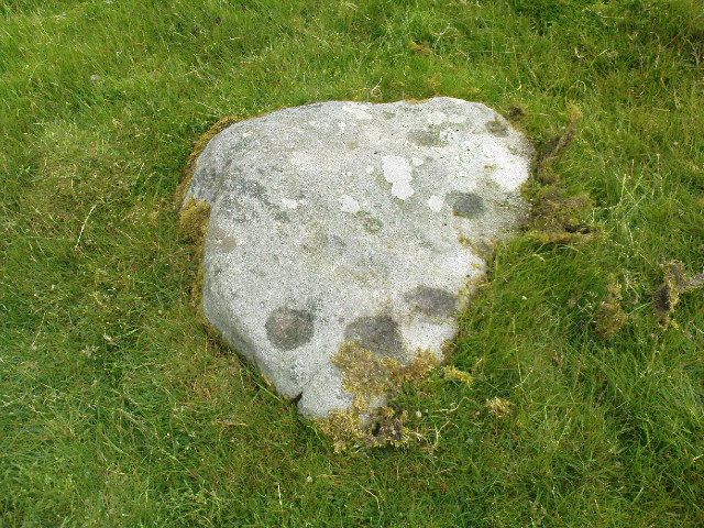
Eller Edge stone 429

Getting Here

A slight walk to get here.  Follow the same directions as if you’re going to the Eller Edge 431 carving.  Once here, walk west as if you’re going into the middle of the field, keeping your eyes peeled about 20 yards along for a small-ish rounded stone with nice colours of lichen amidst the grasses.  If you’re patient, you’ll find it soon enough!

Archaeology & History

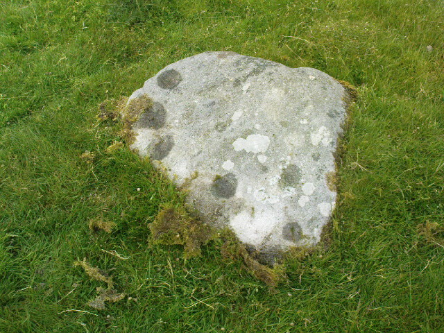
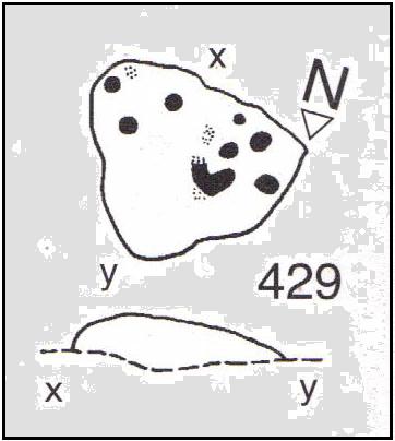
This is another simple cup-marked stone on the grassland ridge overlooking higher Wharfedale.  The carving here is a little clearer and more well-defined than that of its close neighbours, with a number of simple cups visible on its rounded surface.  We counted seven such cups on our cloudy-day visit, but Boughey & Vickerman (2003) thought there might be a little more, describing the stone simply:

from another angle
B & V’s drawing

“Small lichen-covered rough grit rock.  About eight cups and two depressions.”

A rubbing of this small stone (as practiced by English Heritage and rock art students alike) would prove useful in bringing out any other ingredients in the ancient design.  And whilst you’re in this field, have a look at the curious Spiral Stone and some of the other cup-markings close by.

References:

  1. Boughey, Keith & Vickerman, E.A., Prehistoric Rock Art of the West Riding, WYAS: Wakefield 2003.

Links:

  1. Eller Edge Rock Art – more notes & images

© Paul Bennett, The Northern Antiquarian

Eller Edge (424), Pock Stones Moor, Thruscross, North Yorkshire

Cup-Marked Stone:  OS Grid Reference – SE 08973 61487

Also Known as:

  1. Carving no.424 (Boughey & Vickerman)
Eller Edge carving 424

Archaeology & History

A slight walk to get here, but well worth it once you arrive!  Follow the same directions as if you’re going to the Eller Edge 426 carving.  Once you reach this stone, notice the larger rounded rock about 20 yards to your west, a bit further down the field.  You can’t really miss it!

Archaeology & History

A large rounded stone just on the meadows before it begins to slope more steeply downhill, there are several of those large natural ‘bowls’ that we see on a lot of cup-marked and not-so-cup-marked stones in our northern hills.  These basins or bowls may, at times, may have had significance for our ancestors, but it’s the cluster of cup-markings on this stone which are of importance to us here.  There are perhaps as many as a dozen cup-marks here, all very well worn, and mostly to be seen on the eastern sides of the rock.  When I came here with Paul Hornby and QDanT a few months back, the cloud cover stayed with us all day, so I didn’t get any decent images of the carving.  Ne’er mind…

Close-up of faint cups

The stone was described by Boughey & Vickerman (2003) simply as:

“Very large, uneven, rough grit rock with face with scooped-out areas sloping down to grass.  Eleven possible cups and six basins.”

A plain carving, perhaps only of interest to the fanatics amongst you.  But if you do visit here, check out carving 432, 431, and others in the same field.

References:

  1. Boughey, Keith & Vickerman, E.A., Prehistoric Rock Art of the West Riding, WYAS: Wakefield 2003.

Links:

  1. Eller Edge Rock Art – more notes & images

© Paul Bennett, The Northern Antiquarian