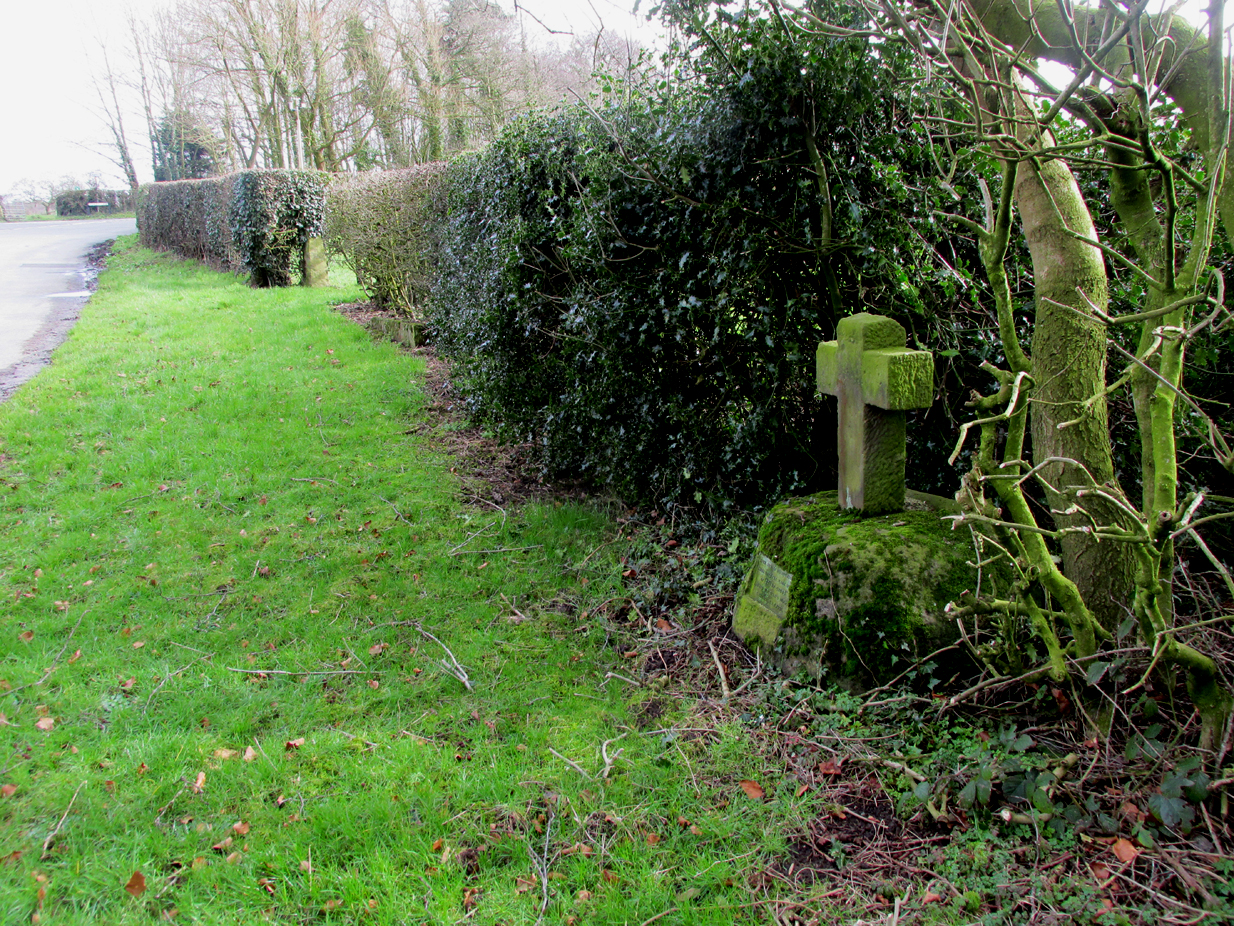
The cross is situated on the verge at the west side of the B5269 road near its junction with Ashley Lane at Stump Cross, north-east of Goosnargh.
Archaeology & History
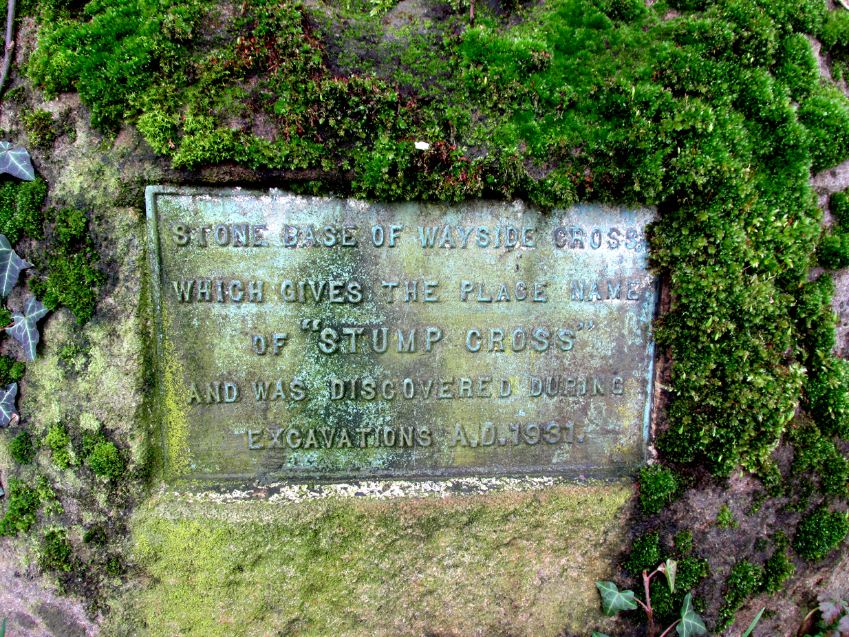
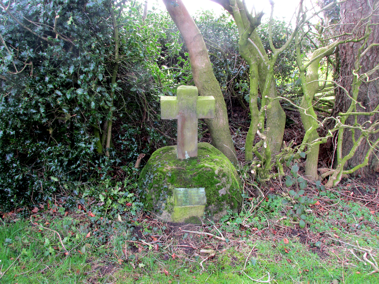
All that survives is the socketed base of the mediaeval cross, into which a small modern carved stone cross has been inserted. A bronze plaque attached to the base informs the reader that the cross gives its name to the locality, and that the base was discovered during excavations in 1931.
Richard Cookson (1888), in his Goosnargh Past & Present, writes:
“We have the remains of several upright crosses in this township called “cross stones” all being placed near to some public road or path. The corpses of the Roman Catholics are rested at those stones on their way to internment, and those funeral attendants who are of that persuasion kneel down and offer up a short prayer for the repose of the soul of the departed individual whose body they are conveying to the grave.”
Further to the destruction of crosses in the township, Cookson writes:
“…the Reverend Richard Wilkinson, late minister, of anti-Romanistic notoriety, in his frenzied hostility to the Roman Catholics, caused [the cross] to be broken up and removed…”
The site is listed by Henry Taylor, in his 1906 magnum opus on Lancashire crosses, and speaking generally on the destruction of wayside crosses in the Hundred of Amounderness, he writes:-
The bronze plaqueModern cross inserted into the Mediaeval socket
“The destruction of so many crosses, which at one time existed in this part of the Hundred, is due to the vandalism early in the nineteenth century of a vicar of Goosnargh, named Wilkinson. He was a vehement Protestant, and owing to his notoriety as a Prophet, was allowed to do much as he liked with these ancient monuments. Many crosses, indeed, it is said, were pulled down with his own hands. His prophesies foretelling the deaths of various persons often unfortunately came true, and he was thus, in this superstitious part of England, dreaded as a wizard. As this work of demolition took place before the date of the Ordnance Survey, there were in all probability many more crosses erected in Mediaeval times in this district than we have now any knowledge of, and it is quite possible that some of the crosses so recklessly destroyed may have been, like those at Halton and Heysham, of pre-Norman date and of great historical value. Fragments of them might even now be found were a diligent search be made.”
Further to this speculation as to the antiquity of these destroyed crosses, it is interesting to note the approximately parallel orientation of roads and field boundaries to the east of the Stump Cross. This may point to the area having been subjected to Roman survey, and the site of the Stump Cross having once been a shrine to the gods of the agrimensores (Roman surveyors) that had been Christianised.
References:
Cookson, Richard, Goosnargh: Past and Present, Preston, H.Oakey, 1888.
Taylor, Henry, The Ancient Crosses and Holy Wells of Lancashire, Manchester, Sherratt and Hughes, 1906.
Richardson, Alan, The Roman Surveyors in Cumberland, P3 Publications: Carlisle 2008.
Take the A701 road from the east end of Princes Street south—down North Bridge, South Bridge, Nicolson Street, onto Liberton Road and then Liberton Gardens—towards Penicuik. 3¾ miles along, in the parish of Liberton itself, where the A701 is called Howden Hall Road, keep your eyes peeled for the turning into the Toby Carvery on your left. Park up and walk across the grass and look behind the trees ahead of you (if you can’t find it, ask the people in the pub). .
Archaeology & History
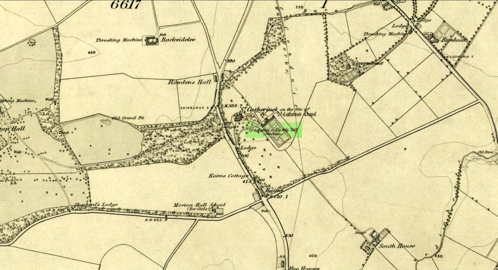
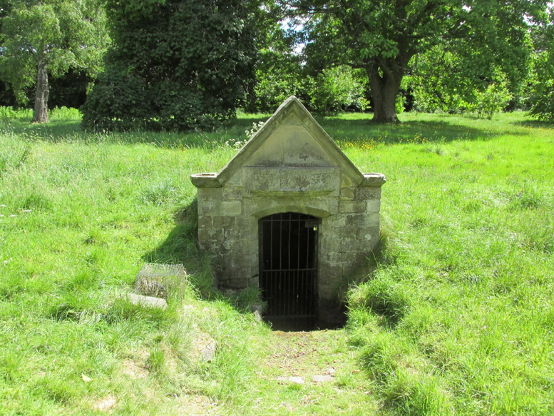
Located south of Liberton village—a few hundred yards west of the long-gone chapel erected by St. Margaret in honour of St. Catherine—this famous holy well is now in the grounds of a public house and is easily accessed. It has been described by many historians through the centuries, from Matthew Mackaile’s (1664) short work to more recent tourist guides. When the local historian George Good (1893) told about it, local lore still spoke of the old church. “These lands,” he wrote,
“belonged to a very ancient chapel dedicated to St. Catherine, which stood with its burying-ground near the modern mansion of St. Catherine’s. All trace of this chapel has disappeared, but at the end of last century its ruins were still extant. It was reputed to be the most ancient place of worship in the parish, and the ground around the chapel was consecrated for burials. Hither came annually in solemn procession the nuns from the Convent of Sciennes, a foundation due to the piety of one of the St. Clairs of Rosslyn, who may possibly have also been connected with the origin of the Chapel of St. Catherine.”
Its relationship with the world-famous Roslyn Chapel, less than 4 miles to the south, remains (to my knowledge) unproven, but it’s an association that would not be unlikely. This aside, St Catherine’s Well has a long history. Described in Hector Boece’s Latin text Scotorum Historia (1526), we have one John Bellenden to thanks for a wonderful translation into early english under the title of The History and Chronicles of Scotland in 1536. Herein one of the later editions we read, in that quaint old dyslexia:
“Nocht two miles fra Edinburgh is ane fontane dedicat to Sanct Katrine, quhair sternis of oulie springs ithandlie with sic abundance that howbeit the samin be gaderit away, it springis incontinent with gret abundance. This fontane rais throw ane drop of Sanct Katrine’s oulie, quhilk was brocht out of Monte Sinai, fra her sepulture, to Sanct Margaret, the blissit Quene of Scotland. Als sone as Sanct Margaret saw the oulie spring ithandlie, by divine miracle, in the said place, sche gart big ane chapell thair in the hounour of Sanct Katrine. This oulie has anr singulare virteu agains all maner of kankir and skawis.”
In the middle of the 17th century, its medicinal virtues were brought to the attention of the surgeon Matthew Mackaile who, in 1664, wrote:
“In the paroch of Libberton, the church whereof lyeth two miles southward from Edinburgh, there is a well at the Chapel of St. Catherine’s, which is distant from the church about a quarter of a mile, and is situate toward the south-west, whose profundity equaleth the length of a pike, and is always replete with water, and at the bottom of it there remaineth a great quantity of black oyl in some veins of the earth. His Majesty King James VI, the first monarch of Great Britain, of blessed memory, had such a great estimation of this rare well, that when he returned from England to visit his ancient kingdom of Scotland in anno 1617, he went in person to see it, and ordered that it should be built with stones from the bottom to the top, and that a door and a pair of stairs should be made for it, that men might have the more easy access into its bottom for getting of the oyl. This royal command being obeyed, the well was adorned and preserved until the year 1650, when that execrable regicide and usurper, Oliver Cromwell, with his rebellious and sacrilegious complices, did invade this kingdom, and not only defaced such rare and ancient monuments of Nature’s handiwork, but also the synagogues of the God of nature.”
St Catherine’s Well today
This historical appraisal has been echoed by other writers and is very probably accurate. Some years after Cromwell and his murderers had desecrated the land and people in this area, the well was again repaired to its former condition and slowly, quietly, people began traditionally using the site for ritual and healing once more. But over the next two hundred years, probably through religious persecution by the Church, the site was used less and less and, by the time Thomas Muir (1861) visited and wrote about it, the well-house had become “dilapidated”. A few years later when the holy wells writer J.R. Walker (1883) visited the place, he found that not only was it still,
“celebrated for the cure of cutaneous diseases, (but) it is still visited for its medicinal virtues”; and was “now carefully protected and looked after.”
In James Begg’s (1845) account of the well for the Statistical Account, he told:
“At St. Catherine’s is a well which contains a quantity of mineral oil or petroleum, obtained most probably from the spring flowing over some portion of the coal beds. This bitumous matter floats copiously on the surface of the water, and is also partially dissolved in it. The spring is reckoned medicinal by the country people, and may have some slight efficacy in cutaneous eruptions…
“At St Catherine’s, there is the famous well, before alluded to, anciently called the Balm Well. Black oily substances constantly float on the surface of the water. However many you remove they still appear to reside in this well, and it was much frequented by persons afflicted with cutaneous complaints. The nuns of the Sheens made an annual procession to it in honour of St Catharine. King James VI visited it in 1617, and ordered it to be properly enclosed and provided with a door and staircase, but it was destroyed and filled up by the soldiers of Cromwell in 1650. It has again been opened and repaired, and is now in a good state of preservation.”
The “nuns of the Sheens” who made the annual pilgrimage here were the nuns of St. Catherine’s of Sienna, in Italy! This crazy-sound journey is more than one thousand miles long and its nature and origin needs exploring in greater depth—although a “Nunnery of St. Catherine of Siena at Edinburgh” was founded in 1516 at Sciennes in Edinburgh, less than three miles away. Much easier! 🙂
It would have been more than just the healing properties of the oily waters that called the nuns across their incredible journey, but they would, no doubt, have been of considerable mythic importance. All of the early writers comment about it and seem confident in its abilities. As the Liberton historian George Good (1893) said,
“…there can be little doubt that its waters had a healing tendency. Oils when rubbed on the skin have often been found to produce most beneficial results in skin diseases. The tarry substance or petroleum mixture discovered in this spot was no doubt due to the presence of the coal or shale strata of the district. The existence of the oil-works at Straiton and elsewhere cannot fail to throw a light upon the history and peculiarities of the so-called Balm Well of St. Catherine’s, which even yet has an occasional visitor.”
This oily substance was examined for medical potential by Dr. George Wilson in the mid-19th century, who found:
“The water from St Katherine’s Well contains after filtration, in each imperial gallon, grs. 28.11 of solid matter, of which grs. 8.45 consist of soluble sulphates and chlorides of the earths and alkalies, and grs. 19.66 of insoluble calcareaous carbonates.”
I am not aware of any modern accounts of cures attached to St Catherine’s waters, but have little doubt that some people will have found it useful….
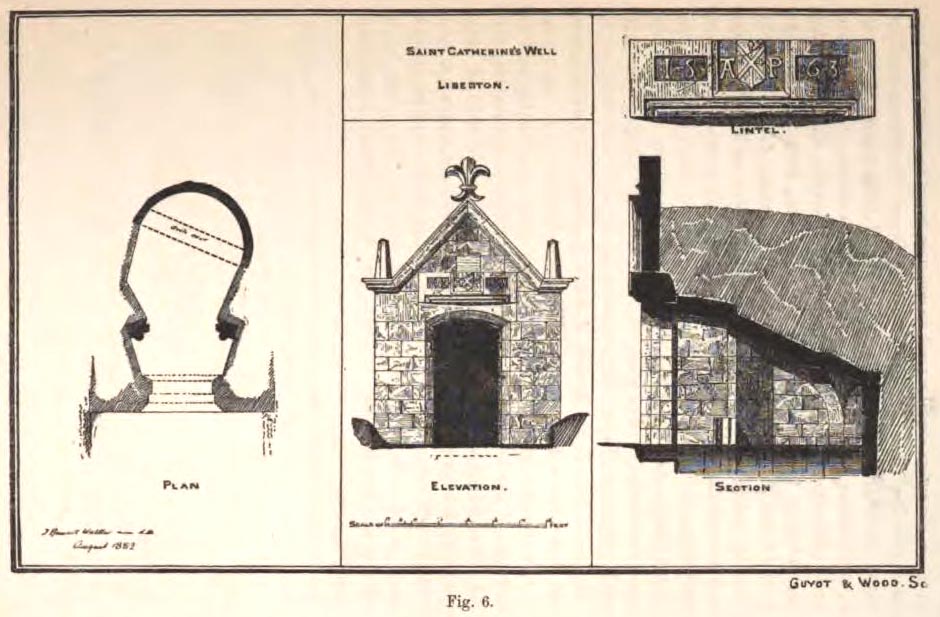
The architecture of the small well-house covering the waters would seem insubstantial, but the Royal Commission (1929) account told:
“The well is housed within a tiny vaulted structure. The Renaissance front is relatively modern, but it contains a door lintel, probably quite unconnected with the structure, on which is inscribed the date 1563 within recessed panels flanking a central panel, which contains a shield flanked by the initials A.P. The shield bears a saltire, in the sinister quarter of which is a Latin cross placed horizontally, i.e., with the shaft towards the fess point (? a merchant’s mark); the upper quarter contains a much worn object resembling a broad arrow, point uppermost.”
Plan of site in 1883
The iron-clad door is locked, as the visitor will see. Please enquire at the hotel regarding it being opened to look inside. Upon our visit here in June 2017, the waters, as in J.R. Walker’s (1883) day, were still bubbling up and were quite high, but it looked as if the inside needed cleaning. For a change, we didn’t drink the water…..
Folklore
Although various writers have posited that the oily waters are probably due related to the nearby coalfields, legend tells otherwise:
“It owes its origin, it is said, to a miracle in this manner: St. Katherine had a commission from St. Margaret, consort of Malcolm Canmore, to bring a quantity of oil from Mount Sinai. In this very place, she happened, by some accident or other, to lose a few drops of it, and, on her earnest supplication, the well appeared as just now described.” (Thomas Whyte 1792)
References:
Banks, M. MacLeod, British Calendar Customs: Scotland – volume 1, Folklore Society: London 1937.
Begg, James, “Parish of Liberton“, in New Statistical Account of Scotland – volume 1: Edinburgh, William Blackwood: Edinburgh 1845.
Muir, Thomas S., Characteristics of Old Church Architecture,in the Mainland and Western Isles of Scotland, Edmonston & Douglas: Edinburgh 1861.
Royal Commission on the Ancient & Historical Monuments of Scotland, Inventory of Monuments and Constructions in the Counties of Midlothianand West Lothian, HMSO: Edinburgh 1929.
Walker, J. Russel, “Holy Wells’ in Scotland,” in Proceedings of the Society of Antiquaries of Scotland, volume 17, 1883.
Watson, W.N.B., “The Balm-Well of St Catherine, Liberton,” in Book of the Old Edinburgh Club, volume 33, 1972.
Whyte, Thomas, “An Account of the Parish of Liberton in Midlothian, or County of Edinburgh,” in Archaeologica Scotica, volume 1, 1792.
Wilson, Daniel, Memorials of Edinburgh in the Olden Times – 2 volumes, Edinburgh 1891.
Acknowledgements:Huge thanks for use of the Ordnance Survey map in this site profile, reproduced with the kind permission of the National Library of Scotland.
This long lost holy well used to be found somewhere on the south-side of the Water of Leith, close to Powderhall, between Warriston and Broughton. References to it are minimal. Whilst Ruth & Frank Morris’ (1981) thought it might have been an alternative name of the Bonnington Mineral Spring—aka St. Cuthbert’s Well—a half-mile to the north-east, we know from John Russel’s (1933) article that it was a quite separate site; but all he could tell us was that St. Leonard’s Well was “a now forgotten mineral well”. The clearest indicator telling of its whereabouts is in John Geddie’s (1896) lovely work on the history of the Leith watercourse, where he described this “forgotten mineral spring” as being below Powderhall “beside the Water”, i.e., the river Leith. A few miles south, a crag at Arthur’s Seat was once dedicated to St. Leonard. (the grid-reference to this site is an approximation).
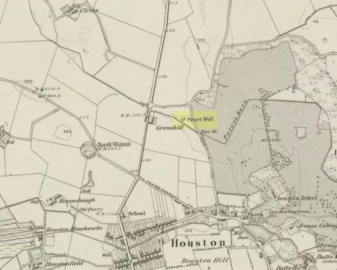
Located on the north side of the village, in a field east of Greenhill Farm, this old Well was once (still is?) covered and protected by an old well-house. References to its mythic history are few and far between. St. Peter’s Day was June 29, which may relate to the last vestiges of midsummer rites local people held here; or perhaps when the genius loci was more notable. The Old Statistical Account of 1790 told that the burn which runs past the well was called St. Peter’s Burn; but T.C.F. Brotchie (1920) thought that an old place-name given to the village is telling:
“Houston is a very ancient village,” he wrote, “and it was known long ago as Kilpeter, which is the ‘cell or church of Peter’. The name of the farm near to the well is Chapelton, ‘the place of the chapel’, and I venture to think that when the saintly Peter came a-wandering to Renfrewshire, he established his habitation or cell adjacent to the well, blessed its water, and in that medieval times a chapel was also built there, its memory being enshrined in the place-name Chapelton. Crawford mentions that on St. Peter’s Day vast numbers of people used to come to Houston. He does not state the reason, but I fancy these people came to pay their devoir at the holy well of St. Peter.”
Mr Brotchie was probably right!
(I haven’t yet visited this site. If you travel to this site, please send us your field notes and accompanying photos to let us know of its present condition. All due credits will be given to any and all contributors, obviously.)
References:
Brotchie, T.C.F., “Holy Wells in and Around Glasgow,” in Old Glasgow Club Transactions, volume 4, 1920.
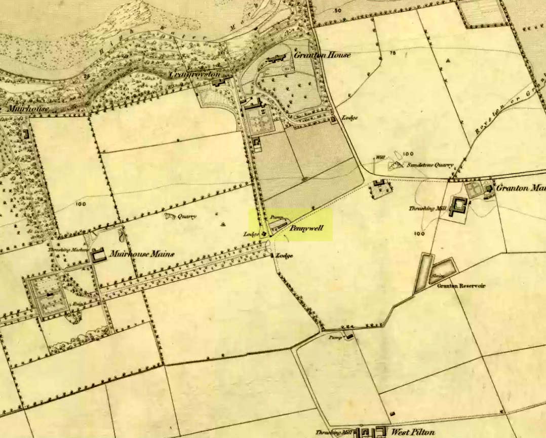
On the 1853 Ordnance Survey map of Granton we are show the house and place-name of Pennywell with a ‘pump’ adjacent to it. Sadly we don’t have as rich a history of the place as its namesake at Newington. Its earliest written appearance seems to be in 1812. A few years later, in the OrdnanceName Book of the area, it was recorded that,
“Two cottages on the property of Sir John McNeil the name appears to be derived from a well which was formerly situated at the North east end of the houses where one Penny was paid for a draught of water.”
Remembered as a watering place for horses, the old Scots word ‘penny’ may be behind this old name, in terms of it giving the animals and locals their water supply. Stuart Harris (1996) thought that this Penny Well may have been the long lost St. Columba’s Well in the parish of Cramond.
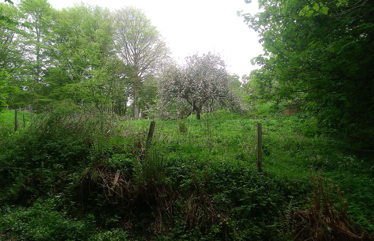
A fascinating site that was described in Johnston & Tullis (2003) local history work on the parish of Muckhart. Amidst an area bedevilled with faerie, boggarts, ghosts and historical shamanic moot sites we find more curious folklore pointing at a long forgotten site, whose age and precise nature remains a mystery. Adjacent to the old boundary line, close to the meeting of streams, the Muckhart authors told that,
“an orchard above the old farmhouse to this day remains mainly untouched. It was the burial site of warlocks from the parish and it is thought some may have even been burned at the Mill. It has always been said that this ground should never be touched! There is an ancient rubble bridge over the Hole Burn which has a Masonic Eye painted on it to ward off any unwelcome spirits. Despite the eye, both the Farmhouse and the Millhouse have been home to many strange and ghostly manifestations.”
The folklore sounds to be a mix of archaic and medieval animistic traits: perhaps of a prehistoric cairn, visited and maintained by local people (as found throughout Britain) until the Burning Times, when christian fanatics arrived, debasing the cultural rites and murdering local innocent people. …Perhaps not.
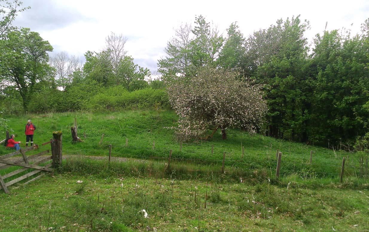
Looking down on the orchard
When Paul, Maggie and I explored the area a few days ago, we were greeted most cordially by the owner of Muckhart Mill, who knew of the folklore, but didn’t know the exact whereabout of the grave. We couldn’t find any clues as to its exact location either. Apart, perhaps, from the top of the hill immediately above the orchard where, alone and fenced off with an old covered (unnamed) well, a solitary Hawthorn tree stood. We each recalled the aged relationship that Hawthorn has in witch-lore… but that’s as far as it went. The grave remains hidden and may have been destroyed. If anyone discovers its whereabouts, please let us know so that a preservation order can be made to ensure its survival.
References:
Johnston, Tom & Tullis, Ramsay (eds.), Muckhart, Clackmannanshire: An Illustrated History of the Parish, MGAS 2003.
Healing Well (destroyed): OS Grid Reference – NT 2511 7322
Archaeology & History
Like many others in the city centre, this old well has long since passed into history. Said by Stuart Harris (1996) to have been “about twenty-five yards east of the eastern corner of Lady Lawson Street”, the Victorian writer Alison Dunlop (1890) told it to be by “a narrow close and an outside stair gave (which) entrance to the Court-house.” It was the focus of much social activity in ages past; and although a number of public wells could be found in this part of the city, south of the Castle, the Westport Well was the most renowned. Miss Dunlop told that,
“…its waters (were) of excellent repute (and) had to satisfy the necessities of all the inhabitants of the district. The early morning never failed to see a long line of water-stoups stretching from it in either direction like the queue at a French theatre door. Not so quiet, however, for tongues, mostly feminine, wagged freely, and the ‘Waal’ news and gossip were then the equivalent for a racy morning newspaper.”
According to her account, the patience of the people collecting the water was exemplary:
“All crowding-in was fiercely resented; gentle and simple had to stand their turn; only the water-caddies had the abiding right of precedence, and satisfied their customers at the moderate rate of two stoupful for a penny. We have already mentioned these ancient aquarian vessels peculiar to Scotland. In the event of a marriage taking place—in which case the bride was responsible for an amount of house plenishing not considered incumbent or even fashionable now-a-days—the ‘stoups’ were invariably purchased by the intending husband. Indeed, the Weetin’ o’ the Stoups was the synonym for the last bachelor supper prior to matrimony. Such festivities are understood to be hilarious, happy, hopeful; and the weetin’ o’ the stoups in Old Portsburgh, as in Old Edinburgh, was sometimes very wet indeed.”
Musselburgh has had an ancient fair—held upon St. James’ Day (July 25)—for many centuries. It was held along the old High Street by a more ancient Market Cross than the one seen there today. R.M. Stirling (1894) told us that, “The cross is erected over a draw-well, and in local parlance is known as the Cross Well.”
On the 1853 township map, a water ‘pump’ is shown at the very spot, with the ‘cross’ and water trough shown on subsequent maps. The Well isn’t mentioned in John Small’s (1900) description of the cross and its authenticity as a ‘holy’ well is questionable.
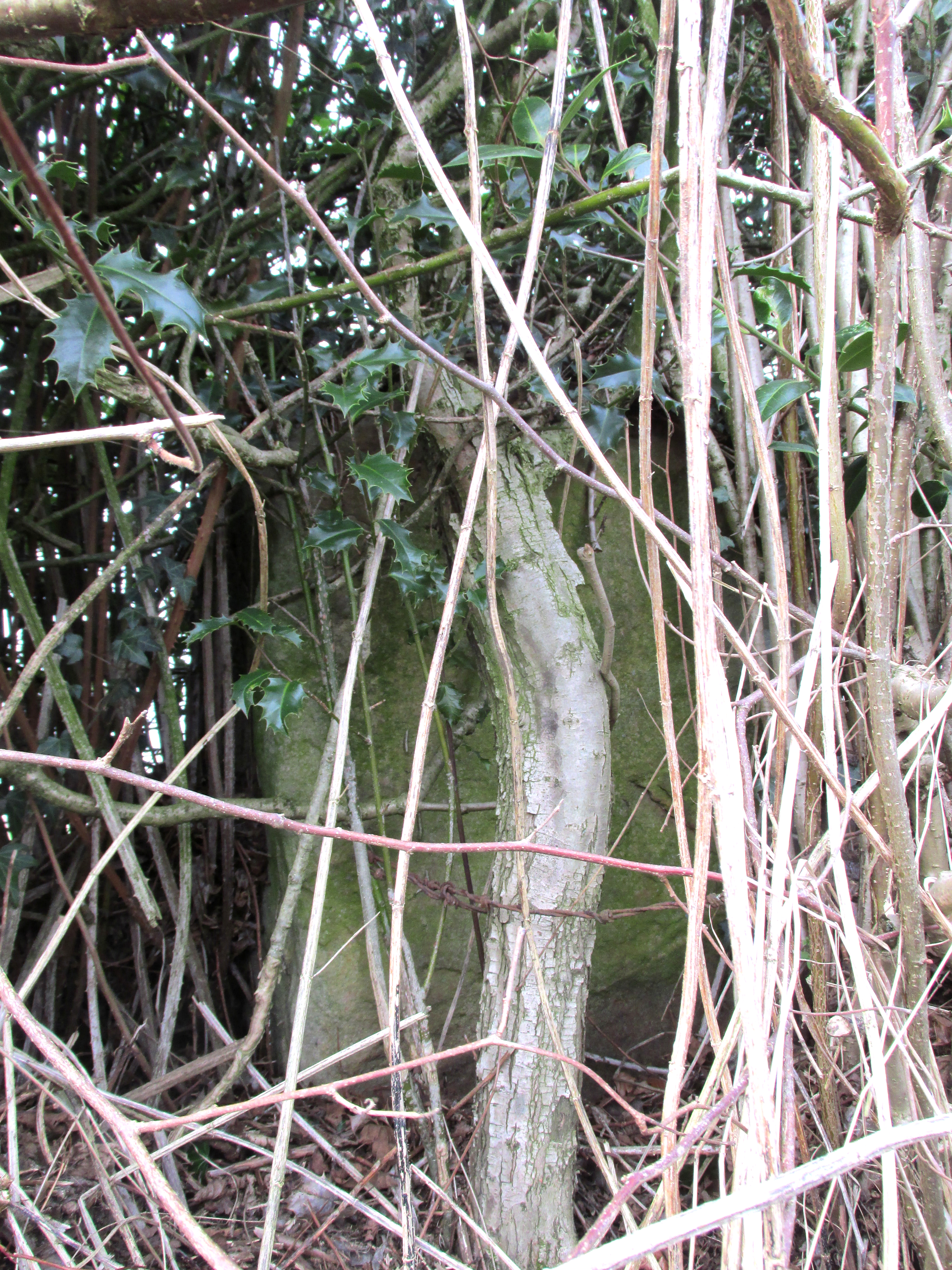
Travelling east out of Goosnargh on the B5269, go straight ahead onto Camforth Hall Lane, follow it northwards and take the left fork at Stump Cross onto Eaves Green Lane, and a lane will be seen on the left signposted Eaves Green. Walk along this lane and a white Snowcemmed house, ‘Bridle Mount’ will be seen on the left. The cross base will be found deep in the holly hedge opposite the driveway to the house.
Archaeology & History
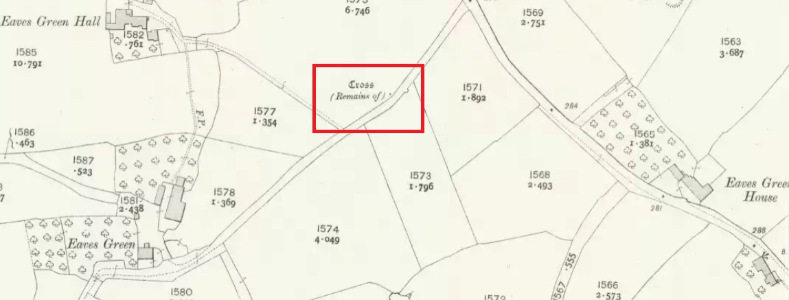
This cross was not mentioned in the 1906 edition of Henry Taylor’s Ancient Crosses andHoly Wells of Lancashire, but was nevertheless marked on the 1910 25″ OS map (the earliest at my disposal) as “Cross (Remains of)”
The 1910 25″ OS Map
In 1958, the Ministry of Works Field Investigator commented: “The socket stone of a probable way-side cross situated on rising ground in a pasture field adjoining a lane. It measures 0.8m by 0.7m and is 0.9m high with a socket 0.2m by 0.15m and 0.2m deep. There are no traces of a cross or shaft.”
To locate the Cross, turn round 180º from this spot.
The current official description describes the remains as “Now missing”…
Well, no! – the intrepid TNA investigator has located it, buried deep in the boscage of a holly and ivy hedge, but he was lucky that the hedge had been very recently trimmed and he made his visit in late winter…
The Cross is registered on the Milestone Society Repository under reference: LAPR_GOO02.
At the roadside, on the south side of Barton Lane, where it crosses the minor road joining Cross House Farm and Barton House, you’ll see the Barton Cross standing upright. You can’t miss it!.
Archaeology & History
Carved stone cut to shape
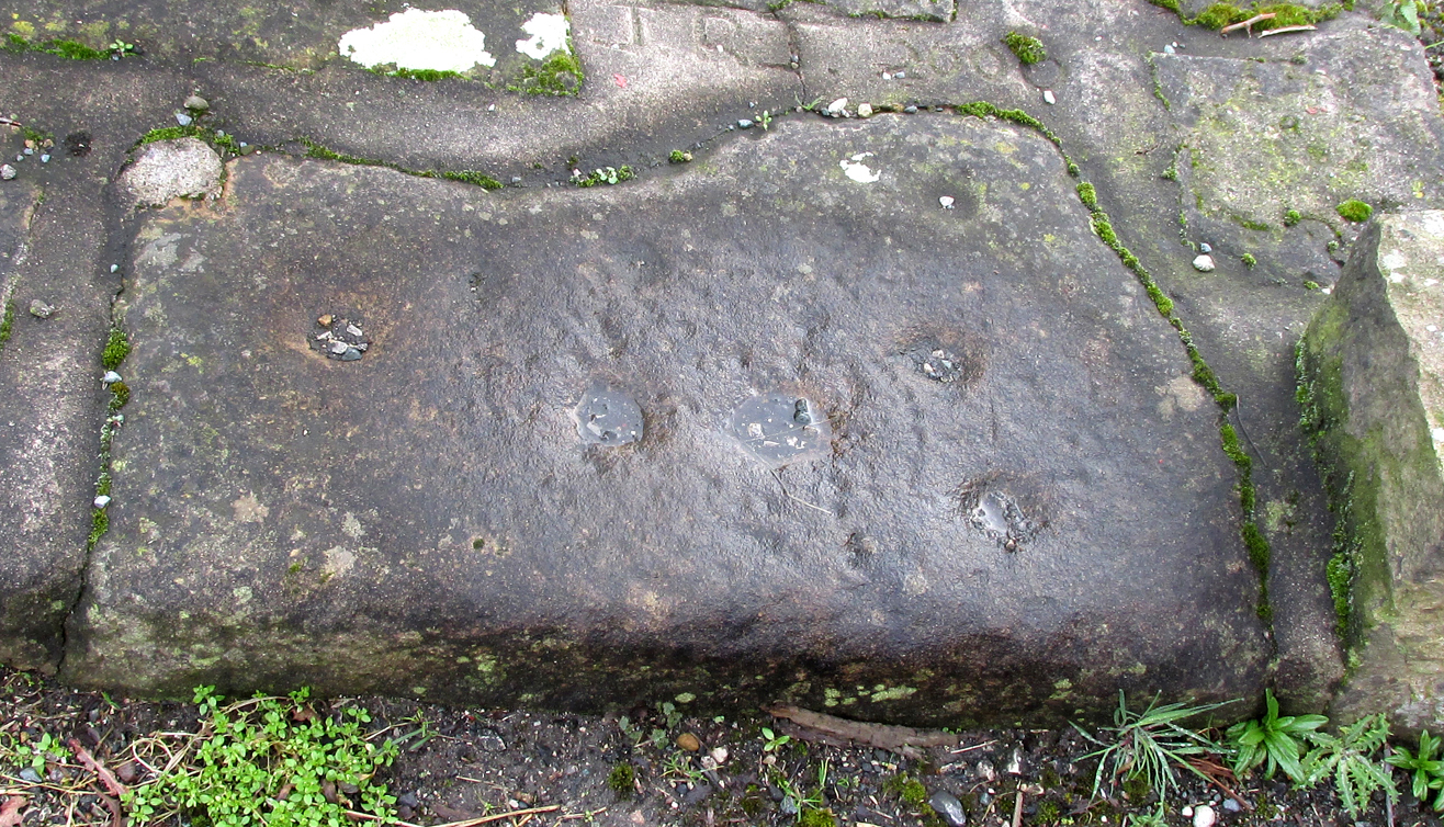
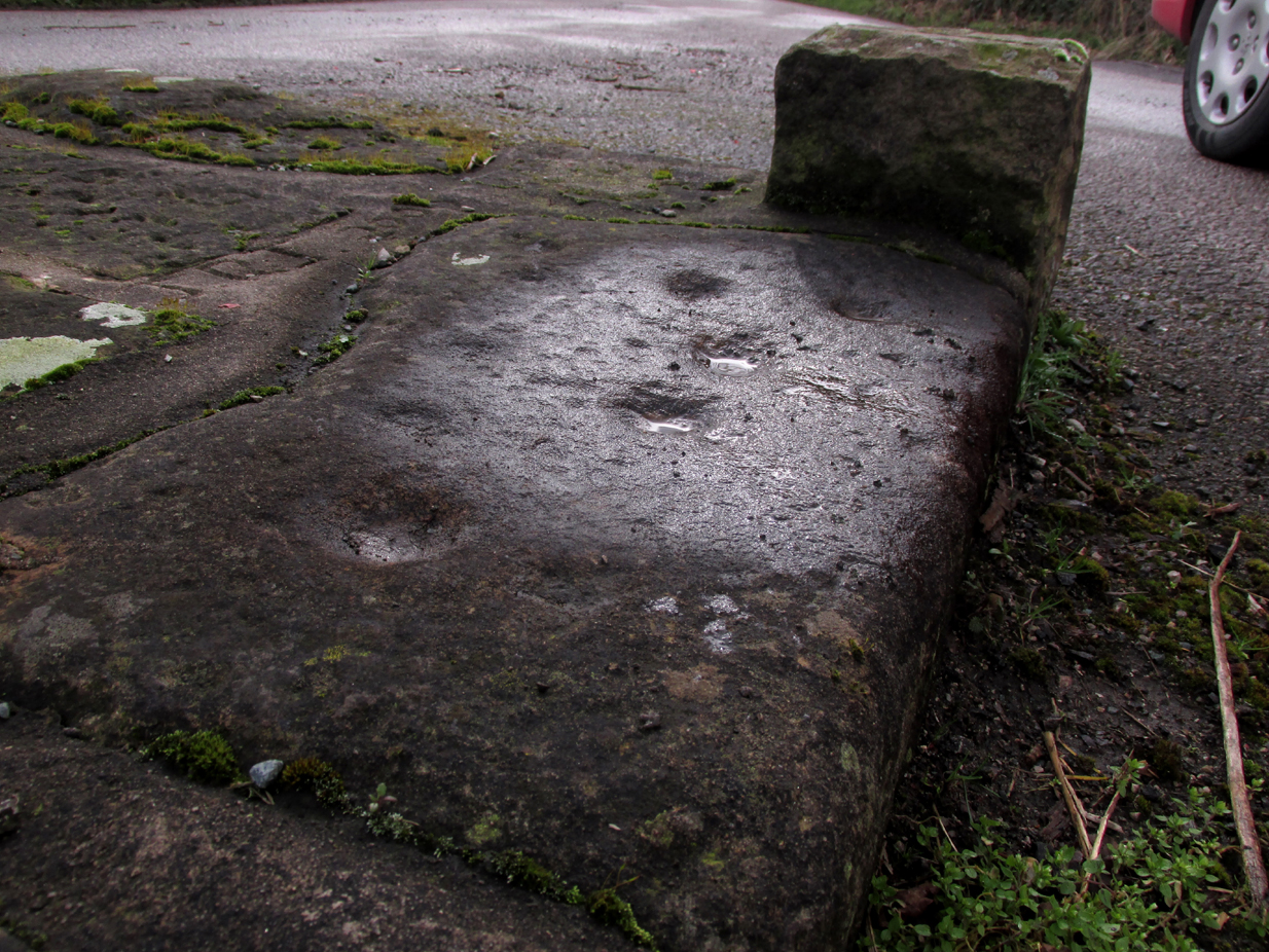
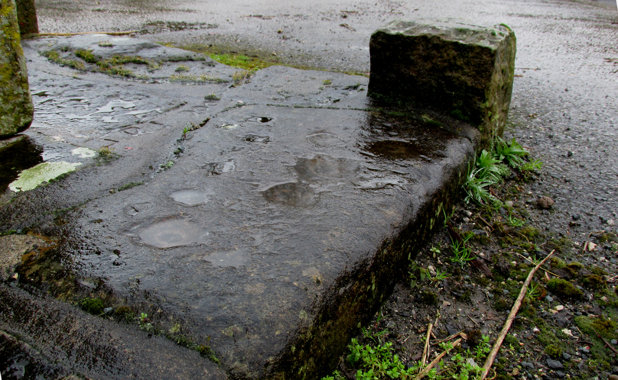
Apparently never before described, this stone has very likely been removed from another locality and cut to shape to form part of the surrounding platform base to Barton Cross, where it is at the southwest corner. It has ten cup marks.
Until or unless more such stones are located, it is a unique example of rock art in this part of Lancashire.
Nine cups visible here10th cup nr camera, after rain
Henry Taylor, in his 1906 work The Ancient Crosses and Holy Wells of Lancashire writes inter alia about the Barton Cross that it had been demolished sometime after 1848, and that the base and part of of the Cross shaft had been ‘lately restored to the old site‘. Thus the cup-marked stone may or not be in its original position as part of the Cross surround, and may have just been a conveniently available slab of stone that was used, rather than a deliberate use of a pre-existing sacred stone.
References:
Taylor, Henry, The Ancient Crosses and Holy Wells of Lancashire, Sherratt & Hughes, Manchester, 1906.