If you’re coming up to Oxenhope from Keighley, up the A6033 road, when you reach the school on the right-hand side of the road, a one-way street (Cross Lane) is where you need to walk down, for 200 yards, and keep your eyes peeled in the walling just before Cross Farm Court. Alternatively, via Haworth, go along Marsh Lane for a few hundred yards until your reach Moorhouse Lane on your left. Go down here for ⅓-mile (0.5km) and then go up Cross Lane on your right. About 120 yards up, in the walling just past the entrance into Cross Farm Court is where you’ll find it.
Archaeology & History
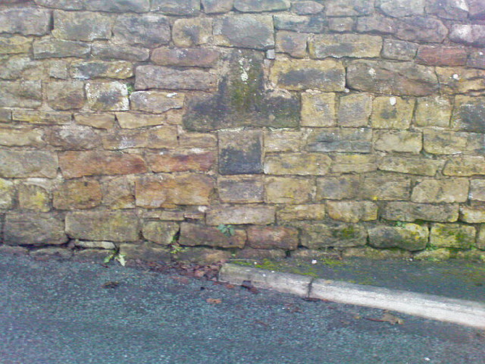
Very little seems to be known about the remains of this cross, embedded into the old walling. When it was described by Brigg & Villy (1914), they could find no information about it, and surmised that it marked the original track or road to Oxenhope from both Haworth and Halifax, “on the line of the old road by Withens.” Ostensibly it would seem to have been a wayside cross, marking old trackways (ley hunters take note!).
Visitors looking at it today can see that it’s barely noticeable. It looked no different even in Brigg & Villy’s days. It simply consists of only part of the original head of the cross, “the shaft having been broken off flush with the horizontal limb.” Some of the other stones that make up the bottom of this very poor-looking excuse of a cross were probably not part of the original, but were assembled into the wall to at least leave of memory of what it used to look like. It’s in a sorry state to be honest. A historic plaque should be placed here.
References:
Brigg, J.J. & Villy, F., “Three Ancient Crosses near Keighley,” in Bradford Antiquary, New Series 6, 1921.
Cross (destroyed): OS Grid Reference – SE 2546 3537
Archaeology & History
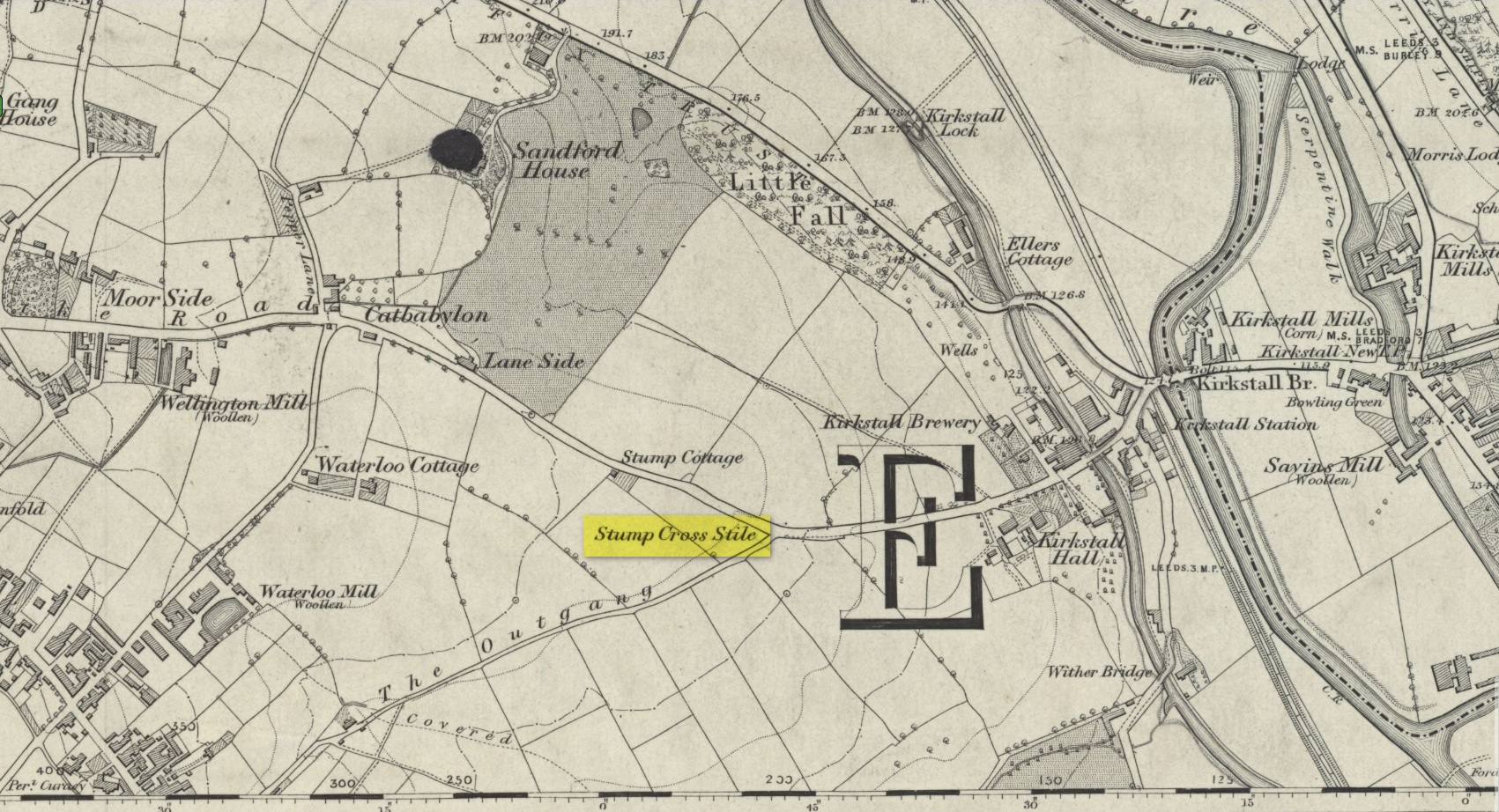
Location of the old cross
In medieval times an old stone cross was erected at the edge of Bramley where two old tracks once met, and which today is the junction where Broad Lane meets with Outgang Lane. The cross is long gone – and even the stone cross base on which it stood no longer existed when the Ordnance Survey lads came here in the 1840s. All that remained when they came here were the place-names which have forever kept a memory of its former existence: Stump Cross Stile and Stump Cottage. It was mentioned, albeit briefly, in Wardell’s (1890) survey of Kirkstall Abbey where he told simply that a
“stone cross formerly stood some distance south of the Abbey by the side of the Old Road to Bradford, at the junction of the lane leading to Bramley, called the Outgang, but no remains of it are left; the site, however, is still known by the name of ‘Stump Cross Stile.’ Whether this cross marked the extent of some boundary, or was erected by the monks or others for the purposes of devotion for wayfarers, I am unable to ascertain.”
References:
Wardell, James, An Historical Account of Kirkstall Abbey, Yorkshire, Samuel Moxon: Leeds 1890.
Acknowledgements:Huge thanks for use of the Ordnance Survey map in this site profile, reproduced with the kind permission of the National Library of Scotland.
Cross (destroyed): OS Grid Reference – SE 3071 3463
Archaeology & History
In James Wardell’s (1890) work on Kirkstall Abbey he describes several of the long lost stone crosses that used to exist in the area. This one,
“formerly stood by the road side at the south end of Sheepscar Bridge, in Leeds.”
The cross had already been destroyed by the time the Ordnance Survey lads explored the area in the 1840s, as there’s no showing of it on any of their maps. Wardell further stated that it was,
“called Killingbeck Cross, from being erected by either the Abbot of Kirkstall or the Vicar of Leeds, of that name.”
References:
Wardell, James, An Historical Account of Kirkstall Abbey, Yorkshire, S. Moxon: Leeds 1890.
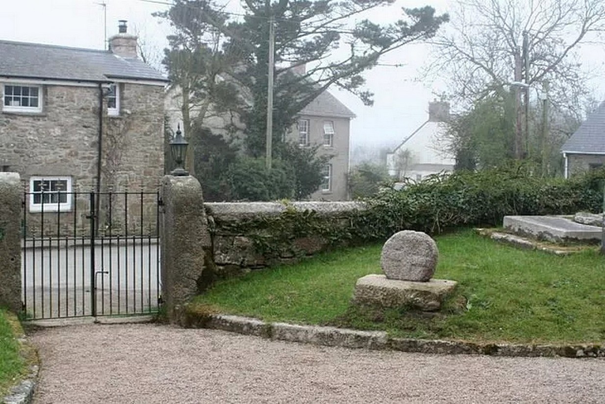
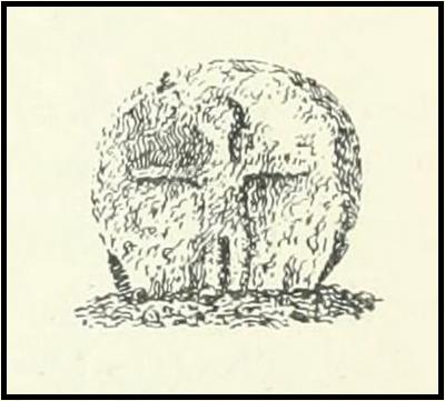
Nice ‘n easy: get into the village and walk through the church gates and there, on your left on the grass verge, a plinth and the cross-head sits before thee!
Archaeology & History
When the great Arthur Langdon (1896) wrote about Crowan’s cross-head, he was puzzled. At the time it was in the garden of a local surveyor in the nearby village of Praze-an-Beeble, but its origins seemed mysterious. The surveyor in question, a Mr William Carah, wrote to Langdon and said,
“It seems a mystery where the cross we have originally came from. A friend of mine, living abroad at present, saw it, I think, at a farm-place, being used as a bottom for a beehive. He asked the people for it, intending to fix it somewhere. At any rate, when he left England he had not done so, and at my request they gave the cross to me.”
The condition of the cross-head wasn’t too good and Langdon suggested it had “received some very rough treatment” – no doubt when it was hacked from its shaft. With his usual precision he gave the dimensions of the cross-head as follows:
“Height, 1 ft. 6 in.; width, 1 ft. 8 in.; thickness: at the bottom 6½ in., at the top 5½ in.
Front. — Part of a small conventional figure of Christ, extending to the knees, at which point the fracture occurred which separated the head from the shaft.
Back. — The remains of a mutilated Latin cross in relief.”
The stone shaft or menhir that once supported this carved head has, it would seem, long since been destroyed.
References:
Blight, J.T., Ancient Crosses and other Antiquities in the West of Cornwall, Simpkin Marshall: London 1858.
Courtney, R.A., The Evolution of the Wheel Cross, Beare & Sons: Penzance 1914.
Doble, Gilbert H., A History of the Parish of Crowan, King Stone Press: Shipston-on-Stour 1939.
Langdon, Andrew, Stone Crosses in West Cornwall, Federation of Old Cornwall Societies 1999.
Langdon, Arthur G., Old Cornish Crosses, Joseph Pollard: Truro 1896.
Holy Well (destroyed): OS Grid Reference – NT 2611 7600
Also Known as:
Bonnington Mineral Well
Archaeology & History
Site shown on 1862 map
If we’d have lived 200 years ago and walked several miles downstream from St Bernard’s Well on the Water of Leith, we would have eventually come across this little-known sacred site, sadly destroyed in the 19th century. It was shown on the earliest OS-map on the south-side of the river, enclosed in a small square building with what looks like two entrances, and what appears to be a covering of the spring on the southeast side. Marked as a chalybeate, or iron-bearing well, this would have obviously have had repute amongst local people and would have worked as a tonic or pick-me-up, aswell as fortifying the blood and a having a host of other benefits.
The Ordnance Survey lads wrote short notes about St. Cuthbert’s Well in the Name Book of 1852-53, where they told:
“A Well Situated at Bonnington. Supposed to have been dedicated to St Cuthbert; about 34 years ago the proprietor repaired the well and at the same time erected a house over it, and fitted it up for Visitors who are charged one penny for a drink. The Water of the well has been analysed by Professor Jameson and Doctor Turner and it was found to Contain Salts of Iron; Soda, magnesia and Lime, also Iodine under the form of Hydrisdate of Potash.”
About the same time as Jameson & Turner’s analysis of St. Cuthbert’s waters, one Dr Edward Schweitzer (1845) wrote one of the most detailed chemical essays on wells, ever!—using Bonnington’s holy well as his primary focus. A near-thirty-page essay found that, along with an excess of iron, the medicinal aspects of the waters were due to the following compounds found, per grains, in each pint of water:
Sulphate of Potassa — 2.46554 gr
Sulphate of Soda — 1.51227 gr
Sulphate of Lime — 6.28816 gr
Iodide of Sodium — 0.00728 gr
Bromide of Sodium — 0.07886 gr
Chloride of Ammonium — 9.49939 gr
Chloride of Sodium — 3.82963 gr
Chloride of Magnesium — 3.12017 gr
Nitrate of Soda — 2.02154 gr
Carbonate of Magnesia — 1.70443 gr
Proto-Carbonate of Iron — 0.05807 gr
Proto-Carbonate of Manganese — 0.01535 gr
Ammonia (united to organic matter) — 0.42285 gr
Alumina — 0.02245 gr
Silica — 0.18651 gr
In 1837, a Mr Robert Fergusson was known to be “the keeper of the Mineral Well, Bonnington,” but much of its traditions and history have fallen outside of memory. The site was soon to become another mid-Victorian ‘Spa Well’, where local people would have to pay for water they had always used as Nature intended. In truth, the waters and its well-house were to become a place where the rich Industrialists could heal their infirm mind-bodies, hoping that the destitution they lacked emotionally and spiritually would be washed away in the sacred waters. But it didn’t last long! What little is known about it historically was best described in John Russel’s (1933) essay on Bonnington in the Old Edinburgh Club journal. He wrote:
“Just where the Bonnington mill lade joins the Water of Leith once flowed St. Cuthbert’s Well, an ancient spring named after the patron saint of the once extensive parish of St. Cuthbert’s, and like the now forgotten mineral well of St. Leonard’s near Powderhall, a relic of a superstitious age. As to when this well was so designated history is silent but it was probably before 1606, when the Leith portions of Bonnington, Pilrig and Warriston were, by the Scots Parliament, included in the Parish of North Leith…
“In May, 1750 St. Cuthbert’s Well was found to be possessed of medicinal properties. The Scots Magazine of that year refers to many persons frequenting it. The Well formed part of a building which included a pump room and a reading room. From advertisements in the periodicals of 1819 we learn that it was open from 6 o’clock in the morning and that newspapers were to be found on the table all day. The tenant also issued handbills headed “St. Cuthbert’s Mineral Well, Bonnington”, giving a chemical analysis of the water and a list of the ailments for which it had been found beneficial. The Well disappeared with the re-construction of Haig’s Distillery in 1857. It now lies beneath the buildings immediately west of the chimney stack of Messrs John Inglis and Sons.”
St. Cuthbert’s feast day was March 20 (Spring Equinox) and September 4.
A half-mile southwest of here could once be seen the waters of St. Leonard’s Well, which Ruth & Frank Morris (1982) erroneously thought to have been this Well of St. Cuthbert.
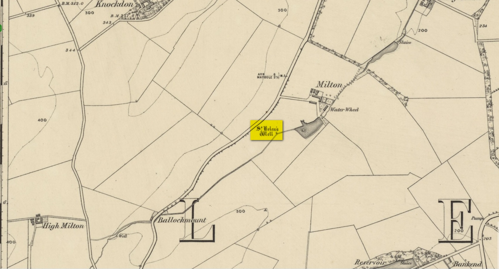
In spite of this site being covered over some time in the 1950s, it is still retained on the modern Ordnance Survey maps. It was shown on the first one in 1860, but its literary history goes back much further. We find it described by the Minister for Maybole — one William Abercrummie — in his short 17th Century work named A Description of Carrict. He noted several springs in Maybole township, with this one of possessing the usual hallmarks of both christian and peasant customs alike:
“Another spring there is called St. Helens well or by a curt pronuntiation St. Emus for St. Antonies well, it is about a myle and ane halfe from Mayboll on the road to Aire a litle north of Balachmont. It is famous for the cure of unthriving children, to which at the change of the quarter especially at May-day there is a great resort of people from all quarters, and at a good distance.”
This piece was repeated in several 19th century works, including one by William Roberston (1891), who commented on the traditions themselves, saying:
“This can unquestionably be traced as a remnant of the ancient superstition that miracles were wrought at Holy Wells; which all the anathemas of the Reformed Kirk could not for a time obliterate from the minds of the common people. The records of the Kirk-session bear witness to the prevalence of applying to Saints’ Wells for the cure of bodily infirmities on stated occasions; particularly, when the Saint or Angel was understood to ‘move the waters.’ Pins, pieces of the dress of the patient, or such small trifles, were left at the well – the remains, no doubt, of the offerings formerly made to the Clergy – and in token that the disease was transferred from the sufferer to the rags, thus offered to the Genius loci. Numerous traces of this prevailing superstition could easily be cited.”
When the Ordnance Survey dudes wrote about the site in the Name Book in 1857, all they could tell us was that it was, “a beautiful spring of excellent water” but was said to have “no medicinal properties.”
Despite this sacred well now being covered over, there is surely a case to be made here for it to be restored back to its former glory, for all to visit and see. Local historians, pagans and Christians alike — join forces and gerrit sorted!
References:
MacKinlay, James M., Folklore of Scottish Lochs and Springs, William Hodge: Glasgow 1893.
This long lost holy well used to be found somewhere on the south-side of the Water of Leith, close to Powderhall, between Warriston and Broughton. References to it are minimal. Whilst Ruth & Frank Morris’ (1981) thought it might have been an alternative name of the Bonnington Mineral Spring—aka St. Cuthbert’s Well—a half-mile to the north-east, we know from John Russel’s (1933) article that it was a quite separate site; but all he could tell us was that St. Leonard’s Well was “a now forgotten mineral well”. The clearest indicator telling of its whereabouts is in John Geddie’s (1896) lovely work on the history of the Leith watercourse, where he described this “forgotten mineral spring” as being below Powderhall “beside the Water”, i.e., the river Leith. A few miles south, a crag at Arthur’s Seat was once dedicated to St. Leonard. (the grid-reference to this site is an approximation).