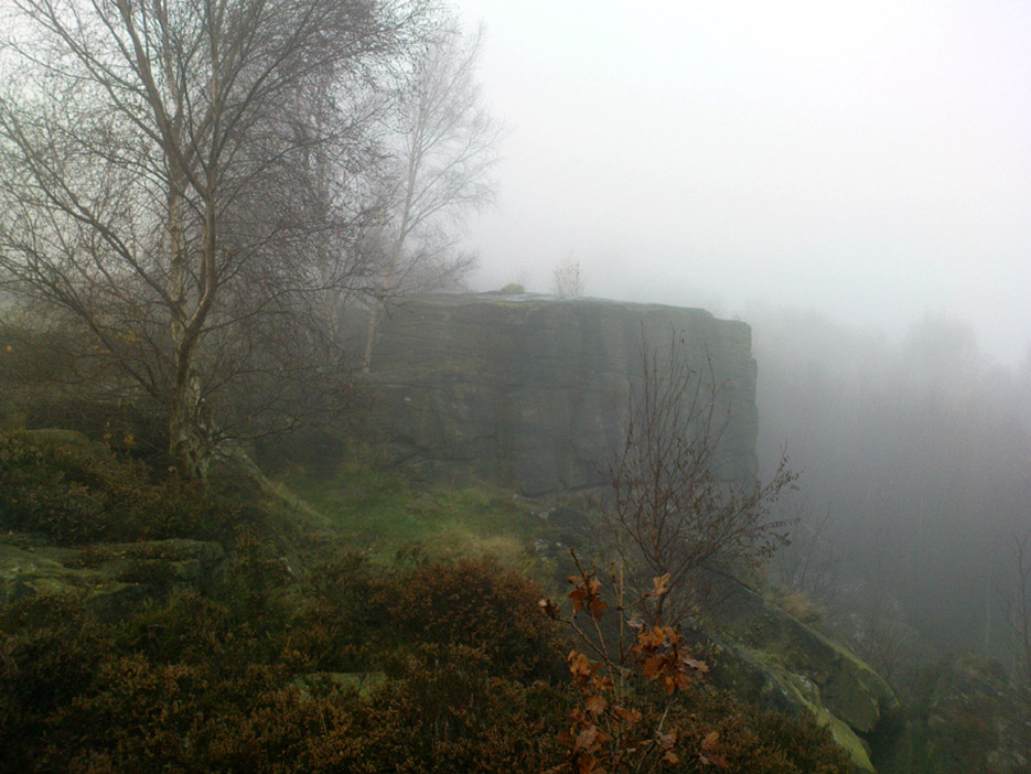
Pretty easy to get to. Best thing to do really, is ask a local and they’ll send you in the right direction. From Bingley, take the Harden road (B6429) across the river. As it bends sharply left, note there’s a track going up into the woods to the right. Walk up it! Keep going and, unless you take a detour, you’ll end up at the rock outcrop eventually (where the woods come to an end, Druid’s Altar appears before you with the track running along its top-side).
Archaeology & History
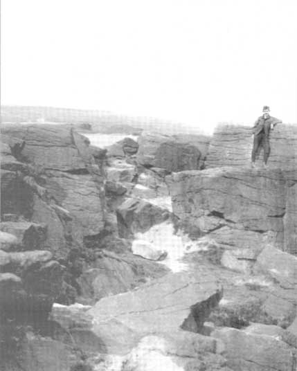
Mentioned in the Tithe Awards of 1849, this lovely outcrop of rocks looking down the Aire Valley on the southern edge of Bingley has “an immemorial tradition” of druidic worship, said Harry Speight in 1898 – though quite when it first acquired such repute is outside of any literary record. In Sidney Greenbank’s (1929) rare book on this place, he could find little by way of archaeological data to affirm the old tradition, save the odd prehistoric find of flints here and there; though it is said that Beltane fires were burned upon the crags here in bygone centuries.
1894 photo of Druid’s Altar (courtesy Clive Hardy)
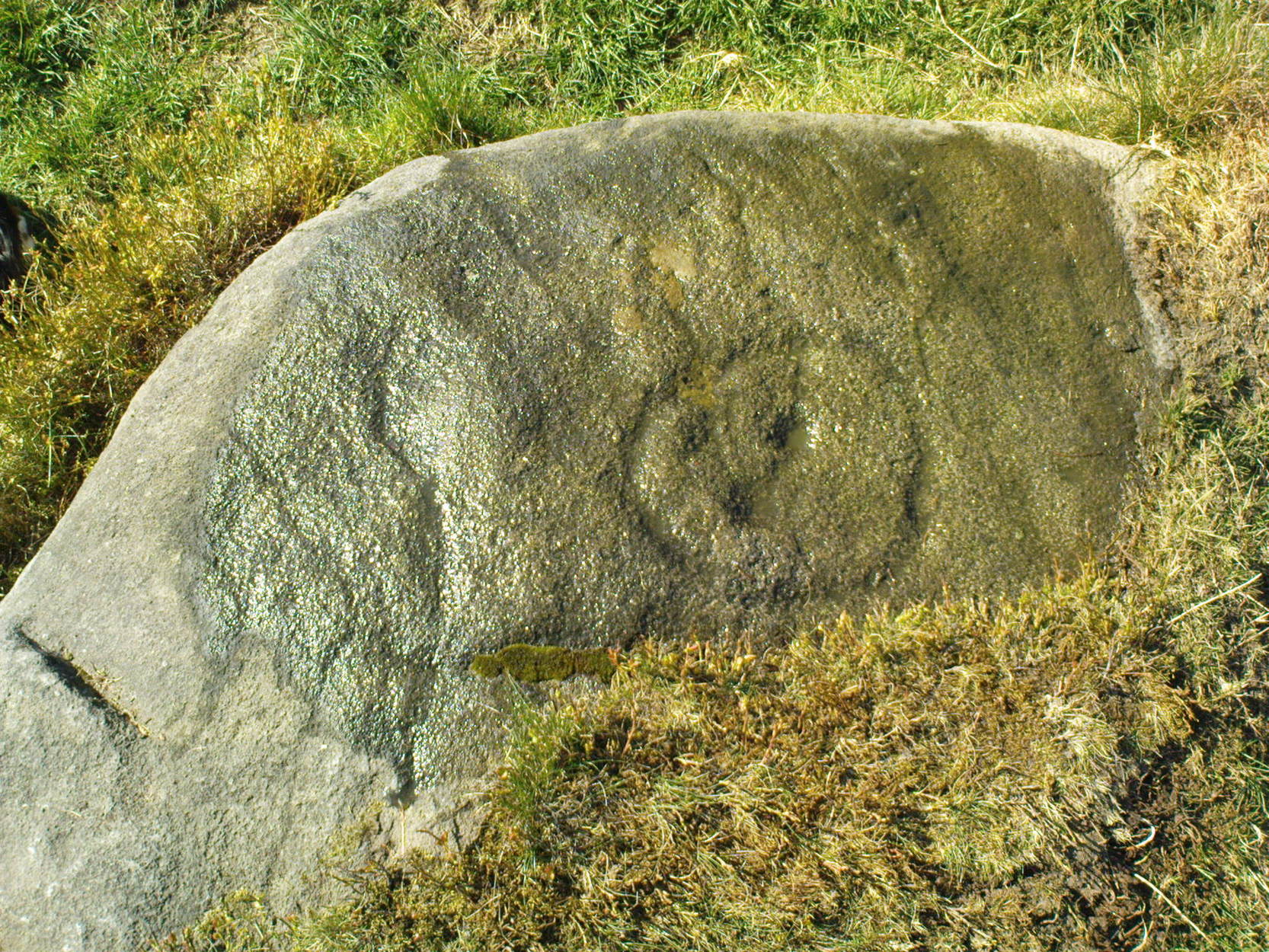
There was a 19th century account from the Ilkley Scientific Club where a member described there being a cup-and-ring carving “near the so-called Druid’s Altar, at Bingley,” but I’m unaware of the whereabouts of this carving and Boughey & Vickerman’s (2003) said nothing about it in their survey; though a possible cup-marking can be seen on one rock less than 100 yards west, which might account for the report. (a bit dodgy though!)
Folklore
Harry Speight (1898) makes what sounds like a rare flight of fancy when he described faerie being seen atop of the many oaks beneath the Druid’s Altar. In Clive Hardy’s (2002) work (from whence the old photo of the Altar is taken), he tells how “local antiquarians say that the cobbled way running from the Brown Cow Inn towards the site, is an old processional route walked by the druids.”
One, possibly two wells, each beneath the Altar rocks, are also reputed to have been associated with the old pagan priests, as their names tell: the Altar Well and the Druid’s Well – though the Altar Well has seemingly fallen back to Earth in recent years.
References:
Greenbank, Sidney, The Druid’s Altar, Bingley, R.G. Preston: Bingley 1929.
Hardy, Clive, Around Bradford, Frith Book Ltd: Salisbury 2002.
Legendary Rocks (destroyed): OS Grid Reference – SE 187 545
Archaeology & History
The original position and nature of this site was difficult to ascertain and left us wondering whether the place was once a monolith, stone circle or legendary rock outcrop, as seemed that there were no remains left of the place. Aswell as that, the only reference we had that describing this place is from William Grainge’s History of Knaresborough (1871), where he wrote:
“At Busky Dike, a place between Cragg Hall and Fewston, according to the report of tradition, there once existed a Druidical altar; and that same venerable authority declares that the same place is the haunt of a Bharguest; and many of the country people yet tremble as they pass that place in the dark, for fear they should meet that strange and terrible beast.”
The latter remark would indicate that something decidely pre-christian was once of renown here. But it seems that an old rock outcrop was the place in question here, found in the now wooded area on the south side of the Busky Dike Road, just northwest a half-mile outside of Fewston itself. It would be good to hear more about this place…if anyone knows owt…
References:
Grainge, William, The History of Harrogate and the Forest of Knaresborough, 1871.
Grainge, William, The History and Topography of Little Timble, Great Timble and the Hamlet of Snowden, William Walker: Otley 1895.
This old stone is another one tucked away, but not too far south of Oban. Take the Kilninver road and keep heading southwest, past Loch Seil. Instead of following the road right, to Clachan and then onto Seil Island, bear left and towards Armaddy Castle. Where the single-track road turns into the woodland towards the castle, the track keeps on into the rocky hills. Keep going for about another 500 yards. You’re nearly there!
Folklore
By the coast just north of Loch Melfort, near the hamlet of Degnish, is the grand old Armaddy Castle. On the other side of the trees from here, to the east, Scottish writer and folklorist A.A. MacGregor tells there to be an old standing stone. In his Ghost Book of 1955, he tells the tale of a local man called Donald MacDougal who, returning home after his day’s work at the castle, crossed over the old burn of Eas nan Caerdach where the standing stone can be found, just past the bend in the track.
On reaching it, Donald became aware of a strange light a short distance in front of him. Thinking at first it was the lamp of his co-worker making for the Home Farm, he walked past the stone – but it wasn’t until he got home himself and found he was alone that he questioned what on earth he’d seen! Upon asking other people in the neighbourhood, it was found that other locals had seen the same light, traversing the land from the old standing stone along the footpath to the farm.
References:
MacGregor, Alasdair Alpin, The Ghost Book, Robert Hale: London 1955.
This lovely little stone is found on Shipley Glen. Walk a few hundred yards up past the Brackenhall circle until, on the right-hand side of the road, you reach the track which leads up the slope to Mitton Springs farmhouse. About 20 yards past the track, cross the road from and near to where the land drops down to the glen below and about 20 yards from the rowan tree, you’ll find this carving on one of the smaller low flat stones. Be patient and look around. You’re damn close!
Archaeology & History
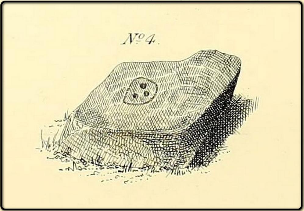
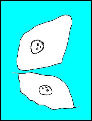
The carving first appears to have been described by the Bradford historian, William Glossop (1888), in his local survey of prehistoric remains here (see his drawing). It’s a cute little thing on a small stone, consisting of a simple large ‘enclosure’ ring with three archetypal cup-markings etched inside. Described by several other local writers since, no other archaeological remains have been found in relation to this carving, making any realistic academic assessment on its nature almost wholly impossible.
(after Hedges, 1968)
References:
Baildon, W. Paley, Baildon and the Baildons (parts 1-15), St. Catherines: Adelphi 1913-26.
Boughey, K.J.S. & Vickerman, E.A., Prehistoric Rock Art of the West Riding, WYAS: Leeds 2003.
Glossop, William, “Ancient British Remains on Baildon Moor,” in Bradford Antiquary No.1, 1888.
Hedges, John (ed.), The Carved Rocks of Rombald’s Moor, WYMCC: Wakefield 1986.
From Askwith village, at the T-junction, go up Moor Lane, taking the left turn up Moorside Lane about half-a-mile up and on the track to Moorside Farm and then onto Top Moorside Farm. Take the path past the farm up onto the moor, then bear right up the small track that heads up onto the small Hollin Tree Hill. As you go up the track, watch out for the small grassy depression to the right; and hereby head into the grasses on your right. You’re close!
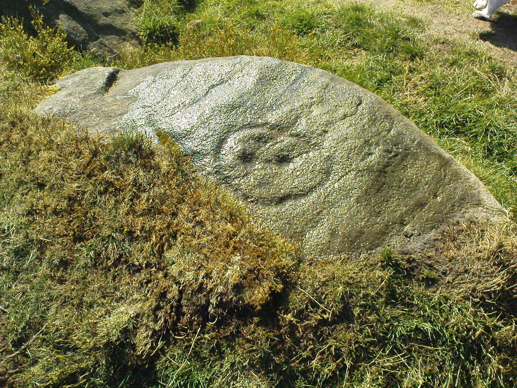
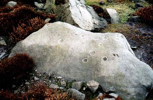
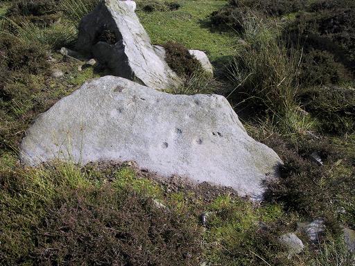
Graeme Chappell was the first to rediscover this carving in the early 1990s when we were up pottering about on these and the adjacent moors, looking for any previously undiscovered prehistoric relics. We found quite a lot! The carving here is nowt special to look at really, but the cups can be seen quite clearly. It’s a rather large stone on the western edge of the hill with at least seven or eight cup-marks carved across its upper surface. Boughey & Vickerman (2003) later described it as “large, fine quartz sandstone rock with surface sloping slightly down into (the) hillside. Seven or eight cups, two particularly sharp.” There’s a possible line running between two of the cups, visible when lighting conditions are right — though we aint sure whether it’s artificial or not.
References:
Boughey, Keith & Vickerman, E.A., Prehistoric Rock Art of the West Riding, WYAS 2003.
To find this, head for the line of old grouse-butts which run north-south, a few hundred yards west of the Askwith Moor Road. Just before y’ get to the one nearest the bottom of the line, frobble about a bit. If by any chance you end up at the Woman Stone carving, walk back up the slope until you’re on the level. Not far ahead of you are the upright stone remains of a grouse-butt. This carving is just a few yards away. You’ll find it.
This was another carving found on one of the many forays of Mr Chappell and I when we were young, sometime in 1993. A short while after, Graeme wrote to Edward Vickerman to inform him of the find, which ended up in their rock art survey a decade later.
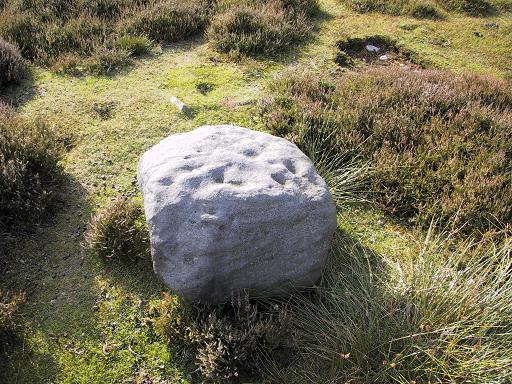
It’s another one of those simple designs: what seems like at least 5 cup-markings on a small rounded rock, with two of them linked together by a groove — possibly natural, possibly man-made — though there may in fact be seven or more cups etched onto its upper surface. It’s difficult to tell. It gives you the impression that its present position isn’t its original one and is suggested by Boughey & Vickerman (2003) to have been “moved from pipeline?” close by. It may even have been dug out and cast here, possibly once being a part of a cairn. In the Boughey & Vickerman survey they give its OS-coordinate as SE 17163 50527 – and describe it as a “medium-sized, free-standing rock of fine grit. Five cups, some perhaps natural.” When Richard Stroud and I visited the site, he found the GPS coordinate was SE 17162 50530; and we have to say that instead of describing it as a free-standing rock, it’s a movable stone (though it’d take a bit of effort), that may once have been part of a larger monument.
References:
Bennett, Paul & Chappell, Graeme, Personal Communication, 1993.
Boughey, Keith & Vickerman, E.A., Prehistoric Rock Art of the West Riding, WYAS: Wakefield 2003.
From Ilkley, head up the road towards White Wells and keep going along the road. Shortly before the road becomes a dirt-track, just over a small stone bridge with gorse all around, there’s a noticeable footpath that runs west onto the moors, going roughly parallel to the wealthy houses by the moorside. Keep going along this footpath and you’ll hit the recently unneeded modern creation of a large sandy trackway (and excessive litter that it’s created) that takes you straight to the curious railings stuck upon some rocks a quarter-mile away. That’s where you’re going!
Archaeology & History
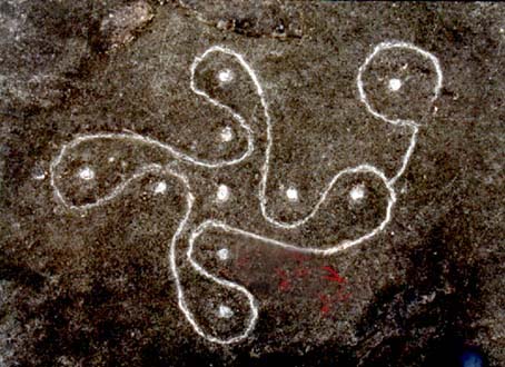
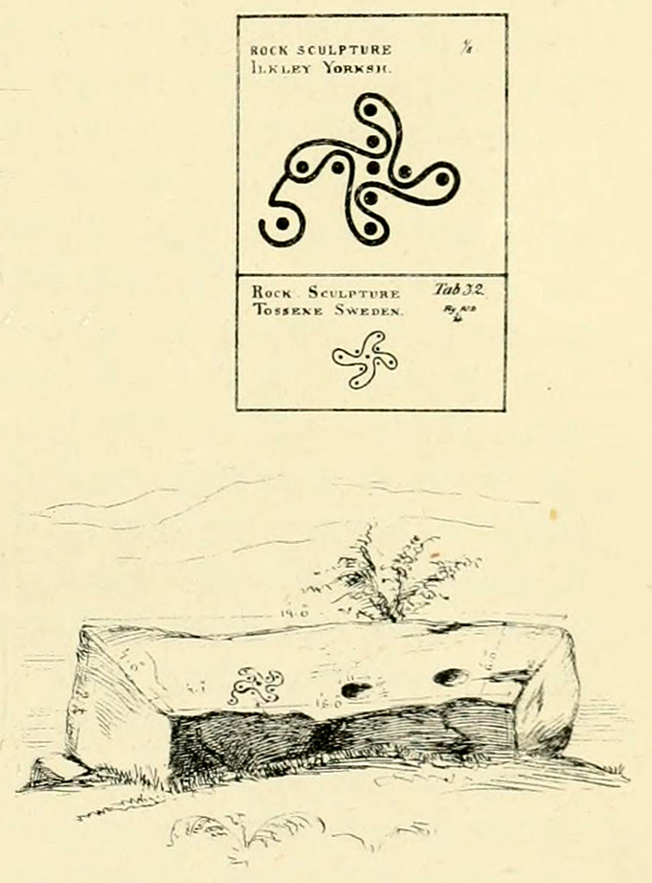
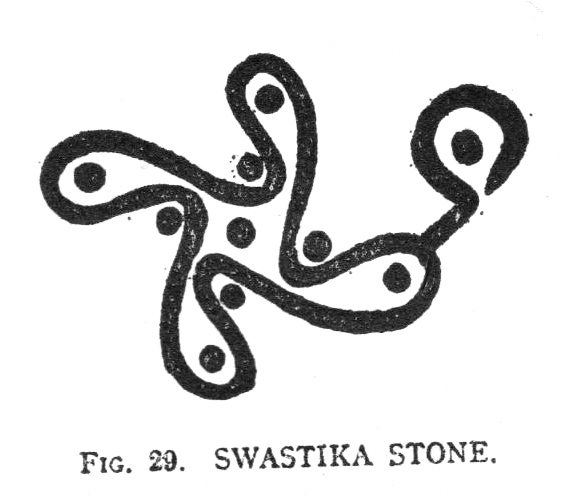
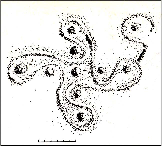
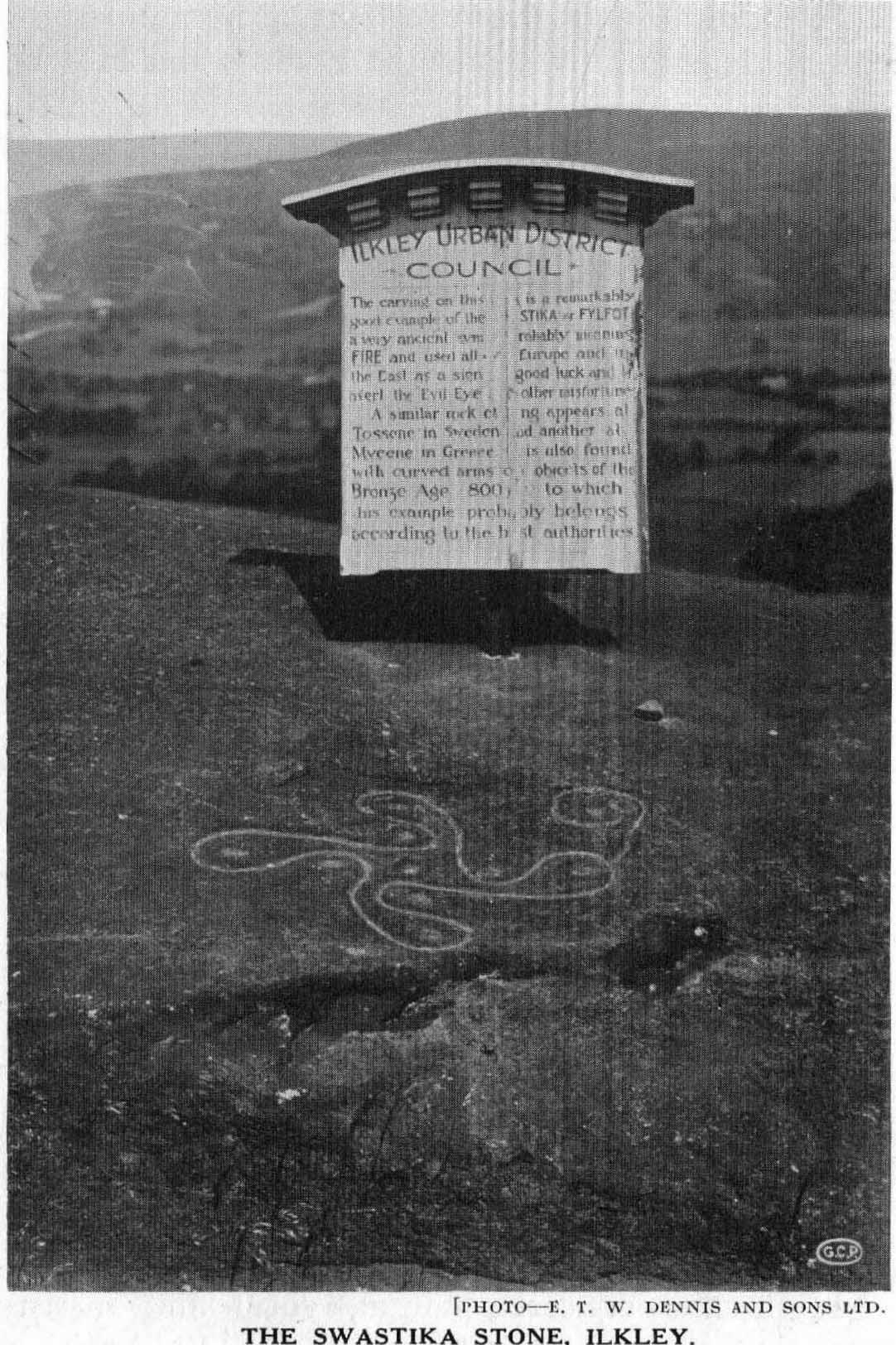
This famous carving was first described as a ‘swastika’ by a Mr J. Thornton Dale around 1880 – and the name seemed to catch on damn quick! The stone had become established with this title at the end of that decade, and seemed immortalized with the name when J. Horsfall Turner wrote about it in the very popular history book he co-authored with the reverend Collyer in Ilkley Ancient and Modern. (1885) By then, comparisons had already been drawn with the acknowledged swastika symbol in Tossene, Sweden, and by the time Harry Speight described it in his colossal Upper Wharfedale (1900), other near-identical European swastika carvings had been found in Valcamonica, northern Italy. (though these lacked the ‘tail’ found on Ilkley’s carving)
J.R. Allen’s drawing of Swastika Stone
Eric Cowling’s sketch of the carving
Earlier images of the swastika symbol can be found in most continents, but the earliest known example appears to be the paleolithic swastika carvings from the Ukraine, etched on pieces of ivory and dating from between 18,000-15,000 BC. Some swastikas have been found carved on mammoth tusks!
Invariably in modern history it is its mythic association of the swastika to certain political imbeciles which troubles many people, but this needs to be set into a much more ancient historical context. The symbol ostensibly relates to sacred notions of the cosmos in all the non-literate cultures where it appears. Numerous surveys by comparative religious scholars isolated the nature of the design many years ago. The Leeds Buddhist, Steve Hart, said that Ilkley’s Swastika Stone:
“to a Buddhist should be a sonorous gatha (a sutra or verse), a plenitude of transcendental boddhisattvic vision. The swirling wheel of the four arms suggests the four realms as experienced by Jains, upanishadic sages and ancient Buddists. They ARE samsara. The samsara is resolved into the nirvana at the hub. The four realms are the human realm, god realm, hell realm and the nature realm. There are no clear delineated demarcations between these realms. All interpenetrate.”
(Images of the popularised ‘modern’ swastika – a huge misnomer – can be found on several church bells in Yorkshire, where they were used as charms to protect against lightning, following in the mythic fashion of Thor. These swastikas date from the 15th century.)
Evan Hadingham’s rubbing of the carving
I first saw this carving when I was 10-years old and it had one helluvan effect on me! I stood and stared at it (or rather gazed, without thought…) for some length of time, knowing that I’d seen this somewhere before* and that it had some considerable importance – though about what, I knew not! The cups in the design align north-south and east-west. The northern line points directly at Simon’s Seat on the northern skyline. The eastern axis points directly at Almscliffe Crag, above which the equinox sun seems to rise from here.
For the real alignment fanatics, check out the alignment from Twelve Apostles to here: on the date of the last major lunar standstill (occurrent every 18.6 years), the moon set over the cairn at Lanshaw Lad. It wasn’t until I got home and checked the extension of this moonset line, that I realised if you follow it further along the course, you hit the Swastika Stone bang on! Though this is probably just a coincidence (we do have hundreds of cup-and-rings on these moors, so it’s bound to hit one or more of them).
The Swastika in 1930, with info-board
In this Swastika Stone, the curious single ‘outlying’ cup-and-ring at the edge of the four spiralling arms is very probably the point from which the four-arms originated and not the other way round. In traditional cultures and early cosmogenic patterns the world over, the cosmos itself emerged from the ’round’, the singular, the point, or uroboros — and this is what this Swastika Stone appears to represent here: the cosmos emerging from the singularity, giving birth to the world and the four cardinal points. Such an element is a simple one and is found in Creation myths the world over. (For those of you who aint into using psychedelics at sites, a good overview of this idea is in Erich Neumann’s Origins & History of Consciousness [although there’s no reference to this symbol] and which should be read by anyone pretending an interest in the nature of the archaic mind. It’s a good work on the psychology of the Dreamtime.)
As some local Ilkley folk are probably aware, a copy of the Swastika Stone carving was executed in the latter-half of the 19th century, probably by a local chap called Ambrose Collins, not far from the original swastika at the edge of the woodland. Some images and a brief history of this copied swastika and associated cup-markings will be published in due course on the Rombalds Moor Project website.
Other important cup-and-ring petroglyphs that are worth visiting on the moor with unique carved symbols in them include the Hanging Stones, the Idol Stone, Haystack Rock, Badger Stone and many many more.
Note:
A fella who used the pseudonym of ‘Pad’ suggests that the carving is only a few centuries old, and compares it to other much more recent etchings on these moors, where the erosion has been of no greater or lesser force. The suggestion has been made about other carvings on these moors and whilst I have an open mind about this, if this is the case, we would have to relate the same reasoning to countless other carving on these hills. In which case, a great deal of cup-and-ring art would have to be redesignated as medieval in nature.
References:
Bennett, Paul, The Old Stones of Elmet, Capall Bann: Milverton 2001.
Boughey, Keith & Vickerman, E.A., Prehistoric Rock Art of the West Riding, WYAS: Wakefield 2003.
Collyer, Robert & Turner, J. Horsfall, Ilkley, Ancient and Modern, William Walker: Otley 1885.
Cowling, Eric T., Rombald’s Way, William Walker: Otley 1946.
Hadingham, Evan, Ancient Carvings in Britain, Garnstone: London 1974.
Hedges, John, The Carved Rocks on Rombalds Moor, WYMCC: Wakefield 1986.
Pennick, Nigel, The Swastika, Bar Hill: Cambridge 1980.
Speight, Harry, Upper Wharfedale, Elliott Stock: London 1900.
Wilson, Thomas, The Swastika – The Earliest Known Symbol and its Migrations, Smithsonian: Washington 1896.
* although I’d never seen the carving before, I had of course seen its archetypal manifestation in the shapes in Nature: spiral galazies, polar rotation (I was a budding astronomer as a kid!), hair growth from the crown, petals, swirling clouds, etc, etc. The Swastika, as we know, is representative of the creative spark itself: the life-essence, emerging from the centre and manifesting itself in the four worlds, which are its emergent arms.
Links:
Reclaim the Swastika – A fine website which is into doing just what it says on the tin!