Shorey Well, Burnley, Lancashire

Healing Well:  OS Grid Reference – SD 844 330

Also Known as:

  1. St. Audry’s Well
  2. Whitaker’s Well
  3. Whittaker’s Well

Archaeology & History
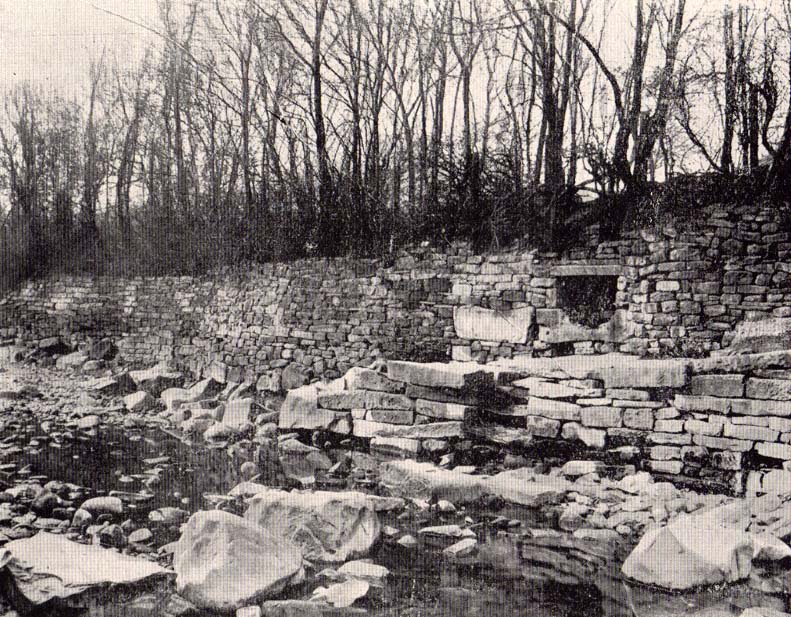
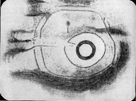
Shorey Well, Burnley (T.Ormerod, 1906)

Recently a good turn of fortune has brought about the discovery of a number of previously unpublished manuscripts detailing a number of prehistoric remains, holy wells and old stone crosses that existed in and around east Lancashire, Burnley, Cliviger and Todmorden.  Many of these papers are the all-but-lost writings of historian and antiquarian Clifford Byrne of Nelson.  Having never previously been published, I think his works deserve greater attention and so I’ll be slowly, gradually, sticking them on the internet and give them the wider audience they deserve.  Not all of his notions are necessarily accurate, but the extent of this mans local history knowledge on the sites he describes in his essays is considerable.  The following is his short essay—with minimal editing—on this all-but-forgotten site:

“Shorey Well, or rather its stone housing, was originally situated in the bank of the River Brun slightly upstream of the parish church at Burnley, at a spot now within the grounds of the Burnley Technical College.  From within the stone housing issued the spring proper, which then ran down the brookside into the river.

“From time immemorial until the late 19th century, Shorey Well supplied part of the town of Burnley with its drinking water, then the water was impounded into a pipe and the stone housing removed to a place of safety.  This housing was thought by our Victorian forebears to have sufficient merit to save it for posterity, and this act I feel implies more than a certain interest in the old stones which I suggest the movers of the Well probably did not themselves fully understand, and it is with this concept that I hope now to deal.

“The present location of the stones of Shorey Well is in the little triangle of greenery outside Prestige Ltd at Burnley.  This spot is bounded on Colne Road and Bank Parade.  Behind it squats the base of Burnley Market Cross and the remains of the stocks with — a little to one side — the shaft of the Godley Lane Cross standing out of a huge square pedestal.

“An old map in Burnley Library shows Shorey Well in situ with a well-defined row of stepping stones crossing the river directly in front.  This line of stones went to the site of a still existing property called Shorey Fold — a spot that was probably once called St. Audry’s Fold, as we shall see.

“Godly Lane Cross is an Anglo-Saxon monolith with a somewhat damaged head.  This damage was probably done around the time of the Reformation in the 16th century, when the anti-Catholic movement was at its height.  The name Godly implies a god-like, or god-inspired or religious tone to the area, and Godly Lane — now Ormerod Road — certainly lived up to its name for there stood the parish church, the Cross itself, the Market Cross, another cross dedicated to a priest in the 16th century and now standing in the rear of Townley Hall, “Foldy’s Cross”, with nearby Shorey Well.

“There is a strong possibility that the Godly Lane Cross — sometimes called the Paulinus Cross — was a preaching cross and that it also marked the way to Shorey Well which issued close by.

“No one to the knowledge of the writer has attempted to explain the name Shorey Well.  I therefore suggest that the Well was used for baptism and that it was dedicated to St. Audry.  The parish church was erected prior to the Reformation and thus certainly had its Holy Well close by, from which the priests obtained water for baptism and blessings, etc.  Because of its propitious nature and close proximity to the church, such a Well would almost certainly have been the Shorey Spring.

“A study of the name may be fruitful.  Holy wells are almost always dedicated to some christian saint.  However, many of them have undergone a slight change in name over the centuries, so that it is not always easy to recognise the dedication.  For instance, the Ransible Well near Colne was dedicated to Our Lady of Ransome, or the Virgin Mary; Stellern Well was dedicated to St. Helen; Maudlin Well near Lathom House was dedicated to St. Mary Magdalen; Pewter Well at Sabden  would be St. Peter’s Well; Mattus Well at Sawley Abbey is St. Matthew’s Well; whilst Cooks Well at Colne was surely dedicated to St. Luke the physician.  Thus Shorey Well in the same context is almost certainly dedicated to St. Audry, and this saint we find was one of the most revered saints in Anglo-Saxon times, from which date the Godly Lane Cross stems.

“The close proximity of church, well and cross surely imply that one showed the way to the other, and that all three were at one period of time one unit: the Cross being a preaching place prior to the Church, and the holy well being a place of baptism and healing.”

Mr Byrne’s etymological reasoning may or may not be right here (Mr Ekwall says nothing in his place-name survey and I’m unaware of local dialect analysis that may account for the word), but the description of this and numerous other lost and forgotten sites in his various papers is hugely worthwhile and is a source of considerable study for us over the coming months.

Ormerod (1906) described the site in his tome, but even in his day this once great well with its “abundance of sparkling water” was “disused and neglected.” (the image above is taken from his work) However, as if to dispel any notions of an earlier saintly dedication, we find that in Walter Bennett’s (1948) magnum opus, the site had a more prosaic title in bygone years:

“Whittaker’s Well, or Shorey Well as it was later known, was situated on the riverbank opposite Dawson Square, and was apparently the only public source of drinking water for the inhabitants of tge Top o’ th’ Town.”

References:

  1. Bennett, Walter, The History of Burnley – volume 3, Burnley Corporation 1948.
  2. Byrne, Clifford H., “A Short Study of Shorey Well, Burnley,” unpublished manuscript 1976.
  3. Ormerod, T., Calderdale, Lupton Bros: Burnley 1906.

© Paul Bennett, The Northern Antiquarian 


Coffin Stone, Sabden, Lancashire

Standing Stone:  OS Grid Reference – SD 7717 3830

Getting Here

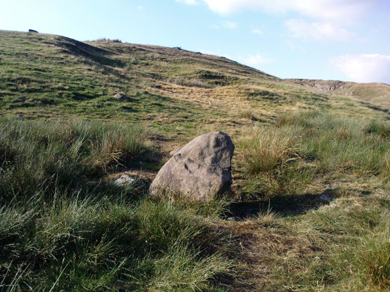
From Sabden village, walk up the Clitheroe Road towards the hairpin Nick o’ Pendle, but take the turning left 100 yards before the Nick.  Walk along the dirt-track for less than 100 yards, watching for the small upright on the right-hand side of the track. You can’t really miss it!

Archaeology & History

The Coffin Stone

To be found on the far southern flanks of Pendle Hill, the Lancashire writer and historian, John Dixon,* brought us to this little-known stone a few days back — and gave us the history of the place. (Dixon 1993)  He pointed out how it’s situated right alongside the legendary cross-Pennine prehistoric route that was labelled ‘Rombald’s Way’ by Eric Cowling. (1946): an important trackway which ran from coast to coast, allowing for the passage and transmission of flints, salt and early metals carried for barter and other uses.  What may be another standing stone is on the nearby skyline a couple of hundred yards east; and on the slopes either side of here are the prehistoric tombs of Jeppe Knave Grave and the Devil’s Apronful (amongst others).  A fine little standing stone!

Folklore

The name derives from it being a place where, in bygone days, when coffins were carried along the ancient routeway hereby, it was rested by this stone.  As John Dixon (1993) told:

“It was used to mark a resting point for coffins en route from Pendle Forest to Whalley, allowing the mourners to refresh and pray by the curative Marion well, in a time before the ‘Newchurch’ of St. Mary was established at Goldshaw Booth in 1544.”

…and from another angle

The Marion Well he mentions is more popularly known as Our Lady’s Well and can be found a hundred yards up the hillside above our Coffin Stone.  If you walk up the slope you’ll see the site emerging where a small boggy pool appears on the hillside, and the course of the small stream marked by the reeds growing down the grassy slopes.  Although it became very much a Roman Catholic practice to venerate the Virgin Mary by this old well, the ritual was of course a much older heathen one.

John has also reminded me to mention “the fossil markings on the side of the stone – some plant from a former age” which you can see curving up from the bottom of the upright.

References:

  1. Cowling, Eric T., Rombald’s Way: A Prehistory of Mid-Wharfedale, William Walker: Otley 1946.
  2. Dixon, John, Journeys through Brigantia – volume 9: The Ribble Valley, Aussteiger Publications: Barnoldswick 1993.
  3. Dixon, John, Pendle – A Mythic Landscape, Aussteiger Publications: Barnoldswick 2010.

* John is the author of many fine historical travel guides, including the Journeys through Brigantia series. See the titles in the Lancashire Bibliography and Yorkshire Bibliography for a more complete listing of all his books to date.  If you wanna buy any of his works, or make enquiries regarding them, email John at: lancashirebooks@fsmail.net – or write to him direct, at: John Dixon, Aussteiger Publications, 21 Lowergate, Clitheroe, Lancashire BB7 1AD.

© Paul Bennett, The Northern Antiquarian

Tobar na Cailleach, Keith, Banffshire

Sacred Well:  OS Grid Reference – NJ 42659 47528 

Also Known as:

  1. Cailleach Well 
  2. Tobar Chailleach 
  3. Well of the Cailleach

Folklore

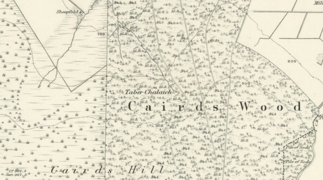
Cailleach Well on 1869 map

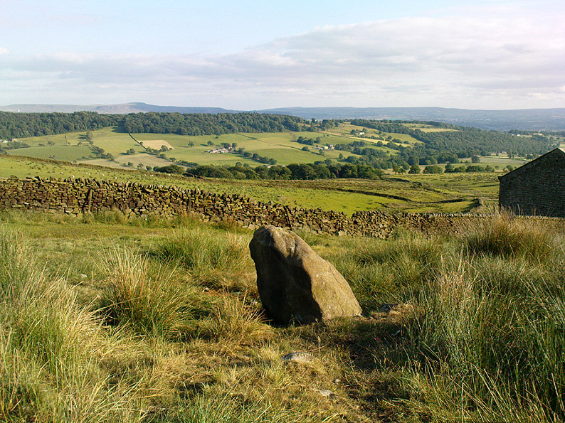
Described on the earliest OS-map of the region as Taber Chalaich, this great “well of the old woman, witch, or hag” is found on the northern slopes of Cairds Hill, amidst increasingly dense woodland up the top of the stream which ebbs and flows in strength (depending on the weather).  A water source dedicated to the prima mater Herself — i.e., the heathen pre-Celtic female creation deity par excellence — it was once of considerable repute locally and was known to cure various ailments.  It was described by Ruth and Frank Morris (1981) as being,

“the scene of a pagan ceremony in which the Earth Mother in her old woman phase bathed at the well and returned as a young maiden.”

Tobar na Cailleach
(21st Century Pict)

This tells us that rites were enacted here around Imbolc (February 1-2).  The well can still be found running.  A visit to the site in July 2025 by Pol Anndrais found that “the East Side of the pool has been dug out and the rocks used to dam the outlet. The pool is roughly square, about 2 metres across.  The inlet is over natural rock visible beneath the surface, the pool is about 1 metres deep and reasonably clear with pond skaters and diving bettles, (but) no visible offerings…”

On the hill at the top we find remains of old tombs (mistakenly ascribed by Mr & Mrs Morris as ‘stone circles’), some of which may have had some mythic relationship with this legendary water source.  If anyone has any further information about the folklore or history of this site, we’d love to know about it.

References:

  1. Morris, Ruth & Frank, Scottish Healing Wells, Alethea Press: Sandy 1982.

Acknowledgements:  Huge thanks to Pol for the info on the site’s condition + the ‘21st century Pict’ for the photo.

© Paul Bennett, The Northern Antiquarian

St. Agnes’ Well, Cothelstone, Somerset

Holy Well:  OS Grid Reference – ST 183 318

Folklore

In this lovely little hamlet we find an ancient well, registered as a scheduled monument in its well-house, but with a long history and lots of legends. It was said to have been a wishing well of considerable power, but many local people wouldn’t use it because it was also the place where mischievous pixies lived. It seems that one of its main magical properties was to divine the love of a person. The writer Ruth Tongue (1965) told a long tale she came across in her county folklore book about such a fortune:

“There was a maid servant, see, and she were coming on in years and she do serve a farmer’s wife as were high in station. Proper tackalackey she made of the dear soul, and she having no living kin. Twas pitiful, and her a-longing for a parcel of children underfoot, even if ’twas only to call her Auntie. But there, ‘twadn’t to be, and her with a heart so full a-drip with loving kindness as a honey comb. Oh, she were a proper mannerly maiden, no ways like her mistress who were just a old ewe dressed up lambs fashion and spending her days living two-three steps from nothing. But it didn’t seem like the maiden couldn’t never meet up with a proper man for her. She wadn’t no summer morning to look at, poor soul, and her mistress kept her so thin as a yard of pump water. But there Providence knows best! There were a old fellow over by Aisholt, and he were such a upstanding courageous man he’d a never got round to marrying, let alone finding the bravery to walk arm in crook with a maiden. Well o’ course he were lonely like she. And it come to a St. Agnes Eve when maids creepy over to her well at Cothelstone and whisper their heart’s desire when ’tis dark, and if St. Agnes do fancy the maiden she’ll send a husband that year. Now the poor maid she were coming to the end of her days of womanhood and beginning to blossom about the head, and she were desperate unhappy about it. Her heart was all a-set on children, and she find bravery to slip out after farm’s a-locked up. She didn’t feel ’twere mannerly to worrit St. Agnes over one who was so on in years when there was young maidens as plentiful as blackberries, so what do the dear soul do but go down all in the dimmit to the Wishing Well in Seven Wells Coombe. Proper unket well ’tis, and hard tew find. But St. Agnes must ha’ knowed, for she found’n though there wadn’ but little moon and old fellow he d’hear summat down in coombe and come to look-see. He were a wise old man and nothing hurted he, but he were shy of folks, seems like. Well, whether ’twere St. Agnes I can’t say, but in a year the farm was sold up and the maid was a-wed to the old fellow. So quiet as a sheep the man was, wouldn’ downarg no-one, but he made her a good husband. In a year or two she’d a babe in the cradle and one under her apron, and two clinging to her skirts, and they was all so happy as daisies in the sunshine, as they say.”

References:

  1. Tongue, Ruth, Somerset Folklore,FLS: London 1965.

© Paul Bennett, The Northern Antiquarian

Goff Well, Keighley, West Yorkshire

Healing Well:  OS Grid Reference – SE 06149 38822

Getting Here

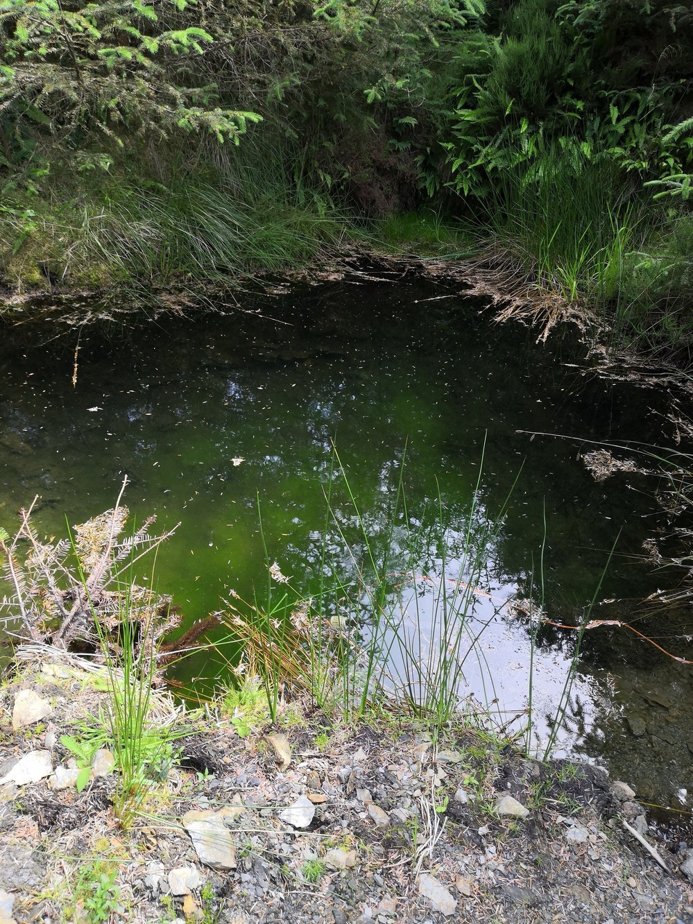
Goff Well is by the Elder tree in the middle

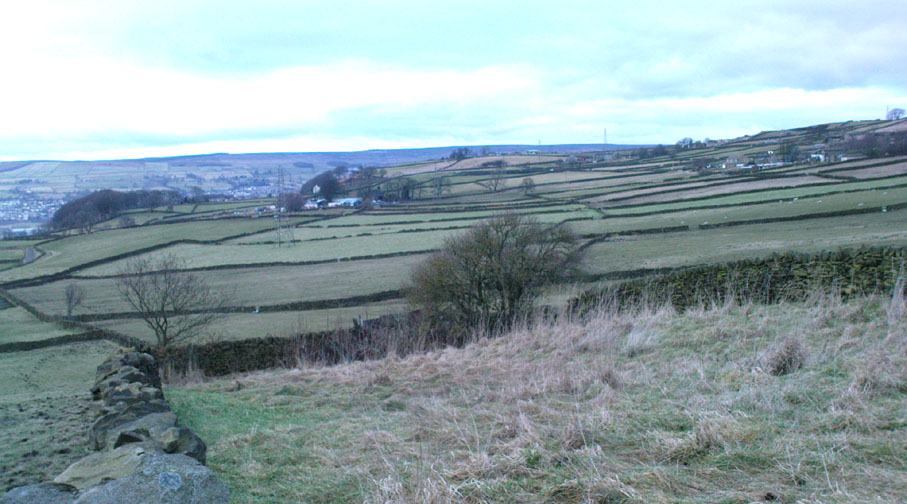
Various ways here. From Keighley, go up the A629 Halifax Road, first left after the Ingrow West train station, uphill; then turn right, and up the long, cobbled, zizaggy road past the little hamlet of Hainworth and uphill till you reach the solitary farmhouse of Goff Well Farm (where its friendly owners can sell you organic fresh eggs!).  It’s the field just before here on your left (if you reach the Guide Inn pub further uphill by the crossroads, you’ve gone too far). Alternatively start at the Guide Inn pub and walk across the road and downhill till you reach the farm. It’s in the first field on the right just past it.

Archaeology & History

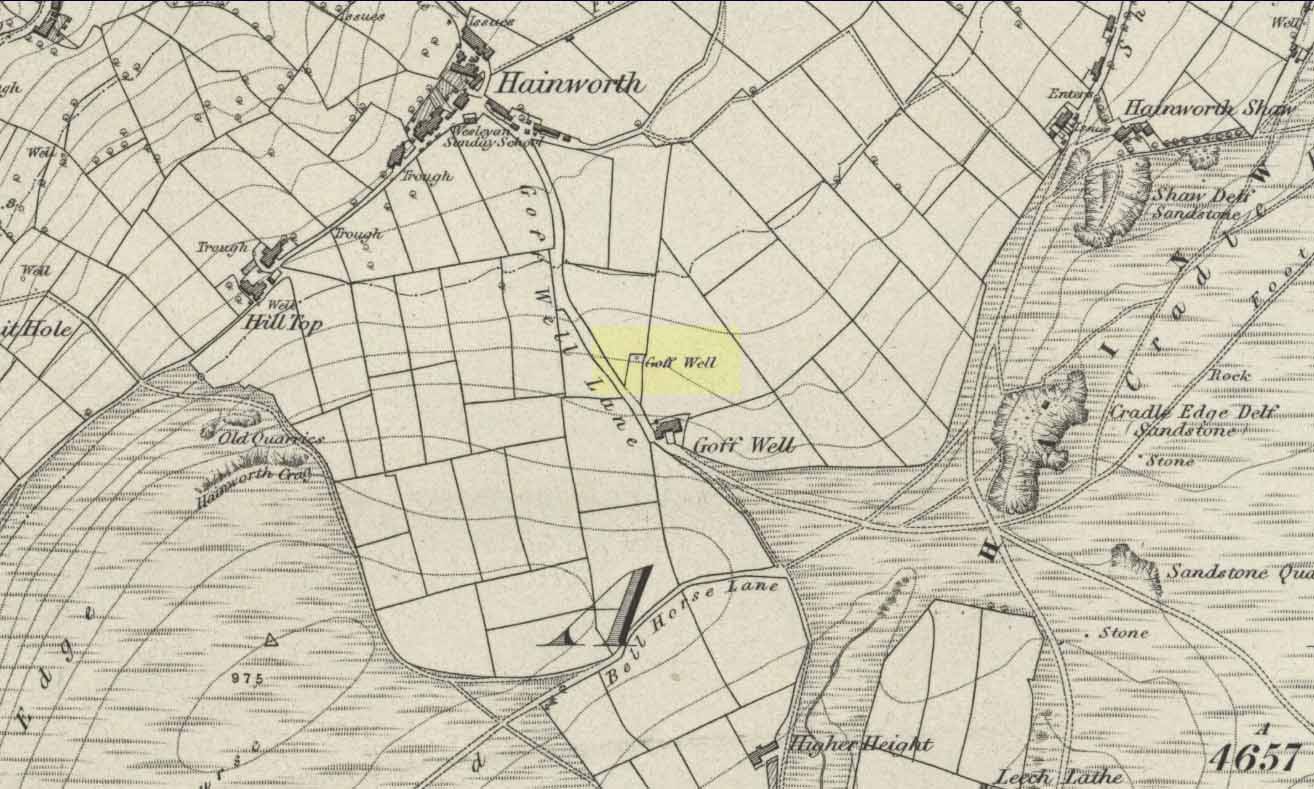
Little is known about the history of this water source.  The first description of it seems to be in 1852.  Harry Speight (1898) mentions it briefly when he talks about the holy wells of the locale, saying simply:

“Goff Well, close to the road on Harden Moor leading to Hainworth, has given name to a neighbouring farm, but the purpose or virtues of this water are not now known.”

Goff Well on 1852 OS-map

Today the well is much overgrown and in need of attention.  It’s near the bottom corner of the field where the larger of the elder tree grows (the witch’s tree par excellence) and could do with being cleaned out.  When the owner of Goff Well Farm, Barry, took us to see the site, the waters couldn’t be seen but we could hear the water running clearly just beneath the surface, so it just needs a few hours work to bring it back into life.  Twouldst do the land and the genius loci the world of good!

The very name of the well is something of an anomaly.  There are several possibilities and we (as yet) cannot say which is the more likely derivation.  We know in northern dialect that Goff is a simpleton or fool, and although we can apply that definition in some cases, it’s unlikely to apply here.  If we could ascertain there was ever an apple tree growing here, the mystery would be solved, as a goff was an old word used for the common apple.  In West Yorkshire dialect the word was also used to denote “a hammer worked by water-power”; aswell as it being a corrupted form of the word ‘God.’  Take your pick!

Folklore

The early Victorian historian William Keighley (1858) thought Goff Well was named after a long-forgotten hermit called Goff who, at some time in the past, gave his name to the old hamlet of Hermit Hole, a half-mile downhill from this water source.  Mr Keighley wrote:

“On the skirts of Harden Moor is a farmhouse known by the name of Goff Well; and as goff is said to be the Danish word for red, it would probably be no great stretch of the imagination to suppose that the hermit was so named on account of his red hair, and the spring or well designated after him from the frequency and sanctimonious nature of his visits.”

But this is pure supposition on Keighley’s part — nice idea though it is!  The only tangible piece of folklore we have is that the well “was a famous resort of gypsies before the moor was enclosed in 1861.” (Speight 1898)

References:

  1. Keighley, William, Keighley, Past and Present, Arthur Hall: London 1858.
  2. Speight, Harry, Chronicles and Stories of Old Bingley, Elliott Stock: London 1898.

© Paul Bennett, The Northern Antiquarian

Holy Ash Well, Bradford, West Yorkshire

Holy Well (destroyed):  OS Grid Reference SE 15942 34208

Also Known as:

  1. Ash Well
  2. Holy Well Ash Well
  3. Pin Well

Archaeology & History

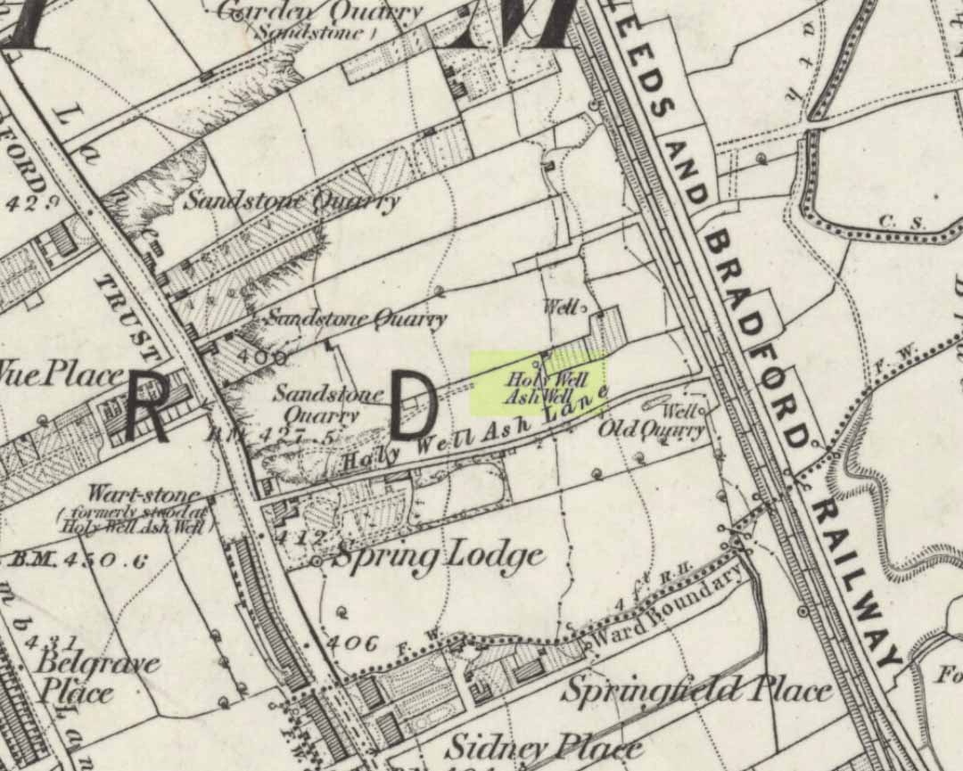
Holy Well Ash on 1852 map

Either right next to, or perhaps now beneath Bradford City’s Valley Parade football ground, was once a very important sacred well site.  Known as the Holy Ash Well and variants thereof, this healing spring was of considerable renown to people all around Bradford district in bygone days.  The site was illustrated on the 1852 OS map, and there was also a sacred stone adjacent to the well known as the Wart or Pin Stone, which had some animistic healing properties related the waters.

The old well was described by local historian Abraham Holroyd (1873) who said that:

“In Manningham Lane there is a fine well, in old deeds called Hellywell, i.e., holy well, in a field now called Halliwell Ash, now a stone quarry… Near this is the ancient Pin Stone.”

A few years later, in Robert Charles Hope’s (1893) monumental study, he described how,

“This holy well, not far from Manningham Lane, probably derived its name from having at some time been dedicated to some saint.  The inhabitants of Bradford were wont in ancient times to resort on Sundays to these wells as a common place of meeting, to drink of the waters and partake of their preternatural virtues.”

Which was another was of saying that he didn’t really know too much about the place!

The Bradford historian William Preston (1933) described this site in one of his early essays, where he informed us that local people knew the accompanying rock hereby as the Ash Stone, due to its proximity and ritual relationship to a great old ash tree (Fraxinus excelsior) that grew next to the well.  The mythic history of this particular tree should not be understated: it was a Creation deity par excellence in northern and Viking myths, but whatever old tales and power might once have been had here, in Bradford, they’ve long since been forgotten.  But it was the industrial historian William Cudworth (1896) who told the most of this all-but forgotten site, saying:

“On the sloping ground between Belle Vue and the Midland Railway there once existed a spring of water, supposed to have preternatural virtues. The name it bore within present recollection is probably a corruption of Holy-well. The holy wells of England as elsewhere had not all the same virtues attached to them. Some were blessed if used for baptisms, to others were attributed curative properties, especially for sore or weak eyes, while others were supposed to possess mystical powers, insomuch as any article dipped in them became charms or safeguards against witchery.  Any traditions associated with the spring at Halliwell (or Holywell) Ash are lost, but certainly in the early part of the present century the place was a favourite resort of the townspeople on Sundays.

“The derivation of the name is doubtful. In the survey of 1638 a close called ” Helliwell Ash” is mentioned as containing 2a. 3r. 26p., but without any indication as to its locality. The spelling of the name is of little moment.  Mr. James, in his “History of Bradford,” states that he had seen the place referred to in old deeds as “Helly-well.” By his will, dated May, 1685, Thomas Lister, of Manningham, devised to his two daughters, Juliana Lambrecht and Elizabeth Stapleton, equal shares in two closes of land called “Holywell Ash” and ” Delf Close,” besides other lands in Manningham. In the will disposing of the possessions of Juliana Lambrecht, her moiety of “Holywell Esh” was bequeathed to Francis Stapleton, her nephew.  In due course the lands in question were inherited by Francis Sharp Bridges, and have latterly belonged to Sir Francis Sharp Powell, M.P., in whose writings the form of spelling is given as ” Halliwell Ash.”

“Upon the ground in question there used to be a fine well of water issuing out of the higher ground, to which tradition assigned healing virtues. Might not the name of “holy” come from this circumstance?  Sufficient importance attaches to the tradition, however, to have led the farmers of the recent ordnance plan of Manningham to preserve the name, although the widening of the Midland Railway below Thorncliffe Terrace has almost obliterated the site.”

A more recent updated overview of the site was written by one of my old school-mates, Dave Pendleton (1997), who said of the place:

“Prior to 1886 the only feature of any real note in the Valley Parade environs was a holy well that emerged near the corner of the football grounds Midland Road and Bradford End stands; hence the road Holywell Ash Lane. Today the site of the well is covered by the football pitch.

Only the road name survives as a reminder of what was apparently one of the district’s foremost attractions. On Sundays and holidays people would gather to take the waters and leave pins, coins, rags and food as offerings to the spirit that resided in the waters.

Accounts suggest that the well was covered and had a great ash tree standing over it (hence ‘holy ash’). There was also a standing stone called the wart stone of unknown antiquity. The stone had a carved depression that collected water. It was believed that the water was a miraculous cure for warts. Indeed, as early as 1638 the Holy Well had been credited with healing powers.

The well suffered a decline in popularity during the late nineteenth century and its keepers resorted to importing sulphur water from Harrogate, which they sold for a half penny per cup. The well disappeared under the Valley Parade pitch during the summer of 1886 and the wart stone was moved to the top of Holywell Ash Lane – which then ran straight up to Manningham Lane. The stone was still there as late as 1911 but thereafter it seems to have disappeared into the mists of time.”

A night-club adjacent to the Valley Parade football ground—called Bibby’s—was said to have had an old well in its cellar, which the owner of the place, Mr Pearl Gladstone Minott, said was ‘haunted’.

Unfortunately I’ve not been able to find any old photos or drawings of this lost holy well – though I imagine that some local, somewhere must be able to help us out with this one.  Surely there’s more of this site hidden away somewhere….?

References:

  1. Bennett, Paul, The Old Stones of Elmet, Capall Bann: Milverton 2001.
  2. Cudworth, William, Manningham, Heaton and Allerton, W. Cudworth: Bradford 1896.
  3. Holroyd, Abraham, Collecteana Bradfordiana, Saltaire 1873.
  4. Hope, R.C., The Legendary Lore of the Holy Wells of England, Elliot Stock: London 1893.
  5. Pendleton, David & Dewhirst, John, Along the Midland Road, Bradford City AFC 1997.
  6. Preston, W.E., ‘Some Bradford Holy Wells’, in Bradford Antiquary, volume 7, 1933.

© Paul Bennett, The Northern Antiquarian 

St. Helen’s Well, Holbeck, Leeds, West Yorkshire

Holy Well (destroyed):  OS Grid Reference – SE 295 329

Archaeology & History

In the Holbeck area of Leeds, one of the three spa wells was previously patronised to this mythical saint, whose wells profuse in this part of the world.  St. Helen’s Well (later becoming the Holbeck Spa Well) was found at the appropriately named St. Helens Bridge.  Ralph Thoresby (1715) wrote of the place: a supposed medicinal holy well, it previously had a chapel by it, of which no trace is seen today. John Mayhall (1860) also mentioned this “medicinal well,” but told little more. It was Andrea Smith (1982), more than a century later, who wrote the most about the place:

“In connection with the well by St.Helen’s Bridge, Holbeck, (Thoresby) refers to “another ancient fabrik called St. Helen’s,” but there is a difficulty in deciding exactly what he means by ancient; it is taken here as meaning more than two hundred years old. This suggests, then, that by St. Helen’s Bridge there was once a well and chapel which gave rise to the dedication and which was probably a Medieval foundation, considering the popularity of St. Helen at that time.”

Both of these sites have long since disappeared. The well eventually became known as a local Spa Well, and was found to possess a high sulphur content.

References:

  1. Mayhall, John, The Annals of Yorkshire, Joseph Johnson: Leeds 1860.
  2. Smith, Andrea, ‘Holy Wells Around Leeds, Bradford & Pontefract,’ in Wakefield Historical Journal 9, 1982.
  3. Thoresby, Ralph, Ducatus Leodiensis: or the Topography of the Ancient and Populous Town and Parish of Leedes, Robinson & Holdsworth: Leeds 1816.

© Paul Bennett, The Northern Antiquarian

Barrow Well, Compton Martin, Somerset

Sacred Well:  OS Grid Reference – ST 537 573

Archaeology & History

This rather delapidated spring of water (there are actually two springs here) marks the western edge of the parish boundary, just on the south-side of the A368 road towards Ubley, on what Phil Quinn (1999) described as “a neglected triangle of shrubby ground.”  Its name derives from once being associated with a prehistoric tomb, or barrow, as the associated field-names of Barrows Orchard and Barrow Cross here indicates.  Sadly however, all remains of whatever tomb there once was appears to have gone.  Aerial imagery shows what may have been two or three barrows in the said field.

Folklore

A haunted site: the folklore here is akin to banshee-lore and similar mythic figures.  The fact that it marked the old boundary line between here and Ubley may have something to do with it.  Quinn (1999) says how,

“Local folklore states that the well was haunted by the ghost of a woman washing cabbages”!

But this vegetative lore is likely a mistranslation of a local dialect word.  Precisely what the spirit was supposedly ‘washing’ seems to have been lost in translation.

References:

  1. Quinn, Phil, The Holy Wells of Bath and Bristol Region, Logaston: Almeley 1999.

© Paul Bennett, The Northern Antiquarian

Jinny Well, Newchurch-in-Pendle, Lancashire

Sacred Well:  OS Grid Reference – SD 82377 39458

Getting Here

Easy to locate: it’s just by the roadside on the left-hand side of the road, Jinny Lane, coming out of the village, just after the last house where the field begins.

Archaeology & History

Nowt to write home about, as they say.  The waters here trickle from the earth into an old stone trough — but they don’t look too appetizing (even I didn’t have a drink, which is something of a rarity!).  Its the folktale accompanying this little site, giving a distinct hint of some heathen past, that I found intriguing.

Folklore

Here was once the spirit of a woman called Jinny – who gave her name to the road it’s on – that wandered betwixt the well and an old stone, once found further up the hillside (after a bitta digging, we found the remains of the old stone, previously an authentic monolith). It was said that if you wandered along the road on certain moonlit nights, her spirit would chase you. To make matters worse, the ghost was a headless one!

Jinny’s spirit originally resided, peacefully, in the broken old stone atop of the hill. At a certain time of the year, the spirit of the stone would venture downhill to drink from the waters here (much as we find at Rollright and other places). But one day a xtian priest came along and, because of its heathen association, broke the old stone in half and cursed the spirit which roamed between the sites. Thereafter, Jinny’s ghost wandered in torment, with her head hacked off, scaring people half to death when they saw her. And so, another priest was eventually called who, to the satisfaction of local people, eventually put Jinny’s ghost to rest, as they say. It seems to have been a successful ritual, as no-one has reporting seeing the headless ghost for many a long year.

References:

  1. Byrne, Clifford H., Newchurch-in-Pendle: Folklore, Fact and Fiction, Marsden Antiquarians: Nelson 1982.

© Paul Bennett, The Northern Antiquarian


Grianan of Aileach, Carrowreagh, Donegal

Hillfort:  OS Grid Reference – C 36686 19721

Also Known as:

  1. Grianan Ailighe
  2. Grianan of Ailech
  3. National Monument 140

Archaeology & History

Attributed by Michael Dames (1996) and others before him as the abode of the Dagda and the house of the sun, this huge monument was recorded in the Irish Annals as being destroyed in 1101 AD following a great battle.  A site of mythic importance to the very early Irish Kings and Queens, and used by the shamans of the tribes, The Grianan is a place of of legendary importance to folklorists, historians and archaeologists alike and has been widely described over the last 150 years.  Although the site you see today was hugely reconstructed between the years 1874 and 1878, it’s still impressive and, wrote George Petrie (1840), commands,

“one of the most extensive and beautifully varied panoramic prospects to be found in Ireland”!

Used over very long periods of time, the archaeologist Brian Lacy (1983) described the Grianan, on the whole, as,

“a restored ‘cashel’*, centrally placed within a series of three enclosing earthen banks; the site of an approaching ‘ancient road’; and a holy well.”

Grianan of Ailech
Early ground-plan of the Grianon

Lacy’s description in the Donegal Inventory is considerable and culls from the various surveys and reports done in the past.  First surveyed by George Petrie in 1835, the internal body of the stone-built site is roughly circular and measures around 25 yards across, with a singular entrance on its eastern (sunrise) side. A stone ‘seat’ is at the end of the internal passage.  At the centre of the huge ‘room’, Petrie recorded traces of a rectangular stone structure that he thought might have been the remnants of some old chapel built sometime in the 18th century.

More than 25 yards outside of the primary stone building is another surrounding embankment, oval in shape, low to the ground and with another singular entrance to the east — though this entrance is not in line with that of the main structure.  At a further distance out from this embankment are the remains of another two oval ‘enclosures’, though the the remains of the outermost one is considerably more fragmented.

Although the replenished ‘fort’ dates from the Iron Age, early remains here are thought to have been of Bronze Age origin.  A ‘tumulus’, now gone, being one such find here.

Folklore

There is much legend here.  The creation myth narrated by Scott (1938) tells that it was,

“built originally by the Daghda, the celebrated king of the Tuatha de Danann, who planned and fought the battle of the second or northern Magh Tuireadh against the Formorians. The fort was erected around the grave of his son Aeah (or Hugh) who had been killed through jealousy by Corgenn, a Connacht chieftain.”

From similar legendary sources, it is told that,

“the time to which the first building of Aileach may be referred, according to the chronology of the Four Masters, would be about seventeen hundred years before the christian era.  There are strong grounds for believing that the Grianan as a ‘royal’ seat was known to Ptolemy, the Greek geographer, who wrote in AD 120.  In his map of Ireland he marks a place, Regia…which corresponds fairly well with its situation.”

By the outer banking on the south-side of the fortress is the remains of a much-denuded spring of water, the old water supply for this place.  It gained the reputation of being a holy well, dedicated to St. Patrick.

References:

  1. Dames, Michael, Mythic Ireland, Thames & Hudson: London 1996.
  2. Harbison, Peter, Guide to the National Monuments in the Republic of Ireland, Gill & MacMillan: Dublin 1982.
  3. Lacy, Brian, Archaeological Survey of County Donegal, DCC: Lifford 1983.
  4. Petrie, George, ‘The Castle of Donegal,’ in Irish Penny Journal, 1,  1840.
  5. Scott, Samuel, ‘Grianan of Aileach,’ in H.P. Swan’s Book of Inishowen, Buncrana 1938.
  6. Swan, Harry Percival, The Book of Inishowen, William Doherty: Buncrana 1938.

Links:

  1. Guarding the Grianan – the WordPress Word
  2. Grianan of Aileagh – Stone House of the Sun

* Cashels are “monuments similar in type to earthen ringforts, but enclosed by walls of drystone construction.”

© Paul Bennett, The Northern Antiquarian