Calf Hey Well, Briercliffe, Lancashire

Healing Well:  OS Grid Reference – SD 87943 34622

Getting Here

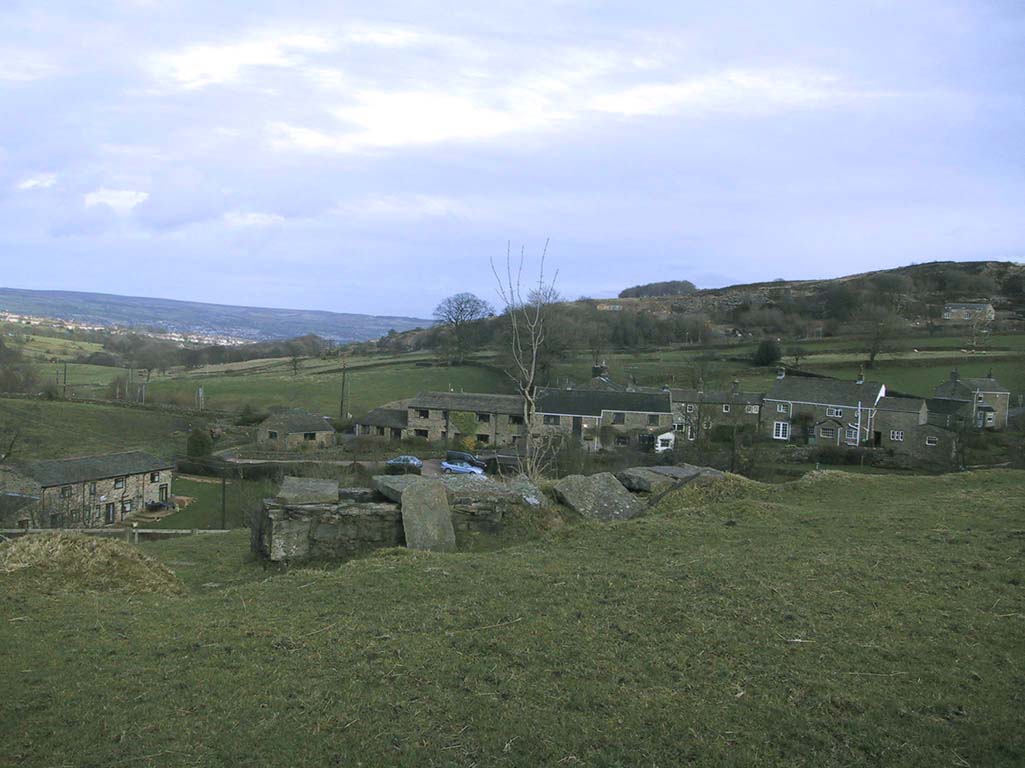
The holy well/spring can be reached by following the Worsthorne road south from Haggate to Cockden Bridge over the River Don, then following the footpath due east beside the river for about a quarter of a mile. At the Ormroyd footbridge where the River Don becomes Thursden brook head in a north-easterly direction up the hillside. The well, or what’s left of it, can be found beside a trackway.

Archaeology & History

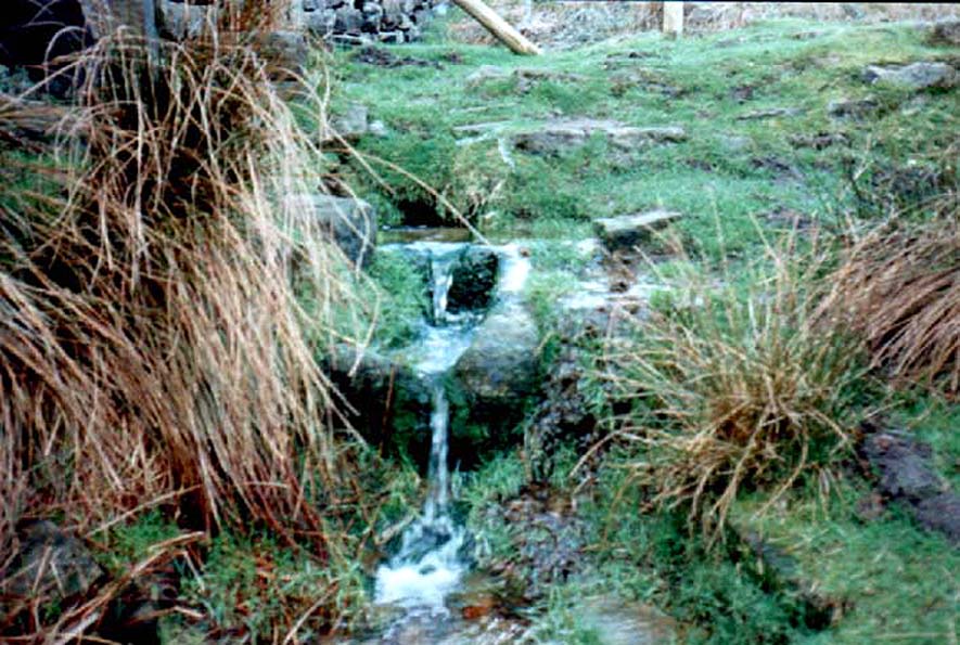
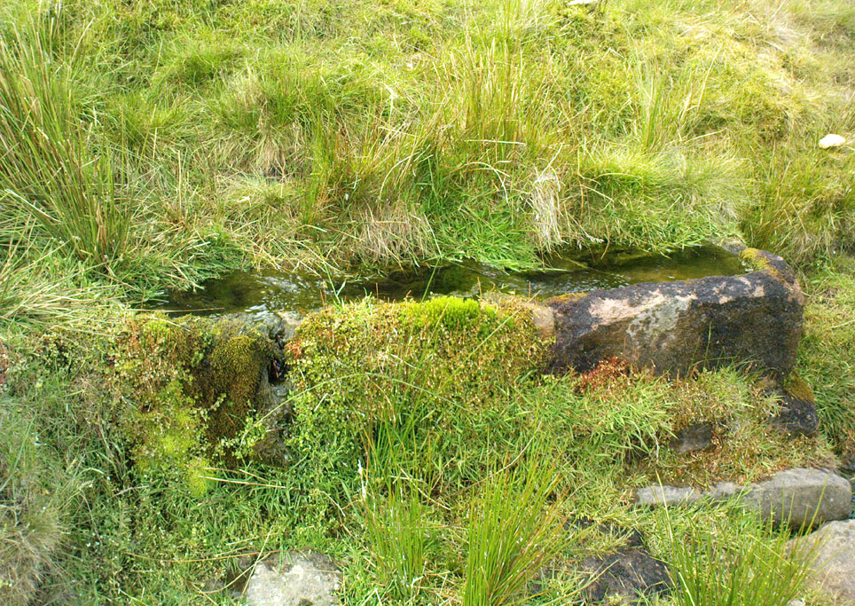
Around twenty-five years ago Calf Hey Well was described as being a square-shaped structure made of five stone slabs, one of which makes the roof. The water, which most probably had some form of mineral content, bubbles up into the large square basin which is a little lower than ground level.  Today, the well is still there but I don’t know in what condition it is.

Folklore

According to Clifford Byrne in his book The Holy Wells and Mineral Springs of N.E.Lancashire,

“Calf Hey Well is a strong spring which rises out of the hillside, but in medieval times it was believed that the waters here had special qualities. Some people thought it was a holy well and reputedly many people visited Calf Hey on holy days when jugs of water were sold. A few accounts state that stalls were set up on a flat piece of land to the west of the well, Here vendors not only sold water but other things (food, religious objects and trinkets) and a market atmosphere must have pervaded the site”.

In 1819 the local water company took over the well and began to use its supply of water for the ever growing population of Burnley a few miles west of here. After this the fairie people were never seen again at the well – they were probably feeling very indignant at what had transpired.

Folklore has played its part here too. Fairies are said to have inhabited the well in days gone by – indeed they were often seen dancing around the well in the moonlight. These fairies or “little people” were not just creatures of the night which our ancestors delighted in when they could catch a rare glimpse of them. In fact these little people were quite normally formed although small in stature. Though not human they had the capacity to intervene in our human affairs – usually but not always for the good of it. They were known to steal little children and babies, supplanting them with their own offspring. So the parents of newly born babies had to be very vigilant and get their babies baptised as quickly as possible.

There are a few lesser-known wells in the same area as Calf Hey. These include The Jam Well at Worsthorne, Sweet Well at Holden Clough and Robin Hood’s Well at Black Clough, Thursden.

References:

  1. Byrne, Clifford, The Holy Wells and Mineral Springs of Northeast Lancashire, MS copy in Nelson Public Library (Reference).
  2. Frost, Roger., A Lancashire Township – The History of Briercliffe-with-Extwistle, Rieve Edge Press: Briercliffe 1982.

Links:

  1. Additional info on the TNA Forum

Copyright © Ray Spencer 2011

Rushy Beck Spring, Burley Moor, West Yorkshire

Healing Well:  OS Grid Reference – SE 1403 4544

Getting Here

Source of the Rushy Beck

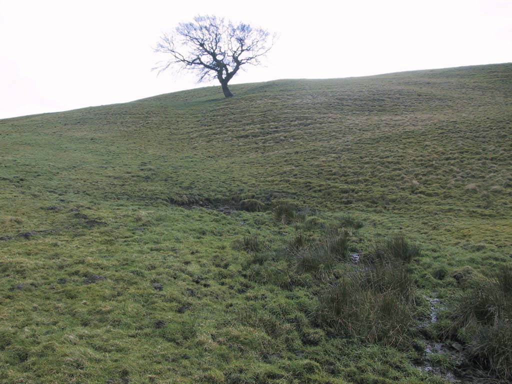
From Ilkley centre, take the road up to Cow & Calf, going past the hotel and along Hangingstone Road for a half-mile until you meet some walling on the right of the road. Stop and walk up the small beck, veering to the left as you approach the brow of the hill.  Keep walking up the beck onto the moor where you’ll eventually reach its source, as shown in the photo here!

Archaeology & History

This once fast-flowing spring of fresh sparkling water has seen better days.  The site has two openings in the Earth about 10 yards east and west of each other, both discernible by the notable difference in vegetation on the moors here, where richer hues of green created by the waters cut a small channel down the moorland slopes through the usual hues of heather.

The waters taste fine when they’re in flow, but much of the land here has fallen into shallow marsh and with the inevitable falling of the water table thanks to the stupid arrogant Industrialists, very little of the goodness is available.  But it wasn’t always like this.  Certainly when our prehistoric ancestors carved the rock art close by the source of the waters, then later constructed the large ritual enclosure immediately west of the springs, the waters would have been very important—and in much greater profusion—for simple nourishment and for rituals enacted at the site.


© Paul Bennett, The Northern Antiquarian


Horncliffe Well, Hawksworth Moor, West Yorkshire

Healing Well:  OS Grid Reference – SE 13214 43326

Also Known as:

  1. Horncliff Well

Getting Here

Horncliffe Well – as it once was

From the famous Dick Hudson’s pub on the south side of Ilkley Moor, take the road right (east) for a half-mile until you reach the large Weecher Reservoir just off the roadside on your right.  Less than 300 yards past the reservoir, a footpath takes you onto the moor itself.  Walk up the path for about ⅔-mile — crossing one wall, then walking roughly parallel with another on your right — until you reach a crossing of paths where there are 2 gates or stiles.  Take the lower of the two stiles, through the wall, but below the fence.  You’ll see an awful Yorkshire Water cover, which has just about destroyed the once-fine well that had always flowed here.  Below this, by the wallside, are the trickling remains of our old healing spring.

Archaeology & History

When I was a young boy, Horncliffe Well was the site we would visit every weekend as our first stopping-spot on our regular ventures exploring these moorlands — “from Wrose to Rombalds,” as we use to call it!  The old well was always very plentiful, strong-flowing, cold and truly refreshing.  It was undoubtedly the best water source on the entire Rombalds Moor region, never drying up.  Even in the great droughts of 1976 and 1995, after all others had just about failed, the waters at Horncliffe were still flowing as strong as ever, as they had always done.  But not anymore…

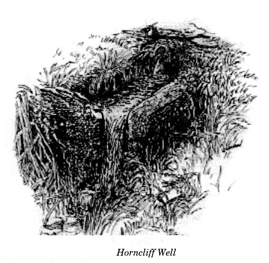
Edna Whelan’s old drawing

First described in land records of 1273 CE, this has always been a well of great repute and oral tradition told that this great old well never ran dry. It marked the ancient boundary point where the moorlands of Hawksworth, Burley and Bingley all meet.  By name alone it is associated with the nearby and curious Horncliffe Circle, whose status itself is unclear (the circle seems more a place of refuge or living than a true ritual site).

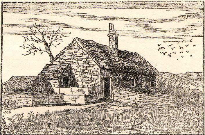
Horncliffe House around 1801

The remains of old buildings on the flat just above where the waters once flowed were built in much more recent centuries.  The building appears to have been started around 1799, for E.E. Dodds (1985) told that in 1800 it was used as a school for several years by local teacher Joshua Briggs.  J. Horsfall Turner (1907) published a copy of an old drawing of the school, as it was soon after construction.

Horncliffe Well was dug into by the privatized water company known as Yorkshire Water (owned by rich greedy fuckers) in the 1990s, who channelled most of its endless supply away for commercial benefit.  When their company was stealing the water from the moors, the workmen snapped an old markstone at its base next to the adjacent Horncliffe House (in ruins).  The waters had always flowed fast and freely, but after Yorkshire Water had finished their ‘work’ here, the great majority of Horncliffe’s water supply subsided considerably, leaving walkers, birds and animals to suffer from its demise.  In all sincerity, it’s to be hoped that good people someday will visit this once-fine site and return it to its previous healthy status.

Folklore

When we were kids we came here every weekend and got to know the old ranger who we’d meet either here or at the adjacent Horncliffe Circle, 250 yards NNE, where we’d sit and eat.  In the mid-1970s, he told us that the old well was once a site where the fairy-folk would play, around Mayday (beltane).  And though in later years I’ve sought for any information about this in all early antiquarian books that cover this area, I’ve never found any mention of this tale in print.  The old ranger knew the moors and its history better than anyone I’ve ever known and many old stories died with him after his death.

References:

  1. Bennett, Paul, The Old Stones of Elmet, Capall Bann: Chieveley 2003.
  2. Dodd, E.E., Bingley: A Yorkshire Town through Nine Centuries, M.T.D. Rigg: Guiseley 1985.
  3. Laurence, Alastair, A History of Menston and Hawksworth, Smith Settle: Otley 1991.
  4. Turner, J. Horsfall, Idle Upper Chapel Burial Registers and Graveyard Inscriptions, Harrison & Son: Bingley 1907.
  5. Whelan, Edna, The Magic and Mystery of Holy Wells, Capall Bann: Chieveley 2001.
  6. Whelan, Edna & Taylor, Ian, Yorkshire Holy Wells and Sacred Springs, Northern Lights: Dunnington 1989.

© Paul Bennett, The Northern Antiquarian


New Edge Chalybeate, Colden, Heptonstall, West Yorkshire

Healing Well:  OS Grid Reference – SD 95447 29403

Getting Here

Take the Heptonstall road up from Hebden Bridge, going round the village (not into it) and head through Slack and onto Colden.  Just as the road begins to go downhill to Colden, note the small single-track road on your right called Edge Road.  Go on here for a good mile until it becomes a dirt-track and there, on your left, is the half-run-down old farmhouse called New Edge.  Just yards past it, off to the right by the trackside, you’ll see this large copper-coloured stone basin oozing with the same-coloured liquid.

Archaeology & History

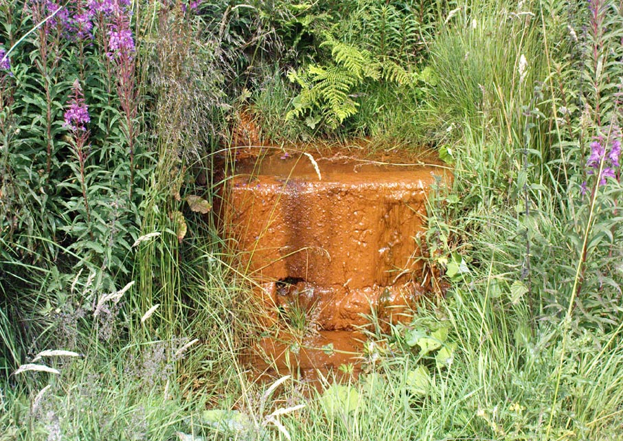
New Edge Chalybeate, above Colden

This is one of what Thomas Short (1724) called “the ten thousand chalybeats”, or iron-bearing springs,  inhabiting the Yorkshire uplands — but he didn’t include this site in his huge survey.  But it’s a beauty amongst chalybeates, as a visit here clearly shows!  The well is one of two found on either side of the old building known as New Edge (as contrasted with Old Edge, a little further along the lane), and its waters trickle gently from the old stone trough.

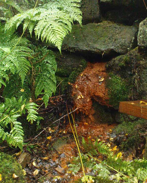
The waters are undoubtedly enriched with large amounts of iron, as the photo here shows, giving the waters clear medicinal value.  In tasting them, not only do the waters give you that copper-coloured hue, but you can clearly taste the minerals in the water. As with other iron-bearing springs, the water from the New Edge spring is good for the blood, good for anæmia, loss of energy and a low immune system.

References:

  1. Short, Thomas, The Natural, Experimental and Medicinal History of the Mineral Waters of Derbyshire, Lincolnshire and Yorkshire, privately printed: London 1734.

© Paul Bennett, The Northern Antiquarian


Walloper Well, Newton, Lancashire

Healing Well:  OS Grid Reference – SD 71823 48265

Getting Here

Walloper Well

Take the B6478 road between Clitheroe and Newton, heading up north out of Clitheroe until you’re on the very top of the hill with fine views, mainly north and west.  There’s a car-park about here, on the right-hand side of the road.  From here, walk further along the road for about 200 yards, keeping your eyes peeled for the large stone trough at the left-hand side of the road.  That’s it!

Archaeology & History

When we met up with John Dixon in the summer of this year, to wander on the nearby hills in search of old monuments, this was the first spot he showed us — and the waters were flowing nicely and tasted alright aswell!  But its history is not widely know.  Jessica Lofthouse (1976) described the place, saying:

“In the days of horse and pedestrian traffic none passed Walloper Well without stopping  to ‘quaff the clear crystal.’  Long ago, hill men, hunters, forest wardens and farmers off to Clitheroe markets and fairs, pedlars, lead miners from the nearby workings, all met here.  The name is thought-provoking. Why Walloper? From a word meaning a ‘fresh bubbling spring’, which this is, fresh from the moorside into stone troughs.  Age, wartime army practice and vandalism of 1974 made renewal of the trough necessary, but the flow has been constant.  One must drink, just as one throws pennies into the Roman fountain, to ensure one comes back again.

“The true derivation does not satisfy everyone.  One can choose.  A man and his wife climbed towards Walloper with raised voices, she nagging, he protesting.  A pedlar watched them.  “I’ll tell thee what I’d do if she were my wife.  I’d wallop her, wallop her, wallop her well.” A song which every local singer was once compelled to have in his repertoire told the same story.  The chorus sums up the reason for the name:

“…lovers of tell, each beau to his belle
The olden time story of Walloper Well.
The mason who built it in love with a maid
Who brought him his dinner one day, so tis said,
Was struggling to kiss her when over the Fell
A pedlar then passing cried, ‘Wallop her well’.”

References:

  1. Byrne, Clifford H., Mineral Springs and Holy Wells of North-East Lancashire, unpublished manuscript, 1972.
  2. Lofthouse, North Country Folklore, Robert Hale: London 1976.

© Paul Bennett, The Northern Antiquarian


Heber’s Ghyll Chalybeate, Ilkley, West Yorkshire

Healing Well:  OS Grid Reference – SE 0988 4692

Getting Here

Hebers Ghyll chalybeate

Walk from Ilkley up the Wells Roads as if you’re going to the White Wells, but keep following the road along, keeping to the moorside (don’t go up Panorama Drive).  A few hundred yards up, crossing the small bridge over the gorse-scattered stream, take the footpath to your right and walk along the moor-bottom, parallel to the rich houses.  Keep walking, past the reservoir (don’t go up the slope on the newly created path) and cross the small wooden bridge.  Once over the other side, head through the gate and walk along the rocky footpath into the woods.  Less than 100 yards down where the first seat is, there’s a slow-running blood of water oozing out from the rocks.

Archaeology & History

At the top of this bit of old woodland, out of rocks near the top of the trees, emerges another of Yorkshire thousands of chalybeates, or iron-bearing springs of water, on the very edge of Ilkley Moor.  Collyer and Turner (1885) mentioned its discovery in 1883, but gave no further details.  Searching for this place on one of my countless moorland ambles as a child, I found its waters oozing slowly from betwixt moss-enriched rocks on the west side of the stream.  If you look for it in the dry season though, there is little to see.  It is best seen later in the year, after heavy rains, although the waters are pretty slow running and have that distinct “off” taste (an attribute well-known of chalybeates —taste ‘em and see!).  The only real account of this little-known healing well was told in an early edition of the Leeds Mercury (1883), shortly after its rediscovery, in which we were told:

“Our Ilkley correspondent says the existence of a chalybeate spring has lately been discovered there, and from its valuable medicinal properties will prove a valuable adjunct in the future development of this health resort.  The water from the spring (which is situated near to the Panorama Rocks, in what is known as Hebers Gill, or Briery Wood) has been submitted to Mr F.M. Rimmington…of Bradford for analysis and his report is of a most favourable character.  The data shows that the water is remarkable for the smallness of the amount of its saline constituents, and (so far as the analyst has been able to discover by reference to published analysis of either English or Continental chalybeate springs), there is not one comparable to it: whilst its ferruginous element is equal to the majority of such waters and, in Mr Remmington’s opinion, as large as is desirable for medicinal effect.  The spa that most resembles the one under notice is that of Tunbridge Wells in Kent, which is derived from exactly the same geological formation (millstone grit), the total solid constituents of this water being 13½ grains to the gallon.  The report adds that, “The use of this class of waters as medical agents has, from remote periods, been found efficacious in those states of debility denominated anemia,” and “the value of this class of spa water as a safe and natural remedy can scarcely be overestimated.”  From the foregoing it will be seen that an important discovery has been made…”

This once important spring of water — that would have been known and used by our prehistoric ancestors living on the moors above — is nowadays but a shadow of its former self.  The water tables drop annually as a result of moorland drainage and other poor land management and we only see a small trickle of water emerging from the mossy rocks these days…

…to be continued…

References:

  1. Anonymous, “Important Discovery at Ilkley,” in Leeds Mercury, August 18, 1883.
  2. Bennett, Paul, Healing Wells and Springs of Ilkley Moor, unpublished: Hebden Bridge 1995.
  3. Collyer, Robert & Turner, J.H., Ilkley: Ancient and Modern, William Walker: Otley 1885.

© Paul Bennett, The Northern Antiquarian


Penny Well, Edinburgh, Midlothian

Holy Well:  OS Grid Reference – NT 2636 7177

Also Known as:

  1. Canmore ID 52492
  2. Pennywell

Getting Here

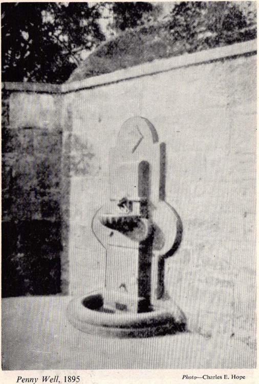
The Penny Well in 1895

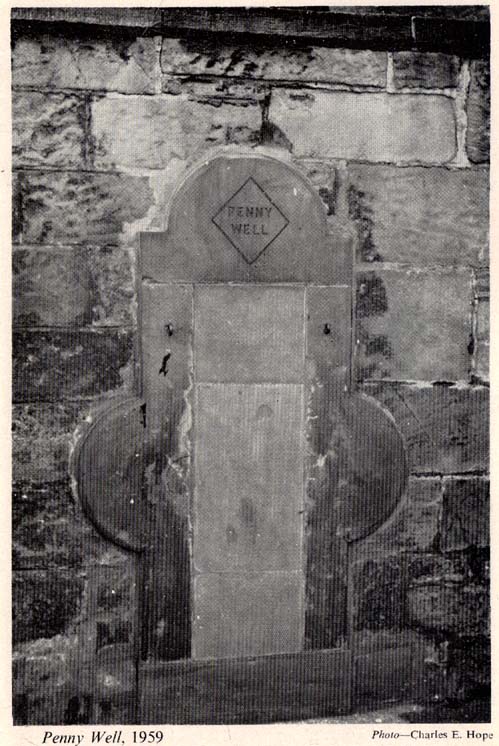
The stone marking the position of the well is situated on the north side of the road at the east end of Grange Loan, a few yards west of the junction with Findhorn Place, at Newington on the south side of Edinburgh.  Unfortunately, all that now remains of the well is a red sandstone front with two pieces of metal on each side.

Archaeology & History

Set back a little into the wall alongside the road, we today see only the architectural memory of this once famous and much-reputed holy well, whose waters sadly no longer flow.  Curiously omitted from the primary Scottish surveys on holy wells, it was long known as an important water source by the people of Edinburgh in ages past. The best article on the site was written by W.F. Gray (1962) some fifty years ago, in which he told:

“Built against a garden wall, the Penny Well looks rather forlorn.  Now that a plentiful supply of water is in every dwelling, its public usefulness is definitely at an end, though it may slake the thirst of a passer-by.  But however that may be, the Penny Well has a long if not distinguished history, though fact and fiction, it is to be feared, are inextricably linked.

“And first, as to its age.  There is documentary evidence of the existence of the Penny Well as far back as 1716.  In that year Sir William Johnston of Westerhall, Dumfriesshire, disposed to William Dick of Grange three acres of his lands of Sciennes, which are described as bounded on the west by the lands belonging to “said William Dick and the Penny Well.”  The well really marked the south-east boundary of the lands of Grange.

“The actual age of the Penny Well is unknown.  All that can be positively stated is that it has existed for at least two hundred years… How the Penny Well came by its name is another unsolved mystery.  There is a story to the effect that in the earlier half of the nineteenth century an old woman who lived in the cottage opposite the well had charge of the spring and sold the water to wayfarers at a penny a glass.  A very plausible story by which to account for the name!  Unfortunately its credibility is shaken by the fact that…the spring was known as the Penny Well fully a century before…

“Sir Thomas Dick Lauder, when he took up residence at Grange House in 1832, was deeply interested in the well at the east end of his property.  He had it restored and above it placed a tablet with the words, ‘Penny Well’ inscribed on it.

“About 1870, when feuing operations were in progress and there was much digging in the vicinity of the well, the water suddenly ceased to flow.  After an interval, however, it again became copious, so much so that it formed a tiny pond in front of an adjoining house.  In the hope of drawing off the water, a pit was dug.  This led to an interesting discovery.  Five feet below the surface, workmen came upon what there seems no reason for doubting was the original trough of the Penny Well.  This “interesting and unexpected find” (to quote from The Scotsman) was covered by a large block of hard sandstone.  The trough, which was circular, measured 32 inches across and had a depth of fully 1o inches in the centre.

“The Society of Antiquaries made investigations and the opinion was hazarded that “the basin into which the water ran was without doubt a baptismal font,” possibly the one which once stood beside St. Roque’s Chapel, situated at the southwest end of Grange Loan, but long since removed.

“In the (1890s) the Penny Well underwent a second restoration, the Town Council providing £30 for the purpose.  By this time however, the spring was found to be impure, but the trouble was got over by substituting the town water.”

Folklore

Penny Well in 1959
Penny Well in 1959

Although there are no documents proving with certainty, local tradition reputed this to be one of Edinburgh’s numerous holy wells.  It probably was.  And whilst W. Forbes Gray seemed at a loss to explain the name of this old water source, it probably comes from the old practice of local people dropping pennies and other offerings into the well in the hope that the spirit of the waters would confer good health or other benefits upon the hopeful pilgrim.  Such rites, of course, are very ancient indeed and relate specifically to the animistic spirit-nature of the site.  In Mr Gray ‘s (1962) essay on the Penny Well he also had this to say:

“According to one statement, it was a holy well attached to the Convent of St. Catherine of Sienna (which stood at the foot of St. Catherine’s Place), a well whose waters were possessed of miraculous powers of healing those afflicted with blindness, in which case it would be in the same category as the well of St. Triduana at Restalrig, and the Balm Well at Liberton.”

Reputed in times gone by to be one of the never-failing springs, this clear and sparkling water supply would keep bubbling away long after all others in the area had dried-up during summer droughts.

“It is also said that the ubiquitous Mary Queen of Scots, when she visited the religious sisterhood at Sciennes, partook of the waters of the Penny Well. “

References:

  1. Bennett, Paul, Ancient and Holy Wells of Edinburgh, TNA: Alva 2017.
  2. Gray, John G. (ed.), The South Side Story, W.F. Knox: Glasgow 1962.
  3. Gray, W. Forbes, “The Penny Well,” in South Side Story, Glasgow 1962.
  4. Smith, J. Stewart, The Grange of St Giles, T. & A. Constable: Edinburgh 1898.

© Paul Bennett, The Northern Antiquarian


St Austin’s Stone, High Hunsley, East Yorkshire

Legendary Rock:  OS Grid Reference – SE 93360 34443

Also known as:

  1. St. Augustine’s Stone
  2. St Austin’s Rock

Folklore

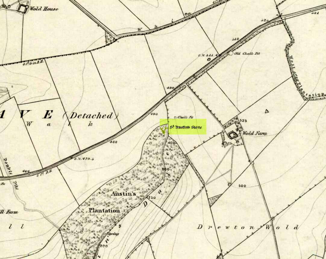
St Austins Stone on 1855 map

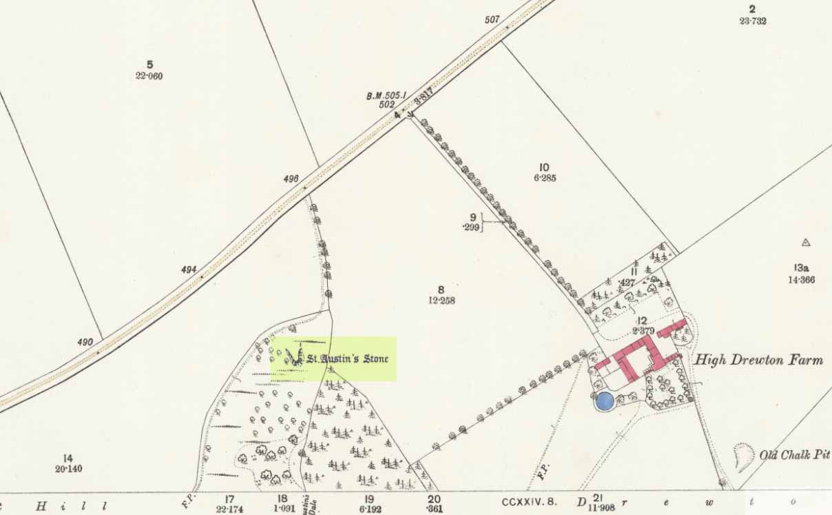
The folklorist John Nicholson (1890) wrote about this “block of natural concrete standing at the head of Drewton Dale, near South Cave” — which modern OS-maps call Austin Dale.  Legend told how it “derived its name from St. Augustine, who used to preach from this stone to the heathen, before Britain became christian.”  This obviously supplanted an earlier heathen site, but it’s difficult to work out what that may have been.  It could have been the lost ‘Rud Stone’ immediately west; or perhaps had some traditional relationship with the healing well which emerges a short distance away further down the valley.  Just above here as well, we find an ancient dragon’s lair at Drakes Hole, which could also hold a clue to this place.

A couple of years after Nicholson mentioned the site, John Hall (1892) published his excellent history of the township, in which he described St. Austin’s Stone thus:

“It’s a mass of rock projecting from the side of a hill and in its longest part, extending  from the hillside to the face of the stone, measures about 60 feet.  By some it is supposed to have formed a centre for druidical worship, and that the adjoining township took its name of Drewton (or Druid’s Town) from this fact.  When St. Augustine came to England…he is said to have visited this part of the East Riding; and that this stone took its name from his visit.”

St Austins Stone 1890 map

The site was also surmounted by a cross at some time in its recent history, but this has gone.  The earth mystery writer Philip Heselton (1986) told that the nearby Well was indeed a place connected to St. Austin’s Stone, in an early article in Northern Earth Mysteries, saying:

“St. Austins Stone near South Cave is a rock outcrop where Saint Augustine is said to have made converts, baptizing them in a nearby well. The site is used for church services.  Every seven years, part of the stone falls away, but it always grows again.”

The site should be examined for potential cup-and-ring markings; as well as reports on the status of the Well.  Any photos of the present situation of the site would be most welcome.

References:

  1. Gutch, Mrs E., County Folk-Lore volume VI: Examples of Printed Folk-lore Concerning the East Riding of Yorkshire, David Nutt: London 1912.
  2. Hall, John George, A History of South Cave and other Parishes in the East Riding of Yorkshire, Edwin Ombler: Hull 1892.
  3. Nicholson, John, Folk Lore of East Yorkshire, Simpkin Marshall: London 1890.
  4. Thompson, Thomas, Researches into the History of Welton and its Neighbourhood, privately printed: Kingston-upon-Hull 1869.

Links:

  1. St. Austin’s Stone (and Well) on “Yorkshire’s Holy Wells” website

© Paul Bennett, The Northern Antiquarian


Dissenters Well, Kelbrook, Earby, Lancashire

Healing Well:  OS Grid Reference – SD 92104 43179

Getting Here

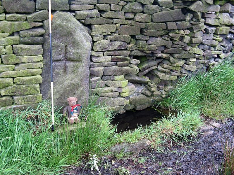
From Kelbrook village head south past Old Stone Trough then continue as far as the lane goes. Then head eastwards for about 1 mile on footpaths to a building called Laycocks. From here continue east along footpaths for another 1 mile or so until you reach Copy House (now called Hawres Farm). Go to the back of the farm where you will see in the wall a cross-incised boundary stone. At the side there is a square-shaped holy well. (You may need to ask permission at the farm).

Archaeology & History

Dissenters Well & Cross (image courtesy ‘QDanT’)

The so-called Dissenters’ Well is a rectangular feature in the ground next to the wall.  It is said locally to date from the 17th-18th century, but is most probably an ancient moorland spring.  The well was in use from the 17th century by Quakers, Baptists, Methodists and possibly Roman Catholics, at a time when there was much animosity towards non-Conformists.  Legislation was passed stopping all illegal gatherings to be held within a 5 mile radius of any church – thus leading to religious gatherings in bleak, remote places on the moorland above towns and villages.  In 1812 an Act of Parliament against non-Conformists was repealed and dissenters were given equality regarding where they could worship. The water in the well no doubt had some medicinal qualities or, was a source of spiritual up-lift at the time.

By the well there is 3 foot high pointed boundary stone or waymarker known as ‘Tom’s Cross’ and it has a thin incised cross carved onto it.  The stone is partly embedded in the wall.  It probably marks the old boundary between Lancashire and Yorkshire.  I don’t know who Tom was though he may have been the person who set up the stone. The age of the stone is not known.

The Bleara Lowe tumulus and its nearby prehistoric companion can be found upon the hilltop a mile north of here.

References:

  1. Oldland, Fay, The Story Of Foulridge, Pendle Heritage Centre Ltd, 1990.

Copyright ©  Ray Spencer 2011

True Well, Oakworth, West Yorkshire

Healing Well:  OS Grid Reference – SE 0272 4017

Getting Here

Modern True Well troughs

Take the Oakworth Road outta Keighley, turning right after a quarter-mile up Fell Lane.  Go all the way up the very end (a mile or so), turning right at the end.  After 100 yards or so, go up the track to the True Well Hall equestrian centre.  As you approach the farmhouse, look on the grassy slope to the left and you’ll see a small run-down stone structure in the field above you.  That’s it! 

Archaeology & History

This is a curious site by virtue of so little being said of it, despite some modern proclamations of it having pagan values.  Even the local historians say little on the place, with William Keighley (1858) being our notable exception.  In his notes on the erroneous dedication of the Jennet’s Well to a fictitious saint of the same name, he mentions this once important water supply, writing:

“Westwards of Jennet’s Well there was another fountain, emphatically styled the ‘true well’, and probably from its once boasted efficacy intended as a rival to the former.  This spring though no longer remembered for its healing qualities, evidently gave name to the farmhouse denominated ‘True Well Hole.'”

In Wright’s Dialect Dictionary (1898) we find the word ‘trew’ — also written as ‘true’ or ‘trow’ — could mean “to trust, believe, feel sure”, which may be applicable in terms of the value of the waters that once flowed here.  We may never know.  Though note should be made of the error at a recent exhibition in Cliffe Castle museum, where the 1842 Tithe Awards map of the region was copied and the field-names listed, showing the old True Well erroneously displayed as the ‘Time Well’.  I assume they must have had a long day when they were copying the notes…!

Spring behind True Well Hall

A little further along the track running beyond True Well Farm we find another spring of water emerging from the grassy hill and which, perhaps, relates to the True Well.  On the 1852 OS-map, we see a ‘trough’ shown in front of the farmhouse and not in the position where the modern map shows the True Well to be — and where the recent stone-worked trough in the photo is shown.  In fact, on the 1852 map, no such well nor stonework is shown in the position presently deemed to be where the True Well is supposed to be, so the original position of the well is unclear.  Is it possible that the spring of water which runs from the hillside behind True Well Farm may have been the site which gave this spot its name.  Certainly the water from this spring is quite fresh and drinkable.  If anyone knows owt more about the history of this curious site, it would be good to hear from you.

References:

  1. Keighley, William, Keighley Past and Present, Arthur Hall: London 1858.

© Paul Bennett, The Northern Antiquarian