Yarnbury Henge, Grassington, North Yorkshire

Henge:  OS Grid Reference – SE 01405 65413

Getting Here

Yarnbury henge from the air

In Grassington, go up the main street and keep going uphill, out of town.  You’re on Moor Road now and it keeps going northeast for about a mile, where the small copse of trees grows just before Yarnbury House.  However, on the other side of the road (right) two field before you reach the house, you’ll notice a slightly raised elevation in the field, close to the wall.  A footpath runs right past it, so you shouldn’t have too much trouble finding it!

Archaeology & History

This is a fine, roughly circular neolithic monument, sat not-quite-on-the-heights, but still possessing damn good views all round (except immediately west), begging the question, ‘what on earth are you and why were you built here?’  Answers to which, we don’t really know.  But ascertaining its geomantic nature wouldn’t be too difficult for local people who have spent years visiting the site.  John Dixon (1990) mentioned how, in the winter months,

“the sun falls behind Pendle (Hill) providing it with a sky-red backdrop.  In my own view the site is related to the presence of Pendle…and may have been the major factor in the location of the monument.”

He may be right!  It has been suggested by one archaeologist (King et al, 1995) that the site was “most probably a wood henge” with upright rings of wooden posts that were built onto the central platform — but until we get a full dig here, we’re not gonna know.

N-NE section of henge
SW section of the henge

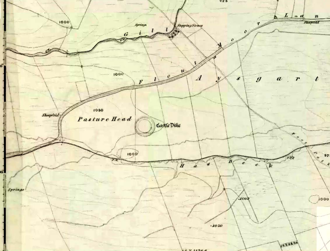
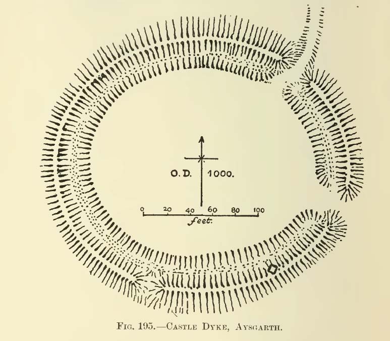
Found close to an extensive amount of other prehistoric remains in the area (dating from the neolithic to Iron Age), this henge monument is notable for its size, as it’s only a little fella!  It’s like a mini-version of the Castle Dykes henge near Aysgarth, 14 miles to the north!  First mentioned as a ‘disc barrow’ in 1929, J. Barrett (1963) added the Yarnbury Henge to the archaeological registers 32 years later, citing it as a “circular platform 60-63 ft diameter, surrounded by a ditch 20ft wide (crest to crest) and an outer bank.”  A couple of years later D.P. Dymond (1965) described the henge in slightly more detail, telling:

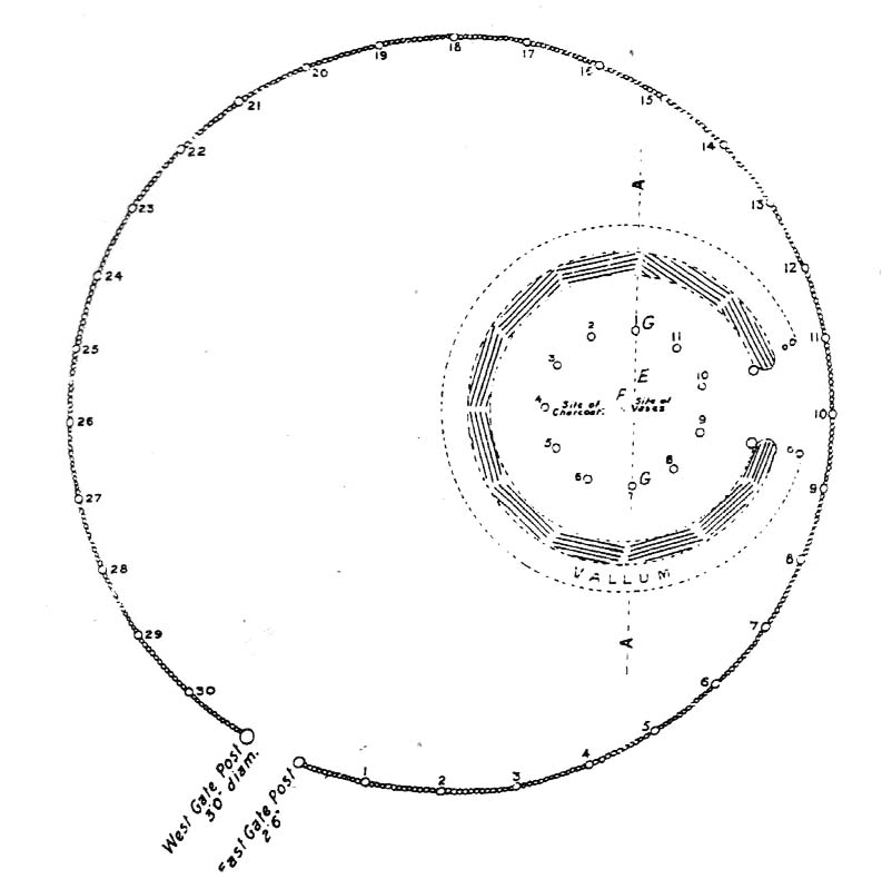
“At Yarnbury, just over one mile north-east of Grassington there is an earthwork 116ft in diameter overall, consisting of a ditch with external bank.  On surface inspection the earthwork appeared to have the characteristics of a henge monument.  An excavation carried out in July 1964 , by an archaeological summer school based on Grantley Hall, proved this thesis.  There was no trace of an internal mound and the entrance to the southeast was obviously  original.  No traces were found of any sort of internal structure, and a square pit in the centre of the circle had been caused by an excavation earlier this century.  The ditch was rock-cut and the bank of simple dump construction.  No dating evidence was found… With its single entrance the Yarnbury henge falls into Atkinson’s Class 1.”

SW area of the henge

In recent years it seems that some damage has been done by digging into the east and southeastern sections of the henge.  Summat we hope doesn’t get any worse.  In the field on the other side of the road we found traces of prehistoric enclosure walling (along with a curious, large, almost cursiform shadow, 44 yards across and running 110 yards NE), typical of the extensive settlement remains found less than a mile away at Lea Green and High Close Pasture, Grassington.  It’s an impressive area, well worth checking out!

References:

  1. Barrett, J., “Grassington, W.R.,” in Yorkshire Archaeological Journal, part 161, 1963.
  2. Beck, Howard, Yorkshire’s Roots, Sigma: Wilmslow 1996.
  3. Dixon, John & Phillip, Journeys through Brigantia – volume 2: Walks in Ribblesdale, Malhamdale and Central Wharfedale, Aussteiger Publishing: Barnoldswick 1990.
  4. Dymond, D.P., “Grassington, W.R.,” in Yorkshire Archaeological Journal, part 163, 1965.
  5. Harding, A.F., Henge Monuments and Related Sites of Great Britain, BAR 175: Oxford 1987.
  6. Harding, Jan, The Henge Monuments of the British Isles, Tempus: Stroud 2003.
  7. King, Alan, et al, Early Grassington, Yorkshire Archaeological Society 1995.
  8. Wainwright, G.J., “A Review of Henge Monuments in the Light of Recent Research,” Proceedings of the Prehistoric Society, volume 35, 1969.

© Paul Bennett, The Northern Antiquarian


Big Rings Henge, Dorchester, Oxfordshire

Henge (destroyed):  OS Grid Reference – SU 572 953

Archaeology & History

Very close to the once impressive Dorchester Cursus, this double-ringed prehistoric monument can no longer be seen thanks to the self-righteous arrogance of modern industrialists who care little for the ancestral monuments of the British people, destroying all traces of the site — an activity which, in this case, astonishingly started in more ancient times, as Jean Cook (1985) told: “The banks and the ditches had been levelled through agricultural activity, possibly in the Iron Age”!

Big Rings ground-plan
1938 photo of the Big Rings, by Major George Allen

The destruction of this environment continues to this day, destroying many important archaeological remains with little care.  Thankfully we we’ve got a good account of the site due to the archaeological excavations of R.J.C. Atkinson (1951) and his team in the late-1940s, from whom Cook and just about everyone else gets most of their data regarding the site.

The Big Rings Henge was probably built sometime in the middle of the second millenium BC.  It was an important prehistoric ritual site and, most likely, had some relevance to the adjacent cursus monument.  A number of important mortuary and ritual sites were also built close to the site over a period of nearly two thousand years, showing the importance this landscape had to our ancestors.

Jean Cook (1985) described the Big Rings henge as follows:

“The ditches, of which there were two, had opposed entrances on the NNW and SSE.  They were about 7.6m wide and 1.8m deep with flat bottoms.  Originally there seems to have been a broad low bank on the inner side of each ditch.  The southern entrance incorporated an existing monument, consisting of a ring ditch which enclosed a large four-post setting and contained a cremation and a stone axe.  Just outside the north entrance was a round barrow, containing a central oval burial pit which produced a crouched inhumation, together with a well-preserved beaker, two small copper or bronze knives and a rectangular wrist-guard of greenstone.  The Big Rings ditches themselves contained pottery belonging to the middle or late Beaker period.  Although the area within the ditches was trenched, there was no evidence of internal timber structures.”

References:

  1. Atkinson, R.J.C., “The Henge Monuments of Great Britain,” in Atkinson, Piggott & Sandars’ Excavations at Dorchester, Oxon (Department of Antiquities: Oxford 1951).
  2. Atkinson, R.J.C., Piggott, C.M. & Sandars, N.K., Excavations at Dorchester, Oxon, Department of Antiquities: Oxford 1951.
  3. Cook, Jean, “The Earliest Evidence,” in Dorchester through the Ages, Oxford University 1985.
  4. Harding, A.F., Henge Monuments and Related Sites of Great Britain, BAR 175: Oxford 1987.
  5. Harding, Jan, The Henge Monuments of the British Isles, Tempus: Stroud 2003.
  6. Wainwright, Geoffrey J., The Henge Monuments: Ceremony and Society in Prehistoric Britain, Thames & Hudson: London 1989.

© Paul Bennett, The Northern Antiquarian


Easington Fell Ring, Newton, Lancashire

Enclosure:  OS Grid Reference – SD 7167 4911

Getting Here

Aerial view of Easington Ring

Go through the gorgeous old village of Waddington northwards, uphill, along the B6478 road, towards the villages of Newton and Slaidburn; or, if you like, go from Newton village uphill southwards along the B6478 road towards Waddington.  Either way, when you reach the top of the moors, park up at the car-park beside the road where the view stretches for miles ahead of you.  Walk on the road for 100 yards, then take the boggy footpath left, going first down and over a stream, then up to the right (northeast) towards a small cairn on the near-horizon.  From the cairn-top you’ll notice a large moorland pond a hundred or so yards ahead of you.  Walk towards and past its left side and onwards again for the same distance until, in front of you (before a nearly-dried stream running downhill) keep your eyes peeled in the deep grasses on where you’ll see a very large ring raised in front of you, defined in parts by scatterings of rocks along the tops and sides.  You’re here!

Archaeology & History

This is an outstanding prehistoric site, all but lost in old literary records until relocated in recent years by Lancashire historian and writer, John Dixon.  However, its precise nature remains a bit of a puzzle.  When John took a small party of us to the site on June 16, 2011, there was a variety of ideas as to the precise nature of the place.

Southwestern arc of the Ring

Structurally similar to a number of prehistoric enclosures in the Pennine range, this very large near-circular monument consists primarily of a very large number of rocks and stones making up a thick outer wall, presently piled less than a yard high above the peat and approximately 6 feet wide on average.  From north-to-south, outer wall to outer wall, it measures more than 42 yards (38.5m) across; whilst measuring 41 yards (38m) east-to-west.  There are distinct entrances on its western and northern sides, and possibly another on the east.  Certain sections of the inner region are now somewhat boggy in parts, perhaps indicating there was at one time an internal spring of water.  A large singular stone is found on the inner eastern section, which may have been placed there deliberately.  On the northwestern inner-edge of the walling is a notable long wide stone which may have stood upright.

My first impression of the site told it to bet at least Iron Age in date, though more probably Bronze Age.  But without excavations, I could be talking bullshit!  It is an obvious enclosure of some sort, but there are no visible internal structures on the present ground level.  There are no notable internal or external ditches and banks, which may have given the site a ‘henge’ classification.  More work is obviously needed here before we can say what it is for sure.

Very little has been said of this huge ring in the past.  John Dixon’s research found the site briefly described in Greenwood & Bolton’s (1955) work, saying:

“On page 24 they refer to the above site thus: ‘There is also a rough stone circle on top of the fells above Easington, like the remains of an ancient fort (the ringwork)…'”

Also mentioning how Richard Rauthmell’s Antiquitates (1746) very briefly mentions the place aswell.  Apart from these passing remarks, John has found little else.

On other parts of this moortop we found scattered evidences of other early human remains (walling, cairns, hut circles), much of it unrecorded.  There may well be other important prehistoric remains hidden upon these hills…

References:

  1. Dixon, John, Slaidburn and Newton, Bowland Forest, Aussteiger Publications: Clitheroe 2003.
  2. Greenwood, Margaret & Bolton, Charles, Bolland Forest and the Hodder Valley: A History, privately printed 1955.
  3. Rauthmell, Richard, Antiquitates Bremetonacenses; or, The Roman Antiquities of Overborough, Henry Woodfall: London 1746.

© Paul Bennett, The Northern Antiquarian


Castle Dykes, Aysgarth, North Yorkshire

Henge Monument:  OS Grid Reference – SD 9822 8728

Also Known as:

  1. Castle Dyke

Getting Here

Castle Dyke on 1856 map

Go west through Aysgarth village along the A684 road and, just as you’re coming out of the town, take the left turn on the Thornton Rust road, past Town Head Farm, and turn left up the track (called Folly Lane).  Go past the house where the track veers to your right and follow it straight on (don’t turn up the track on your left a short distance along).  Keep walking on here for nearly a mile (about 10 mins), keeping your eyes peeled for the embanked rise in the field on your left, which is where the henge can be found!  You’re damn close!

Archaeology & History

A.H. Allcroft's 1908 plan
A.H. Allcroft’s 1908 plan

One of the earliest accounts I’ve found describing the Castle Dykes henge is in Mr Barker’s (1854) lovely literary exploration of Wensleydale, where he describes, “on Aysgarth Moor, which is now enclosed, may be seen a circular encampment, probably Danish” in origin.  But he tells no more.  When Edmund Bogg (c.1906) came here fifty years later, he added little extra, simply telling of, “the earthworks known as ‘Castle Dykes’, probably Angle or Danish, although Roman relics have been found here.”  However, the brilliant Mr Speight (1897) gave what seems to be the earliest real description of the site when he described “the Celts” and the earliest settlers of the region, saying how:

“The so-called ‘Castle Dykes’ at Aysgarth betrays a probable connection with the same settlers.  It is an irregular circular rampart, measuring about forty yards across its longest diameter, and not unlike the earthwork on Harkaside called ‘Maiden Castle’… A ditch completely encloses the mound, which, it should be noted, is unusually low, being little higher than the outer bank or upcast from the trench.  It is totally different from the elaborate burh at Middleham; indeed, from its low and simply form, as well as from its situation in Celtic territory, there seems little doubt that it was the work of these early people.”

Ditch of Castle Dykes henge, looking east (photo credit – Richard Stroud)

Speight also made a suggestion that the place-name of Aysgarth itself may derive from this monument.  He may have a point.  A.H. Smith (1928) and other place-name authorities tell the name to derive from “an open space” either surrounded by, or — in some way — defined by oak trees.  We might never know for sure…

Not long after the works of Speight and Bogg came the first real survey of British prehistoric earthworks by A.H. Allcroft (1908) — and amidst the mass of archaeological curiosities (as many were at the time) was another description of this great ceremonial monument.  Allcroft told that here,

“a weak vallum of earth encloses a perfectly regular oval area measuring from crest to crest of the vallum 257 feet (east to west) by 217 feet (north to south).  Immediately within the vallum is a broad fosse varying from 25 to 32 feet in width.  The vallum at its highest (east) rises not more than seven feet above the floor of the fosse.  The “island” measures 196 by 160 feet and is perfectly flat.  There is no berm and no outer fosse.  The vallum is broken by three gaps, of which that to the southeast is apparently original, as the fosse has never been excavated across it.  The other gaps point respectively northeast and south-southwest, the latter being a mere depression like that to be seen at the eastern side of the northern ring at Thornborough.  At one point in the vallum, on the southeast, a single large stone rises slightly above the turf which otherwise covers the whole work, and certain depressions observable at other points suggest that other such blocks have been removed —that, in fact, it originally had a peristalith standing upon the vallum.  The principal entrance looks towards Pen Hill…”

Around the same time, the early scientific discipline of astroarchaeology was taking root and in Sir Norman Lockyer’s Nature journal, the reverend J. Griffith (1908) explored the potential astronomical orientation of Aysgarth’s Castle Dykes, thinking that the main entrance to the site gave indications of an alignment towards either Alpha Centauri or Capella.  Y’ never know…

Although many visitors and local people knew of Castle Dykes, it was pretty late before the site gained status as a henge monument.  This happened following a visit here by the pedantic archaeologist R.J.C. Atkinson (1951) in September of 1948.  Following his visit, Atkinson described the place, saying:

“It consists of an oval enclosure bounded by a well-preserved ditch and external bank, with an entrance on the East side.  Two small gaps in the bank, without corresponding causeways across the ditch, were probably made in recent times to allow the escape downhill of the surface water which collects in the ditch.  The dimensions in H. Allcroft’s plan are incorrect.  The markedly oval shape is probably in part dictated by the situation, in order that as much as possible of the enclosed area should lie on the level ground topping the ridge.  There is no sign of any stone structure in the central area, but the district abounds in stone walls, for which the site may have been robbed in the past.”

Aerial image

In more recent years, archaeologists have speculated that the site was a sacred site or meeting place, aswell as a site where trade occurred, particularly a place where axes were traded; but this latter idea is  more due to the projection of a modern religious notion, of ‘The Market’ with little veracity in terms of the site’s function.  This increasing imposition of ‘economics’ and ‘trade’ (see Brown 2008:44-6)  as vital ingredients to this and other sites has little relevance outside of a simple epiphenomenalistic adjunct to magical and tribal exchanges.  But such notions are outside of archaeological frameworks, so we shouldn’t be surprised at so prevalent an error.

But this place is damn impressive — though with the exception of Mr Griffith, one notable ingredient archaeologists seem to have forgotten about was the position of this site in the landscape.  The views surrounding the henge are excellent, giving a 360° arena all round.  If the monument once had a ring of stones around it, as Allcroft suggested, the views would still have been the same.  A modern excavation here might prove worthwhile and, as a result, open up once again, the potential for further astronomical investigations with the many hills and notches along the living horizon.  This site, whilst requiring analysis of it as a ‘specimen’, must also be placed in the context of the wider living environment which, to all early traditional cultures, were such important and integral ingredients.

We have also found some previously unrecorded prehistoric remains nearby which, hopefully, we’ll be able to explore a little more in 2011 and report here.

…to be continued…

References:

  1. Allcroft, A. Hadrian, Earthwork of England, MacMillan: London 1908.
  2. Atkinson, R.J.C., “The Henge Monuments of Great Britain,” in Atkinson, Piggott & Sandars’ Excavations at Dorchester, Oxon (Department of Antiquities: Oxford 1951).
  3. Barker, W.G.M.J., The Three Days of Wensleydale, Charles Dolman: London 1854.
  4. Bogg, Edmund, Wensleydale and the Lower Vale of Yore, E. Bogg: Leeds (c.1906).
  5. Brown, Paul & Barbara, Prehistoric Rock Art in the Northern Dales, Tempus: Stroud 2008.
  6. Griffith, Rev. J., “English Earthworks and their Orientation,” in Nature, volume 80, 18 March 1909.
  7. Harding, A.F., Henge Monuments and Related Sites of Great Britain, BAR 175: Oxford 1987.
  8. Smith, A.H., The Place-Names of the North Riding of Yorkshire,Cambridge University Press 1928.
  9. Speight, Harry, Romantic Richmondshire, Elliot Stock: London 1897.

AcknowledgementsMany thanks to Richard Stroud for use of his photo of the henge.

© Paul Bennett, The Northern Antiquarian


Bryn Celli Ddu, Llandaniel Fab, Anglesey

Chambered Cairn:  OS Grid Reference – SH 50761 70185

Also known as:

  1. Bryncelli Ddu
Bryn Celli Dhu in 1847

Archaeology & History

An excellent passage grave tomb that’s been described by many historians over the last two hundred years, and was subject to a fine excavation in the first half of the 20th century.  Ascribed as neolithic in origin, recent finds of human activity on the edge of the surrounding henge indicates people have been “up to things” hereby since at least 6000 BC.  Deriving its name from “the mound of the black grove,” the site as we see it today has been much restored and is so different to when it was visited by Thomas Pennant and other antiquarians.

According to an anonymously written essay in Archaeologia Cambrensis in 1847, the site was first described by Henry Rowlands (1723) where, in relation to another site, he told were,

“the remains of two carnedds, within a few paces of one another: the one is somewhat broken and pitted into on one side, where the stones had been carried away; the other having had its stones almost all taken away into walls and hedges, with two standing columns erected between them.”

A somewhat more detailed description came from Thomas Pennant a few years later.  He wrote:

“A few years ago, beneath a carnedd similar to that at Tregarnedd, was discovered, on a farm called Bryn-celli-ddu…a passage three feet wide, four feet two or three inches high and about nineteen feet and a half long, which led into a room about three feet in diameter and seven in height.  The form was an irregular hexagon, and the sides composed of six rude slabs, one of which measured in its diagonal eight feet nine inches.  In the middle was an artless pillar of stone, four feet eight inches in circumference.  This supports the roof, which consists of one great stone near ten feet in diameter.  Along the sides of the room was, if I may be allowed the expression, a stone bench, on which were found human bones, which fell to dust almost at a touch: it is probable that the bodies were placed on the bench… The diameter of the incumbent carnedd is from ninety to a hundred feet.”

Ground-plan

But the main excavation work at Bryn Celli Ddu was done in the late-1920s by W.J. Hemp (1930) and his team, who, as usual following such digs, ended up with just as many questions about the site as they had answers!  One of the best descriptions of Hemp’s excavation work was by W.F. Grimes (1932) in an essay he wrote for the East Anglian Prehistoric Society where he gave the following detailed description of the finds:

“The cairn here was circular, with a chamber of some 160ft and an original maximum height of at least 12ft.  The chamber is a polygonal structure of large stones augmented…with dry-stone walling, entered on the northeast side by a long passage built in the same way.  Many of the stones had been dressed and in the chamber stood a single pillar which had been artificially rounded and smoothed, but which had never actually supported the capstone.

“These features had been more or less apparent for many years.  But the reparation work soon showed that this was by no means all.  In the first place, it was found that the chamber had been surrounded by four circles of standing stones.  The first of these, around the outside of the mound at its base, had disappeared, although early accounts and a single hole found in the course of the work of excavation, are evidence of its existence.  The second and third circles were found when the entrance to the passage wall was being cleared.  Here the walls of the passage were found to merge into an outer circle of large stones and an inner of smaller, set close together and elaborately packed and sunk in a ditch six feet deep and eighteen wide, enclosing the chamber in such a way that passage, chamber and circles together form a gigantic unbroken spiral, with the chamber itself as an unbroken loop in it.  The fourth and innermost circle was in the area enclosed by the ditch (which is represented on the plan by the shaded portion).  This consisted of a number of stones of various sizes, irregularly placed and in some cases inclined outwards.  Under some of them were deposits of burnt human bones.  Lines connecting these stones diametrically were found to intersect at the centre of the monument, directly behind the chamber, and here was found a slab-covered pit which contained an elaborate filling whose purpose is unexplained.  Beside the cover-stone of the pit was a second larger slab of grit, lying flat, the faces of which were covered with an elaborate and continuous pattern of spirals, scrolls and zig-zags.  The position of this stone is shown beside the central stone on the plan.  Of it purpose it can only be said that it was probably magical…

“As if the elaborate features already described thus badly were not enough, a uniform floor of purple clay was found to cover the old natural surface within the area enclosed by the ditch, and there were on the floor, in the ditch, and in many other places extensive traces of fire in the form of burnt patches, blackening and quantities of charcoal.  In addition there were outside the entrance, a line of post-holes and remains of walls suggesting the former existence of some kind of forecourt crossed by a temporary barrier.  Here also were traces of fire and of elaborate ritual.  It must be emphasized of course, that all these features, with the exception of the outer circle of stones and the forecourt, had been completely concealed by the mound, so that they were not visible once the monument was completed… Moreover…the entrance to the chamber had been closed with an elaborate blocking which suggested that once closed the chamber had not been intended to be re-opened.”

Although many questions emerged following the excavation, perhaps that relating to the chronology and evolution of the site (after its ritual use) was most important.  The site as we see it today sits within the confines of a henge monument (which should also be given an independent entry account) and once a stone circle.  And although present day field evidence is inconclusive about which came first, archaeologists like Richard Bradley, Clare o’ Kelly and others are not without opinion.  Bradley (1998) told:

“O’ Kelly argued that there had been two successive monuments on the site.  The earlier one was a stone circle, enclosed by the earthworks of the henge.  In a later phase this was replaced by a passage grave which was built over the surviving remains of the stone circle, its outer kerb being bedded in the ditch of the older monument.”

But Bradley himself doubts this for various reasons, himself interpreting,

“the sequence at Bryn Celli Ddu is to suggest that in its first phase it consisted of a circular unrevetted mound about 15m in diameter, containing a passage grave.  Around the edge of this structure was a stone circle, and beyond that there was a quarry ditch.  When the monument was enlarged, not on one occasion but twice, the passage was extended as far as the earlier ditch and a significantly larger mound was bounded by kerbstones.”

Though adding himself that there is also a trouble with this idea!  As with many other sites, Bryn Celli Ddu appears to have been aligned to the summer solstice.  This notion was first propounded by astronomer Sir Norman Lockyer (1909) in his hugely revised work on the astronomical function of megalithic sites.  It was nearly 100 years before any archaeologist got off their backside and tested Lockyer’s original proposal and found the scientist to have been way ahead of them at their own discipline.  Not unsurprisingly, archaeologist Mike Pitts (2006) was a bit slow in his gimmicky headline in British Archaeology, where he deemed Steve Burrow’s personal observation as “sensational.”  Oh how common this theme seems to be in archaeology.  Twenty years previously Miranda Green (1991) posited that the chamber alignment from Bryn Celli Ddu aligned towards “May Day sunrise” — which doesn’t seem to work.  And on a similar astronomical note, archaeologist Julian Thomas (1991) thought that five post-holes found some five yards beyond the entrance were somewhat reminiscent of the “A” holes at Stonehenge and related to some lunar alignments, thinking that:

“It seems likely that  (they) record a series of observations upon the rising of some heavenly body in order to ascertain its standstill position.”

A point that Clive Ruggles (1999) explored with a little scepticism, pointing out:

“The only possibility is the northern minor limit of the moon, and while the adjacent posts are ranged on the correct side to record the position, say, of the midwinter full moonrise in years before and after the minor standstill, many other interpretations of these posts are doubtless possible.”

There’s been lots written about this place and lots more could be added with various archaeologists showing their relative opinions about the place.  But perhaps more worthwhile is a visit to the place, later on, when the tourists have fallen back under a starlit sky…

References:

  1. Anonymous, “Cromlech at Bryn Celli Ddu, Anglesey,” in Archaeologia Cambrensis, volume 2, 1847.
  2. Barber, Chris & Williams, John G., The Ancient Stones of Wales, Blorenge: Abergavenny 1989.
  3. Bradley, Richard, “Stone Circles and Passage Graves – A Contested Relationship,” in Prehistoric Ritual and Religion, edited by Alex Gibson & Derek Simpson (Sutton: Stroud 1998).
  4. Green, Miranda, The Sun Gods of Ancient Europe, Batsford: London 1991.
  5. Grimes, W.F., “Prehistoric Archaeology in Wales since 1925,” in Proceedings of the Prehistoric Society of East Anglia, 7:1, 1932.
  6. Hemp, W.J., “The Chambered Tomb of Bryn Celli Ddu, Anglesey,” in Archaeologia, volume 80, 1930.
  7. Lockyer, Norman, Stonehenge and other British Stone Monuments Astronomically Considered, MacMillan: London 1909.
  8. Lynch, Frances, Prehistoric Anglesey, Anglesey Antiquarian Society 1991.
  9. o’ Kelly, Clare, “Bryn Celli Ddu: A Reinterpretation,” in Archaeologia Cambrensis, volume 118, 1969.
  10. Ruggles, Clive, Astronomy in Prehistoric Britain and Ireland, Yale University Press 1999.
  11. Thomas, Julian, Rethinking the Neolithic, Cambridge University Press 1991.

© Paul Bennett, The Northern Antiquarian


Castlestead Ring, Cullingworth, West Yorkshire

Earthworks:  OS Grid References – SE 0514 3627

Also Known as:

  1. Blood Dykes

Getting Here

The complete Castlestead Ring on 1852 map

Dead easy this one!  On the Keighley-Halifax A629 road, about 500 yards south past Flappit Spring (public house), there’s a small road to your right.  Walk on here for 200 yards and look in the field to your right.  If the grass is long you might struggle to see it, but gerrin the field and it runs right up against the wall.  Y’ can’t miss it really!  You can park up a coupla hundred yards down the A629 main road, by the old quarry, and walk back to get here.

Archaeology & History

Although I’ve earlier described this as “nowt much to look at,” the more I come here, the more I like the place (sad aren’t !!?).  The hard-core  archaeology folks amidst you should like it aswell.  Not to be confused with the site of the same name a mile to the south of here, this large earthwork was shown on the 1852 OS-map as a complete ring, which is also confirmed in old folklore; and a survey done by Bradford University in the late 1970s indicated a complete circle was once in evidence.  To view this for yourself: if you type the OS grid-reference into Google maps, you’ll see from the aerial image that a complete ring was indeed here at sometime in the not-too-distant past.

Bend in the ditch on northern side of the ring
Harry Speight’s 1898 drawing

Today however – indeed, since William Keighley described it 1858 – there’s only a shallow, semi-circular ditch to be seen in the fields.  But despite this, its remains have brought it to the literary attention of about a dozen writers – though we still don’t know exactly what it was!  The best conjecture is by the archaeologist Bernard Barnes (1982), who thinks it best to describe as a enclosure or earthwork dating from the Bronze Age.  Eighty feet across and covering more than 1.5 acres, an excavation of the site in 1911 found nothing to explain its status.

One of the first descriptions of this site comes from the pen of the industrial Bradford historian, John James in 1876 (though Hearne, Leland and Richardson describe it in brief much earlier). Talking of the sparsity of prehistoric remains in the region (ancient history wasn’t his forte!), he said, “I know of no British remains in the parish that are not equivocal, unless a small earth-work lying to the westward of Cullingworth may be considered of that class.”

Indeed it is! He continued:

“It is situated on a gentle slope, about two hundred yards from a place called Flappit Springs, on the right-hand side of the road leading thence to Halifax. The form has been circular. (my italics) The greater part of it to the south has been destroyed by the plough. I took several measurements of that part which remains, but have mislaid the memoranda I then made; I however estimate the diameter to have been about 50 yards. The ditch to the westward is very perfect. It is about two yards deep and three wide; with the earth thrown up in the form of a rampart on the inner side. The remain is less perfect to the eastward.”

James then speculates on the nature of the site, thinking it to be “one of a line of forts erected by the Brigantes…to prevent the inroads of the Sistuntii.” Intriguing idea!

A few years later when William Cudworth (1876) visited the site, he described:

“At present there only remains about one-fourth part of a circle representing the appearance of a considerable earthwork or rampart. The remainder has been cut away by the construction of the road leading to the allotments.”

Echoing Mr James’ sentiments, Cudworth also suggested “it may have been an enclosure to guard their cattle, while in summer they grazed on the vast slope on which it stands.”  Y’ never know…

NW section showing bank and ditch
Exposed stonework of inner embankment

A visit to the place on October 21 2007, found not only a profusion of mushrooms scattering the field (varying species of Amanita, Lycoperdon, Panaeolina, Psilocybes, etc), and the remnants of two old stone buildings 20 yards of the NE side, but a distinctive ‘entrance’ on the northern side of the ring, which gave the slight impression of it being a possible henge monument. It’s certainly big enough! All traces of the southern-side of the ring however, have been ploughed out.

The views from here are quite excellent, nearly all the way round. You’re knocking-on a 1000 feet above sea level and the high hills of Baildon, Ilkley, Ogden Moor and the Oxenhope windmills are your mark-points. There’s one odd thing to think about aswell: if this is a prehistoric site, it’s pretty much an isolated one according to the archaeo-catalogue – and as we know only too well, that aint the rule of things. We’ve got adjacent moorlands south and west of here, very close by. Likelihood is, there’s undiscovered stuff to be foraged for hereabouts…

Folklore

An old folk-name given to this ring is the Blood Dykes, which is supposed to relate to the place being the site of a great battle.

References:

  1. Barnes, Bernard, Man and the Changing Landscape, Eaton: Merseyside 1982.
  2. Bennett, Paul, The Old Stones of Elmet, Capall Bann: Milverton 2001.
  3. Cudworth, William, Round about Bradford, Thomas Brear: Bradford 1876.
  4. Elgee, Frank & Harriett, The Archaeology of Yorkshire, Methuen: London 1933.
  5. Forshaw, C.F., ‘Castlestead, near Cullingworth,’ in Yorkshire Notes and Queries – volume 4, H.C. Derwent: Bradford 1908.
  6. James, John, The History and Topography of Bradford, Longmans: London 1876.
  7. Keighley, J.J., ‘The Prehistoric Period,’ in Faull & Moorhouse’s, West Yorkshire: An Archaeological Survey to AD 1500 – volume 1, WYMCC: Wakefield 1981.
  8. Keighley, William, Keighley, Past and Present, Arthur Hall: Keighley 1858.
  9. Speight, Harry, Chronicles and Stories of Bingley and District, Elliott Stock: London 1898.

© Paul Bennett, The Northern Antiquarian


Bleasdale Circle, Lancaster, Lancashire

Timber Circle:  OS Grid Reference – SD 57717 46004

Getting Here

Pretty easy to find, and a nice walk to boot! Head up to Bleasdale Church (worth a look in itself!), keep going up the path north to the aptly named Vicarage Farm.  From here you’ll notice a small copse of trees on your left (east) heading to the hills.  To those of you who like Predator, “it’s up there – in them trees…!”

Archaeology & History

On my first visit here in the company of John Dixon and other TNA regulars, my first impression was “this is a henge” – and noted subsequently that it’s been described as such by several writers.  But the general category given to this fascinating place is a ‘timber circle.’

Bleasdale ‘henge’ circle

First discovered at the end of the 19th century and described in considerable detail by Mr Dawkins (1900), this is a gorgeous-looking monument was erected in at once a gentle and tranquil, aswell as an imposing natural setting, at the foot of Fair Snape Fell (to the northwest) and Bleasdale Fell (due southwest).  These aspects of the landscape would have  had obvious mythic importance to the people who built this ring amongst the trees.  A condensed version of Dawkin’s material was described in J. Holden’s (1980) Story of Preston, that outlined this circle as being,

“a centre for religious worship in about 1700 BC.  It was made up of a circle of timber posts which enclosed an area 45 metres in diameter. In the centre was a small mound surrounded by a ring of oak posts and a circular ditch.  Inside the mound there was a grave that had in it two pottery urns filled with human bones and ashes. Examination of the contents of these urns shows that the bodies were wrapped in linen and burnt on a funeral pyre. A small ‘accessory’ cup was found inside one of the urns and this may have contained food or drink for the afterlife.”

Urns from Bleasdale Ring
1898 photo of Shadrach Jackson (left) & Tom Kelsall (centre) digging the site

Located within a much larger circular enclosure, the internal Bleasdale ‘henge’ Ring consisted of a small circle of eleven timber posts near the edge of the ditch, and an entrance way to the east, to or from which was an avenue of further wooded posts that led to the edge of the larger enclosure.  It gives the impression that this was some sort of avenue along which a ceremonial procession may have took place, strongly suggesting a ritual function.  Robert Middleton (1996) told that,

“The post circle and barrow appear to respect each other  (in date), whilst the enclosure may be later.  The post circle has been dated to around 2200 BC, although the context and reliability of this date is unclear.”

Looking out eastwards from the middle of the internal henge-style ring and through the ‘entrance’ we find an alignment with a large notch on the skyline which, modern folklore ascribes, is where the midwinter sun rises — which is very believable, but I aint seen it proven anywhere yet.

A much greater and full excavation report of this site was written by Raymond Varley (2010), whose essay I urge fellow antiquarians to read.

References:

  1. Dawkins, W.B., ‘On the Exploration of Prehistoric Sepulchral Remains of the Bronze Age at Bleasdale,’ in Transactions of the Lancashire & Cheshire Antiquarian Society, volume 18, 1900.
  2. Dixon, John, Journeys through Brigantia – volume 8: Forest of Bowland, Aussteiger Publications: Barnoldswick 1992.
  3. Edwards, Ben, “The History of Archaeology in Lancashire”, in Newman, 1996.
  4. Gibson, Alex, Stonehenge and Timber Circles, Tempus: Stroud 1998.
  5. Holden, Jennifer (ed.),  The Story of Preston, Harris Museum: Preston n.d. (c.1980)
  6. Middleton, Robert, “The Neolithic and Bronze Age,” in Newman, 1996.
  7. Newman, Richard (ed.), The Archaeology of Lancashire, Lancaster University 1996.
  8. Sever, Linda (ed.), Lancashire’s Sacred Landscape, History Press: Stroud 2010.
  9. Varley, W.J., ‘The Bleasdale Circle,’ in Antiquaries Journal, volume 18, 1938.
  10. Varley, Raymond, “The Bleasdale Bronze Age Timber Circle,” in Lancashire History Quarterly, 2010.

© Paul Bennett, The Northern Antiquarian


Ciceley Low, Houndkirk Moor, South Yorkshire

Ring Cairn:  OS Grid Reference – SK 27535 80800

Getting Here

Located just off Hathersage Road, by Parsons House outdoor pursuits centre with parking in a roadside layby. Don’t Park at Parsons House – they won’t like it!  Head up the old road besides Parsons house and take the entrance onto the moor about 100 metres past the pursuits centre track.  If memory serves me correct, it’s by the second wall on the right. Follow the post-and-mesh fence to the end of the wall and turn right, following the wall for around 70 metres down hill and you’ll be able to see the cairn’s bank before you in the heather.  The stone pictured lays in the banking by the entrance which faces NNW.

History and Archaeology.

There’s no excavation taken place here that I know of, but the site is well known and mentioned in an old report I found Here.   The article also contains an old map of the area showing the site.

Also mention is made of a stone referred to as the Fingeram stone.  There is a stone laid flat in the position marked on the map,  but I’m unsure whether it’s the standing stone mentioned.  According to the old text the ring cairn has a diameter between 83ft and 95ft.  Directly to the north and roughly 50 metres onto the moor, in line with the wall, is an interesting egg-shaped  and weather-worn boulder that’s also worth a look at.  This whole area is a sea of sandstone.

© Geoff Watson, The Northern Antiquarian


Sarn-y-Bryn-Caled, Belan, Montgomeryshire

Cursus:  OS grid reference – SJ 217 048

Also Known as:

  1. Welshpool Cursus

Archaeology & History

Much has been written about this ancient site.  Indeed, the archaeologist Alex Gibson (1999) told that, “the ritual complex at Sarn-y-bryn-caled has been extensively studied…and a development sequence based on relative and absolute chronologies, as well as site analogy, has been proposed.”  Created over a lengthy period spanning nearly 2000 years, Gibson (1999b) described this monument as a

“cropmark showing as two parallel ditches, 12m apart, running SW-NE for a distance of 370m. Causeways are visible through both side ditches. The terminals are not readily visible on the aerial photographs but have been proven with geophysical survey. The terminal ditches are straight and at right angles to the side ditches. Excavations proved the ditches to be 2m across at the gravel surface and c.0.8m deep. Charcoal from the base of the ditch provided a C14 date of 4960<>70BP. Silting patterns in both ditches and the raised profile of the gravel surface suggest external banks. Towards the NE end of the cursus is a cluster of circular ritual monuments comprising a large pit, timber circle, two ring ditches and a pennanular ring ditch. A possible second pennanular enclosure was located towards the SW end by geophysical survey.”

Less than 200 yards north of the northeast terminal is a second cursus-looking monument, ascribed in Gibson’s (1999b) survey as Sarn-y-bryn-caled II and which runs dead straight for 250 yards.  Although being nearly 40 foot across, Gibson thinks this long stretch is more likely to be the remains of an old trackway or road, telling that the very title — Sarn-y-bryn-caled — or “road by the hard hill”, may derive from this secondary linear feature.

Folklore anyone…?

References:

  1. Gibson, Alex & Simpson, Derek (eds.), Prehistoric Ritual and Religion, Sutton: Stroud 1998.
  2. Gibson, Alex, The Walton Basin Project, CBA: York 1999.
  3. Gibson, Alex, ‘Cursus Monuments and Possible Cursus Monuments in Wales,’ in Barclay & Harding’s Pathways and Ceremonies, Oxbow: Oxford 1999b.

© Paul Bennett, The Northern Antiquarian


Hutton Moor Henge, Dishforth, North Yorkshire

Henge:  OS Grid Reference – SE 3525 7351

Getting Here

Hutton Moor Henge from above (photo © Pete Glastonbury)

From junction 49 on the A1 (M), Dishforth turn-off, bear west on the Copt Hewick and Ripon road.  100 yards past Copt Hewick, take the track on the right-side of the road, leading to Blois Hall and further up to Low Barn.  Once at Low Barn, go north through the trees called Harland’s Plantation and the barely visible henge remains are in the field on the other side – as PeteG’s fine aerial photo here shows!

Archaeology & History

At ground-level there’s not too much to see of this once fine henge, thanks to the usual excesses of modern agriculture and modern industry.  Which is a pity, as the completed monument here was similar in size and lay-out to the three huge henges a few miles north at Thornborough.  Archaeologist Jan Harding (2003) believes this and the Thornborough henges and others nearby, suggests “there was a unity of purpose behind” all of them, in terms of their lay-out, alignments and ritual purpose.  He may be right.  Aubrey Burl thinks similarly, noting how,

“The central plateau of these enclosures are remarkably similar in shape and size, slightly ovoid and varying no more than 5 metres or so from a norm of 97 by 92 metres.  All have their entrances near the northwest and southeast following the lie of the land.

Each of them could have held as many as two thousand people and yet they crowd together in a narrow rectangle 11km (7 miles) long and no more than 1.5km (1 mile) across, like an avenue of architect-designed houses with a river frontage to their west.”

Intriguing stuff – and all from the neolithic period.  But focussing on Hutton Moor’s monument, …

In Walbran’s (1851) historical work on Ripon and district, he gave us one of the earliest descriptions of Hutton Moor’s henge, telling:

“we have far more direct and conclusive evidence, that the immediate vicinity of Ripon was regarded with peculiar interest and veneration ; since one of the tribes of the Brigantian Celts had chosen it as their station for the dispensation of justice and the celebration of religious rites ; in fact, had made it the seat of their government. This position — novel as it may be — is, I believe, sufficiently proved.by a remarkable earth-work on the high land near ” Blows Hall,” commanding extensive prospects up and down the Vale of Ure, as well as of the distant ranges of hills which form the side screens of the great Yorkshire plain. Like Abury and Stonehenge, which it rivals in antiquity, its outline is that of a circle, of which the diameter is not less than 680 feet ; but no stones remain, nor indeed does that material seem to have been used in its formation. Though recent agricultural operations have partially effaced the regularity and proportion of its plan, it is sufficiently evident that it was enclosed by a lofty mound and corresponding trench — the latter being inside, and a platform or space about thirty feet wide intervening.

“…At two opposite points, bearing nearly north and south, the mound and trench, for about the space of twenty-five feet, have been discontinued, in order to form an approach to the area of the temple. Outside the mound, also, are some slight vestiges of a further avenue, but too indefinite to be traced. But, however obscure the denotation of its several parts may have become, the antiquity and purpose of the place, as a temple for the performance of Druidical rites, is satisfactorily ascertained by the existence of at least eight large Celtic barrows in its immediate vicinity ; one of which, being on the very ridge of the vale, and planted with fir trees, forms a conspicuous and useful object to guide a stranger to the site. Two of these barrows were opened five years ago, but I found nothing but a few calcined human bones, the ashes of the oaken funeral pile, and some fragments of flint arrow-heads, such as are still used by the North-American Indians. Several bronze spear-heads and celts have, however, been found in the neighbourhood, within recollection.”

Walbran also described there being some upright stones at the henge:

“two small pyramids or obelisks, built on the mound of the temple, about fifty years ago, in the place, it is said, of two similar erections, apparently of high antiquity.”

Loveday (1998) addressed some interesting notes about potential alignment features at henges first described in Anthony Harding’s (1987) text, Hutton Moor included — i.e., the angle of their respective entrances/exits very closely mirror the alignment of adjacent Roman roads.  Curious correlates akin to the ley hunter’s assertions find the alignment or direction of nearby Roman roads is echoed in the alignments of henge entrances.  Now this wouldn’t seem too unusual, but in 4 out of 5 henges, this peculiar parallel has been found.  The Hutton Moor henge is no exception; with its aligned entrances closely paralleling the ancient straight Roman road of the A1 (though there are evidences of a pre-Roman track preceding the Roman construction), less than a mile to the east.  The same alignment is echoed in all of the Ure Valley henges.

Folklore

Ley alignment at Hutton henge

This is a site that seems to have been laid out in some form of linear arrangement in prehistoric times.  The notion was first posited in Norrie Ward’s (1969) work, but later expanded in Devereux & Thomson’s (1979) survey of prehistoric alignments.  Although the axis of the henge doesn’t line up with other sites surveyed, they include it in what’s known as the “Devil’s Arrow’s Ley” and the western side of the henge lines up with the Devil’s Arrows and other sites along the line.  When this ley was assessed for statistical probability, Robert Forrest found the alignment to have a probability much greater than that of chance.

References:

  1. Atkinson, R.J.C., “The Henge Monuments of Great Britain,” in Atkinson, Piggott & Sandars’ Excavations at Dorchester, Oxon, Ashmolean Museum 1951.
  2. Burl, Aubrey, Prehistoric Henges, Shire: Princes Risborough 1997.
  3. Devereux, Paul & Thomson, Ian, The Ley Hunter’s Companion, Thames & Hudson: London 1979.
  4. Harding, Anthony F. & Lee, G.E., Henge Monuments and Related Sites of Great Britain, BAR 175: Oxford 1987.
  5. Harding, Jan, Henge Monuments of the British Isles, Tempus: Stroud 2003.
  6. Loveday, Roy, “Double Entrance Henges”, in Prehistoric Ritual and Religion, Sutton: Stroud 1998.
  7. Walbran, John Richard, A Guide to Ripon, Harrogate, Fountains Abbey, Bolton Priory, W. Harrison: Ripon 1851.

Acknowledgements:

Huge thanks to Paul Devereux for use of his ley alignment drawing.

© Paul Bennett, The Northern Antiquarian