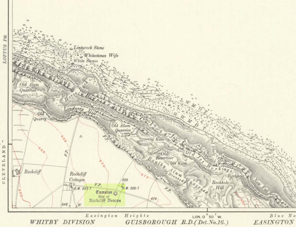
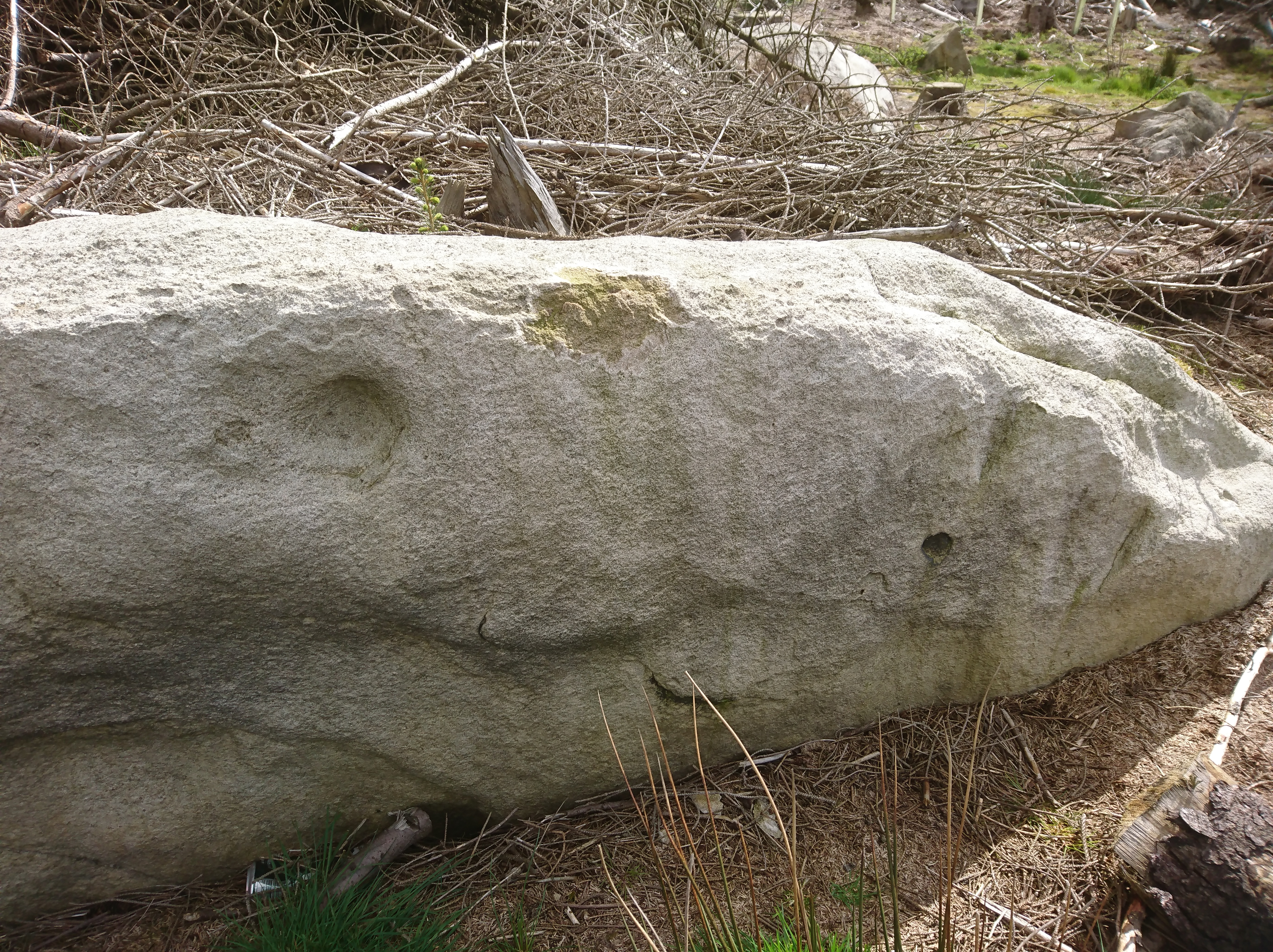
Occupying a prominent position above the ever-closer North Sea, upon which an old beacon was subsequently placed, this denuded prehistoric tomb was first surveyed by the Ordnance Survey lads in 1913, and subsequently in an essay by Messers Hornsby & Laverick (1920) on the ancient sites of Boulby, east of Easington. This was the first one they explored, calling it ‘Mound No.1.” They located it,
“due south of the ‘Soldier’s Garth’ in the east corner of the field called The Falls. It was a cairn with a diameter of 50ft. Two-and-a-half feet northwest of the centre peg, at a depth of 21 inches below the present surface, there was an unaccompanied burnt burial, which occupied a space of 15in by 18in. In a centre cut 7ft 6in by 6ft, at a depth of 3ft 6in, we found much burnt bone and many potsherds of the Bronze Age type, scattered over the whole space of the trench, down to a further depth of 3ft 10½in. In the south corner there were four stones set on edge and running in a direct (straight) line. The interment had been placed upon the clay, the soil of the original surface having been cleaned off. With this burial we found a good flint made from a polished celt and worn smooth at the point—possibly through having been used for striking fire on iron pyrites—many chips and several cupstones.”
The “several” cup-marked stones they describe at the end seem to have been lost; perhaps sleeping in some museum cellar somewhere (does anyone know?).
This cairn was one in a complex of eight that Frank Elgee (1930) suggested may have been laid out deliberately in the form of the constellation of Ursa Major, or The Plough, also known as ‘Charles Wain’.
References:
Brown, Paul & Chappell, Graeme, Prehistoric Rock Art in the North York Moors, Tempus: Stroud 2005.
Crawford, G.M., Bronze Age Burial Mounds in Cleveland, Cleveland County Council 1990.
Elgee, Frank, Early Man in North-East Yorkshire, John Bellows: Gloucester 1930.
Hornsby, William & Laverick, John D., “British Barrows round Boulby,” in Yorkshire Archaeological Journal, volume 25, 1920.
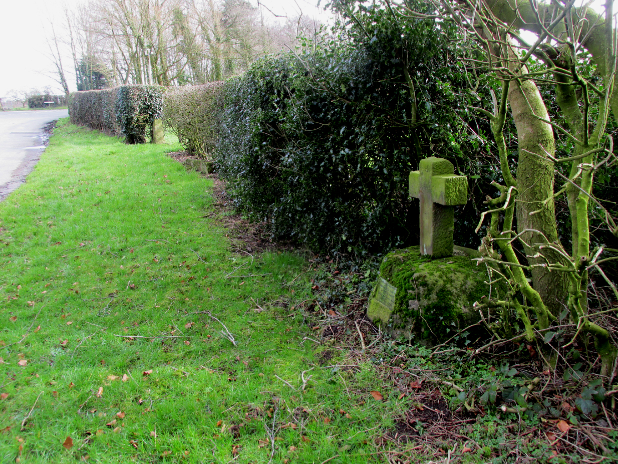
The cross is situated on the verge at the west side of the B5269 road near its junction with Ashley Lane at Stump Cross, north-east of Goosnargh.
Archaeology & History
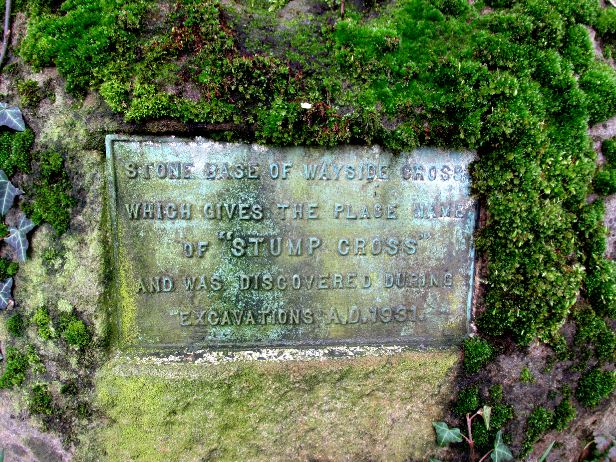
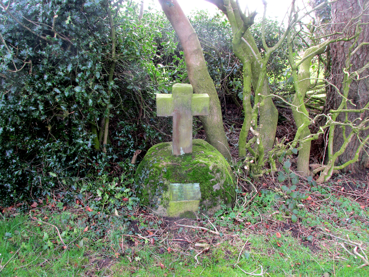
All that survives is the socketed base of the mediaeval cross, into which a small modern carved stone cross has been inserted. A bronze plaque attached to the base informs the reader that the cross gives its name to the locality, and that the base was discovered during excavations in 1931.
Richard Cookson (1888), in his Goosnargh Past & Present, writes:
“We have the remains of several upright crosses in this township called “cross stones” all being placed near to some public road or path. The corpses of the Roman Catholics are rested at those stones on their way to internment, and those funeral attendants who are of that persuasion kneel down and offer up a short prayer for the repose of the soul of the departed individual whose body they are conveying to the grave.”
Further to the destruction of crosses in the township, Cookson writes:
“…the Reverend Richard Wilkinson, late minister, of anti-Romanistic notoriety, in his frenzied hostility to the Roman Catholics, caused [the cross] to be broken up and removed…”
The site is listed by Henry Taylor, in his 1906 magnum opus on Lancashire crosses, and speaking generally on the destruction of wayside crosses in the Hundred of Amounderness, he writes:-
The bronze plaqueModern cross inserted into the Mediaeval socket
“The destruction of so many crosses, which at one time existed in this part of the Hundred, is due to the vandalism early in the nineteenth century of a vicar of Goosnargh, named Wilkinson. He was a vehement Protestant, and owing to his notoriety as a Prophet, was allowed to do much as he liked with these ancient monuments. Many crosses, indeed, it is said, were pulled down with his own hands. His prophesies foretelling the deaths of various persons often unfortunately came true, and he was thus, in this superstitious part of England, dreaded as a wizard. As this work of demolition took place before the date of the Ordnance Survey, there were in all probability many more crosses erected in Mediaeval times in this district than we have now any knowledge of, and it is quite possible that some of the crosses so recklessly destroyed may have been, like those at Halton and Heysham, of pre-Norman date and of great historical value. Fragments of them might even now be found were a diligent search be made.”
Further to this speculation as to the antiquity of these destroyed crosses, it is interesting to note the approximately parallel orientation of roads and field boundaries to the east of the Stump Cross. This may point to the area having been subjected to Roman survey, and the site of the Stump Cross having once been a shrine to the gods of the agrimensores (Roman surveyors) that had been Christianised.
References:
Cookson, Richard, Goosnargh: Past and Present, Preston, H.Oakey, 1888.
Taylor, Henry, The Ancient Crosses and Holy Wells of Lancashire, Manchester, Sherratt and Hughes, 1906.
Richardson, Alan, The Roman Surveyors in Cumberland, P3 Publications: Carlisle 2008.
Stone Circle (destroyed): OS Grid Reference – SK 26 94
Archaeology & History
This lost ring of stones was one many sites that could once be found in this area. It was written about in John Watson’s (1776) essay on the local antiquities, where, in describing places he thought were druidical remains (like the prehistoric Bar Dike and Apronful of Stones cairn), he told that
“There is something also of this sort on the other side of Bardike on Bradfield Common; in particular a circle of about eight yards diameter composed of twelve stones, and a confused heap in the centre, near Handsome Cross, and the faint remains of two larger not far off.”
Subsequent local historians like Joseph Hunter (1819) and Harold Armitage (1939) mention the place, with Armitage giving the impression that remains of it could be seen in his lifetime, but today we are at a loss to known its exact position and nature. By the sound of Watson’s initial description, this circle sounded as if a cairn of some sort was in the centre, giving it more a funerary nature than an open stone circle. But we don’t know for certain. This is also what John Barnatt (1990) posited in his local survey.
Based on the landscape, an initial analysis would place the circle most probably at SK 2615 9424, close to where the Handsome Cross itself stood—but this is conjectural. The natural landscape hereby has been ruined by extensive farming and forestry, so any remains of it seem improbable.
References:
Armitage, Harold, Early Man in Hallamshire, Sampson Low: London 1939.
Barnatt, John, Stone Circles of Britain – volume 2, BAR: Oxford 1989.
Barnatt, John, The Henges, Stone Circles and Ringcairns of the Peak District, University of Sheffield 1990.
Hunter, Joseph, Hallamshire: The History and Topography of the Parish of Sheffield, Lackington: London 1819.
Morgan, Paul & Vicki, Rock around the Peak, Sigma 2001.
Smith, A.H., The Place-Names of the West Riding of Yorkshire– volume 1, Cambridge University Press 1961.
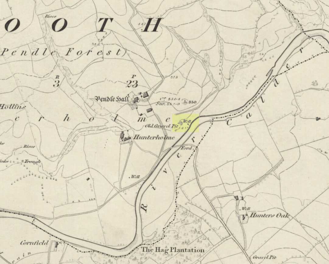
On the north-side of the River Calder, a short distance above the riverbank below Pendle Hall—as shown on the earliest OS-map of the area, but without a name—the local history writer, Joe Bates (1926), told us about this “spring of icy cold water”, which, in bygone years, “used to be called Robin Hood’s Well.” (Having moved out of the area, I’m not able to say whether this site is still visible. Can any local folk illuminate us on the matter?)
Folklore
Like many other sacred and healing wells across Britain, Bates (1926) said that the waters from Robin Hood’s Well,
“was at one time considered a specific for certain ailments of the eyes.”
References:
Bates, Joe, Rambles twixt Pendle and Holme, Nelson 1926.
From Otley, take the road north across the River Wharfe up and up, heading towards Askwith Moor. As the moorland opens up ahead of you, at the crossroads turn right along Snowden Carr Road and literally ¾-mile along (1.25km) where a track on your right goes to Carr Farm, on the left-side of the road is a gate. Go through here to the Naked Jogger Stone and walk up the rocky ridge ahead of you, alongside the walling (as if you’re going to the Sunrise Stone), and about 20-30 yards up you’ll reach this carving.
Archaeology & History
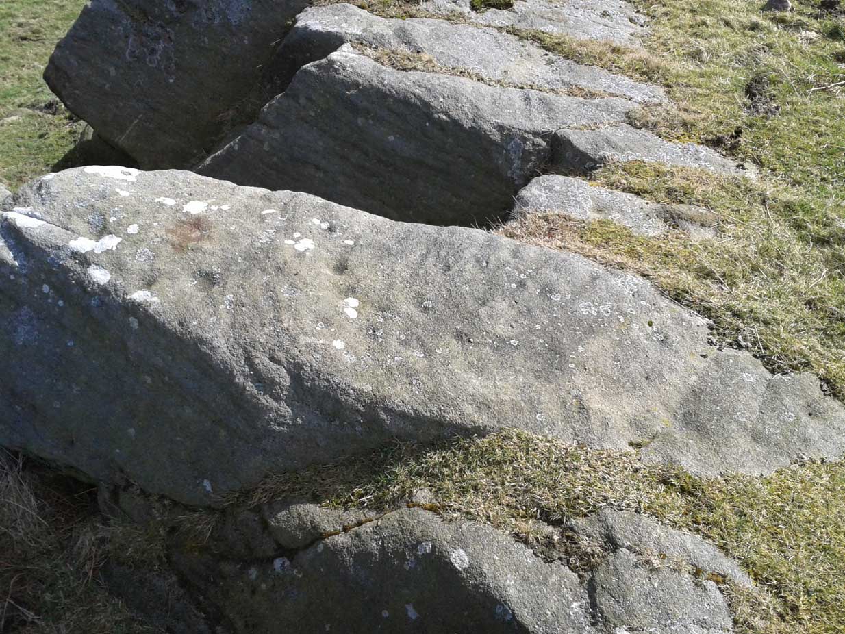
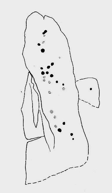
Best visited on a clear day, this is one carving amidst a small cluster of cup-marked petroglyphs found along the small geological ridge between the Sunrise Stone and Naked Jogger carving (none of which are as impressive as those two!). This particular design consists of a number of faint cup-marks— between 17 and 25 of them—reaching along the horizontal surface, with no distinct formal pattern, as usual. The carving continues beneath the encroaching soil.
Looking down at the carvingArchaeo-sketch
It seems to have been described for the first time by Stuart Feather (1973); then subsequently in Boughey & Vickerman’s (2003) survey, in which they attach a single cup-marking on an adjacent rock into the matrix of this design—but the two rock surfaces are distinctly separate. This apart, their description tells, briefly as always: “Large long rock which may be outcrop, with hill falling away steeply below. Seventeen worn cups.”
References:
Boughey, Keith & Vickerman, E.A., Prehistoric Rock Art of the West Riding, WYAS: Leeds 2003.
The long country road running between Aysgarth and Kettlewell is the B6160. Whether you’re coming from the north (Aysgarth) or south (Kettlewell), when you reach either Buckden or Cray, take the minor road west to Hubberholme. Just over 1½ miles further on, you reach the tiny hamlet of Yockenthwaite itself. Cross the river bridge, then turn left and walk along the footpath parallel with the river. 600 yards or so along, keep your eyes peeled for the low small ring of stones in front of you.
Archaeology & History
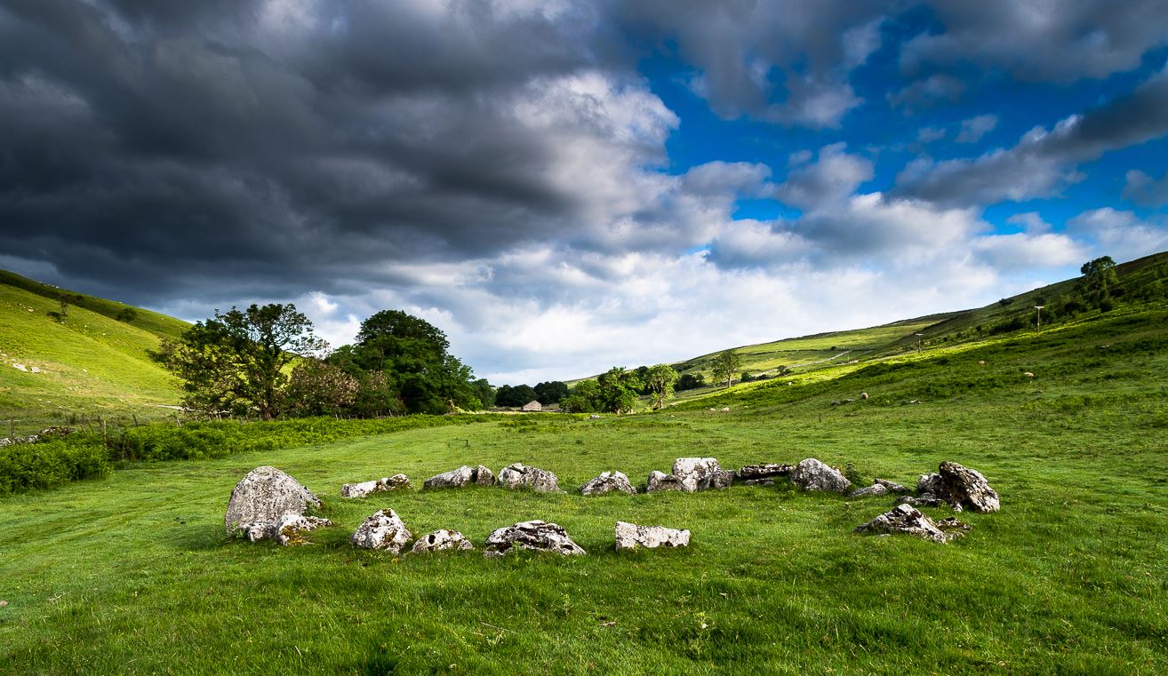
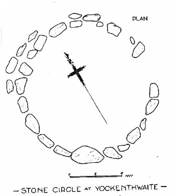
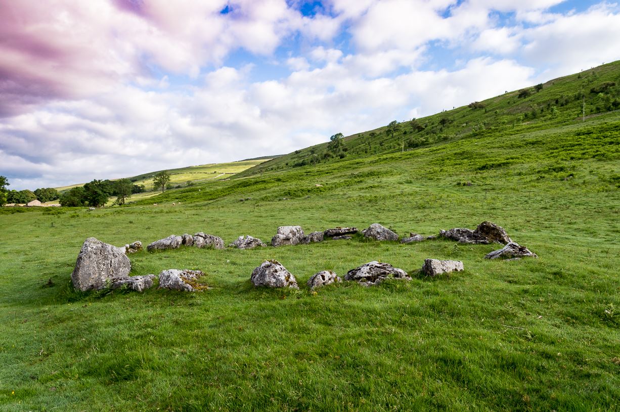
Just above the well-trod path that runs parallel with the usually shallow River Wharfe, this small and silent ring of stones rests in the idyllic host of Langstrothdale, deep in olde Yorkshire. Tis a wonderful spot… Classed as a ‘stone circle’ for many a decade (even by the esteemed Aubrey Burl), this small but ancient ring shouldn’t really be held in the same category as our larger megalithic circles. In truth, it looks more like some of the larger hut circles I’ve seen and uncovered down the decades—and it may well be that. Indeed, even the archaeo’s aren’t in agreement as to what it is, with the general idea being that it is the remains of a ring cairn of some type, despite no human remains being found here.
Raistrick’s 1929 planLooking northwest
Yockenthwaite itself was already know by this name in 1241 CE, when the monks of Fountains Abbey were given the land by one of the murderous invading Norman families of the period. This ingredient may be relevant to the history of the circle, for as the great northern antiquarian Harry Speight (1900) pointed out,
“in several places in the dales there are traces of what seems like ancient sheep or cattle enclosures, which are probably vestiges of this grant to the monks of Fountains in 1241.”
And Speight thought the circle had a similar origin to these remains. He continued:
“An enclosure of this kind, composed of a number of big stones on end, lies at the low end of the second pasture on the north side of the river between Yockenthwaite and Deepdale, and has been described as a Druid’s Circle. It is doubtless one of these monastic folds.”
And he may have a point. Although when Arthur Raistrick (1929) ventured here in the early 1920s, he had other ideas, pushing the date of the site way way back into the Bronze Age. “The circle,” Raistrick told,
“is slightly raised above the surrounding ground-level, and the stones, standing edge to edge, can be seen from a considerable distance on either fell side. The circle is 25 feet diameter, very nearly a true circle, there being only about 6 inches variation in diameter. The stones number 20, placed on edge to edge to edge…with only two small gaps, which would accommodate three or perhaps four more stones. These stones were probably removed some years ago to repair the stile in the neighbouring wall. Outside this circle of 20 stones, on the northwest side, there are four others placed concentrically, and very close to the circle, but there is no evidence that the circle was ever double, or that there were ever more than these extra four stones. There is a slight mound at the centre, and probing with a rod proved a small circle of stones, about 9 feet diameter at the centre, indicating probably a burial. Several large boulders lie on the level ground around the circle, but these are all rolled down from the fell-side above, and not placed in any connection with the circle. All the stones of the circle are of limestone…”
It was this designation that led to Burl (1976; 2000) to include it in his corpus of megalithic rings; although John Barnatt (1989) did question the validity of the site as a true ‘stone circle’ in his own gazetteer, saying:
“This unusual site comprises a contiguous ring of orthostats of c. 7.5m diameter, which are graded downslope to the SSW to allow for the gradient; their tops are all roughly horizontal. They range from 0.30 to 1.05m in height, 22-3 stones survive today and 3-4 appear to be missing. To the NNW there is a short outer arc of 4-5 stones placed immediately outside the main ring. 4 loose stones appear to have been added to the ring recently. Raistrick’s plan does not tally with the present remains, despite the sites undisturbed nature. The interior of the site is filled by a low horizontal platform, with virtually no height upslope to the north-east and a height of c. 0.5m to the south-west. The ring of stones stand well proud of this round the full circumference. This site appears to be a variant form of kerb-cairn rather than a true stone circle.”
The structure has been built onto a slight but notable platform, as has also been done with many hut circles—and the Yockenthwaite site may just be one of them. Only an excavation will tell us for sure. It’s isolated from other remains, but on the hills above, both north and south, denuded Iron Age and Bronze Age settlements look down on this solitary ring. Whatever it may be, it’s olde and in a beautiful setting. Well worth checking out if you like yer ancient sites!
References:
Barnatt, John, Stone Circles of Britain (2 volumes), BAR: Oxford 1989.
Burl, Aubrey, A Guide to the Stone Circles of Britain, Ireland and Brittany, New Haven & London 1995.
Burl, Aubrey, The Stone Circles of Britain, Ireland and Brittany, Yale University Press 2000.
Elgee, Frank & Harriet, The Archaeology of Yorkshire, Methuen: London 1933.
Longworth, Ian H., Regional Archaeologies: Yorkshire, Cory, Adams & MacKay: London 1965.
Raistrick, Arthur, ‘The Bronze Age in West Yorkshire,’ in Yorkshire Archaeology Journal, volume 29, 1929.
Standing Stone? (destroyed): OS Grid Reference – SE 2428 2329
Archaeology & History
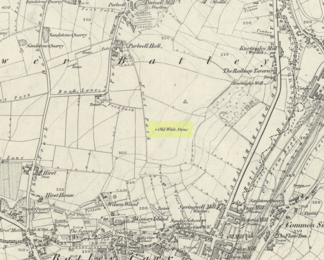
Old Wifes Stone on 1854 map
My first hint at the existence of this once valuable archaeological relic came as a result of me seeking out the history and folklore of some hitherto unknown, forgotten holy wells in the Batley and Dewsbury area. I located the material I was looking for on the old wells, but my fortuitous discovery of this site, the Old Wife’s Stone, blew me away!
It was the place-name of ‘Carlinghow’ about one mile northwest of the grid-reference above that initially caught my attention. From an antiquarian or occultist’s viewpoint, it’s intriguing on two counts: the first is the element ‘how‘ in Carlinghow, which can mean a variety of things, but across the Pennines tends to relate to either an ancient tribal or council meeting place, or a prehistoric burial cairn: an element that wasn’t lost in the giant archaeology survey of West Yorkshire by Faull & Moorhouse (1981). But the first part of this place-name, ‘carling‘, was the exciting element to me; for it means ‘old woman,’ ‘old hag,’ ‘witch’ or cailleach! The cailleach (to those who don’t know) was the prima mater: the Great Mother deity of our pre-christian British ancestors. Meaning that Carlinghow hill was a hugely important sacred site no less—right in the heart of industrial West Yorkshire! What is even more intriguing—or perhaps surprising—is that we have no record of such a powerful mythic creature anywhere in local folklore… Or so it first seemed…
Memory told me that no such prehistoric remains were recorded anywhere in that area—and certainly no prehistoric tombs. I scoured through my library just to triple-check, and found the archaeological records as silent as I first thought. Just to make sure I spent a day at the Central Library, where again I found nothing… So then I explored the region on the modern OS-maps, only to find that much of the area where the Carlinghow place-name existed was, surprisingly, still untouched by housing and similar modern pollutants. This was a great surprise to say the least. And so to check for any potential archaeological sites which might once have been in the Carlinghow area, I turned to the large-scale 1850 OS-maps (6-inch to the mile).
This is when I came across the Old Wife’s Stone, marked in the middle of fields on the outskirts of old Batley. There was no notice of it being a standing stone, or a simple boulder, or archaeological relic—nothing. But its place-name compatriot of ‘Carlinghow’ was the rising hill about a mile to the northwest. In days of olde, if Carlinghow was indeed the ‘burial tomb of the Old Woman’ or ‘meeting place of the cailleach’ (or whatever variants on the theme it may have been), it may have marked the setting sun on the longest day of the year if you had been standing at the Old Wife’s Stone – a midsummer sunset marker no less. (There are other ancient and legendary sites scattering northern England and beyond that are dedicated to the Cailleach, like the Old Woman Stone in Derbyshire, the Old Wife’s Neck in North Yorkshire, the Carlin Stone in Stirlingshire, the Old Woman Stone at Todmorden, Carlin Stone of Loch Elrig and many more.)
As if these curious ingredients weren’t enough to imply something existed in the heathen pantheon of Batley before the Industrialists swept away our indigenous history, we find echoes of the ‘Old Woman’ yet again, immediately east; this time where the animism of water and trees enfolded Her mythos in local rites and traditions, thankfully captured by the pens of several writers, and transmuted into another guise—but undeniably Her! But that, as they say, is for another day and another site profile…
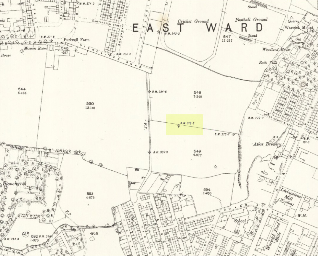
Position of stone in 1894
So is our Old Wife’s Stone (or for that matter, Carlinghow’s old tomb) still in evidence? A school has been built where it was highlighted on the 1854 OS-map and, from the accounts of local people, seems to have long since disappeared. The stone looks to have been incorporated into a length of walling, sometime between 1854 and 1888, and a bench-mark of “BM 318.2” carved onto it. But when the Ordnance Survey lads re-surveyed the area in 1905, this had gone. I have been unable to find any more information about this site and hope that, one day, a fellow antiquarian or occult historian might be able to unravel more of its forgotten mythic history.
References:
Faull, M.L. & Moorhouse, S.A. (eds), West Yorkshire: An Archaeological Survey to 1500 AD – volume 1, WYMCC: Wakefield 1981.
Goodall, Armitage, Place-Names of South-west Yorkshire, Cambridge University Press 1914.
Keighley, J.J., ‘The Prehistoric Period’, in Faull & Moorhouse, 1981.
o’ Crualaoich, Gearoid, The Book of the Cailleach, Cork University Press 2004.
Smith, A.H., English Place-Name Elements – volume 2, Cambridge University Press 1956.
Smith, A.H., The Place-Names of the West Riding of Yorkshire – volume 2, Cambridge University Press 1961.
Wright, Joseph, English Dialect Dictionary – volume 1, Henry Frowde: London 1898.
Acknowledgements: Many thanks for the assistance of Simon Roadnight and Julia King in the Batley History Group.
Follow the same directions as if you’re visiting the James Stone monolith. From here, walk about 60 yards southeast and zigzag about in the heather until you find a small squarish-shaped earthfast rock, barely 6 inches above ground-level (might be hard to find when the heather’s fully grown). If you’ve got a petroglyphic nose, you’ll find it!
Archaeology & History
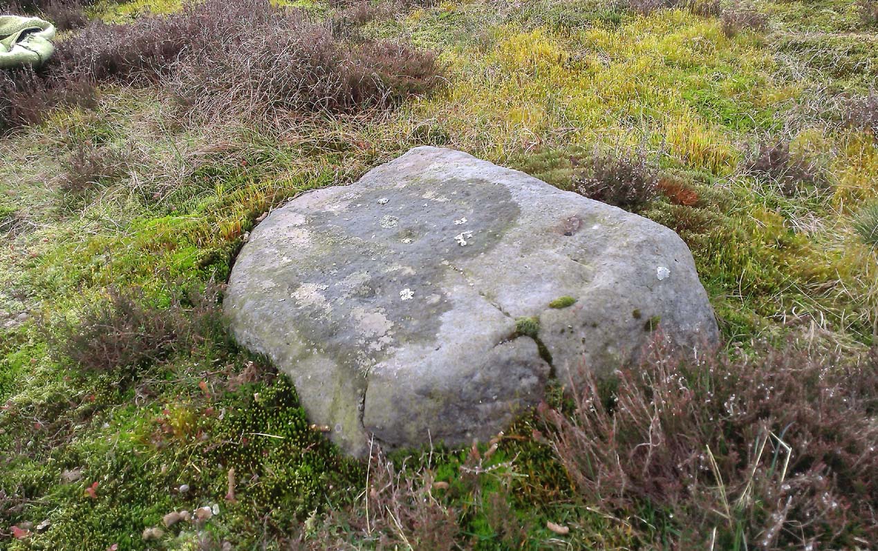
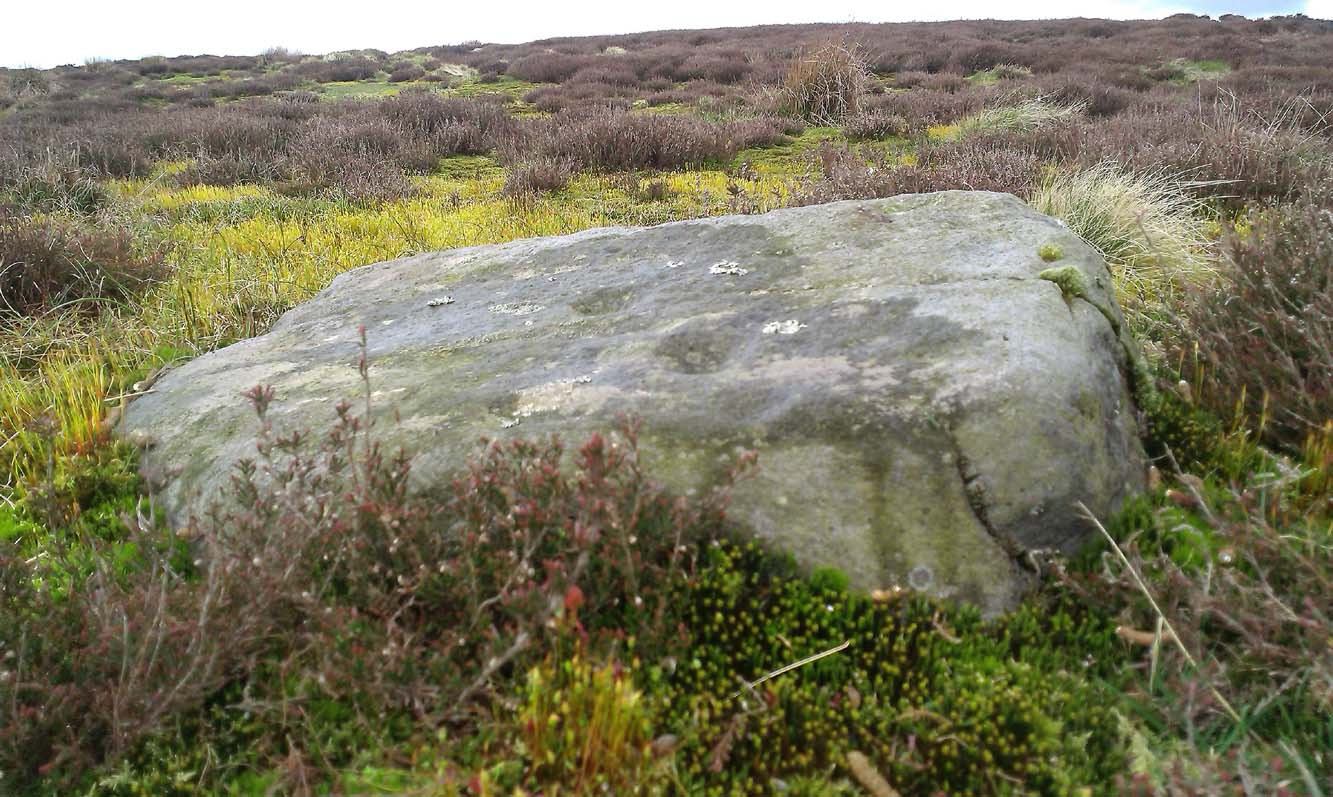
A simple faded cup-marked stone, roughly 2½ feet by 2 feet across, can be found about 65 feet southeast of the James Stone and 40 yards west of the Benty Gate prehistoric enclosure. Sadly when we visited the place a few days ago, the sky was grey and the conditions for good photos were poor.
Line of faint cups from centreExtra faint cup near centre left
At least five cup-marks have been etched onto the stone, with the main element being a row a three cups in a straight line from the centre of the stone to its SE edge. The central cup-mark has been carved where a natural crack in the rock, running from the edge of the stone, terminates. There also seemed to be a carved faded line running along the bottom edge of the stone—but it was unclear and another visit is needed in better light to see if there’s more on the stone.
From Blubberhouses church by the crossroads, walk up the slope (south) as if you’re going to Askwith, for 100 yards or so, taking the track and footpath past the Manor House and onto the moor. Once you hit the moorland proper, take the footpath that bears left going down into heather and keep going till you hit the dead straight Roman Road path running west onto Blubberhouses Moor. Carry along the Roman Road for about 200 yards as though you are going towards the Eagle Stone, and looking right (if you squint) you can just make out a small pimple on the top of the moors about a quarter of a mile away. That is where you are heading (be warned – it is boggy getting there).
Archaeology and History
James Stone, looking NE
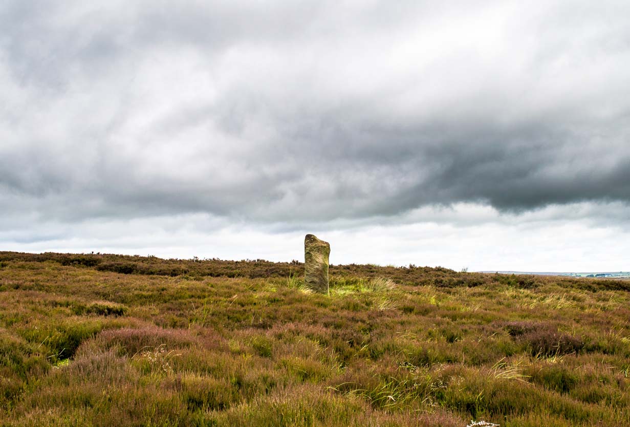
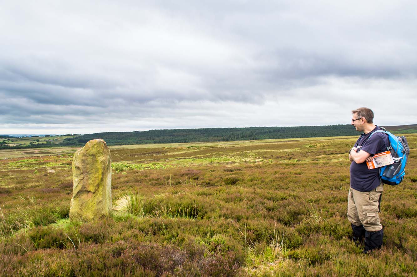
Discovered (or rather ‘noticed’) by James Turner and James Elkington in July 2016 (hence the name James Stone), this standing stone is of an indeterminable age – although it does look ancient. Standing more than 5 feet tall, and in the middle of nowhere, it is fairly difficult to get to unless you want to get wet feet. It is situated very close to a small and unexcavated prehistoric settlement and we could find no physical evidence of any tracks nearby (although Google Earth does show what looks like one or two very short, faint tracks near the stone, which is the old ‘Benty Gate’ track).
It could be a boundary stone, although doubtful – it has a feel to it that says it is prehistoric, although this is just guesswork on our part. I can find no reference to it in Cowlings Rombalds Way (1946) and there seems nothing about it in either of William Grainge’s (1871; 1895) detailed history works of the region.
Mr Turner gazing at the stone
At first we thought it unlikely to be a new find, however the stone is difficult to see from the Roman Road (I had been up here dozens of times before I noticed it) and seeing that people rarely go up here anyway, and it is relatively difficult terrain getting to it, it is not surprising that no one has bothered visiting it. It would take someone who is quite keen on megaliths to want to examine it and it is well off any tracks.
Having said that, it is a nice find and it could be linked in some way with the small unexcavated settlement nearby, or possibly the large Green Plain settlement nearly a mile away. Well worth a visit…bring your wellies!
References:
Cowling, Eric T., Rombald’s Way, William Walker: Otley 1946.
Grainge, William, The History and Topography of Harrogate and the Forest of Knaresborough, John Russell Smith: London 1871.
Grainge, William, The History and Topography of the Townships of Little Timble, Great Timble and the Hamlet of Snowden, William Walker: Otley 1895.
From the B6265 valley road between Bingley and Keighley, just near Riddlesden Hall, take the road up and over the canal into Riddlesden, bearing left up past West Riddlesden Hall and up Banks Lane. As you reach the T-junction at the top, where you hit the Silsden Road that goes round the moors, park up. Cross the road and follow the footpath up the field, go over a stile and continue up the track to the next gate. Once through this gate, go across the field to another gate which leads to a narrow track. The stone is situated on the left hand side about 75 yards from the gate.
Archaeology & History
Not previously recorded, this carving comprises of a large cup on the vertical surface of the stone with a faint surrounding ring mark.