Take the road from Shipley to Guiseley, the A6038, past the turn-off to Esholt, until you get to the top of what’s locally known as Hollins Hill. There’s a small farm-track to your leftand in the woodland here you’ll find the rocky outcrop.
Archaeology & History
Nothing has been written about this spot, but in this large wind-and-water worn rock outcrop, with its small cave, on the top part of the rock are several faint cup-markings.
Folklore
Legend tells that a man on horseback jumped from the top of here and landed safely at Low Hall, Yeadon, 2500 yards away to the east. (probably some sort of solar lore)
References:
Gray, Johnnie, Through Airedale, from Goole to Malham, 1891.
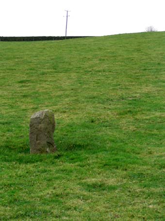
About a metre tall and found standing near the bottom of one of the fields diagonally across from the old farmhouse of Laverock Hall, here’s another old stone which may not have a prehistoric provenance. It is seemingly unknown by all but local people and would seem to be an old rubbing post for cattle — albeit a small one! There seems to be no written accounts of this stone; though until all of the local field-name maps have been checked, we can’t discount the possibility that this is the “standing stone” described in early place-name records that was mentioned by A.H. Smith in 1963.
References:
Bennett, Paul, The Old Stones of Elmet, Capall Bann: Milverton 2001.
Smith, A.H., The Place-Names of the West Riding of Yorkshire – volume 6, Cambridge University Press 1963.
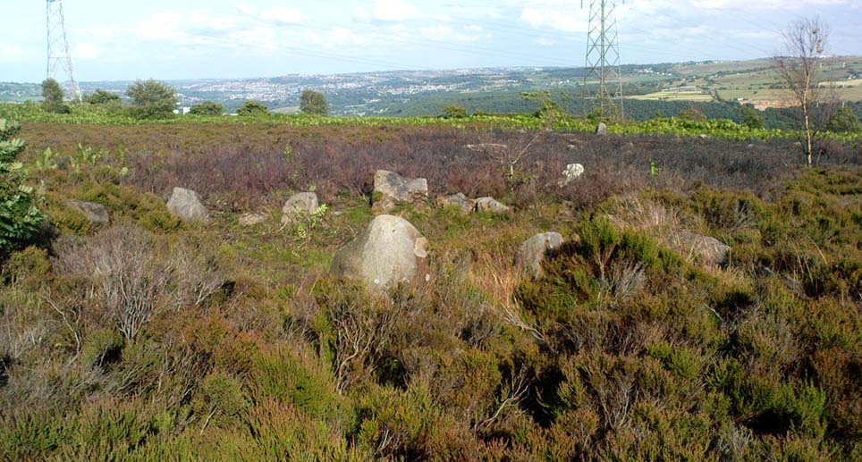
From Harden, go up Moor Edge High Side (terraced row) till you reach the top. Follow the path thru’ the woods on the left side of the stream till you bend back on yourself and go uphill till you reach the moor edge. Keep walking for about 500 yards and keep an eye out to your immediate left. The other route is from the Guide Inn pub: cross the road and go up the dirt-track on the moor-edge till you reach a crossing of the tracks where a footpath takes you straight onto the moor (south). Walk on here, heading to the highest point where the path eventually drops down the slope, SE. As you drop down, watch out for the birch tree, cos the circle’s to be found shortly after that, on your right, hidden in the heather!
Archaeology & History
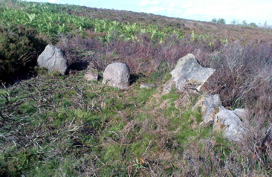
This aint a bad little site hidden away on the small remains of Harden Moor, but is more of a ‘ring cairn’ than an authentic stone circle (a designation given it by previous archaeologists). An early description of it was by Bradford historian Butler Wood (1905), who also mentioned there being the remains of around 20 small burials nearby. When the great Sidney Jackson (1956; 1959) and his team of devoted Bradford amateurs got round to excavating here, he found “four or five Bronze Age urns” associated with the circle. His measurements of the site found it to be 24 feet across, and although the stones are buried into the peat with none of them reaching higher than 3 feet tall, it’s a quietly impressive little monument this one. About 20 upright stones make up the main part of the ring.
I’ve visited the place often over the last year or so since a section of the heather has been burnt away on the southern edges of the circle. This has made visible a very distinct surrounding raised embankment of packing stones about a yard wide and nearly two-feet high, particularly on the southern and eastern sides of the circle, giving the site a notable similarity in appearance and structure to the Roms Law circle (or Grubstones Ring) on Ilkley Moor a few miles to the north.
There is also the possibility that this ring of stones was the site described by local historian William Keighley (1858) in his brief outline of the antiquities of the region, where he wrote:
“On Harden Moor, about two miles south of Keighley, we meet with an interesting plot of ground where was to be seen in the early days of many aged persons yet living, a cairn or ‘skirt of stones,’* which appears to have given name to the place, now designated Cat or Scat-stones. This was no doubt the grave of some noted but long-forgotten warrior.
* The Cairn was called Skirtstones by the country people in allusion to the custom of carrying a stone in the skirt to add to the Cairn.”
However, a site called the ‘Cat stones’ is to be found on the nearby hill about 500 yards southeast – and this mention of a cairn could be the same one which a Mr Peter Craik (1907) of Keighley mentioned in his brief survey of the said Catstones Ring at the turn of the 20th century. We just can’t be sure at the moment. There are still a number of lost sites, inaccuracies and questions relating to the prehistoric archaeology of Harden Moor (as the case of the megalithic Harden Moor Stone Row illustrates).
Section of the inner ring
The general lack of an accurate archaeological survey of this region is best exemplified by the archaeologist J.J. Keighley’s (1981) remark relating specifically to the Harden Moor Circle, when he erroneously told that, “there are now no remains of the stone circle on this site” — oh wot an indicator that he spent too much time with paperwork! For, as we can see, albeit hidden somewhat by an excessive growth of heather, the ring is in quite good condition.
It would be good to have a more up-to-date set of excavations and investigations here. In the event that much of the heather covering this small moorland is burnt back, more accurate evaluations could be forthcoming. But until then…..
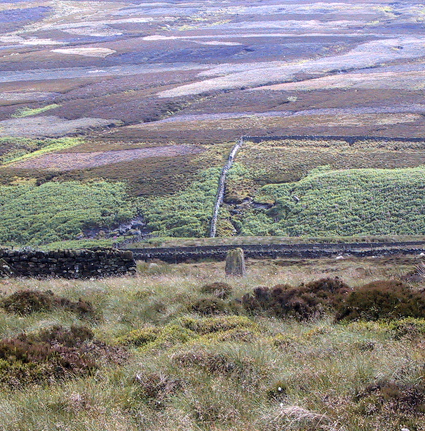
Pretty easy to find. Go along the Oakworth-Wycoller road, between Keighley and Colne, high up on the moors. When you get to the Water Sheddles Reservoir right by the roadside (y’ can’t miss it), stop! On the other side of the road walk onto the moor, heading for the walling a coupla hundred yards to your east (right). Where the corner edge of the walling ends, your standing stone is right in front of you! If for some reason you can’t see it, wander about – though beware the very boggy ground all round here.
Archaeology & History
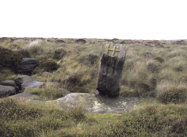
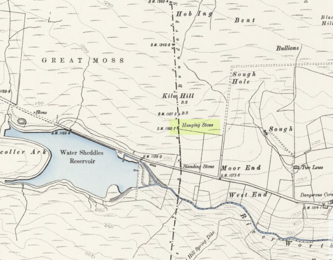
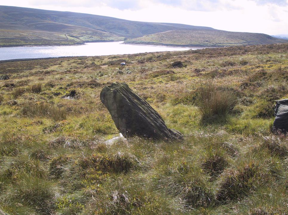
This seven-foot tall monolith, leaning to one side thanks to the regularly water-logged peat beneath its feet, stands on the Yorkshire-Lancashire. It is locally known as the Hanging Stone and the Standing Stone, but the name ‘Water Sheddles’ is a bittova puzzle. The place-names authority, A.H. Smith (1961) thinks it may derive from the middle-english word, shadel, being a ‘parting of the waters’ – which is pretty good in terms of its position in the landscape and the boggy situation around it. But ‘sheddle’ was also a well-used local dialect word, though it had several meanings and it’s difficult to say whether any of them would apply to this old stone. Invariably relating to pedlars, swindling or dodgy dealings, it was also used to mean a singer, or someone who rang bells, or a schedule, aswell as to shuffle when walking. Perhaps one or more of these meanings tells of events that might have secretly have been done here by local people, but no records say as such — so for the time being I’ll stick with Mr Smith’s interpretation of the word! Up until the year 1618 it was known simply as just a ‘standing stone’, when it seems that the words “Hanging Stone or Water Sheddles Cross” were thereafter carved on its west-face, as the photo below shows.
Cross carved on top of the stoneThe old stone, with its names carved for all to see
Whether or not this stone is prehistoric has been open to conjecture from various quarter over the years. Is it not just an old boundary stone, erected in early medieval times? Or perhaps a primitive christian relic? Certainly the stone was referred to as “le Waterschedles crosse”, as well as “crucem”, in an early record describing the boundaries of the parish of Whalley, dating from around the 15th century. This has led some historians to think that the monolith we see today is simply a primitive cross. However, sticking crosses on moortops or along old boundaries tended to be a policy which the Church adopted as a means to ‘convert’ or christianize the more ancient heathen sites. It seems probable in this case that an old wooden cross represented the ‘crucem‘ which the monks described in the early Whalley parish records.
Site marked on 1892 map
This monolith likely predates any christian relic that might once have stood nearby; although the carving of a ‘cross’ on the head of the stone may have supplemented the loss of the earlier wooden one. But it seems likely that this carved ‘cross’ was done at a later date than the description of the ‘crucem‘ in the parish records — probably a couple of centuries later, when a boundary dispute was opened, in 1614, about a query on the precise whereabouts of the Yorkshire-Lancashire boundary. After several years, as John Thornhill (1989) wrote,
“the matter was resolved on the grounds that the vast Lancastrian parish of Whalley had claimed territorial jurisdiction as far east as the Hanging Stone, thus the county boundary was fixed on the Watersheddles Cross.”
Water Sheddles stone looking SW
Certainly the stone hasn’t changed in the last hundred years, as we can tell from a description of it by Henry Taylor (1906), who said:
“The remains consist of a rough block of stone, leaning at an angle of about forty-five degrees against a projecting rock. The top end has been shaped into the form of an octagon, on the face of which a raised cross is to be seen. The stone is about six feet long and two feet wide, tapering to eleven inches square at the upper end, and appears once to have stood upright. Some local authorities have cut on it the words, ‘Hanging Stone or Waterscheddles Cross.'”
So is it an authentic prehistoric standing stone? Tis hard to say for certain I’m afraid. It seems probable – but perhaps no more probable than the smaller Great Moss Standing Stone found just a couple of hundred yards away in the heather to the west, on the Lancashire side of the boundary. Tis a lovely bitta moorland though, with a host of lost folktales and forgotten archaeologies…
In the vicinity of the denuded ring-cairn and old tumulus of Wortshorne Hill, the Calderdale historian Mr J.A. Heginbottom (1979) described finding this simple cup-marked rock, a hundred yards or so northwest of the old circle. In my ambles here I was unable to locate it. The stone may have been reburied or destroyed. Prehistoric cup-marked carvings are (officially at least) rare things in Lancashire – and usually where you find one, others lurk close by. Do any local folk out there know anything more about this site?
References:
Heginbottom, J.A., The Prehistoric Rock Art of Upper Calderdale and the Surrounding Area, YAS: Leeds 1979.
Take the single-track country lane between Farnhill and Low Bradley until you reach Hamblethorpe farmhouse. Where the birch woodland is on the slope going uphill, the field on the other side of the road, protected by walling, is where the stones are, just south of the farmhouse. There’s nowhere to park any car hereabouts, so it’s best walking here.
Archaeology & History
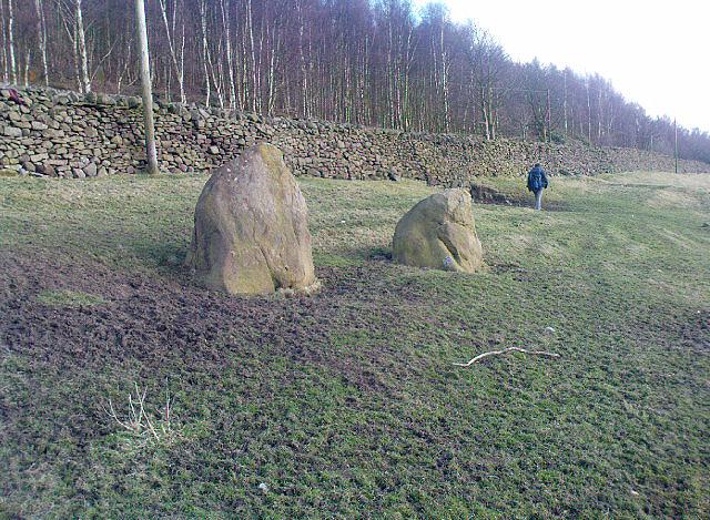
It seems that nothing has previously been written of this place. Hidden away at the top of the field we find two curious-looking standing stones: one nearly six-feet tall, and its companion about four-feet. They’re near the bottom of the slope from the giant Round Cairn and Long Cairn tombs of Low Bradley Moor, several hundred yards to the east— and were it not for the fact that they have a distinctive Castlerigg-like appearance about them, perhaps I wouldn’t have given them a second chance. Curious earthworks are in the same field, to which written records also appear silent. Tis a lovely little spot…
Although cited as being on Weston Moor, it is closer to Askwith village. From the village, take the north road and shortly before reaching the T-junction, park-up (somewhere!). There’s a small copse of trees on your right and fields above them – that’s where you’re heading. You might have to bimble about a bit before the rock catches your attention, but it’s worth the wandering. Look around!
Archaeology & History
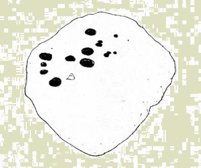
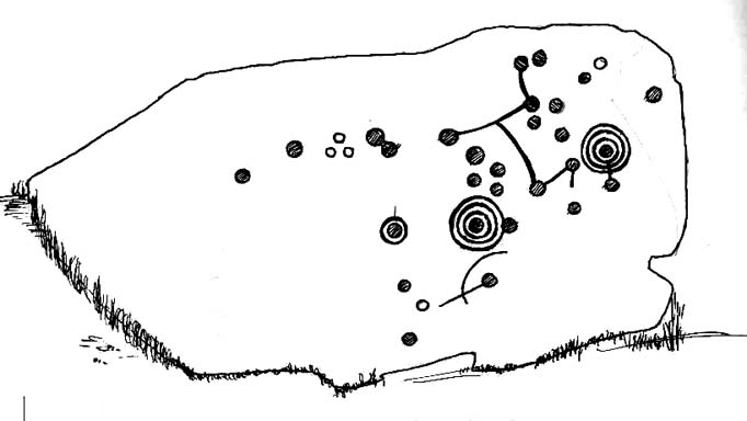
Sketch of the design c.1985
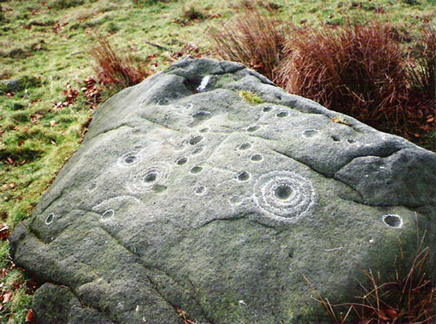
This is an excellent, archetypal cup-and-ring stone that’ll be loved by any real rock art student! Cups-and-multiple rings are the main visual feature to this stone, along with another 20 single cups and another primary cup-and-ring, all on a medium-sized sloping rock face. The carving was first described by Cowling & Hartley (1937). Since their initial discovery, several other writers have mentioned it with little further comment. The smaller but impressive double cup-and-ring carving 543 can be seen at the bottom left of the woodland in front of you – well worth seeing if you’re visiting here!
References:
Boughey, Keith & Vickerman, E.A., Prehistoric Rock Art of the West Riding, West Yorkshire Archaeology Service 2003.
Cowling, Eric T., Rombald’s Way, William Walker: Otley 1946.
Cowling, E.T. & Hartley, ‘Cup-and-Ring Markings to the North of Otley,’ in Yorkshire Archaeological Journal, 33, 1937.
Hotham, John Paul, Halos and Horizons, Hotham Publishing: Leeds 2021.
The best way to get here it is to head from the Cow and Calf Hotel up the hillside to where the great rock is sticking out (the Pancake Stone). From here, head straight onto the moor toward the Idol Stone — close to the Idol Rock which you can see 400 yards south in front of you. From here, follow the footpath up the hill before you and keep on the path towards Lanshaw Lass. About 100 yards on, turn straight west into the heather and keep your eye towards the south. About 250 yards on, about 100 yards away from the Green Crag Top cup-marked boulder, you’ll see it!
Archaeology & History
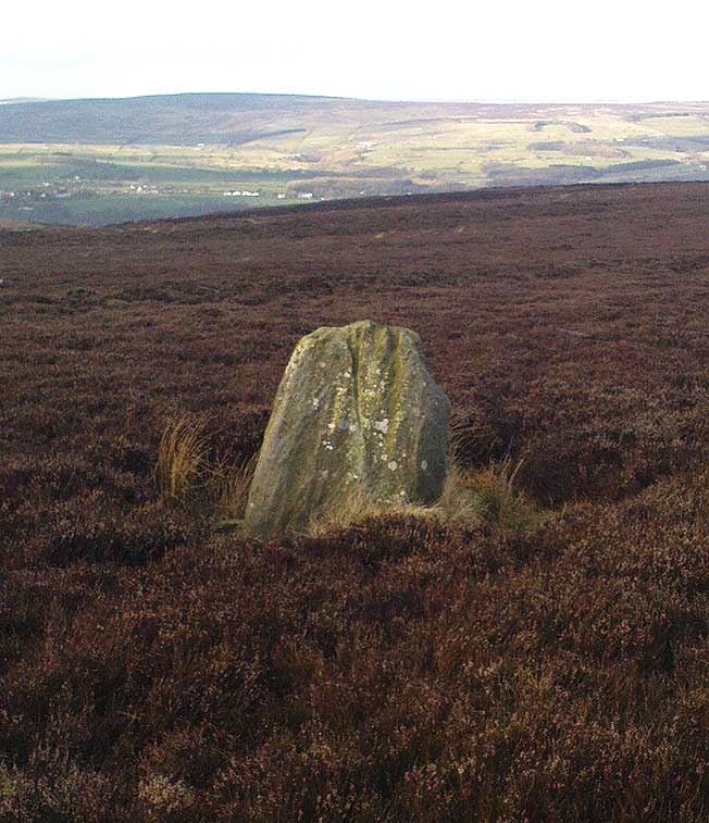
One of very few solitary standing stones on Ilkley Moor, and one which I relocated after The Old Stones of Elmet (2001) had gone to press — which was a great pity. Nearly four feet tall, this is a good chunky monolith which stands close to being on line with the summer solstice alignment from the nearby Twelve Apostles stone circle. (I was gonna call it the Summer Stone, but thought better of it!)
There’s another recumbent stone, more than five feet tall when erected, 200 yards northwest of here. (This is also very close to being in line with with our chunky monolith, plus the Twelve Apostles. Anyone out there with a GPS who can check if this possible alignment is the last remnant of a summer solstice stone row? It probably isn’t, but it’d be good to find out.) On the same moorland level, heading back down, when the heather’s burnt back you’ll find a number of prehistoric tombs along the edge of the ridge. These don’t appear to be in the archaeological registers.
Follow the directions to reach the Great Skirtful of Stones giant cairn (very worryingly being encroached upon, illegally [it’s a protected monument], by employees of Bradford Council digging tracks into its edges). Walk less than 100 yards to the east, down the slight moorland slope (Leeds & Otley Chevin are in the distance). You’re here!
Archaeology & History
This is a very intriguing site. Intriguing because we don’t actually know what it is! It’s best seen at the end of winter, shortly after the heather-burning’s been done; but if there’s been no burning here, after a year or two it’s almost impossible to find!
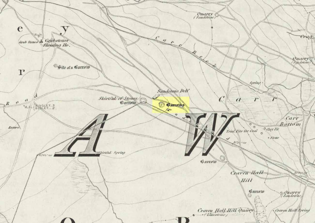
Great Skirtful Ring on 1851 mapColls’ 1846 plan
Despite it being only a short distance east of the Great Skirtful giant cairn, very little has been written about it (a surprise in itself!) – but this is down the failings of archaeological professionals in the area, who still neglect this incredible prehistoric arean. It was first described in Mr J.N.M. Colls’ (1846) survey of sites in the region, where he thought it to be a prehistoric camp. Several years later the Ordnance Survey lads visited here and deemed it to be prehistoric barrows, which doesn’t seem true. Nearly a hundred years later, the great northern antiquarian Eric Cowling (1946) who saw fit to describe it as an “enclosure” — so I’m copying his idea so I don’t get into too much trouble! Thinking it to be a Bronze Age monument, he wrote:
“On the main ridge of Rombald’s Moor and about eighty yards to the east of the Great Skirtful barrow, is a small circular enclosure with a diameter of twenty yards. There appears to have been an entrance on the eastern side, which is protected by a short length of banking to the east.”
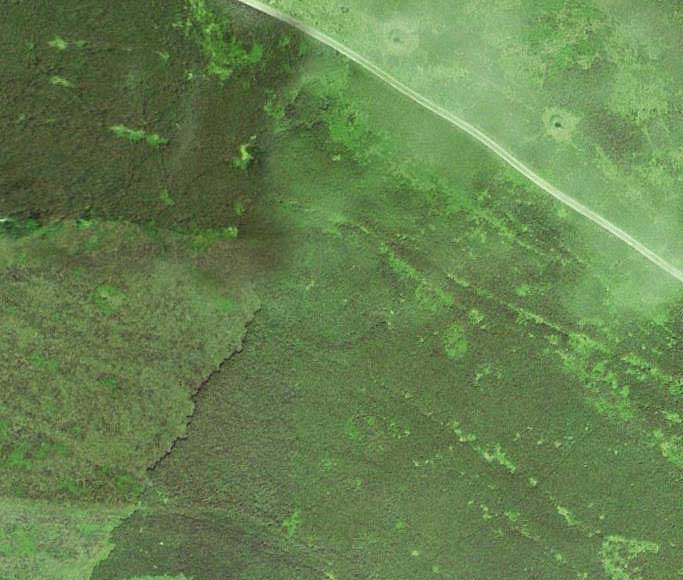
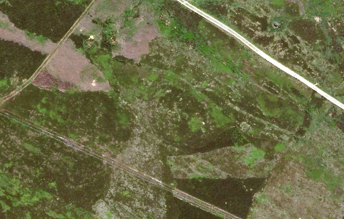
Aerial image, 2002Aerial image, 2009
The “length of banking” he described didn’t seem apparent when we visited the site yesterday (23.3.09), but we intend a further exploration of this and the adjacent monuments in the coming weeks and hope to locate it!
Interestingly, the archaeologists Faull & Moorhouse (1981:1:103), in their otherwise fine survey, actually doubted this place as having any prehistoric status, without giving any reason why—which was a big mistake. No doubt they spent too much time in offices and board meetings instead of getting out a bit more! Unless evidence to the contrary can be strongly presented, this site must be classed as undoubtedly prehistoric in nature (Bronze Age or Iron Age certainly) and almost certainly had something to do with rituals of the dead.
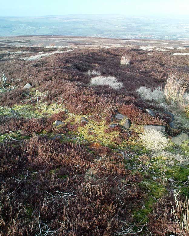
Great Skirtful Ring embankmentSouthern edge of the ring
From outer edge to outer edge the ‘ring’ measures 102 feet across, N-S, and with a rough maximum 101 feet E-W, being diameter, being some 300 feet in circumference. When you look at the site at ground level it appears to be an almost perfect ring, consisting of an embankment little more than 2 feet high at the most, with entrances both east and west. However, as the aerial images show, the perfect circle aint quite so perfect! But at ground level, there’s a certain uniformity about it. The embankment is in very good condition around much of the ring, with only slight damage in certain parts. The western opening strongly implies a direct relationship with the Great Skirtful cairn — which would infer this monument to have more of a ritual nature rather than the simple domestic enclosure, inferred by Colls and Cowling. Adding to this we find a tumulus 100 yards east and the remains of several other cairns nearby, making the site almost hemmed in by death-sites. A prehistoric cemetery is a short distance further down the moorland slopes to the east. Add also the fact that the Burley Moor stone avenue runs immediately south and the death-motif has to be increased.
What do I think it is? Not sure! The thought that it’s a previously unrecognized henge has crossed my mind…but henge monuments aren’t things that I’m very clued-up on, so wouldn’t like to say for sure. If there are any university archaeology students out there who are into getting their feet dirty, give this site a look-over. It’s intriguing, in very good condition, and could do with an accurate ID!
References:
Bennett, Paul, The Old Stones of Elmet, Capall Bann: Chieveley 2001.
Colls, J.N.M., ‘Letter upon some Early Remains Discovered in Yorkshire,’ in Archaeologia, volume 31, 1846.
Cowling, Eric T., Rombald’s Way, William Walker: Otley 1946.
Faull, M.L. & Moorhouse, S.A. (eds), West Yorkshire: An Archaeological Survey – volume 1, WYMCC: Wakefield 1981.
Easy enough to get to – and a lovely place to behold for an amble! From Settle, take the B6479 road up to Horton-in-Ribblesdale (ask a local if you’re too dumb to find it!), turning right at Stainforth and up the single-track road towards Pen-y-Ghent. Keep yer eyes peeled for Rainscar – you’ve about a mile to go. If you end up at Pen-y-Ghent House you’ve gone past ’em. Turn back for 2-300 yards. It’s on the right-hand side of the road as you’re coming up, about 100 yards up the footpath.
Archaeology & History
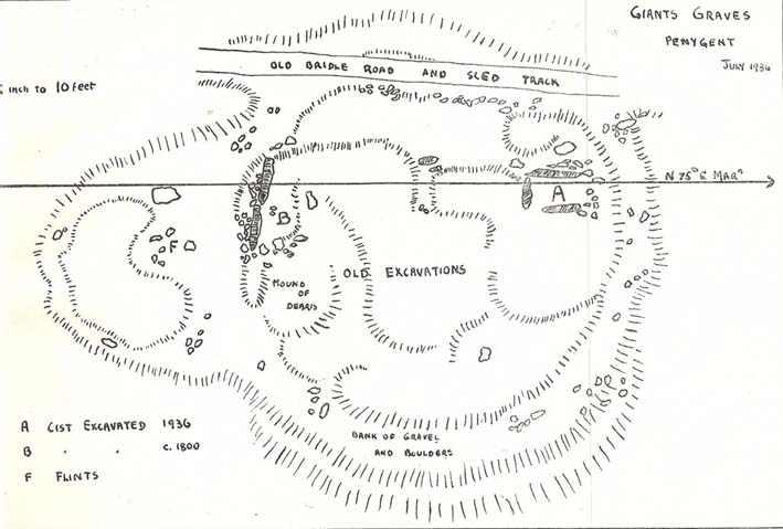
The Giants’ Graves (after W. Bennett, YAJ 1937)
The earliest description I’ve found of this is in Terence Dunham Whitaker’s History and Antiquities of Craven (1878), where he reckoned the remains here to be of Danish origin. The same thing was professed by the southerner, archdeacon W. Boyd, who said as such to the local people hereabouts more than 100 years ago, but they thought him a bit stupid and laughed at his notions! (though it does seem that Boyd wasn’t liked locally, tending to think himself better than the local people, who told him very little of local lore and legend) Describing the remains, Whitaker said there were skeletons found in the tombs:
“The bodies have been inclosed in a sort of rude Kist vaen, consisting of limestone pitched on edge, within which they appear to have been artificially bedded in peat earth.”
But Harry Speight (1892) doubted this, saying that Whitaker never even visited the site! When he went here he told us that,
“What is left at present are a few mounds of earth, the largest, which is divided into two, and lies north and south, measures about 28 feet by 25 feet. There is another apparent grave-mound on the east side of it, and again to the north is an oblong excavation or trench, 7 feet wide and nearly 30 feet long, in which several bodies or coffins may have been deposited. Several large oblong stones lay flay upon the ground beside the graves, but these were removed a few years ago and degraded to the service of gate-posts.”
The site was excavated in June 1936 by Arthur Raistrick and W. Bennett (1937) after they had been badly damaged and the stones robbed for walling and other profane building operations. Herein were found two burial cists with fragments of human bones in each tomb. In Bennett’s short account he told:
“The site consists of a nearly circular bank, about eight feet wide, and in parts two feet high, surrounding a much disturbed area. Within the area are the remains of two cists and a number of hollows that certainly represent other similar structures. The farmer tells of the removal of more than twenty large stones from these hollows, for use as gateposts, wall throughs and drain covers.* The bank encloses an area fifty-four feet east to west…and fifty feet north to south. At the west end there is a smaller bank, roughly in form of a circular apse, extending a further thirty feet. Many large boulders and vast quantities of smaller stone are incorporated in the bank.
“Near the east end, with its axis bearing N75E, is a cist — three stones in position. This was cleared to a depth of eighteen inches, and though no floor stone was present, among the sifted soil were found (i) broken bones, including parts of humourus, axis, vertebrae, ulna, ribs and cranium, all human; (ii) five teeth — two molars, one wisdom tooth, and two incisors, which appear to represent tow individuals. Sir Arthur Keith reports that the bones submitted to his examination may represent more than one adult person, and there is also a fragment of a child’s tibia. Most of the limb bones belong to a man of medium stature… He suggests from the condition of the bones a person of the Iron Age. While this is possible with a secondary interment in the area, it is rather unlikely, as all the bones came from within the built cists, and not from the earthen part of the mound, where secondary burials would be expected.
“At the west end are two large stones, the side stones of cists or of a chamber. The ground in front of them has been excavated many years ago…and partially refilled with boulders… Within the small extension on the west a trial excavation showed eighteen inches to two feet of random boulders, and beneath them, on the old sub-soil surface, two inches of fine grey sand, with two small flints — one of them a well-worked blade. These probably pre-date the construction of the circle.
“The whole site is suggestive of a multiple cist burial mound, or even a “passage grave” type. The obvious hollows, from which many of the larger stones have been lifted, are aligned in a parallel series, along an axis N75E, directed towards the two remaining large stones at the west, which may be part of a chamber wall and not part of a cist.”
Recent archaeological analysis has suggested these may be the remains of an old chambered cairn, although there is today far too much damage that’s been done to give us an accurate portrayal of what this originally looked like. The Dawson Close prehistoric settlement is less than half-a-mile further up the ridge.
Folklore
The folklore here is simple: these are the graves of giants who lived in the valley of Littondale in ancient times.
References:
Bennett, Walter, ‘Giants’ Graves, Penyghent,’ in Yorkshire Archaeological Journal, part 131, 1937.
Boyd, W. & Shuffrey, W.A., Littondale Past and Present, Richard Jackson: Leeds 1893.
Feather, Stuart & Manby, T.G., ‘Prehistoric Chambered Tombs of the Pennines,’ in YAJ 42, 1970.
Speight, Harry, The Craven and North-West Yorkshire Highlands, Elliott Stock: London 1892.
Whitaker, Thomas Dunham, History and Antiquities of the Deanery of Craven, Joseph Dodgson: Leeds 1878 (3rd edition).
* It might be worthwhile exploring the local gateposts and walls to see if any of these covering stones had cup-and-rings carved on them, as was traditional in many parts of Yorkshire and northern England.