Gough’s Barrow, Long Compton, Warwickshire

Tumulus (destroyed):  OS Grid Reference – SP 2946 3090

Archaeology & History
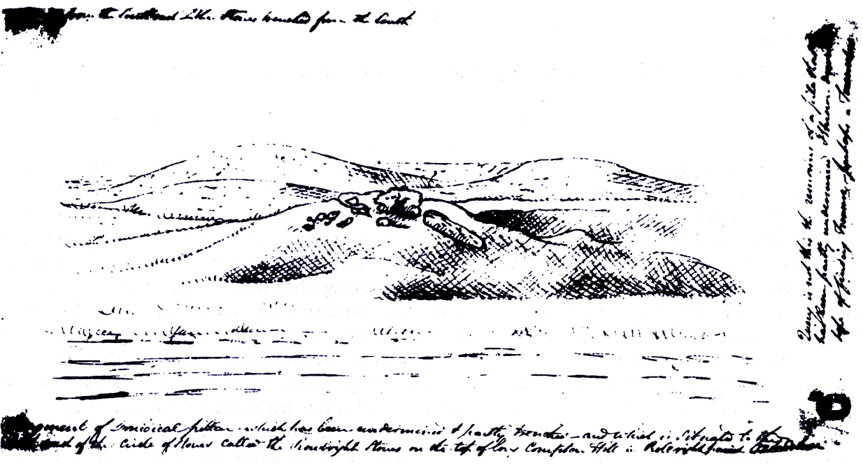
Only known drawing of Gough’s Barrow

In days of olde there were heathen sites around the edges of the beautiful Rollright Stones complex that have sadly fallen prey to the intensive agriculture of more modern ‘civilized’ times.  It’s become the way of things….. One site of importance in this geomythic  pantheon was the ‘Gough’s Barrow’—so named after a drawing was done of the site by Richard Gough, editor of the 1789 edition of Camden’s Britannia.  As far as I’m aware, it is the only one ever done of this monument.  The Oxford archaeologist George Lambrick (1988) saw “every reason to accept the position and details of the barrow”, upon which stood at least two large stones—one of which gained the description of a ‘druidical pillar.’
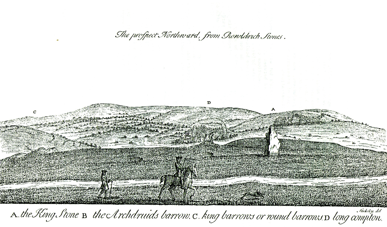
Stukeley's 1743 drawing

Stukeley’s 1743 drawing

The same barrow may have been recorded in one of drawings of the great William Stukeley, who visited the Rollright Stones in 1710 and then again in 1723.  On the left-side of the adjacent drawing you can see a denuded mound close to the edge of the picture, similar in shape and form to that drawn by Richard Gough.  It is probably the same tumulus or barrow.  Trial excavations at the site in 1983 looked for any remains of the old tomb, but nothing significant was uncovered.  Lambrick estimated that the site probably measured “about 18m wide and 20m long east-west,” and “was a megalithic barrow and was therefore probably Neolithic in origin.” 

References:

  1. Bennett, Paul & Chanter, James, The Complete Rollright Stones, forthcoming
  2. Bennett, Paul & Wilson, Tom, The Old Stones of Rollright and District, Cockley Press: Chipping Norton 1999.
  3. Burl, Aubrey, Great Stone Circles, Yale University Press 1999.
  4. Lambrick, George, The Rollright Stones, English Heritage 1988.
  5. Peters, Frances, “An Antiquarian Visit to the Rollright Stones,” in Wiltshire Archaeological & Natural History Magazine, volume 94, 2001.
  6. Stukeley, Willliam, Abury – A Temple to the British Druids, London 1743.

© Paul Bennett, The Northern Antiquarian

Craigenkirn, New Kilpatrick, Dumbartonshire

Long Cairn:  OS Grid Reference – NS 51839 78157 

Getting Here

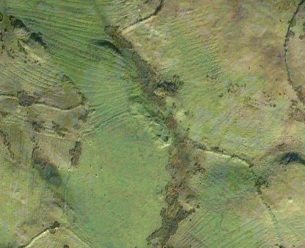
Aerial view of the cairn

Aerial view of the cairn

Take the A809 road several miles north out of Glasgow, between Bearsden and Drymen.  Once out of the suburban sprawl, passing Milngavie, you’re heading to the famous Carbeth hutters.  Before this, note the gold course on your right (east).  Park here and cross the road where a gate and overgrown footpath takes you onto the grassy hills.  Keep to the fence-side for about 700 yards until it veers downhill.  Don’t walk downhill!  Keep in the same direction into the short grasses and, veering gradually left, downhill for a couple hundred yards ahead and, across a small boggy area, you’ll note some large upright stones in front of a mound.  That’s it!

Archaeology & History

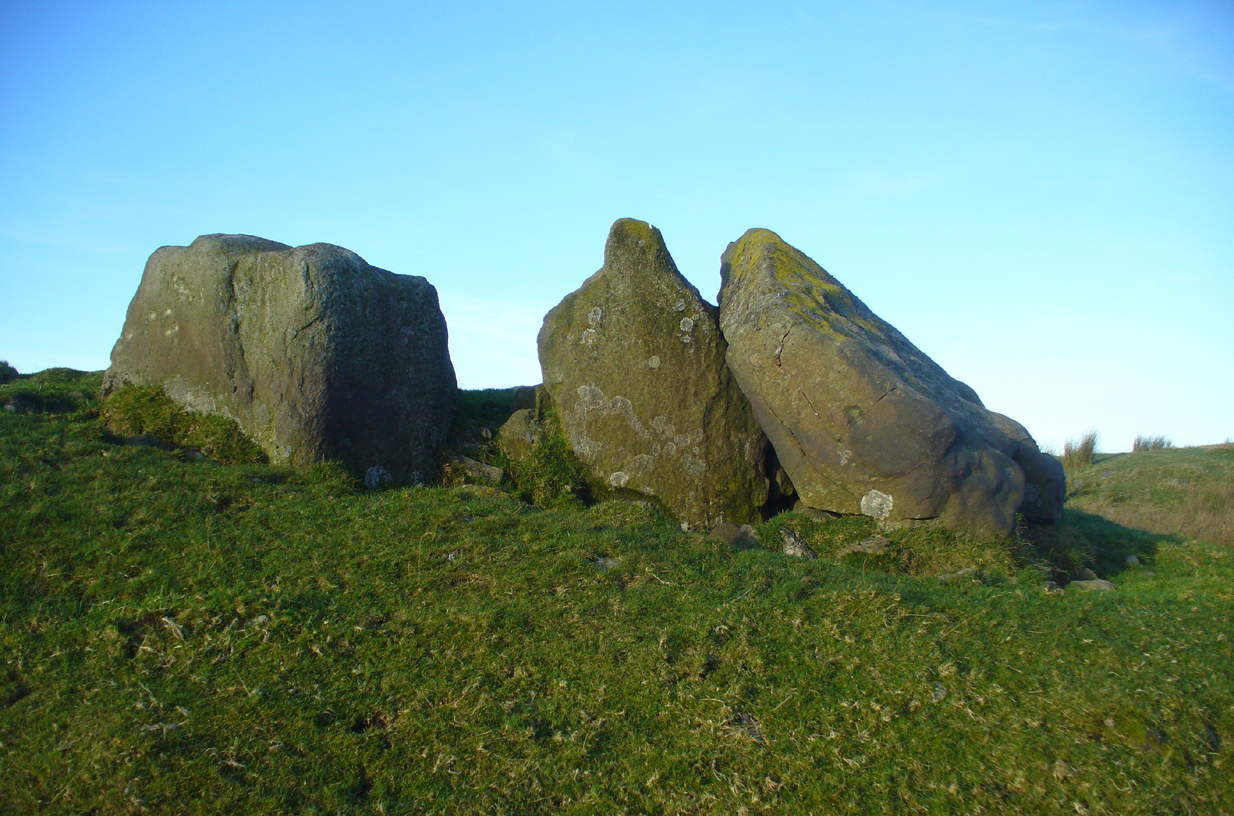
The SE stone 'entrance'

The SE stone ‘entrance’

There is no previous reference to this site which was found, quite fortuitously, by Nina Harris of Organic Scotland a few years ago.  She visited the site a number of times, puzzling over the curious line of possible standing stones at the edge the grass-covered mound—wondering if it was anything at all.  A few months ago she took us to see the place…

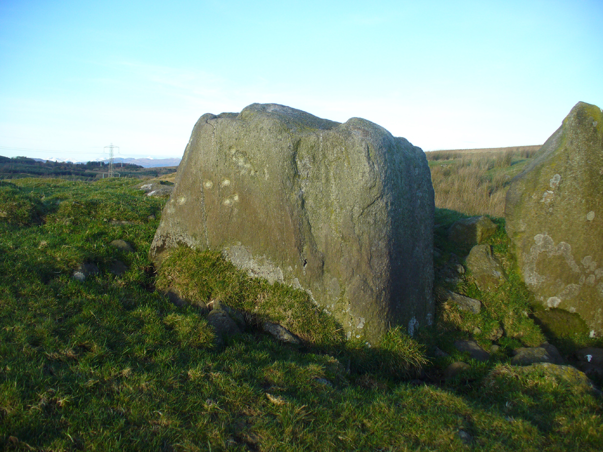
Modern gunshot cup-marks on entrance stone

Modern gunshot cup-marks on entrance stone

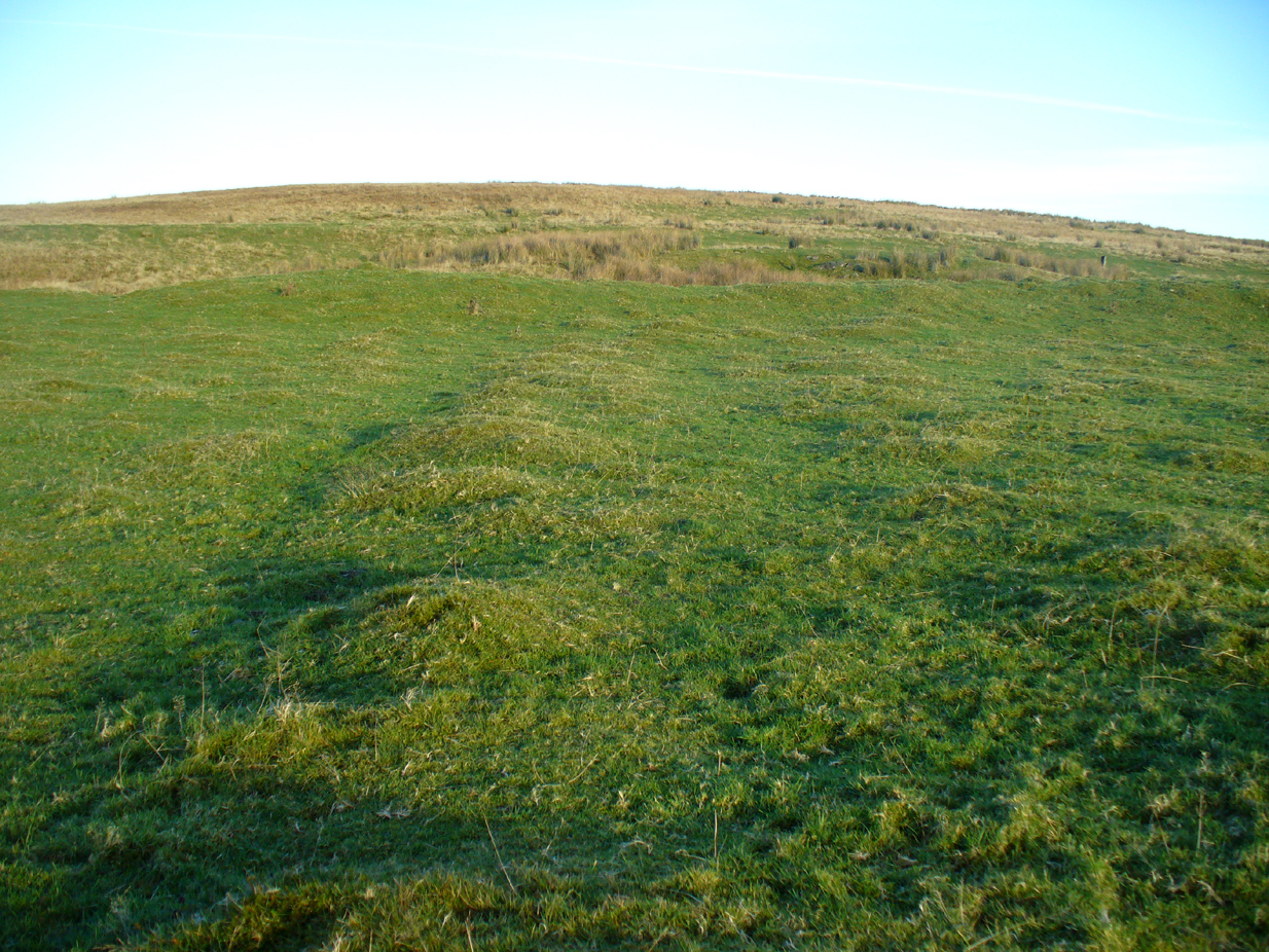
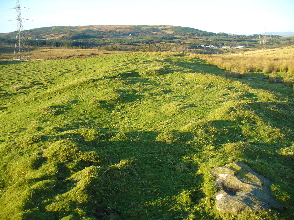
The site has been damaged and elements of it have been stripped for walling that are visible all around here.  The cairn is more than 55 yards in length, running from its southeastern stone ‘entrance’ to the gradually diminishing northwestern edges.  At its widest it is 14.6 yards (13.5m) across, near its southeastern end.  The main three standing stones at its entrance are four-feet tall at the highest, with one of them leaning upon another; an adjacent fourth stone, smaller than the main three, is more embedded into the cairn mass a couple of yards away.  Cup-marks on one of the three larger uprights here are recent gunshot marks; whilst the possible cup-marks on the largest upright are natural.

Line of ealling runs to the cairn

Line of ancient wall runs up and over the cairn

Looking NW along the cairn mass

Looking NW along the cairn mass

In standing on top of the long cairn, just above the large stones, you can see how sections of it have been stripped away.  Just beneath the surface is a line of internal walling, with what seems to be another one running parallel.  These run for a few yards until we reach a large circular depression within the overall cairn mass, a yard deep and 6-7 yards across; on the northern edge of which we can clearly see a section of walling beneath the surface.  When we look at the aerial view of this on Google Earth, we can clearly see how this walling actually begins way outside of the cairn mass itself, as a much denuded line of it (probably medieval in origin, though possibly Iron Age) curves across the grasslands from the west, crosses the long cairn and re-emerges on the other side of the adjacent boggy ground at its southeastern edges and continues on its way: indicating that the cairn mass beneath the wall is much older than the walls running across it.

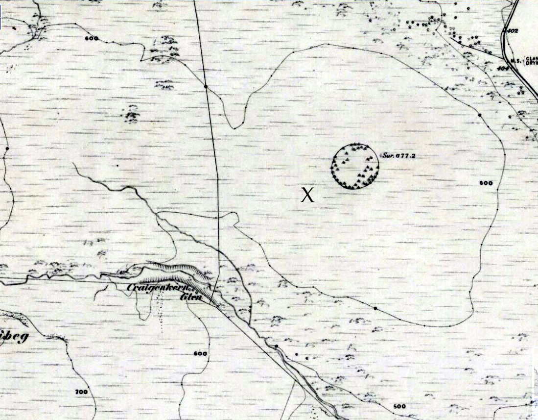
"X" marks the spot!

“X” marks the spot!

The main three 'entrance' stones

The main three ‘entrance’ stones

Audrey Henshall (1972) described the existence of another prehistoric chambered tomb like this one at Cairnhowit 1.95 miles (3.14km) southwest, and we find the Stockie Muir long cairn 3.12 miles (5.02km) to the northwest, clearly showing that the incidence of this monument is not an isolated one.  Others can be found not much further away.  The existence of the raised geological plate known as Carneddans Wood just over a mile south may have once been home to another chambered cairn.

Please note that the grid reference for this site fixes on the southeastern section of the cairn, where the upright stones are.

References:

  1. Henshall, Audrey S., The Chambered Tombs of Scotland – volume 2, Edinburgh University Press 1972.

Acknowledgements:  First and foremost to Nina Harris, for unknowingly finding the place; also to Paul Hornby and Marion Woolley for visits to the site.

© Paul BennettThe Northern Antiquarian


Tillicoultry House Carving, Tillicoultry, Clackmannanshire

Cup-and-Ring Stone (lost):  OS Grid Reference – NS 9240 9752

Also Known as:

  1. Canmore ID 48255

Archaeology & History

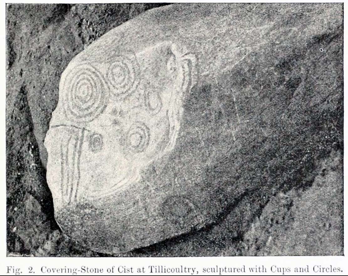
Multiple-ringed carving

A recent visit to try find this intricate carving—the only one of its kind in Clackmannanshire—proved unsuccessful, and so I add it here in the hope that someone might know where it is and bring it back to light.  It looked like quite an impressive petroglyph.  If the stone isn’t hiding in undergrowth at the edge of someone’s garden, it may well have been destroyed—which would be appalling.  As a unique design, this important carving should have been preserved.  Even when the Victorian explorers found it, the covering stone circle had been greatly damaged and many stones in the ring had been removed.  This carved stone remained intact however.  When Mr R. Robertson (1895) and his friend visited the site, it was covered in sand and dirt and had fallen to the side of an internal cist:

“On clearing this away a remarkable feature was brought to light.  The block was found to be elaborately ornamented on its sides and upper surface, with rings, spirals and lines.  The labour of cutting these in the hard granite with primitive tools of the period must have been very great. Several successful photos of the stone and its carvings were taken by Provost Westwood, Dollar…. This stone has now been removed to the vicinity of Tillicoultry for safety.”

In the same article, George Black told slightly more of the design:

“The covering stone of the cist…bears on the face a series of concentric circles, and spirals springing from one of the groups of circles,  Four grooves also unite the same set of circles with the left-hand edge of the stone.  On the edge shown in the photograph there is another group, consisting of two concentric circles.  The unevenness of the surface of the stone appears to have been of no moment to the sculptor of the circles, as the incisions follow the surface into its sinuosities and depressions.”

Not long after Robertson & Black’s visit, the great megalithomaniac Fred Coles (1899) came here—and he found that the “spirals” that Mr Black described were nothing of the sort.

“The huge irregularly-shaped diorite boulder which covered the cist has several cup-and-ring marks on one face and one side…. These marks are now, so I was informed when inspecting them, very much less distinct than they were when the photograph was taken (above) in 1894.  It would be difficult now to describe the incised markings with accuracy; it is difficult even to see them when wet.  But…I must take exception to the term ‘spirals’ as applied to any of these ‘rings.’  There are three groups of rings so placed as to make the outermost ring in each group touch that of the others (not an uncommon form), but there is no one true volute.

“…What is more noteworthy is the group of four long parallel, nearly perpendicular grooves issuing (probably) from the outermost ring of the group of five rings, and ending at the edge of the boulder.”

Alison Young’s 1937 sketch

Cole also noted that the carvings were to be found on the upper surface of the stone.  It would seem very probable that the excessive erosion which Cole described was due to the fact that the stone was, many centuries earlier, exposed to the elements within the stone circle and not buried as it later came to be.  It makes sense.

The excessive erosion was spoken of by the Royal Commission (1933) lads, aswell as the last person to describe the site, Ronald W.B. Morris (1981), who said that during his visits here between 1966-75,

“the author has only found traces of possible cups visible on the rough surface, which has flaked badly.”

Morris (1981) said that the stone measured “1½m by 1¾m by ½m (5½ft x 4½ft x 2ft)”—and was last known to be some 10 yards NW of the Tillicoultry House cottage, but we could locate no trace of the stone or its carving.  If anyone is aware of the whereabouts or fate of this important neolithic carving, please let us know.

References:

  1. Coles, Fred R., (1899b) ‘Notices of the discovery of a cist and urns at Juniper Green, and of a cist at the Cunninghar, Tillicoultry, and of some undescribed cup- marked stones’in Proceedings of the Society Antiquaries, Scotland, volume 33, 1899.
  2. MacWhite, Eoin, “A New View on Irish Bronze Age Rock-Scribings,” in Journal Royal Society Antiquaries, Ireland, 76:2, 1946.
  3. Morris, Ronald W.B., ‘The cup-and-ring marks and similar sculptures of Scotland: a survey of the southern Counties, part II’in Proceedings of the Society Antiquaries, Scotland, volume 100, 1969.
  4. Morris, Ronald W.B., “The Cup-and-Ring and Similar Early Sculptures of Scotland; Part 2 – The Rest of Scotland except Kintyre,” in Transactions of the Ancient Monuments Society, volume 16, 1969.
  5. Morris, Ronald W.B., The Prehistoric Rock Art of Southern Scotland, BAR: Oxford 1981.
  6. Robertson, R., Black, G.F. & Struthers, J., ‘Notice of the discovery of a stone cist and urns at the Cuninghar, Tillicoultryin Proceedings of the Society Antiquaries, Scotland, volume 29, 1895.
  7. Royal Commission on the Ancient & Historical Monuments of Scotland, Fife, Kinross and Clackmannan, HMSO: Edinburgh 1933.
  8. Young, Alison, “Cup-and-Ring Markings on Craig Ruenshin, with some Comparative Notes,” in Proceedings of the Society Antiquaries, Scotland, volume 72, 1937.

© Paul BennettThe Northern Antiquarian


Coilsfield, Tarbolton, Ayrshire

Cup-and-Ring Stone (lost):  OS Grid Reference – NS 4469 2624

Also Known as:

  1. Canmore ID 42713
  2. King Coil’s Grave Stone
  3. Old King Cole’s Stone (Morris 1981)

Archaeology & History

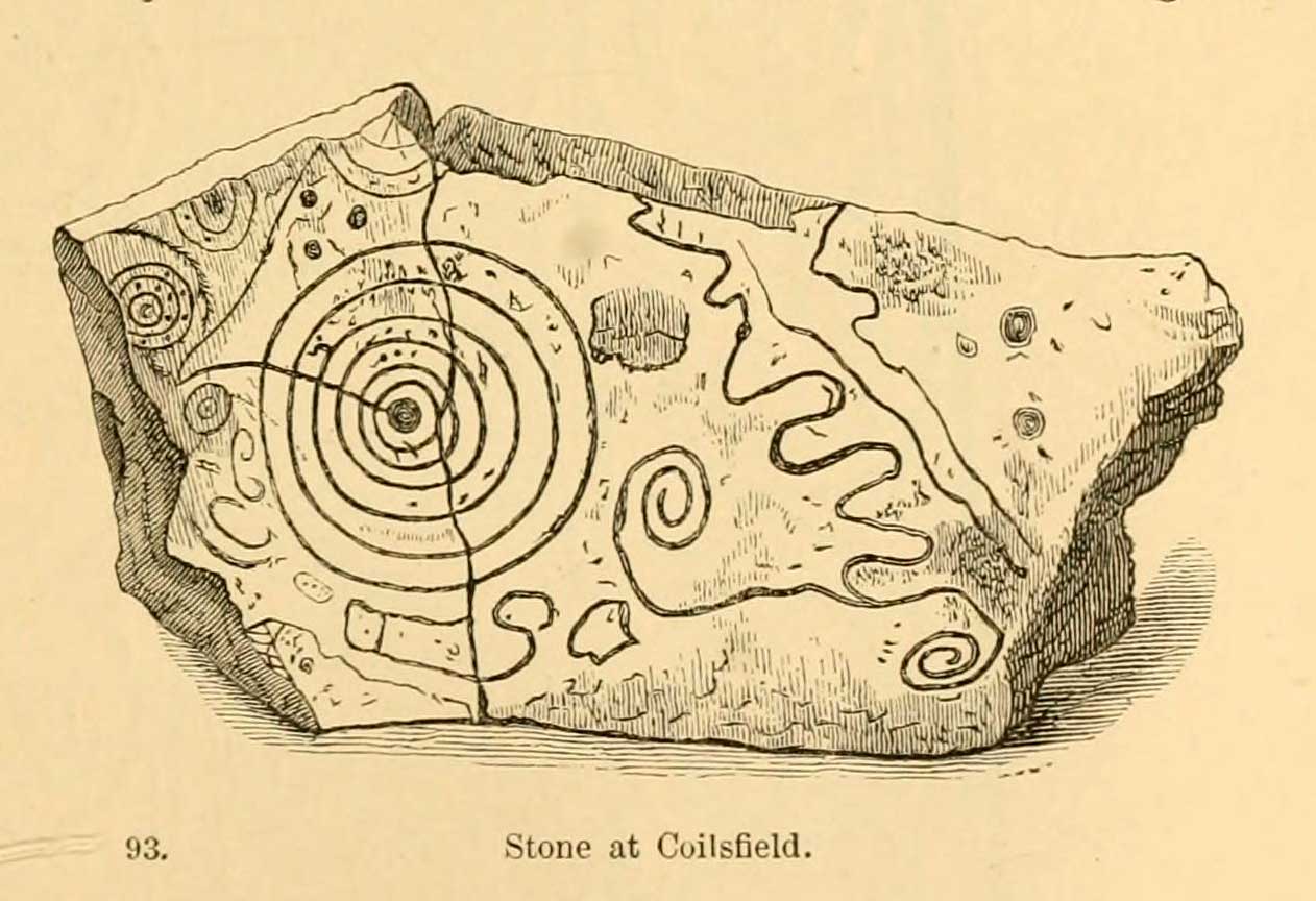
Daniel Wilson’s 1851 sketch

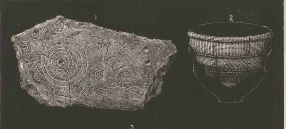
This fascinating and very ornate prehistoric carving was found on the underside of a grave-slab beneath Old King Coil’s Grave, or an adjacent prehistoric burial feature (we don’t know for sure).  In Daniel Wilson’s (1851) superb early work on prehistoric Scotland is a detailed drawing of this ornate petroglyph—similar in design and form to those found across the waters in Ireland—copied “from a drawing presented to the Royal Society of Edinburgh by Colonel Hugh Montgomery of Shielmorly, in 1785.”  Mr Wilson informed us that,

“It formed the cover of a cist, discovered in digging a gravel-pit at Coilsfield, in Ayrshire, and underneath it was found an urn filled with incinerated bones. The dimensions of the stone were about five feet in length by two and a half feet in breadth”

A few years later Sir James Simpson (1866; 1867) wrote and published the earliest (and still one of the finest) books on aboriginal rock carvings in the British Isles, and all but echoed what Wilson had described.  He added a further description of the designs that were carved onto the stone, telling us that,

“it had cut upon it a series of concentric circles, consisting of six rings placed around a central cup, the rings traversed by a straight radial groove.  On the drawing are marks of other cups and rings, or rather volutes, and a number of angular lines… This sculptured stone covered an urn…”

Following the descriptions of our early authors, many archaeologists and antiquarians explored the site but could find little else about the carving.  In Ron Morris’ (1981) most recent survey, he told us that it was,

“a gritstone slab, 1½m by ¾m (5ft x 2½ft), possibly broken after carving, had on one side (not now known if this was the inner of outer face); a cup-and-six-complete-rings with radial groove from the cup – diameter 50cm (20in) – 5 other cups-and-rings, mostly partly broken off or incomplete, an irregular ‘reversed-S-shaped’ single spiral with 3 convolutions at each end, other irregular grooved figures, 4 cups and about 7 ‘dots’ (6 of these are in the cup-and-six-rings).”

James Simpson’s 1866 sketch

The Royal Commission at Canmore tell us that “the present location of the food vessel and cist cover is unknown”; yet the rock art researcher Ronald W.B. Morris (1981) reported the petroglyph was “said to have been given to the Society of Antiquaries of Scotland but (is) now missing”; whilst the local writer E.H. Letham (1900) told us “the urns were conveyed to Eglintoun Castle.”  This aint good.  Has anyone subsequently found out what became of it?

Folklore

The tumulus of King Coil’s Grave was the legendary resting place of the “Old King Cole” of popular rhymes.  There were two such northern kings in ancient times and, as William Robertson (1889) said, “the only difficulty is to say which of the King Coils he was, whether the Coilu who lived three hundred and thirty years before Christ; or Coel, King of the Roman districts, who must have lived in the third century.”

References:

  1. Letham, E.H., Burns and Tarbolton, D.Brown: Kilmarnock 1900.
  2. Morris, Ronald W.B., The Prehistoric Rock Art of Southern Scotland, BAR: Oxford 1981.
  3. Morris, Ronald W.B. & Bailey, Douglas C., “The Cup-and-Ring Marks and Similar Sculptures of Southwestern Scotland: A Survey,” in Proceedings of the Society of Antiquaries, Scotland, volume 98, 1966.
  4. Morrison, Alex, The Bronze Age in Ayrshire, Ayrshire Natural History & Archaeology Society 1978.
  5. Robertson, William, Historical Tales and Legends of Ayrshire, Thomas D. Morrison: Glasgow 1889.
  6. Paterson, James, History of the County of Ayr – volume 2, Thomas Stevenson: Edinburgh 1852.
  7. Simpson, J.Y., “On Ancient Sculpturings of Cups and Concentric Rings,” in Proceedings of the Society of Antiquaries, Scotland, volume 6, 1866.
  8. Simpson, James, Archaic Sculpturings of Cups, Circles, etc., Upon Stones and Rocks in Scotland, England and other Countries, Edmonston & Douglas: Edinburgh 1867.
  9. Smith, John, Prehistoric Man in Ayrshire, Elliot Stock: London 1895.
  10. Wilson, Daniel, The Archaeology and Prehistoric Annals of Scotland, Sutherland & Knox: Edinburgh 1851.
  11. Young, Alison, “Cup-and-Ring Markings on Creag Ruenshin, with Some Comparative Notes,” in Proceedings of the Society of Antiquaries, Scotland, volume 72, 1937.

© Paul BennettThe Northern Antiquarian 


Dumpton Park, Ramsgate, Kent

Tumulus (destroyed):  OS Grid Reference – TR 389 661

Archaeology & History

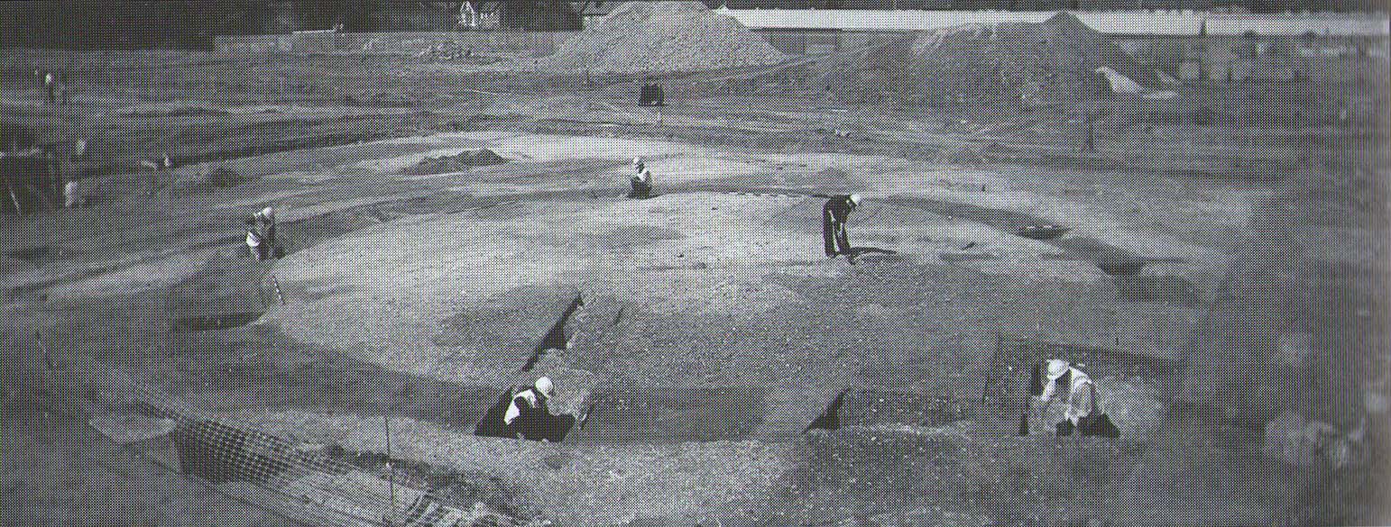
A little-known site which archaeologist Brian Philp (2002) called “a Bronze Age barrow”.  When the old Greyhound Stadium at Ramsgate was being demolished for a new housing estate, planning conditions required an archaeological evaluation and so Philps and his team set out to explore the area in February 2000.  They weren’t to be disappointed!  Unearthing a ring ditch nearly 20 yards (18m) across, they found that it had been cut into the local chalk some three feet deep.  Although there was no obvious entrance, the northeast section of the ancient monument,

“was found to be covered by a compact layer of flint metalling.  This was a wide and well-made surface or platform, perhaps of Iron Age date, which clearly covered the silted ring-ditch,  Nearby was a large male skeleton in a very shallow grave and with head missing due to later disturbances.”

The excavated ring ditch (after Philp 2002)

The excavated ring ditch (after Philp 2002)

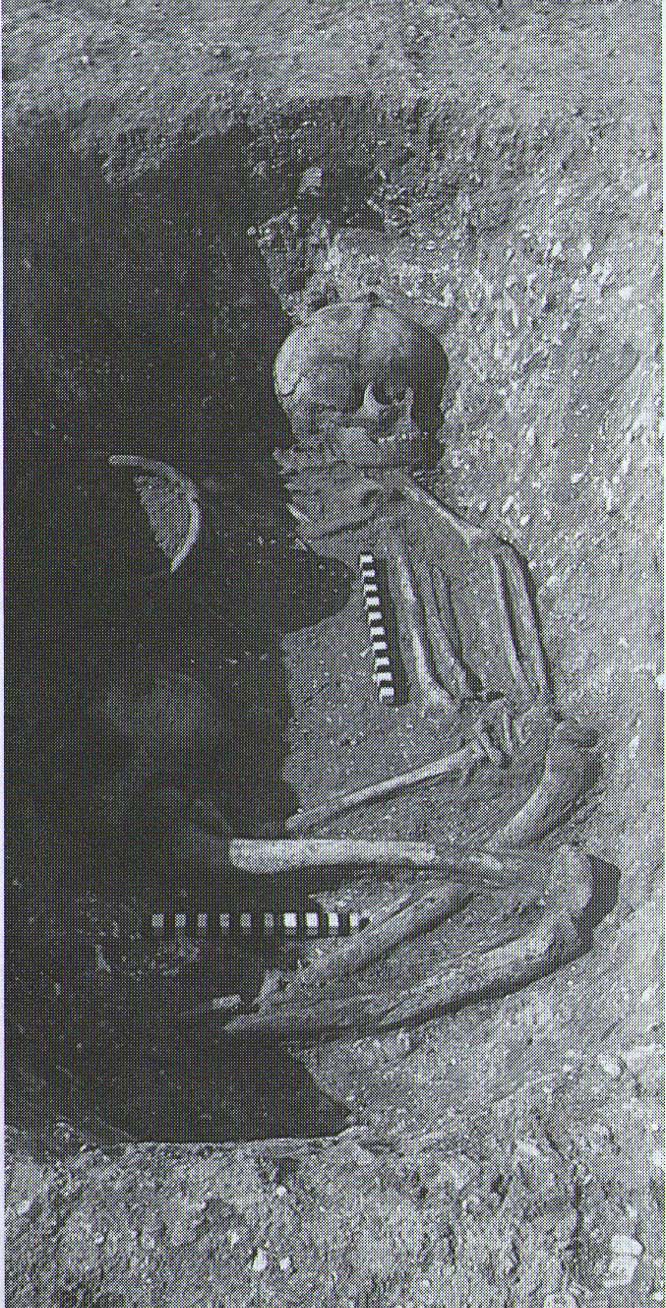
The crouched skeleton (after Philp 2002)

The crouched skeleton (after Philp 2002)

But the best was yet to come!  In another section of the circular monument, cut into the chalk itself, they found a complete male skeleton laid in typical foetus position, on its left side, with a large beaker pot positioned in front of it.  These beakers are pretty common and tend to be seen as once holding food enabling the dead to eat in their journey into the Land of the Dead.  It makes sense.  The entire monument has since been completely destroyed.

References:

  1. Philp, Brian, Archaeology in the Front Line, KARU: Dover 2002.

Links:

  1. Kent Archaeological Review

© Paul BennettThe Northern Antiquarian 2016


Down Farm, Basingstoke, Hampshire

Barrow (destroyed):  OS Grid Reference – SU 6018 5013

Archaeology & History

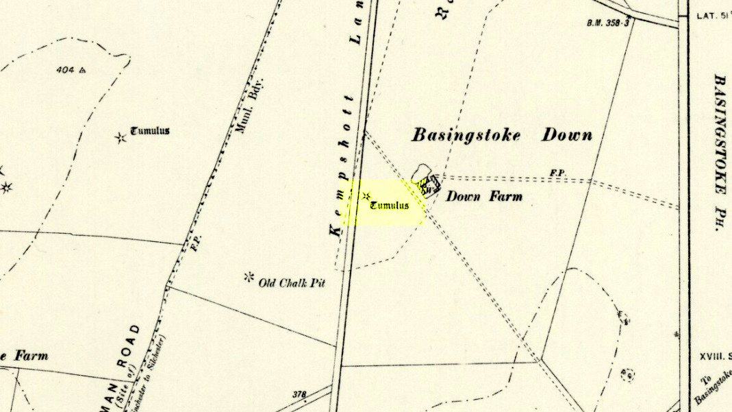
Downs Farm tumulus on 1897 map

Downs Farm tumulus on 1897 map

On the western edges of Basingstoke, at Kempshott, could once be found this ancient site—destroyed many decades ago.  It was one of number of similar prehistoric burial mounds in the area.  First described in a listing of tumuli by Mr Andrews (1898) who told us that it was “oval” in shape, the monument was completely destroyed in 1939 and according to the Royal Commission (1979) lads,

“its site now lies beneath a house at the southwest corner of Kempshott Lane and Homesteads Lane.”

When the house where it once stood was being constructed, a collared urn was recovered from the tomb, which the Royal Commission thought indicated “that the monument (was) likely to have been of early Bronze Age date”—but obviously we cannot be sure.  The site was listed in Leslie Grinsell’s (1979) extensive survey of prehistoric tombs in the area, in which he suggested it may have been a long barrow.

References:

  1. Andrews, S., “A Short List of Some Tumuli in North Hampshire,” in Proceedings of the Hampshire Field Club & Archaeological Society, volume 4, 1898.
  2. Grinsell, Leslie V., “Hampshire Barrows – part 3,” in Proceedings of the Hampshire Field Club & Archaeological Society, volume 14, 1940.
  3. Royal Commission on Historic Monuments, England, Long Barrows in Hampshire and the Isle of Wight, HMSO: London 1979.
  4. Willis, G.W., “Bronze Age Burials round Basingstoke,” in Proceedings of the Hampshire Field Club & Archaeological Society, volume 18, 1953.

© Paul Bennett, The Northern Antiquarian

Galley Hill, Streatley, Bedfordshire

Long Barrow (destroyed):  OS Grid Reference – TL 086 268

Archaeology & History

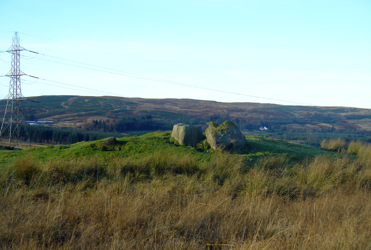
Aligned east-west, a large neolithic long barrow could once be seen to the west of Galley Hill, on where now we find a golf course.  It was sadly destroyed sometime around 1900 AD and its demolition was witnessed by a Mr A. Cumberland of the Dartford Antiquarian Society, who reported there being no archaeological finds of note in the tomb.  Curious…

Equally curious was the view of archaeologist James Dyer (1964) in his assessment of the site, who wrote how

“Air photographs suggest that the barrow was 300 ft long, but this is much larger than normal in the Chilterns, and 150 ft is more reasonable.”

The neolithic and Bronze Age burial specialist Paul Ashbee (1984) maintained the “300 feet” measurement.

Other tumuli can still be seen on the slopes either side of Galley Hill a few hundred yards to the east; and a henge monument has also be found in the area.

References:

  1. Ashbee, Paul, The Earthen Long Barrow in Britain, Geo: Norwich 1984.
  2. Dyer, J.F., “A Secondary Neolithic Camp at Waulud’s Bank, Leagrave,” in Bedfordshire Archaeological Journal 2, 1964.

© Paul BennettThe Northern Antiquarian 2016


Ruston Beacon, Ruston Parva, East Yorkshire

Tumulus (destroyed):  OS Grid Reference – TA 0584 6128

Archaeology & History

Ruston Beacon tumulus on 1854 map

Ruston Beacon tumulus on 1854 map

A fallen tumulus that once marked the southwestern side of the village boundary line, and was once adjacent to the prehistoric Green Dikes earthworks that once passed here.  Sadly however, sometime early in the 20th century, this ancient burial mound fell victim to usual ignorance of arrogant land-owners who place money ahead of history and local tradition and it was ploughed-up and destroyed.  Thankfully we have an account of the site in J.R. Mortimer’s (1905) incredible magnum opus.  Listing it as ‘Barrow no.272’ in the number of tombs excavated, he told us that:

“It is situated on elevated ground about half-a-mile (south)west of Ruston Parva.  On September 20th and 21st, 1886, it measured about 70 feet in diameter and 2 feet in elevation; and had originally been several feet higher, as an old inhabitant remembered assisted in removing its upper portion, which was carried away and spread on the surrounding land many years previously.  At the base of the barrow, near the centre, was a long heap of cremated bones which had been interred in a hollow log of wood with rounded ends, about 3 feet in length and 14 inches in width, well shown by impressions in the plastic soil, and by the remains of the decayed wood.  The heap of bones was rather large and probably consisted of the remains of more than one body.  No relic accompanied them.  Several splinters and flakes of flint were picked from the mound.”

The tumulus (as its name implies) became a spot besides which one of East Yorkshire’s many ancient beacons were built.  In Nicholson’s (1887) survey of such monuments, he told that

“the modern beacon, apparently, stood on the site of the old one, on the high ground in the angle of the road from Driffield to Kilham.  It was a prominent object and would be well-known to the coachmen and guards…for it stood on the side of the road from Driffield to Bridlington.  Mr John Browne, of Bridlington, remembers it; and says, ‘It would be the last of the beacons that remained in this district and was removed between fifty and sixty years ago.  My recollection of it is that it was a tall pole, with a tar barrel at the top, and had projected steppings to reach the barrel.”

One of the earliest accounts of the beacon from the late-1500s told that it took signal for its light from the beacon at Rudston, which stood upon one of the Rudston cursus monuments, a short distance from the massive Rudston monolith.

References:

  1. Mortimer, J.R., Forty Years Researches in British and Saxon Burial Mounds of East Yorkshire, Brown & Sons: Hull 1905.
  2. Nicholson, John, Beacons of East Yorkshire, A. Brown & Sons: Hull 1887.

© Paul Bennett, The Northern Antiquarian

Toad Stones, Baildon Moor, West Yorkshire

Ring Cairn:  OS Grid Reference – SE 1305 4004

Getting Here

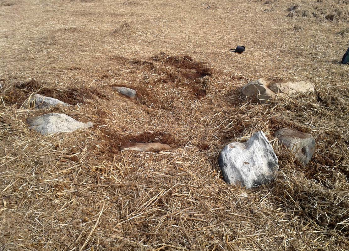
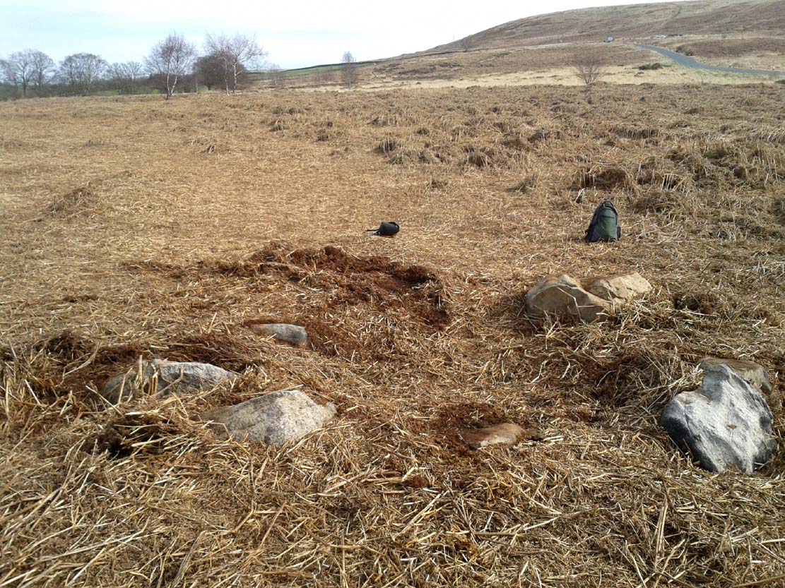
Much overgrown Toad Stones ring

Much overgrown Toad Stones ring

From the double-ring that is the Brackenhall Circle at Shipley Glen, go up the road towards the hills and seek out the cup-marked Glovershaw Quarry Stone.  Shortly before this, notice the small trees close the quarry edge.  From here, walk straight east, as if you’re going toward Baildon Hill.  Barely 10 yards into the bracken you’ll notice this small ring of stones (best looked for in winter before the bracken grows back – otherwise you’ve no chance!).

Archaeology & History

This site was explored when James Elkington, Paul Hornby and I came across it on Wednesday, 11 March 2015, after returning from a short excursion to look at some of the petroglyphs on Baildon Hill.

Ostensibly it is a small ring of stones comprising of at least 7 large rocks that are set deeply into the peat and bracken-mass, with a small eighth movable stone on the northern side.  It seemed likely that another, larger rock was beneath this small portable rock, but we didn’t dig into the vegetative mound to explore this.  The most curious thing about the ring of stones was that it measured barely 4 yards in diameter.  My initial thought was that this was a previously unrecorded cairn, but there seemed to be no internal mass of rocks in the centre that characterize such monuments and which you’d expect in a ring of this size – meaning that it may be, perhaps, the smallest stone circle in Britain.  It’s a pretty good contender at least! (the stone circle known as “Circle 275” at Penmaenmawr in Wales is of similar size to this one, but with less stones in that ring)

Close-up of the stones

Close-up of the stones

It would be good if the regional archaeologists could give this site their attention and clean it up to see exactly what lays beneath the boscage.  Close by are several cup-marked stones and a couple of other larger cairn circles.

The name of the site came after I almost stood on a hibernating toad, found beneath the bracken-mass right at the edge of one of the stones.  I carefully picked him up and reburied him in another spot close by, leaving him (perhaps) to ponder his venture into the bright daylight of consciousness!  Mr Hornby promptly declared – “these are the Toad Stones!” – and it stuck.

© Paul BennettThe Northern Antiquarian

Pickel Well, Birstall, West Yorkshire

Sacred Well:  OS Grid Reference – SE 2180 2633

Archaeology & History

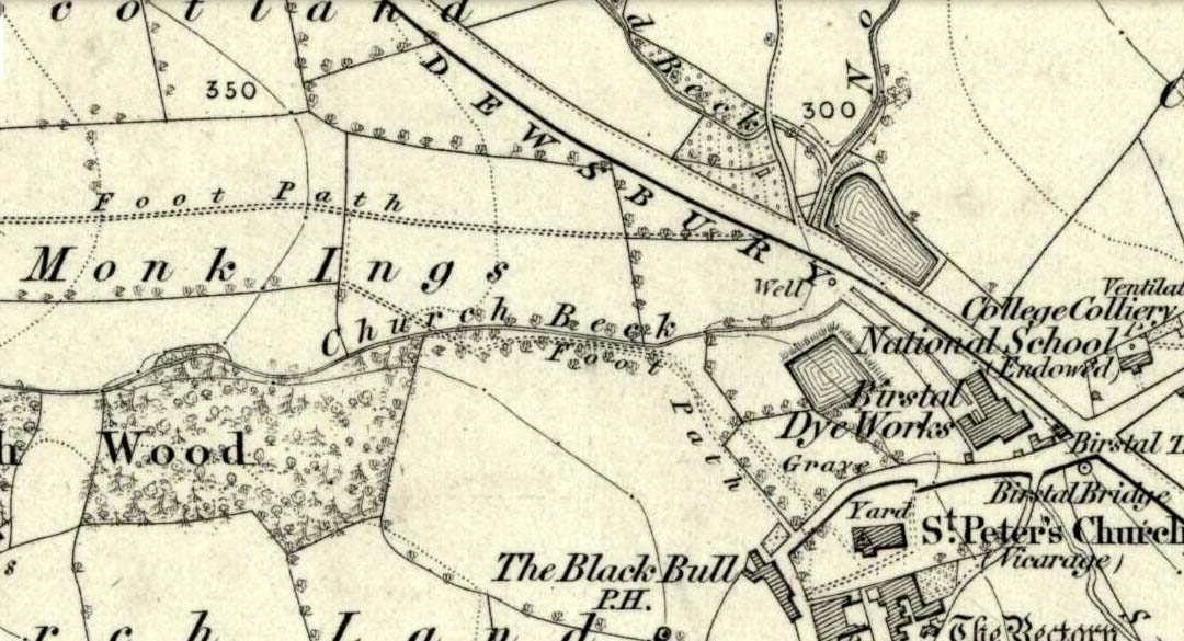
The Pickel Well at Monk Ings, 1847

The Pickel Well at Monk Ings, 1847

Seemingly built over in recent years, the Pickel Well was one of the main water supplies to the people of Gomersal and Birstall in earlier times.  Getting its name, probably, from the northern dialect word pikel or pickel, meaning “very heavy rain” (Joseph Wright [1903] associates it with the expression “raining cats and dogs”), this may be a description of the heavy flow of water which helped feed the large man-made ponds either side of the road.

The Monk Ings Field in which it was found, derives its name from the monks from Nostell Priory who lived here, centuries ago.  They would, no doubt, have drunk the water from this well.

Folklore

A very curious legend relates to this place. H.A.  Cadman (1930) told,

“that whenever a birth was expected in Great Gomersal, a pad-foot came out at night from the Monk Ing fields and shouted out, ‘Thee first or me first!’  This was said to be a warning to people not to go out.”

Padfoots were phantom black dogs, stories of which occur all over northern England and beyond.  They were ostensibly interpreted as omens of doom and bringers of Death.  This example at Gomersal is peculiar in that it is equated with birth, as well as giving warnings for local people to stay indoors, as is more usual.

Incidences of black dogs at wells are not uncommon. In West Yorkshire alone we find them haunting the waters at Low Moor, Idle, Thorp Arch, Eccleshill, Heaton and others.  Their nature is quite complex, but ostensibly derives from animistic cyclical notions of death and rebirth—hence their emergence sometimes from wells; and in this instance, presaging a local birth.

References:

  1. Cadman, H. Ashwell, Gomersal, Past and Present, Hunters Armley: Leeds 1930.
  2. Eliade, Mircea, Zalmoxis – The Vanishing God, University of Chicago Press 1972.
  3. Wright, Joseph (ed.), English Dialect Dictionary – volume 4, Henry Frowde: London 1903.

© Paul BennettThe Northern Antiquarian