Clach na Croiche, Balnaguard, Perthshire

Standing Stones:  OS Grid Reference – NN 94624 52118

Also Known as:

  1. Balnaguard Farm
  2. Gallows Stone

Getting Here

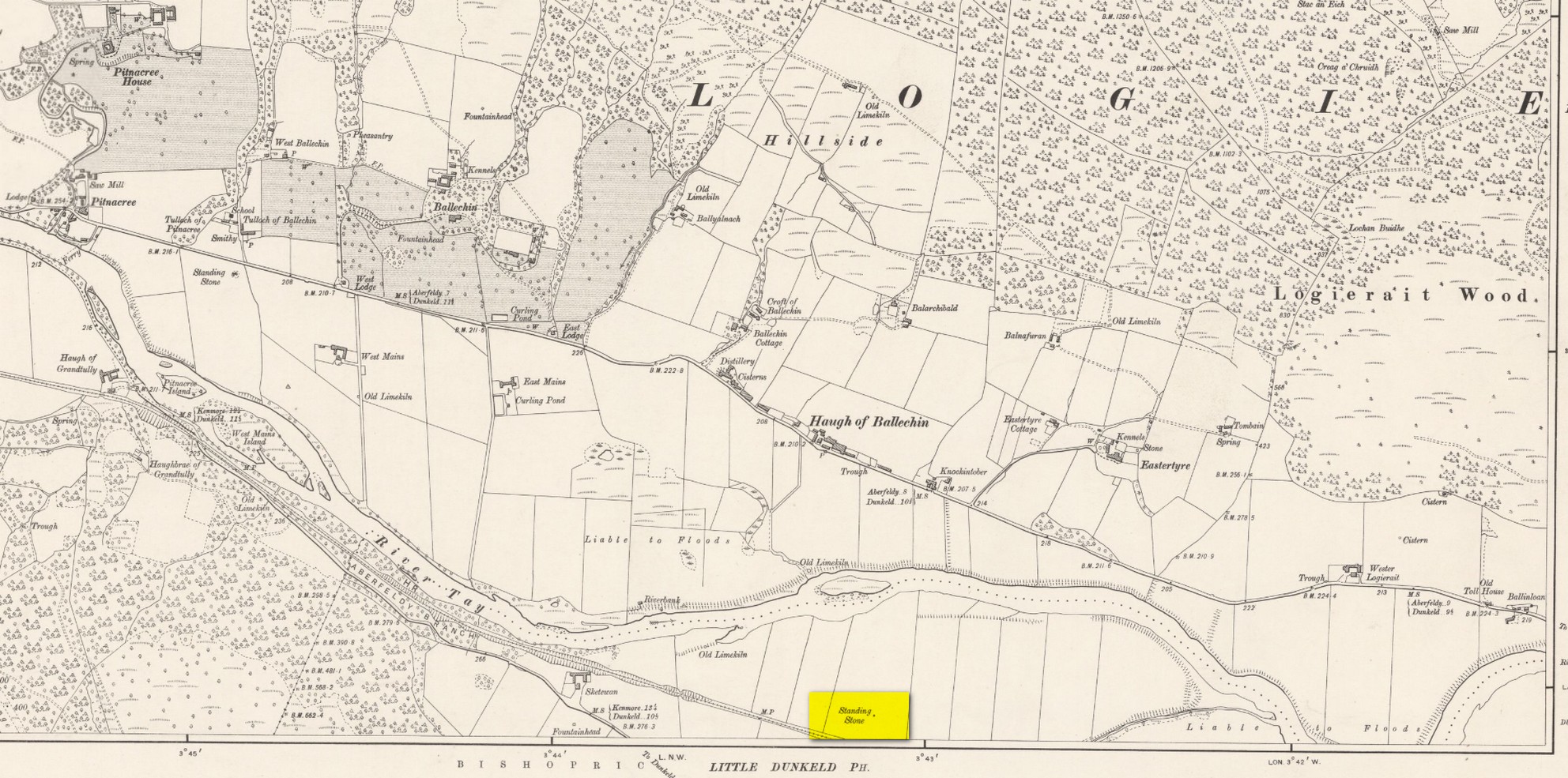
Site on the 1899 OS-map

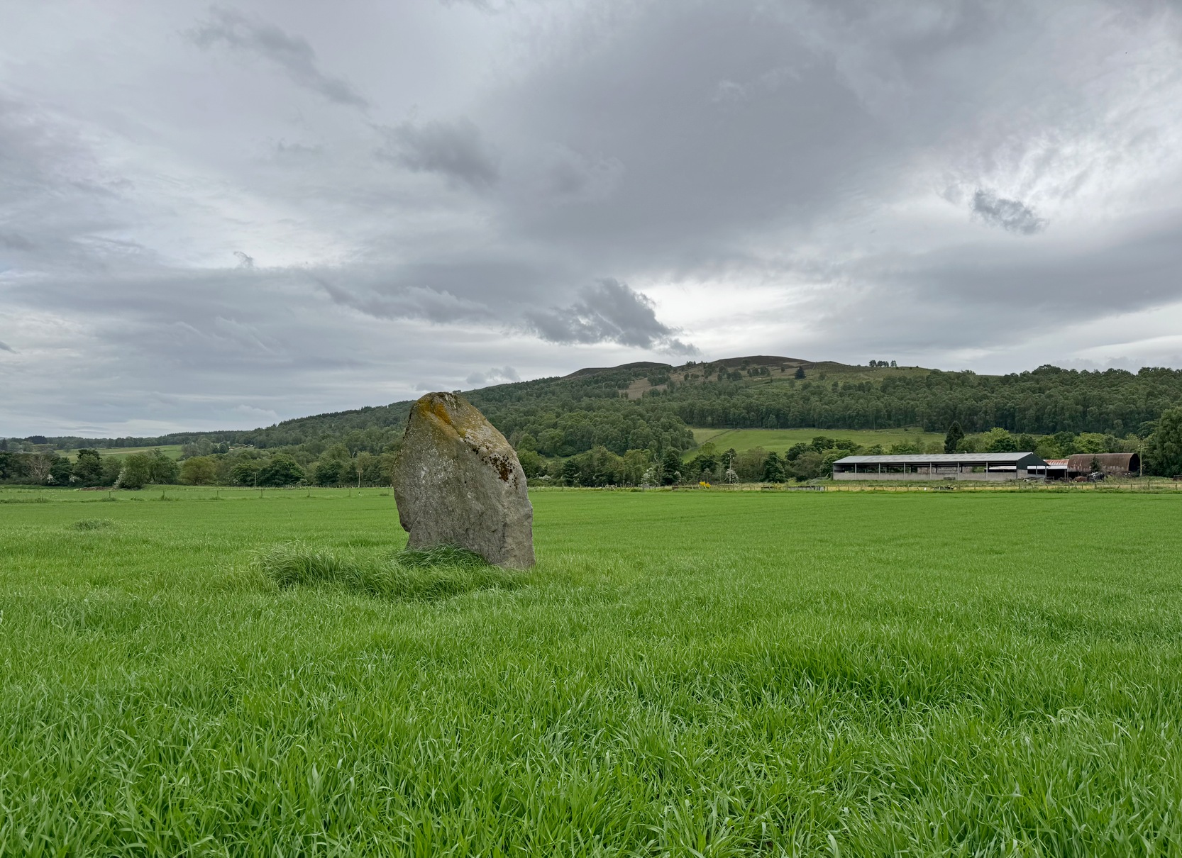
Just as you’re coming into Balnaguard village on the B898 road from the eastern side (as if you’ve come via the A9 from near Pitlochry), just where the road crosses a small burn (stream), take the first farm-track on your right and walk down to the end where it meets the field.  Here, walk to your left left and you’ll see a gate that takes you into the field.  You should have already noticed the standing stone before you even open the gate!  It’s about 100 yards in front of you.  You can’t really miss it.

Archaeology & History
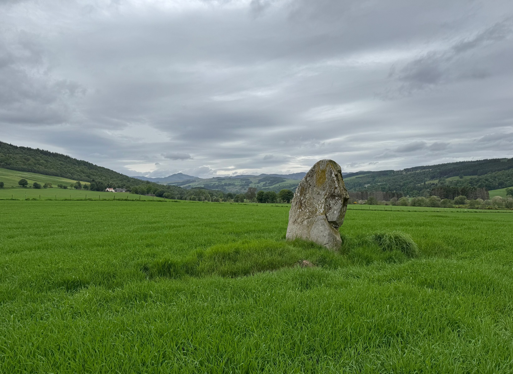
Clach na Croiche

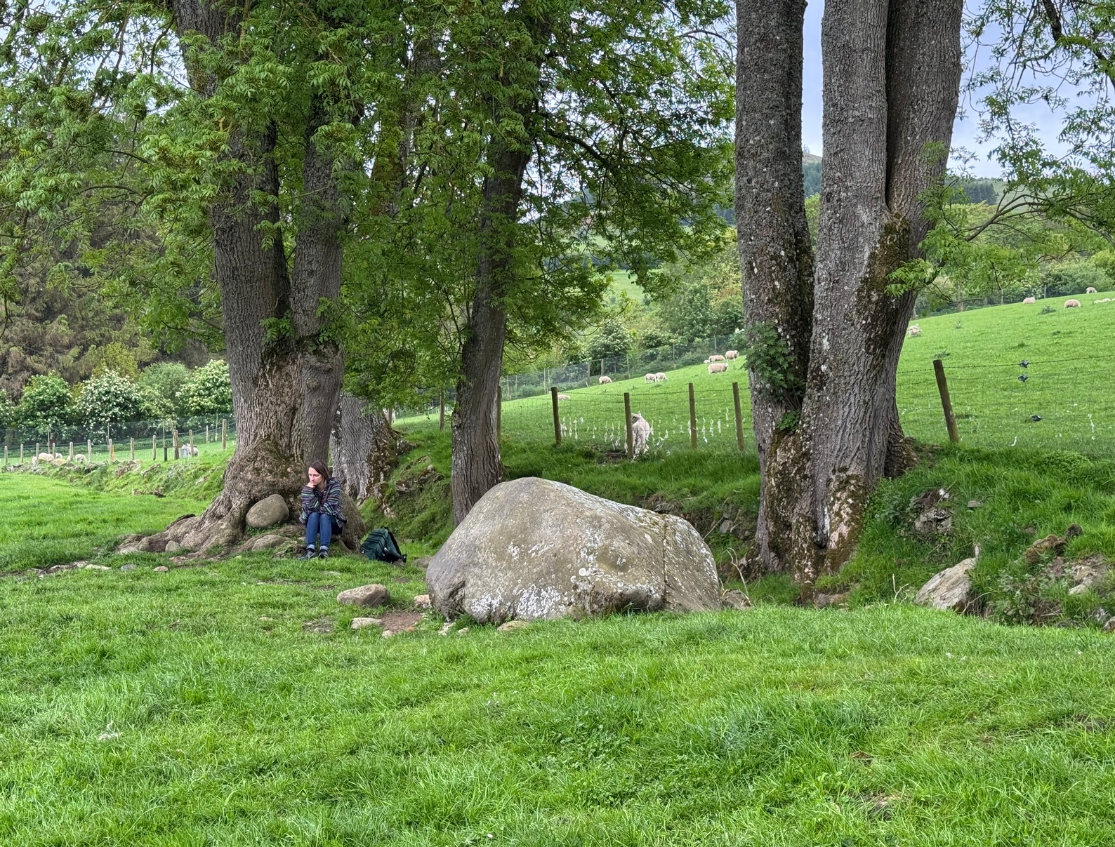
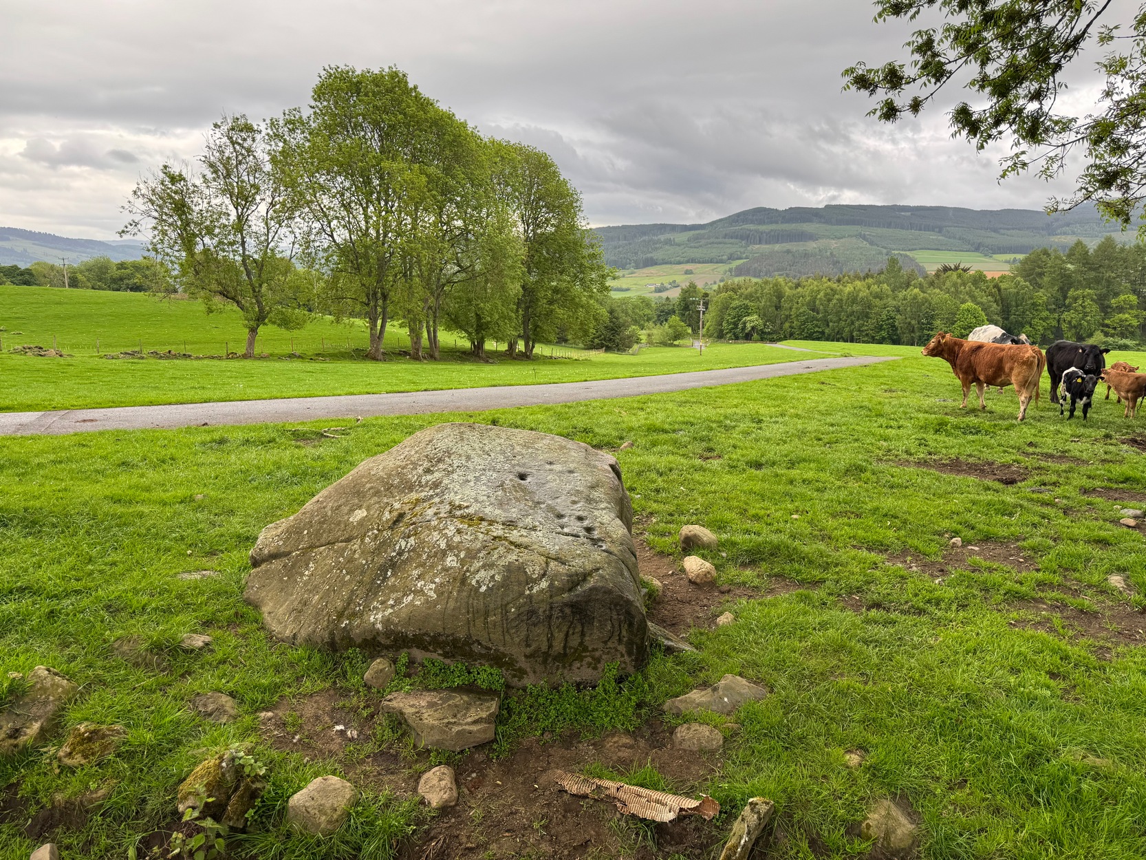
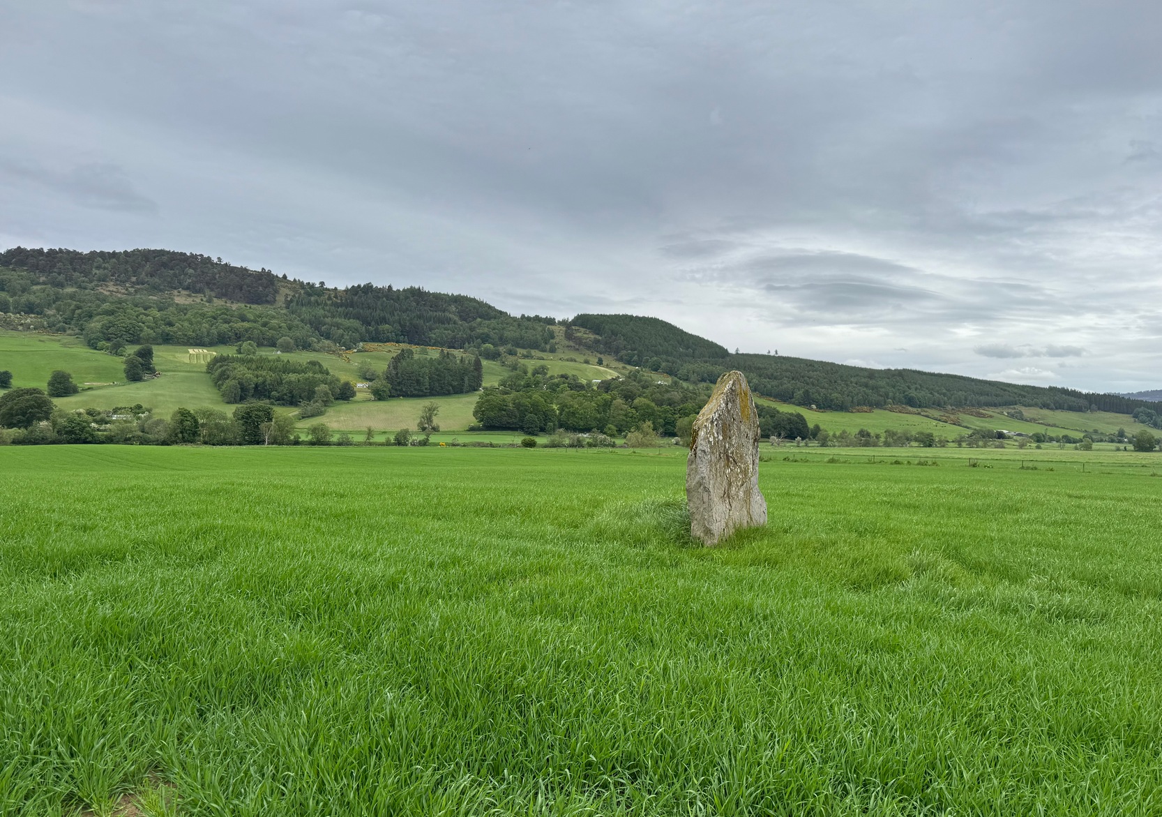
Standing alone in this field a short distance south of the River Tay is this fine old standing stone, nearly seven feet high, from whose locale we gaze west to the opening of the Perthshire mountains—but in times gone by it wasn’t alone.  Less than 10 yards east of the Clach na Croiche stood another seven-foot tall standing stone and, some six yards further east (and along the same axis) there may have stood another one, some 7½ feet high.  This alignment ran east-west in line with the rising and setting of the sun at the equinoxes. (whether that was deliberate or not is another matter altogether) and was first noticed by the great antiquarian Fred Coles (1904) in one of his many megalithic ventures.  He wondered “whether they (were) fallen Standing Stones, or the covers of cists” and when they were looked at by Margaret Stewart in 1971 she found that one of them laid beside “a shallow socket outlined with packing stones”—meaning that it had stood upright.  The other stone didn’t seem as certain, although Stewart did report finding “a single cupmark…on the eastern side of the upper surface.”  We’ve yet to see a photo of this carving.

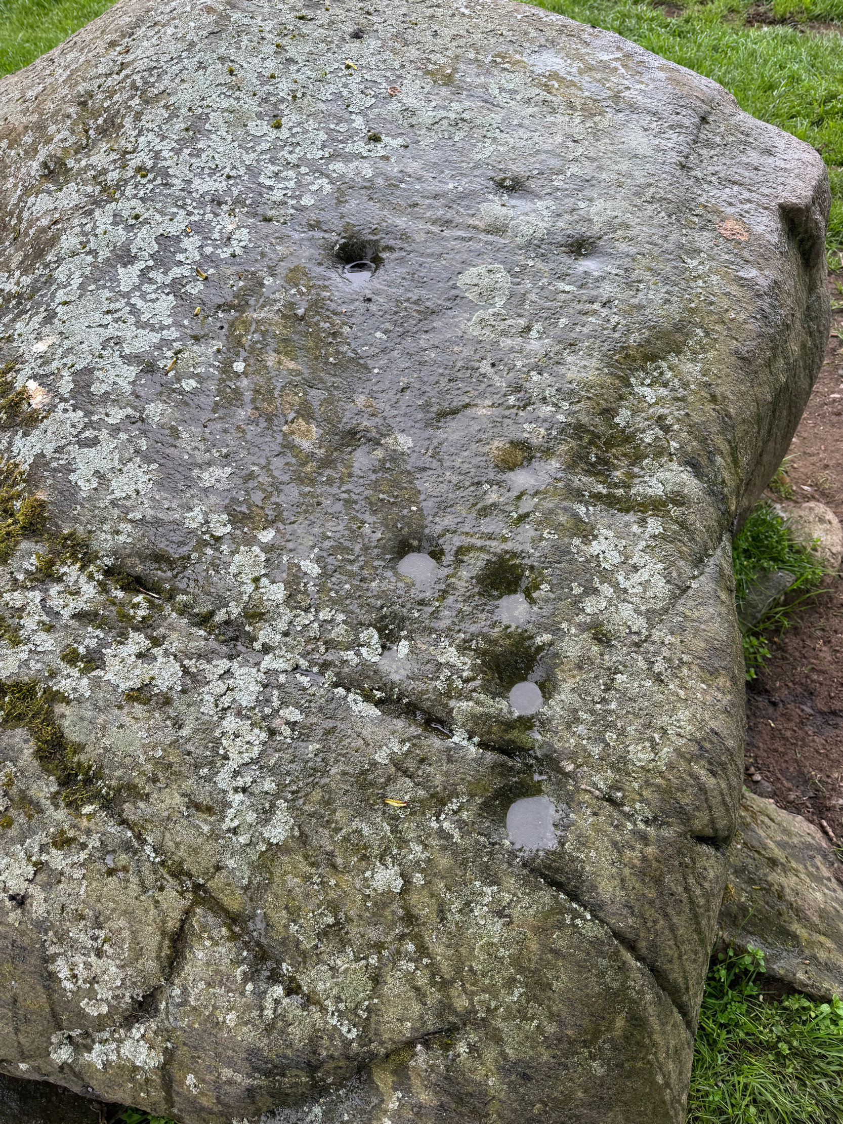
The Clach na Croiche also has its own cup-markings, just above the bottom of the stone on its southern-face.  Margaret Stewart described them  as being “strung out irregularly across the face.”  Sounds about right!  Sadly, somehow, I didn’t get any photos of these when I last visited, but will grab some the next time I’m there.
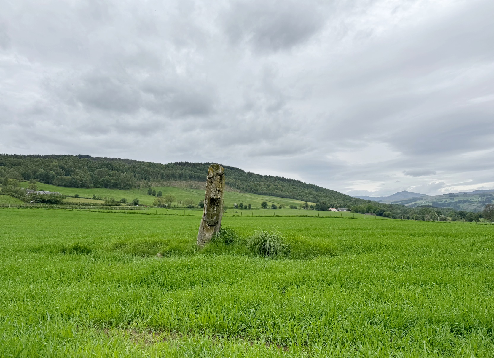
Looking to the west
Looking to the northeast

In the fields either side of the stones, ancient tombs have been found.  Around 1887, the Duke of Atholl dug under some of the stones in the field and found a “cup” or urn which Coles reported “was found in a cist in the haugh near Tom-na-Croiche.”  Then, in 1969, the farmer John MacBeth was ploughing the field and unearthed another cist some 15 yards north-west of the present upright.  The base of the cist was cobbled and whilst whilst the tomb itself was filled-in, the farmer moved the covering stone to the fence at the west-side of the field (NN 9455 5205).  Also, on the eastern side of the field in 1971, Stewart reported finding what she thought were the remains of cremated bones that seemed to have been part of another prehistoric structure.
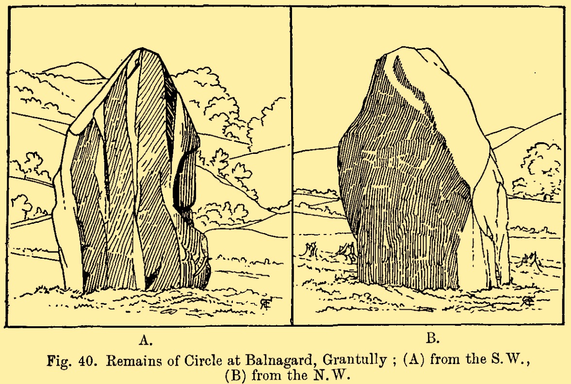
Fred Cole’s 1904 sketch
Looking to the southeast

Nearly 250 yards to the west of the stone, in the adjacent field, a huge prehistoric cairn—known as the Sketewan Cairn—was uncovered and fully excavated in the late 1980s.  It originally stood some four feet high and was nearly seventy feet across.  Within the cairn complex, a small standing stone accompanied some cremations.  Unfortunately this entire archaeological site has since been completely covered over.  You wouldn’t even know it was there if you stood right next to it!  But if you want to see Balnaguard’s remaining tombs, head for the Fairy Mound right in the heart of the village…

References:

  1. Coles, Fred, “Report on Stone Circles Surveyed in Perthshire – North Eastern Section,” in Proceedings Society Antiquaries Scotland, volume 42, 1908.
  2. Dixon, John H., Pitlochry, Past and Present, L. Mackay: Pitlochry 1925.
  3. Kennedy, James, Folklore and Reminiscences of Strathtay and Grandtully, Munro Press: Perth 1927.
  4. Omand, Donald (ed.), The Perthshire Book, Birlinn: Edinburgh 1999.
  5. Stevenson, J., “Prehistory,” in Omand’s The Perthshire Book, Edinburgh 1999.
  6. Stewart, Margaret E.C., “Perthshire: Balnaguard”, in Discovery & Excavation in Scotland, 1971.
  7. Swarbrick, Olaf, A Gazetteer of Prehistoric Standing Stones in Great Britain, BAR: Oxford 2012.
  8. Yellowlees, Sonia, Cupmarked Stones in Strathtay, Scotland Magazine: Edinburgh 2004.

Acknowledgements:  Huge thanks for use of the Ordnance Survey map in this site profile, reproduced with the kind permission of the National Library of Scotland.

© Paul BennettThe Northern Antiquarian 

Drumchanachan, Edradynate, Weem, Perthshire

Cup-and-Ring Stone:  OS Grid Reference – NN 87937 52593

Also Known as:

  1. Lurgan

Getting Here

The stone in question

Various ways to get here, but it’s probably easiest if you’re coming via Aberfeldy.  From here, go over the river bridge to Castle Menzies and Weem, but turn right once you’ve crossed the bridge and follow the road parallel to the river for just over 3 miles (4.9km) where you’ll reach a tiny road on your left, going uphill.  You can park the car 150 yards up, on your right – then walk uphill (don’t drive any further).  Walk up the road for just over half-a-mile (0.95km) and take the right turn; go along here for 300 yards where the pond appears and keep walking along the same road for another 250 yards till you reach a cottage by a small crossroads.  From here, walk up (left) for another 300 yards where, near the top of the field, a large boulder sits close to the fence.  You’ve arrived!.

Archaeology & History

Drumchanachan carving

On the way back down from a bimble to the beautiful and haunted Loch Derculich, Naomi and I stumbled upon this large stone just off the track below Lurgan farmhouse and found there to be a number of cup-marks on its sloping upper surface.  Naomi was really truly excited! 🙂

On its northwestern surface there’s is a distinct scattering of cup-marks: one in particular near the middle of the stone that’s been deepened in more recent times, as if it was ready to be blown-up and destroyed but, once realised it was a stone of the fairy folk, the operation was terminated and the stone left here to live!  Thankfully…

Close-up of cups
Deep lines of cups

It’s a pretty basic design, consisting of at least eleven cup-marks, mainly running in a line upwards along its westernmost side,  following the edge of a natural ridged contour.  Of the two topmost cups, one of them may have a carved line running to it with a faint semi-circle then emerging from the line around the edge of the cup.  But it’s faint—if it’s real—and the daylight was fading when we came here so this and any other design elements that may exist weren’t too easy to see.  Hopefully I’ll get back up here pretty soon and see if there’s anything else hiding beneath the aged shadows.

It’s a wonderful arena above Edradynate, with countless other ancient sites peppered across the landscape hereby…

© Paul BennettThe Northern Antiquarian 

Redhills, Penrith, Cumbria

Cup-and-Ring Stone (lost):  OS Grid Reference – NY 5019 2776

Also Known as:

Archaeology & History

Taylor’s 1883 sketch

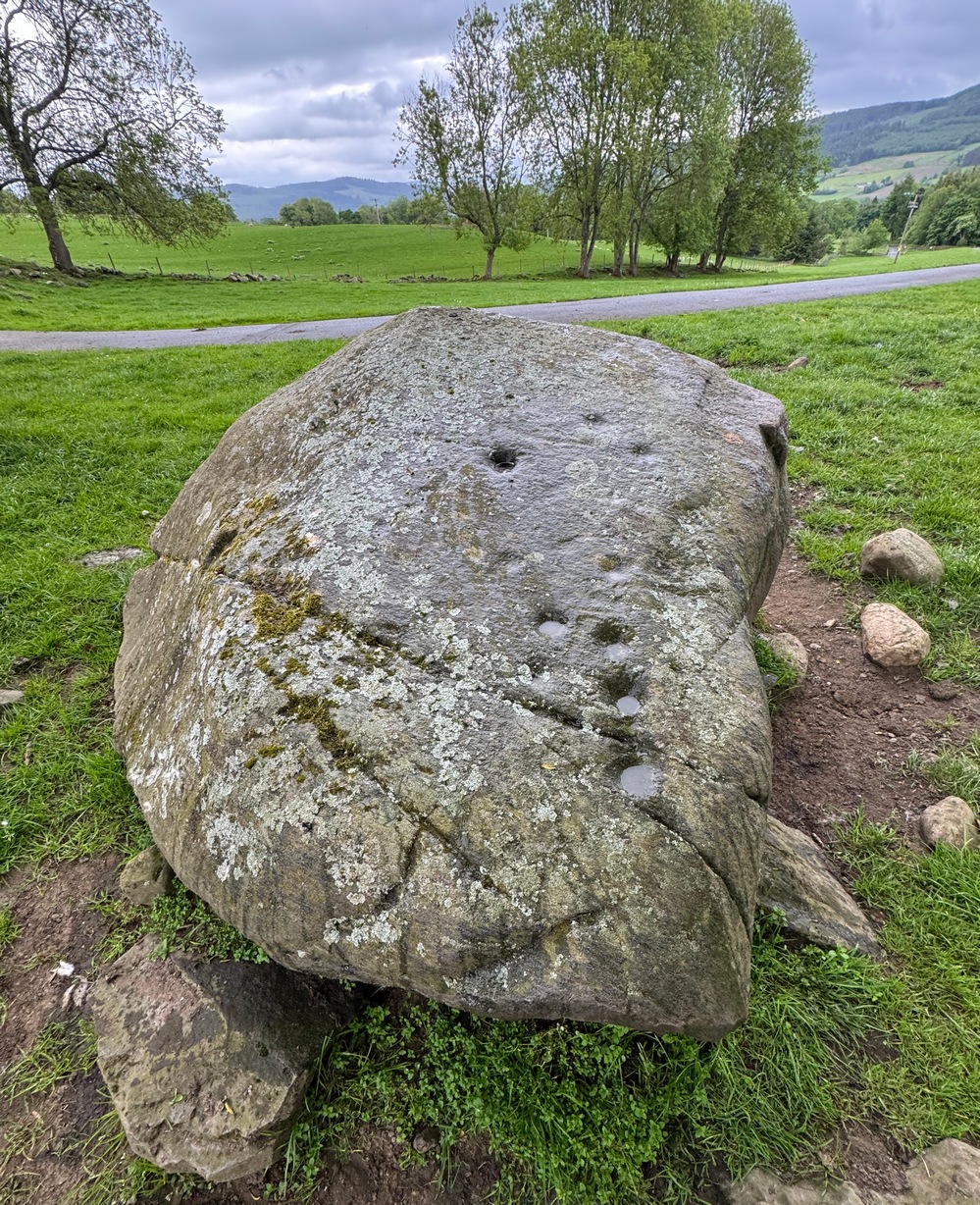
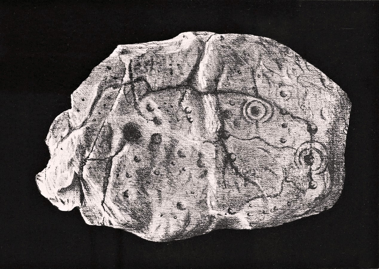
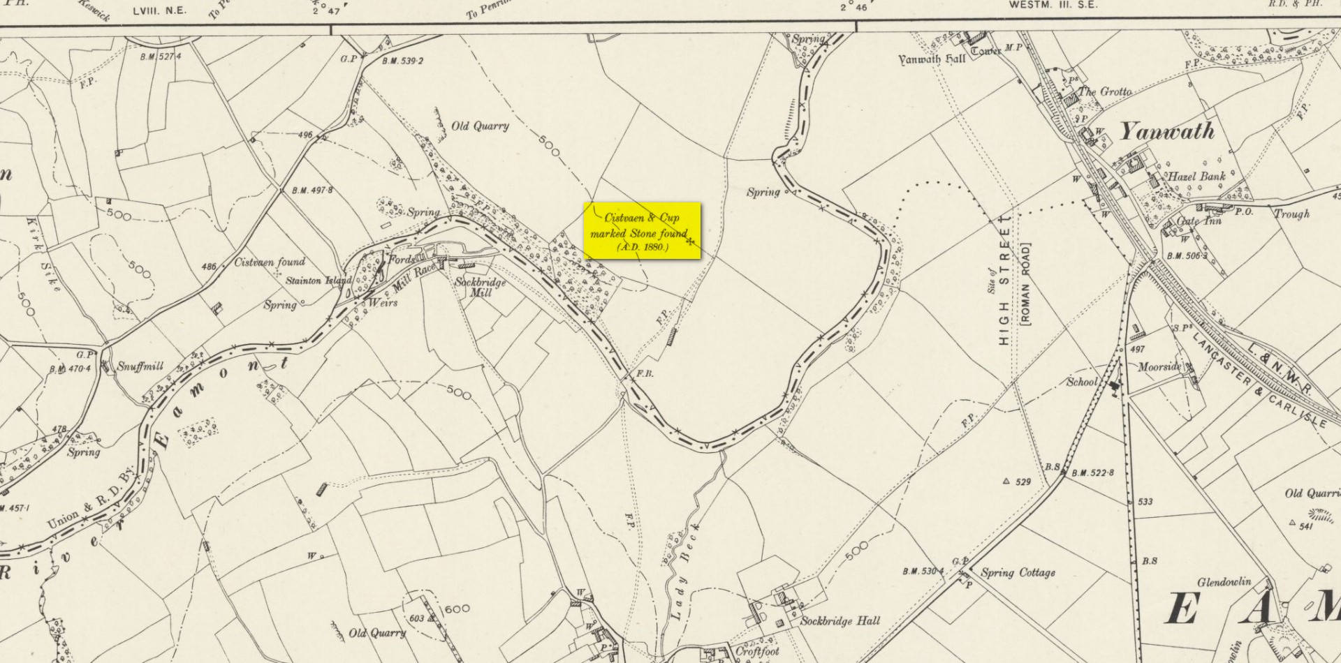
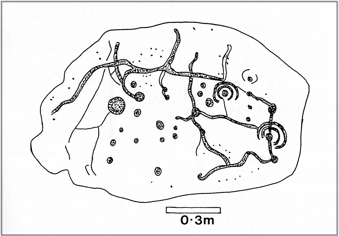
The geographical position of this site was shown on the 1897 Ordnance Survey map, albeit in the past tense as it had been destroyed not long after after being uncovered.  Thankfully however, local antiquarian Mick Taylor (1882; 1883) did a damn good job recording what had been found here, and although he had remains of the stone in his possession shortly after it had been found, the carving has subsequently been lost.  Thankfully Mr Taylor left us with a good drawing of the design (right).

Located a short distance west of the grand henges of Mayburgh and King Arthur’s Round Table, the carving was found some ten inches below the ground during work that was being done to lay some new fencing.  The lads doing the work hit some stone and found it to be covered with a number of standard cup-and-ring motifs facing downwards.  This carved stone, wrote Taylor (1882), was in fact “the cover of a kist-vaen”, a.k.a, prehistoric stone burial cist.  He then proceeded to give a lengthy account of the site and the carving, telling:

Site shown on 1897 map

“There are traces of ancient occupancy, and vestiges of cairn structure still to be discerned on the hill-side on which it was found, but no barrow nor mound covered this particular grave.  A space had been excavated for the interment dipping into the limestone rock to a depth of about 3 feet; the length of the grave was 4 feet, and the breadth about 3 feet 6 inches.  Cobble stones had been used partially to line the cavity, but there was no flagging at the sides or bottom.  The space was filled with blackish soil, amid which was a quantity of burnt bones, all in a fragmentary state.  No implement nor shreds of pottery could be found, but there were several pieces of charcoal.  It had evidently been an interment of cremated remains.

“The massive stone which formed the cover of the kistvaen I saw in situ immediately after its discovery.

Beckensall’s impression of the design

“This stone is a natural slab of white freestone; it is of a broadish ovoid form, 5 feet 4 inches long, and at the centre 3 feet 6 inches broad, tapering towards each end; and it varies from 8 inches to 13 inches in thickness.   The superior surface is rough and irregular, and scored in many places with marks of the ploughshare and harrows, which have passed over it in frequent cultivation.  The interior surface, which was presented towards the grave, shows a fairly smooth cleavage, and on it were carved the sculptured markings which I shall describe.

“The slab, which is in my possession, was unfortunately broken in three or four pieces by the hammer of the workman, but I have put it together, and when viewed with a certain light when the shadows are deep, the sculpturings may be well made out, and appear to be arranged as follows: near the bottom there is a central cup deeply carved, about 3 inches in diameter; around this there are two concentric rings, somewhat faintly incised, the outermost of which has a diameter of 6 inches.  From this central cup proceed two grooves 6 inches long, which bisect the concentric circles, and traverse in a straight line to join a similar cup on each side of the central one.  From this line of cups three gutters meander upwards over the surface of the slab; the main channel takes a direction upwards on the right side of the stone, and receives a number of branches like the tributaries of a river from each side, and terminates on the free margin of the upper part of the stone.  On the lowest quarter of the stone to the right there is a large hollow cup 3 inches in diameter, around which also there are two well-executed concentric rings, the largest with a diameter of 6 inches.   These rings are cut by a radial groove which joins a gutter in the centre of the stone, and in the opposite direction, at a point in their circumference, they fall into and are subtended by the larger side channel.  These are the only two cuttings on the stone which present this annular arrangement; on the other hand, the simple cup markings are numerous, in fact, twenty-four may be  counted. One of these cups is greatly larger than any of the rest.  It is situated in the centre of the upper half of the slab, and on first view forms the most strikingly characteristic feature of the tablet.  This cup is 6 inches in diameter, and is carved out to the depth of 3 inches.  The chisel marks are distinct and fresh, as if done yesterday; and there is a smoothness and regularity of execution about it, which evinces that more pains have been taken with it than with some of the other incisions.  The other cup-markings vary from 1 inch to 3 inches in measurement.  A number of them (about twelve of them may be counted) are associated with the furrowed lines, either forming the beginning of a gutter, or joining or being included in the line of the channel itself.  These form the series of the larger cup-markings, and are an inch or more in depth.  On the other hand, others of these cups are isolated, and scattered singly, and apparently without regular order over the surface, and unconnected with the branch-like lines; these for the most part are mere shallow depressions, and with less defined margins.  Again, there is another class of markings on the stone; they are very numerous, and are dispersed apparently irregularly over all the surface; these are little pits or pick marks, small irregular holes picked into the stone, evidently done with some pointed tool.”

Taylor thought that these “small irregular holes” had been made with a flat-edged chisel whacked with a hammer, and the cup-marks “by a flint or harder stone.”  In examples I’ve found in Perthshire where the tools have been left at the site, both a harder stone was found at one (for some reason actually laid within the cup-mark and left there before it had been finished), whilst a flint was laid in the cup-mark of another carving (although that example seemed to be more a deliberate deposit rather than being the tool that made the carving).

Anyhow, considering the poor condition of the carving when Taylor described it—”broken in three or four pieces”—there’s little likelihood of it having survived.  But, on the off-chance that someone’s mum or granny has it hiding in the rockery at the back of the garden somewhere, give us a shout….

References:

  1. Beckensall, Stan, Cumbrian Prehistoric Rock Art, Abbey Press: Hexham 1992.
  2. Beckensall, Stan, Prehistoric Rock Art in Cumbria, Tempus: Stroud 2002.
  3. Taylor, Michael W., “On a Sculptured Stone with Cup and Ring-Markings, found at Redhills, near Penrith,” in Proceedings Society of Antiquaries Scotland, volume 16, 1882.
  4. Taylor, Michael W., “On a Cup-marked Stone found at Redhills, near Penrith,” in Transactions Cumberland & Westmorland Antiquarian & Archaeological Society, volume 6, 1883.

Acknowledgements:  Huge thanks for use of the Ordnance Survey map in this site profile, reproduced with the kind permission of the National Library of Scotland.

© Paul BennettThe Northern Antiquarian

High Brunthwaite (2), Silsden, West Yorkshire

Cup-Marked Stone:  OS Grid Reference – SE 05621 46181

Getting Here

High Brunthwaite (2) stone

From Silsden, head up to Brunthwaite village and follow the same directions as if you’re going to see the Brunthwaite (1) cup-marked stone and, once there, look at the walling immediately behind it and you’ll see, at the base of the wall, peeking out is a small earthfast boulder.  It’s about a yard away.  You’ll find it.

Archaeology & History

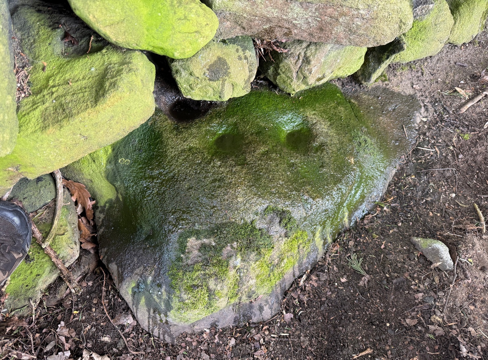
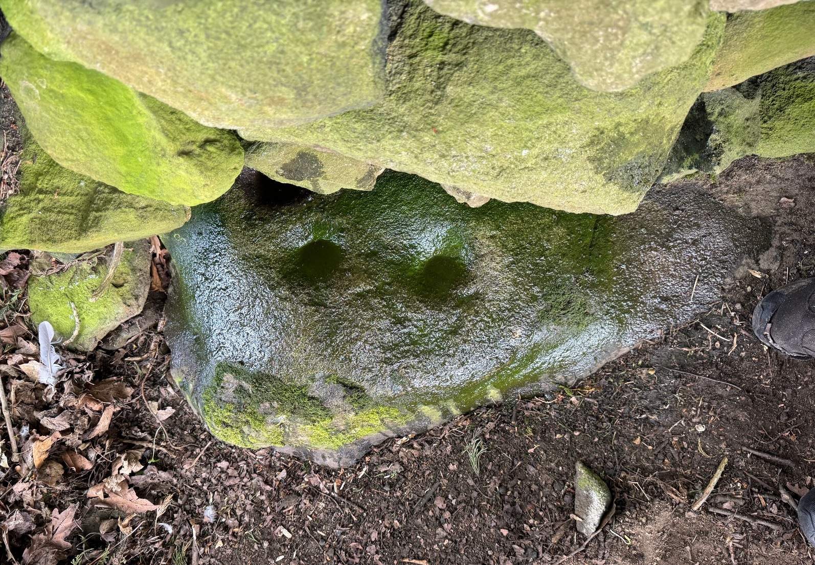
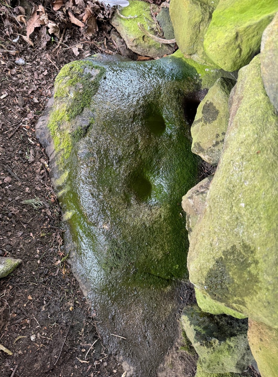
Sticking out from the edge of the walling at ground level is this low small cup-marked stone, rediscovered by rock art explorer Tom Cleland just a few weeks ago.  It sits behind the cluster of rocks that were dumped here not too many years back. The carving comprises of at least three well-defined and quite deep cups, only two of which were initially visible until we cleared out a third one that had become filled with soil.  It’s possible that there’s more of them on the stone, but we’d have to take the wall down to find that out!

The stone seems to be earthfast and may have remained in the same spot, untouched, since when it was first carved four or five thousand years ago—and certainly the depths of the cups suggest that its it’s been pretty much covered over for most of its life.  The walling that’s been built on top of it is  pretty recent by comparison; but it’s notable that its petroglyphic neighbour, the High Brunthwaite (3) carving, 175 yards to the east, is also an earthfast rock with the field-wall built on top of it.

Its somewhat minimalist appearance reminds me of several of the cup-marked petroglyphs at the top of Shipley Glen, six miles southeast of here, including the Baildon Moor (126) and (130) carvings…

Acknowledgements:  Massive appreciation to Thomas Cleland for finding this carving and showing us it’s whereabouts.

© Paul BennettThe Northern Antiquarian

Ryton (2), County Durham

Cup-and-Ring Stone (removed):  OS Grid Reference – NZ 1475 6350

Archaeology & History

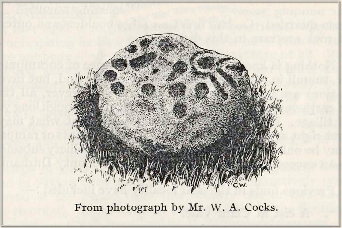
This carving presently lives in what Beckensall & Laurie (1998) described as “the stone store” at the Museum of Antiquities at the University of Newcastle-upon-Tyne, but it was discovered in some walling close to the road on the south-side of Ryton by a Mr William Cocks in 1934.  The carved rock is relatively small—measuring “roughly two feet five inches, by one foot ten inches, by one foot three inches in thickness”—and was obviously not in its original position, but would have lived relatively close to the walling into which was placed.  Mr Cocks told that,

1934 sketch of the carving
Modified Beckensall sketch

“the stone bears one “cup and ring” with four radial ducts, the latter being in an exceedingly fine state of preservation.  There are also ten plain cups of circular form; one cup with a deep conical duct; and one large cup which appears to have been formed by uniting two circular cups.  All show the “pocking” or tool marks of manufacture, and these are especially noticeable in the radial ducts.”

The cup-marked Ryton (1) stone was found some 250 yards to the west and the Ryton (3) petroglyph was less than half-a-mile north, making it likely that other types of prehistoric remains once existed in this locale.

References:

  1. Beckensall, Stan, Northumberland’s Prehistoric Rock Carvings – A Mystery Explained, Pendulum: Rothbury 1983.
  2. Beckensall, Stan & Laurie, Tim, Prehistoric Rock Art of County Durham, Swaledale and Wensleydale, County Durham Books 1998.
  3. Cocks, W.A., “The Ryton ‘Cup and Ring’ Marked Rock,” in Proceedings Society of Antiquaries Newcastle-upon-Tyne, volume 6, no.8, 1934.

© Paul BennettThe Northern Antiquarian

High Brunthwaite (1), Silsden, West Yorkshire

Cup-Marked Stone:  OS Grid Reference – SE 05619 46181

Getting Here

High Brunthwaite (1) stone

As you’re going into Silsden up the A6034 road, over the canal bridge, turn right (east) and go up Howden Road for half-a-mile, then go left up Hawber Lane and after 250 yards veer right along Brunthwaite Lane.  After nearly another half-mile, through gorgeous High Brunthwaite hamlet and just as the road bends round past the last of the gardens and houses, go through the gate into the field on your right.  You’re needing to look at the walling here, which runs alongside the road, but on the field-side, barely 10 yards up.  A cluster of rocks has been piled-up against the wall.  The largest rounded broken one is the one you’re looking for.

Archaeology & History

Looking across the cups

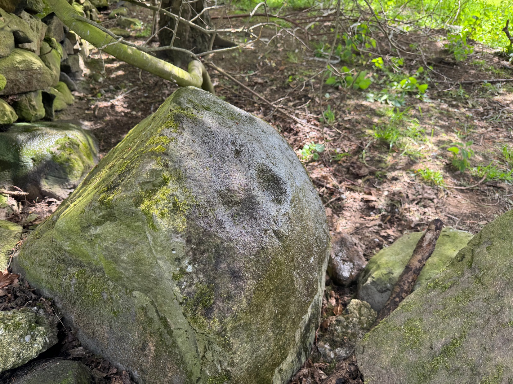
Discovered recently by the petroglyph explorer Thomas Cleland, this is one of two cup-marked stones in close attendance to each other.  It’s nowt special to look at—unless you’re an ardent rock art buff!—as it consists of just two large well-formed cup-marks on its near-vertical face: the most distinct one being some two-inch across and a half-inch deep.  The stone was obviously rolled here from very close by and just piled up against the wall and has been broken from a larger piece of rock, but we could see no other cup-marks on the others laid around it (although we couldn’t lift and turn the others over to see if there was anything on their undersides).  The earthfast High Brunthwaite (2) cup-marked stone is just a yard away at the base of the wall.

Acknowledgements:  Massive appreciation to Thomas Cleland for finding this carving and showing us it’s whereabouts.

© Paul BennettThe Northern Antiquarian

Hangingstones Quarry (1), Ilkley Moor, West Yorkshire

Cup-Marked Stone:  OS Grid Reference – SE 12681 46748

Also Known as:

  1. Carving no.120 (Hedges)
  2. Carving 278 (Boughey & Vickerman)

Getting Here

Hangingstone Quarry (1)

From the Cow & Calf car-park, walk towards and past the gigantic Calf rock, swerving round the fallen mass of rocks and into the trees at the back.  Walk uphill to the Hanging Stones cup and ring stones, then keep heading—down the slope then back up the next one—west, for barely 100 yards until you’re on the level ground again, following the footpath alongside the heather.  Barely 50 yards along, keep your eyes peeled in the heather for a low flat rock just a few yards in.  Forage around and you’ll find it.

Archaeology & History

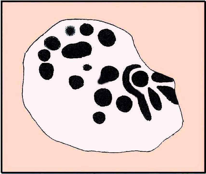
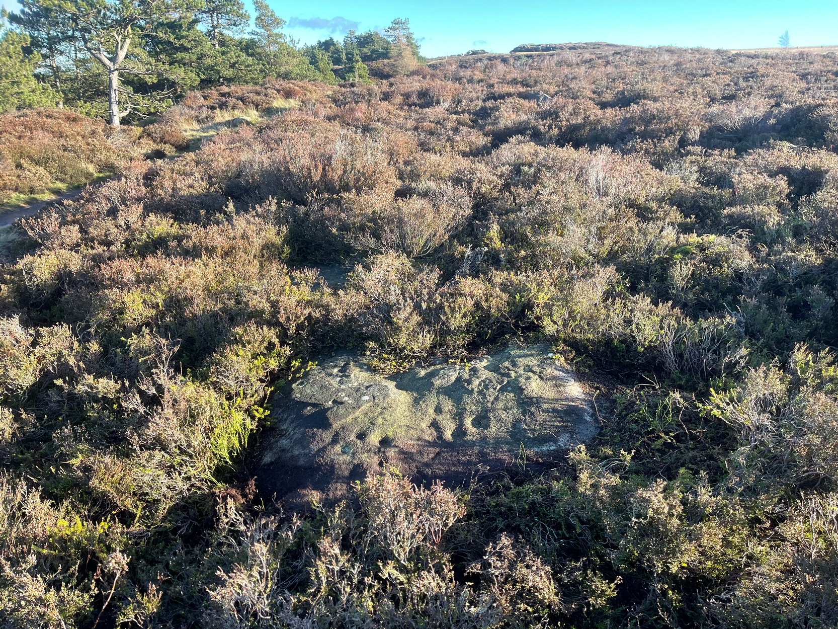
You’ll no doubt be seeing this carving after you’ve visited the impressive Hanging Stones petroglyphs 150 yards to the east.  And you’ll probably be disappointed in its lack of visual grandeur when compared to its more ornate eastern neighbour.  But the petroglyph fans among you should give it your attention.

Hedges 1986 sketch
Looking to the SE

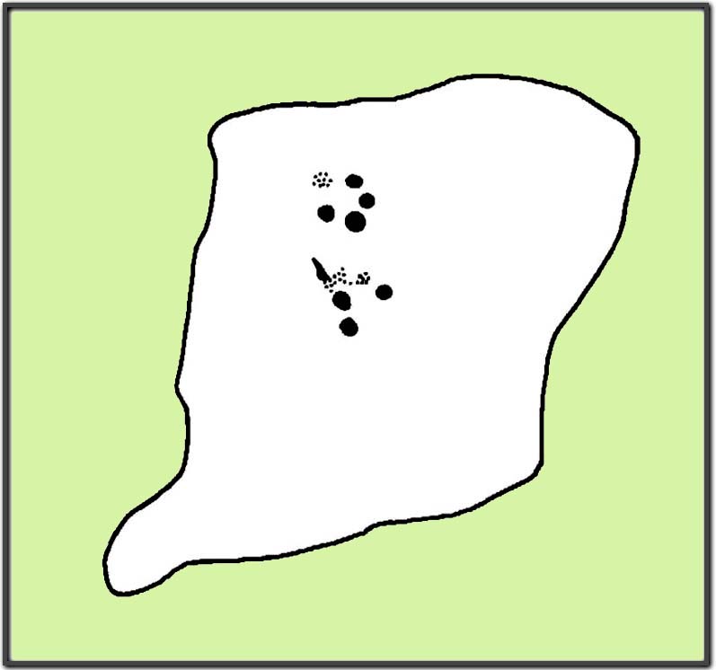
When the dawn or evening daylight cuts across the rock, the design looks much better than at sun high, perhaps telling us that the message of the stone coincided with those periods of the day.  The gentle folds of the stone itself morph into the carving: evening and morning light cutting subtle shadowy folds across the rock, giving it an organic texture that our aboriginal ancestors told to be a vital essence of stone itself.  The two small clusters of cup-marks upon this stone become greater than their basic design when brushed with the shadows and glows of a sunset.  And when our aboriginal peoples painted them in ochre and other colours, an even greater mythos emerged—but sadly it is forgotten here….

When looked at with the simplistic eyes of the archaeo-mind, this and its compatriots are little more than a number of marks on lifeless rocks.  This stone for example was described in John Hedges’ (1986) survey as being just “two groups of four and five cups and grooves”—nothing more—with naught but an echo in Boughey & Vickerman’s (2003) later work.  The carving has neighbours even more basic in the heather close by…

References:

  1. Boughey, Keith & Vickerman, E.A., Prehistoric Rock Art of the West Riding, WYAS: Wakefield 2003.
  2. Hedges, John (ed.), The Carved Rocks on Rombalds Moor, WYMCC: Wakefield 1986.

© Paul BennettThe Northern Antiquarian

Kilravock, Croy, Nairnshire

Cup-Marked Stone (lost):  OS Grid Reference – NH 814 503

Archaeology & History

Somewhere on the outskirts of Kilravock Castle grounds sat (or still sits, hopefully) one of our country’s legendary healing stones bound within the animistic veil of a cup-marked stone.  It seems to have fallen off the archaeological registers (if it was ever included!) and so I add it here in the hope that someone can locate it and let us know of its present condition.

Described during a meeting of the Inverness Scientific Society by a Dr Grigor in a short presentation on cup-marked stones at Nairn in July 1884, the matter of some faint traditions concerning a tiny number of cup and ring stones in Scotland was mentioned, and,

“Dr Grigor said he would be able, next day, at the roadside on the Kilravock property, to point out a large rounded stone of gneiss, in the centre of which is a large cut cup-mark of a diameter of six or seven inches which, fifty years ago, was resorted to by many, and water was taken from it long distances.  The water was believed to cure skin diseases, but it was principally used for washing warts on the human subject, which it was believed the water quickly removed.  It was also particularly in repute for removing warts from cow’s teats.”

The custom described here sounds very similar to others found at so-called ‘Wart Stones’ in England and Scotland (there was one that existed a short distance from where I grew up near Eccleshill, West Yorkshire).  Several miles west of here is the cluster of prehistoric carvings in the Clava complex, but this one at Kilravock seems to have fallen off the radar. Does anyone know if it can still be seen? (the grid-reference given to this site is an approximation)

References:

  1. Grigor, Dr, “Cup Marked Stones,” in Transactions Inverness Scientific Society Field Club, volume 3, 1884.

Acknowledgements:  Huge thanks for use of the Ordnance Survey map in this site profile, reproduced with the kind permission of the National Library of Scotland

© Paul BennettThe Northern Antiquarian

Druim An Rathaid, Glenbarr, Kintyre, Argyll

Cairn:  OS Grid References – NR 66926 38320

Also Known as:

  1. Glencreggan Cairn

Archaeology & History

First described in the Object Name Book* of 1867 as being “the remains of a cairn in which D MacMillan of Glenbarr says a cist was found”, this prehistoric tomb was subsequently going to be destroyed in the 1950s by the farmer when local researchers Mr & Mrs J.G. Scott (1958) took to checking the place out before its demise.  And it was a damn good job they did!  The cairn still remains to this day—albeit in a very dilapidated state.  The assistant editor of The Prehistoric Society journal, Ian Longworth (1959), wrote an account of the findings, telling:

“A small mound, apparently the remains of a cairn, was excavated on the farm of Glencreggan by Mr and Mrs J.G. Scott.  The mound was roughly oval in shape, about 20 feet by 14 feet in size, and about 2 feet in height, with its longer axis lying almost E-W.  A large stone slab, about 8 by 3 feet in size, lay against its N corner.

“The cairn was found to consist of a small and fairly compact core of stones intermixed with sand and clay, surrounded by a rather ill-defined outer ring of boulders, the intervening space being largely filled with earth.  Remains of a cremated burial were found beneath the centre core, but there was no trace of a cist, and the bones seemed to be scattered, giving the impression that the cairn might mark the spot where the cremation took place.  Apart from a flint flake, the only finds were two small boulders, each bearing a single cup-mark, which were incorporated in the material of the centre core.”

Of the two cup-marked stones found beneath the cairn, they’re presently living in some box somewhere in the Kelvingrove Museum, Glasgow, who are very approachable when it comes to viewing them if you make an appointment.  I have to say though, one of them may be natural, as it has the distinct look of being the creation of molluscs, who live in profuse numbers just off the coast hereby.  Nonetheless, they were left in the tomb as offerings to the ancestral spirits here. 

References:

  1. Bede, Cuthbert, Glencreggan – 2 volumes, Longman Green: London 1861.
  2. Longworth, Ian, “Notes on Excavations in the British Isles, 1958,” in Proceedings of the Prehistoric Society, volume 25, 1959.
  3. Royal Commission Ancient & Historical Monuments of Scotland, Argyll – volume 1: Kintyre, HMSO: Edinburgh 1971.
  4. Scott, Mr & Mrs J.G., “Argyllshire: Glencreggan, Glenbarr, Kintyre,” in Discovery & Excavation, Scotland, 1958.
* The Object Name Book website recently got “upgraded”, to make it better, smilier, user-friendly, and the usual buzzwords we all hear when things are just gonna get worse.  The website is now a real pain-in-the-arse to use since those halfwit management-types upgraded the site, making it much more hard work to find anything.  Fucking idiots! Who pays these morons?!

© Ian Carr, The Northern Antiquarian
Gazing Stone, Steeton, West Yorkshire

Cup-and-Ring Stone:  OS Grid Reference – SE 03420 43572

Getting Here

Gazing Stone of Steeton

In Steeton, walk up the High Street and after a hundred yards or so, turn right to go up to Quarry House (opposite Falcon Cliffe), up past Quarry Cottages to the end where it turns into a track.  Follow the track for 200 yards, where it bends left, then immediately right go into the field, following the wall along for 450 yards where you’ll go through a gate to another rocky steep hill-slope.  Walk up by the side of the walling here, at the edge of the trees and, once at the top, bear right and a few yards along keep your eyes peeled.  You’re virtually on top of it!

Archaeology & History

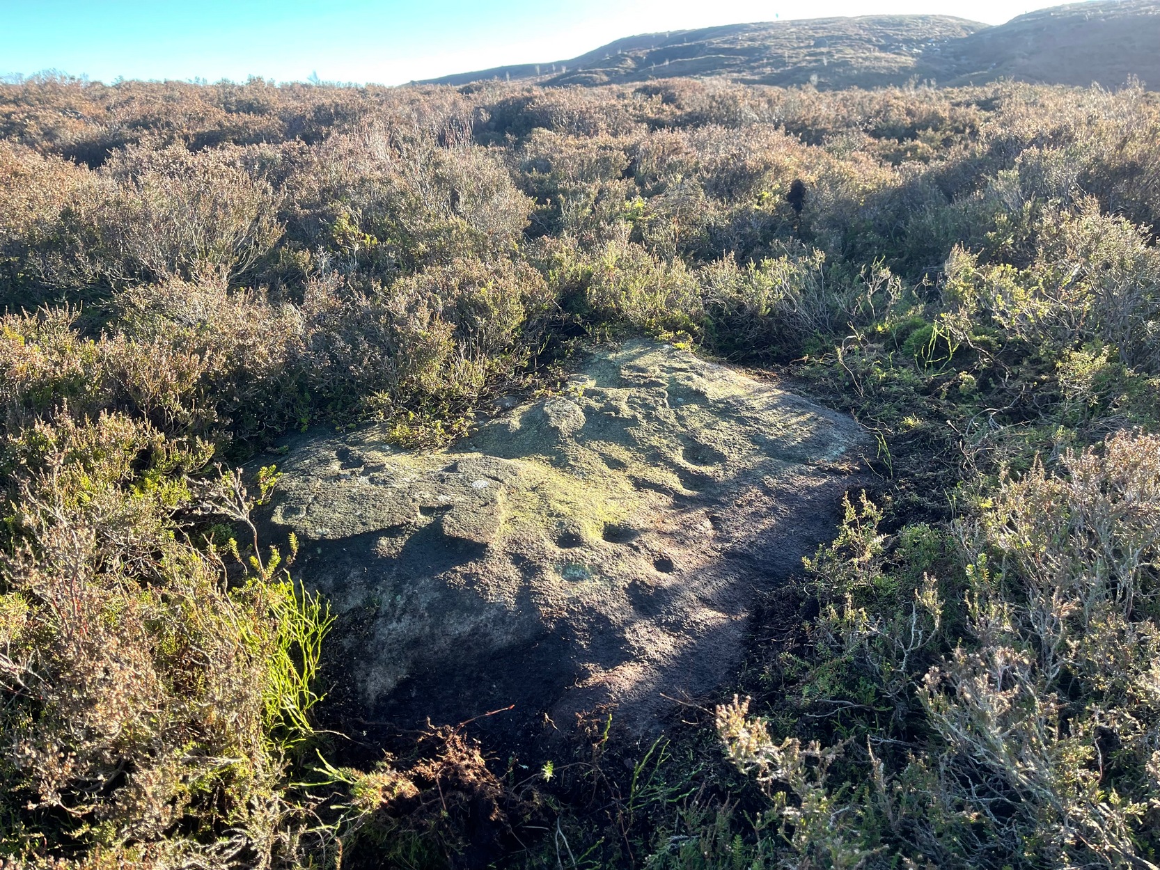
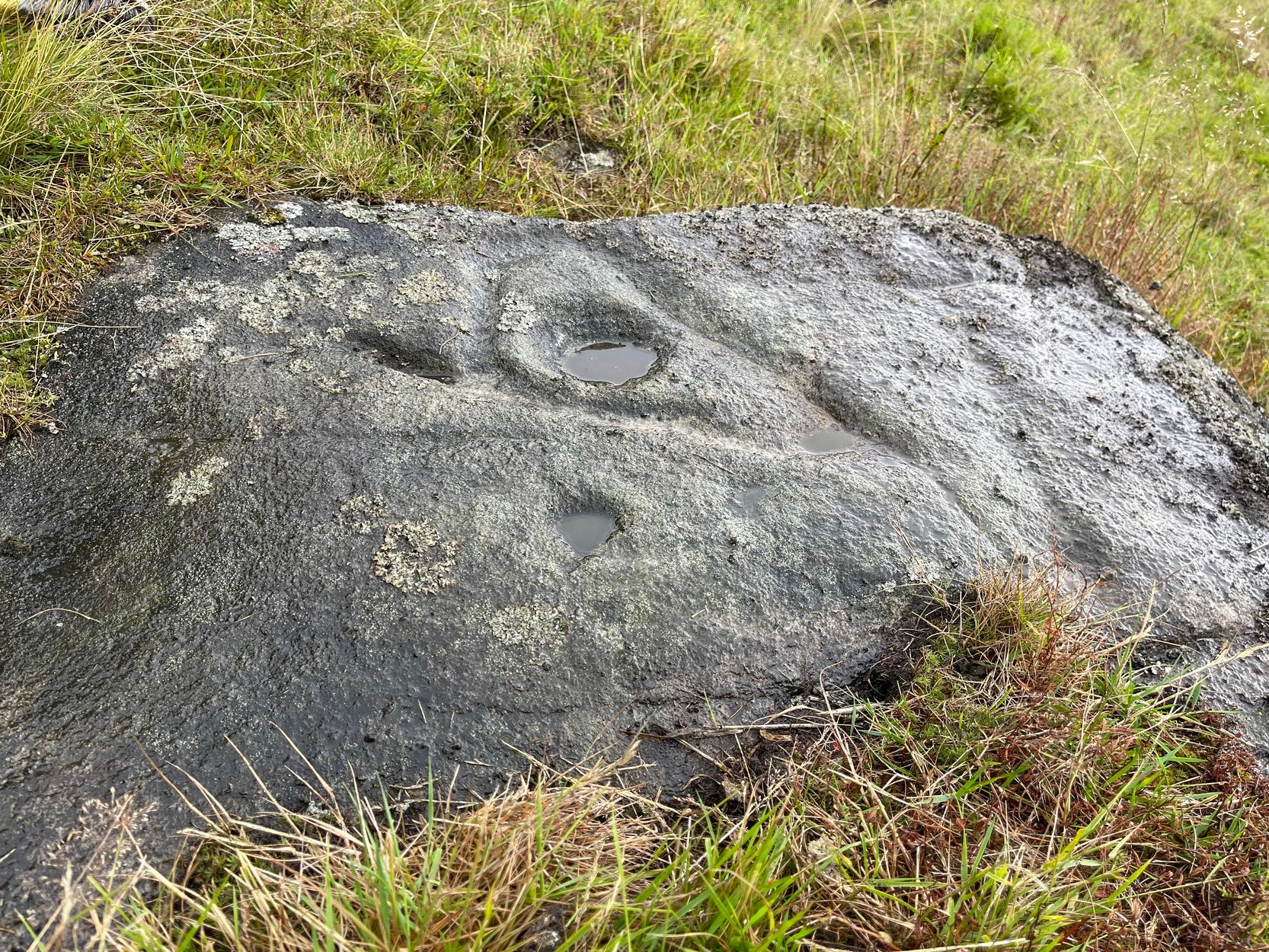
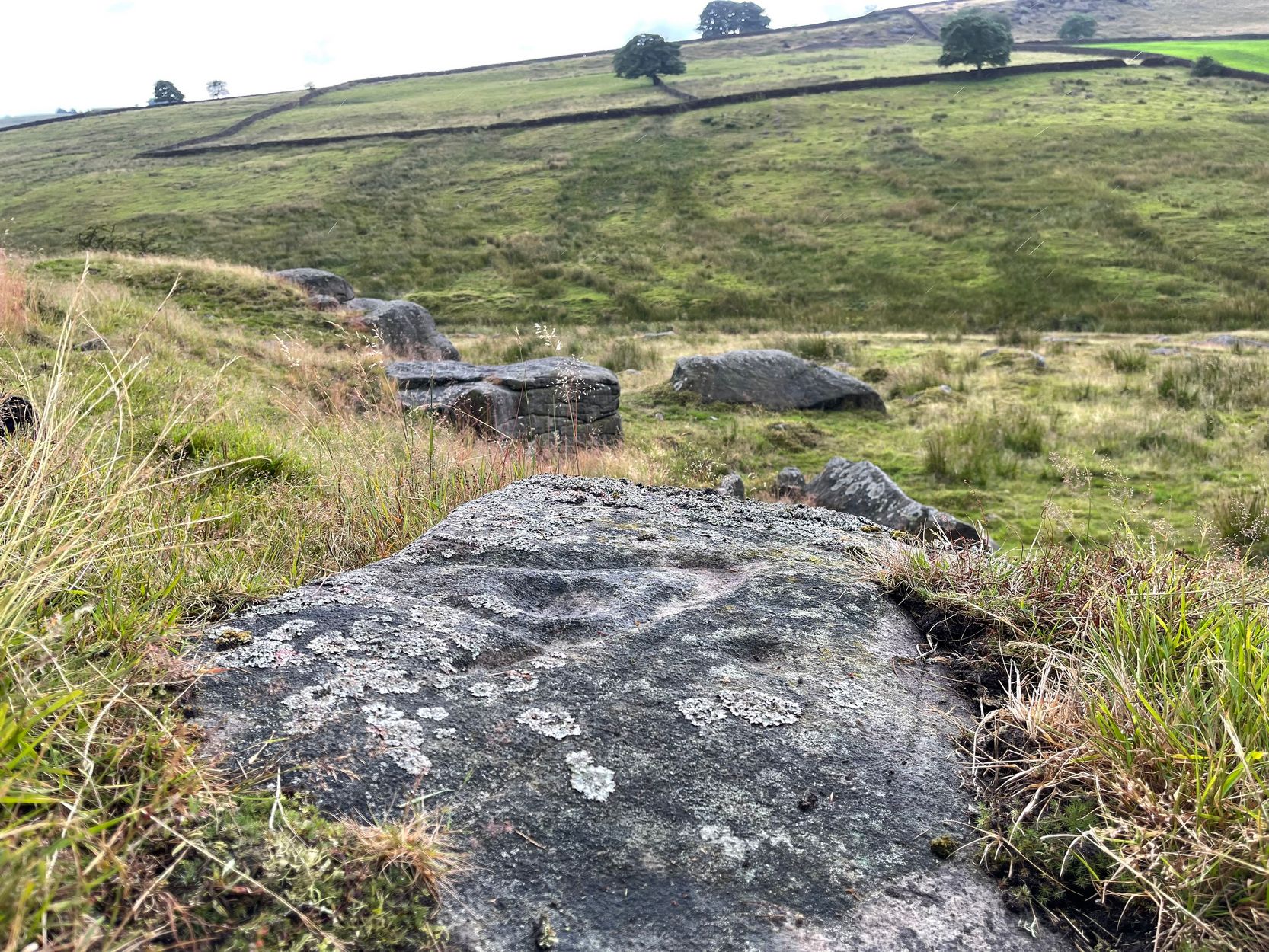
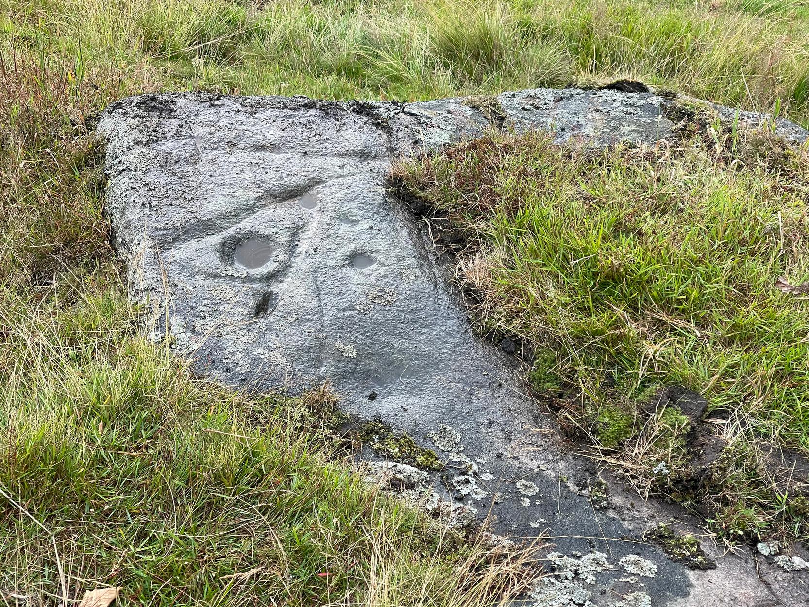
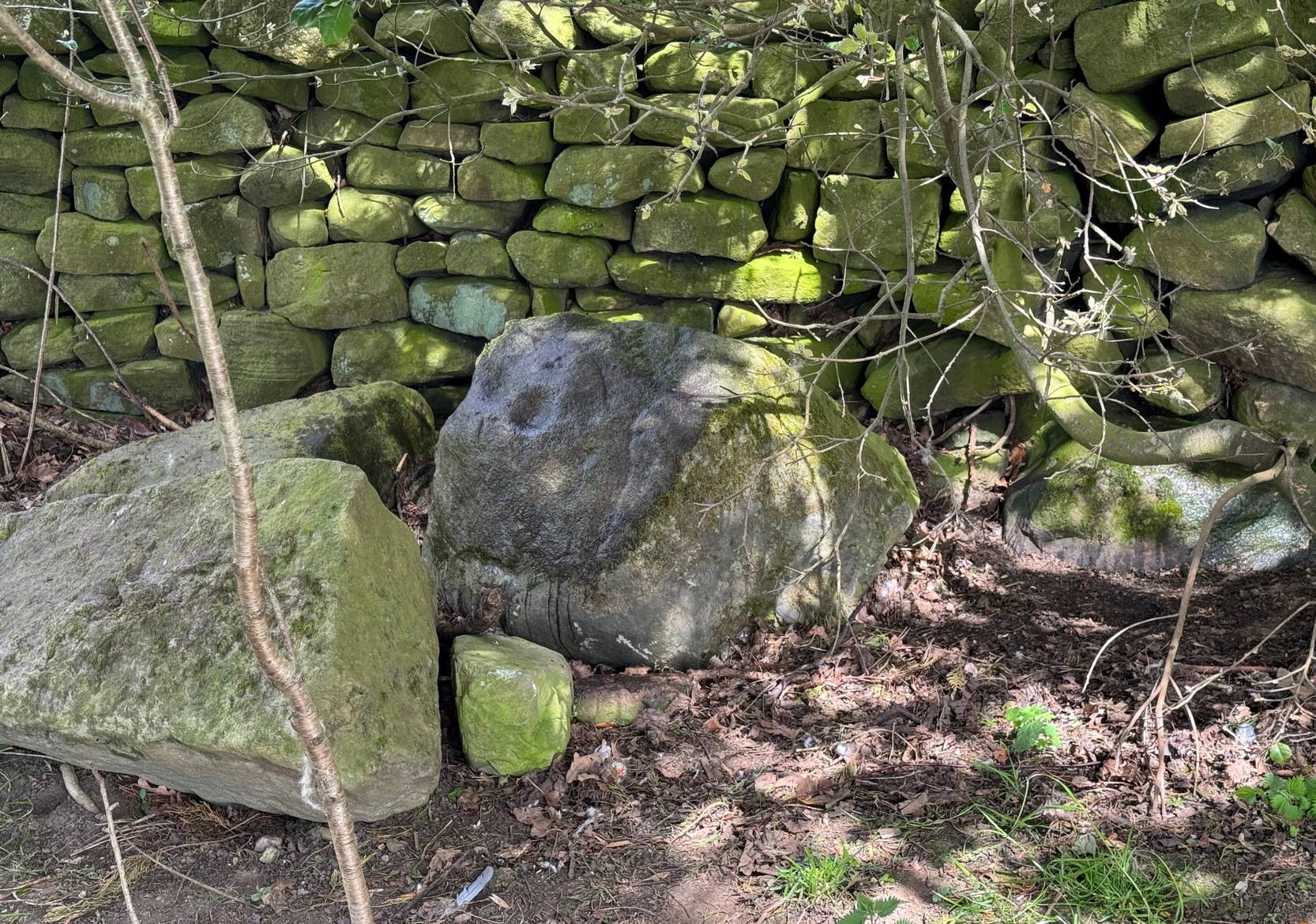
Not previously recorded, this is an unusual design: unusual in more ways than one.  Firstly, it’s not entirely ‘ancient’; and secondly, the linearity in some of the carved lines around the cup-marks is unusual.  It reminded me a little of the Hanging Stones above Ilkley, with its deeply cut lines, swerving around cup-marks, whose lack of ‘ancient’ guise is somewhat betrayed by the fact that Victorian quarry operations uncovered them—much like happened here…

It was first noticed in 2024 by Collette Walsh during a petroglyphic foray in the area.  She noticed the distinct cup-marks on the rock surface, but then when she noticed a distinct quarrying mark, she dropped the idea that it was prehistoric.  But this distinct quarry or stone-mason mark—executed sometime in the 19th century when the Industrialists were working here—shouldn’t take our attention away from the cup-marks; nor indeed all aspects of the other carved lines that swing round the edges of the deepest of the three cups, which is surrounded by a long curved triangle, some of which was carved into a natural crack, highlighting it more. The single outlying cup looked, from some angles when wet, that it may have had a partial ring around it—but we were unsure and it may have just been a trick of the light, along with our desire to see more than there actually is.  Anyhow, it’s worth seeing.  But we could do with a stonemason to check it out, enabling us a better assessment of which bits of this design are old and which are not-so-old.

Acknowledgements:  To Collette Walsh for uncovering this design; and to Tom Cleland for showing me where it lives!

© Paul BennettThe Northern Antiquarian